 English
 Spanish
 French
 Chinese
 Russian
 Portuguese
 最新宪章启动
Charter activations
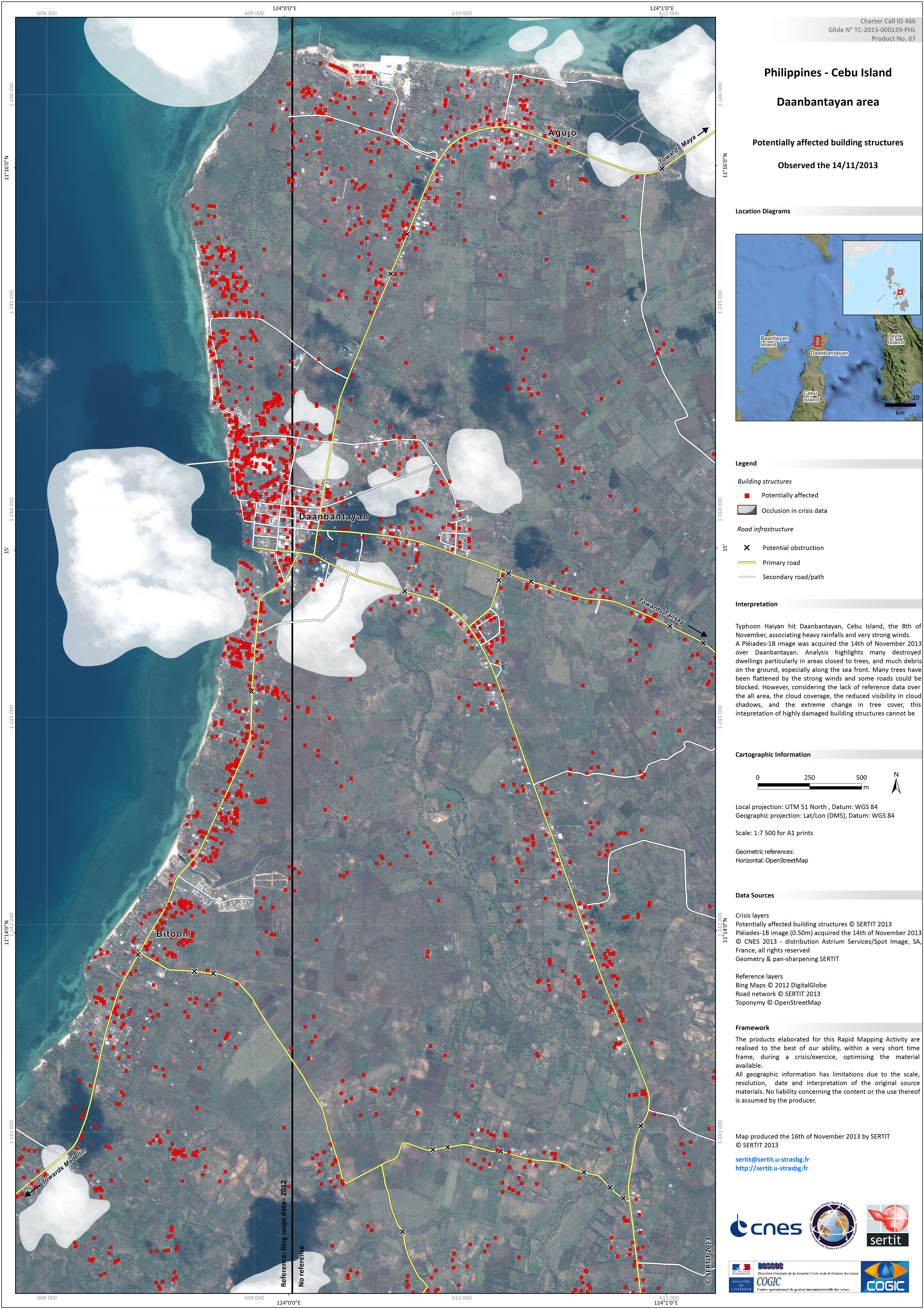
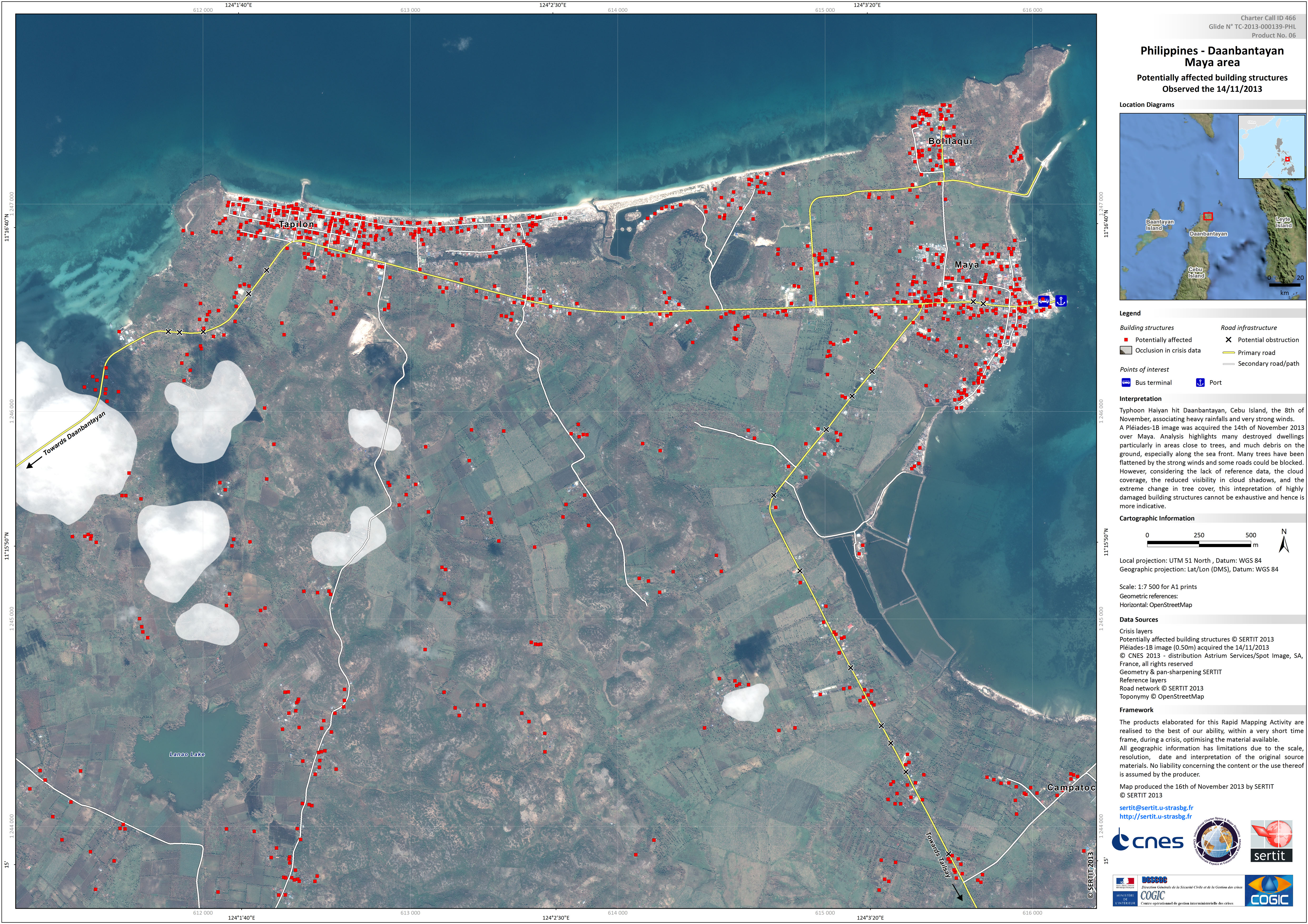
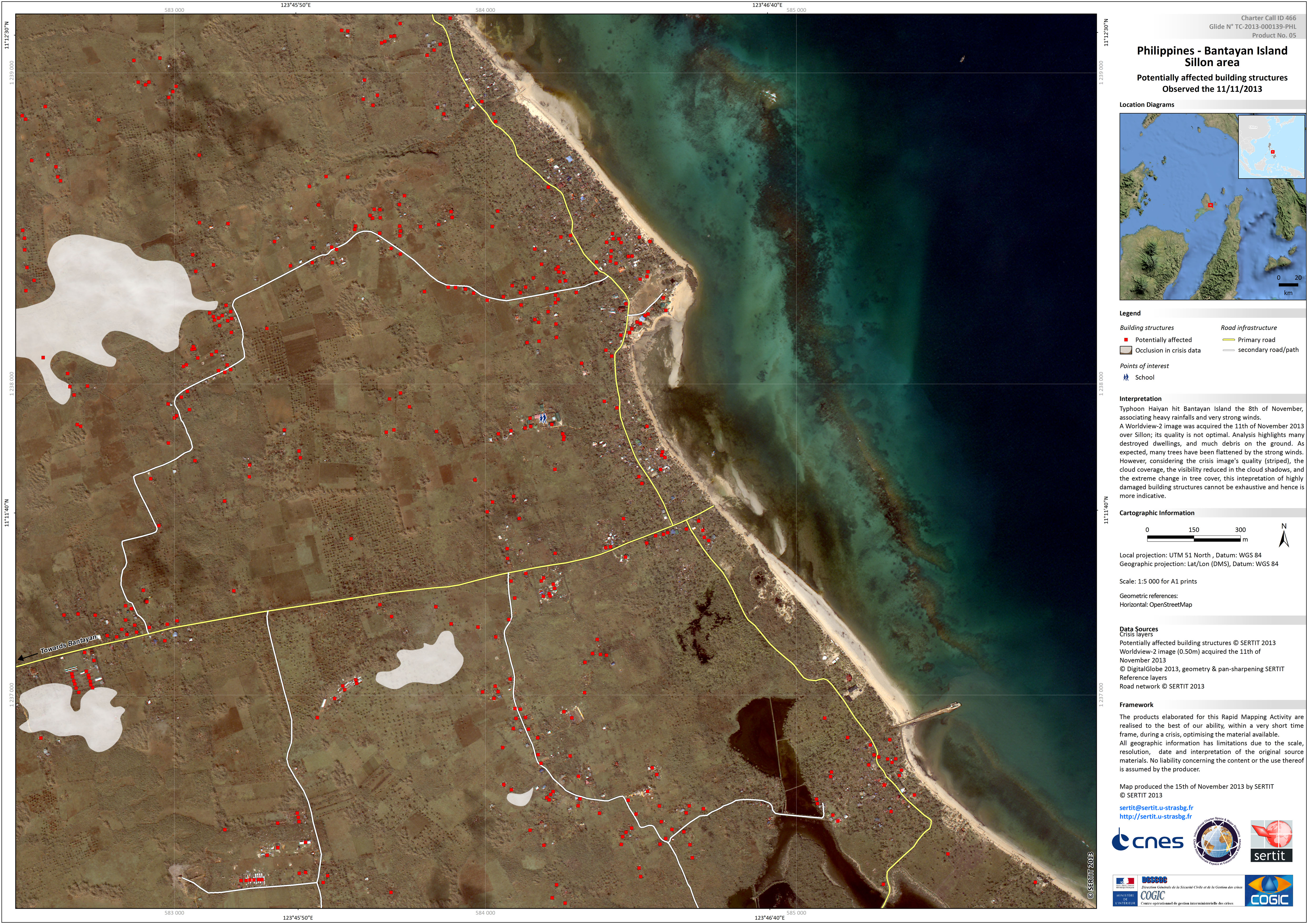
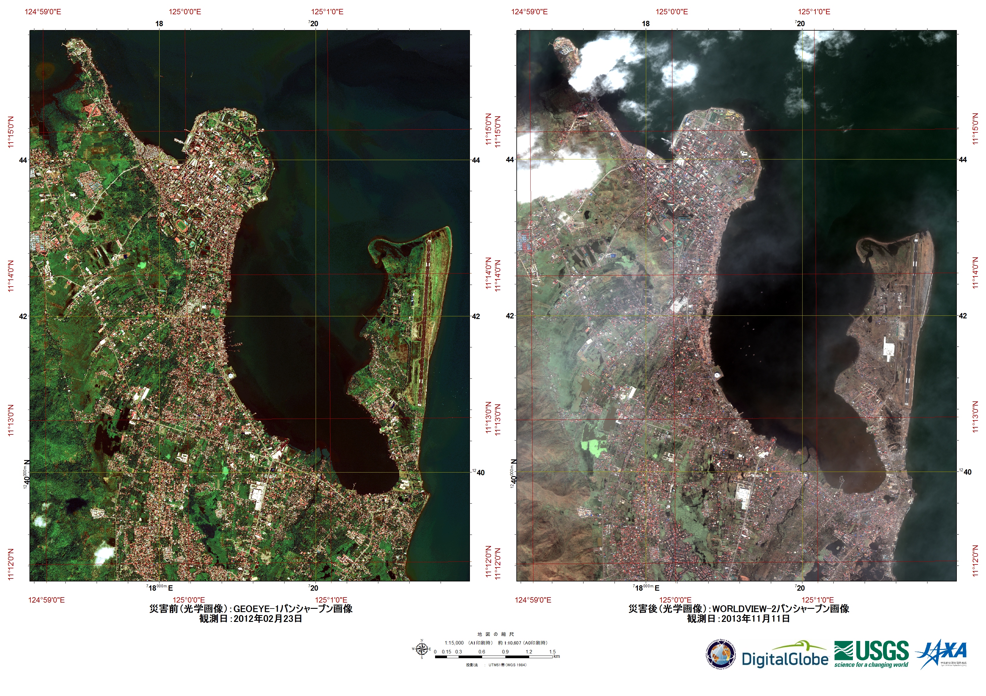
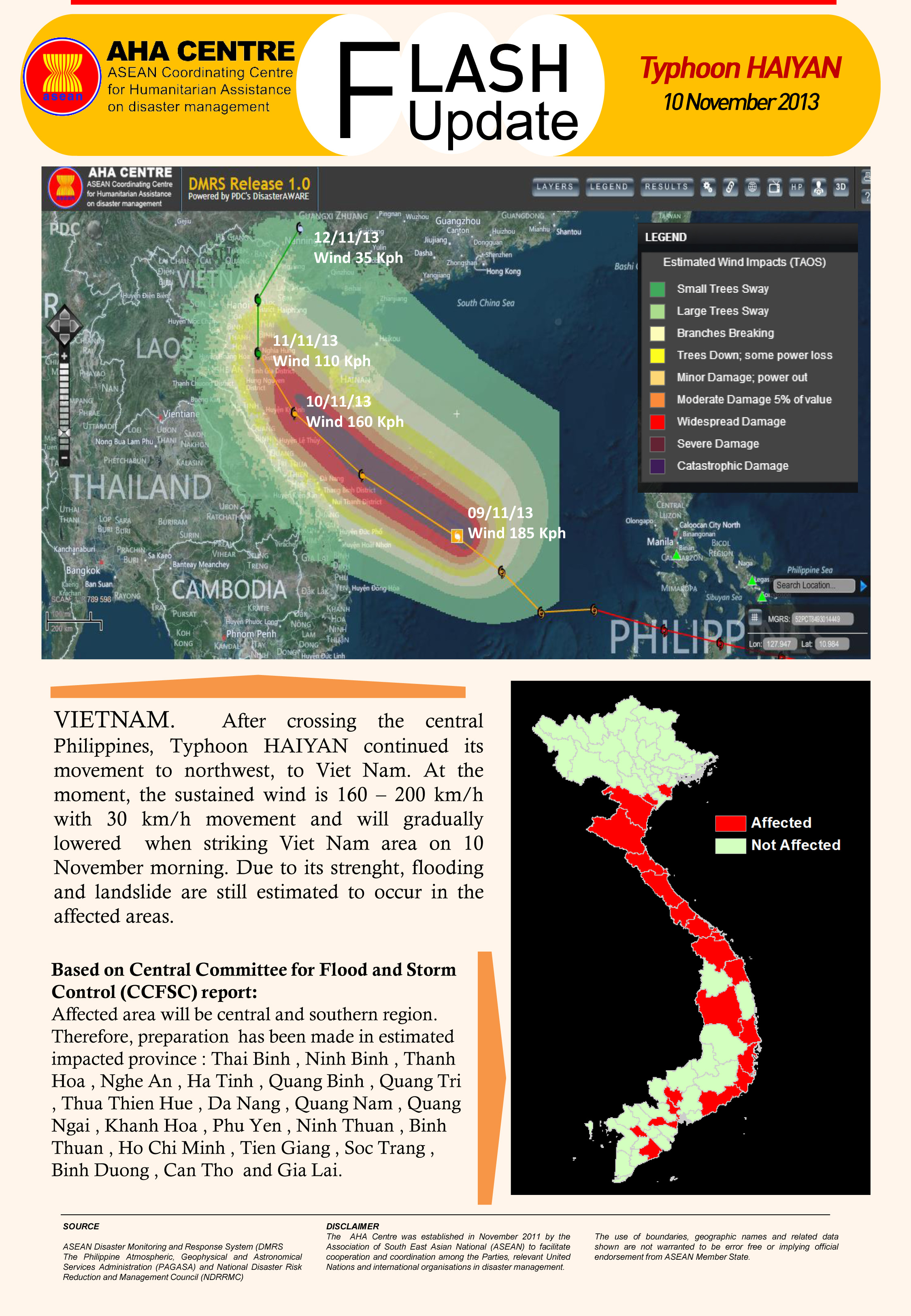
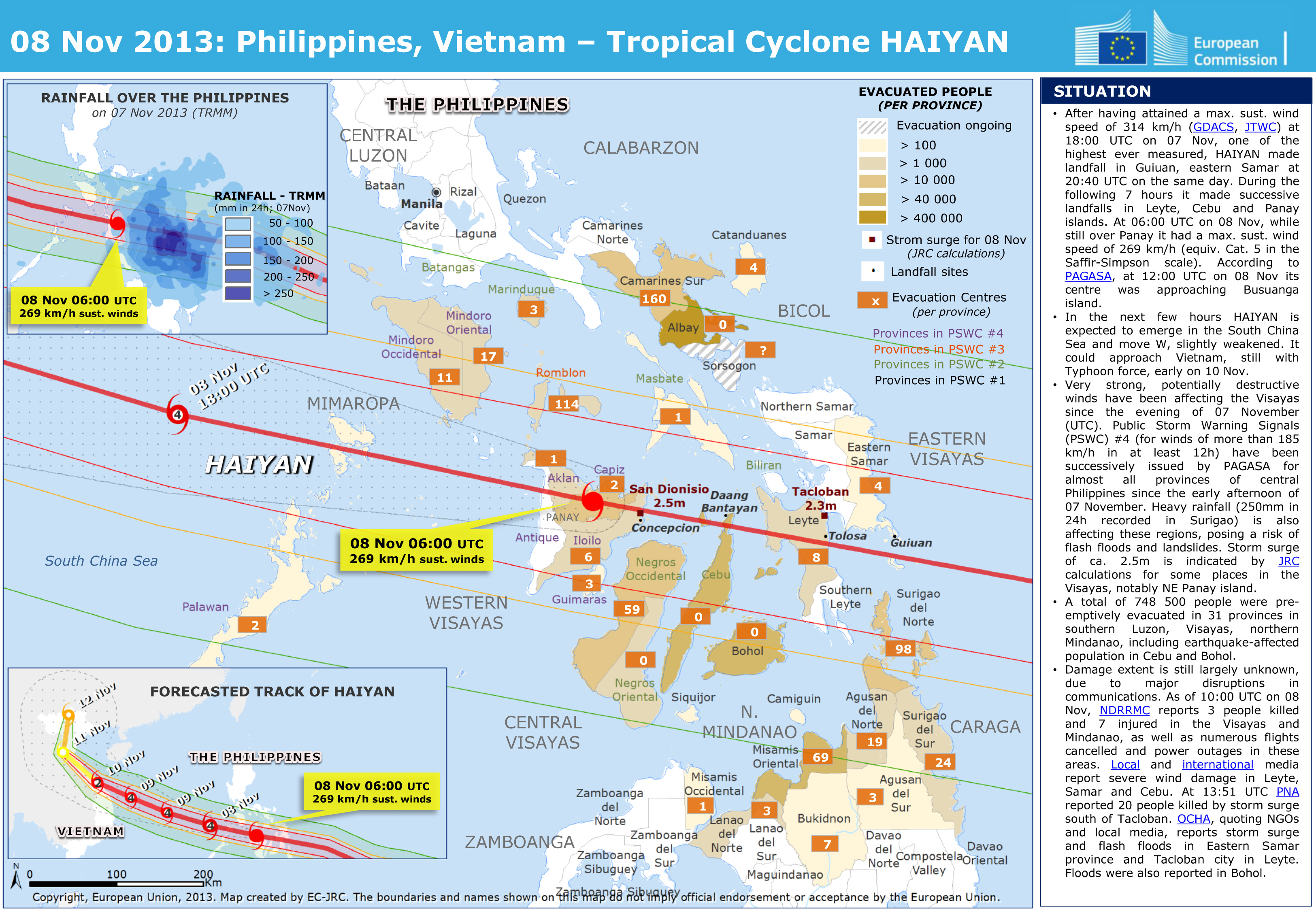
菲律宾台风"海燕"
超强台风“海燕”(当地称“尤兰达”)于当地时间4:40在菲律宾中部登陆,截至目前已造成至少4人死亡,预计将有20个省份的1200万人受灾。
此次五级台风带来风速高达每小时314公里的强风,分析人士称“海燕”可能是有历史记录以来登陆的最强台风之一。
受灾最严重的是中部的莱特岛和萨马岛,以及台风登陆的东米沙鄢大区。台风从该地区向东移动,预计将在未来数日内向北面的越南和中国方向移动。
台风过境对菲律宾诸岛造成大面积破坏,电力线路被切断,道路被倾倒的树木和散落的杂物阻断。据报道,强风将一些建筑物吹倒,尤其是缺少抗风能力的木质房屋。
菲律宾仍未从10月15日袭击保和岛的7.3级地震中恢复,本次台风为这一岛国带来更多灾难。
| 事件类型: | 海洋风暴 - 台风 |
| 事件地点: | 菲律宾 |
| 启动宪章的日期: | 2013年11月8日 |
| 宪章要求者: | UNITAR/UNOSAT代表UNOCHA |
| 项目经理: | 太平洋灾害中心 |
Products


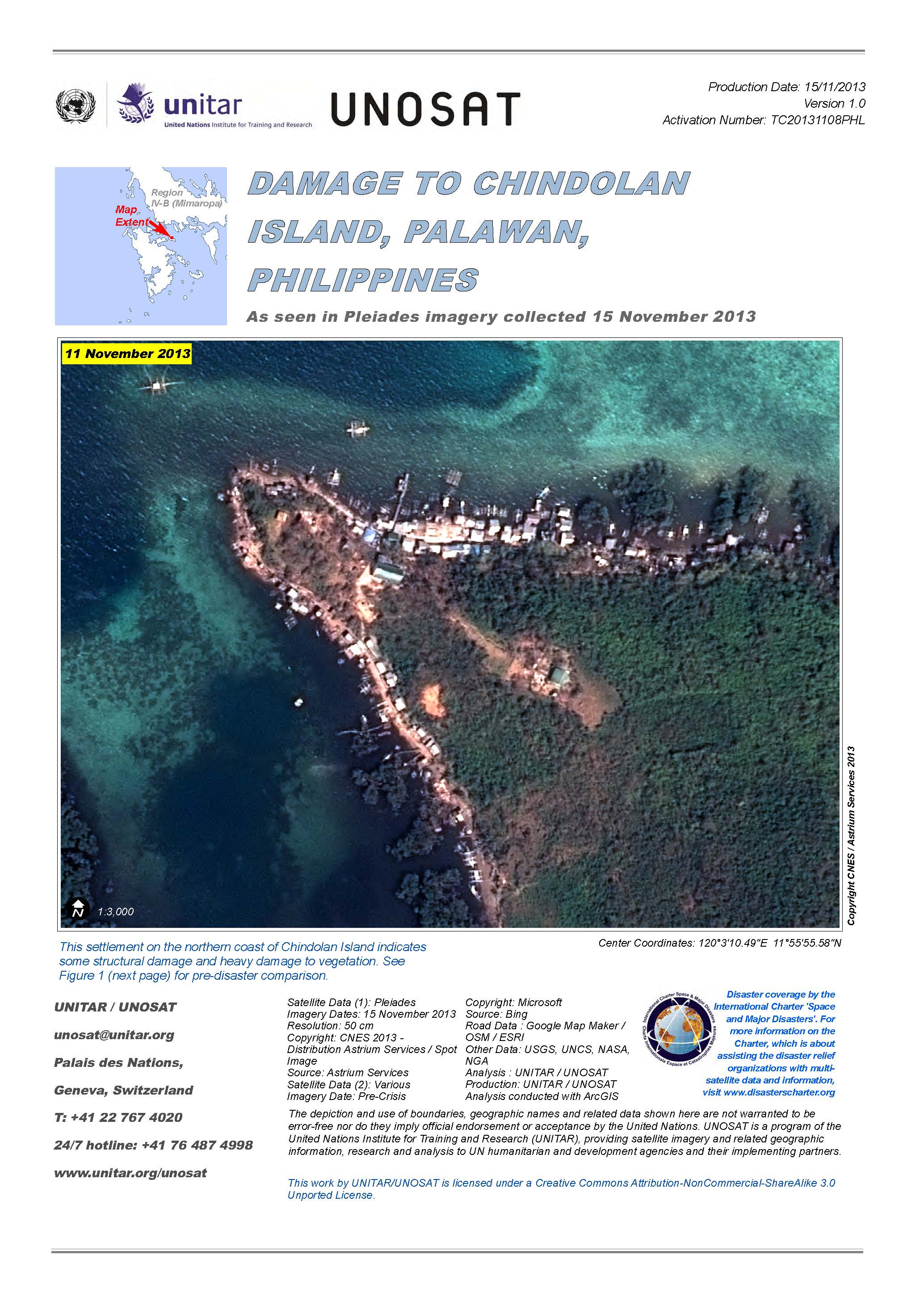
Damage to Chindolan Island, Palawan, Philippines
View the full report (PDF)
版权: CNES 2013 - Distribution: Astrium Services/Spot Image S.A., all rights reserved
Map produced by UNITAR/UNOSAT
Information about the Product
已获得: 15/11/2013
源: Pleiades
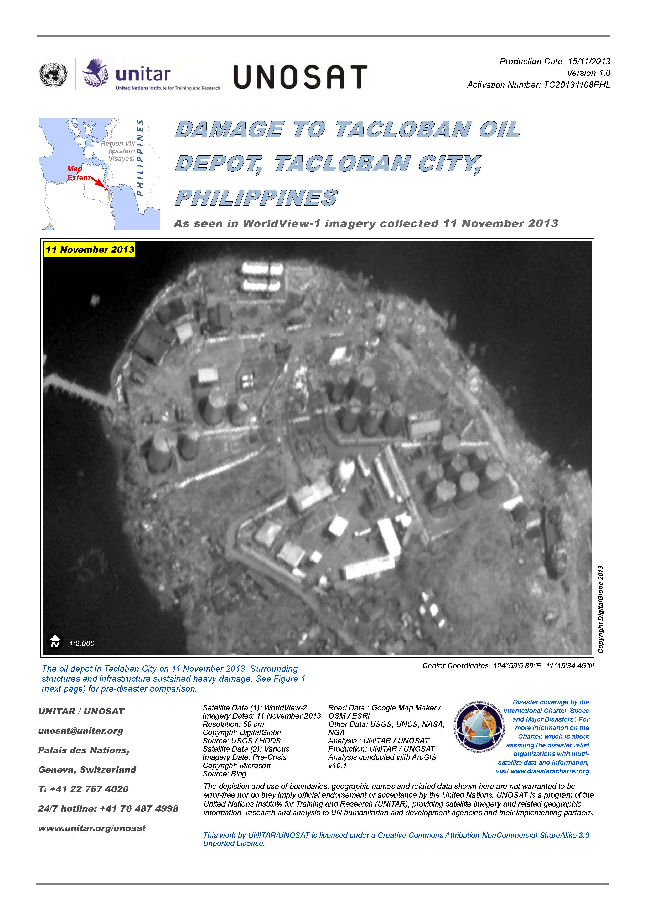
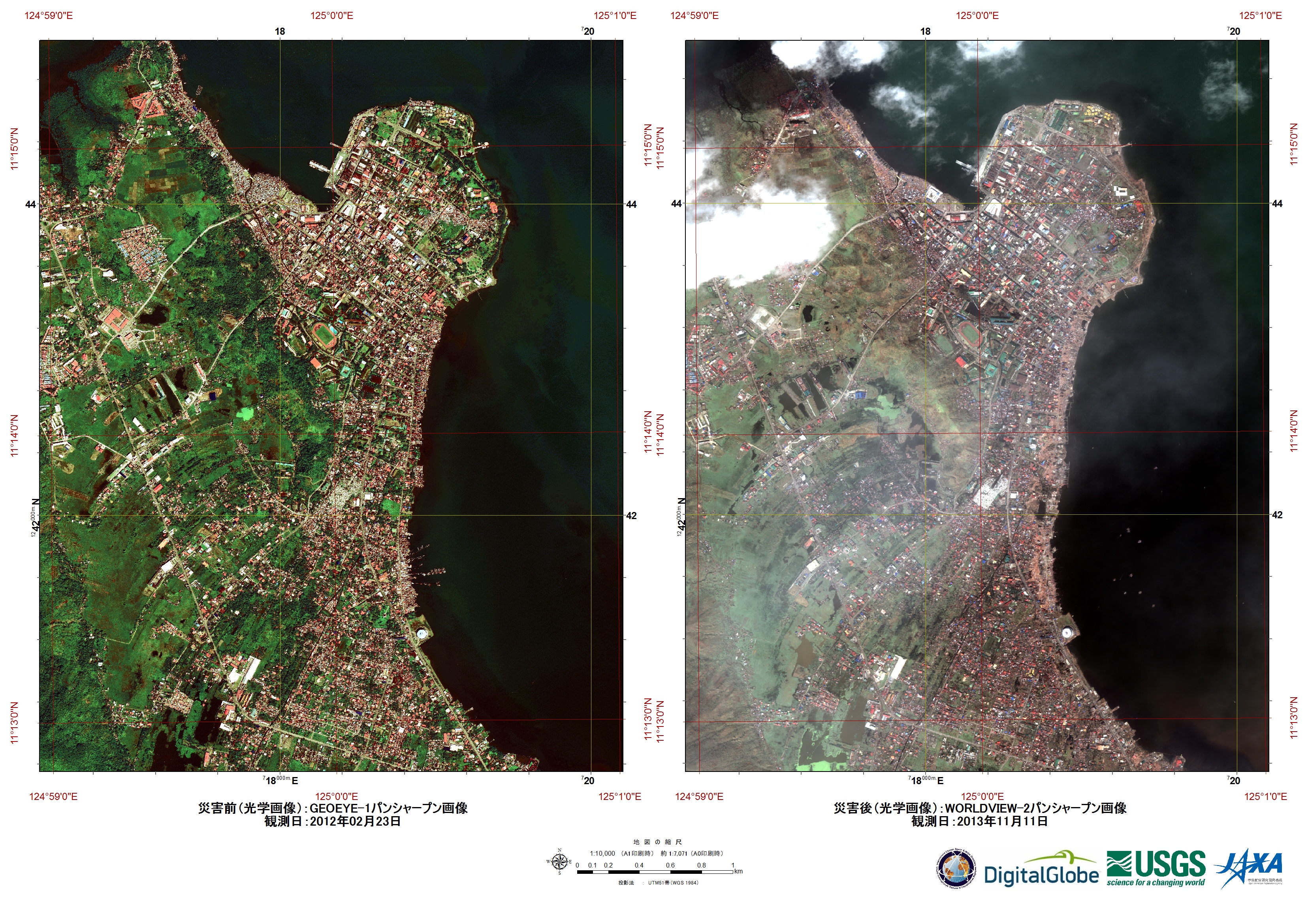
Damage to Tacloban oil depot, Tacloban City, Philippines
View the full report (PDF)
版权: DigitalGlobe
Map produced by UNITAR/UNOSAT
Information about the Product
已获得: 11/11/2013
源: WorldView-2

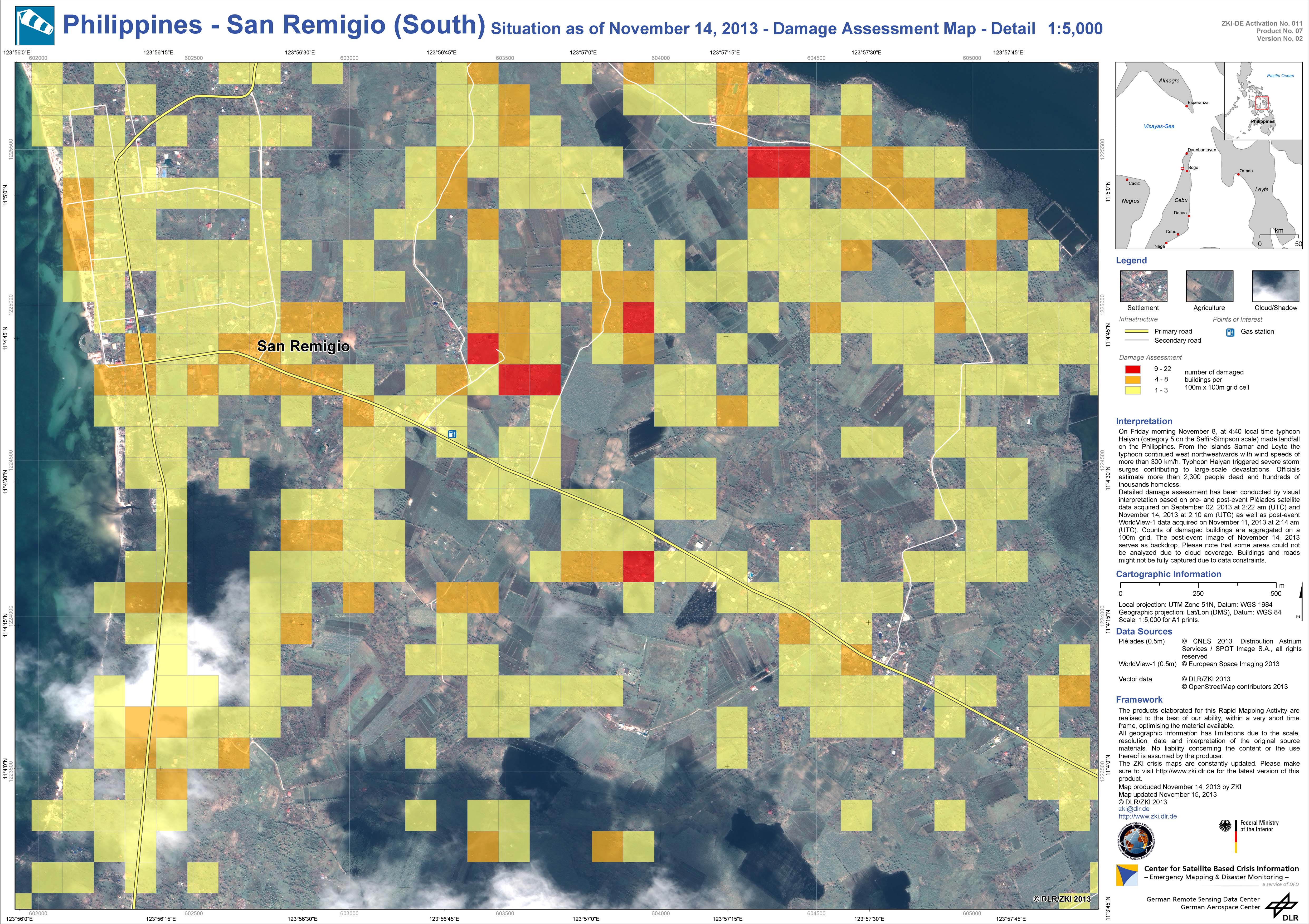
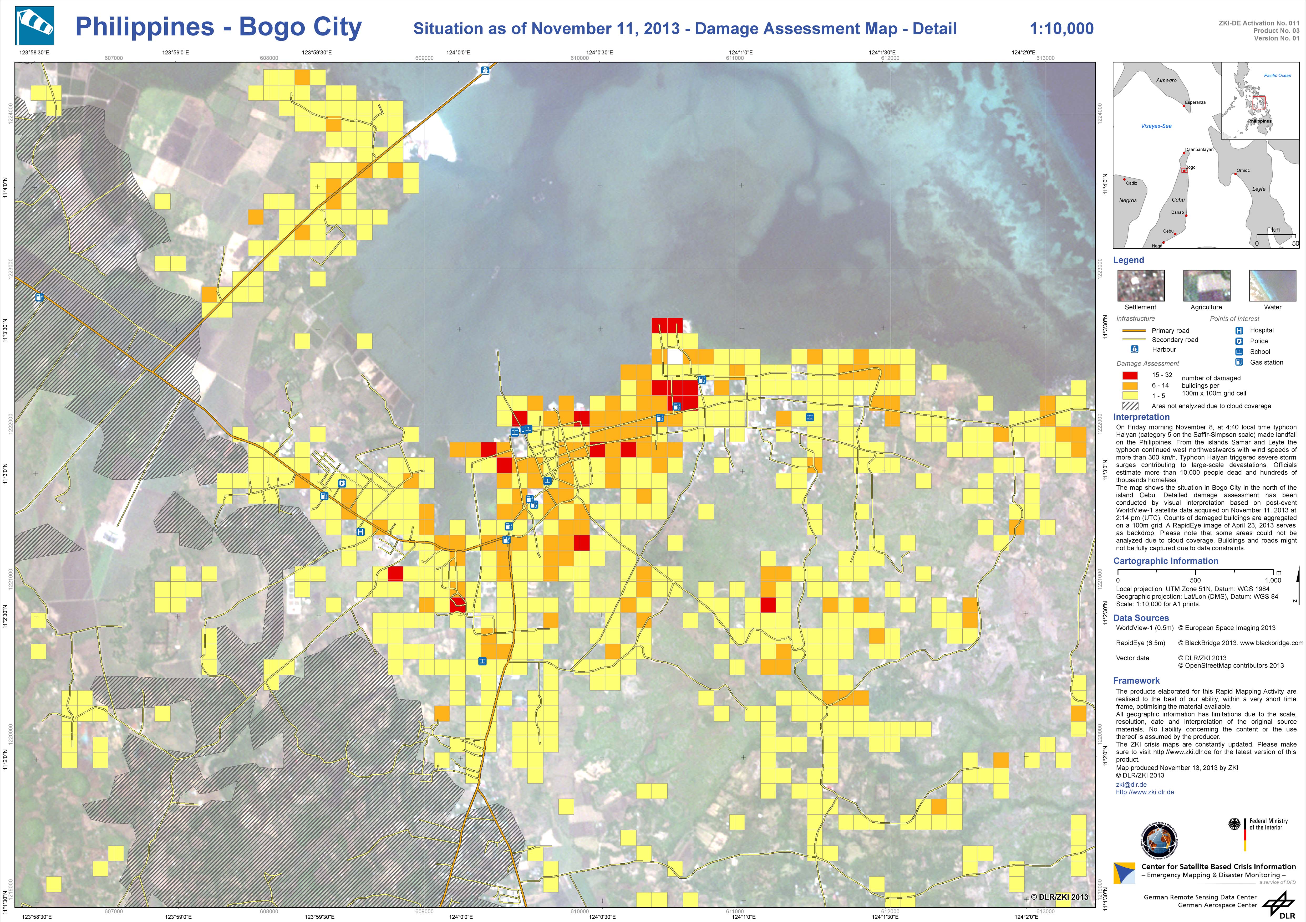
Damage assessment map
San Remigio (South), Philippines
版权: Pleiades © CNES 2013 - Distribution: Spot Image S.A., all rights reserved
WorldView-1 © European Space Imaging 2013
Map produced by DLR/ZKI
Information about the Product
已获得: Pleiades: 02/09/2013 and 14/11/2013
WorldView-1: 11/11/2013
源: Pleiades and WorldView-1
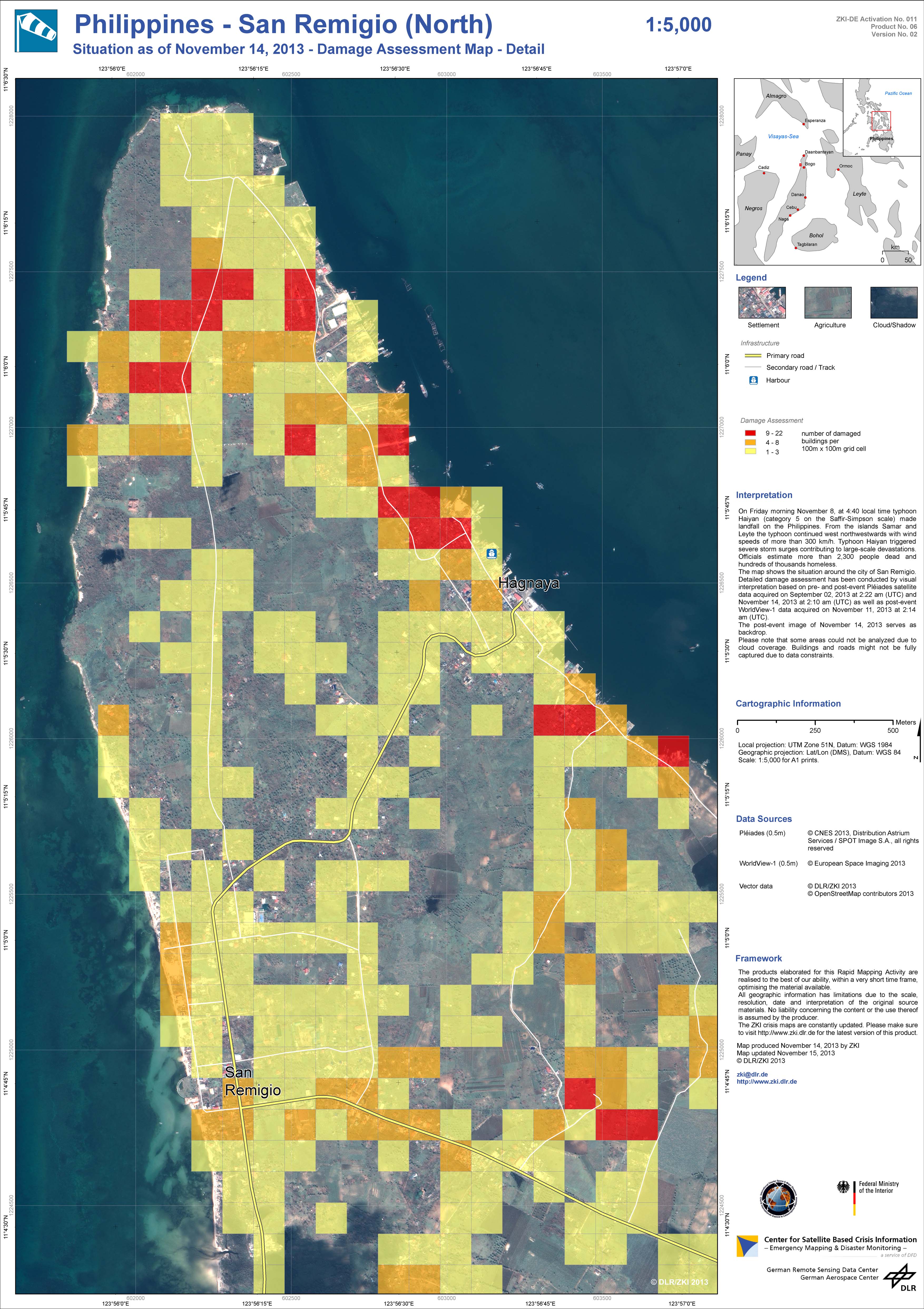
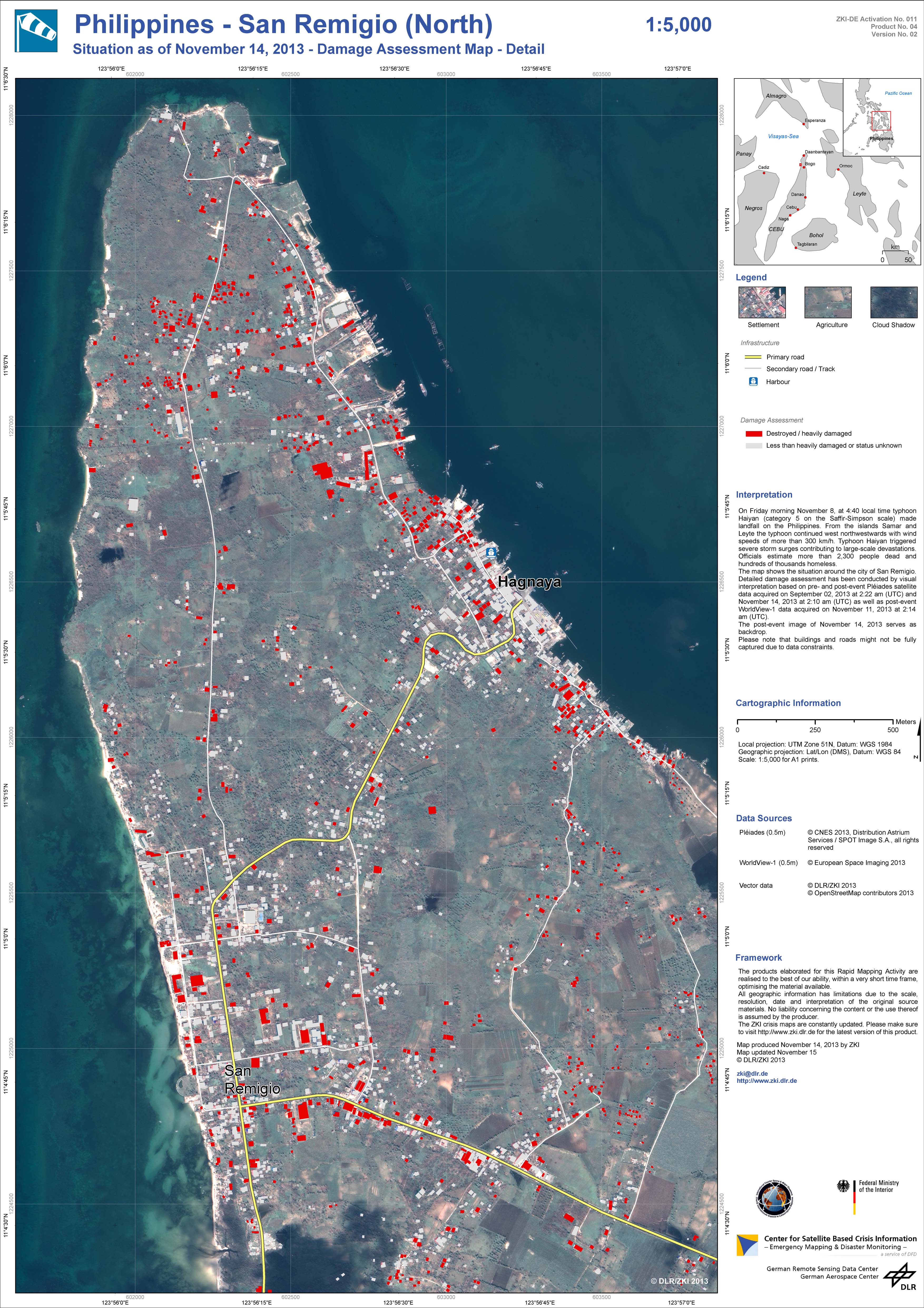
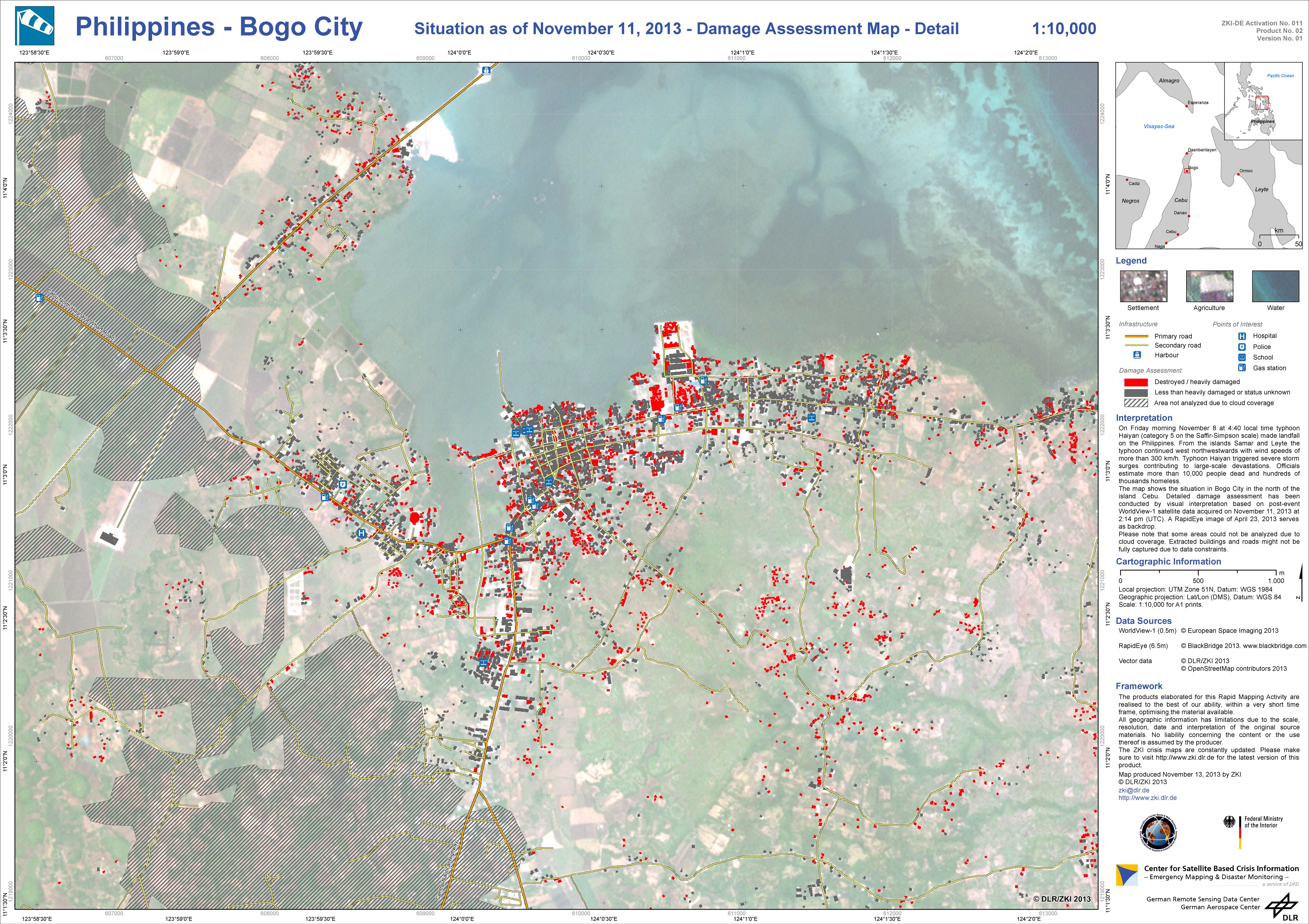
Damage assessment map
San Remigio (North), Philippines
版权: Pleiades © CNES 2013 - Distribution: Spot Image S.A., all rights reserved
WorldView-1 © European Space Imaging 2013
Map produced by DLR/ZKI
Information about the Product
已获得: Pleiades: 02/09/2013 and 14/11/2013
WorldView-1: 11/11/2013
源: Pleiades and WorldView-1
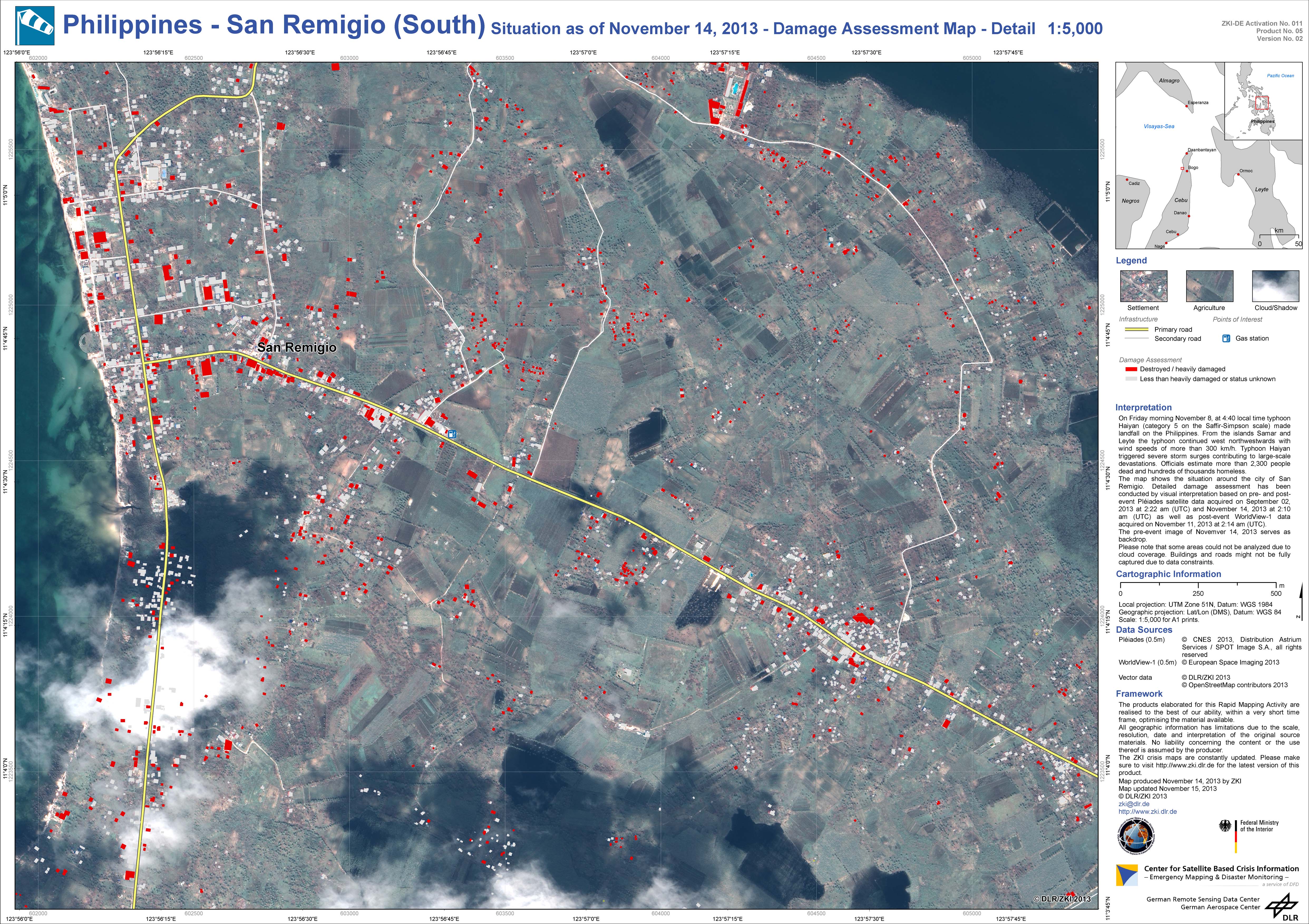
Damage assessment map
San Remigio (South), Philippines
版权: Pleiades © CNES 2013 - Distribution: Spot Image S.A., all rights reserved
WorldView-1 © European Space Imaging 2013
Map produced by DLR/ZKI
Information about the Product
已获得: Pleiades: 02/09/2013 and 14/11/2013
WorldView-1: 11/11/2013
源: Pleiades and WorldView-1
Damage assessment map
San Remigio (North), Philippines
版权: Pleiades © CNES 2013 - Distribution: Spot Image S.A., all rights reserved
WorldView-1 © European Space Imaging 2013
Map produced by DLR/ZKI
Information about the Product
已获得: Pleiades: 02/09/2013 and 14/11/2013
WorldView-1: 11/11/2013
源: Pleiades and WorldView-1

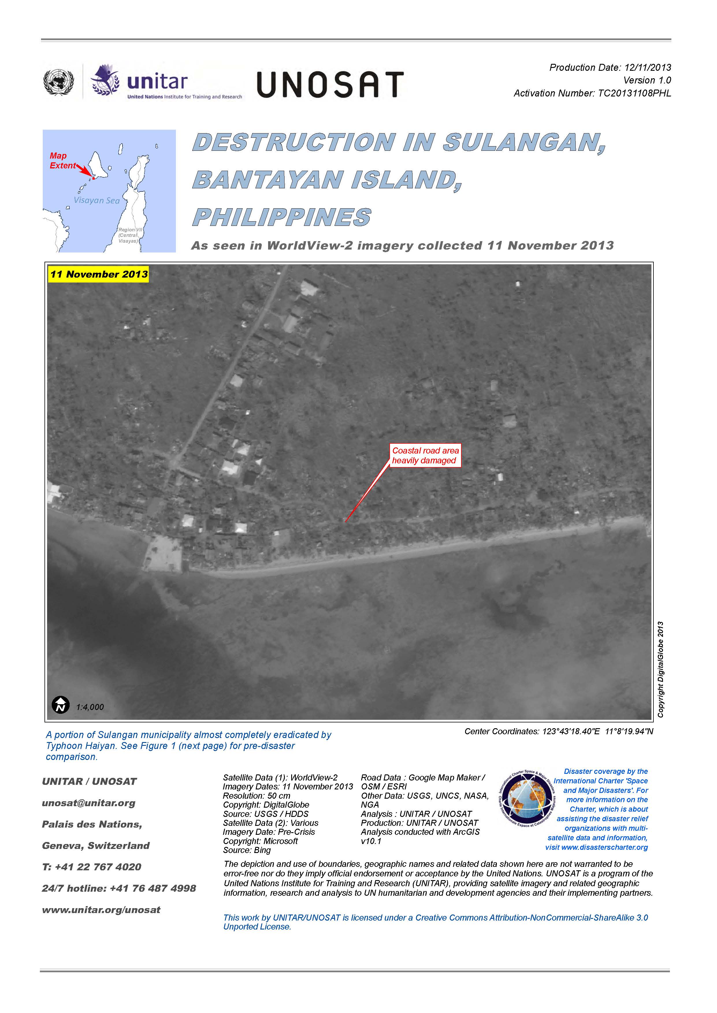
Destruction in Sulangan, Bantayan Island, Philippines
View the full report (PDF)
版权: DigitalGlobe
Map produced by UNITAR/UNOSAT
Information about the Product
已获得: 11/11/2013
源: WorldView-2
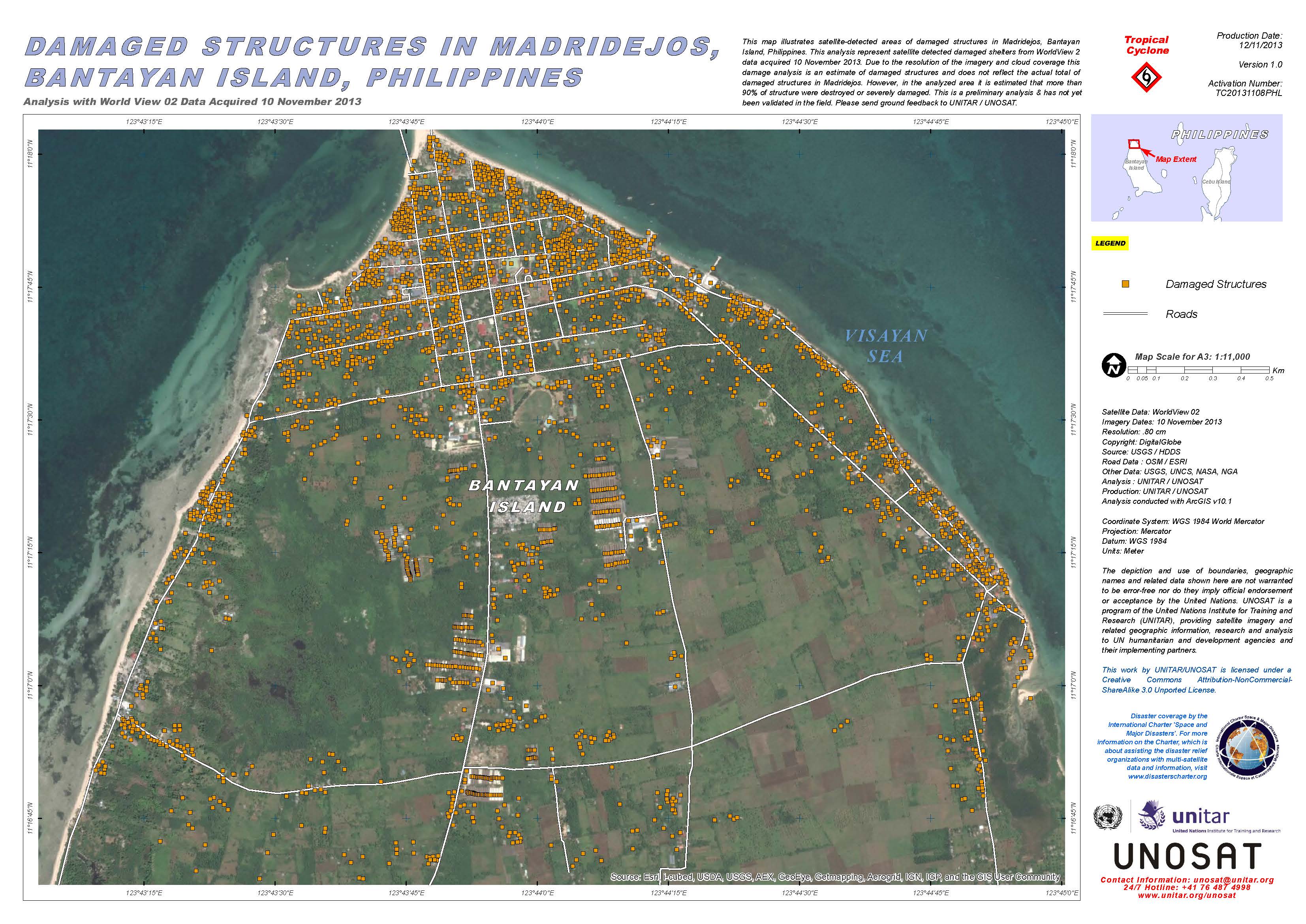

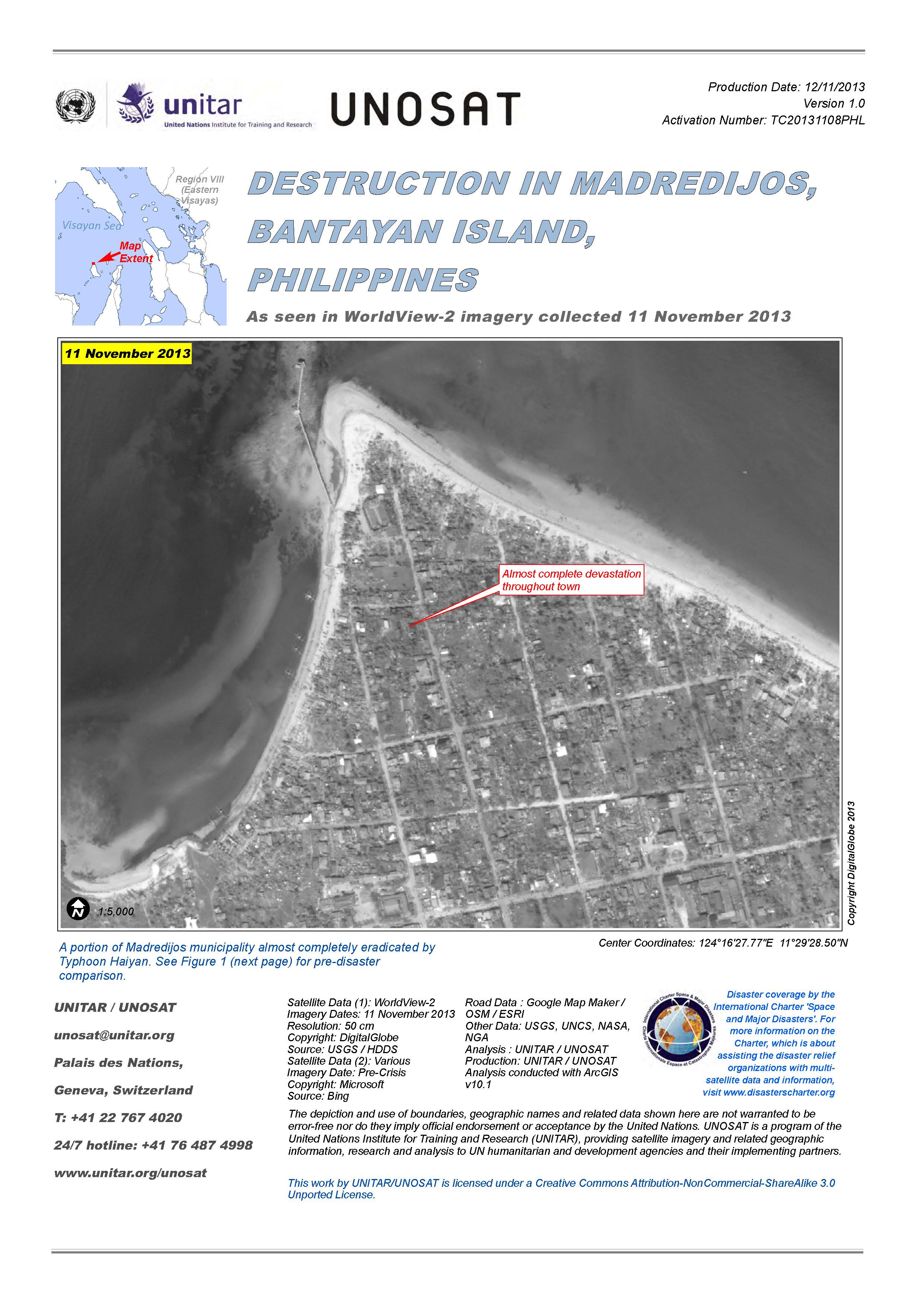
Destruction in Madredijos, Bantayan Island, Philippines
View full report (PDF)
版权: DigitalGlobe
Map produced by UNITAR/UNOSAT
Information about the Product
已获得: 11/11/2013
源: WorldView-2
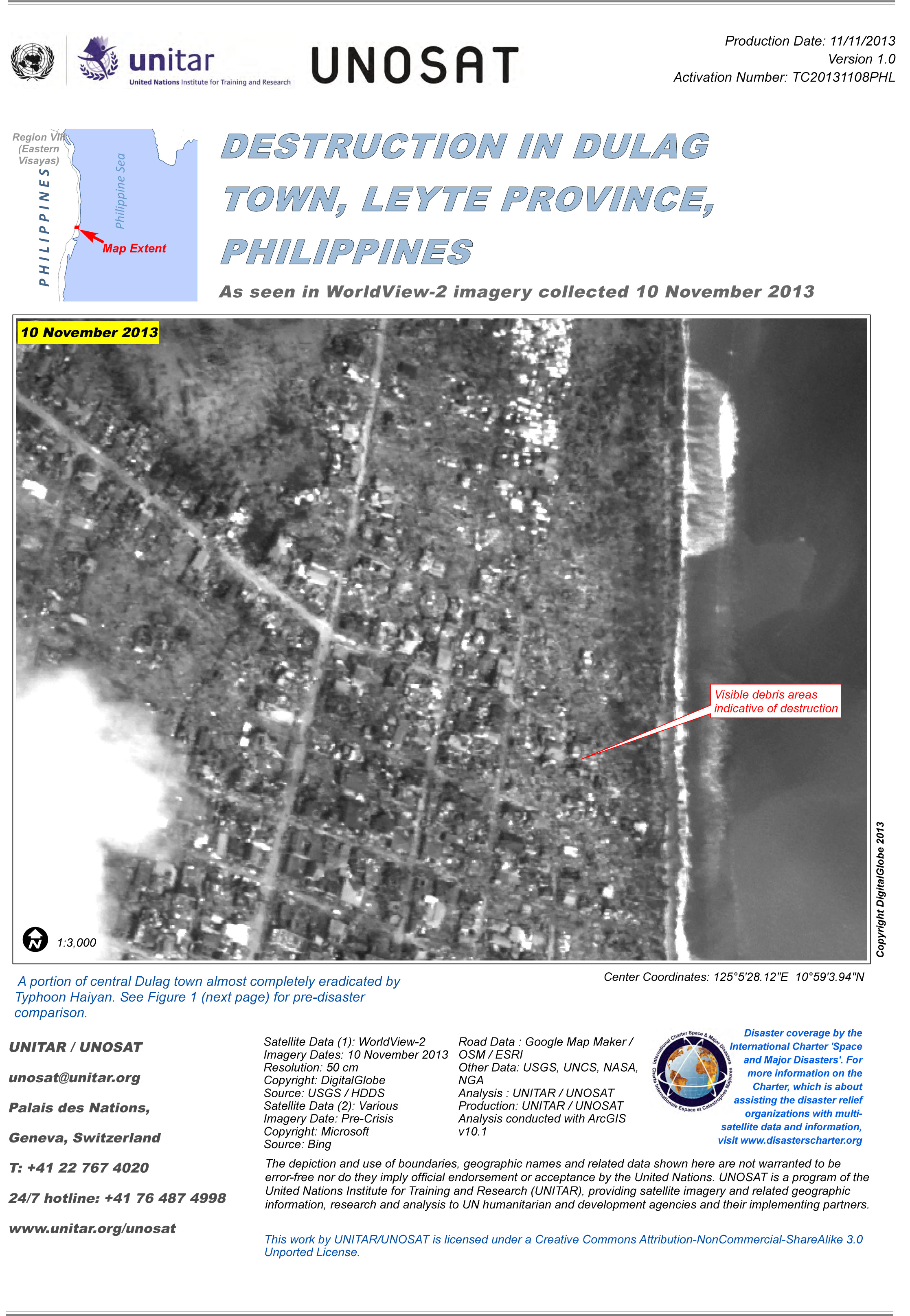
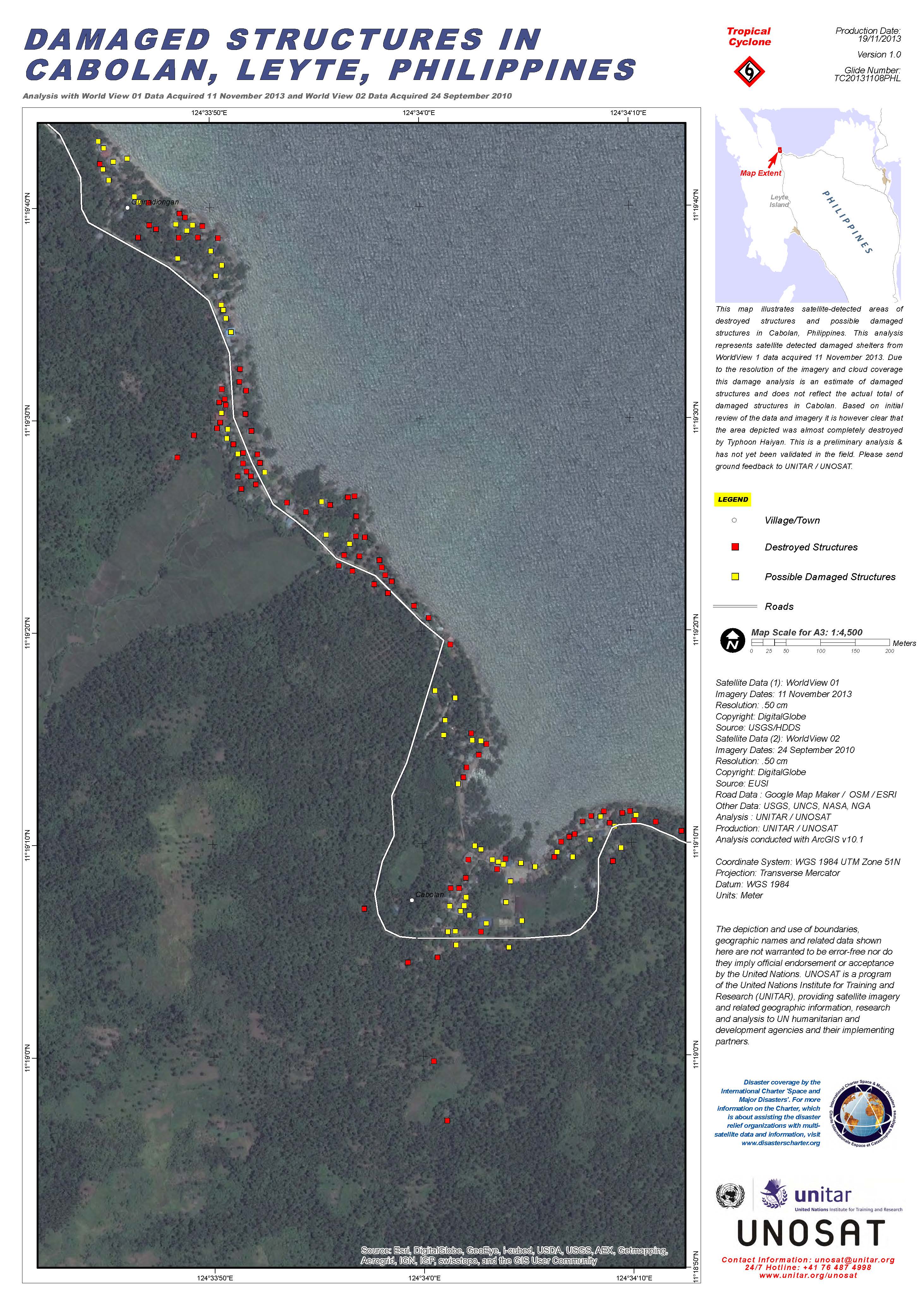
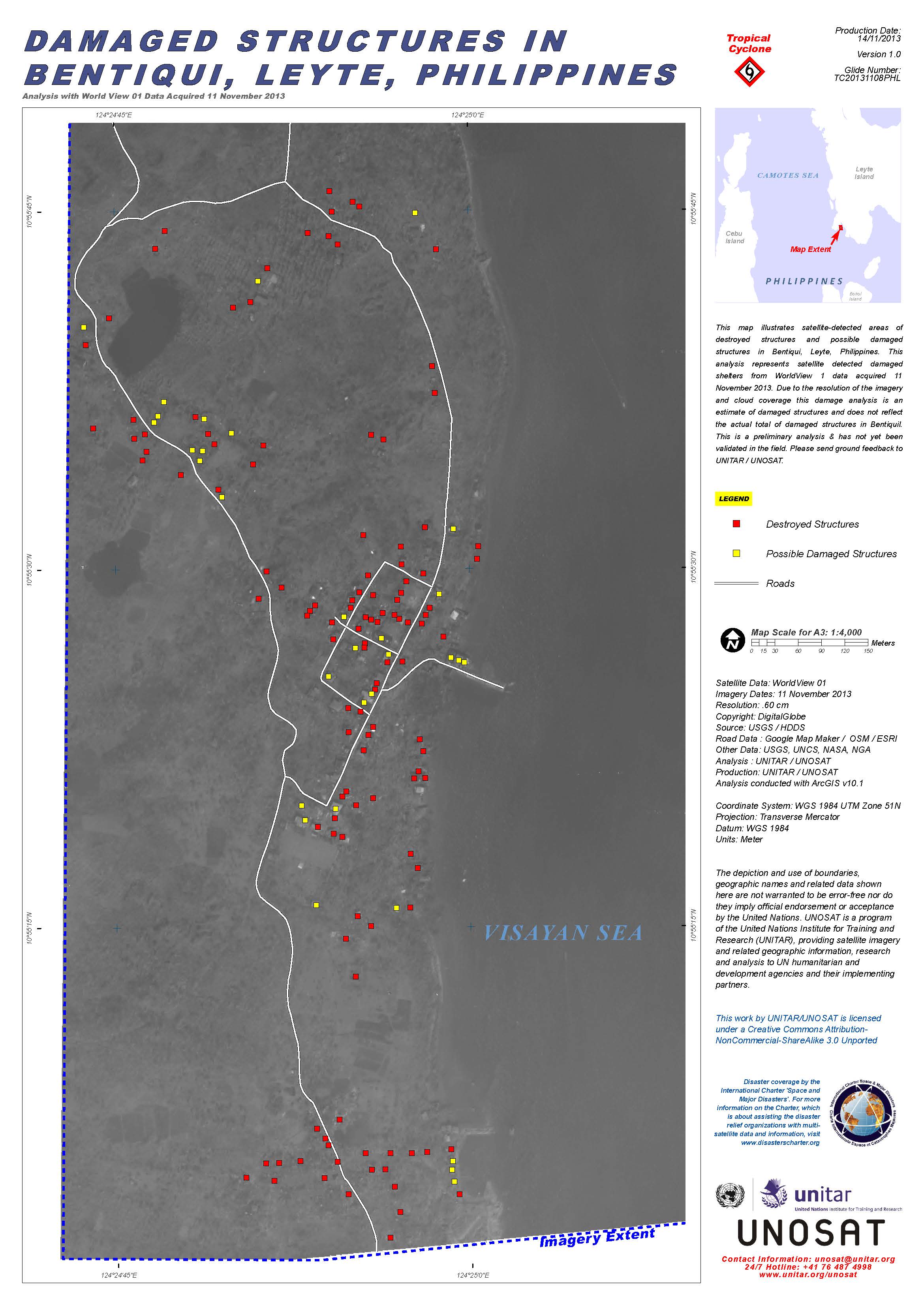
Destruction in Dulag Town, Leyte Province, Philippines
View full report (PDF)
版权: DigitalGlobe
Map produced by UNITAR/UNOSAT
Information about the Product
已获得: 10/11/2013
源: WorldView-2

Destruction in Luntad Town, Leyte Province, Philippines
View full report (PDF)
版权: DigitalGlobe
Map produced by UNITAR/UNOSAT
Information about the Product
已获得: 10/11/2013
源: WorldView-2

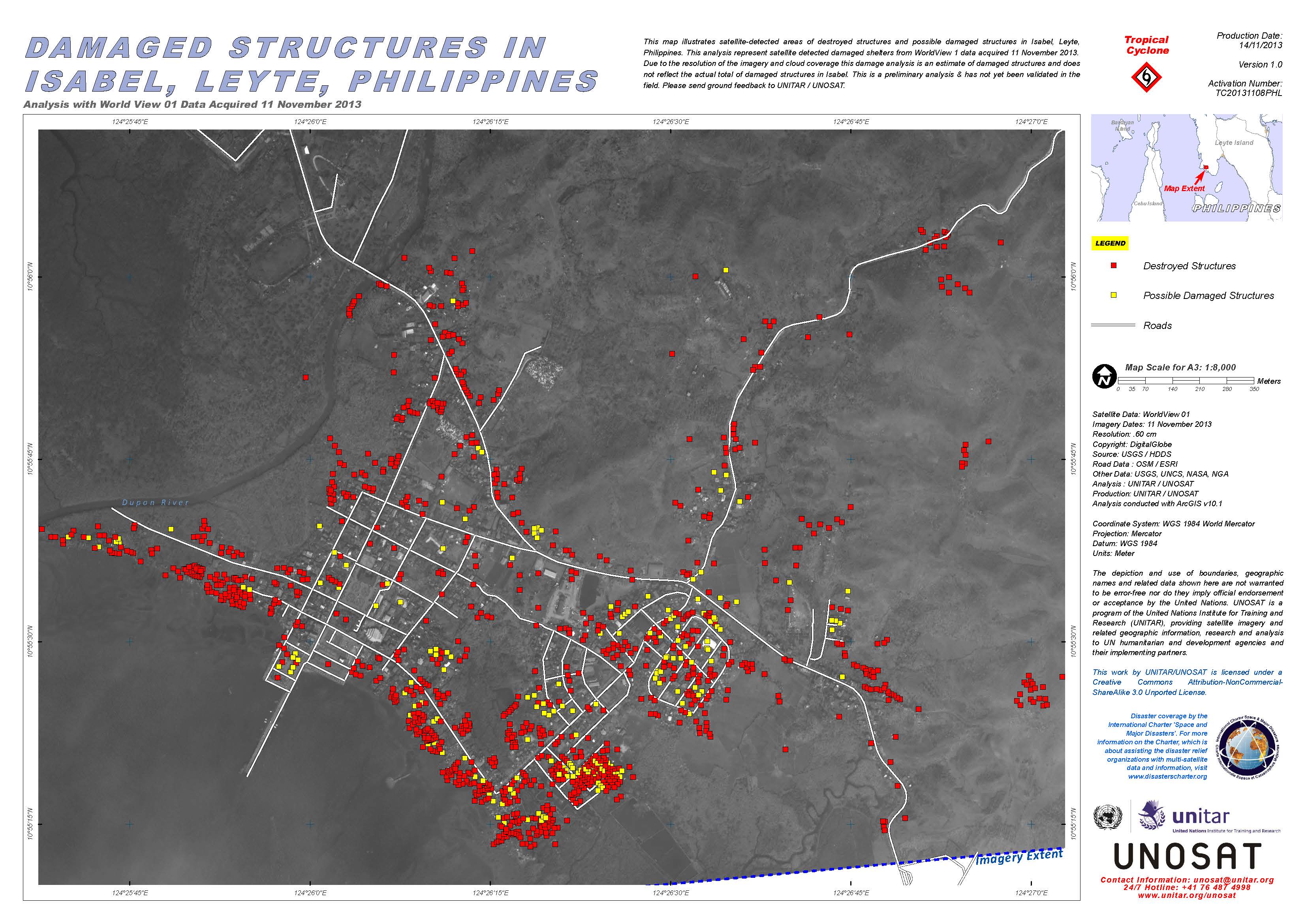
Destruction in Tacloban City, Leyte Province, Philippines
View full report (PDF)
版权: DigitalGlobe
Map produced by UNITAR/UNOSAT
Information about the Product
已获得: 10/11/2013
源: WorldView-2

Destruction in Tabontabon Town, Leyte Province, Philippines
View full report (PDF)
版权: DigitalGlobe
Map produced by UNITAR/UNOSAT
Information about the Product
已获得: 10/11/2013
源: WorldView-2
 返回完整的响应档案

