 English
 Spanish
 French
 Chinese
 Russian
 Portuguese
 Последняя Активация
Charter activations
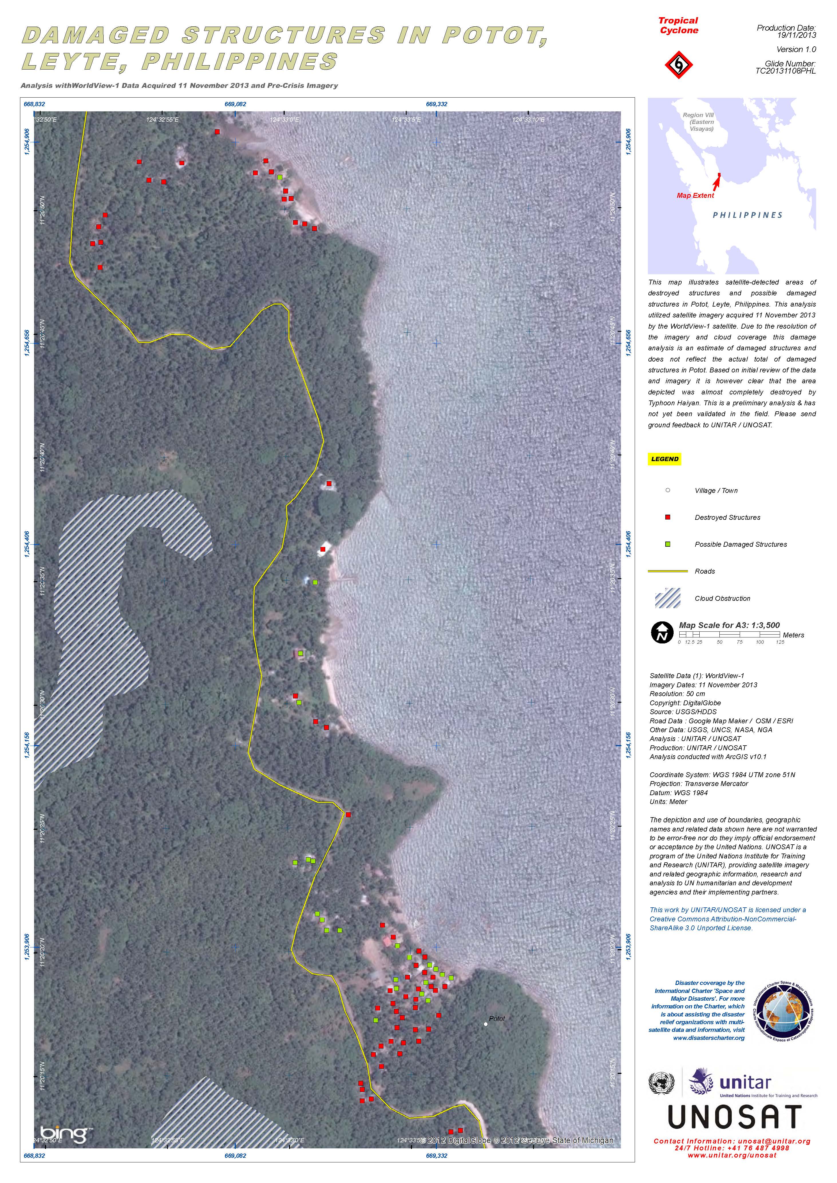
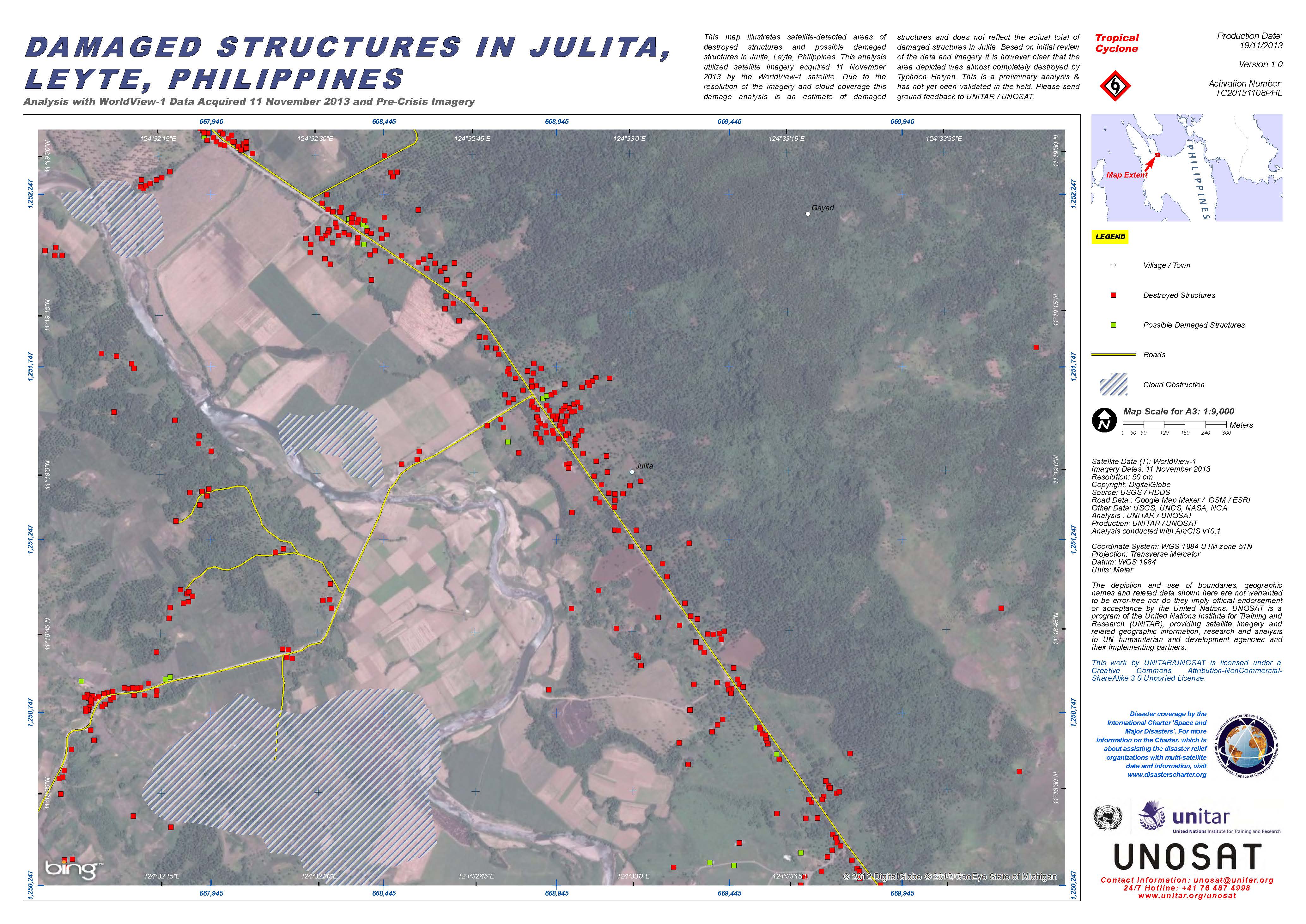
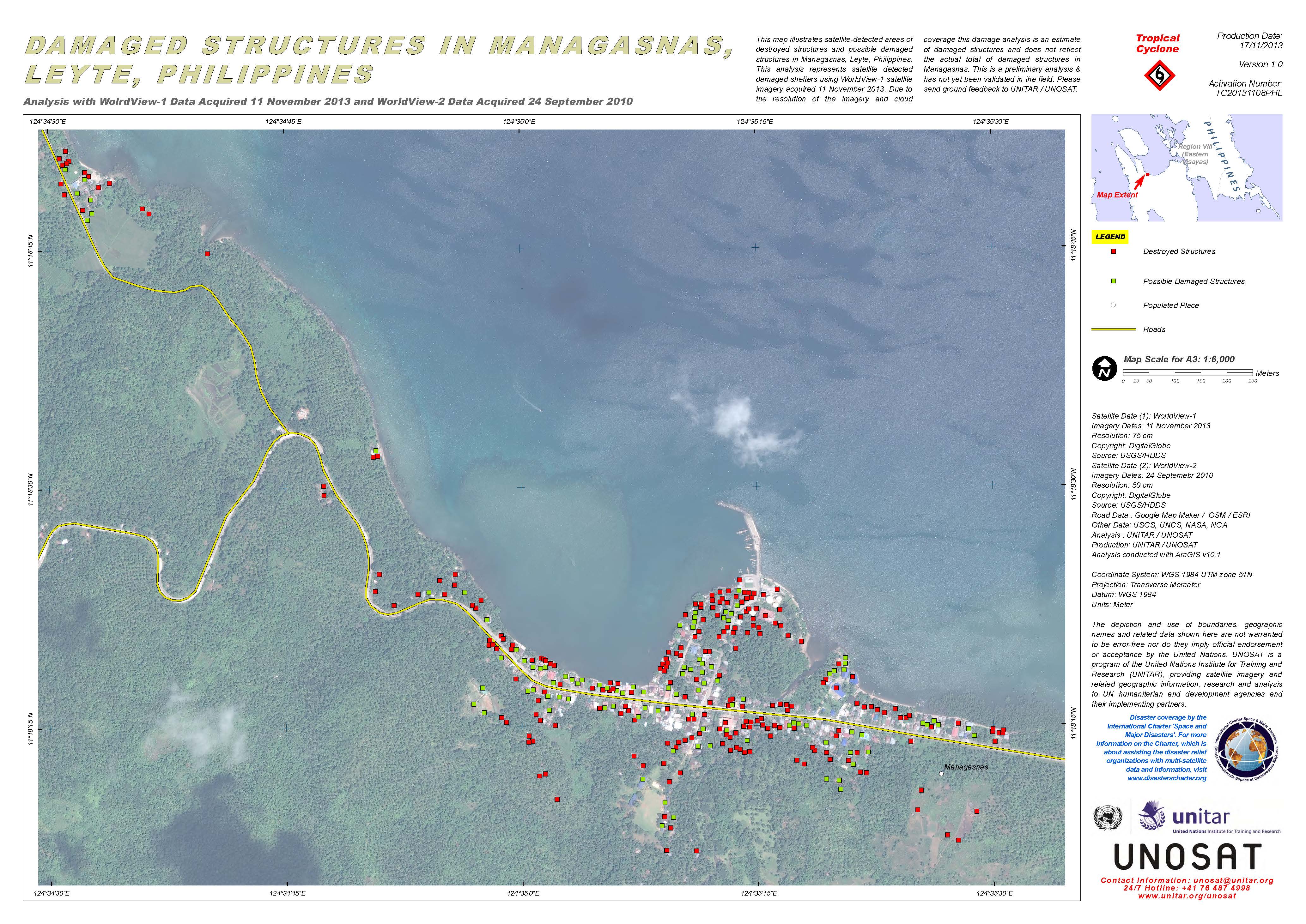
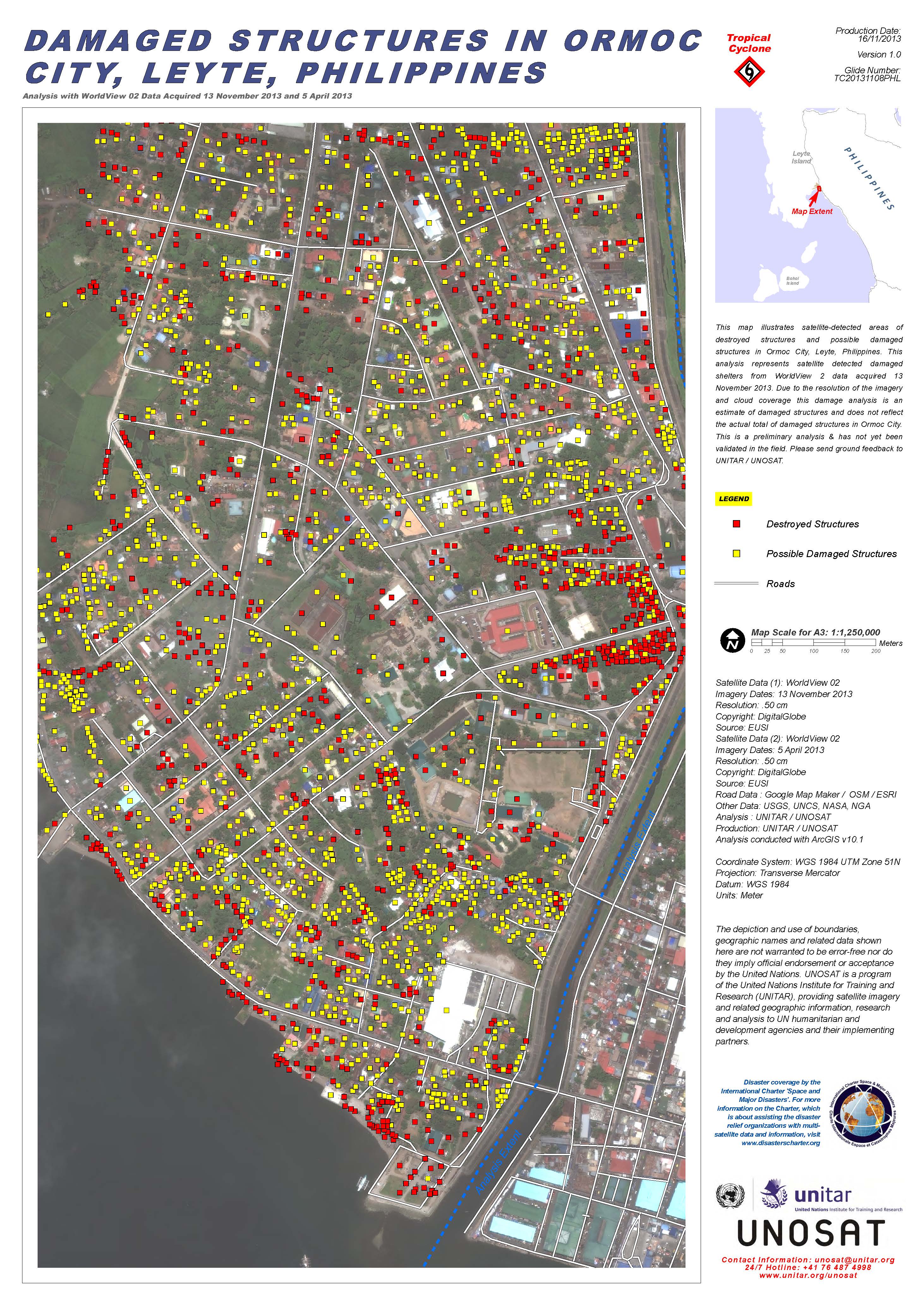
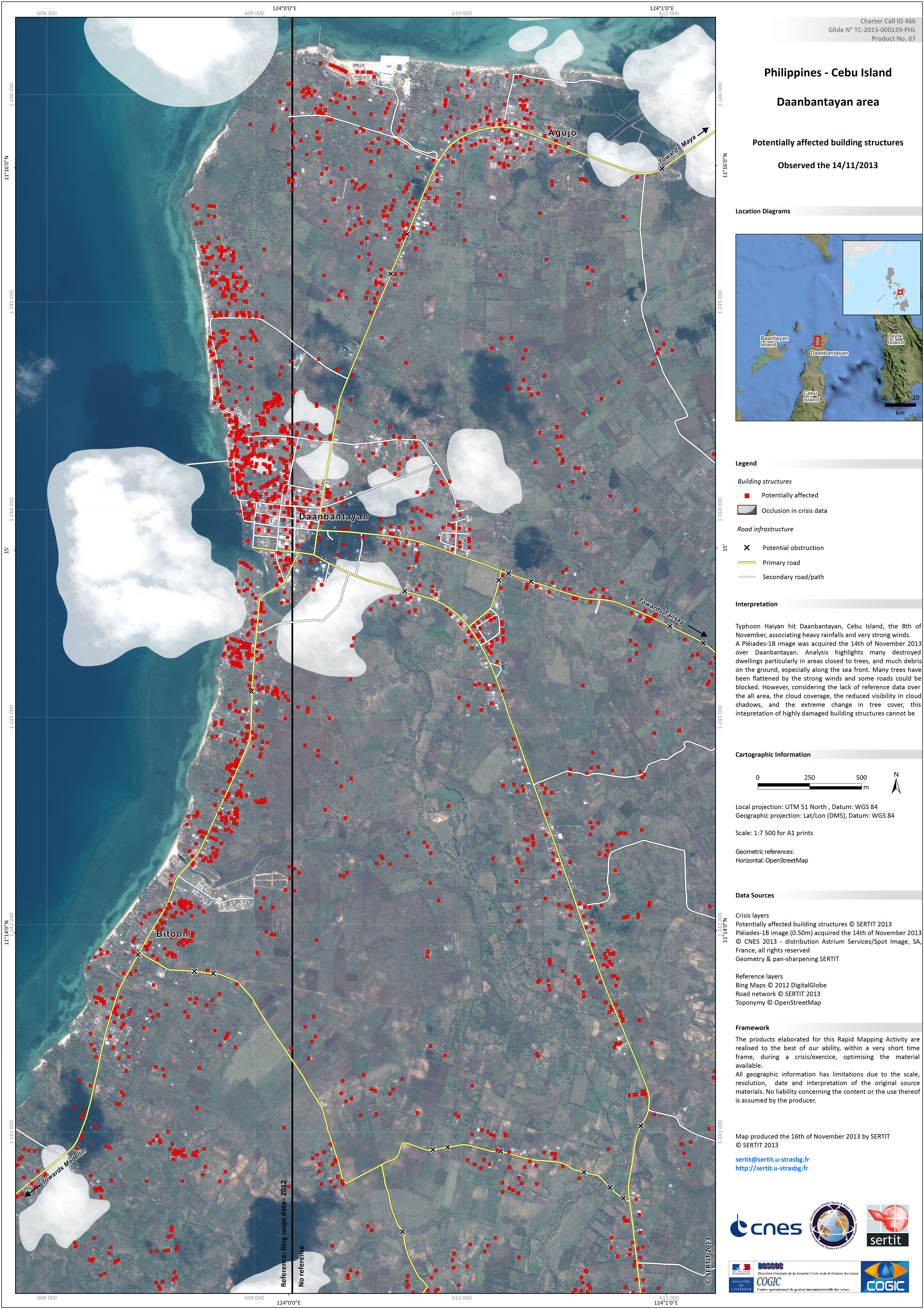
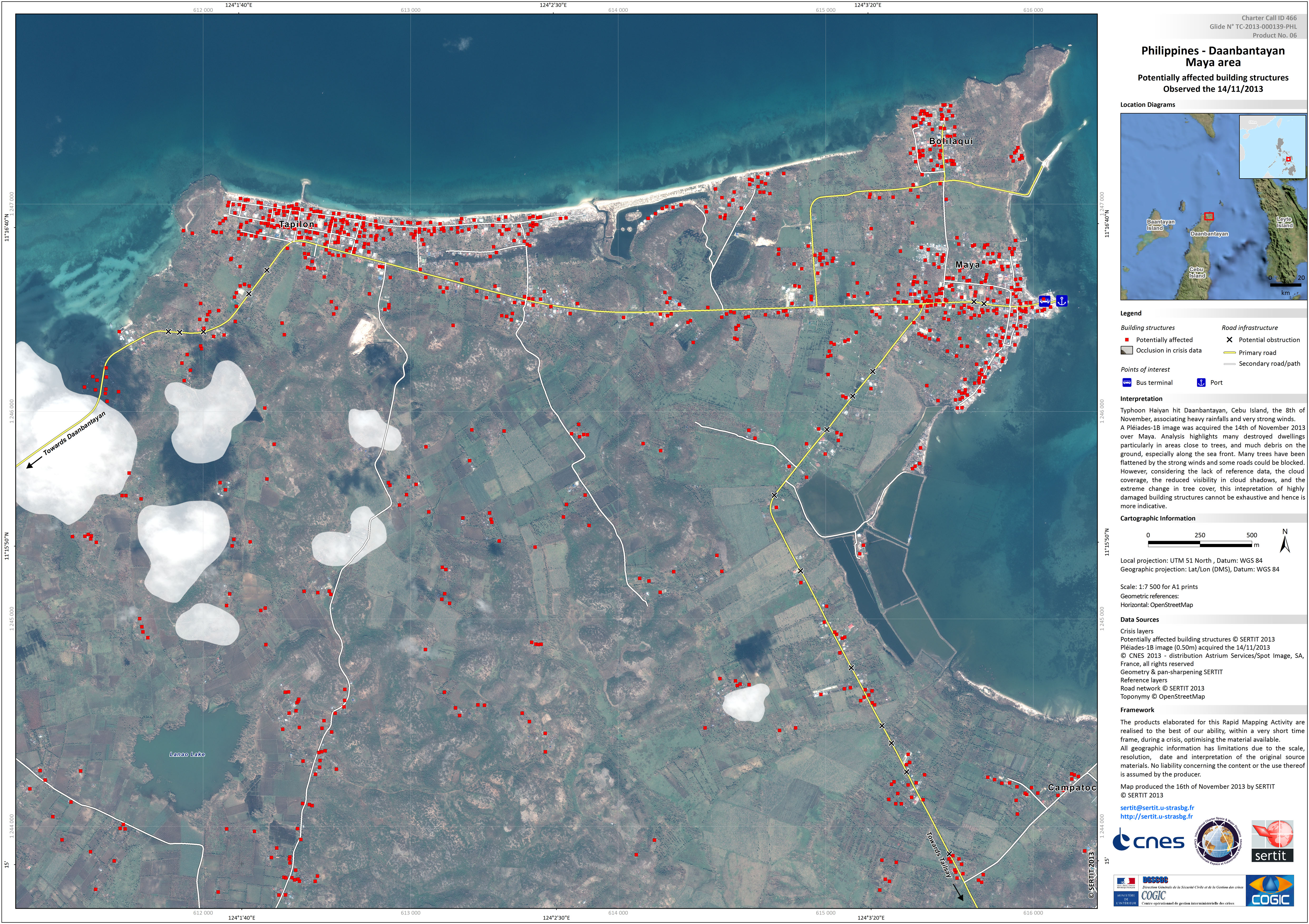
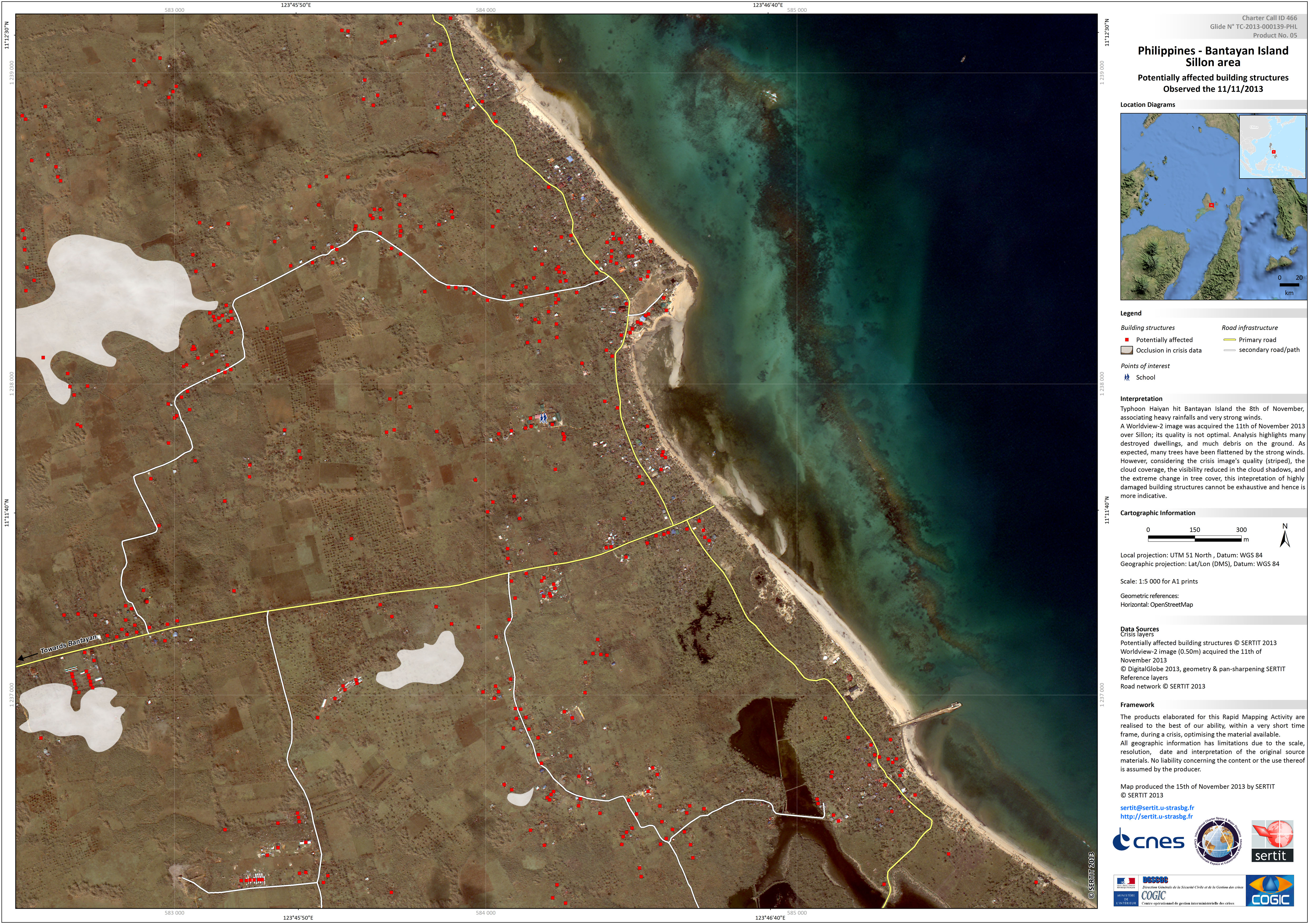
Typhoon Haiyan in the Philippines
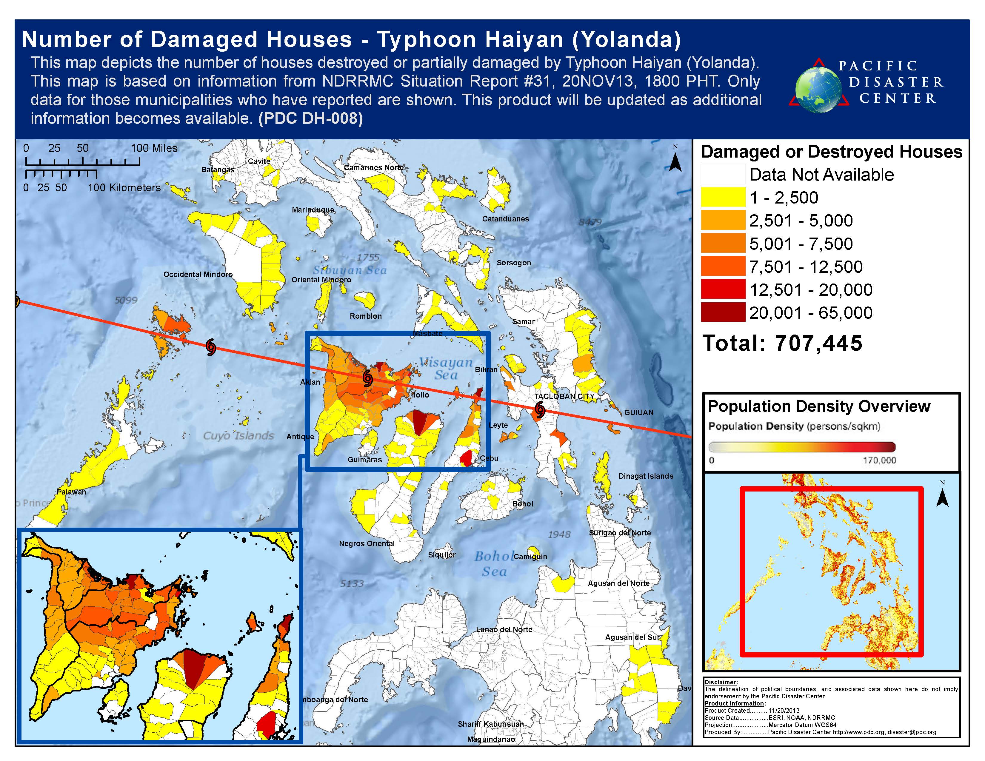
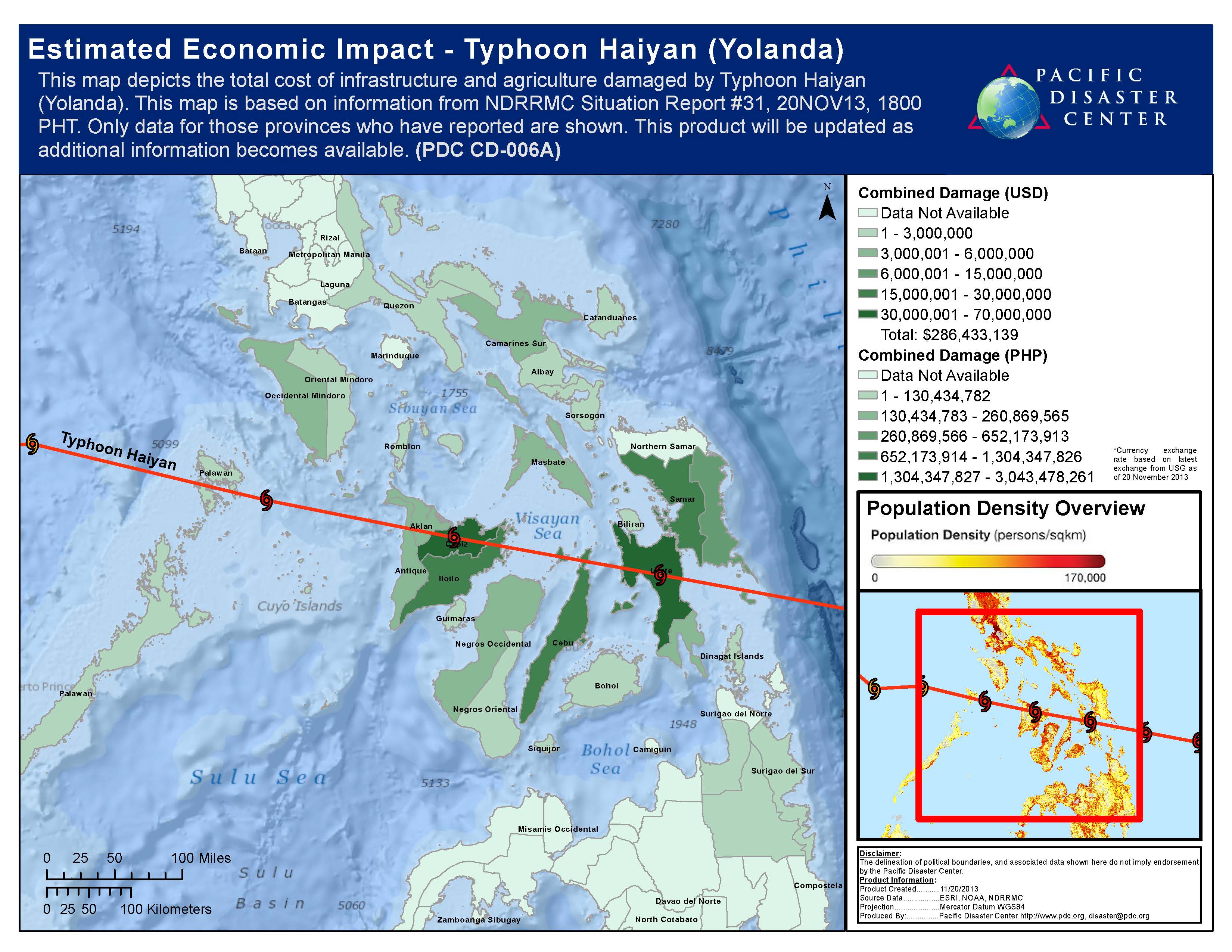
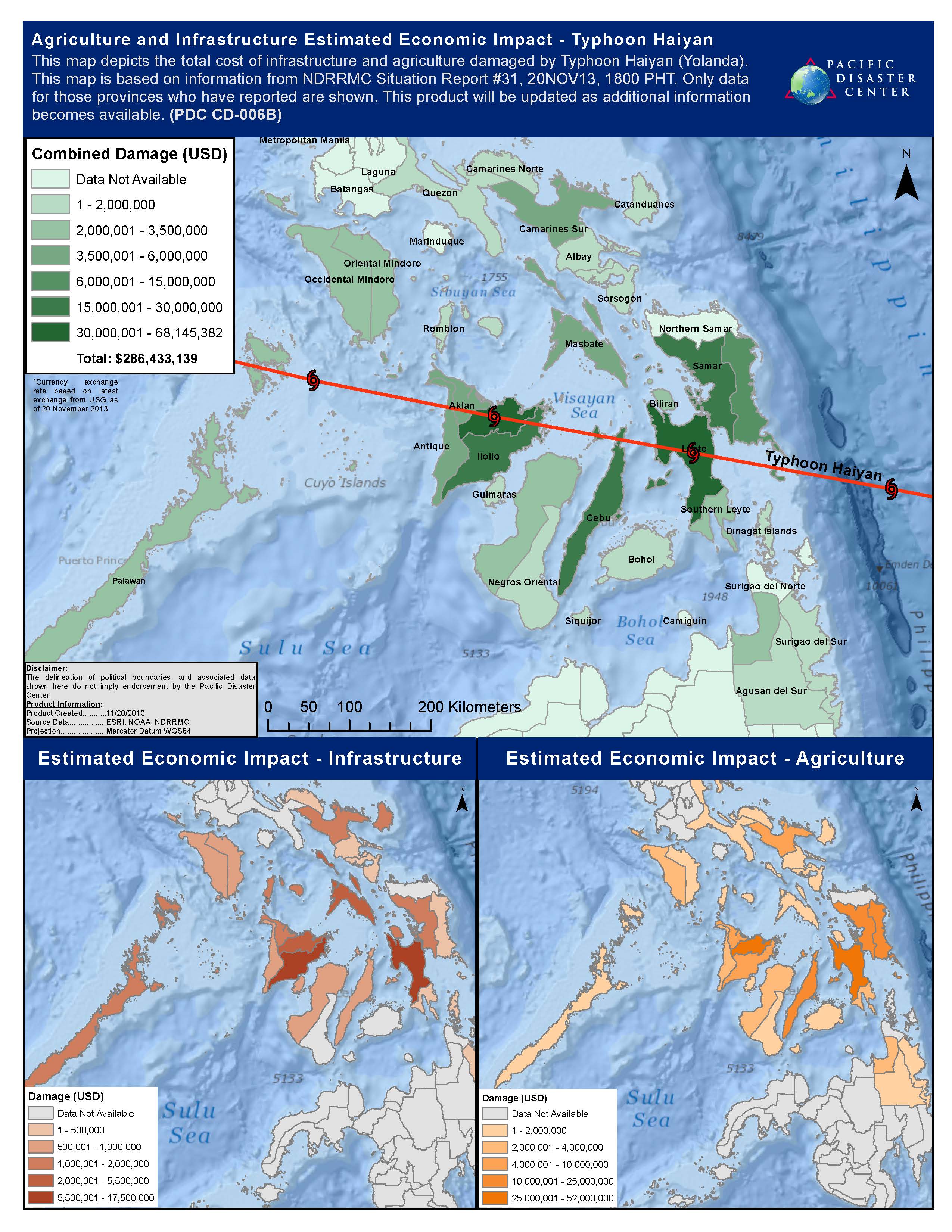
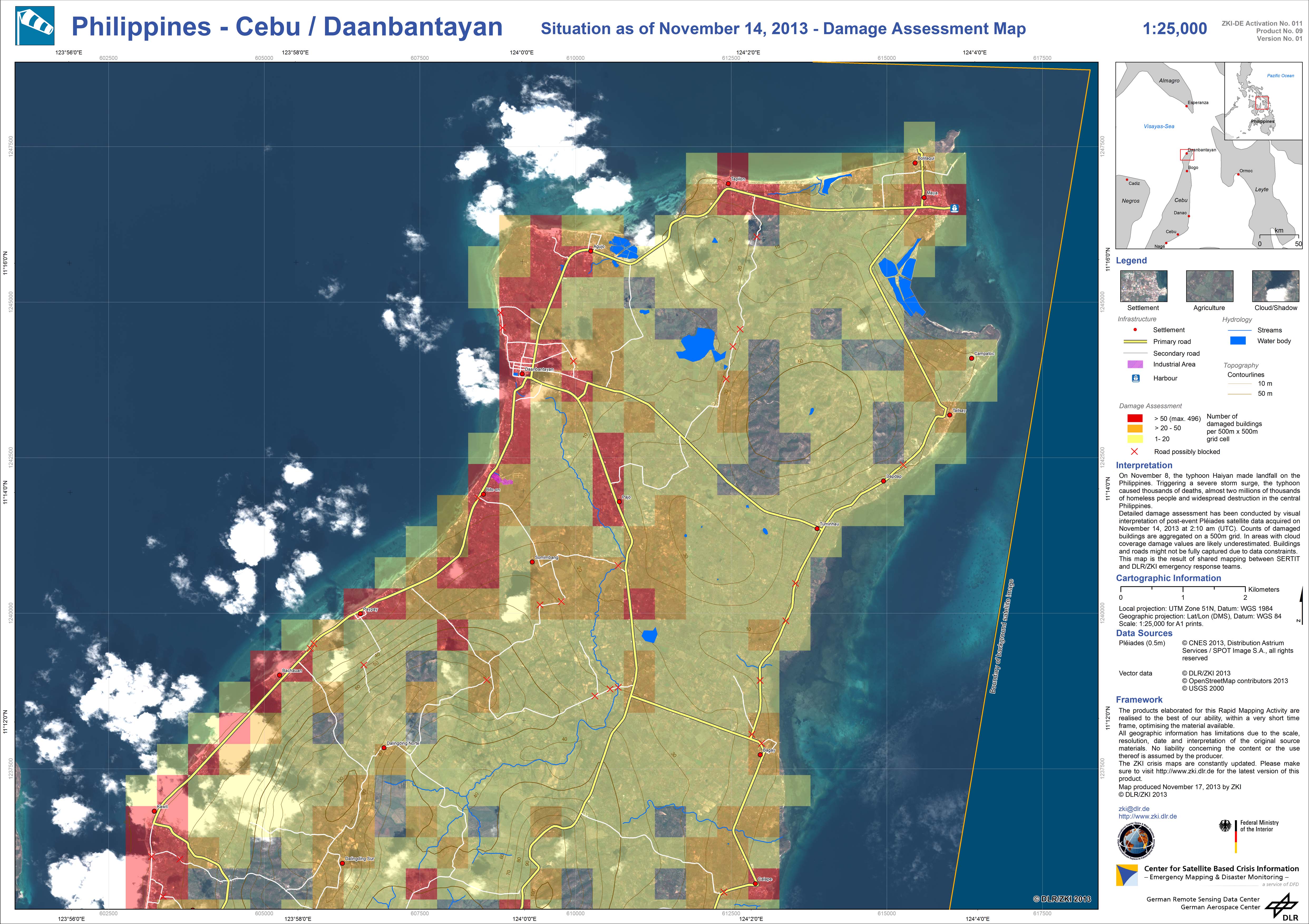
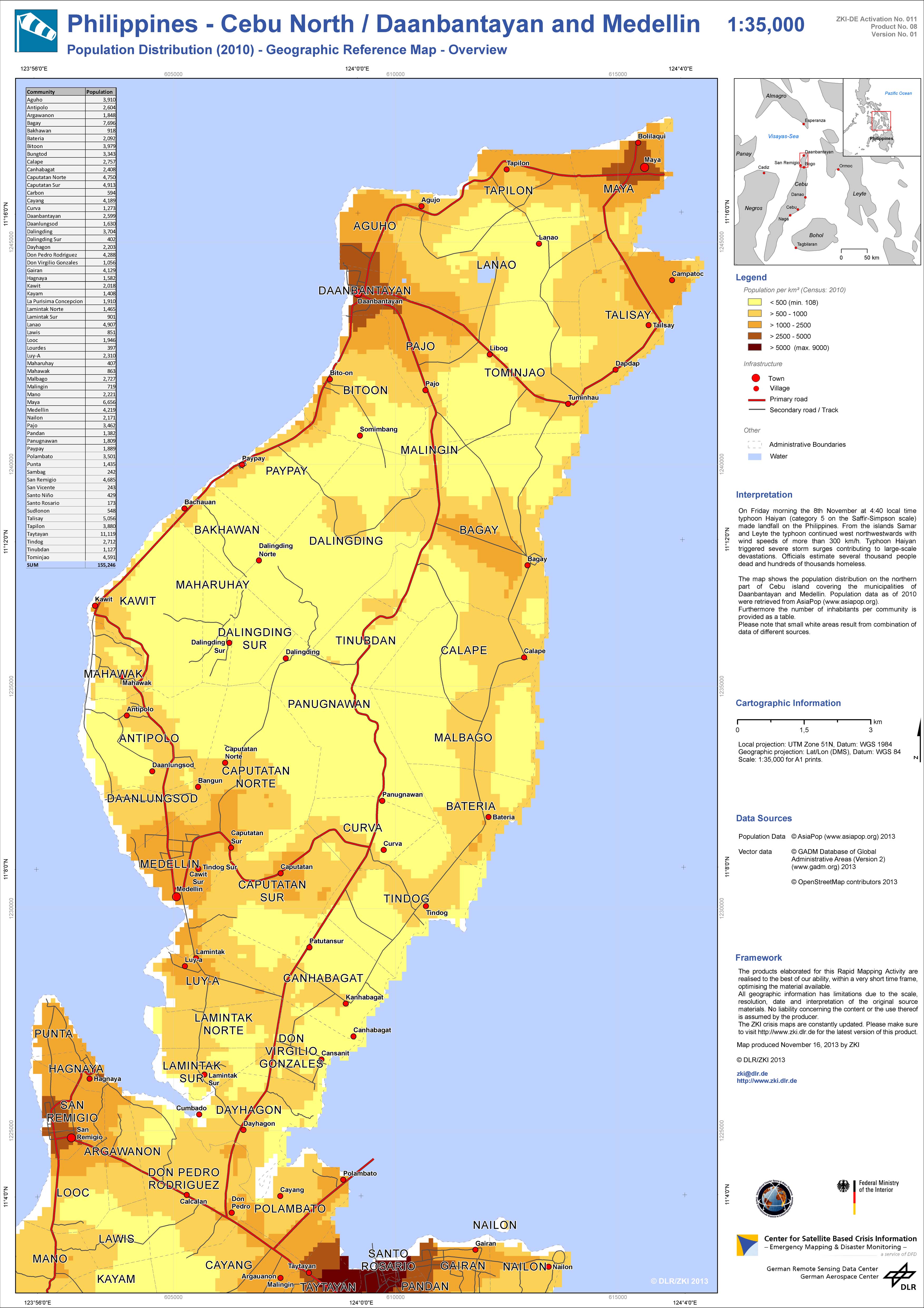
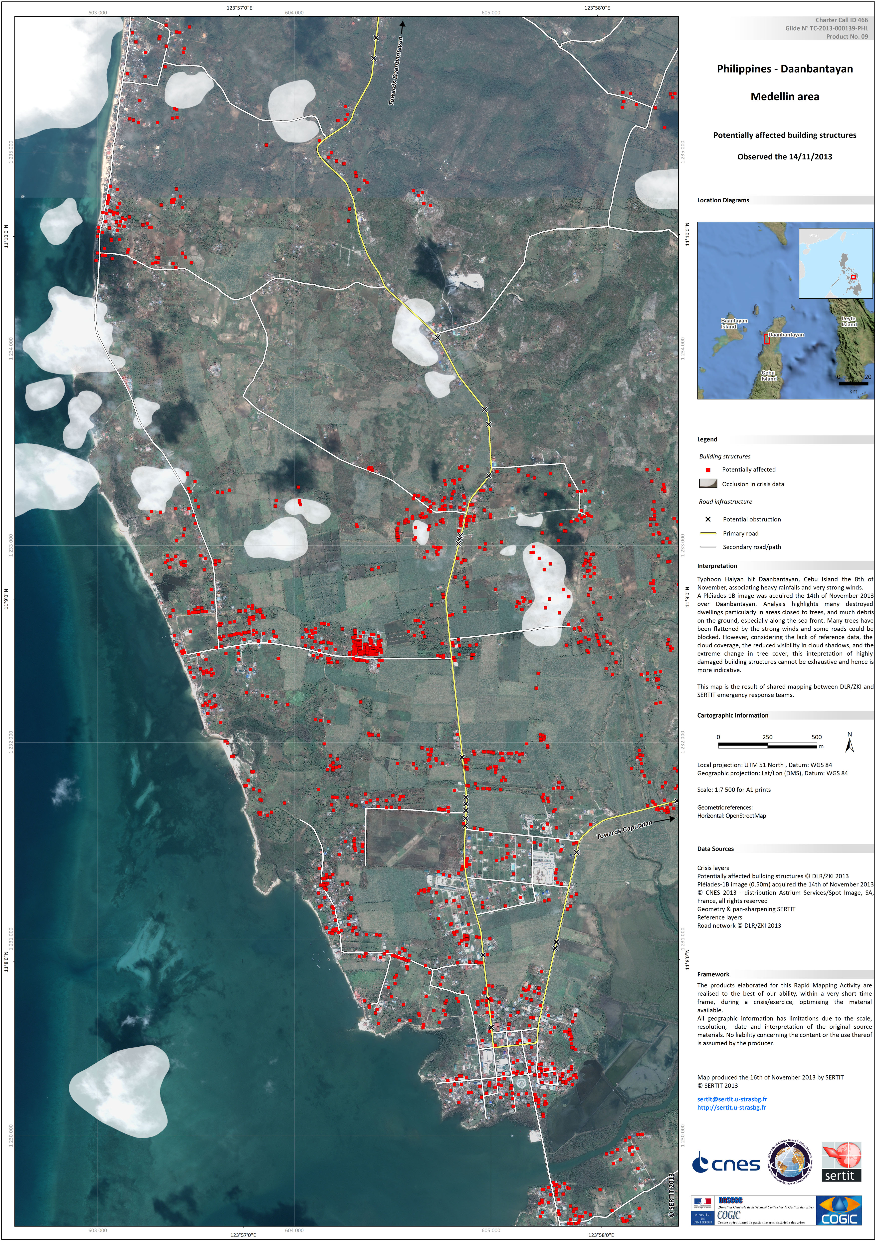
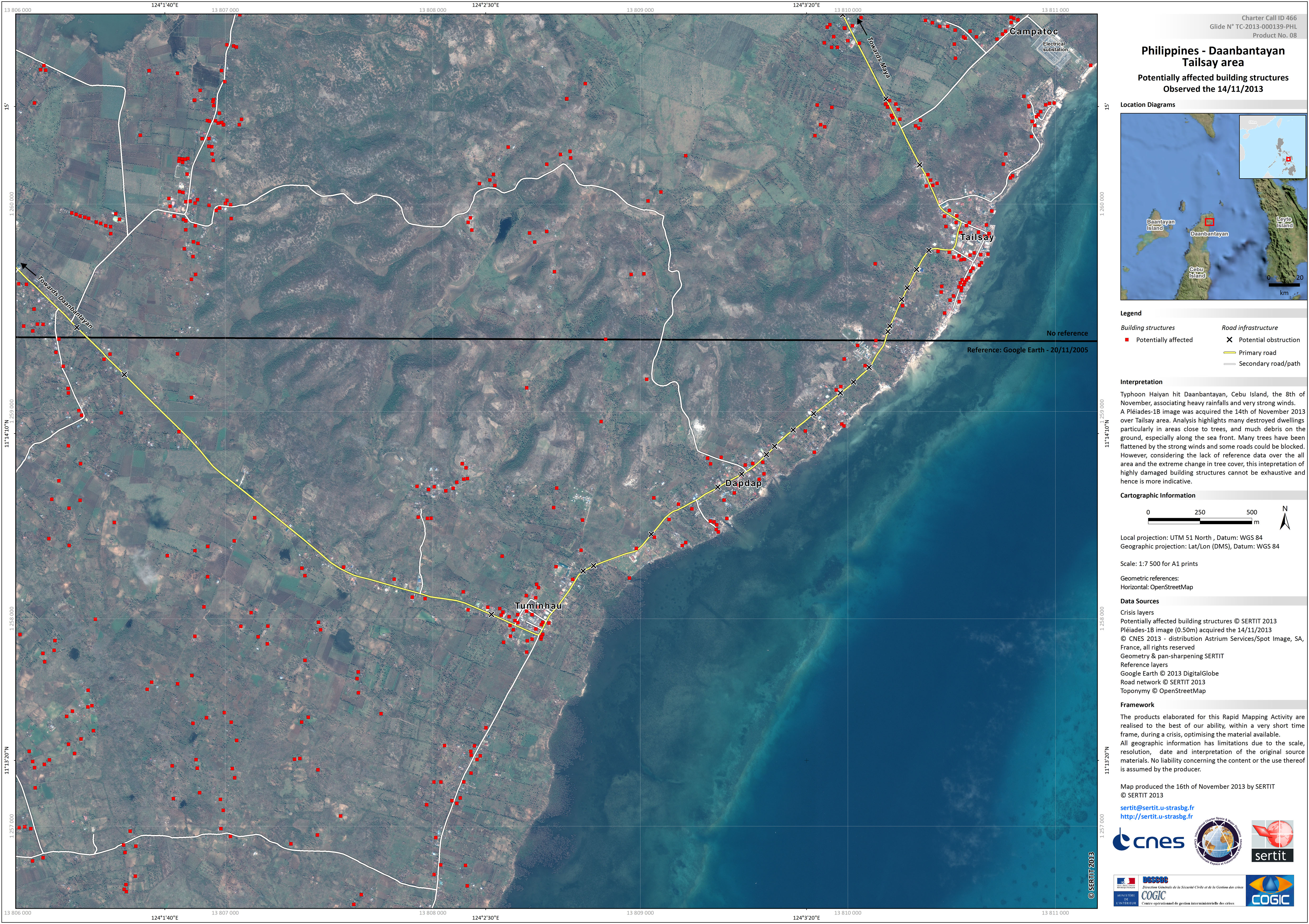
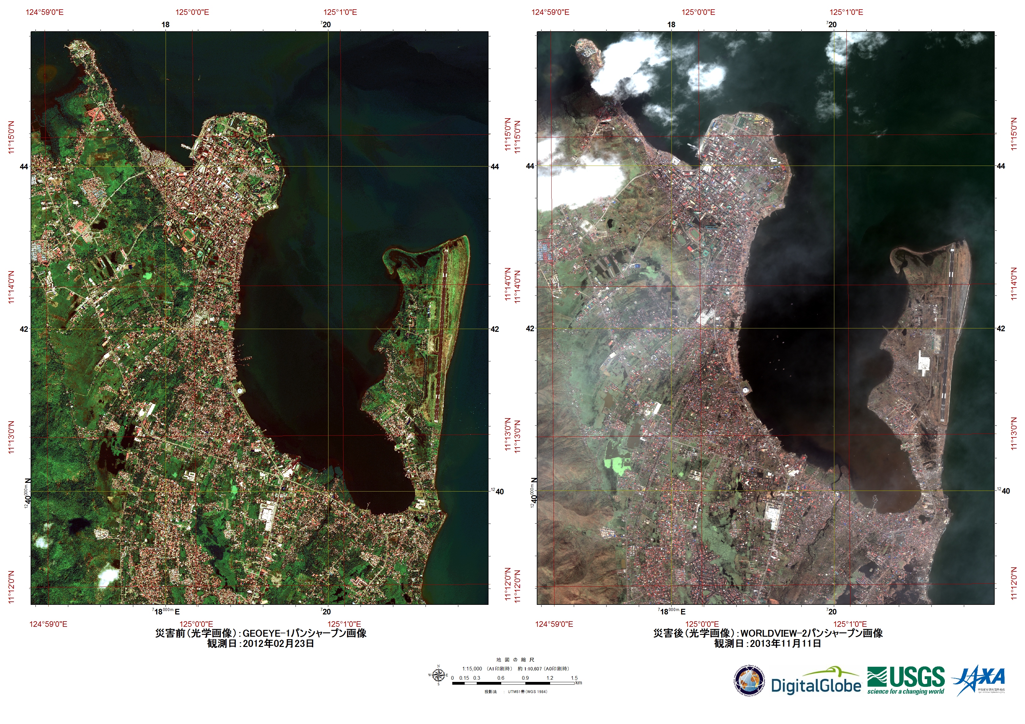
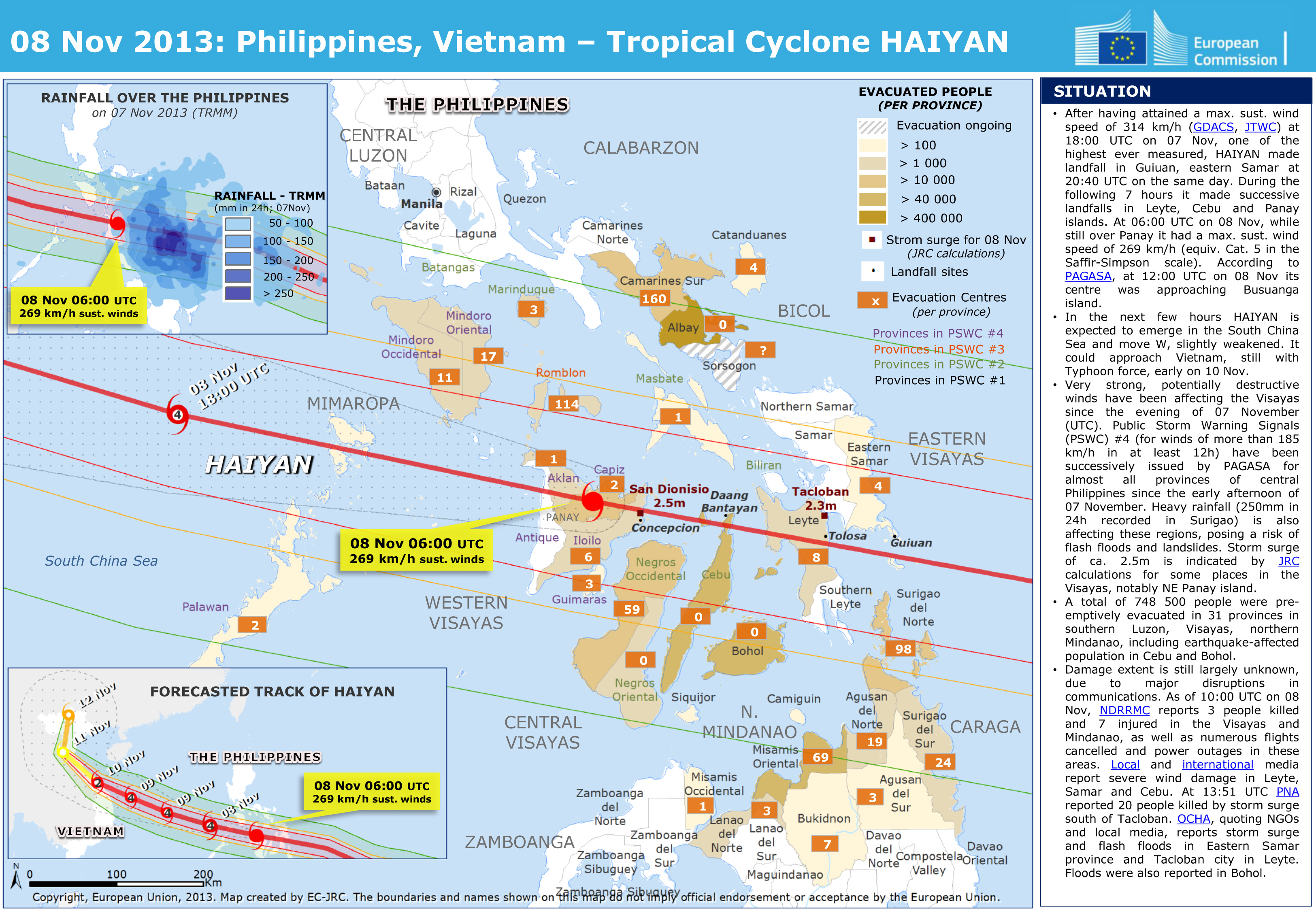
Super Typhoon Haiyan (known locally as Yolanda) made landfall over the central Philippines at 04:40, local time, on 08 November 2013. The official death toll from the storm was 6,300, but a full tally of the lives lost may never be achieved. Millions of people in 20 provinces were affected.
The category five storm brought winds as strong as 314 km/h and analysts believe it may be one of the strongest storms to make landfall in recorded history.
Among the worst affected areas were the central islands of Leyte and Samar and made landfall over the eastern Visayas. From there it moved in an easterly direction then north toward Vietnam and China over the coming days.
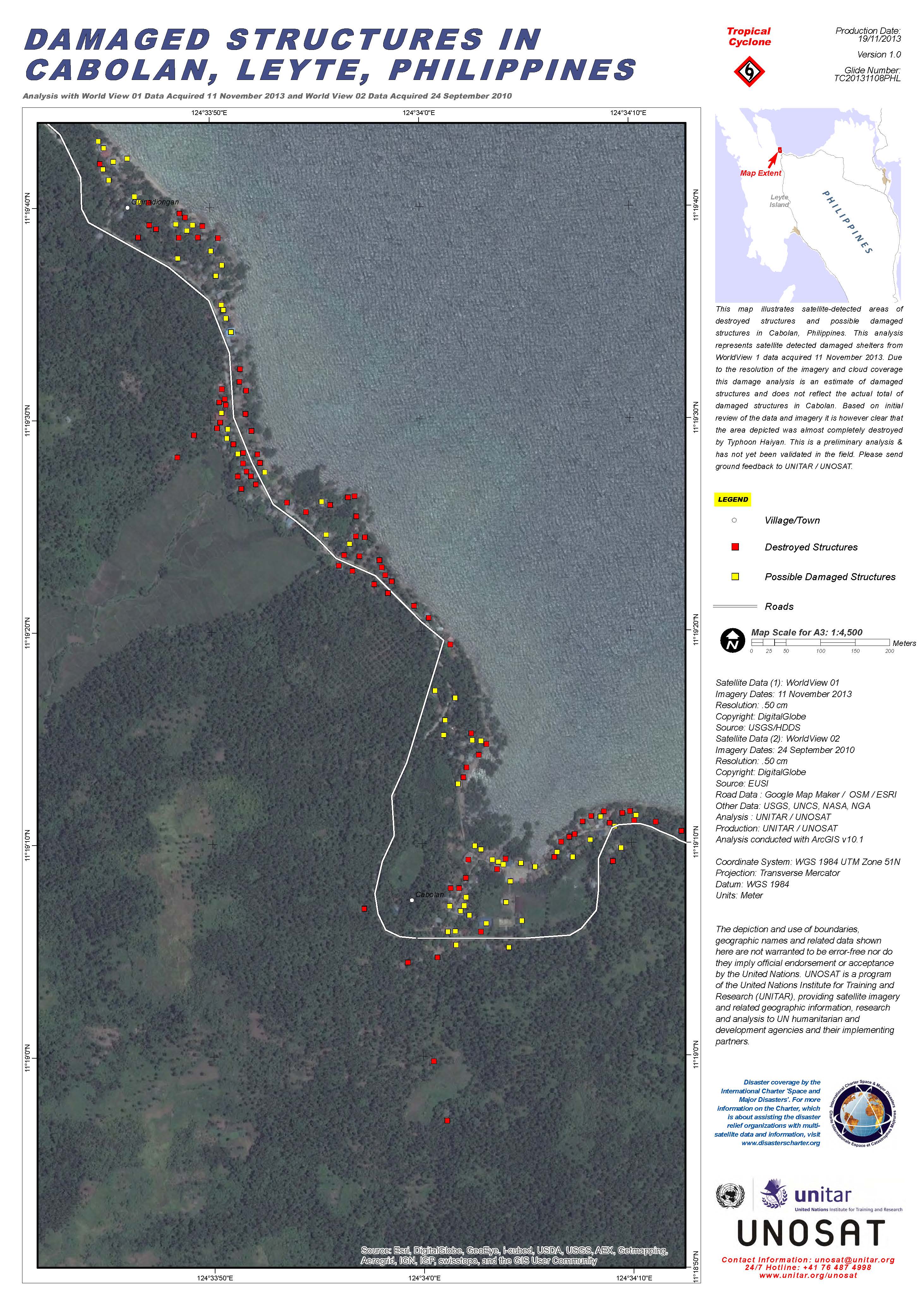
The storm left widespread damage in its wake across the Philippine islands, with power lines cut off and roads blocked by fallen debris and trees. Buildings were flattened under the strong winds, with wooden houses particularly susceptible to the storm. Haiyan also caused a storm surge which brought waves crashing down onto coastal areas, and the damage from the storm surge was more extensive than that of the winds.
The Philippines was still recovering from the 7.3 magnitude earthquake that struck the island of Bohol on 15 October, causing further misery to the island nation.
Typhoon Haiyan had a devastating and long-lasting impact on the Philippines.
| Тип события: | Ocean Storm - Typhoon |
| Место события: | The Philippines |
| Date of Charter Activation: | 08 November 2013 |
| Запрос на активацию поступил от: | UNITAR/UNOSAT on behalf of UNOCHA |
| Менеждер проекта от: | Pacific Disaster Center |
Products


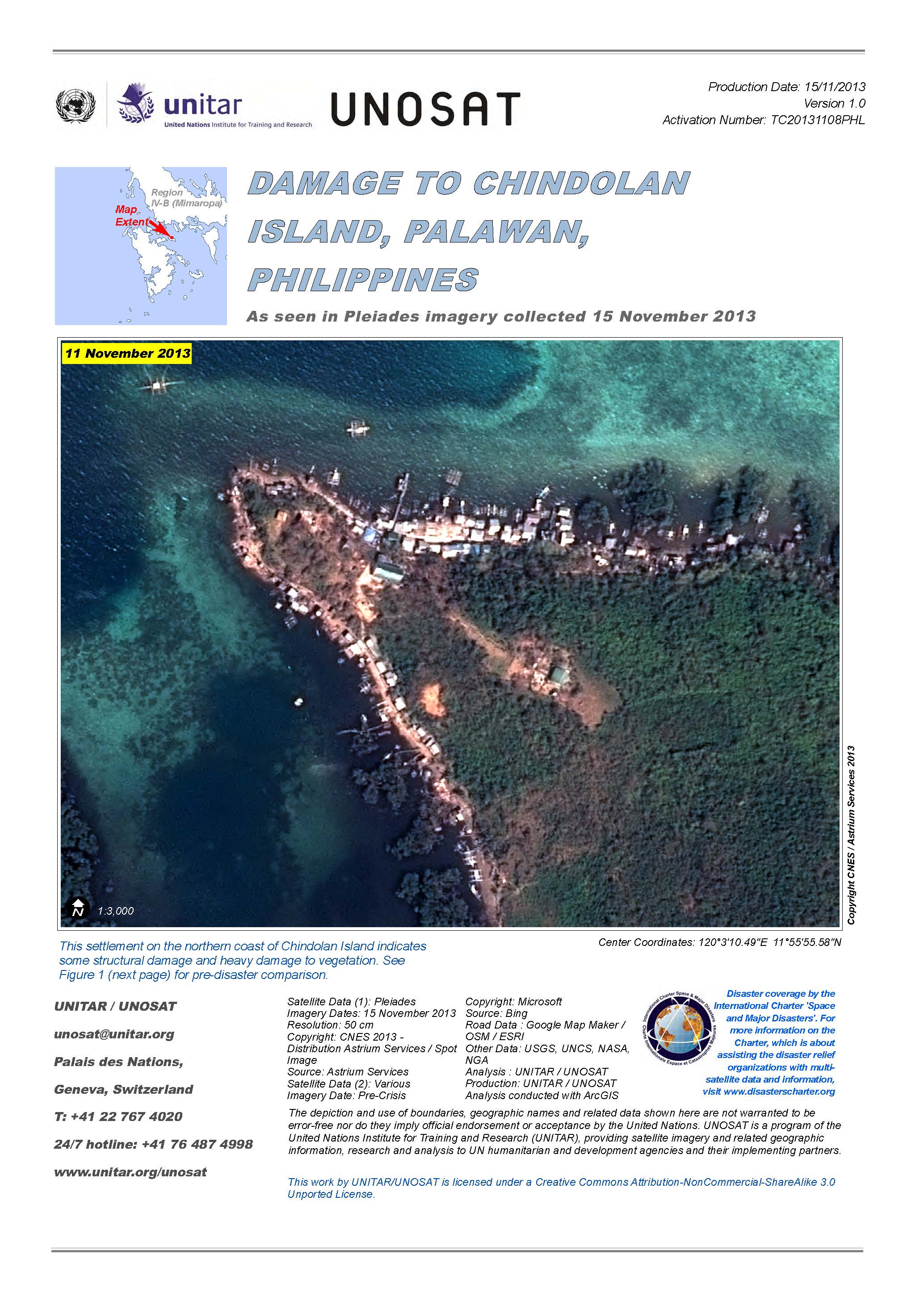
Damage to Chindolan Island, Palawan, Philippines
View the full report (PDF)
Авторские права: CNES 2013 - Distribution: Astrium Services/Spot Image S.A., all rights reserved
Map produced by UNITAR/UNOSAT
Information about the Product
Получено: 15/11/2013
Источник: Pleiades
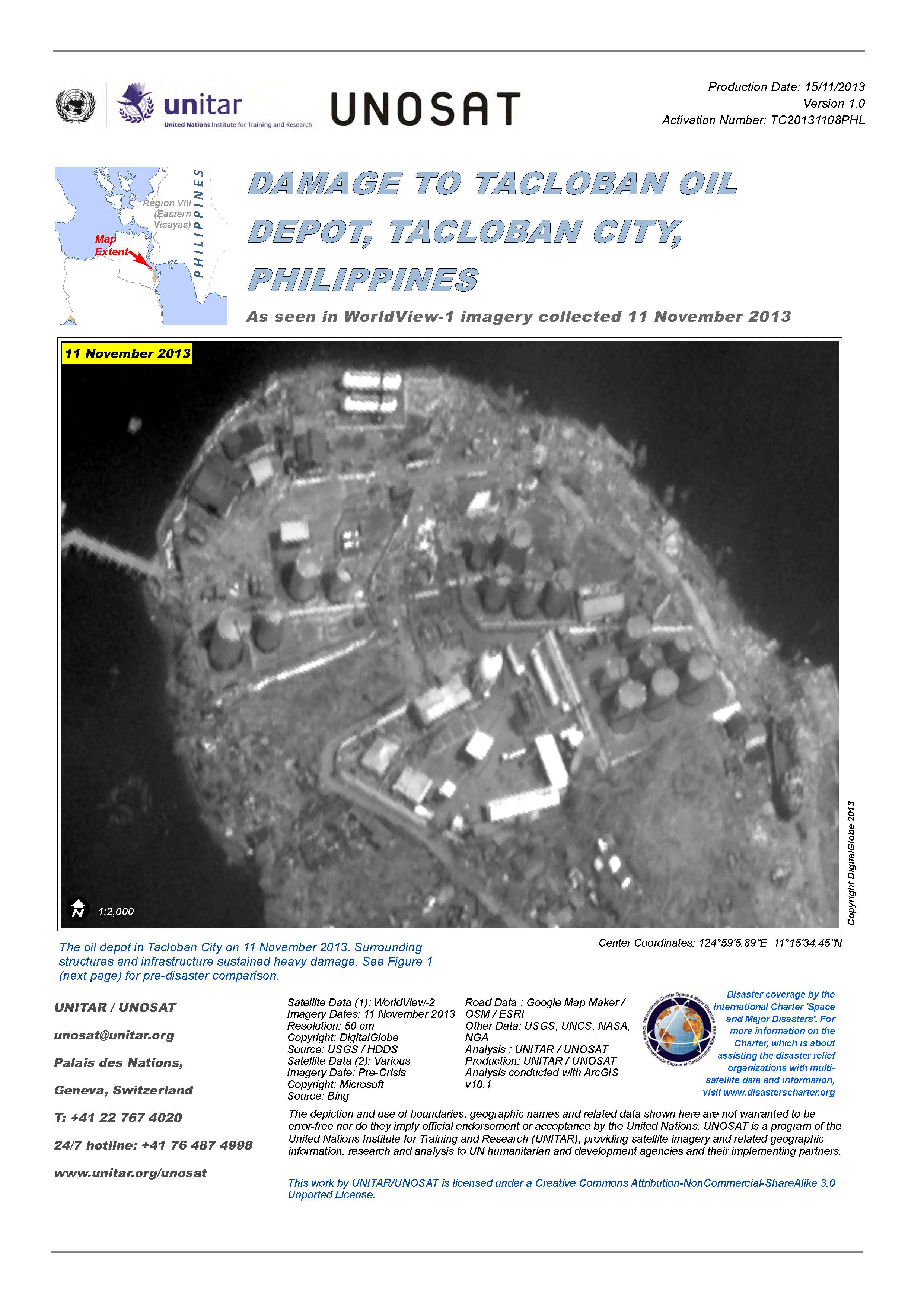
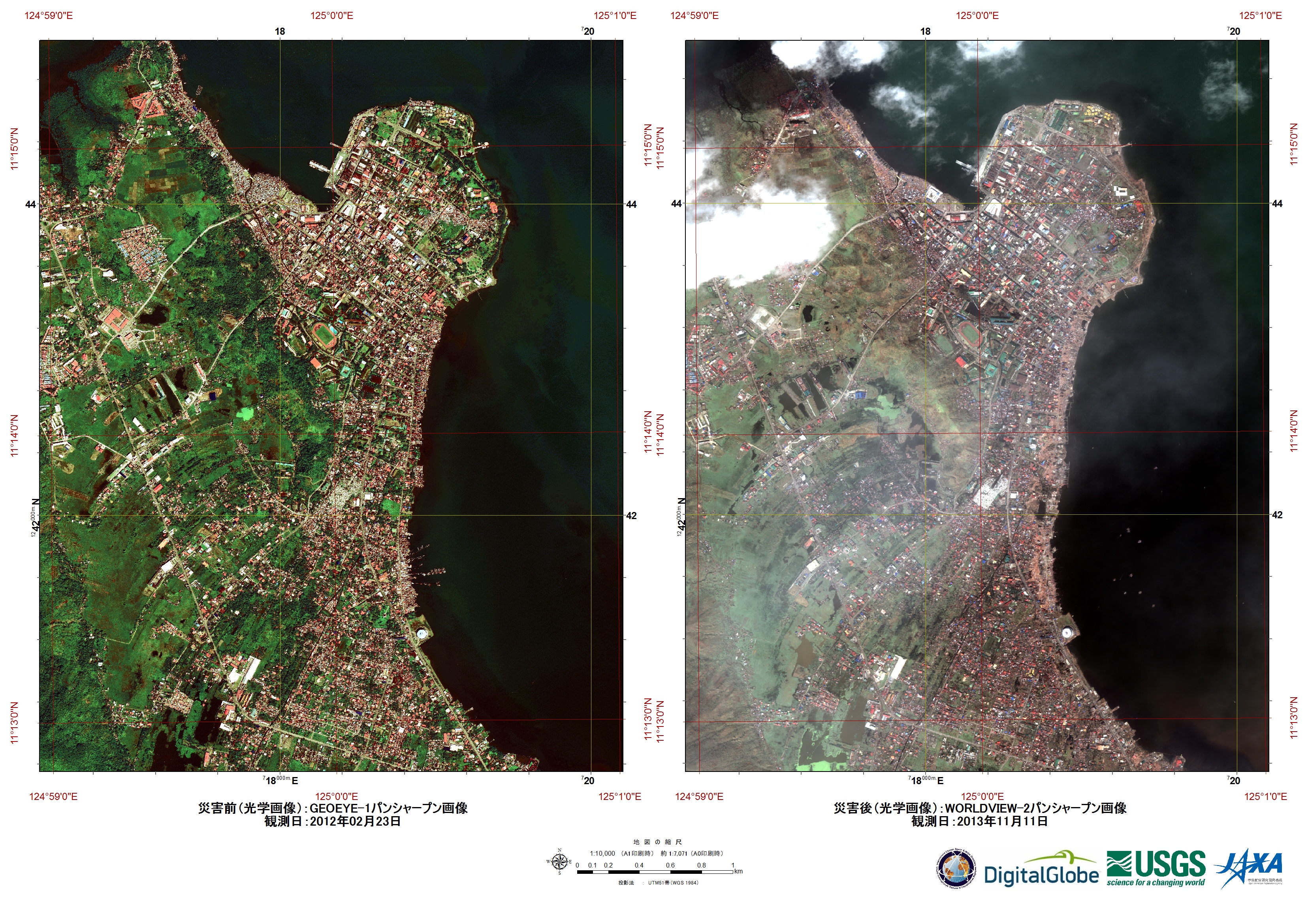
Damage to Tacloban oil depot, Tacloban City, Philippines
View the full report (PDF)
Авторские права: DigitalGlobe
Map produced by UNITAR/UNOSAT
Information about the Product
Получено: 11/11/2013
Источник: WorldView-2
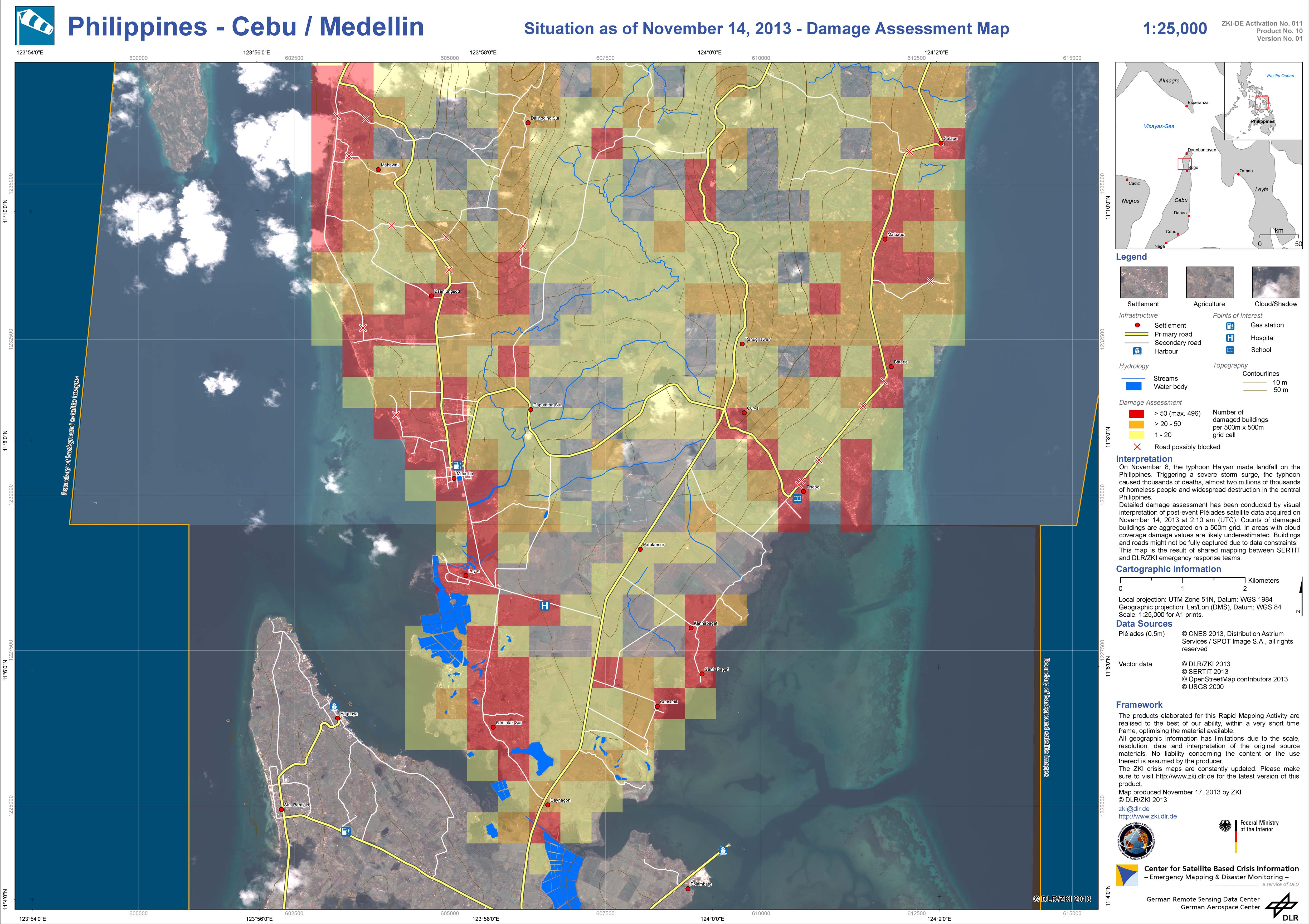

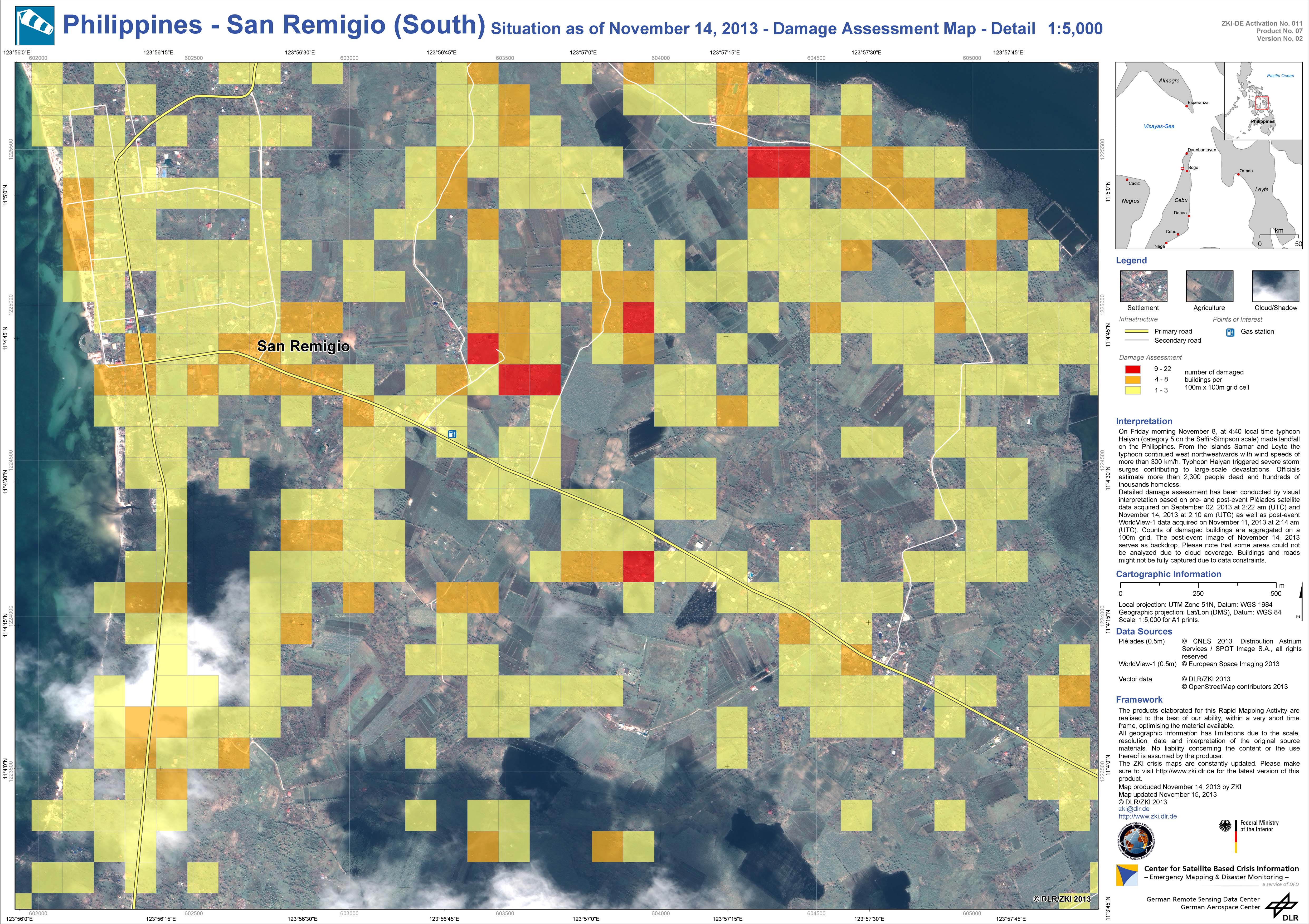
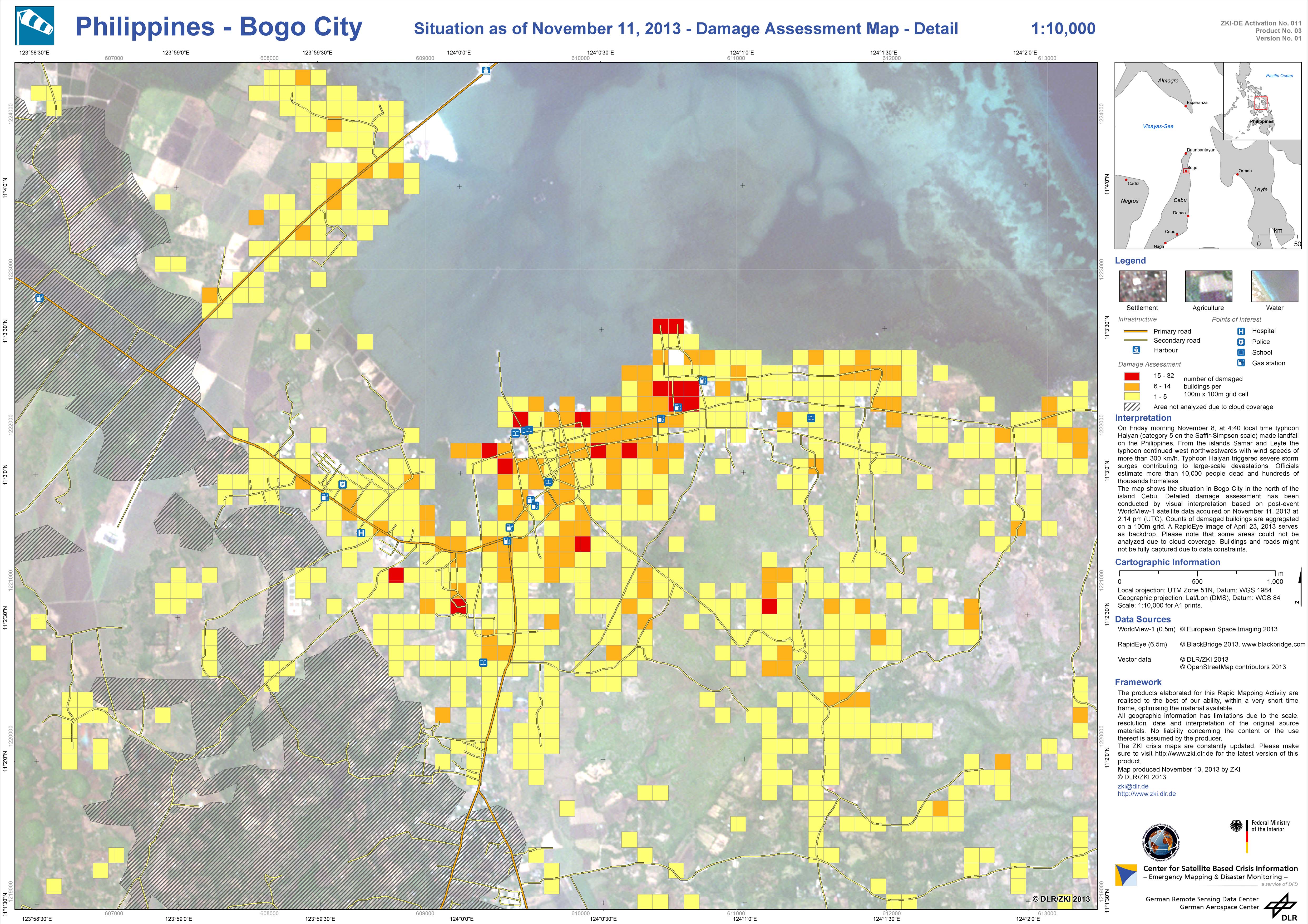
Damage assessment map
San Remigio (South), Philippines
Авторские права: Pleiades © CNES 2013 - Distribution: Spot Image S.A., all rights reserved
WorldView-1 © European Space Imaging 2013
Map produced by DLR/ZKI
Information about the Product
Получено: Pleiades: 02/09/2013 and 14/11/2013
WorldView-1: 11/11/2013
Источник: Pleiades and WorldView-1
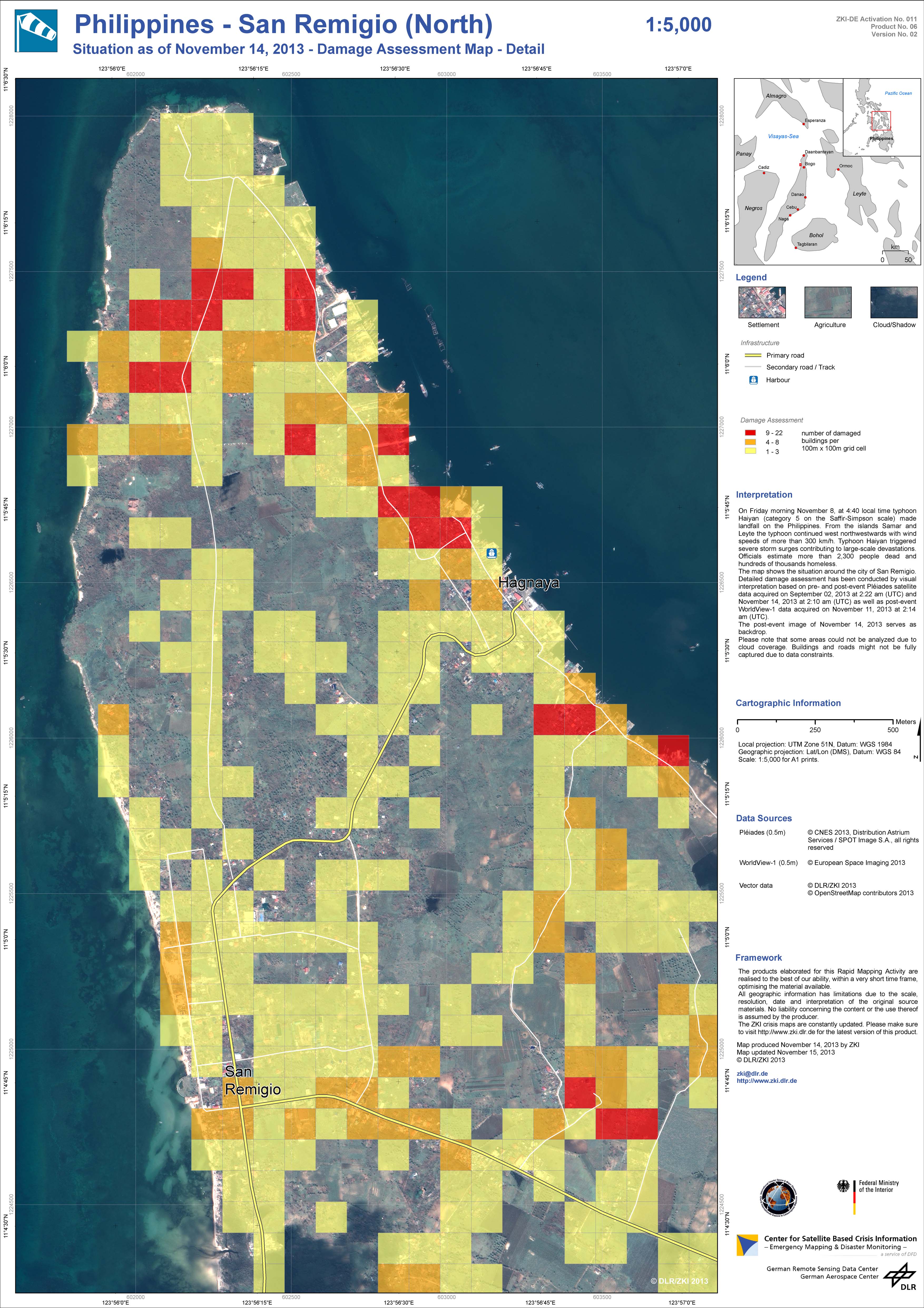
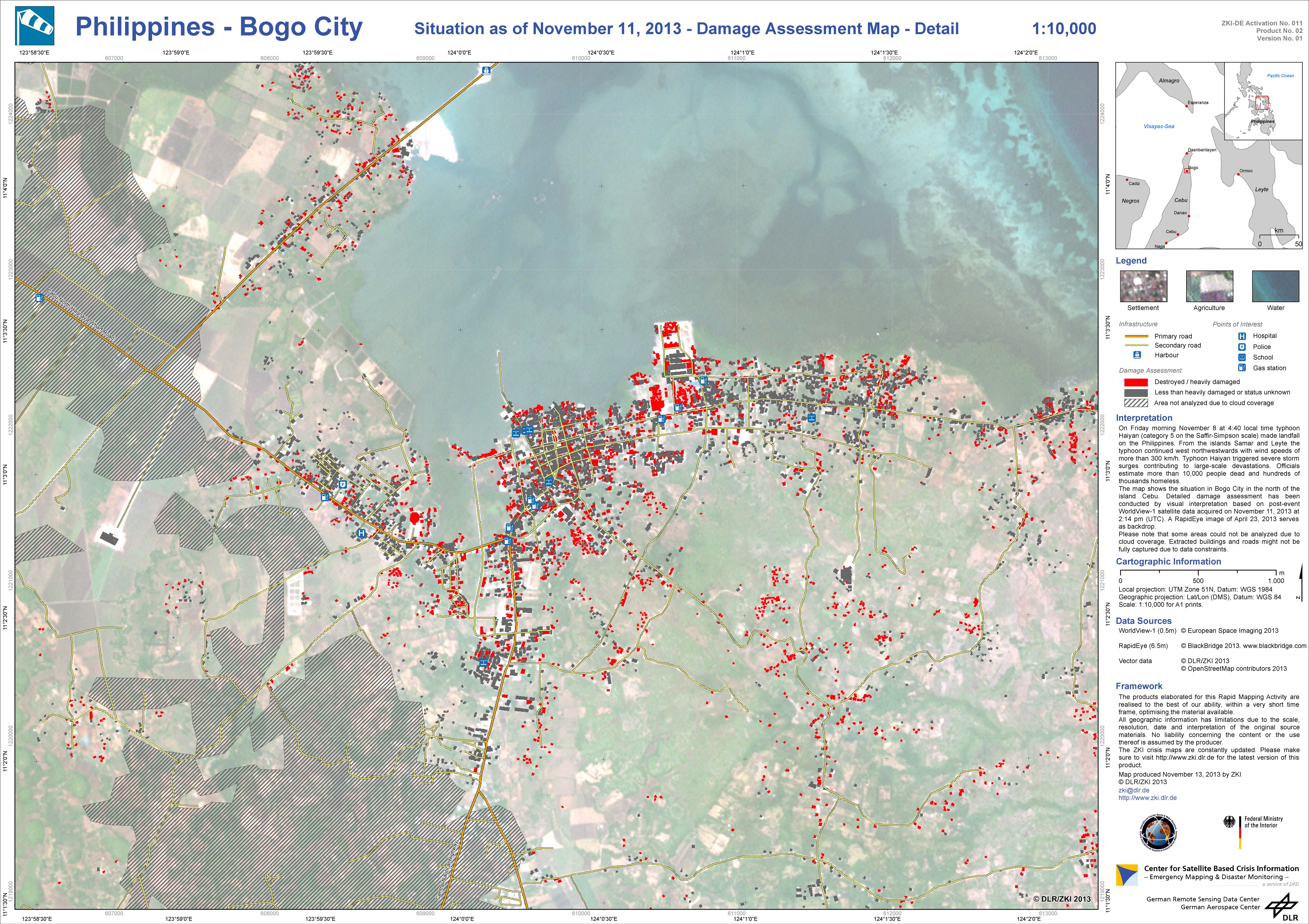
Damage assessment map
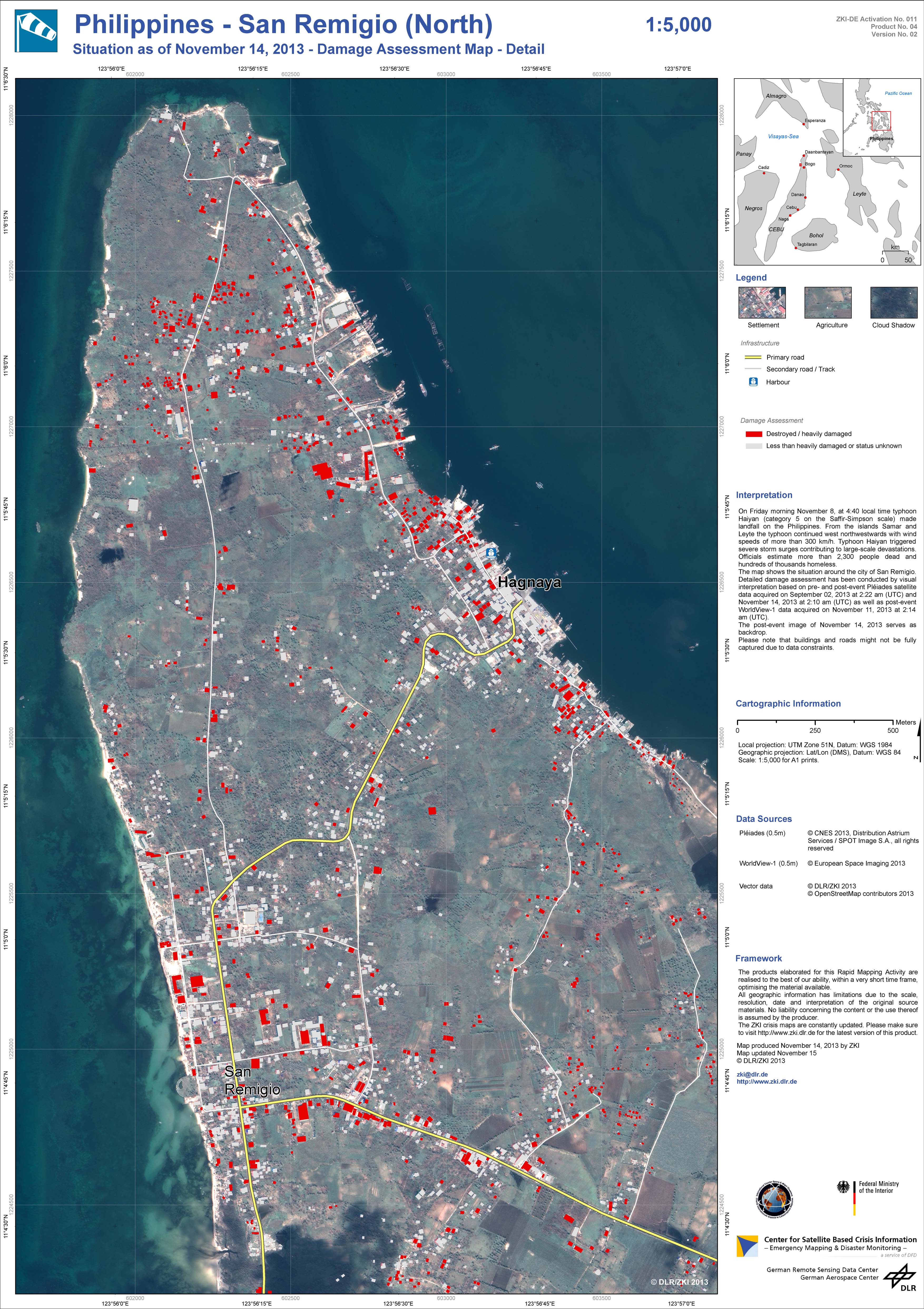
San Remigio (North), Philippines
Авторские права: Pleiades © CNES 2013 - Distribution: Spot Image S.A., all rights reserved
WorldView-1 © European Space Imaging 2013
Map produced by DLR/ZKI
Information about the Product
Получено: Pleiades: 02/09/2013 and 14/11/2013
WorldView-1: 11/11/2013
Источник: Pleiades and WorldView-1
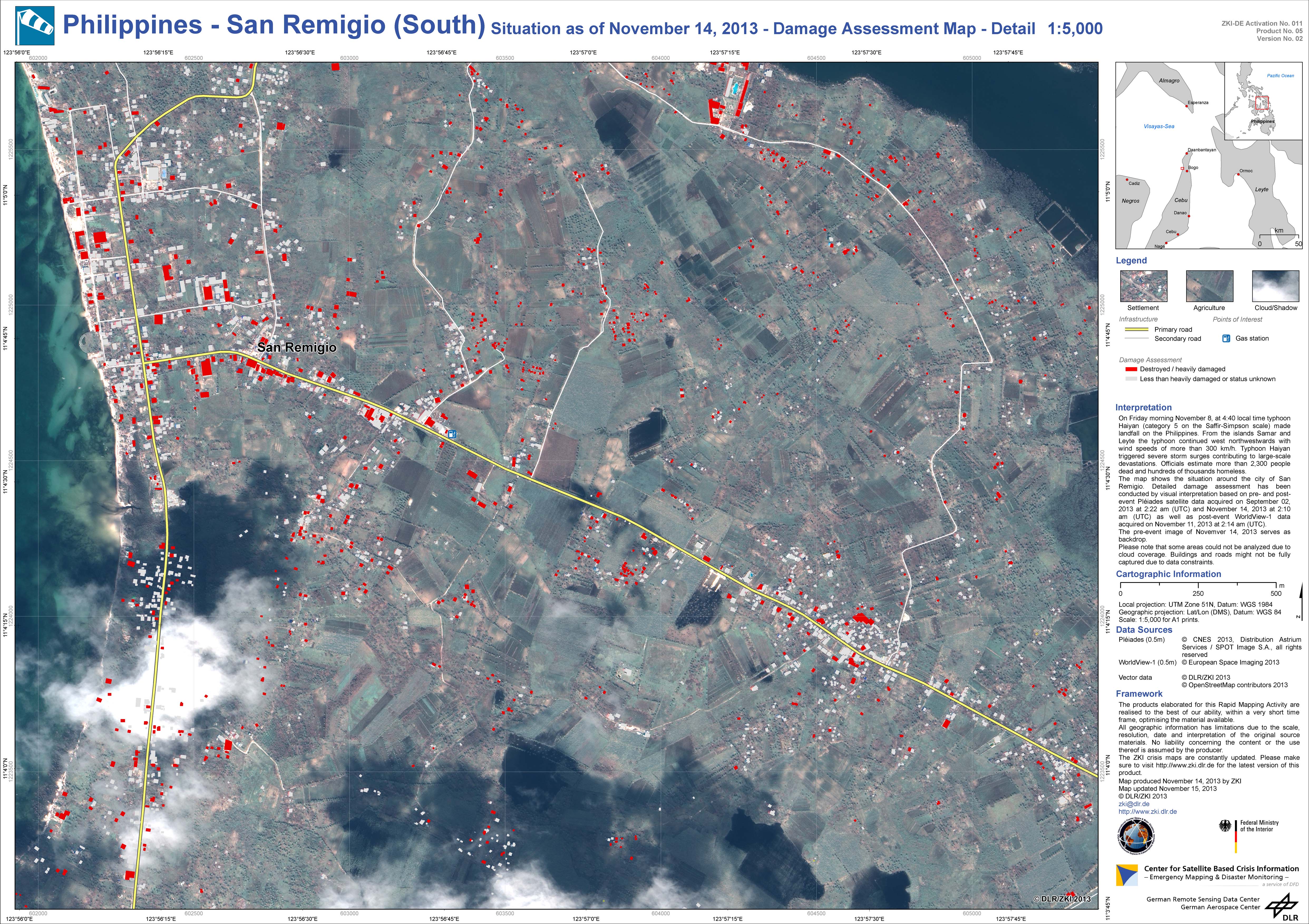
Damage assessment map
San Remigio (South), Philippines
Авторские права: Pleiades © CNES 2013 - Distribution: Spot Image S.A., all rights reserved
WorldView-1 © European Space Imaging 2013
Map produced by DLR/ZKI
Information about the Product
Получено: Pleiades: 02/09/2013 and 14/11/2013
WorldView-1: 11/11/2013
Источник: Pleiades and WorldView-1
Damage assessment map
San Remigio (North), Philippines
Авторские права: Pleiades © CNES 2013 - Distribution: Spot Image S.A., all rights reserved
WorldView-1 © European Space Imaging 2013
Map produced by DLR/ZKI
Information about the Product
Получено: Pleiades: 02/09/2013 and 14/11/2013
WorldView-1: 11/11/2013
Источник: Pleiades and WorldView-1
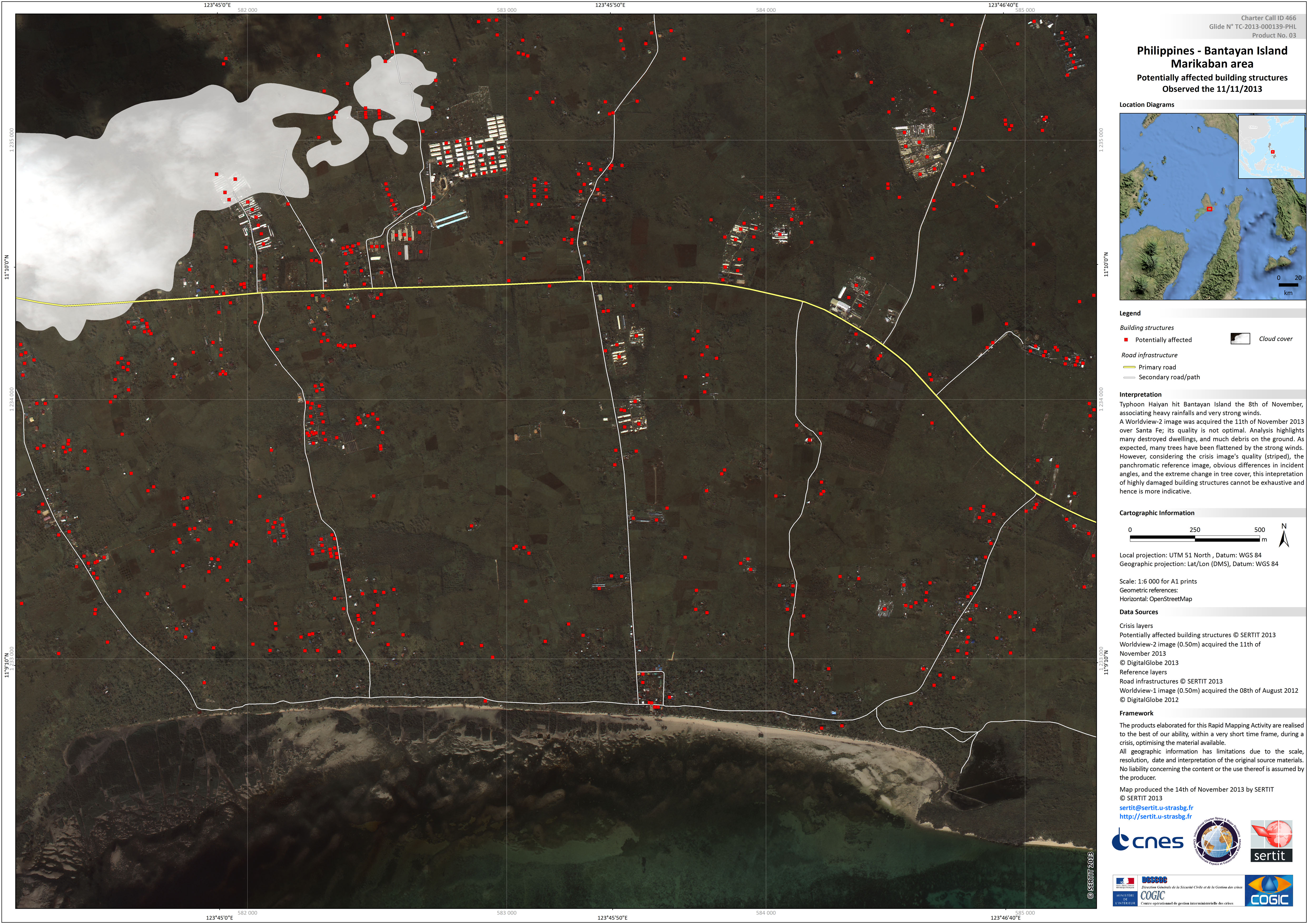
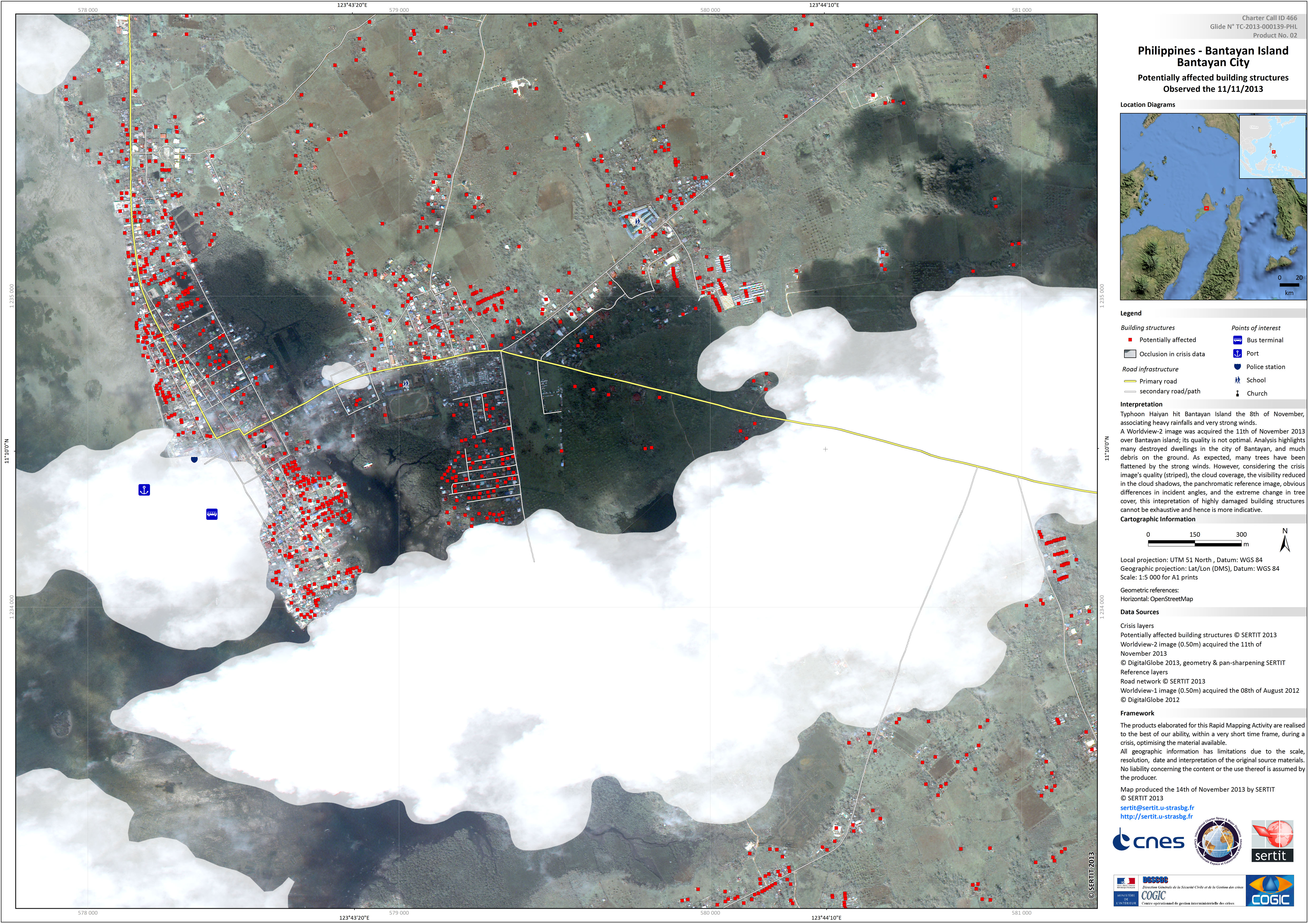
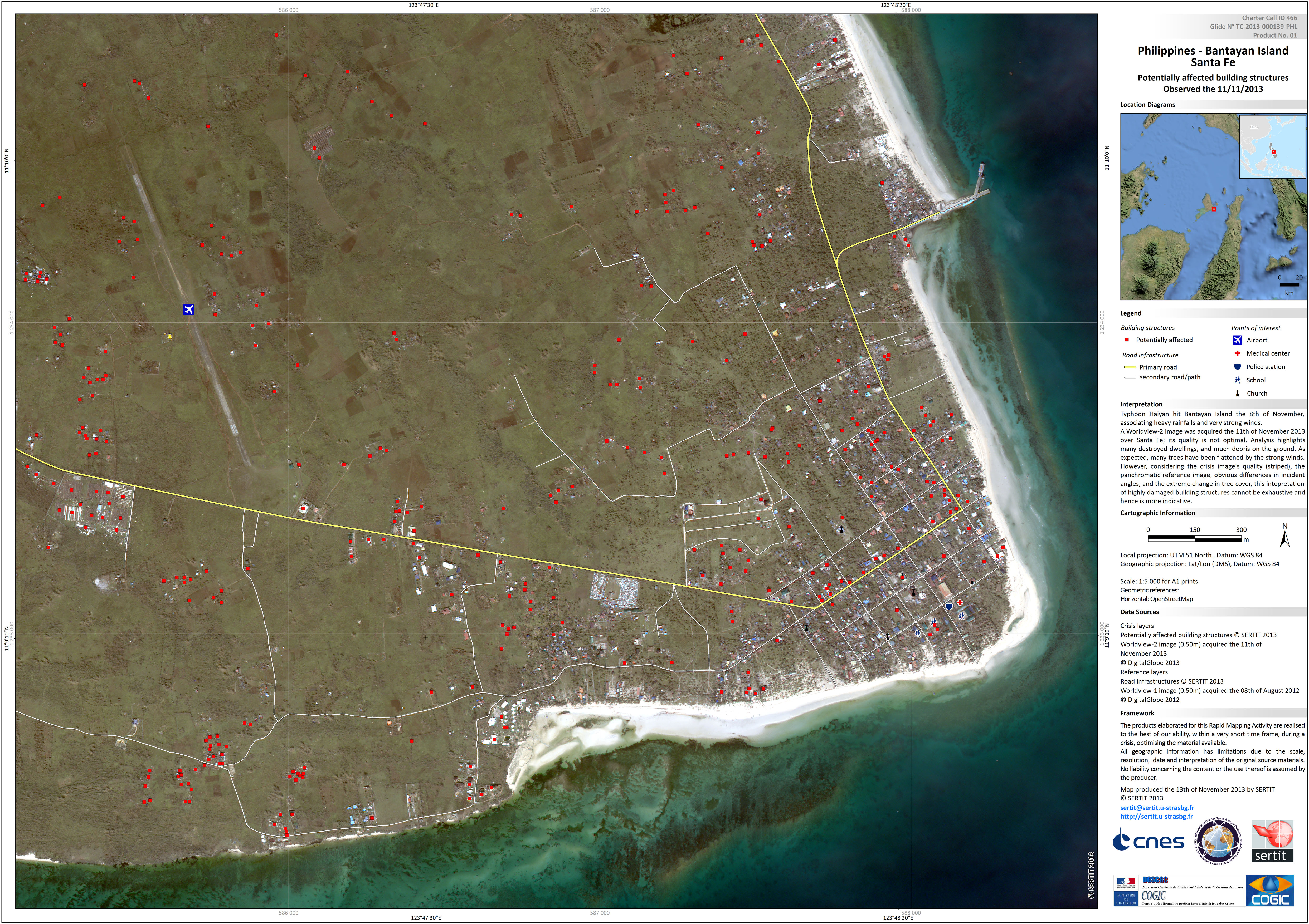

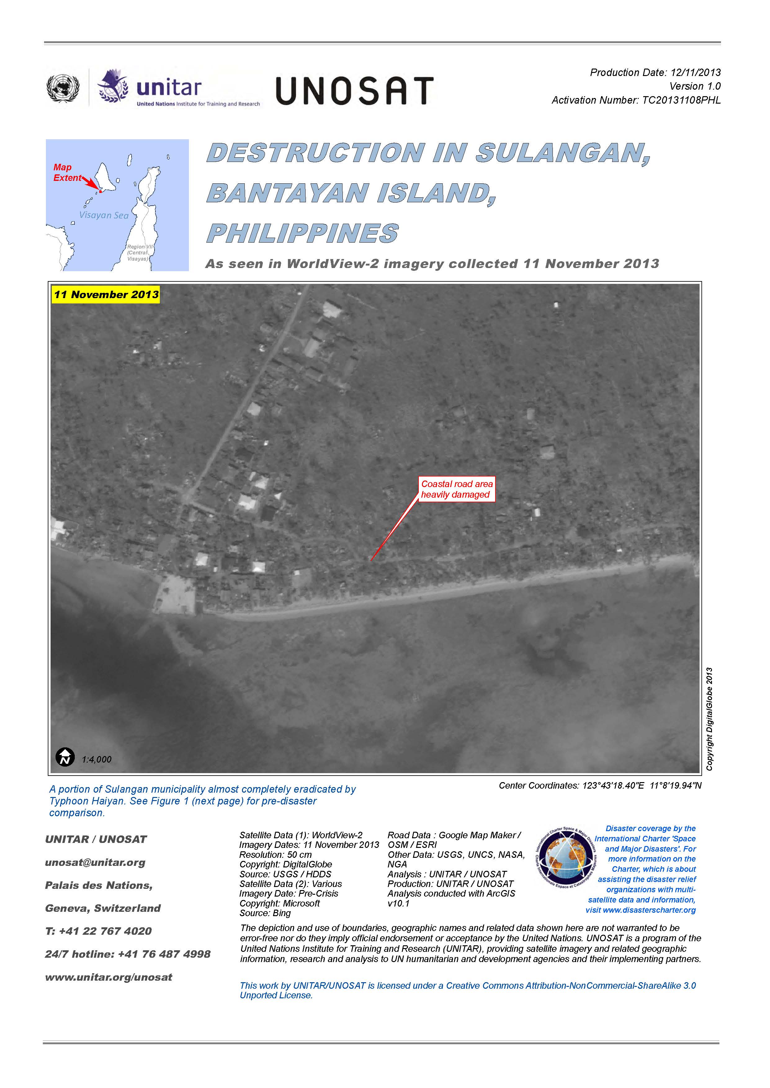
Destruction in Sulangan, Bantayan Island, Philippines
View the full report (PDF)
Авторские права: DigitalGlobe
Map produced by UNITAR/UNOSAT
Information about the Product
Получено: 11/11/2013
Источник: WorldView-2
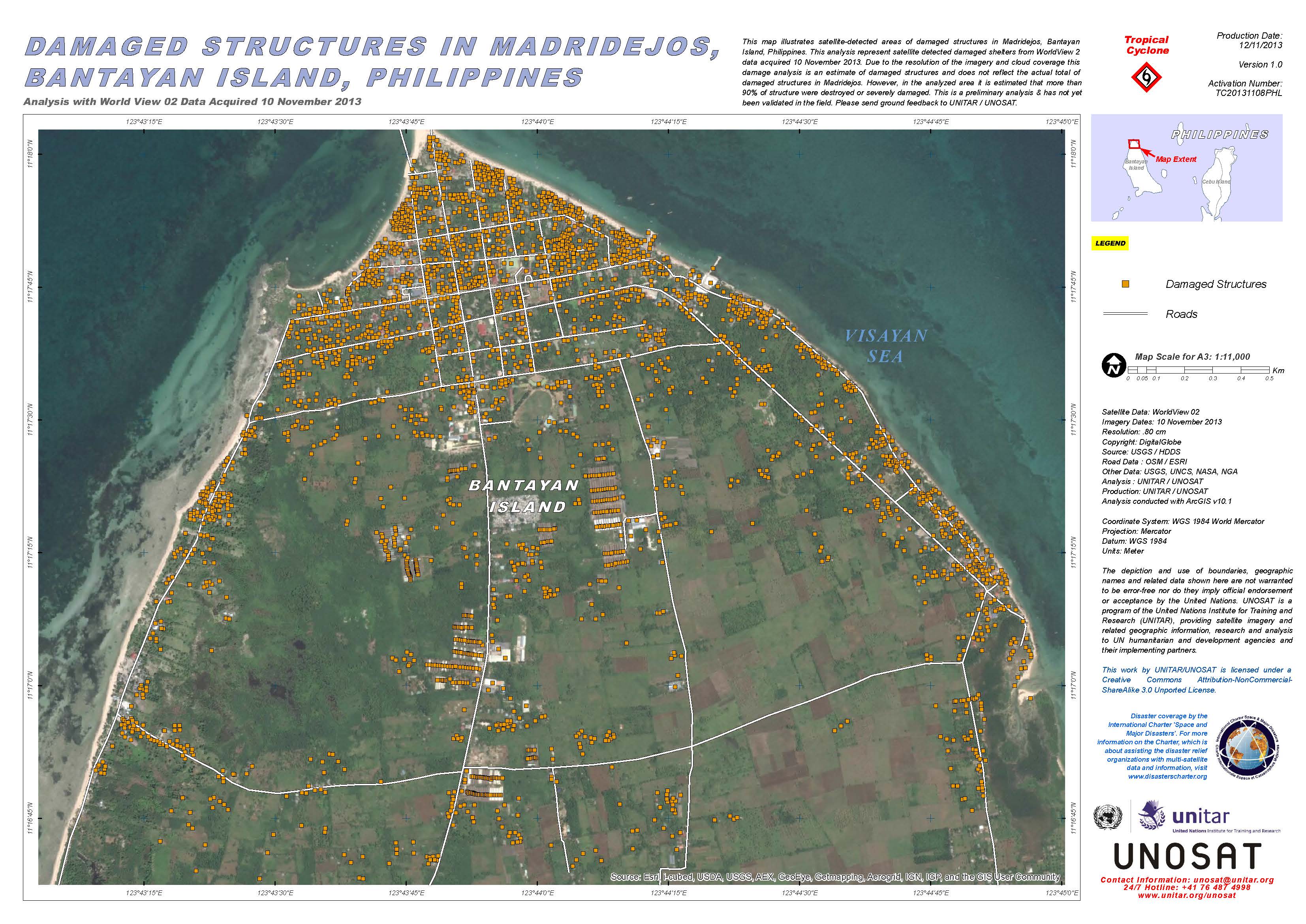

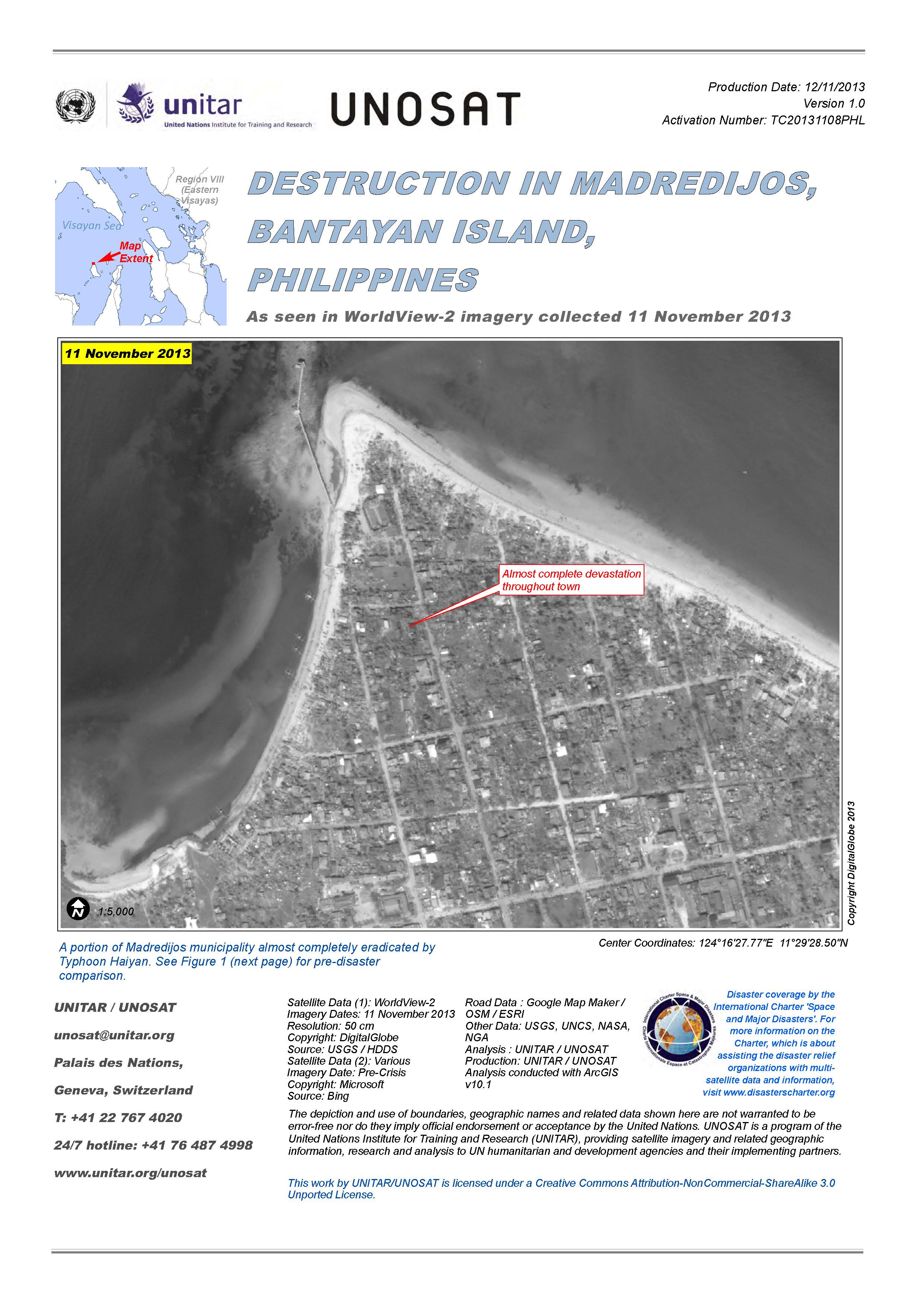
Destruction in Madredijos, Bantayan Island, Philippines
View full report (PDF)
Авторские права: DigitalGlobe
Map produced by UNITAR/UNOSAT
Information about the Product
Получено: 11/11/2013
Источник: WorldView-2
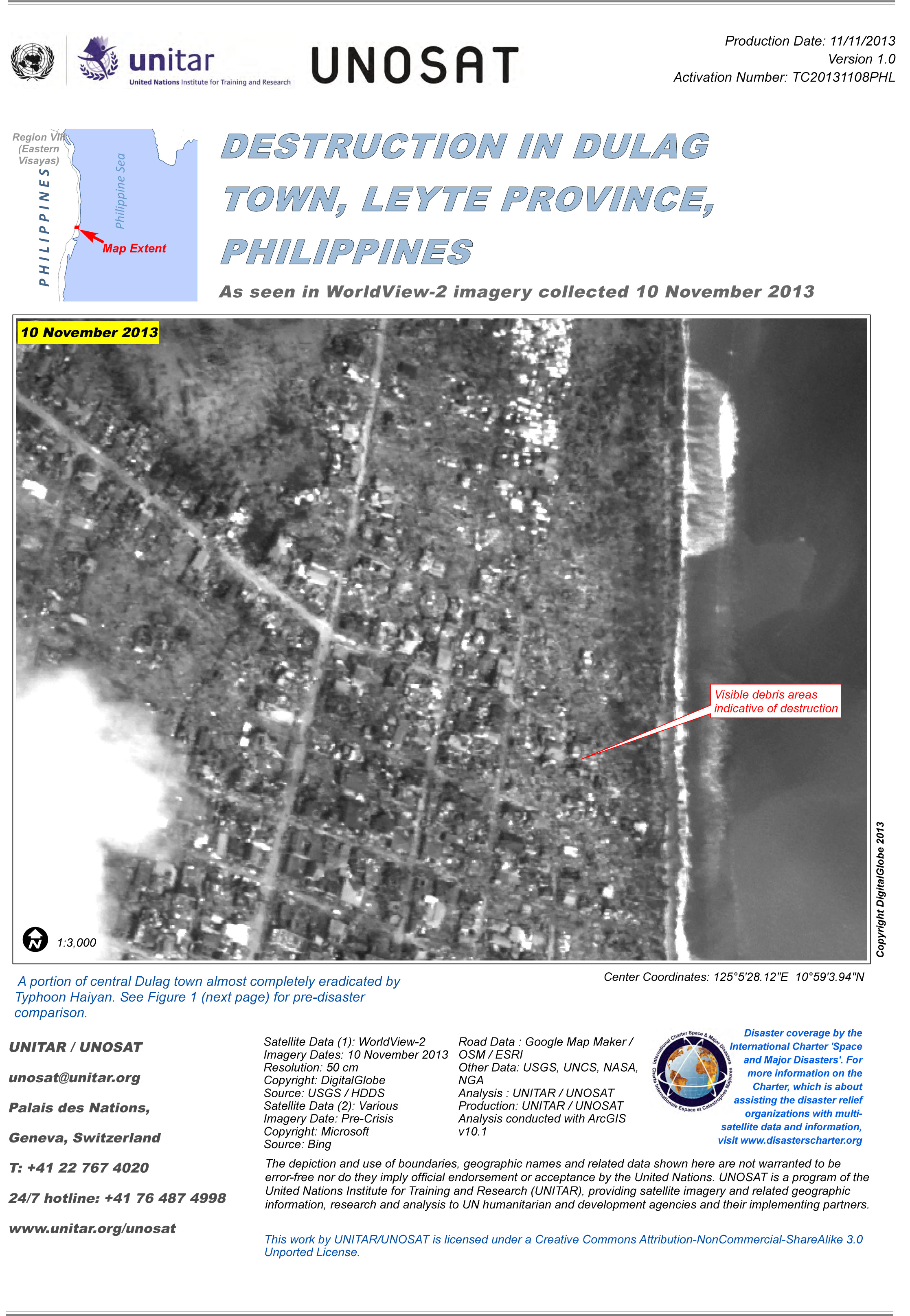
Destruction in Dulag Town, Leyte Province, Philippines
View full report (PDF)
Авторские права: DigitalGlobe
Map produced by UNITAR/UNOSAT
Information about the Product
Получено: 10/11/2013
Источник: WorldView-2

Destruction in Luntad Town, Leyte Province, Philippines
View full report (PDF)
Авторские права: DigitalGlobe
Map produced by UNITAR/UNOSAT
Information about the Product
Получено: 10/11/2013
Источник: WorldView-2

Destruction in Tacloban City, Leyte Province, Philippines
View full report (PDF)
Авторские права: DigitalGlobe
Map produced by UNITAR/UNOSAT
Information about the Product
Получено: 10/11/2013
Источник: WorldView-2

Destruction in Tabontabon Town, Leyte Province, Philippines
View full report (PDF)
Авторские права: DigitalGlobe
Map produced by UNITAR/UNOSAT
Information about the Product
Получено: 10/11/2013
Источник: WorldView-2
 Вернуться к полному архиву активаций

