 English
 Spanish
 French
 Chinese
 Russian
 Portuguese
 Latest Activation
Charter activations
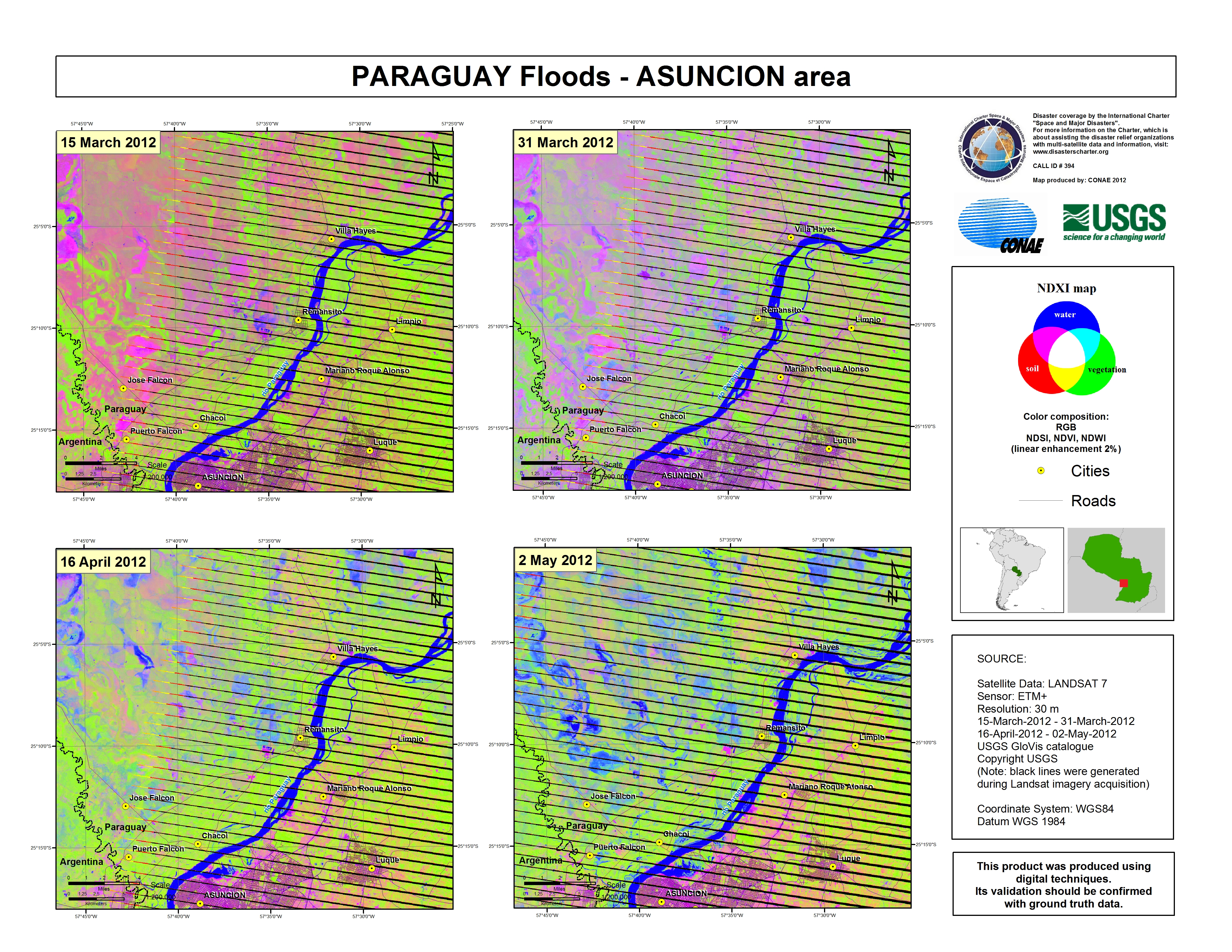
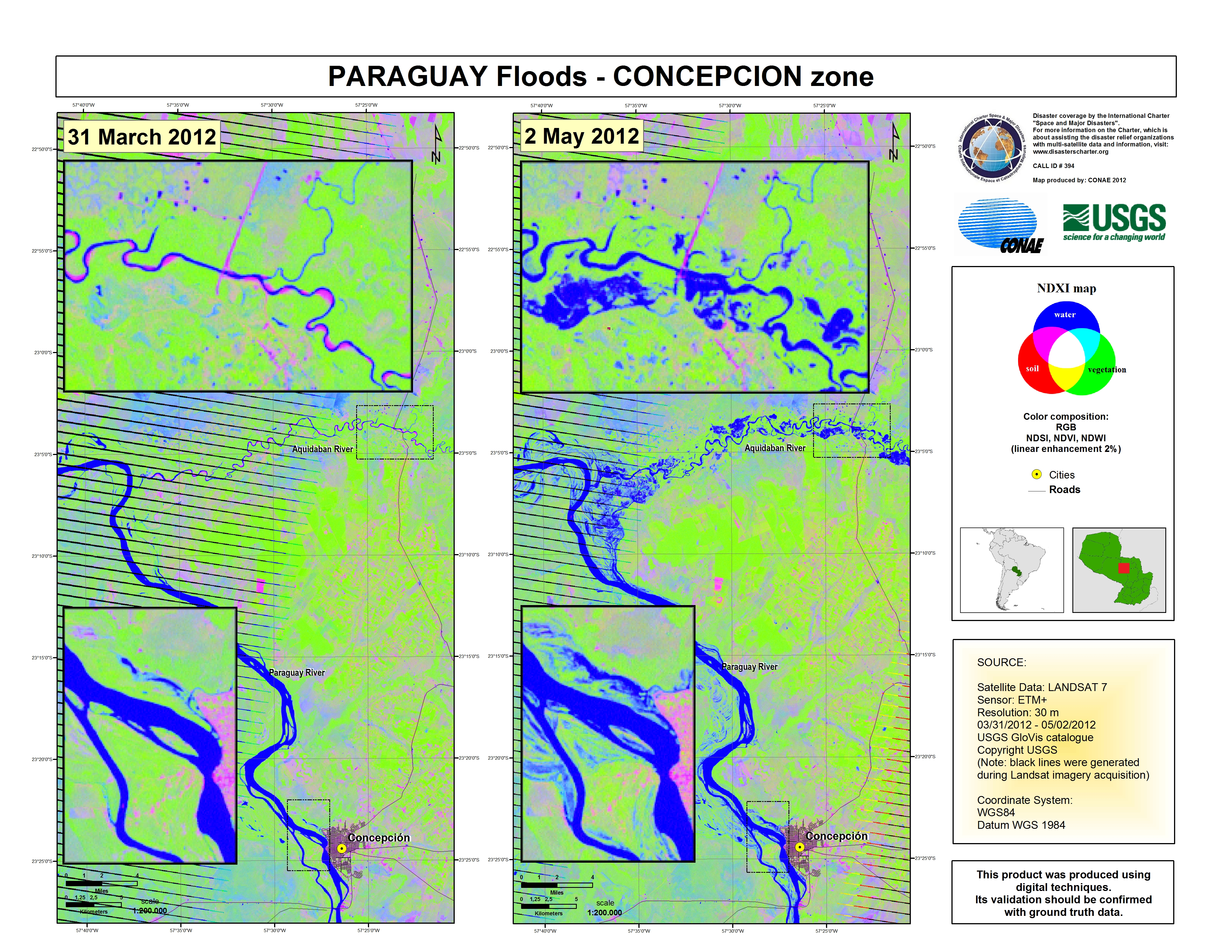
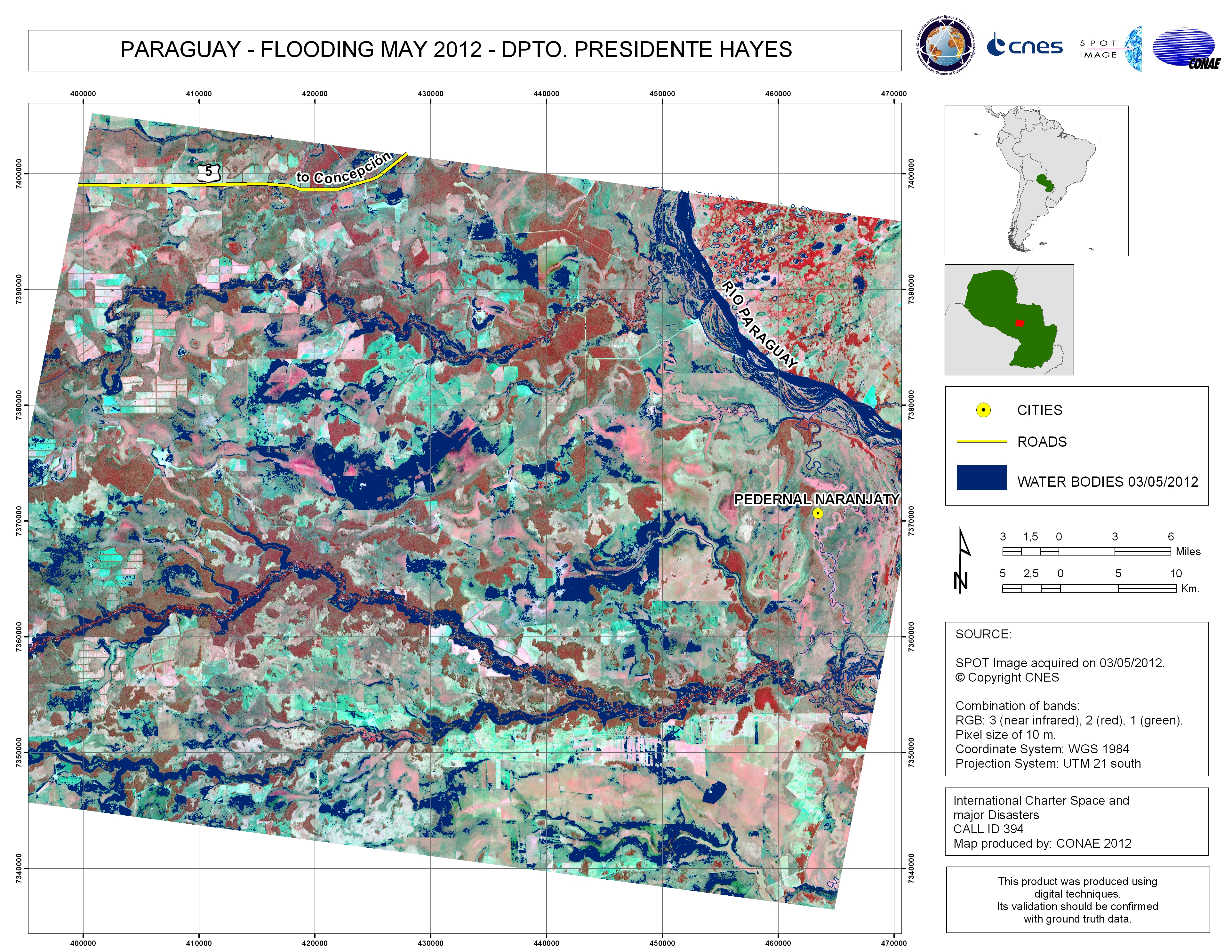
Floods in Paraguay
Heavy rain, which began in March, has caused the Pilcomayo river in Paraguay to overflow; resulting in flooding throughout the country. An estimated 13,000 families have been isolated due to the floods.
The main affected areas are:
North of the country: Puerto Casedo, Pinasco
Central area of the country: Villa Choferes del Chaco, Tte. Manuel Irala Fernandez, Cruce Pioneros
South of the country: Teniente Esteban Martinez, Cacique Sapo
| Type of Event: | Flood |
| Location of Event: | Paraguay |
| Date of Charter Activation: | 30 April 2012 |
| Charter Requestor: | Sistema Federal de Emergencias (SIFEM) |
| Project Management: | CONAE |
Products


 Back to the full activation archive

