 English
 Spanish
 French
 Chinese
 Russian
 Portuguese
 最新宪章启动
Charter activations
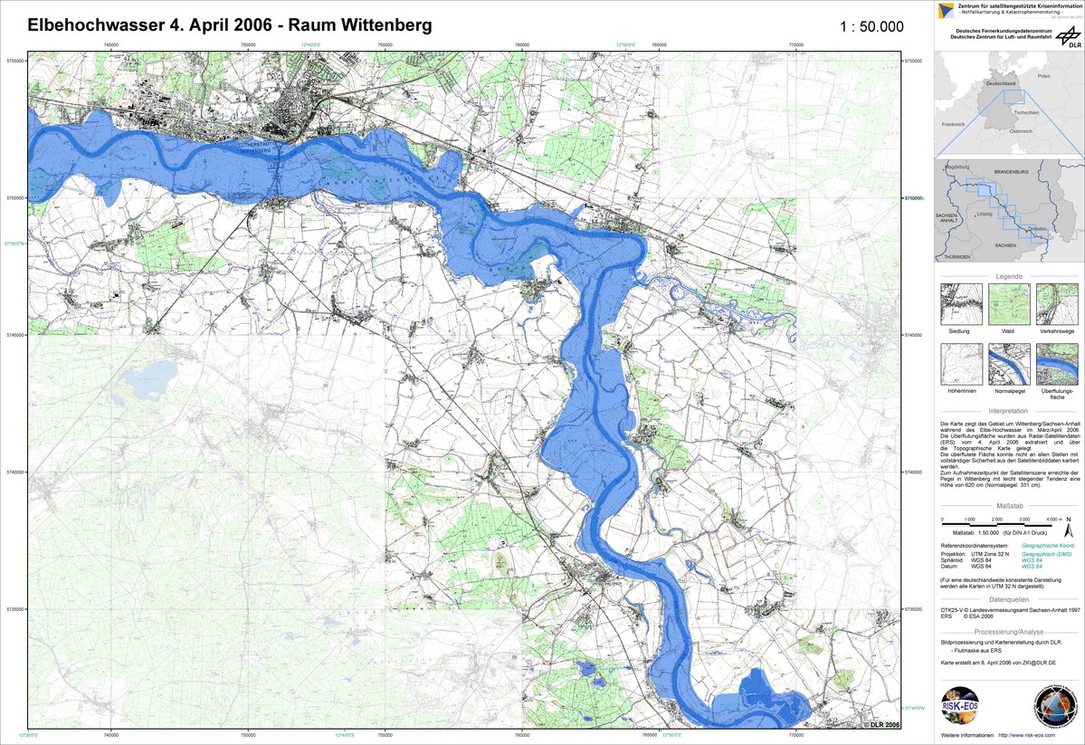
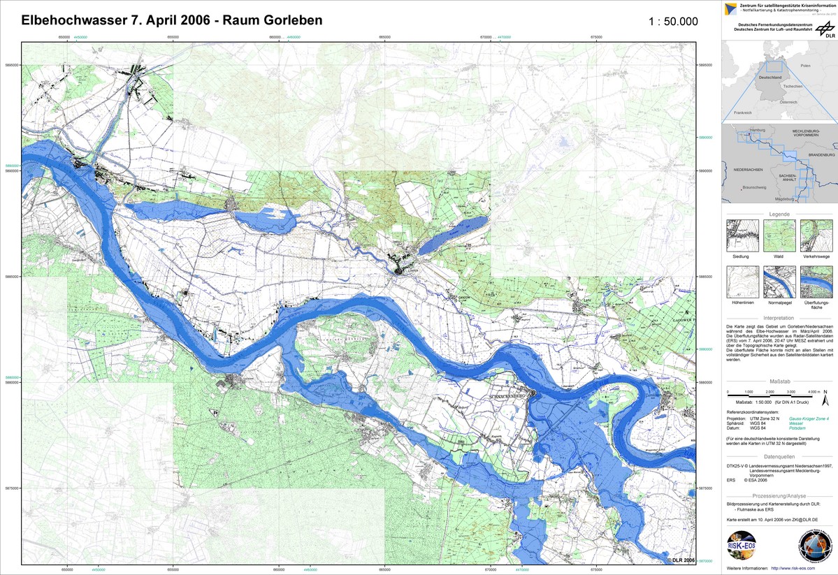
德国洪水
由于发生强降雨,加上科尔科诺谢山脉(捷克共和国)的融雪,造成德国萨克森易北河地区洪水泛滥。易北河水位上升到7.45米。在德累斯顿市,河水附近地区被迫撤离。易北河沿岸几个城镇全部遭受洪灾。萨克森地区的四个县已宣布进入紧急状态。
| 事件类型: | 洪水 |
| 事件地点: | 德国易北地区 |
| 启动宪章的日期: | 2006年4月1日 |
| 宪章要求者: | 德国联合信息态势中心;欧洲委员会民事保护部门 |
| 项目经理: | DLR |
Products

Germany, Elbe Flood: Dresden
版权: Canadian Space Agency 2006 Image processing, map created 08/04/2006 by DLR in the framework of GMES RISKEOS.
Information about the Product
已获得: 06/04/2006 Topographic map with flood mask derived from radar satellite data from April 2006 - Dresden (1:50.000)
源: RADARSAT-1
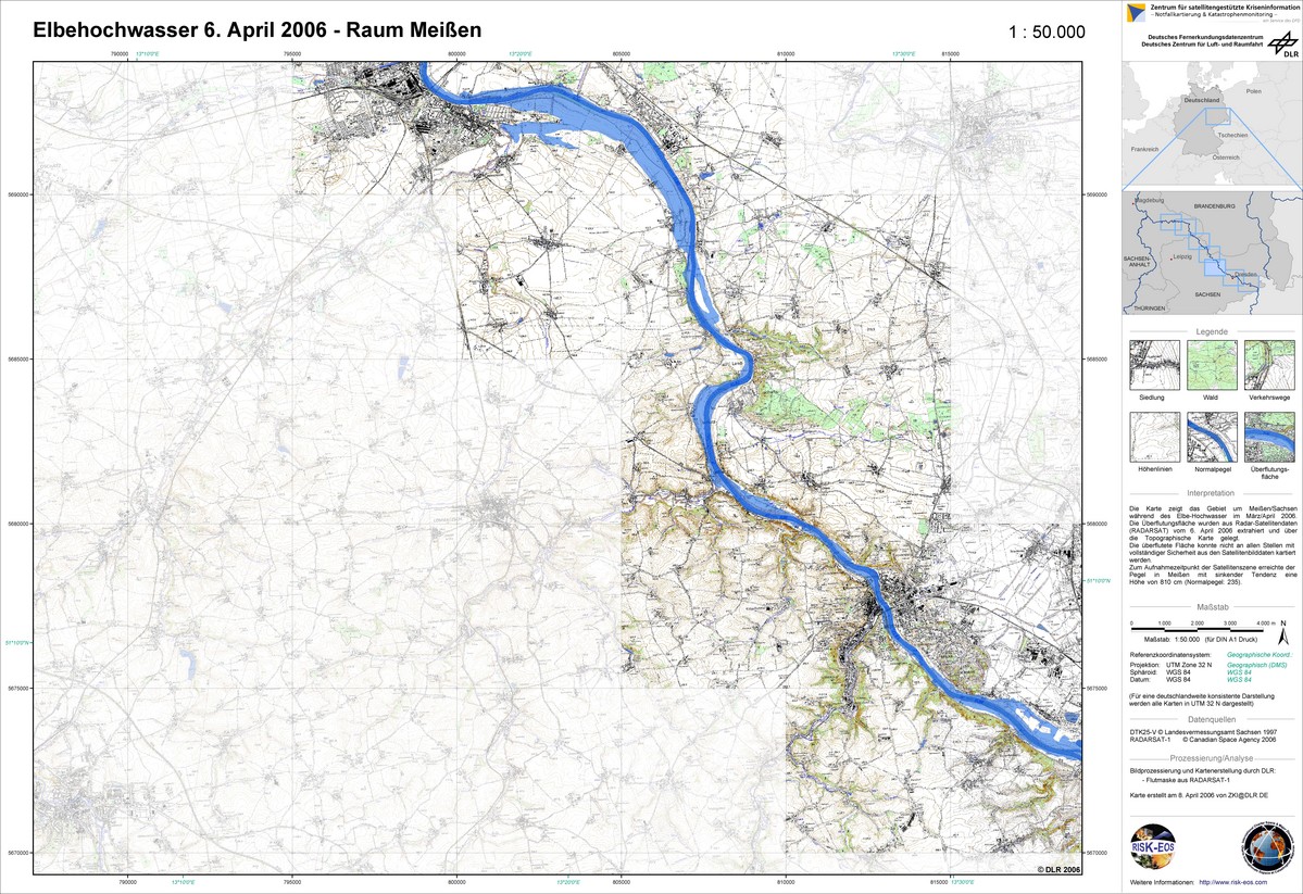
Germany, Elbe Flood: Meissen
版权: Canadian Space Agency 2006 Image processing, map created 08/04/2006 by DLR in the framework of GMES RISKEOS.
Information about the Product
已获得: 06/04/2006 Topographic map with flood mask derived from radar satellite data from April 2006 - Meissen (1:50.000)
源: RADARSAT-1
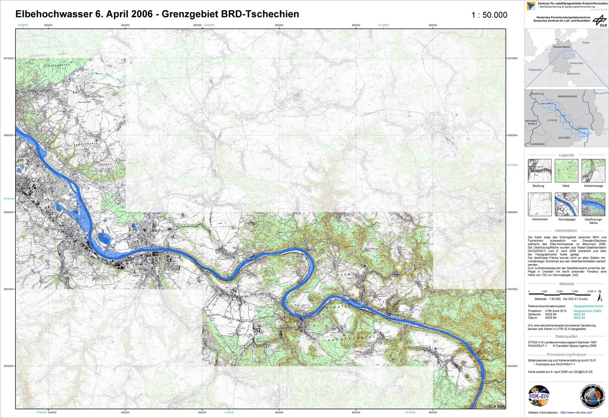
Germany, Elbe Flood: Border Area
版权: Canadian Space Agency 2006 Image processing, map created 08/04/2006 by DLR in the framework of GMES RISKEOS.
Information about the Product
已获得: 06/04/2006 Topographic map with flood mask derived from radar satellite data from April 2006 - German-Czech border area (1:50.000)
源: RADARSAT-1


Germany, Elbe Flood: Dresden
版权: NRSA 2006, USGS 2000 Image processing, map created 08/04/2006 by DLR in the framework of GMES RISKEOS.
Information about the Product
已获得: 02/04/2006, 24/09/2000 Topographic map with flood mask derived from radar satellite data from April 2006 - Greater Dresden (1:50.000)
源: IRS-P6/LISS III, Landsat 7 ETM
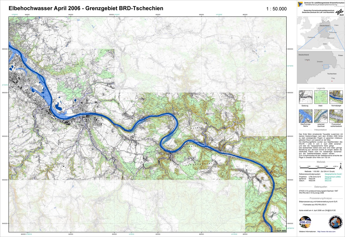
Germany, Elbe Flood: German-Czech Border Area Topographic Map
版权: NRSA 2006 Image processing, map created 04/04/2006 by DLR in the framework of GMES RISKEOS.
Information about the Product
已获得: 02/04/2006 Topographic map with flood mask derived from radar satellite data from April 2006 - German-Czech border area (1:50.000)
源: IRS-P6/LISS III

Germany, Elbe Flood: Topographic Map
版权: NRSA 2006 Image processing, map created 04/04/2006 by DLR in the framework of GMES RISKEOS.
Information about the Product
已获得: 02/04/2006 Topographic map with flood mask derived from radar satellite data from April 2006 - Greater Dresden (1:50.000)
源: IRS-P6/LISS III


 返回完整的响应档案

