 English
 Spanish
 French
 Chinese
 Russian
 Portuguese
 最新宪章启动
Charter activations
苏丹洪水
苏丹的雨季始于七月,自那时起,洪水就已经影响到了苏丹的18个州,特别是尼罗河和科尔多凡州北部,并带来了严重的伤亡和损失。据估计,3000间房屋被洪灾彻底摧毁,另有2000间房屋被破坏。
首都喀土穆,也受到一定程度的冲击,数百市民目前无家可归。居民都对国家的排水管网系统表示不满,因其缺乏合理的安排,不能及时疏导洪水的排放,使洪水挥之不去,导致细菌疾病的滋生。
在受灾地区的志愿者试图用临时建筑的壁垒阻挡住洪水的肆虐,但也有人对洪水的造成的长期影响,以及接下来几个星期内增大的降雨量表示忧虑。
| 事件类型: | 洪水 |
| 事件地点: | 苏丹 |
| 启动宪章的日期: | 2014年8月5日 |
| 宪章要求者: | UNITAR/UNOSAT 代表UNOCHA |
| 项目经理: | 中国资源卫星应用中心 (CRESDA) |
Products
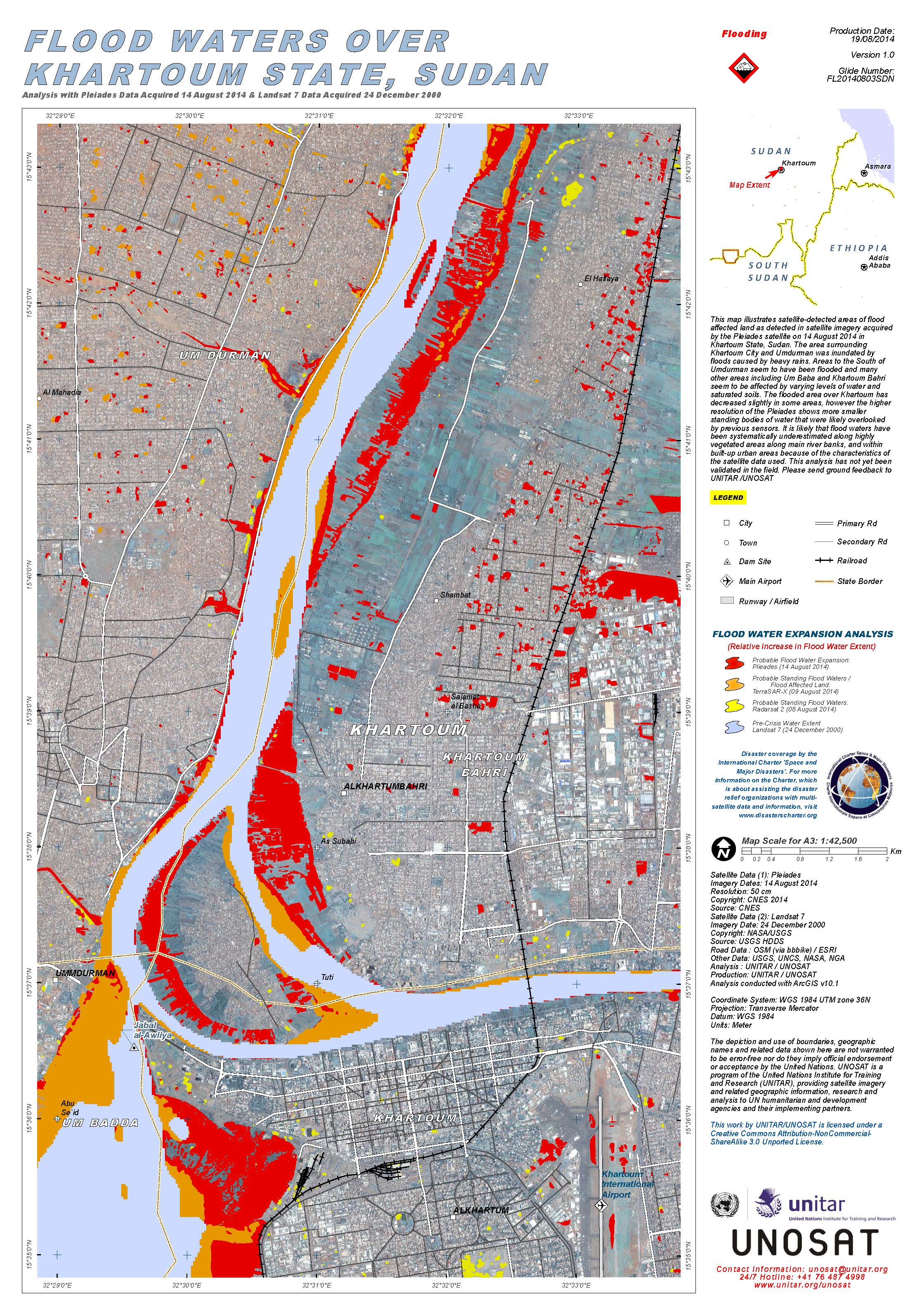
Flood waters over Khartoum State, Sudan
版权: Pleiades © CNES 2014
Landsat 7 © NASA/USGS
Map produced by UNITAR/UNOSAT
Information about the Product
已获得: Pleiades: 14/08/2014
Landsat 7: 24/12/2000
源: Pleiades / Landsat 7
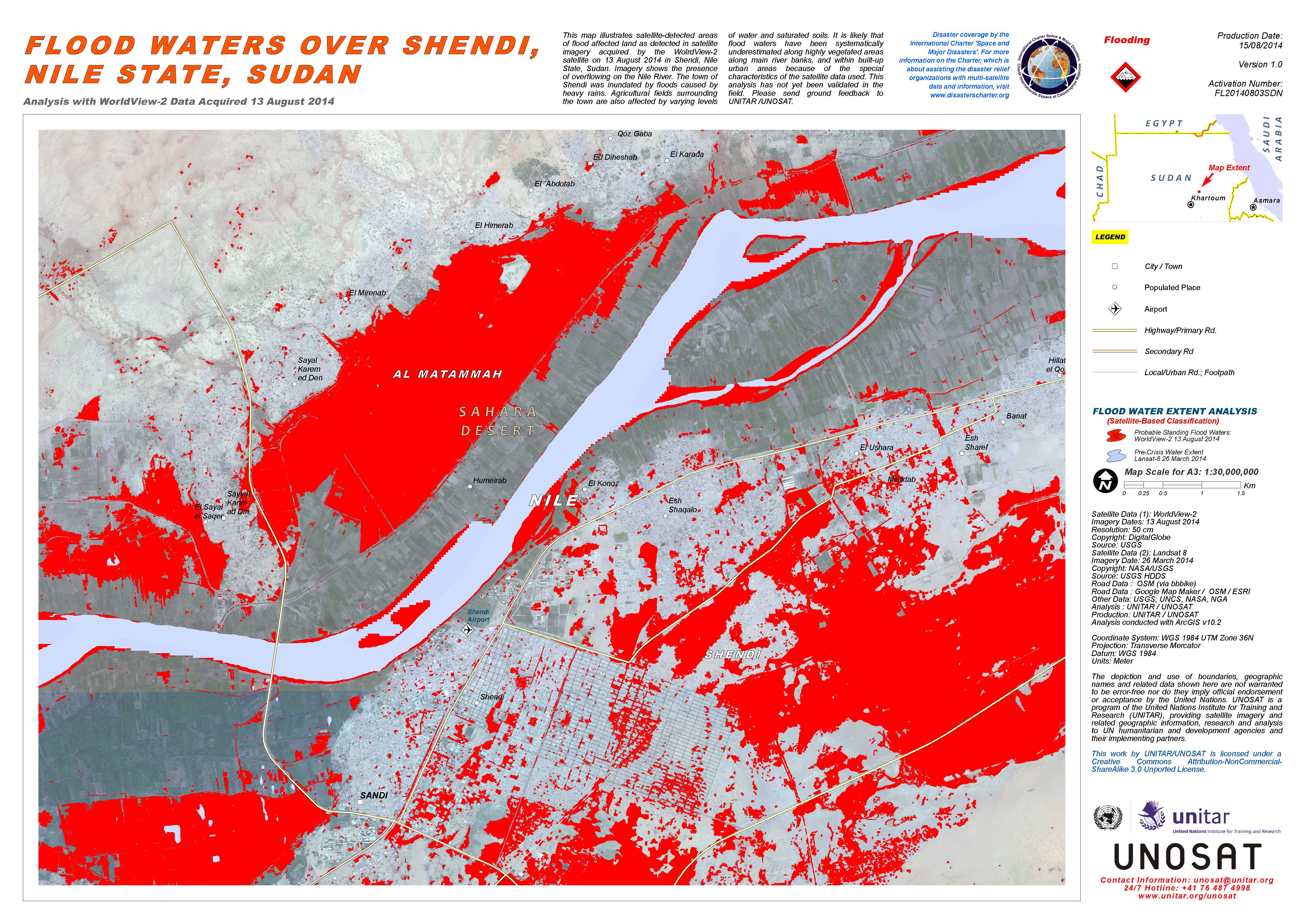
Flood waters over Shendi, Nile State, Sudan
版权: WorldView-2 © DigitalGlobe
Landsat-8 data and products © NASA/USGS (2014) - All rights reserved
Map produced by UNITAR/UNOSAT
Information about the Product
已获得: WorldView-2: 13/08/2014
Landsat 8: 26/03/2014
源: WorldView-2 / Landsat 8
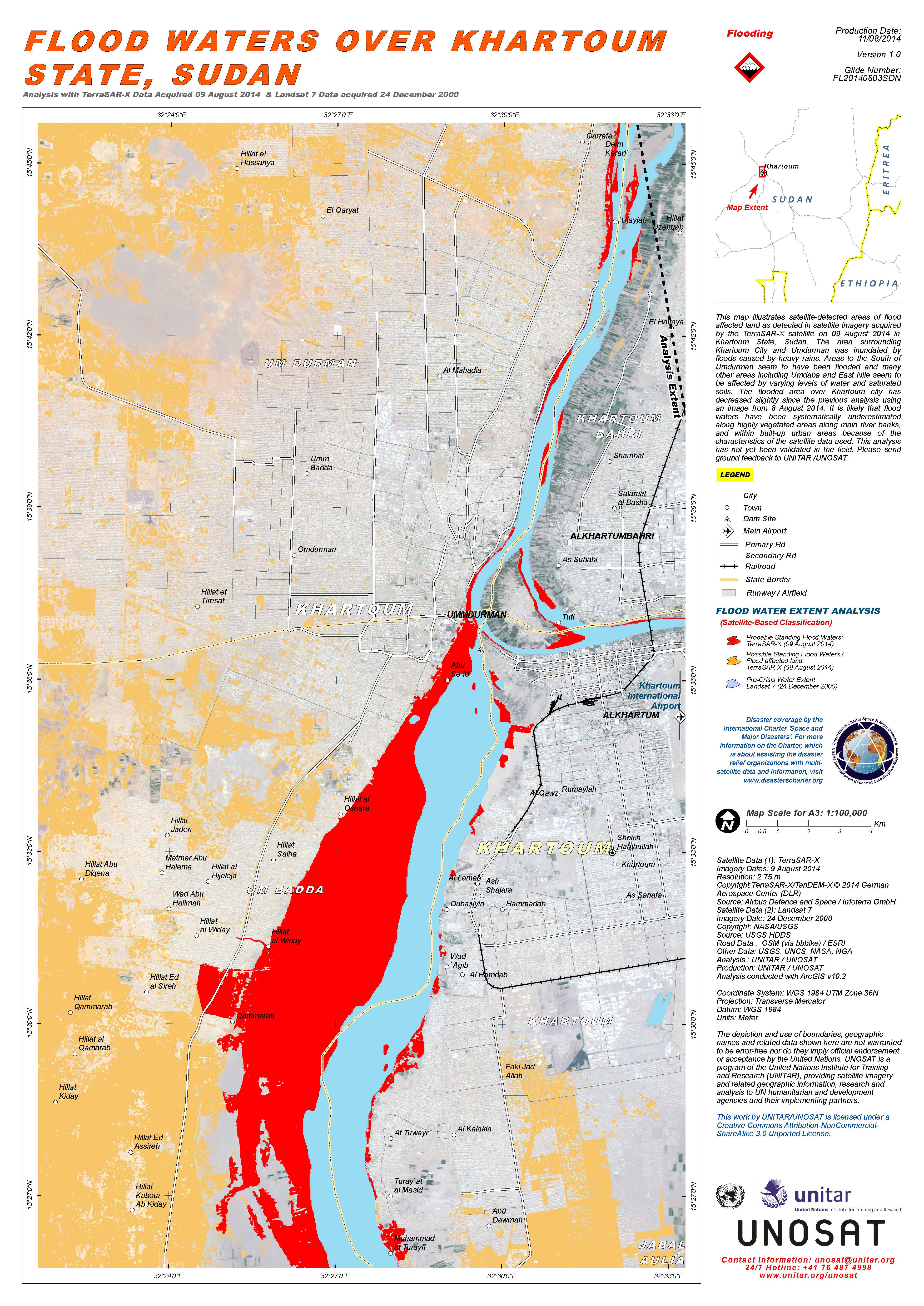
Flood waters over Khartoum State, Sudan
版权: TerraSAR-X © German Aerospace Center (DLR), 2014 Airbus Defence and Space / Infoterra GmbH
Landsat 7 © NASA/USGS
Map produced by UNITAR/UNOSAT
Information about the Product
已获得: TerraSAR-X: 09/08/2014
Landsat 7: 24/12/2000
源: TerraSAR-X / Landsat 7
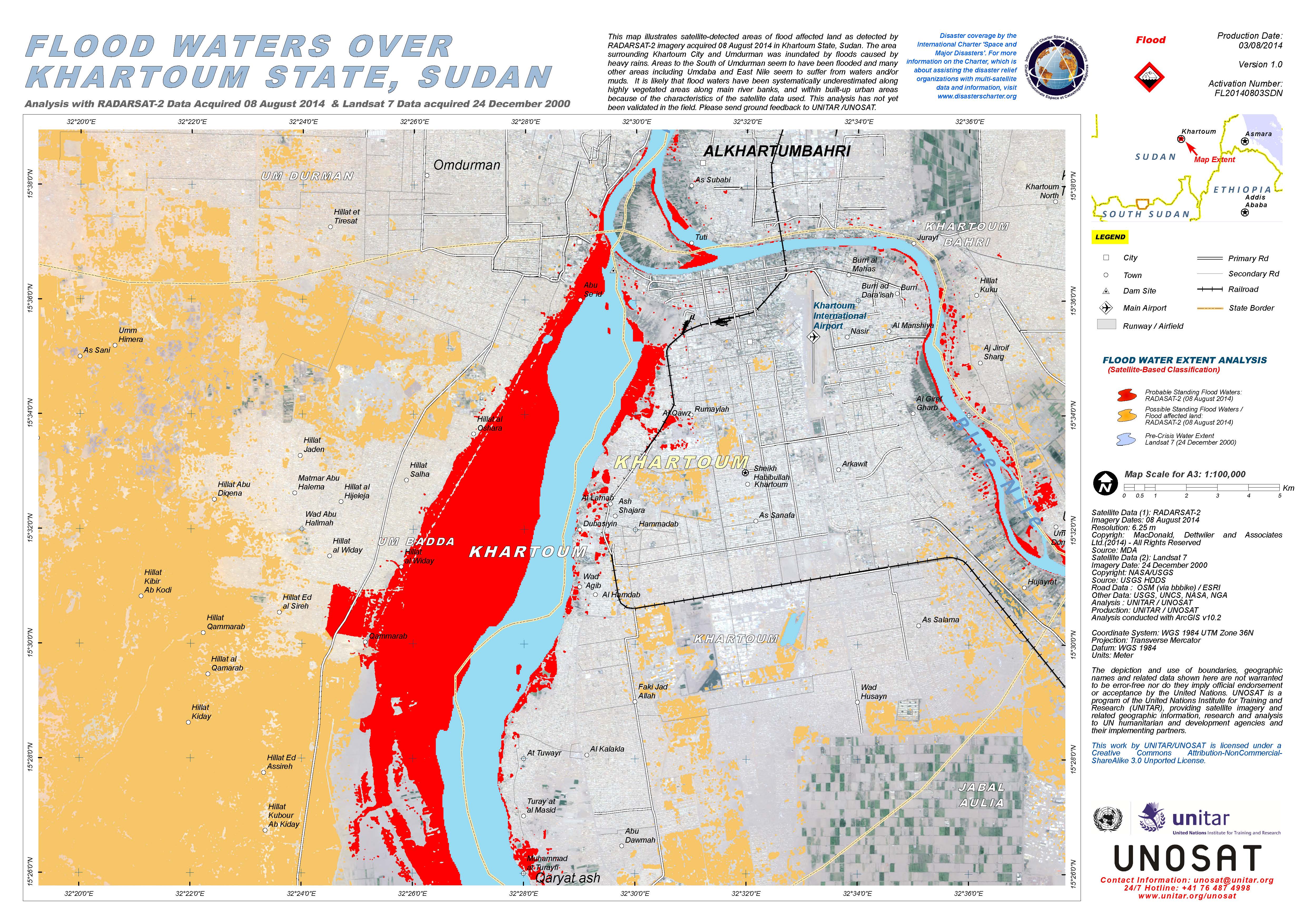
Flood waters over Khartoum State, Sudan
版权: RADARSAT-2 Data and Products © MacDonald, Dettwiler and Associates Ltd. (2014) - All Rights Reserved. RADARSAT is an official trademark of the Canadian Space Agency.
Landsat 7 © NASA/USGS
Map produced by UNITAR/UNOSAT
Information about the Product
已获得: RADARSAT-2: 08/08/2014
Landsat 7: 24/12/2000
源: RADARSAT-2 / Landsat 7
 返回完整的响应档案

