 English
 Spanish
 French
 Chinese
 Russian
 Portuguese
 Latest Activation
Charter activations
Flood in Sudan
Several weeks of heavy rain have caused floods in Sudan which have left approximately 39 people dead and 6000 homeless.
Sudan's rain season began in July and since then the floods have affected eight of Sudan's eighteen states, particularly the River Nile and North Kordofan states, where much of the damage has taken place. It has been estimated that 3000 homes were destroyed by the flooding and a further 2000 damaged.
The capital city, Khartoum, has also been affected, and hundreds of people are currently left homeless in the city. Residents have stated dissatisfaction with the nation's sewage network, which is ill-equipped to channel flood waters out of areas of habitation. The result is lingering flood waters which are a breeding ground for disease.
Volunteers in affected areas have attempted to keep back the flood waters with improvised barriers, but there are concerns over the long-term impact of the flooding, and over the risk of more rain to come in the following weeks.
| Type of Event: | Flood |
| Location of Event: | Sudan |
| Date of Charter Activation: | 05 August 2014 |
| Charter Requestor: | UNITAR/UNOSAT on behalf of UNOCHA |
| Project Management: | UNITAR/UNOSAT |
Products
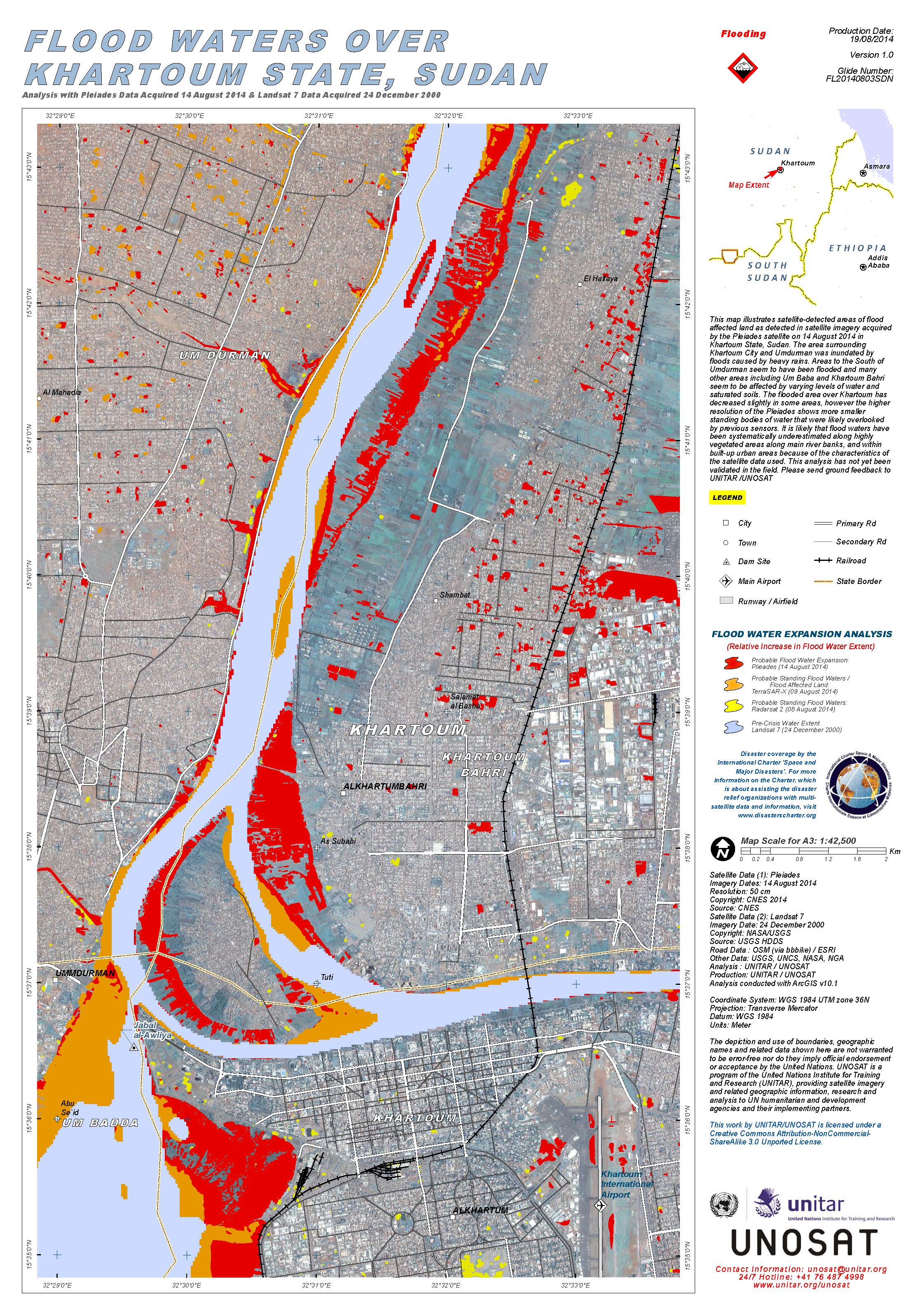
Flood waters over Khartoum State, Sudan
Copyright: Pleiades © CNES 2014
Landsat 7 © NASA/USGS
Map produced by UNITAR/UNOSAT
Information about the Product
Acquired: Pleiades: 14/08/2014
Landsat 7: 24/12/2000
Source: Pleiades / Landsat 7
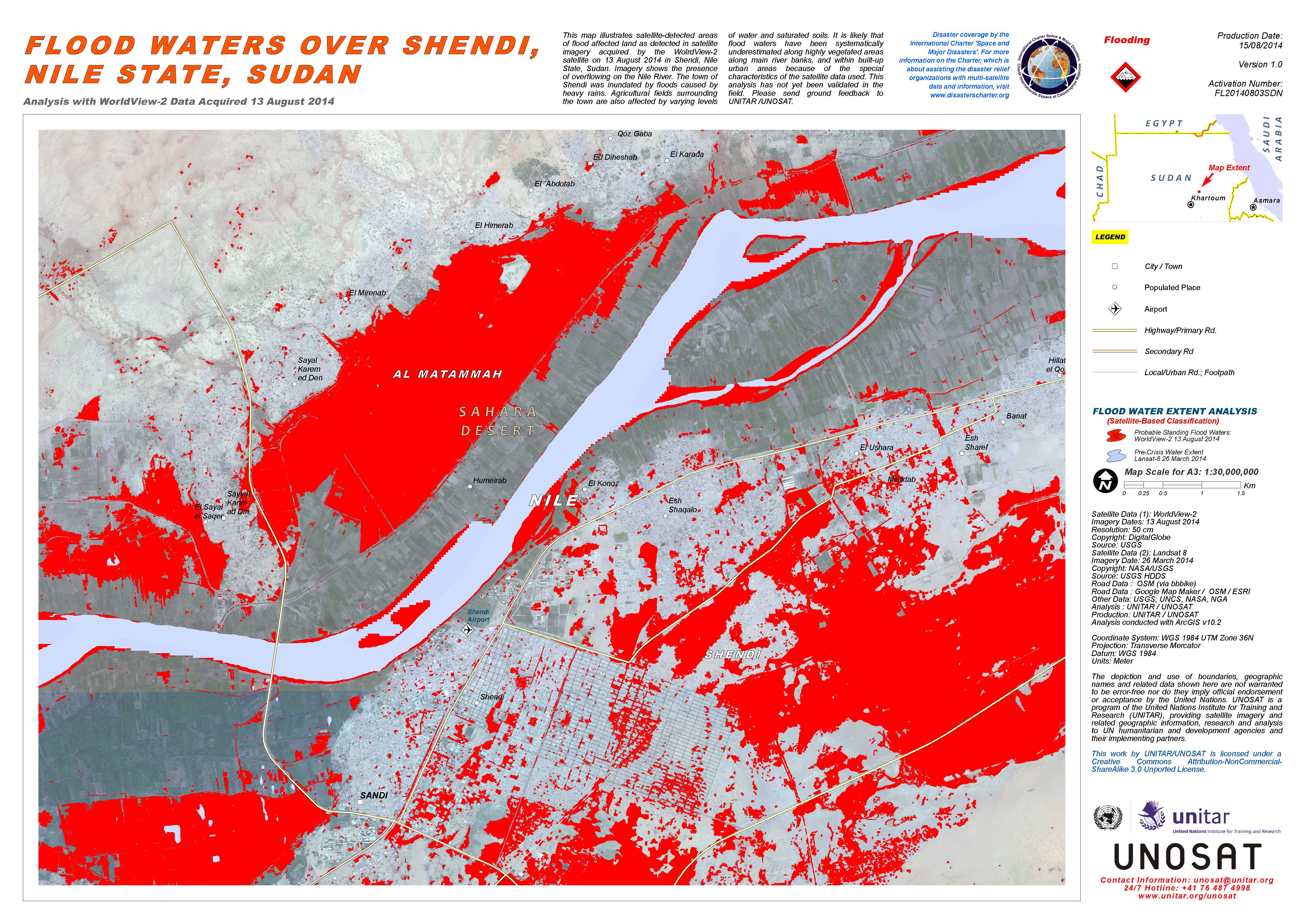
Flood waters over Shendi, Nile State, Sudan
Copyright: WorldView-2 © DigitalGlobe
Landsat-8 data and products © NASA/USGS (2014) - All rights reserved
Map produced by UNITAR/UNOSAT
Information about the Product
Acquired: WorldView-2: 13/08/2014
Landsat 8: 26/03/2014
Source: WorldView-2 / Landsat 8
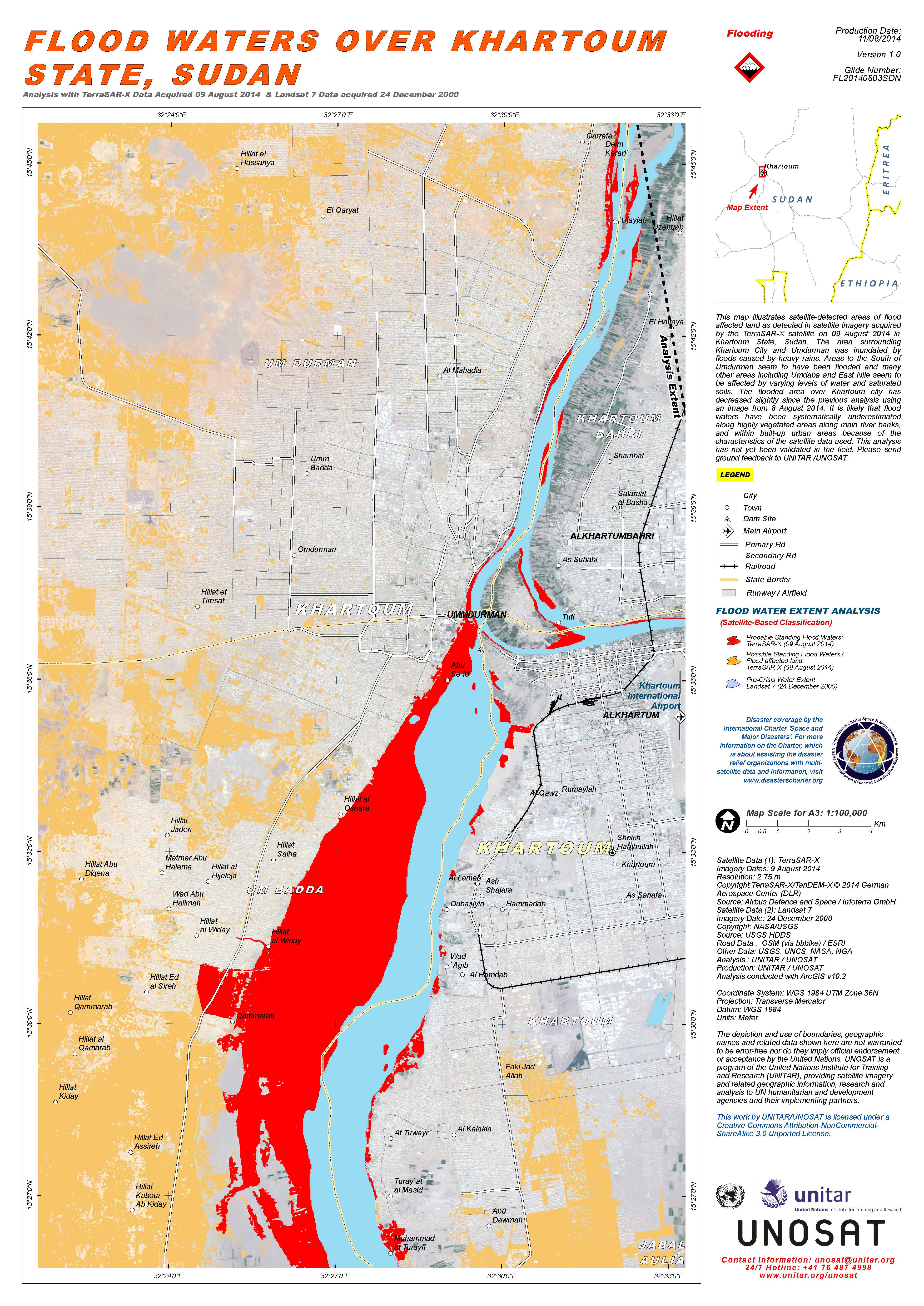
Flood waters over Khartoum State, Sudan
Copyright: TerraSAR-X © German Aerospace Center (DLR), 2014 Airbus Defence and Space / Infoterra GmbH
Landsat 7 © NASA/USGS
Map produced by UNITAR/UNOSAT
Information about the Product
Acquired: TerraSAR-X: 09/08/2014
Landsat 7: 24/12/2000
Source: TerraSAR-X / Landsat 7
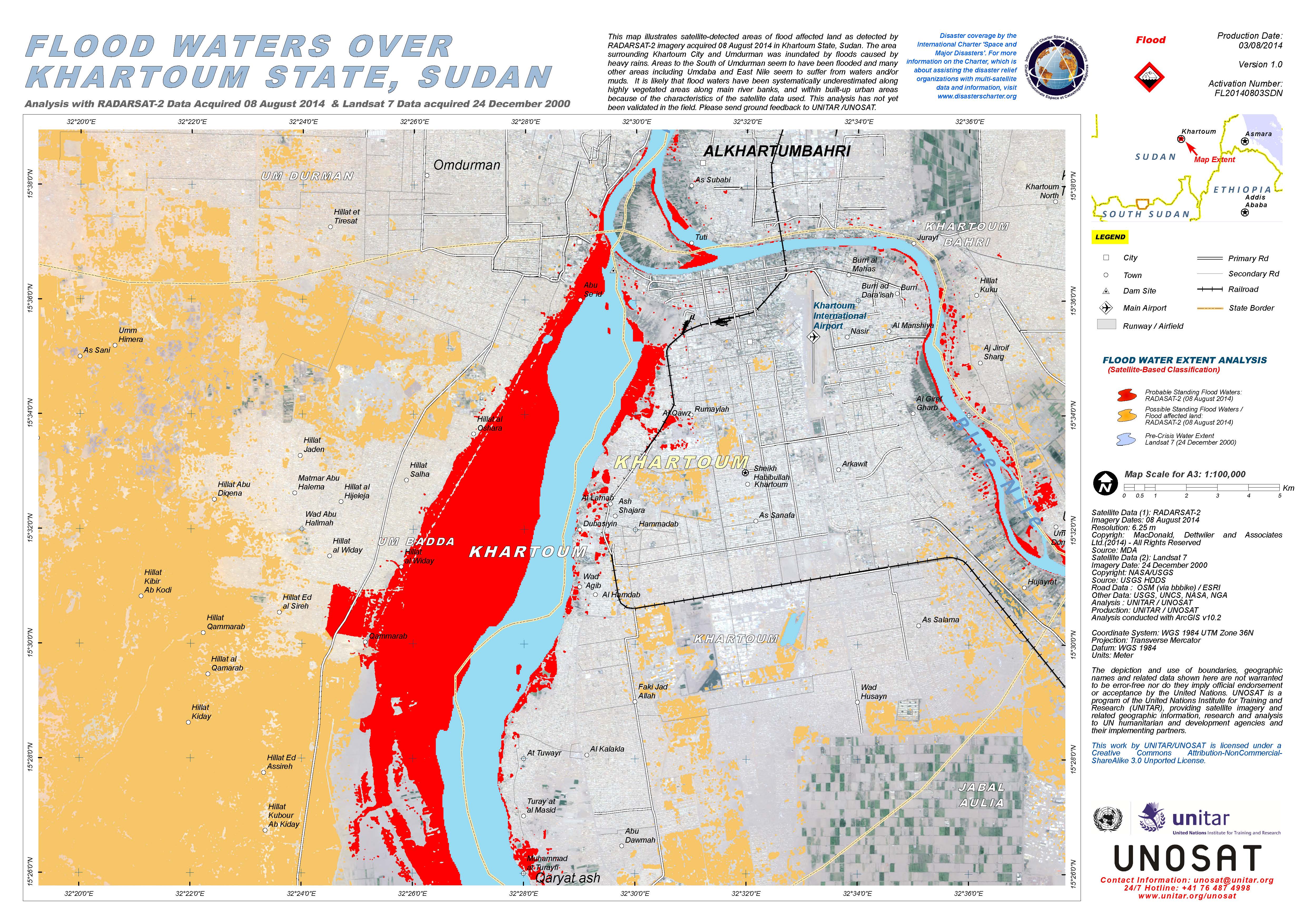
Flood waters over Khartoum State, Sudan
Copyright: RADARSAT-2 Data and Products © MacDonald, Dettwiler and Associates Ltd. (2014) - All Rights Reserved. RADARSAT is an official trademark of the Canadian Space Agency.
Landsat 7 © NASA/USGS
Map produced by UNITAR/UNOSAT
Information about the Product
Acquired: RADARSAT-2: 08/08/2014
Landsat 7: 24/12/2000
Source: RADARSAT-2 / Landsat 7
 Back to the full activation archive

