 English
 Spanish
 French
 Chinese
 Russian
 Portuguese
 最新宪章启动
Charter activations
英格兰洪水
在过去的5天里,蔓延的洪水已侵袭了英格兰的若干地区,且灾情仍在持续。
环境局 - BBC新闻
超过900处房屋被淹,据报道已有2人死亡。除被淹的房屋以外,还有大片漫滩上的农地被淹没。
受灾地区包括: 萨默塞特平原、牛津、蒂克斯伯里、达灵顿到约克、内内河漫滩和诺丁汉。
截至2012年11月29日,有1650处房屋被淹,又有1人死亡(共3人死亡)。
| 事件类型: | 洪水 |
| 事件地点: | 英国英格兰 |
| 启动宪章的日期: | 2012年11月27日 |
| 宪章要求者: | 环境局(英格兰和威尔士) |
| 项目经理: | 环境局(英格兰和威尔士) |
Products
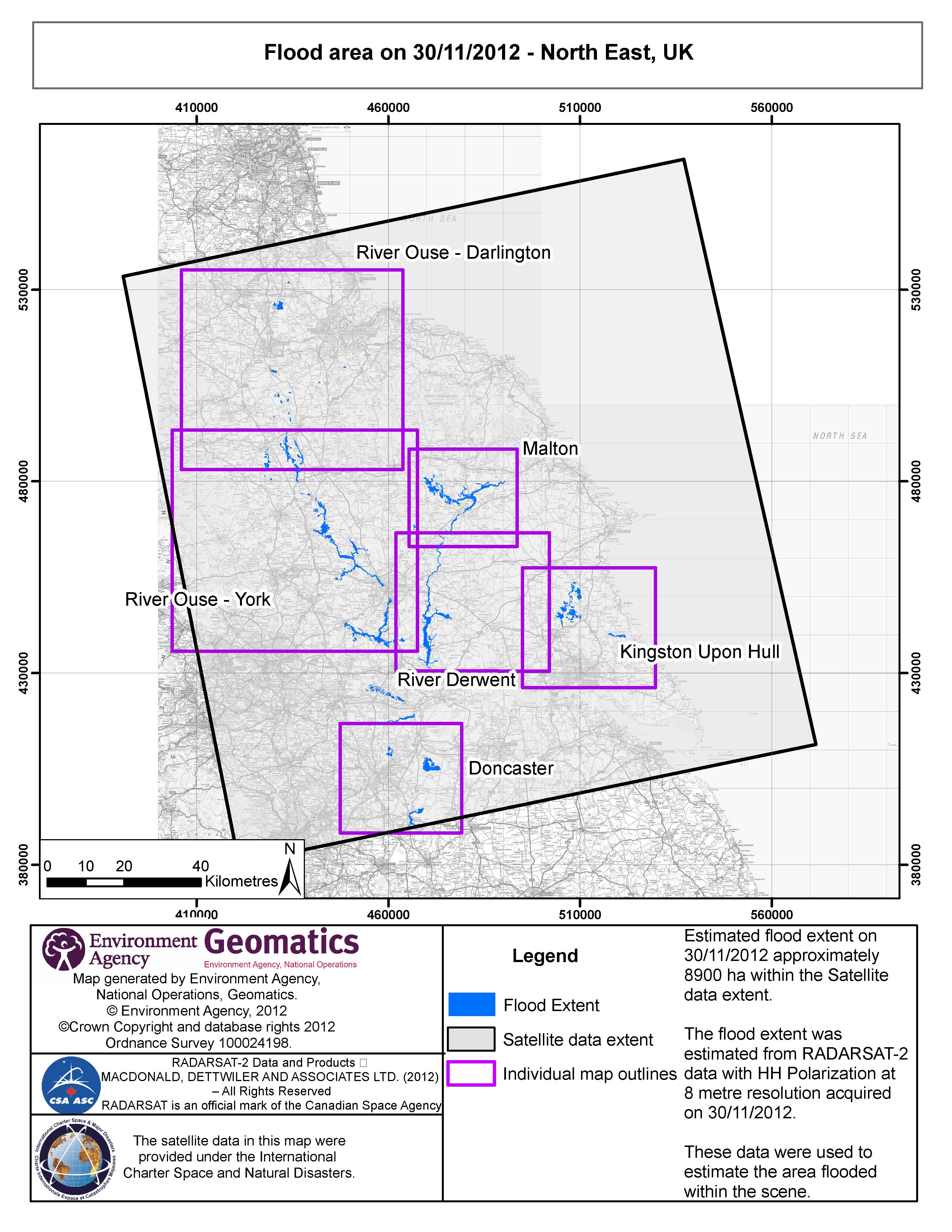
Estimated flood extent on 30/11/2012 approximately 8900 ha within the Satellite data extent.
The flood extent was estimated from RADARSAT-2 data with HH Polarisation at 8 metre resolution.
版权: RADARSAT-2 Data and Products © MacDonald, Dettwiler and Associates Ltd. (2012) - All Rights Reserved. RADARSAT is an official trademark of the Canadian Space Agency.
Map produced by Environment Agency, National Operations, Geomatics
Information about the Product
已获得: 30/11/2012
源: RADARSAT-2
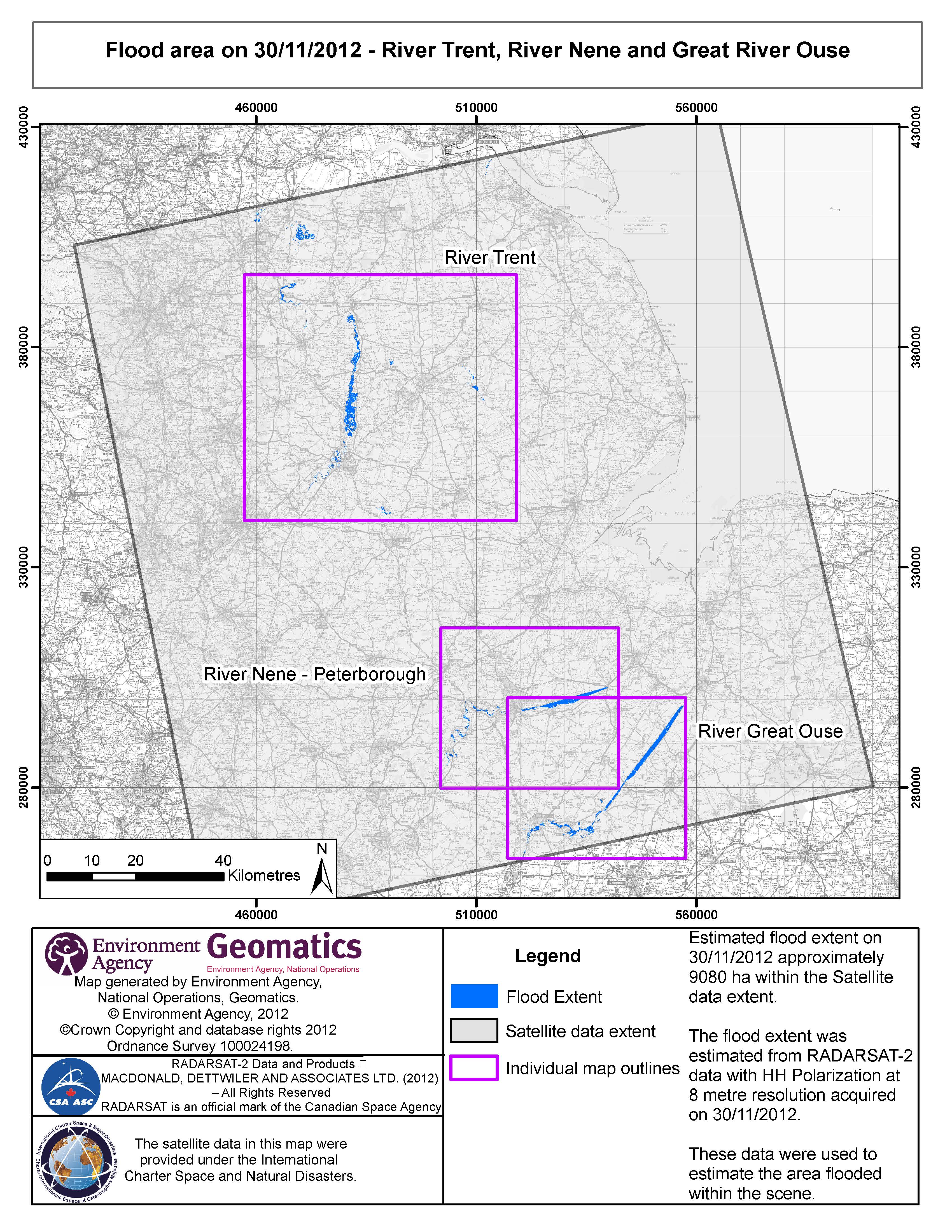
Estimated flood extent on 30/11/2012 approximately 9080 ha within the Satellite data extent.
The flood extent was estimated from RADARSAT-2 data with HH Polarisation at 8 metre resolution.
版权: RADARSAT-2 Data and Products © MacDonald, Dettwiler and Associates Ltd. (2012) - All Rights Reserved. RADARSAT is an official trademark of the Canadian Space Agency.
Map produced by Environment Agency, National Operations, Geomatics
Information about the Product
已获得: 30/11/2012
源: RADARSAT-2
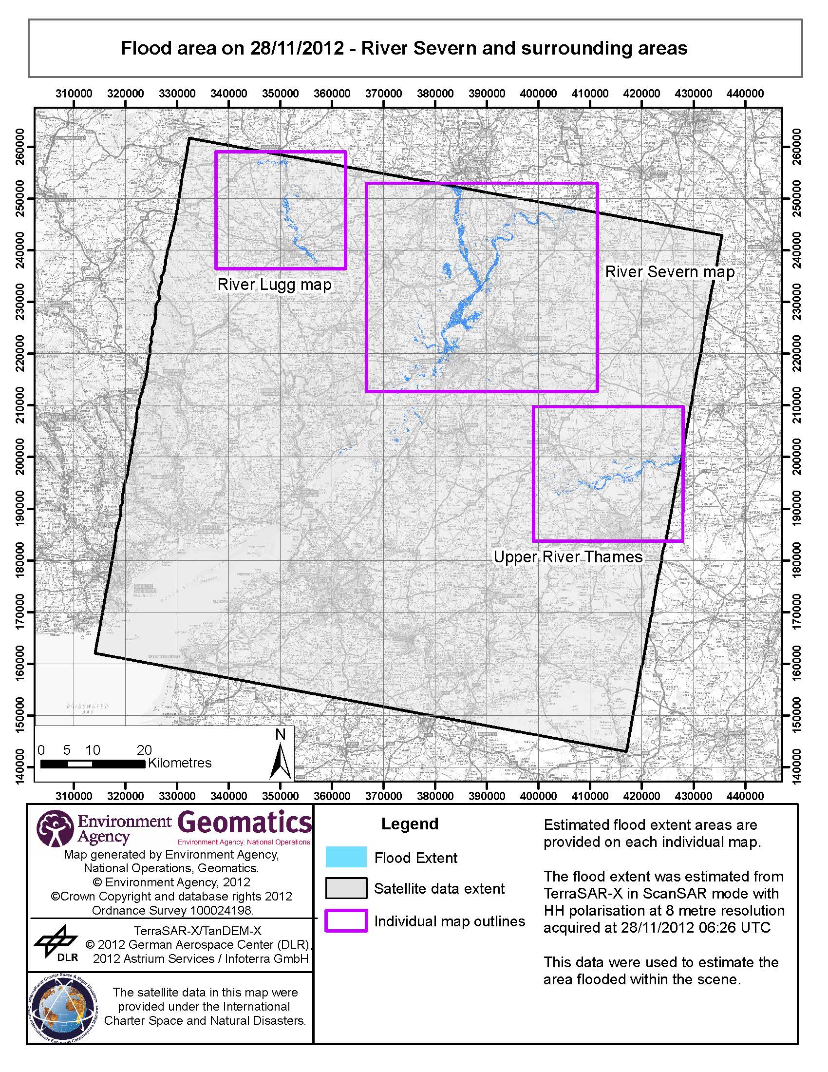
Estimated flood extent areas are provided on each map.
The flood extent was estimated from TerraSAR-X in ScanSAR mode with HH polarisation at 8 meter resolution.
版权: TerraSAR-X/TanDEM-X © 2012 German Aerospace Center (DLR), 2012 Astrium Services / Infoterra GmbH
Map produced by Environment Agency, National Operations, Geomatics
Information about the Product
已获得: 28/11/2012
源: TerraSAR-X
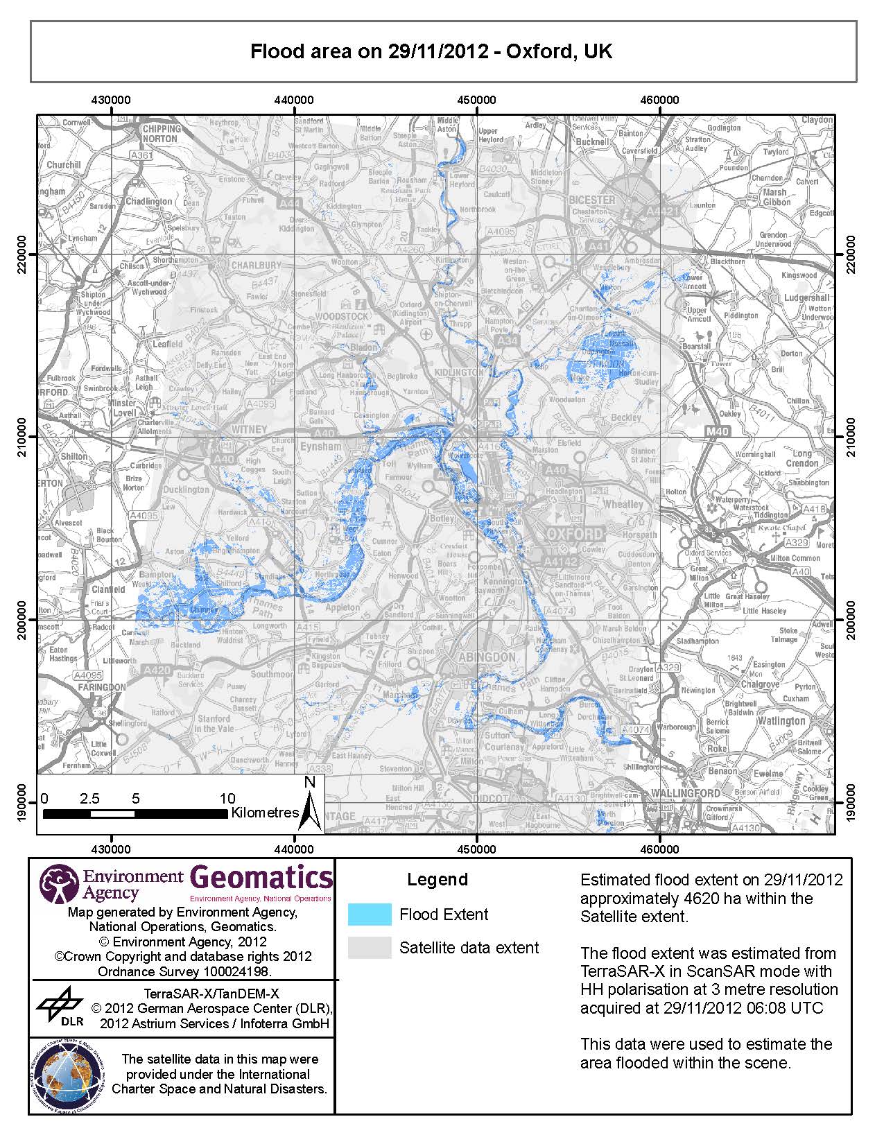
Estimated flood extent on 29/11/2012 - approximately 4620 ha within the Satellite extent.
The flood extent was estimated from TerraSAR-X in ScanSAR mode with HH polarisation at 3 metre resolution.
版权: TerraSAR-X/TanDEM-X © 2012 German Aerospace Center (DLR), 2012 Astrium Services / Infoterra GmbH
Map produced by Environment Agency, National Operations, Geomatics
Information about the Product
已获得: 29/11/2012
源: TerraSAR-X

Flood area on 28/11/2012 - Somerset Levels, UK
Aerial photography campaign overlaid
版权: TerraSAR-X/TanDEM-X © 2012 German Aerospace Center (DLR), 2012 Astrium Services / Infoterra GmbH
Map produced by Environment Agency, National Operations, Geomatics
Information about the Product
已获得: Pre-crisis: 08/04/2010
Post-crisis: 23/11/2012, 26/11/2012 and 28/11/2012
源: TerraSAR-X
 返回完整的响应档案

