 English
 Spanish
 French
 Chinese
 Russian
 Portuguese
 最新宪章启动
Charter activations
Wildfire in Guatemala
On 22 February, 2024, a forest fire started on the slopes of the inactive Agua volcano in Guatemala. The Agua volcano, one of the highest in Guatemala, is approximately 10 kilometres from the colonial city of Antigua, which is a popular tourist destination in the country.
Firefighters and military personnel faught to extinguish the fires, working against thick smoke and dense vegetation around the clock to reduce the risk of escalation. Two helicopters were also used to provide support, dropping water from above to combat the flames. The cause of the fire remains unknown, and the exact amount of burned hectares was not determined. Investigations were carried out to understand the origins of the fire are till ongoing.
There have been no reported casualties or evacuations. The fire significantly damaged the vegetation on the upper part of the 3,766-meter-high volcano, which will have an ecological impact on the local ecosystem and biodiversity.
The Agua volcano, also known as Hunahpú by the Maya indigenous people, holds historical significance and is part of a protected area due to its rich diversity of flora and fauna. Therefore, efforts are being made to preserve the area and reduce the spread of the blaze as much as possible.
| 事件类型: | Fire |
| 事件地点: | Guatemala |
| 启动宪章的日期: | 2024-02-22 |
| 宪章启动时间: | 23:12 |
| 宪章启动时区: | UTC+01:00 |
| 宪章要求者: | UNOOSA/UN-SPIDER on behalf of Executive Secretariat, National Coordinating Agency for Disaster Reduction of Guatemala (SE-CONRED) |
| 启动ID: | 863 |
| 项目经理: | Danilo Juarros (SE-CONRED) |
| act-value-adders: | Alexander Ariza (UNSPIDER) |
Products


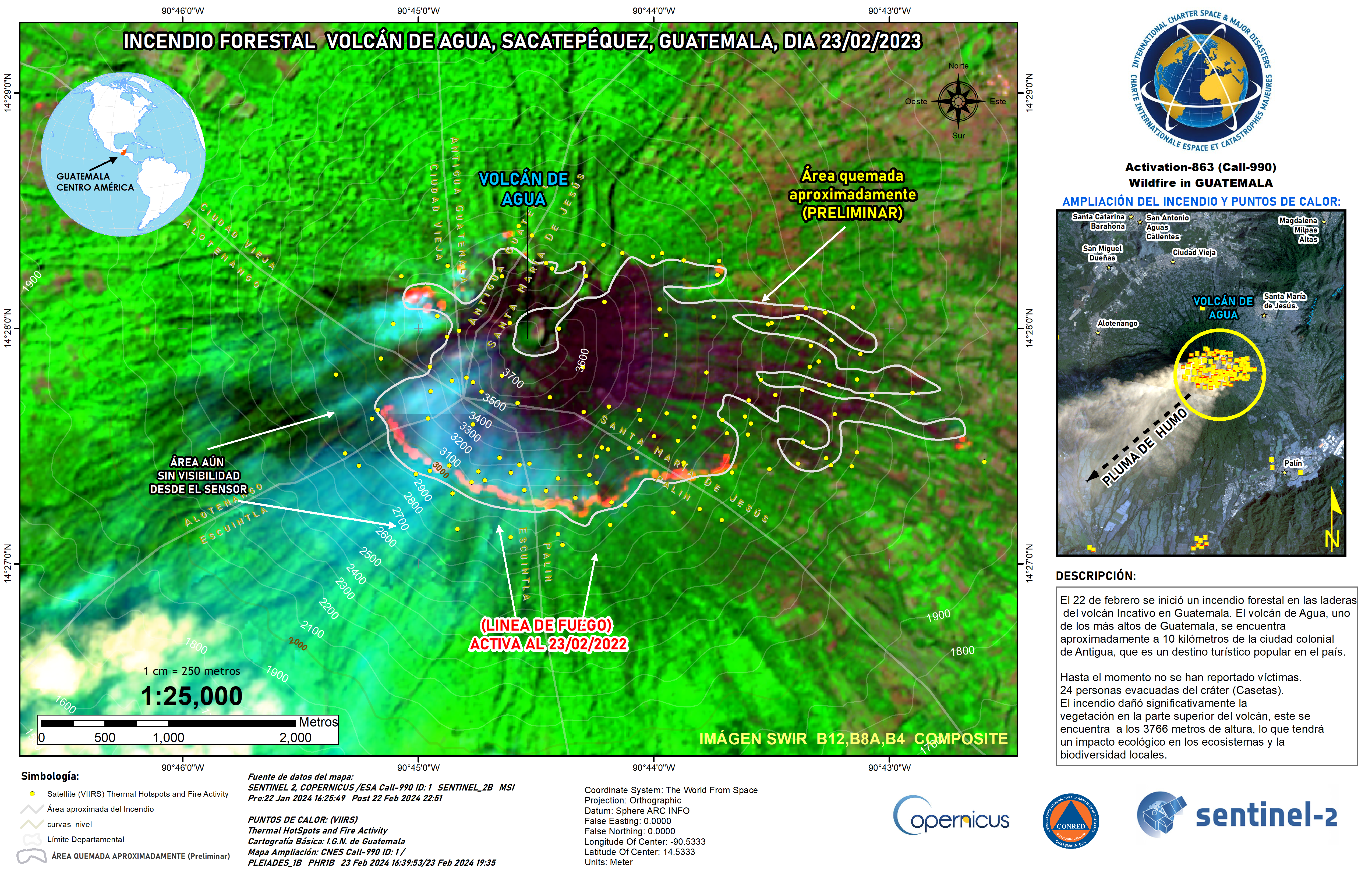
Potential area burned in the Agua Volcano fire
版权: Contains modified Copernicus Sentinel data (2024)
Includes Pleiades material © CNES (2024), Distribution Airbus DS.
Map produced by CONRED
Information about the Product
已获得: Sentinel-2: 23/02/2024, Peiades: 23/02/2024
源: Sentinel-2, Pleiades
类别: Delineation Map


 返回完整的响应档案

