 English
 Spanish
 French
 Chinese
 Russian
 Portuguese
 Latest Activation
Charter activations
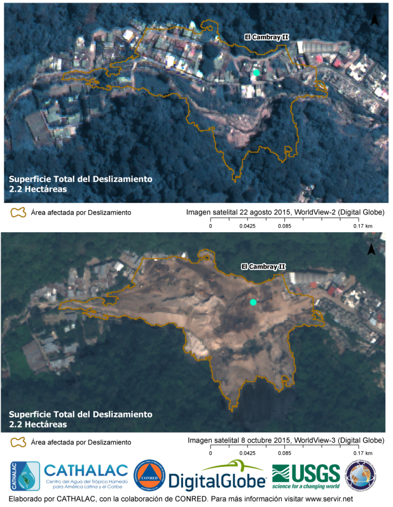
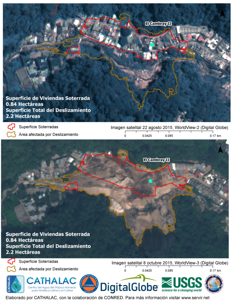
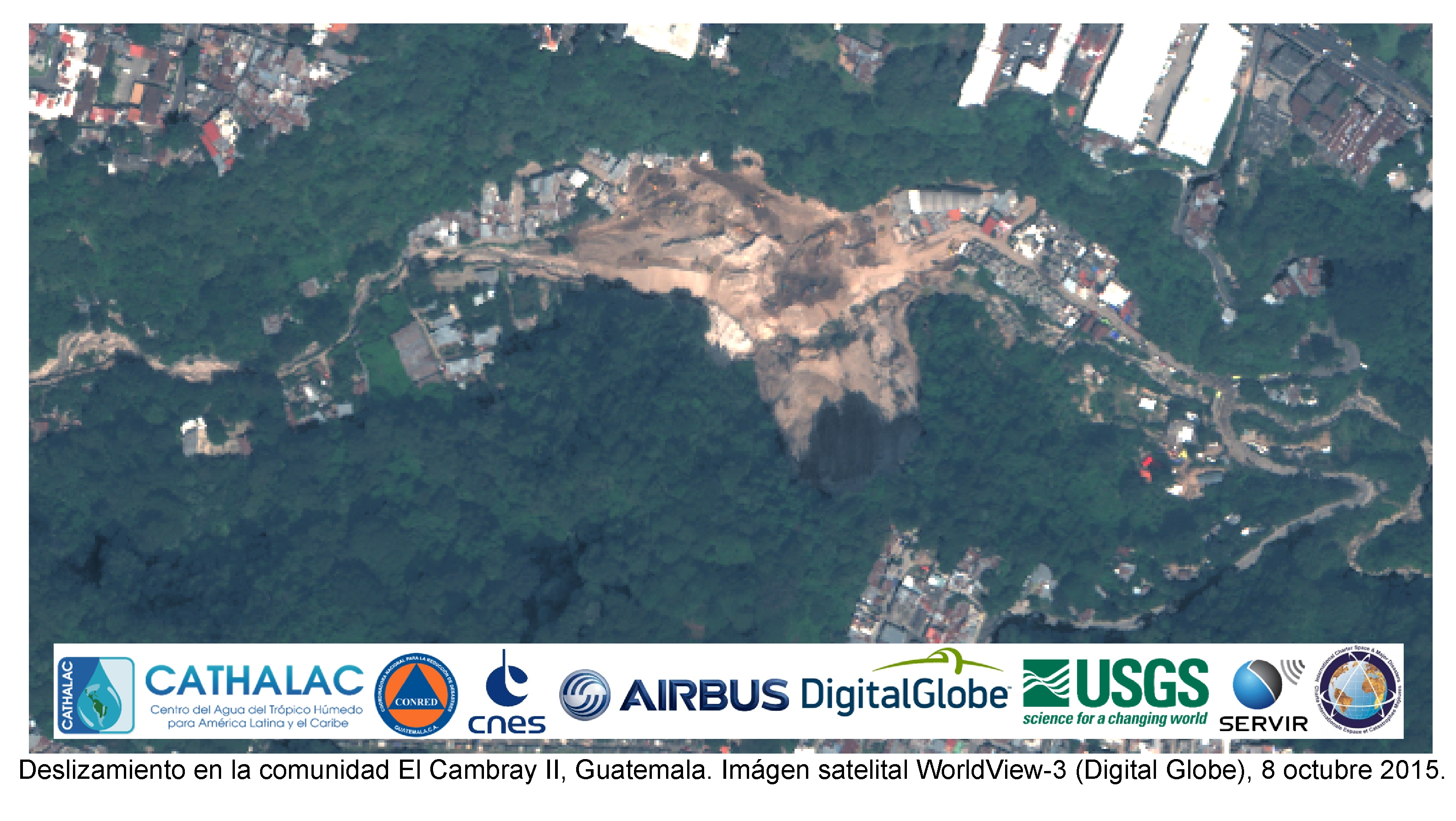
Landslide in Guatemala
Heavy rains triggered a landslide in Santa Catarina Pinula, Guatemala on the evening of 1 October, as a hillside came loose and buried parts of the town. At least 191 people were killed and over 300 people are unaccounted for.
Rescuers began digging through tons or earth and rubble looking for survivors trapped in houses covered by trees and up to 12 metres of debris. Around 1800 soldiers, firemen and local residents helped with the rescue efforts.
Officials have declared the area uninhabitable, with around 230 people being relocated. Guatemala's National Disaster Reduction Commission (CONRED) said they had detected cracks in the hilltop through which water was seeping, heightening the risk of further mudslides.
| Type of Event: | Landslide |
| Location of Event: | Guatemala |
| Date of Charter Activation: | 7 October 2015 |
| Time of Charter Activation: | 02:57:45 |
| Time zone of Charter Activation: | UTC+02:00 |
| Charter Requestor: | USGS on behalf of National Emergency Operations Center of Guatemala |
| Project Management: | CATHALAC |
Products


 Back to the full activation archive

