 English
 Spanish
 French
 Chinese
 Russian
 Portuguese
 Latest Activation
Charter activations
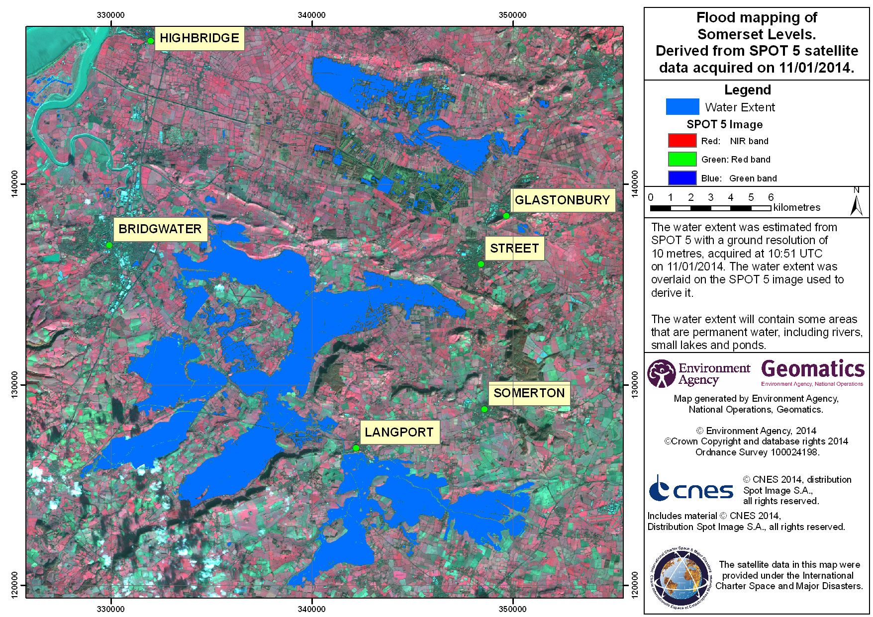
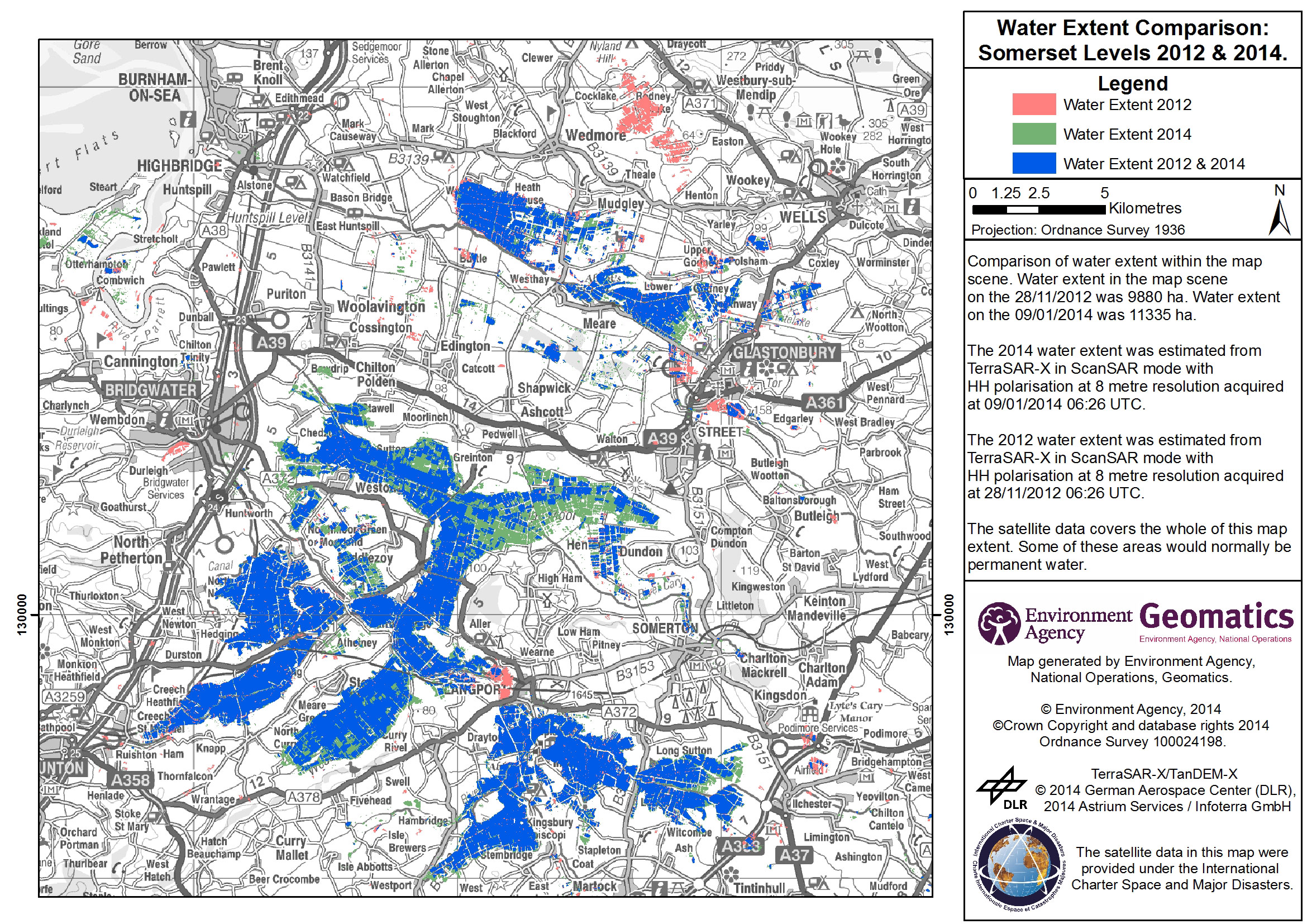
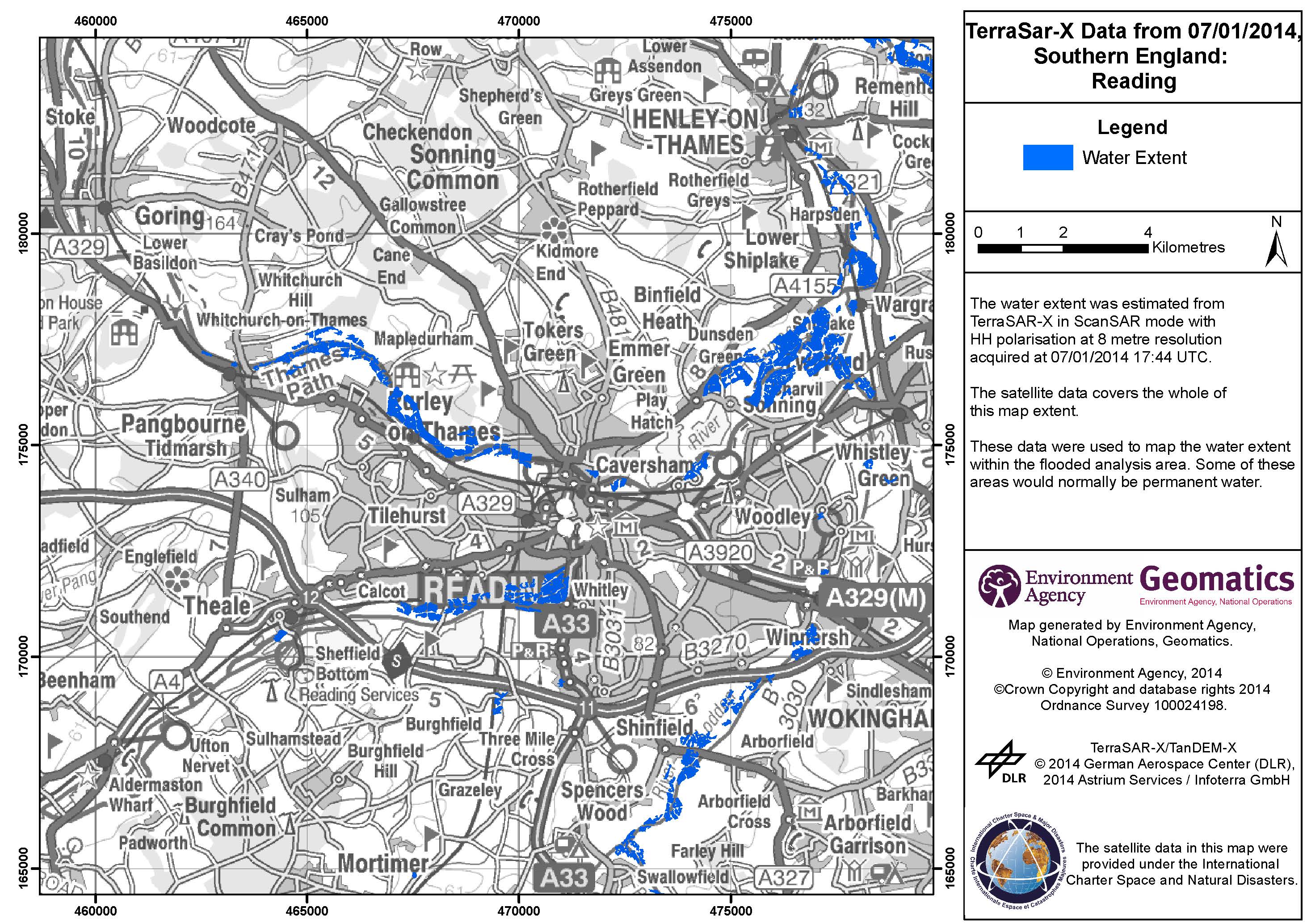
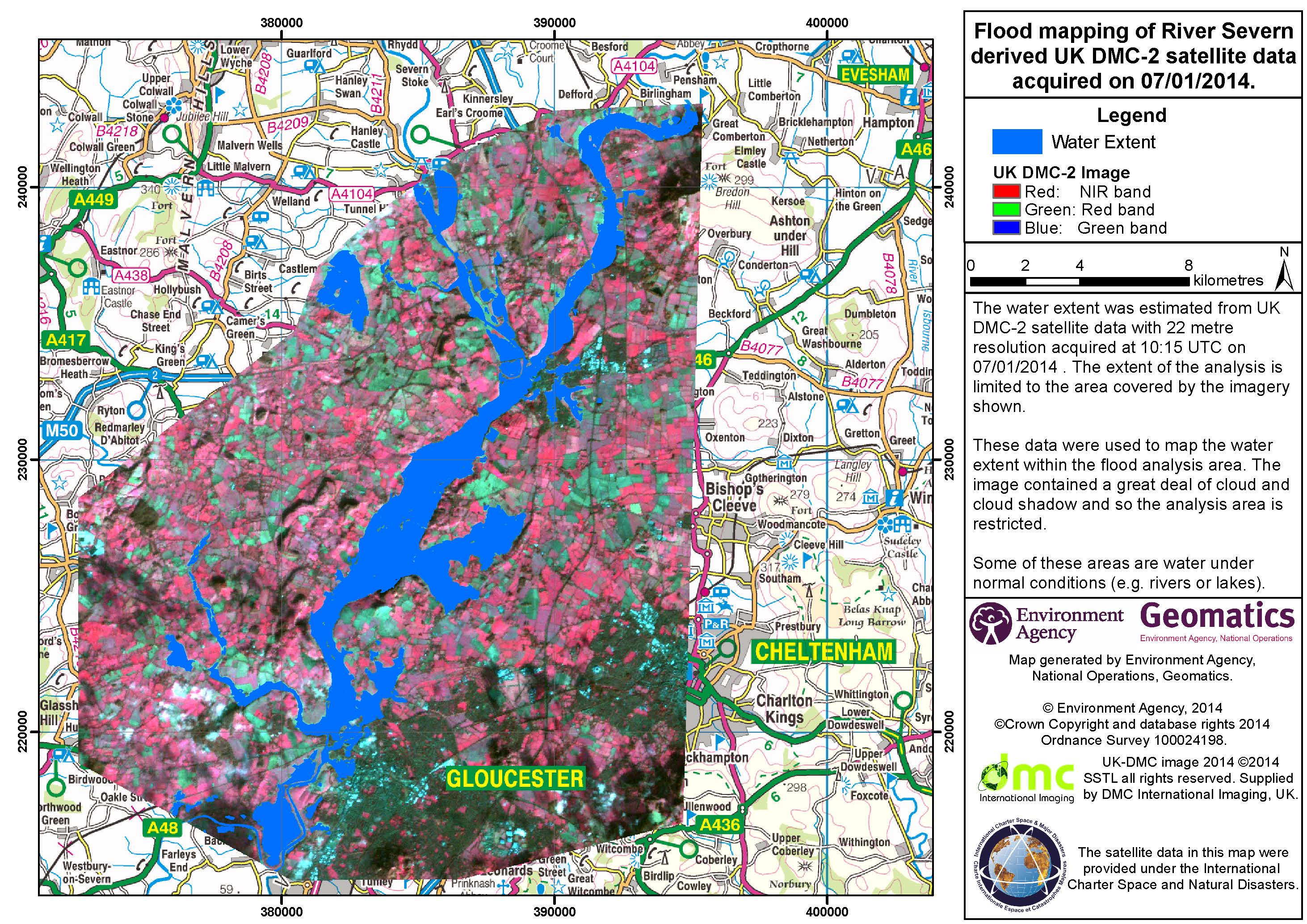
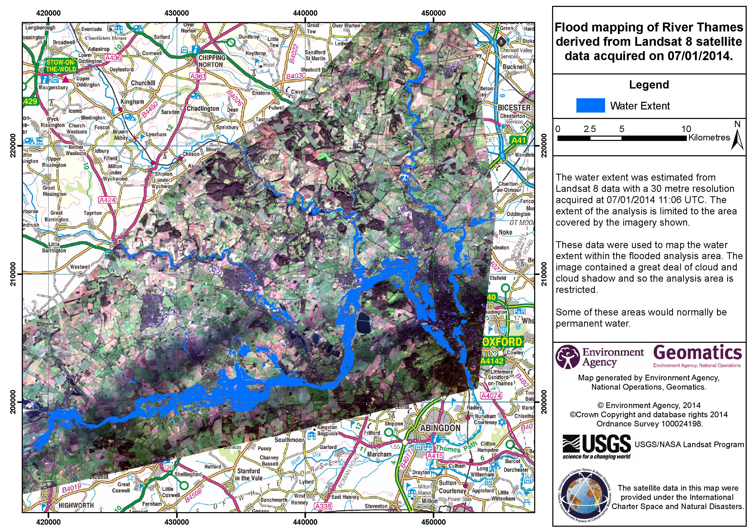
Flood in England, UK
Ongoing storms and heavy rain since 23 December 2013 has caused flooding across the United Kingdom. One person has been reported killed, and it is estimated that over 300 properties have been flooded so far.
In England a number of major rivers are in the process of flooding, or are expected to do so over the next few days. Significant flooding is expected along the Thames, Severn, and Stour rivers. Due to the continuing rain, saturated ground is also contributing to flooding.
Roads and train services have been disrupted by the flooding and turbulent conditions.
The Environment Agency has issued over 200 flood alerts as of 06 January and more storms are forecast to bring further rain and coastal flooding along the south east and west of England over the coming days. Residents of areas affected by flooding are urged to take care and avoid coastal areas due to the risk of storm surges and high tides.
It is estimated that over 200,000 properties have been protected by the existing flood defences, and further measures are being implemented in an attempt to stem further flooding.
| Tipo de evento: | Flood |
| Local do evento: | England, United Kingdom |
| Data da Ativação da Carta: | 06 January 2014 |
| Requisitante da Carta: | Environment Agency (of England and Wales) |
| Gerenciamento de projeto: | Environment Agency (of England and Wales) |
Products

 Voltar ao arquivo completo da Ativação

