 English
 Spanish
 French
 Chinese
 Russian
 Portuguese
 最新宪章启动
Charter activations
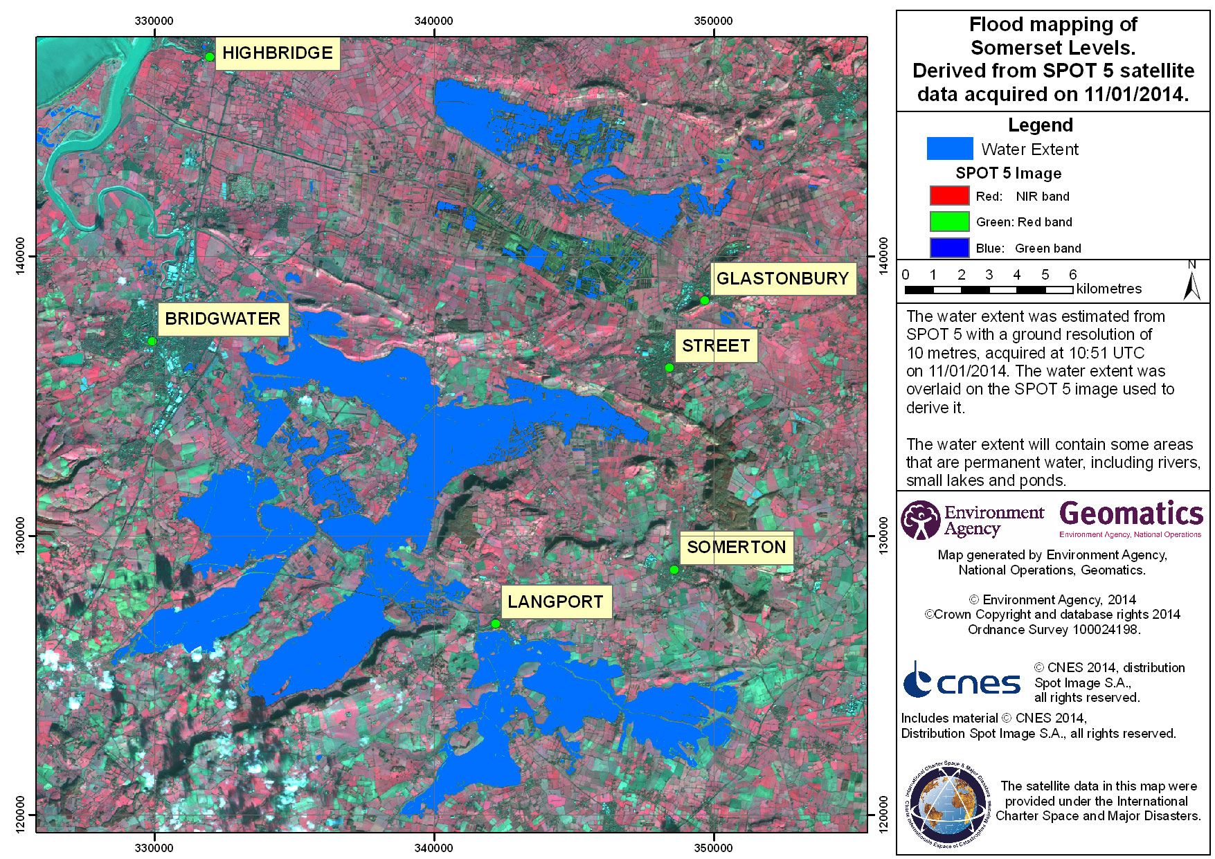
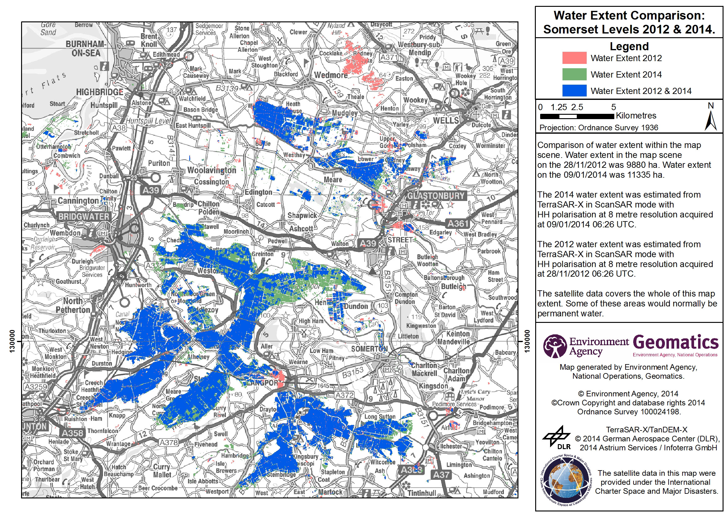
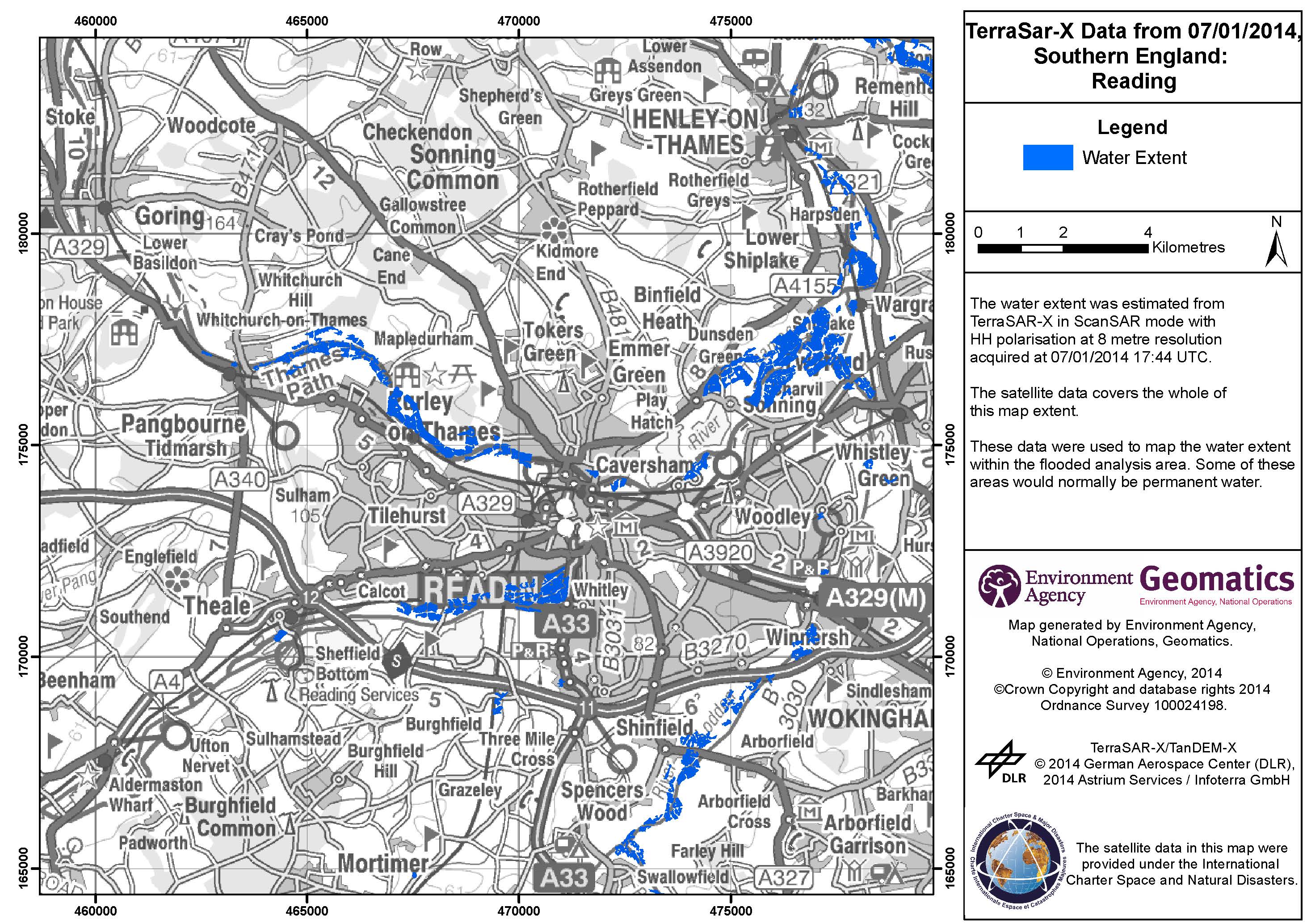
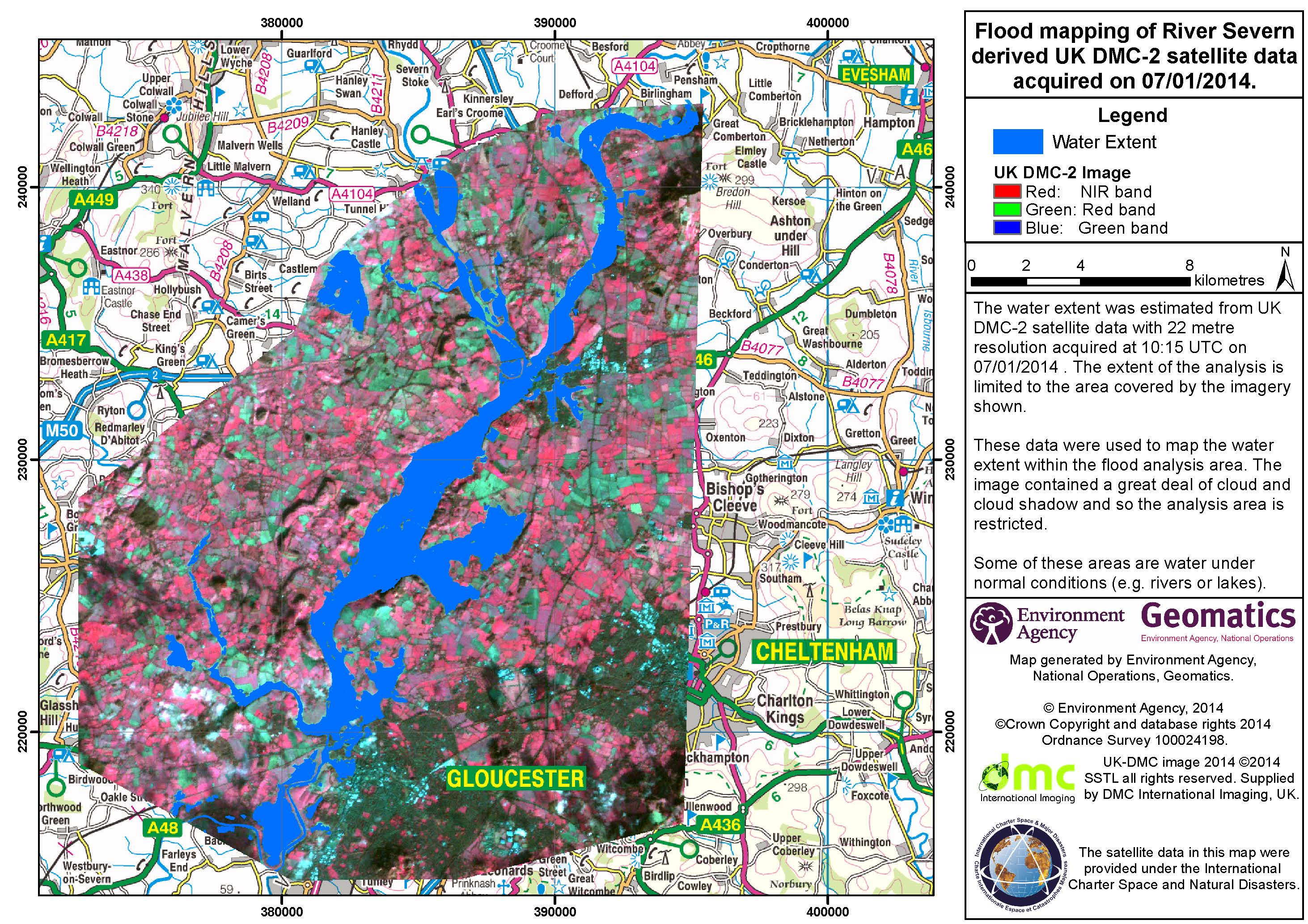
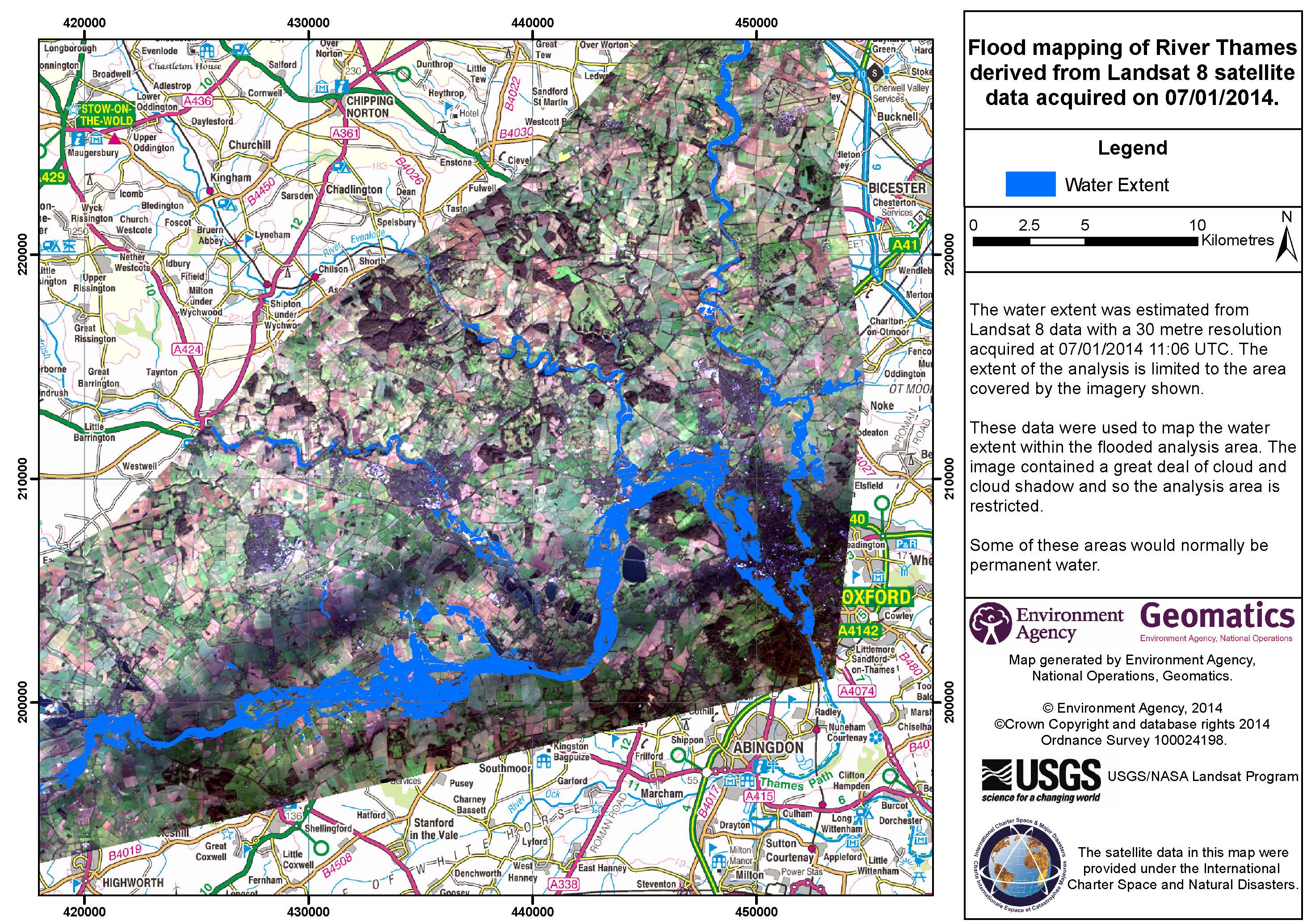
英国英格兰洪水
2013年12月23日以来持续的暴风雨和强降雨,在整个英国已经引起了严重的洪灾。据报道已有一人丧生,同时据估计,截至目前,超过300处房屋已被洪水淹没。
在英格兰,一些主要河流有的正在形成洪水,有的即将在未来的几天内形成。预计特别严重的洪水将发生在泰晤士河、塞文河和斯陶尔河沿线。由于持续的降雨,土壤已经饱和,这在某种程度上也加剧了了洪灾的发生。
公路和铁路服务由于洪水以及动荡的状况,现已被迫中断。
截止到01月06日,环境局已发出超过200条的洪灾警报,预计在未来几天内,风暴将给英格兰南东部和西部带来进一步的降雨和沿海洪涝。由于沿海地区存在风暴潮及涨潮风险险,洪水影响地区的居民已被敦促注意防范并避免前往沿海地区。
据估计,超过20万的房屋已经被现有的防洪设施保护。同时,相关部门正在采取进一步的洪灾防范措施,以阻止更大洪灾的发生。
| 事件类型: | 洪水 |
| 事件地点: | 英国英格兰 |
| 启动宪章的日期: | 2014年1月6日 |
| 宪章要求者: | 环境局(英格兰和威尔士) |
| 项目经理: | 环境局(英格兰和威尔士) |
Products

 返回完整的响应档案

