 English
 Spanish
 French
 Chinese
 Russian
 Portuguese
 最新のチャータ発動
Charter activations
ベトナムの台風ダムレイ
11月4日、ダムレイと名付けられた台風がベトナムに大きな被害を与えました。
| Type of Event: | 海洋ストーム 台風 |
| Location of Event: | ベトナム |
| Date of Charter Activation: | 2017年11月6日 |
| Time of Charter Activation: | 16:35 |
| Time zone of Charter Activation: | UTC+05:30 |
| Charter Requestor: | UNOCHAに代わってUNITAR-UNOSAT |
| Activation ID: | 557 |
| Project Management: | UNITAR / UNOSAT |
Products
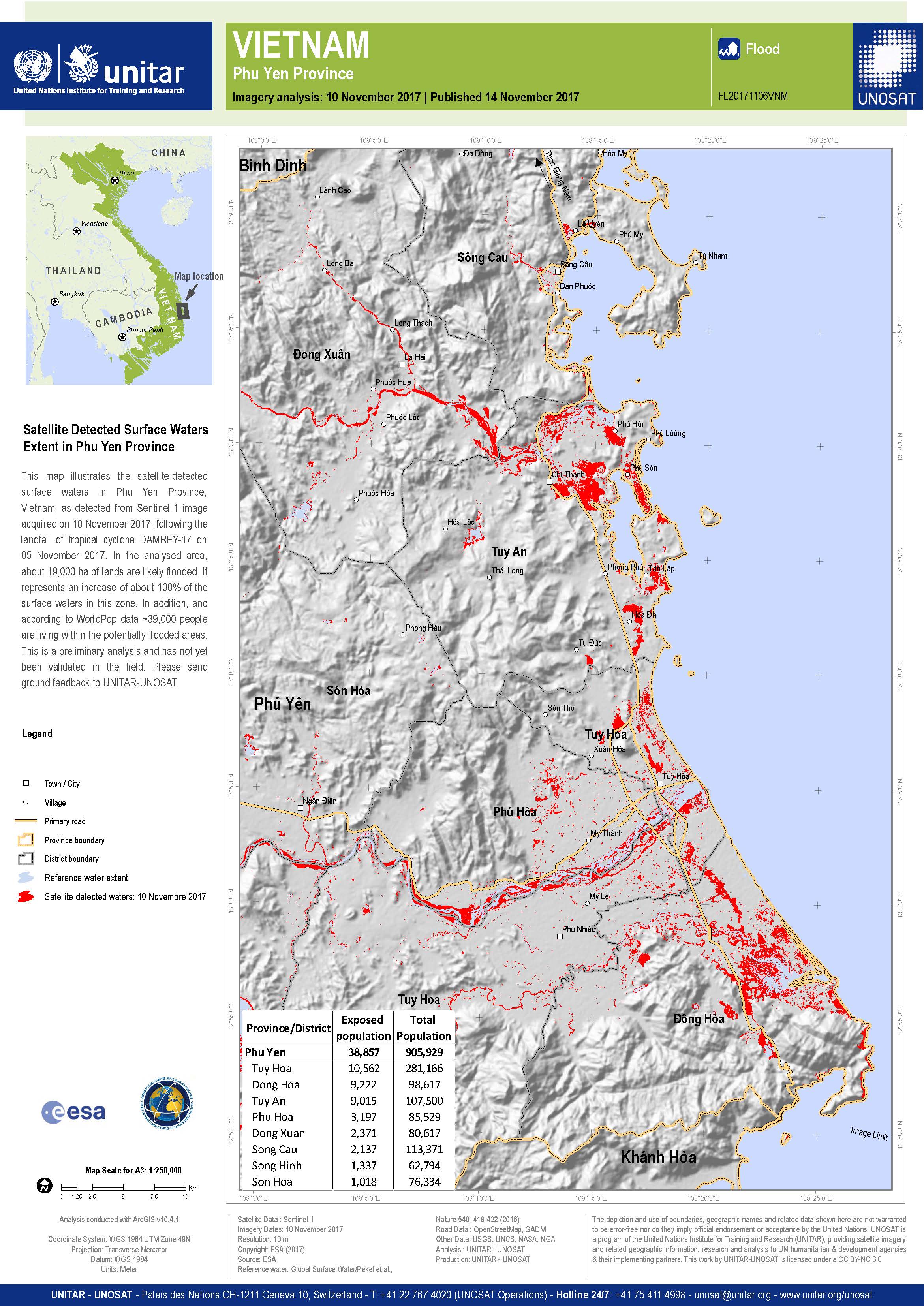
Flood detection in Phu Yen Province, Vietnam
Copyright: Sentinel-1© Contains modified Copernicus Sentinel data (2017)
Map produced by UNITAR / UNOSAT
Information about the Product
Acquired: 10/11/2017
Source: Sentinel-1
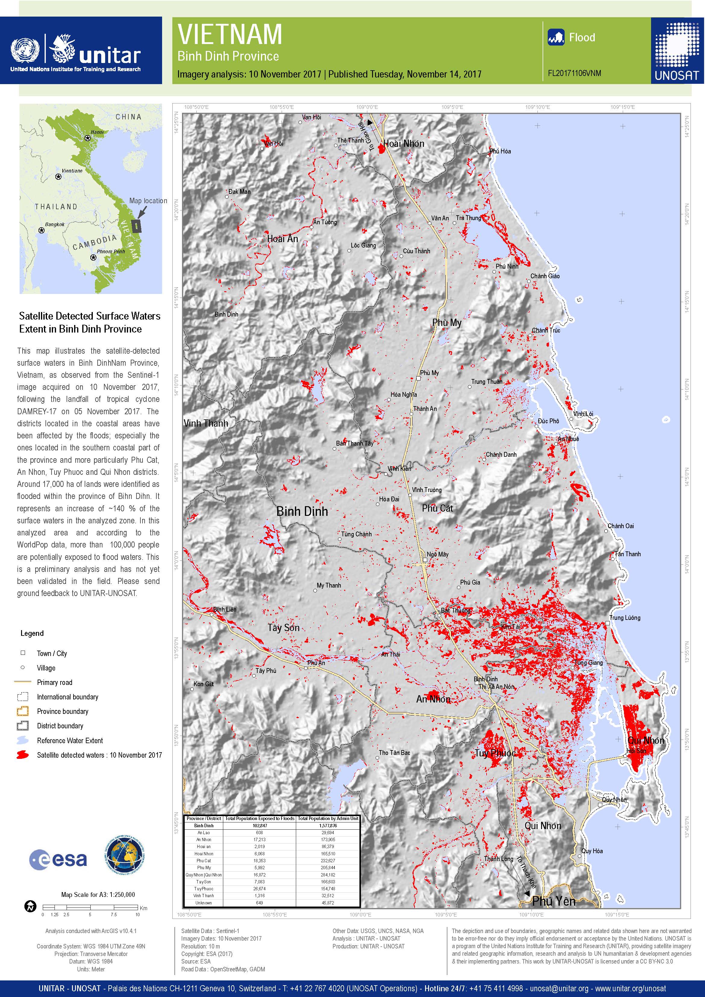
Flood detection in Binh Dinh Province, Vietnam
Copyright: Sentinel-1© Contains modified Copernicus Sentinel data (2017)
Map produced by UNITAR / UNOSAT
Information about the Product
Acquired: 10/11/2017
Source: Sentinel-1

Flooding in the southern part of Vietnam
Copyright: Sentinel-1© Contains modified Copernicus Sentinel data (2017)
Map produced by UNITAR / UNOSAT
Information about the Product
Acquired: 07/11/2017
Source: Sentinel-1
Preliminary rapid flood assessment in Quang Binh Province
Download the full report
Copyright: RADARSAT-2 Data and Products © MacDonald, Dettwiler and Associates Ltd. (2017) - All Rights Reserved. RADARSAT is an official trademark of the Canadian Space Agency.
Sentinel-1 © Copernicus Sentinel data (2017)
Report produced by UNITAR/UNOSAT
Information about the Product
Acquired: RADARSAT-2: 07/11/2017
Sentinel-1: 03/11/2017
Source: RADARSAT-2 / Sentinel-1

Satellite detected surface water extent in Quang Nam Province
Copyright: RADARSAT-2 Data and Products © MacDonald, Dettwiler and Associates Ltd. (2017) - All Rights Reserved. RADARSAT is an official trademark of the Canadian Space Agency.
Map produced by UNITAR-UNOSAT
Information about the Product
Acquired: 07/11/2017
Source: RADARSAT-2
 Back to the full activation archive

