 English
 Spanish
 French
 Chinese
 Russian
 Portuguese
 最新宪章启动
Charter activations
北海溢油
4000吨原油从国家湾油田的一个装油浮筒中溢出。油田清理工作已经展开,但由于风大浪高,工作进展缓慢。
| 事件类型: | 溢油 |
| 事件地点: | 挪威(北海) |
| 启动宪章的日期: | 2007年12月12日 17:31 UTC |
| 宪章要求者: | 欧洲委员会民事保护部门 |
| 项目经理: | 欧洲海事安全局 |
Products
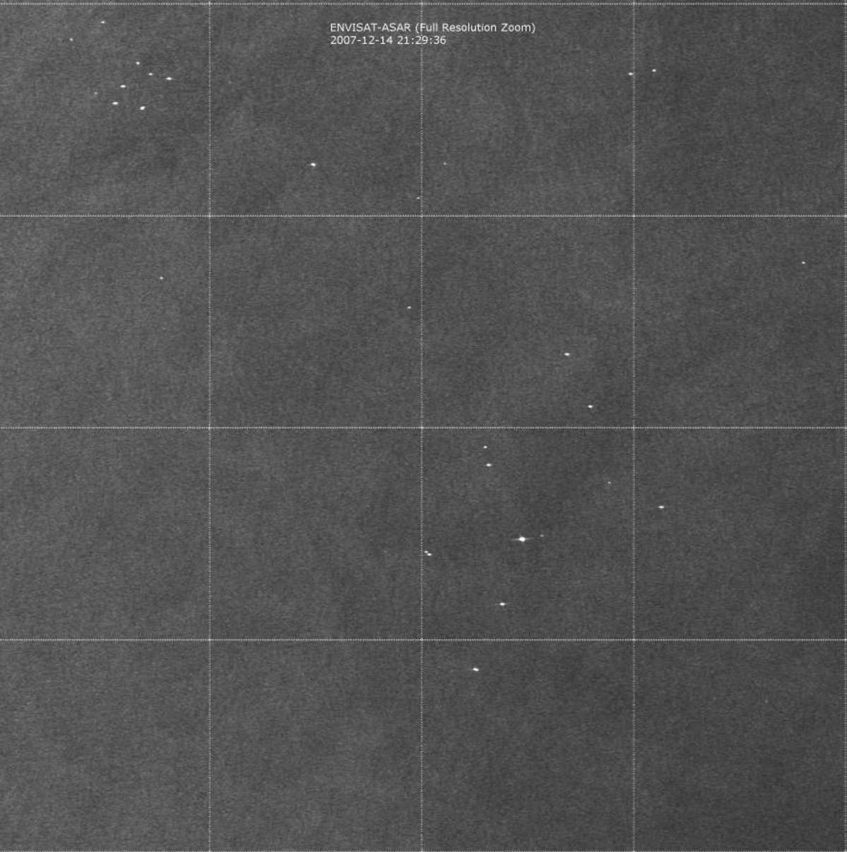
Statfjord-A Oil Spill: Envisat ASAR-WS 2007-12-14
版权: ESA 2007 Image processing, map created 21/12/2007 21:29:36 UTC by EMSA/Kongsberg Satellite Services (KSAT).
Information about the Product
已获得: 14/12/2007 This ESA ENVISAT synthetic aperture radar image shows no oil slicks on the sea surface. SAR derived wind information indicates wind speed in the North Sea area of approximately 13-15 m/s from the South. Wind speeds above 12 m/sec increase the radar backscatter from the sea surface and make the discernment of possible oil spills on the sea surface more difficult. Scene coordinates: Top Left corner: 61°20'N 002°00'E - Low Right corner: 60°00'N 003°20'E Report (PDF)
源: ENVISAT ASAR WSM, 150m/pixel resolution.
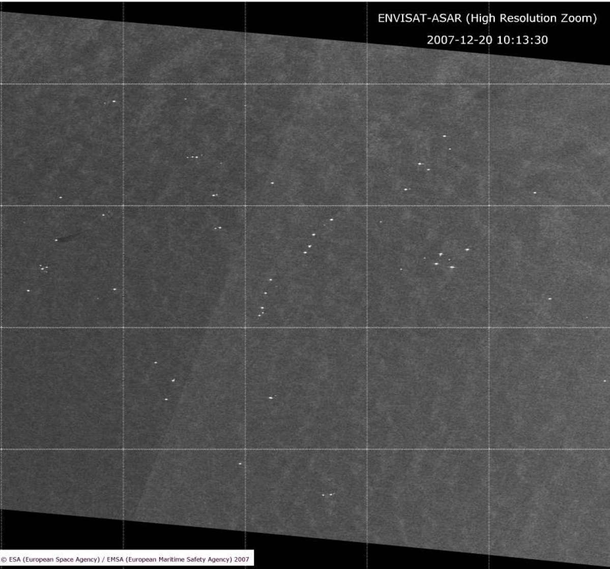
Statfjord-A Oil Spill: Envisat ASAR-WS 2007-12-20
版权: ESA 2007 Image processing, map created 21/12/2007 by EMSA/Kongsberg Satellite Services (KSAT).
Information about the Product
已获得: 20/12/2007 An oil spill feature observed (not related to Statfjord-A accident): This ESA ENVISAT synthetic aperture radar image shows a possible oil slicks on the sea surface, most likely associated with the Cormorant North oil installation/platform (61°14N 001°08E). This possible oil spill is not related with to the Statfjord-A accident. SAR derived wind information indicates wind speed in the area of approximately 11 m/s from the South-West. Scene coordinates: Top Left corner: 61°55'N 001°00'E - Low Right corner: 60°20'N 002°40'E Report (PDF)
源: ENVISAT ASAR WSM, 150m/pixel resolution.
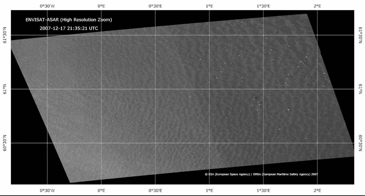
Statfjord-A Oil Spill: Envisat ASAR-WS 2007-12-17
版权: ESA 2007 Image processing, map created 21/12/2007 by EMSA/Kongsberg Satellite Services (KSAT).
Information about the Product
已获得: 17/12/2007 21:35:21 UTC This ESA ENVISAT synthetic aperture radar image shows no oil slicks on the sea surface near the Statjford A platform. Individual platforms are visible as bright white point features. Small oil discharges are visible from the Ninian Northern and Ninian Central oil platforms. SAR derived wind information indicates wind speed of approximately 6-7 m/s from the South West. SAR derived wave heights in the area were approximately 2 meters. Report (PDF)
源: ENVISAT ASAR WSM, 150m/pixel resolution.
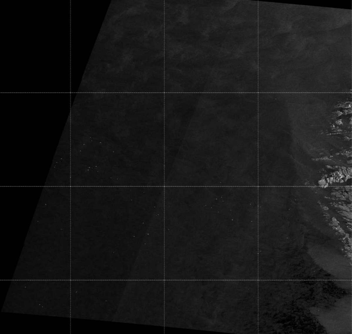
Statfjord-A Oil Spill: Envisat ASAR-WS 2007-12-17
版权: ESA 2007 Image processing, map created 21/12/2007 by EMSA/Kongsberg Satellite Services (KSAT).
Information about the Product
已获得: 17/12/2007 This ESA ENVISAT synthetic aperture radar image shows no oil slicks on the sea surface. SAR derived wind information indicates wind speed in the North Sea area of approximately 9-10 m/s from the South West. SAR derived wave heights in the area were approximately 3 meters. Scene coordinates: Top Left corner: 63.00°N 1.24°E - Low Right corner: 59.45°N 5.00°E Report (PDF)
源: ENVISAT ASAR WSM, 150m/pixel resolution.
 返回完整的响应档案
