 English
 Spanish
 French
 Chinese
 Russian
 Portuguese
 Latest Activation
Charter activations
Oil Spill in the North Sea
4,000 metric tons of crude oil were released to the sea from a loading buoy at the Statfjord oil field. An oilfield cleanup operation was started but was slowed down by strong winds and high waves.
| Type of Event: | Oil Spill |
| Location of Event: | Norway (North Sea) |
| Date of Charter Activation: | 12/12/2007 17:31 UTC |
| Charter Requestor: | Civil Protection of the European Commission |
| Project Management: | European Maritime Safety Agency |
Products
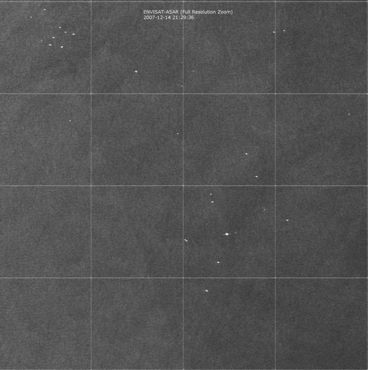
Statfjord-A Oil Spill: Envisat ASAR-WS 2007-12-14
Copyright: ESA 2007 Image processing, map created 21/12/2007 21:29:36 UTC by EMSA/Kongsberg Satellite Services (KSAT).
Information about the Product
Acquired: 14/12/2007 This ESA ENVISAT synthetic aperture radar image shows no oil slicks on the sea surface. SAR derived wind information indicates wind speed in the North Sea area of approximately 13-15 m/s from the South. Wind speeds above 12 m/sec increase the radar backscatter from the sea surface and make the discernment of possible oil spills on the sea surface more difficult. Scene coordinates: Top Left corner: 61°20'N 002°00'E - Low Right corner: 60°00'N 003°20'E Report (PDF)
Source: ENVISAT ASAR WSM, 150m/pixel resolution.
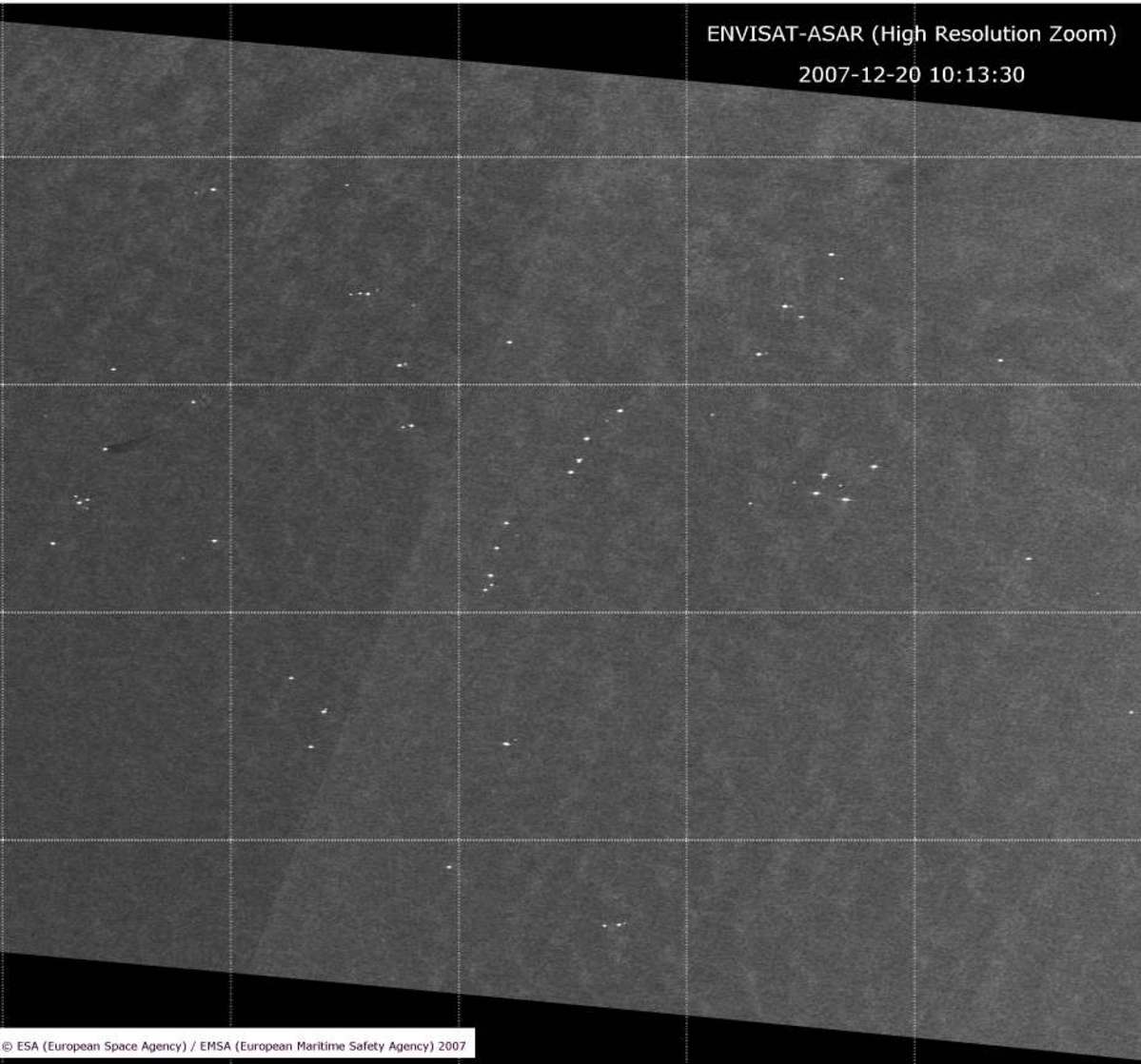
Statfjord-A Oil Spill: Envisat ASAR-WS 2007-12-20
Copyright: ESA 2007 Image processing, map created 21/12/2007 by EMSA/Kongsberg Satellite Services (KSAT).
Information about the Product
Acquired: 20/12/2007 An oil spill feature observed (not related to Statfjord-A accident): This ESA ENVISAT synthetic aperture radar image shows a possible oil slicks on the sea surface, most likely associated with the Cormorant North oil installation/platform (61°14N 001°08E). This possible oil spill is not related with to the Statfjord-A accident. SAR derived wind information indicates wind speed in the area of approximately 11 m/s from the South-West. Scene coordinates: Top Left corner: 61°55'N 001°00'E - Low Right corner: 60°20'N 002°40'E Report (PDF)
Source: ENVISAT ASAR WSM, 150m/pixel resolution.
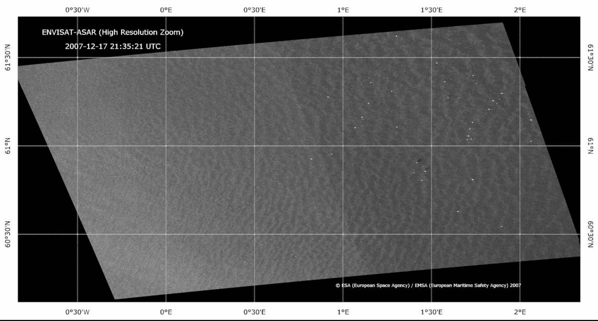
Statfjord-A Oil Spill: Envisat ASAR-WS 2007-12-17
Copyright: ESA 2007 Image processing, map created 21/12/2007 by EMSA/Kongsberg Satellite Services (KSAT).
Information about the Product
Acquired: 17/12/2007 21:35:21 UTC This ESA ENVISAT synthetic aperture radar image shows no oil slicks on the sea surface near the Statjford A platform. Individual platforms are visible as bright white point features. Small oil discharges are visible from the Ninian Northern and Ninian Central oil platforms. SAR derived wind information indicates wind speed of approximately 6-7 m/s from the South West. SAR derived wave heights in the area were approximately 2 meters. Report (PDF)
Source: ENVISAT ASAR WSM, 150m/pixel resolution.
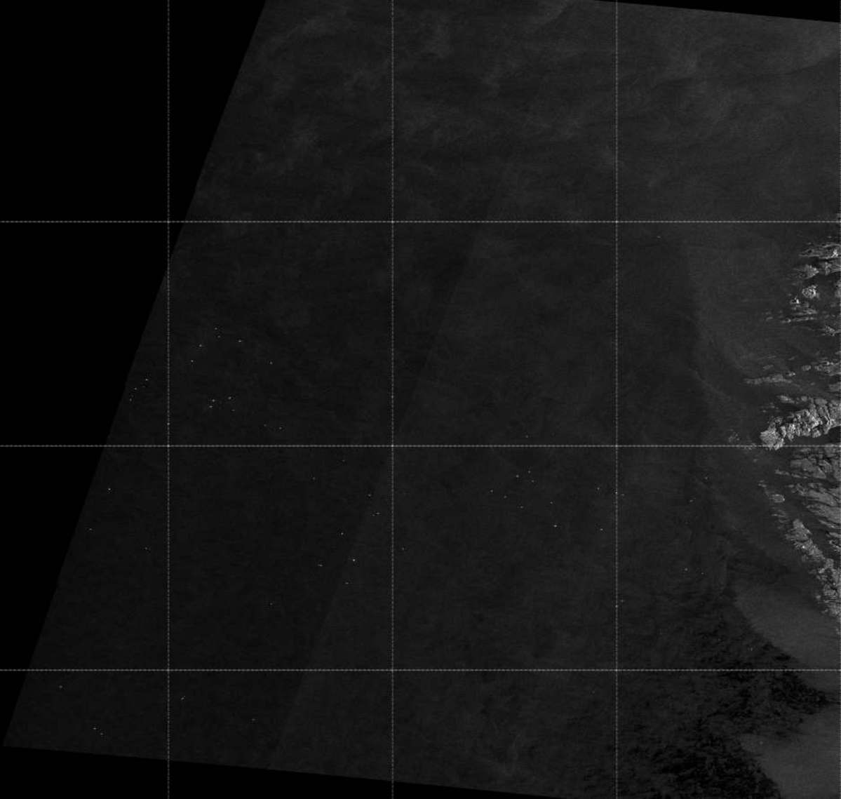
Statfjord-A Oil Spill: Envisat ASAR-WS 2007-12-17
Copyright: ESA 2007 Image processing, map created 21/12/2007 by EMSA/Kongsberg Satellite Services (KSAT).
Information about the Product
Acquired: 17/12/2007 This ESA ENVISAT synthetic aperture radar image shows no oil slicks on the sea surface. SAR derived wind information indicates wind speed in the North Sea area of approximately 9-10 m/s from the South West. SAR derived wave heights in the area were approximately 3 meters. Scene coordinates: Top Left corner: 63.00°N 1.24°E - Low Right corner: 59.45°N 5.00°E Report (PDF)
Source: ENVISAT ASAR WSM, 150m/pixel resolution.
 Back to the full activation archive
