 English
 Spanish
 French
 Chinese
 Russian
 Portuguese
 最新宪章启动
Charter activations
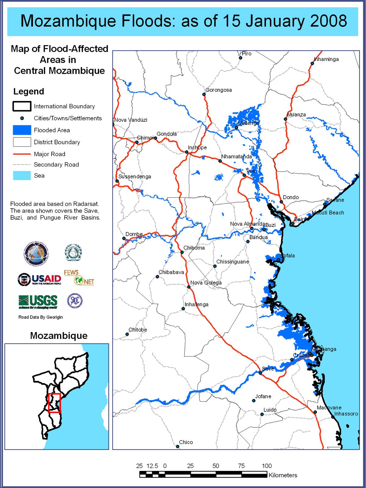
南非洪灾
严重的洪灾已殃及数个南非国家,包括莫桑比克、津巴布韦和赞比亚。目前媒体报道已有将近7000户家庭搬到了安置中心,3万多公顷农作物被毁。
| 事件类型: | 洪水 |
| 事件地点: | 赞比亚、津巴布韦、莫桑比克 |
| 启动宪章的日期: | 2008年1月10日 17:44 UTC |
| 宪章要求者: | USGS |
| 项目经理: | Regional Centre for Mapping of Resources for Development |
Products
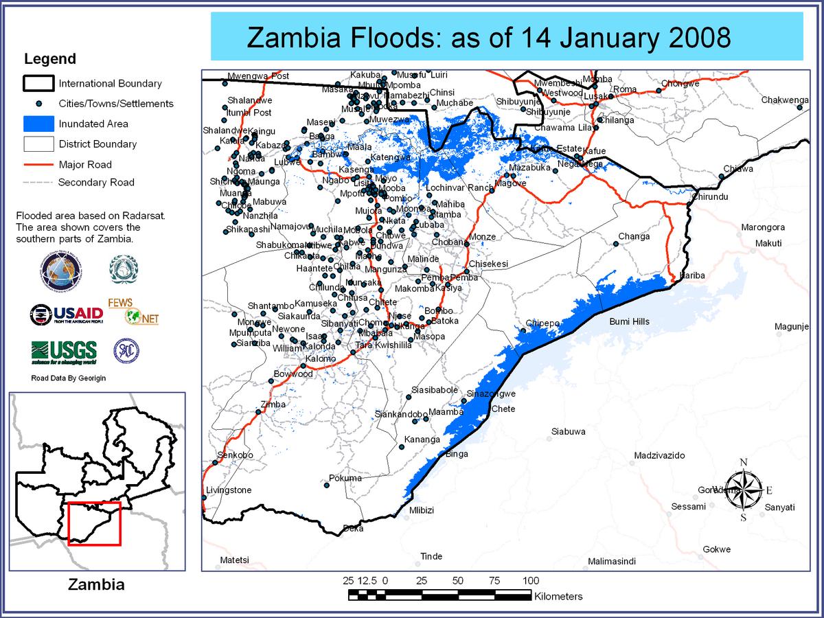
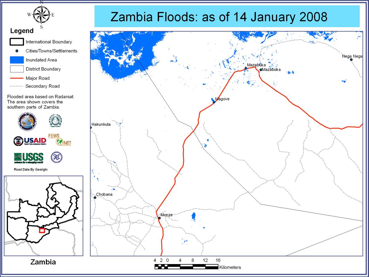
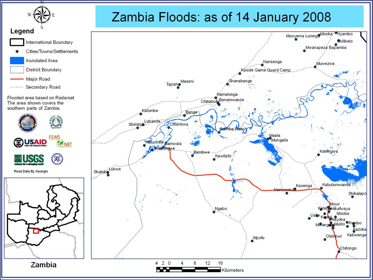
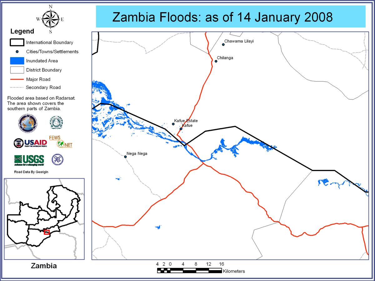
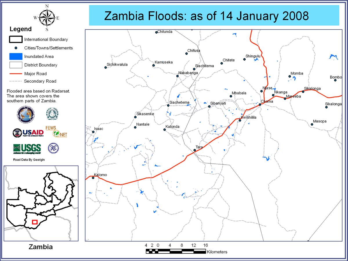
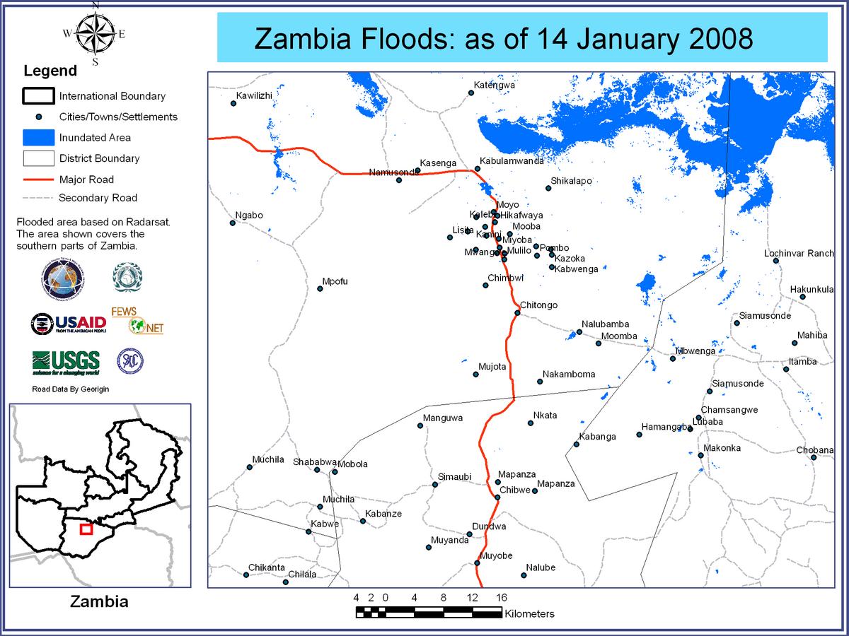

Flood Waters over Southern Provinces of Zambia, 10/01/2008
版权: ESA 2008, 2007 Image processing, map created 25/01/2008 by USGS/SADC (South African Development Community).
Information about the Product
已获得: 10/01/2008 and 25/01/2007 Satellite-detected flood waters over southern Zambia (in red). Flood water analysis using multi-temporal ASAR scenes from 10/01/2008 and 25/01/2007. Preliminary analysis not yet validated in the field.
源: Envisat ASAR WSM, 150m/pixel resolution.
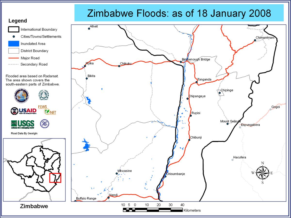
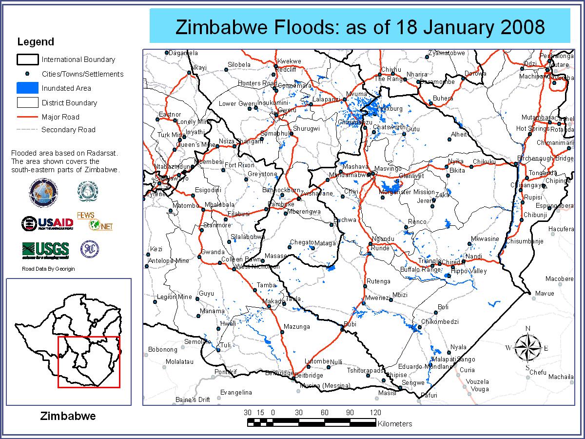
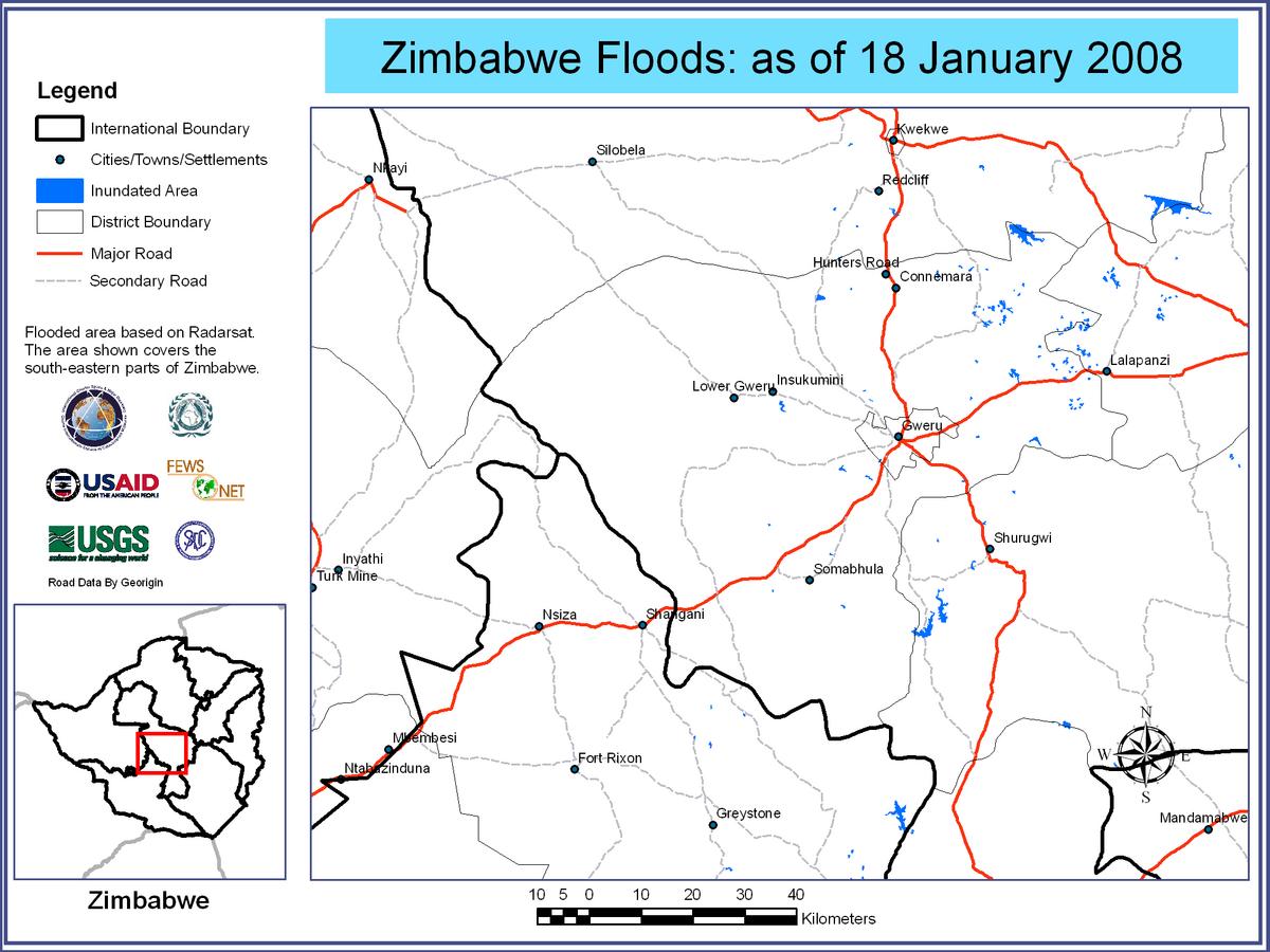
Flooded Areas of Zimbabwe, 18/01/2008
版权: CSA 2008 Image processing, map created 03/02/2008 by USGS/SADC (South African Development Community).
Information about the Product
已获得: 18/01/2008 Satellite-detected flooded areas over Zimbabwe, areas around Tonganda.
源: RADARSAT-1 , 12.5m/pixel resolution.

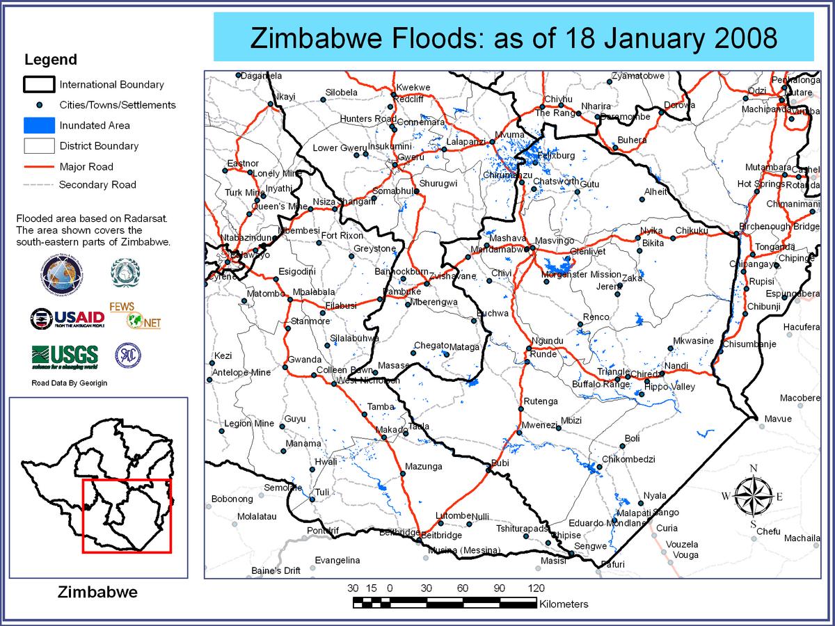
Flooded Areas of Zimbabwe, 18/01/2008
版权: CSA 2008 Image processing, map created 03/02/2008 by USGS/SADC (South African Development Community).
Information about the Product
已获得: 18/01/2008 Satellite-detected flooded areas over Zimbabwe, areas around Masvingo.
源: RADARSAT-1 , 12.5m/pixel resolution.
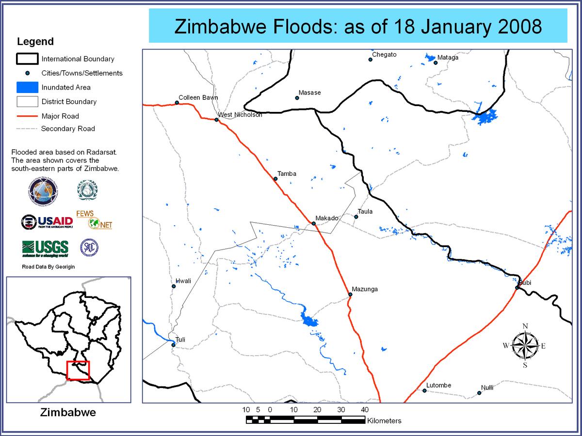

Flooded Areas of Zimbabwe, 18/01/2008
版权: CSA 2008 Image processing, map created 03/02/2008 by USGS/SADC (South African Development Community).
Information about the Product
已获得: 18/01/2008 Satellite-detected flooded areas over Zimbabwe, areas around Chikombedzi.
源: RADARSAT-1 , 12.5m/pixel resolution.
 返回完整的响应档案

