 English
 Spanish
 French
 Chinese
 Russian
 Portuguese
 最新宪章启动
Charter activations
厄瓜多尔洪灾
2月,拉尼娜现象导致厄瓜多尔洪水大幅上涨,洪水殃及11个省,受灾地区达到国土面积的一半。据政府估计,洪水夺走12个人的生命,26.5万人受灾。1.4万人住进了棚子中。
| 事件类型: | 洪灾 |
| 事件地点: | 厄瓜多尔 |
| 启动宪章的日期: | 2008年2月26日 22:09 UTC |
| 宪章要求者: | UNOOSA代表FAO |
| 项目经理: | INA |
Products
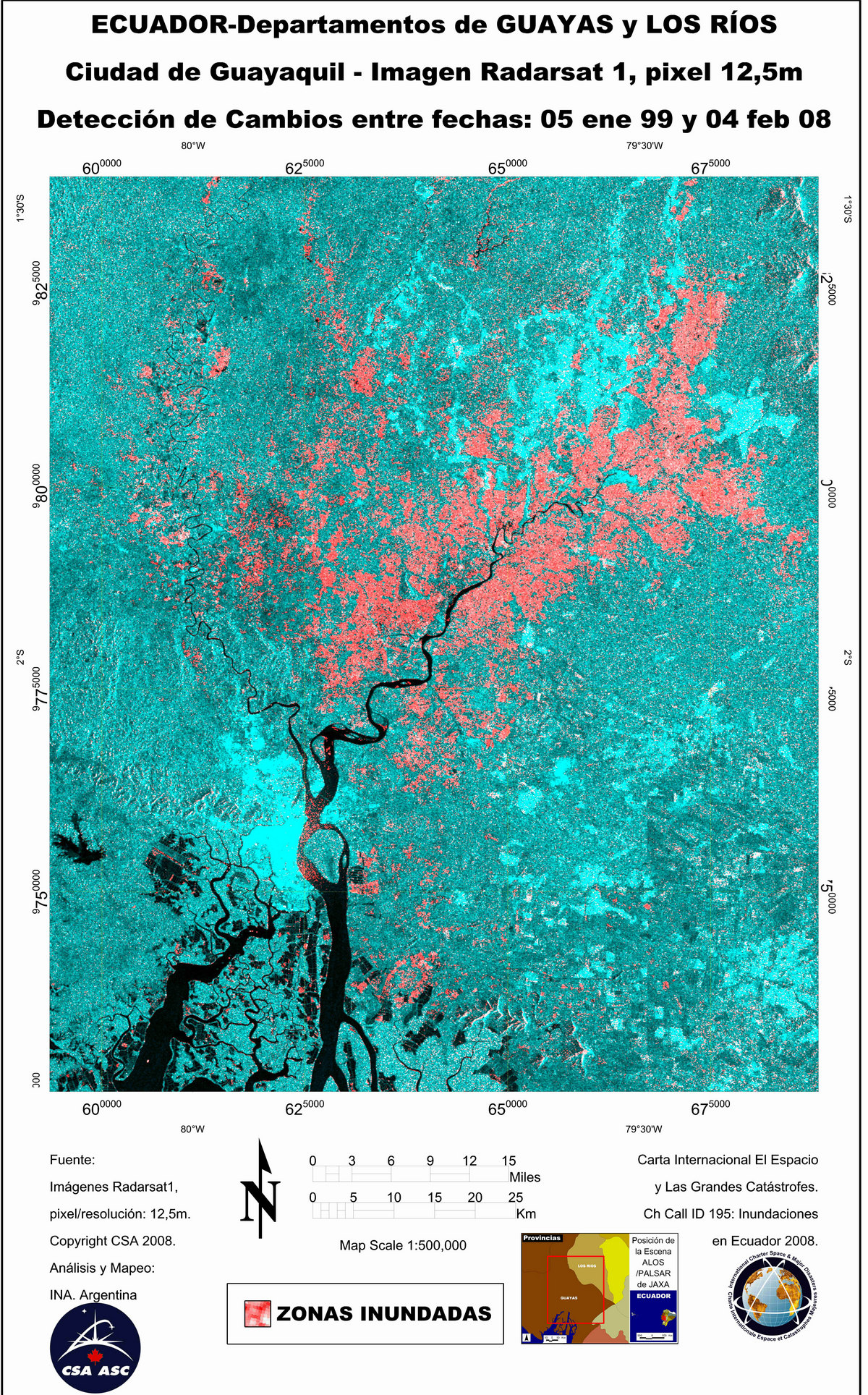
RADARSAT-1 Image, Change Detection
版权: CSA 1999, 2008 Image processing, map created 05/03/2008 by INA.
Information about the Product
已获得: 05/01/1999 and 04/02/2008 Radarsat-1 change detection image, flooded areas in the Guayas and Los Rios Departments. Credit:
源: RADARSAT-1 , 12.5m/pixel resolution.

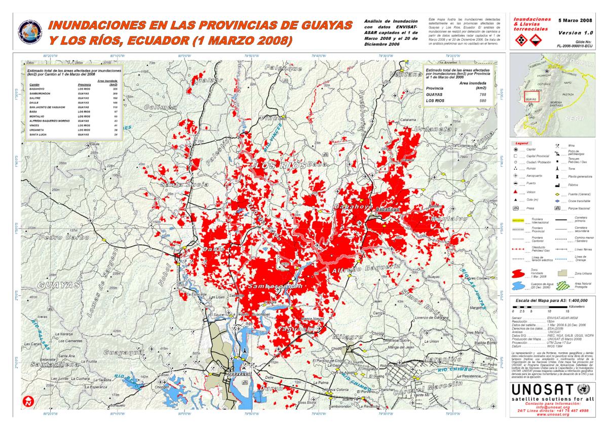
ENVISAT Image, Change Detection Flood Map
版权: ESA 2006, 2008 Image processing, map created 04/03/2008 by UNOSAT. Higher resolution version
Information about the Product
已获得: 20/12/2006; 01/03/2008 Change detection map showing flooded areas in the departments of Guayas and Los Rios. Preliminary analysis not verified in the field. Credit:
源: ENVISAT ASAR WSM, 150m/pixel resolution.
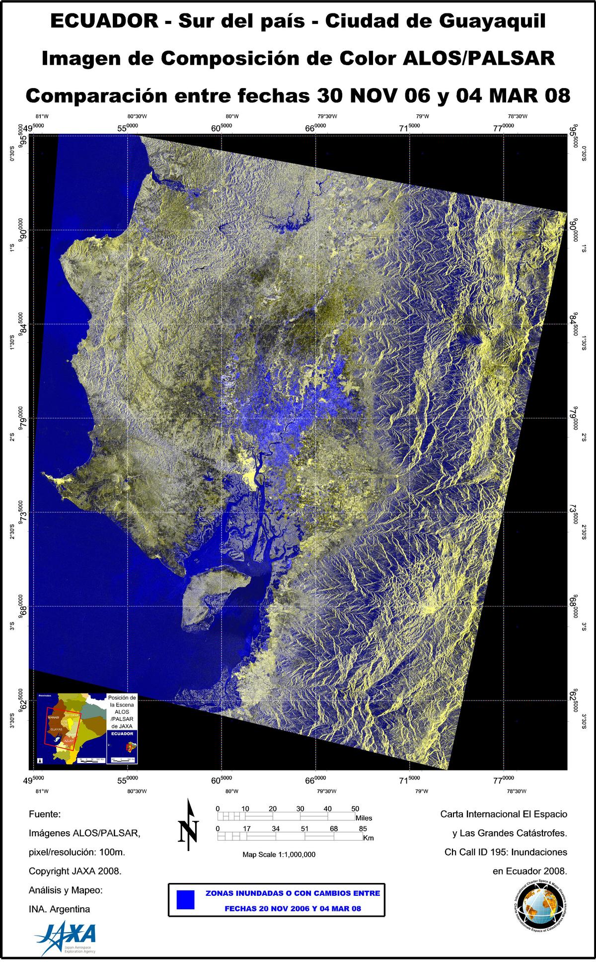
ALOS/PALSAR image, Change Detection
版权: JAXA 2008 Image processing, map created 05/03/2008 by INA.
Information about the Product
已获得: 20/11/2006 (archive image) and 04/03/2008 Color Composition Image, analysis by INA, showing flooding in Guayaquil City and the south.
源: ALOS/PALSAR, 100m/pixel resolution.

ENVISAT Image, Change Detection
版权: ESA 2008 Image processing, map created 03/03/2008 by INA.
Information about the Product
已获得: 20/12/2007 (archive image) and 01/03/2008 Color Composition Image, analysis by INA, showing flooding in the Guayas and Los Rios Departments.
源: ENVISAT ASAR , 75m/pixel resolution.
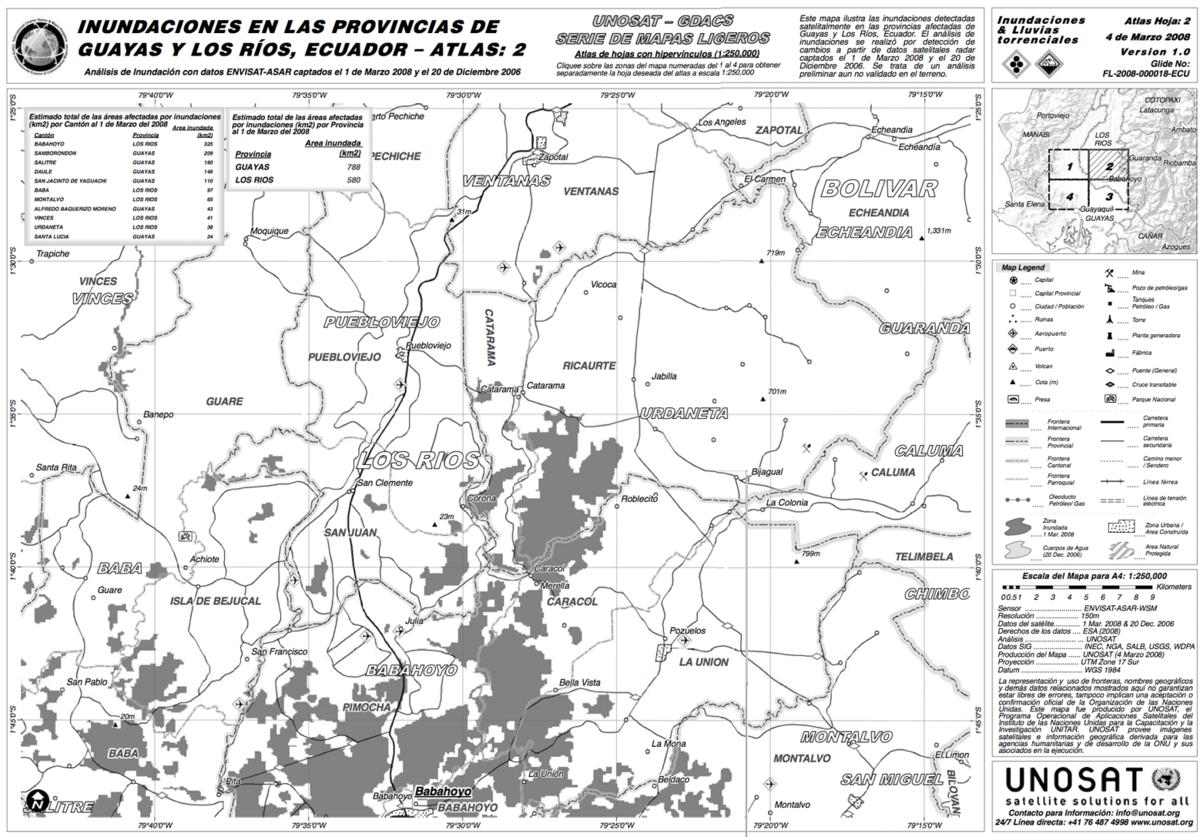
ENVISAT Image, Change Detection Light Map
版权: ESA 2006, 2008 Image processing, map created 04/03/2008 by UNOSAT. Higher resolution version
Information about the Product
已获得: 20/12/2006; 01/03/2008 Map showing flooded areas detected by satellite in the departments of Guayas and Los Rios. Preliminary analysis not verified in the field. Credit:
源: ENVISAT ASAR WSM, 150m/pixel resolution.
 返回完整的响应档案

