 English
 Spanish
 French
 Chinese
 Russian
 Portuguese
 Последняя Активация
Charter activations
Flooding in Ecuador
Due to the La Niña phenomenon, floods in Ecuador increased substantially in February, affecting 11 provinces or 50% of the territory. According to government estimates, the floods claimed 12 lives and affected some 265,000 persons. Some 14,000 persons were in shelters.
| Тип события: | Flooding |
| Место события: | Ecuador |
| Date of Charter Activation: | 26/02/2008 22:09 UTC |
| Запрос на активацию поступил от: | UNOOSA, on behalf of FAO |
| Менеждер проекта от: | INA |
Products
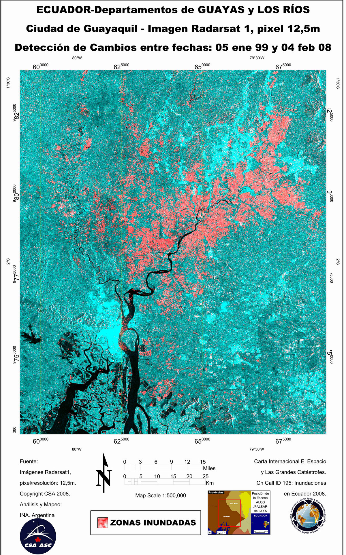
RADARSAT-1 Image, Change Detection
Авторские права: CSA 1999, 2008 Image processing, map created 05/03/2008 by INA.
Information about the Product
Получено: 05/01/1999 and 04/02/2008 Radarsat-1 change detection image, flooded areas in the Guayas and Los Rios Departments. Credit:
Источник: RADARSAT-1 , 12.5m/pixel resolution.

ALOS/PALSAR image, Change Detection
Авторские права: JAXA 2008 Image processing, map created 05/03/2008 by INA.
Information about the Product
Получено: 20/11/2006 (archive image) and 04/03/2008 Color Composition Image, analysis by INA, showing flooding in the northwest.
Источник: ALOS/PALSAR, 100m/pixel resolution.
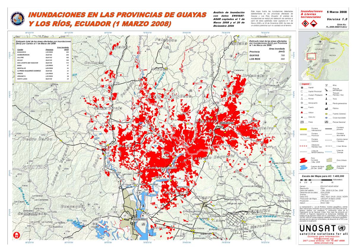
ENVISAT Image, Change Detection Flood Map
Авторские права: ESA 2006, 2008 Image processing, map created 04/03/2008 by UNOSAT. Higher resolution version
Information about the Product
Получено: 20/12/2006; 01/03/2008 Change detection map showing flooded areas in the departments of Guayas and Los Rios. Preliminary analysis not verified in the field. Credit:
Источник: ENVISAT ASAR WSM, 150m/pixel resolution.
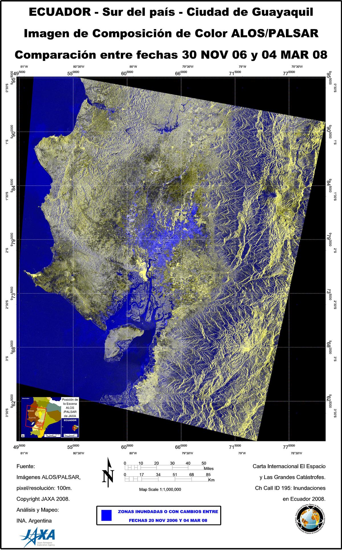
ALOS/PALSAR image, Change Detection
Авторские права: JAXA 2008 Image processing, map created 05/03/2008 by INA.
Information about the Product
Получено: 20/11/2006 (archive image) and 04/03/2008 Color Composition Image, analysis by INA, showing flooding in Guayaquil City and the south.
Источник: ALOS/PALSAR, 100m/pixel resolution.

ENVISAT Image, Change Detection
Авторские права: ESA 2008 Image processing, map created 03/03/2008 by INA.
Information about the Product
Получено: 20/12/2007 (archive image) and 01/03/2008 Color Composition Image, analysis by INA, showing flooding in the Guayas and Los Rios Departments.
Источник: ENVISAT ASAR , 75m/pixel resolution.
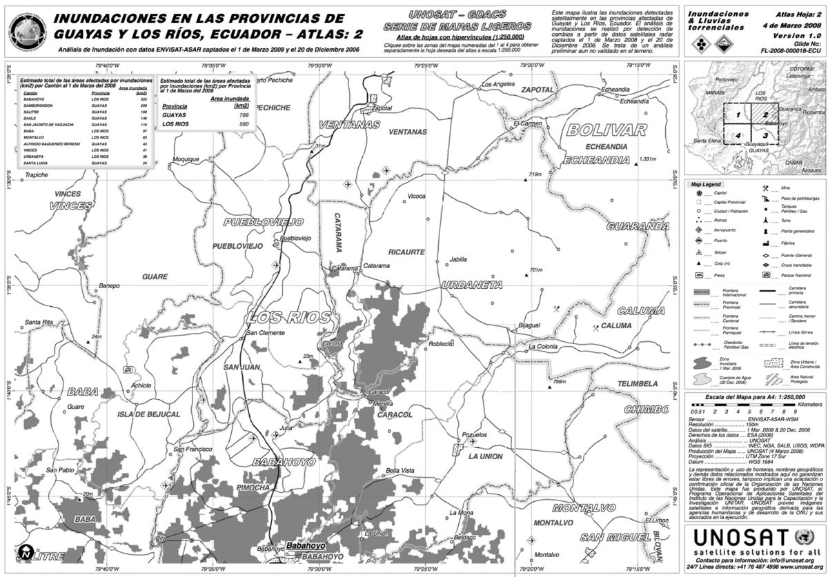
ENVISAT Image, Change Detection Light Map
Авторские права: ESA 2006, 2008 Image processing, map created 04/03/2008 by UNOSAT. Higher resolution version
Information about the Product
Получено: 20/12/2006; 01/03/2008 Map showing flooded areas detected by satellite in the departments of Guayas and Los Rios. Preliminary analysis not verified in the field. Credit:
Источник: ENVISAT ASAR WSM, 150m/pixel resolution.
 Вернуться к полному архиву активаций

