 English
 Spanish
 French
 Chinese
 Russian
 Portuguese
 最新宪章启动
Charter activations
Flood in Philippines
Typhoon Vamco has bought severe flooding to the towns and villages in Cagayan Valley, northeastern Philippines. At least 42 people have been killed as large swathes of land were submerged.
Rescue teams have deployed to evacuate thousands of people as the cumulative affect of successive storms has caused numerous landslides and damaged hundreds of homes. 14,000 people have moved to evacuation centres because of the flooding.
Vamco made landfall in the Philippines as communities were still trying to clean up from Typhoon Goni, the most powerful storm in the world this year.
Local reports suggest it will take more than a week before the floods subside if there is no further rain.
| 事件类型: | Floods |
| 事件地点: | Philippines |
| 启动宪章的日期: | 2020-11-15 |
| 宪章启动时间: | 17:26 |
| 宪章启动时区: | UTC+09:00 |
| 宪章要求者: | ADRC on behalf of PHIVOLCS |
| 启动ID: | 686 |
| 项目经理: | Asian Institute of Technology |
Products
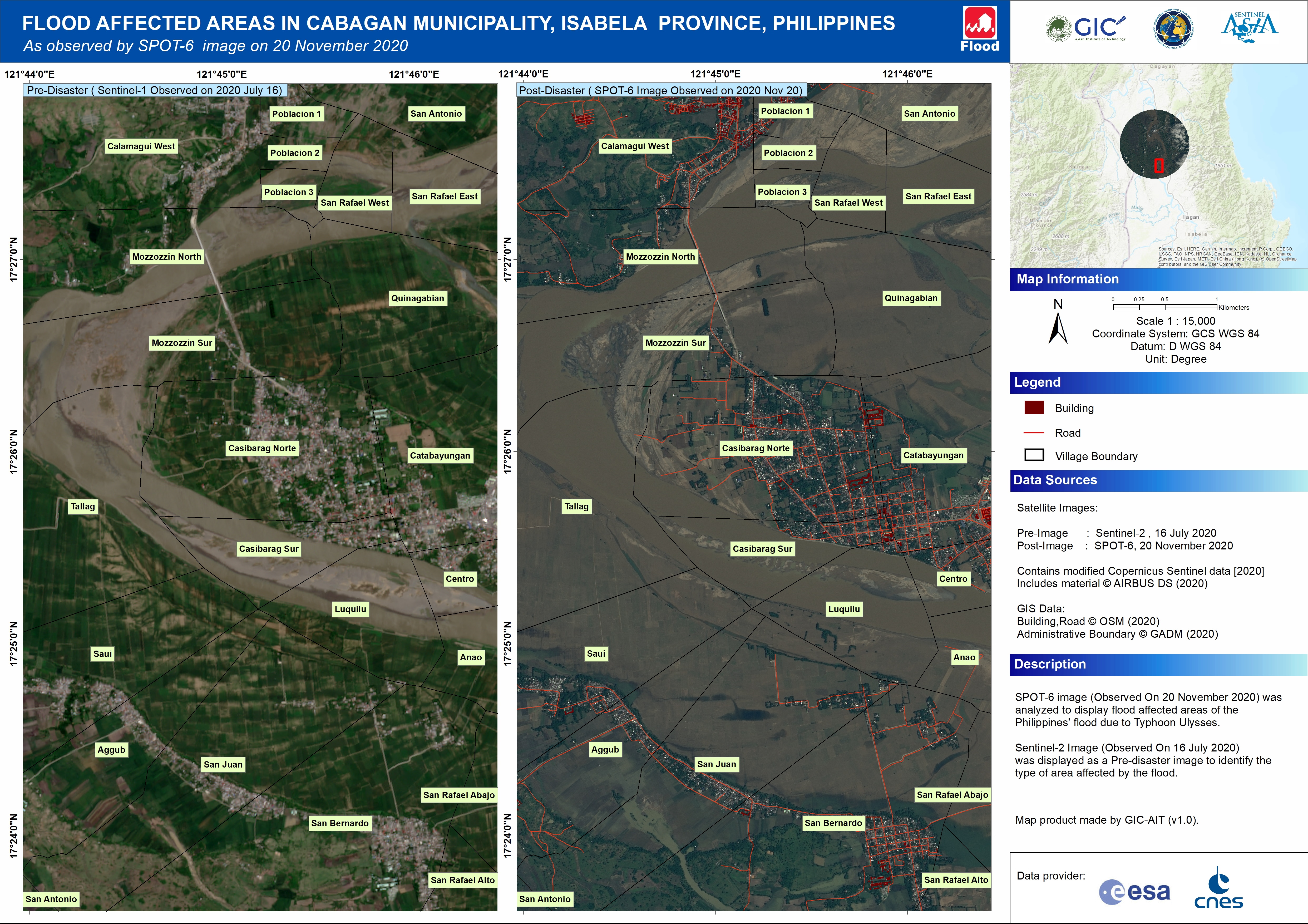
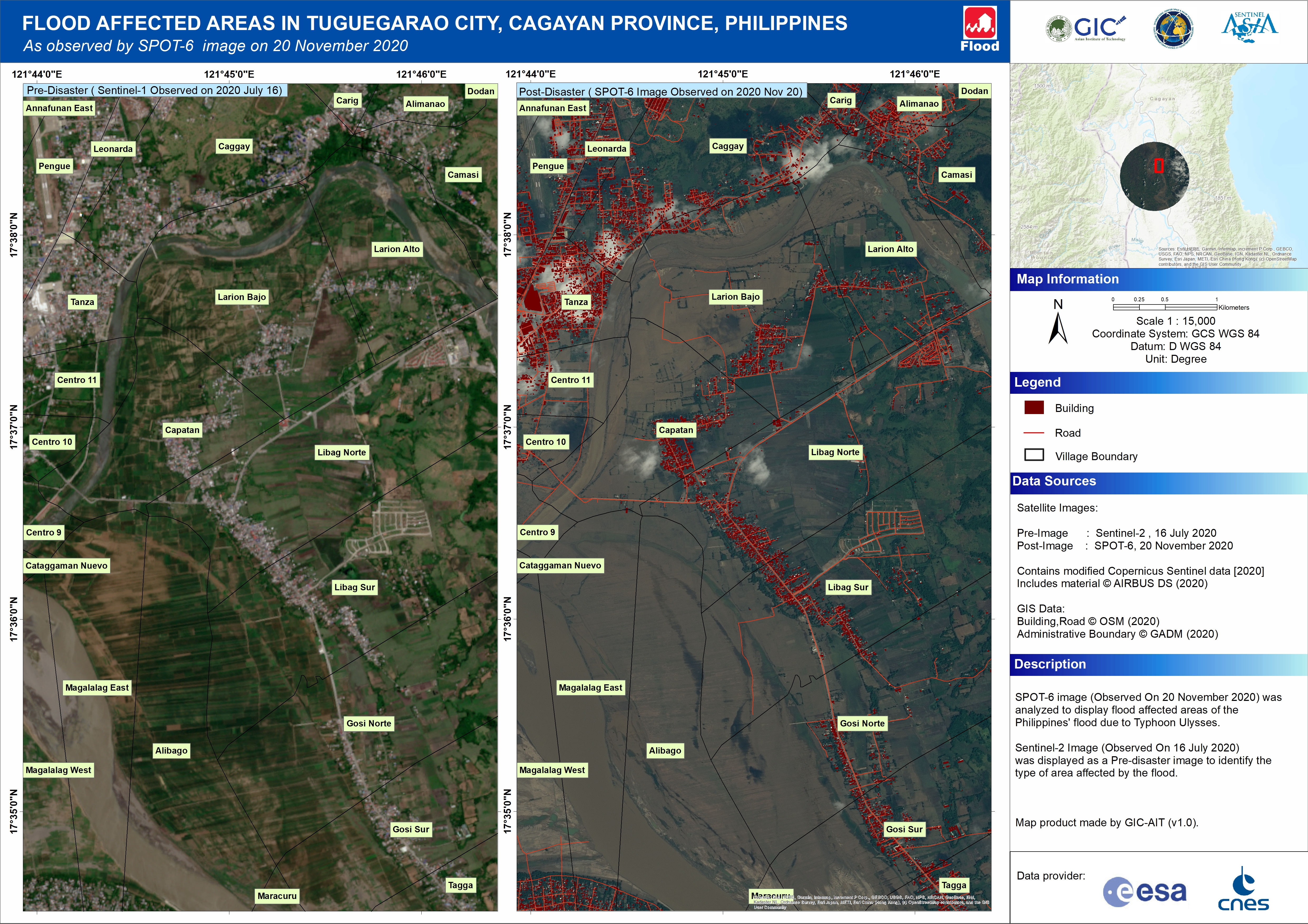
Flood affected areas in Tuguegarao City Municipality, Cagayan Province, Philippines
版权: Includes material © AIRBUS DS (2020)
Contains modified Copernicus Sentinel data (2020)
Map produced by GIC - AIT
Information about the Product
已获得: Sentinel-2: 16/07/2020
SPOT-6: 20/11/2020
源: SPOT-6 / Sentinel-2


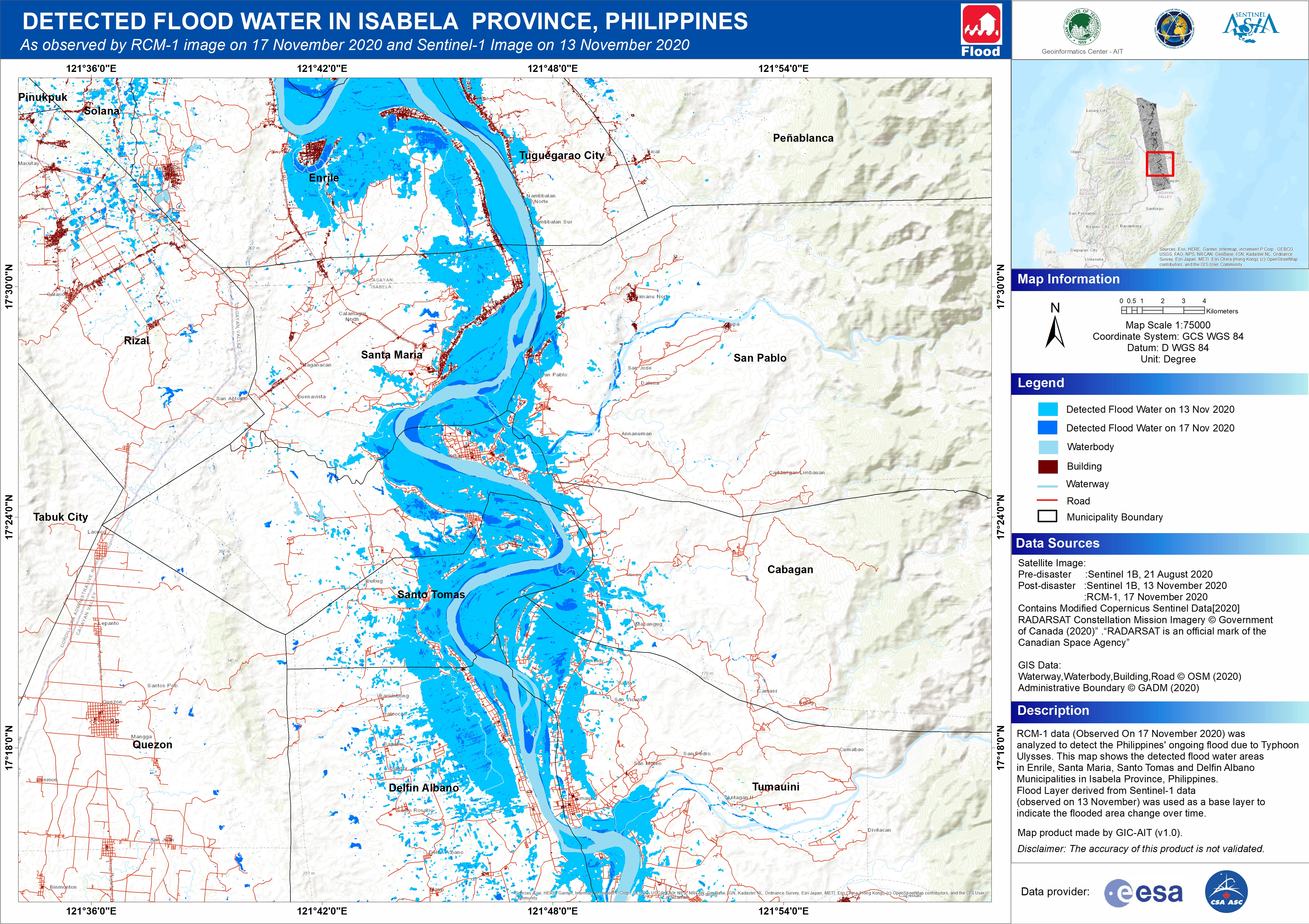
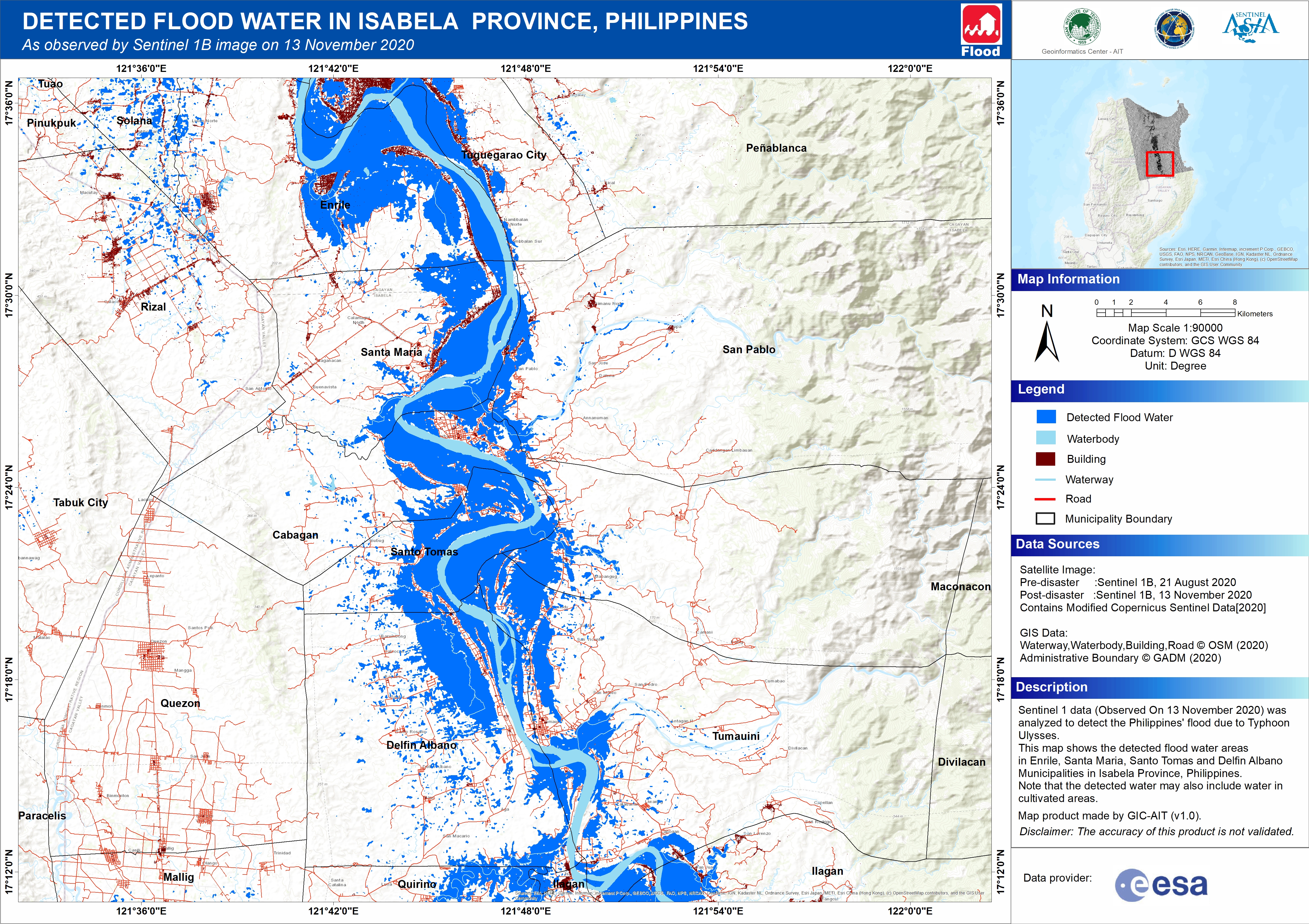
Detected Flood Water in Isabela Province, Philippines
版权: Contains modified Copernicus Sentinel data (2020)
RADARSAT Constellation Mission Imagery © Government of Canada (2020) - RADARSAT is an official mark of the Canadian Space Agency
Map produced by GIC-AIT
Information about the Product
已获得: Sentinel-1: 21/08/2020 - 13/11/2020
RCM: 17/11/2020
源: Sentinel-1 / RCM
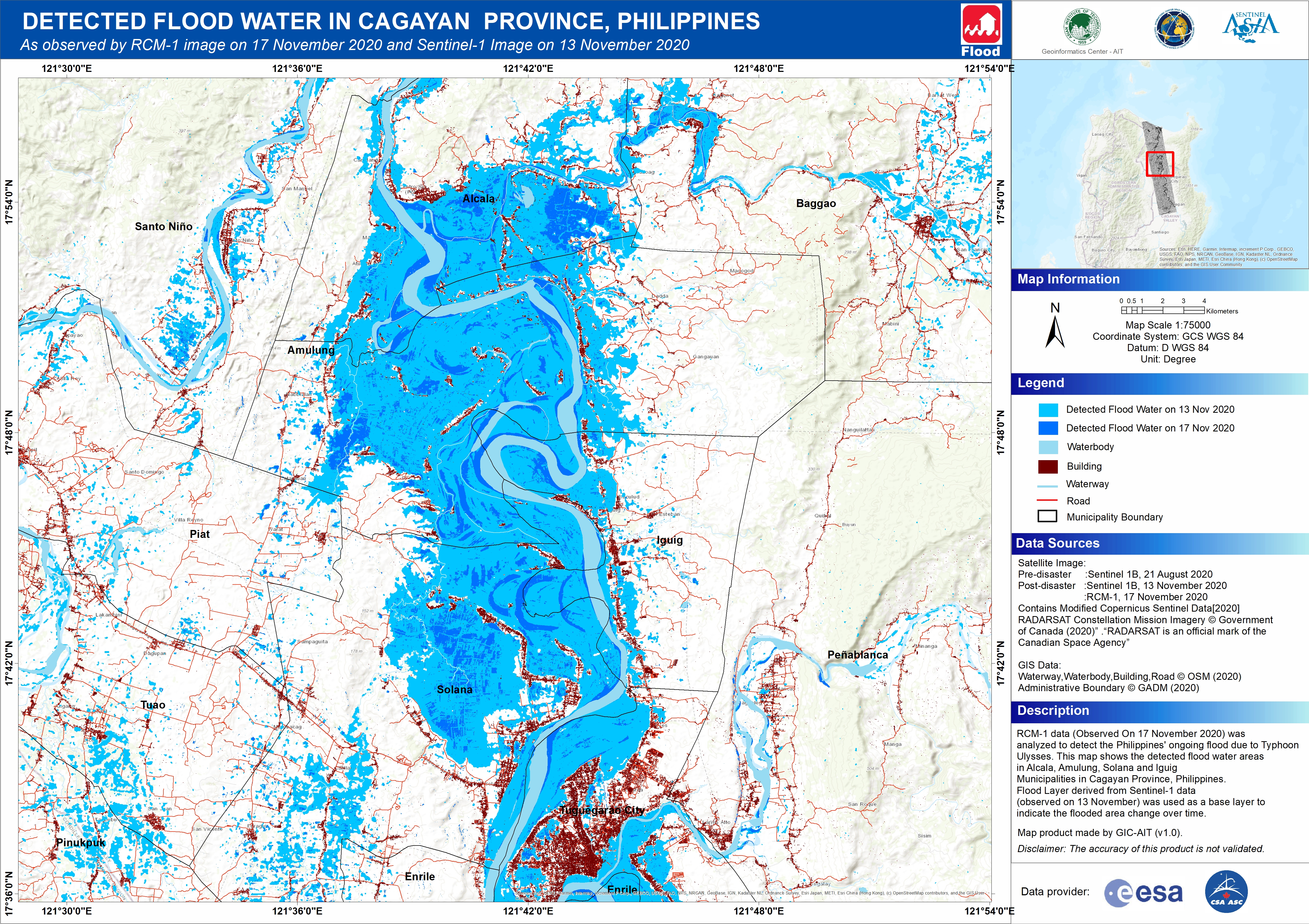
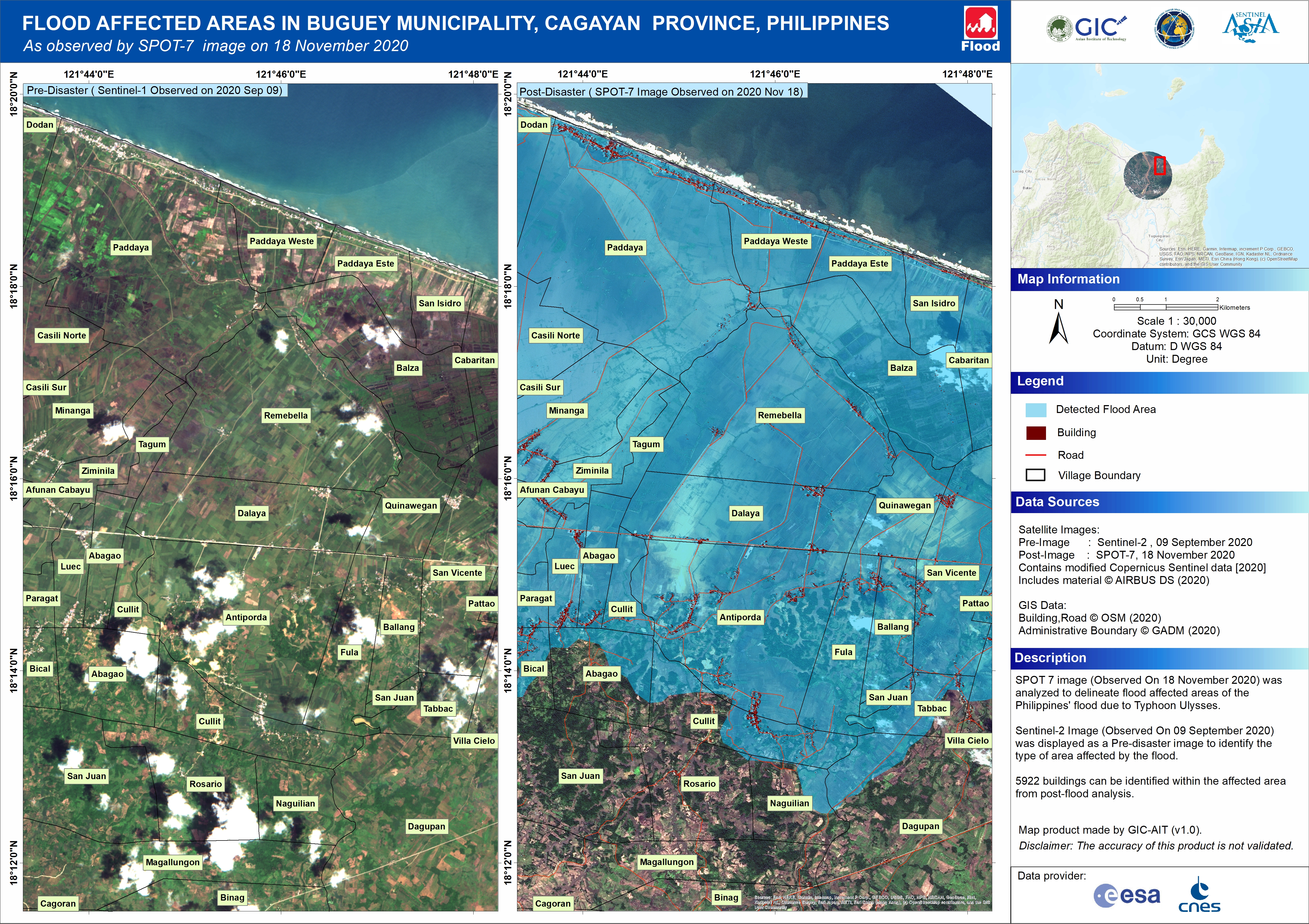
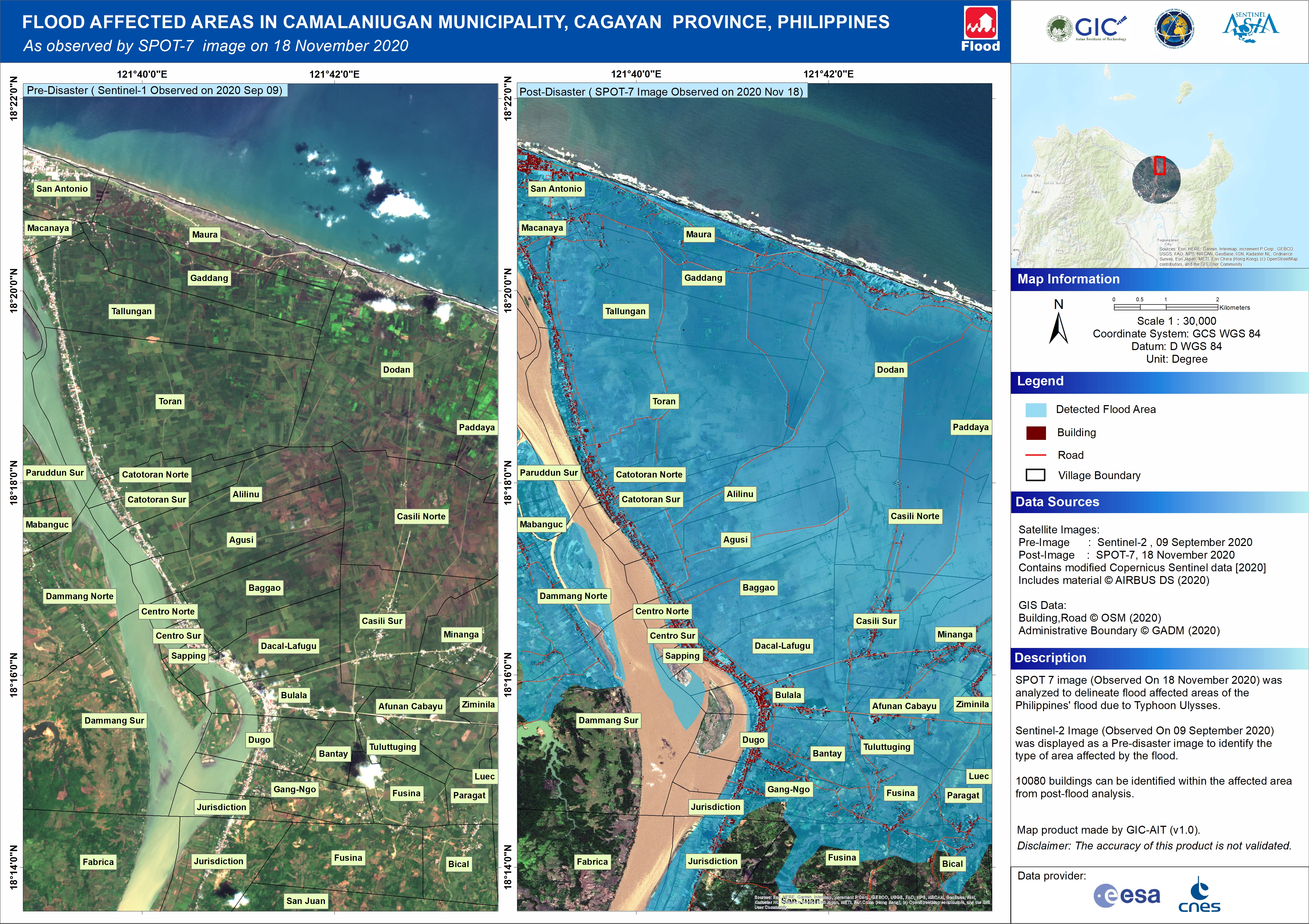
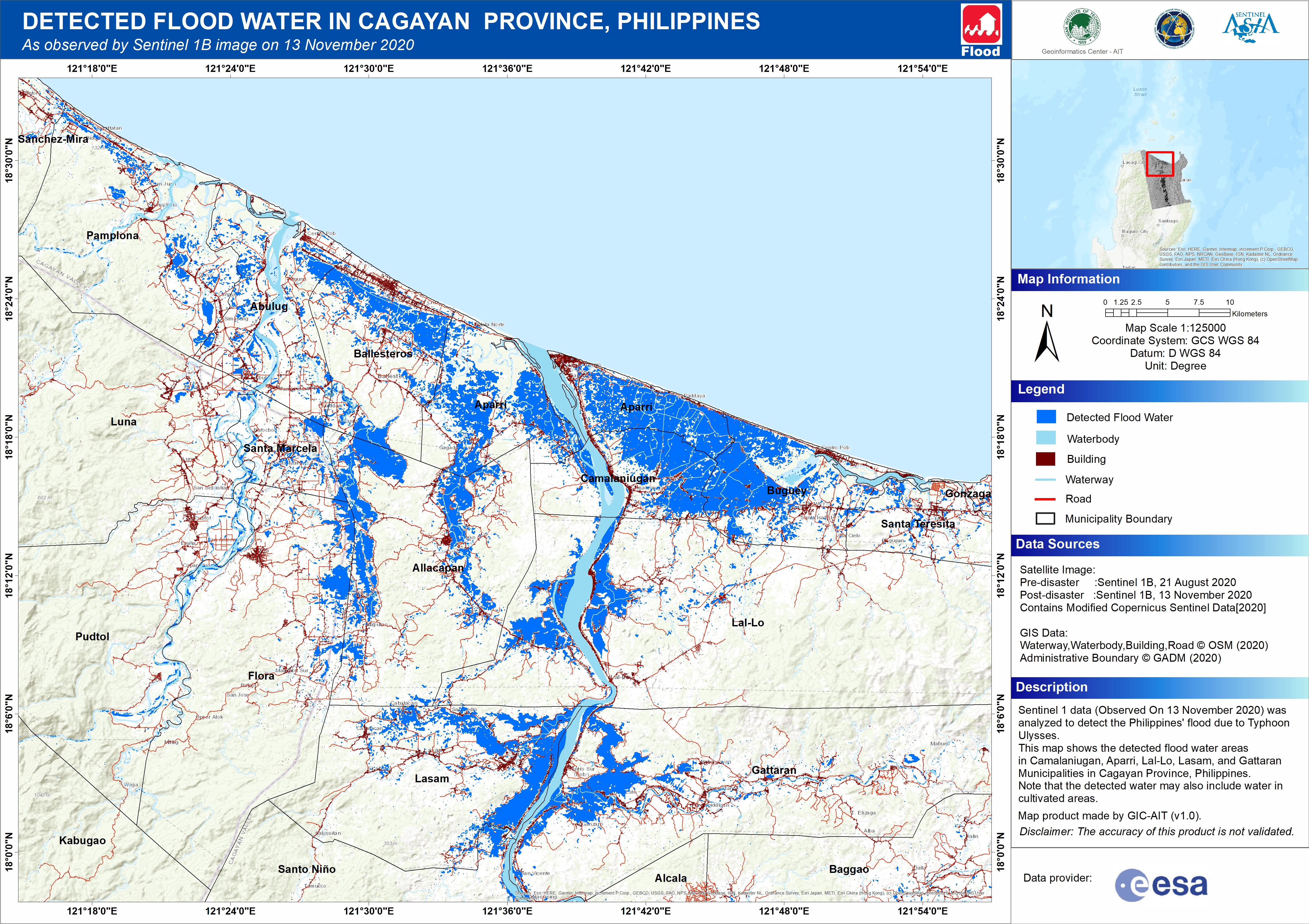
Detected Flood Water in Cagayan Province, Philippines
版权: Contains modified Copernicus Sentinel data (2020)
RADARSAT Constellation Mission Imagery © Government of Canada (2020) - RADARSAT is an official mark of the Canadian Space Agency
Map produced by Geoinformatics Center AIT
Information about the Product
已获得: Sentinel-1: 21/08/2020 - 13/11/2020
RCM: 17/11/2020
源: Sentinel-1 / RCM
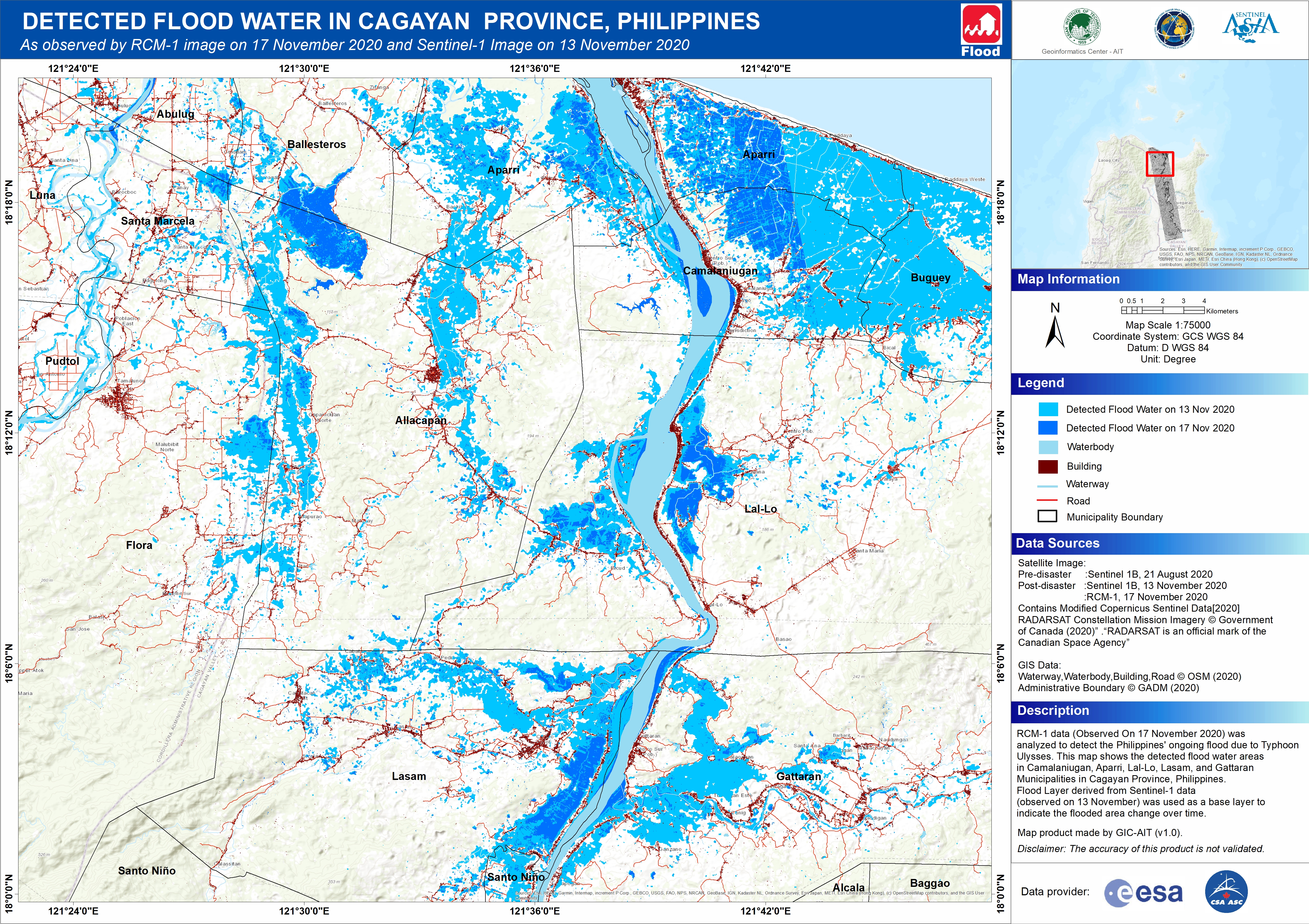

 返回完整的响应档案

