 English
 Spanish
 French
 Chinese
 Russian
 Portuguese
 最新宪章启动
Charter activations
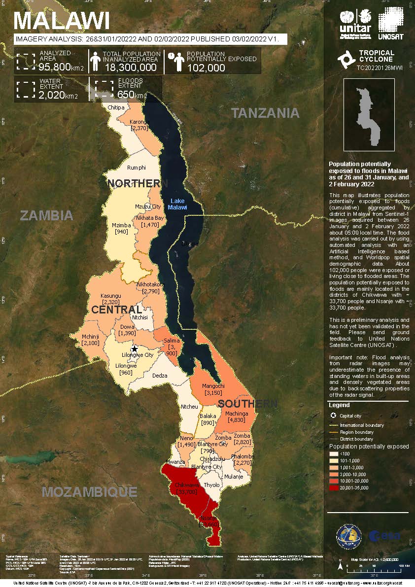
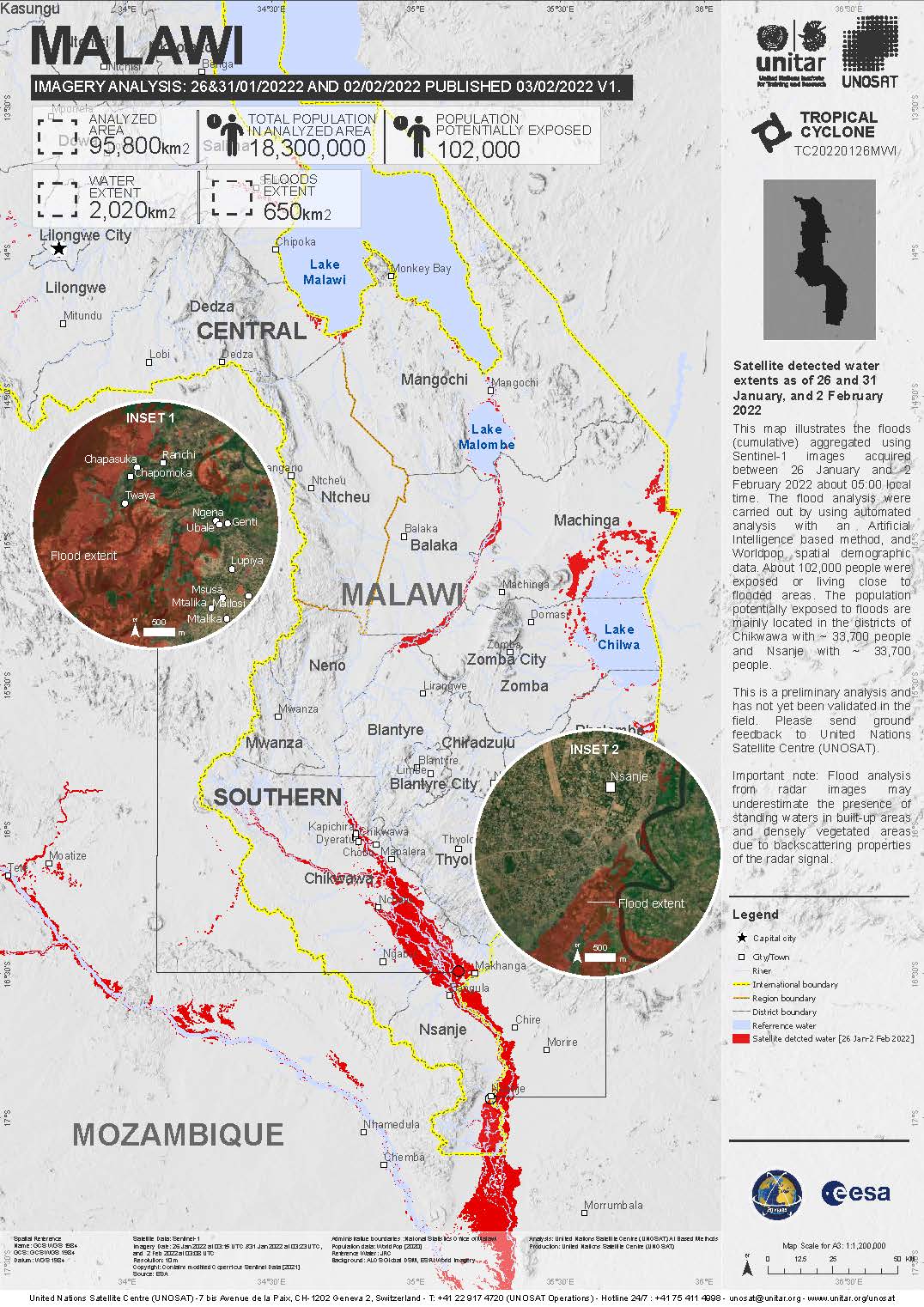
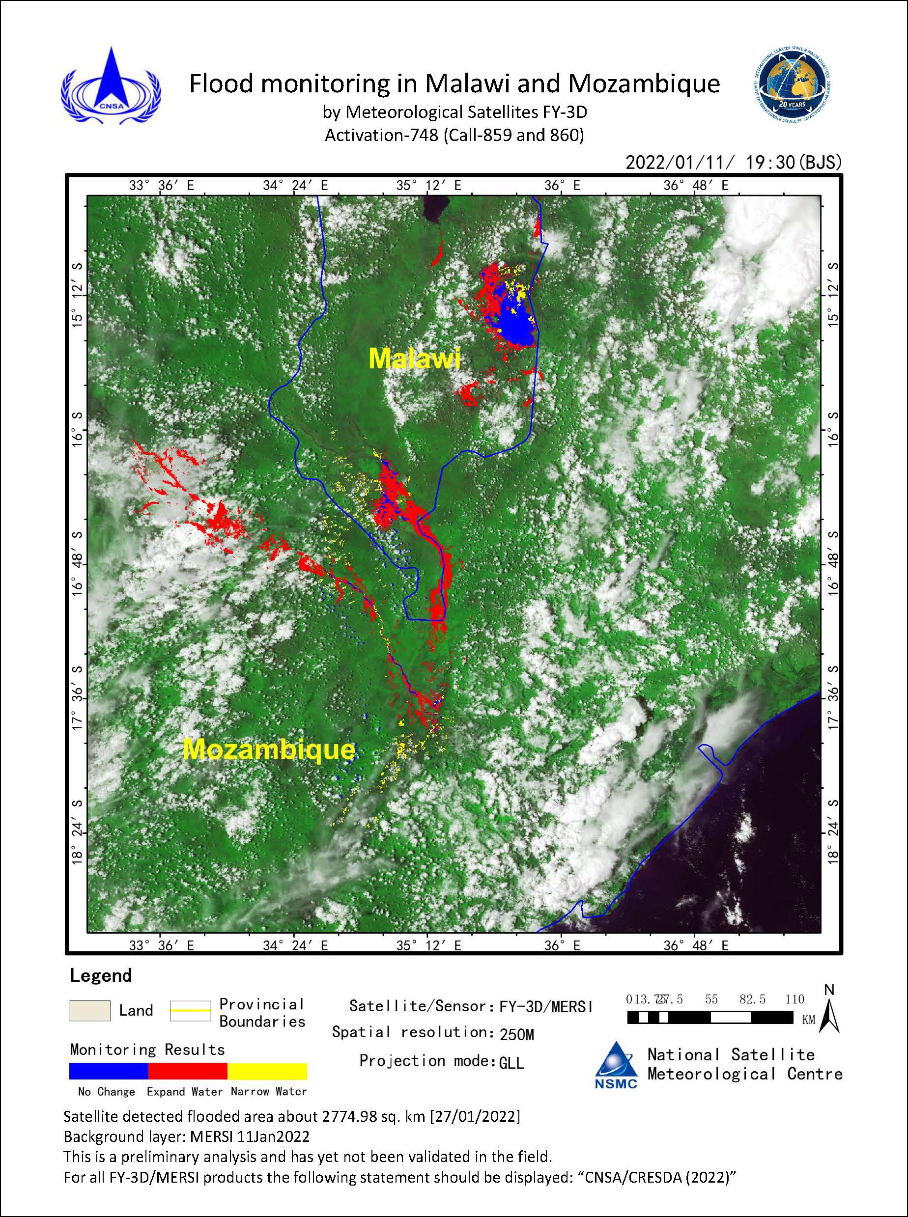
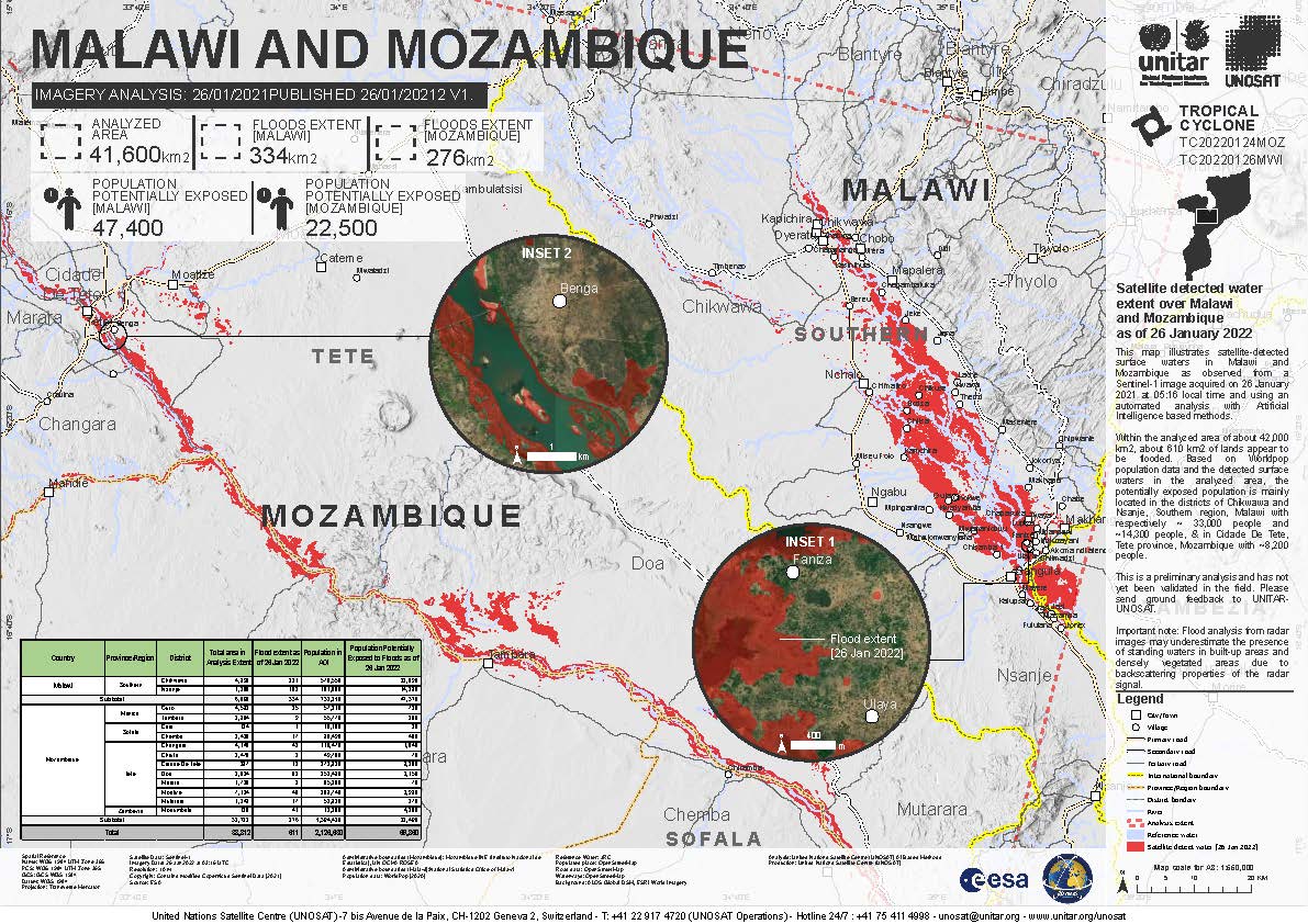
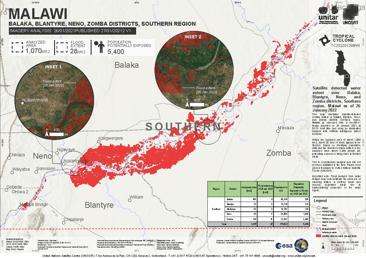
Tropical storm Ana in Mozambique
Tropical storm Ana has killed at least eight people in Mozambique after making landfall on 24 January, bringing heavy rains and strong winds.
Ana is reported to have affected thousands of people, causing damage to homes and other infrastructure.
The storm reached Mozambique a day after passing over Madagascar. Ana gained strength as it traversed the channel, forming into a Tropical Storm before it made landfall.
| 事件类型: | Ocean Storm |
| 事件地点: | Mozambique |
| 启动宪章的日期: | 2022-01-25 |
| 宪章启动时间: | 13:11 |
| 宪章启动时区: | UTC+01:00 |
| 宪章要求者: | UNOOSA/UN-SPIDER on behalf of National Institute for Disaster Risk Reduction of Mozambique (INGD) UNOOSA/UN-SPIDER on behalf of Department of Disaster Management Affairs of Malawi |
| 启动ID: | 748 |
| 项目经理: | UFSM |
Products


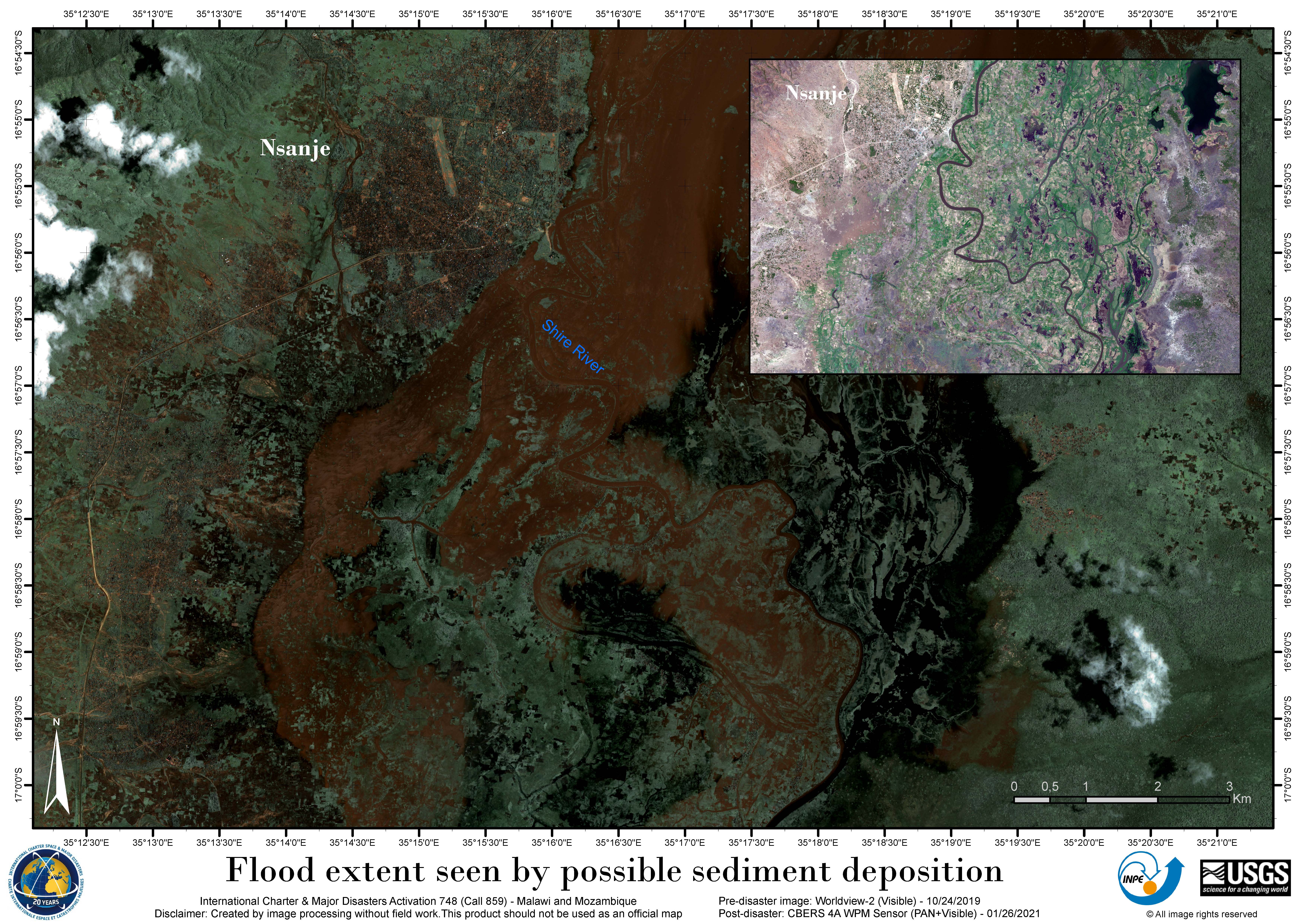
Flood extent seen by possible sediment deposition - Shire River, Mozambique and Malawi
版权: © (2019) DigitalGlobe, Inc., Longmont CO USA 80503. DigitalGlobe and the DigitalGlobe logos are trademarks of DigitalGlobe, Inc. The use and/or dissemination of this data and/or of any product in any way derived there from are restricted. Unauthorized use and/or dissemination is prohibited
copyright (2022) INPE
Map produced by INPE
Information about the Product
已获得: WorldView-2: 24/10/2019
CBERS-4: 05/02/2022
源: WorldView-2 / CBERS-4
类别: Delineation Map


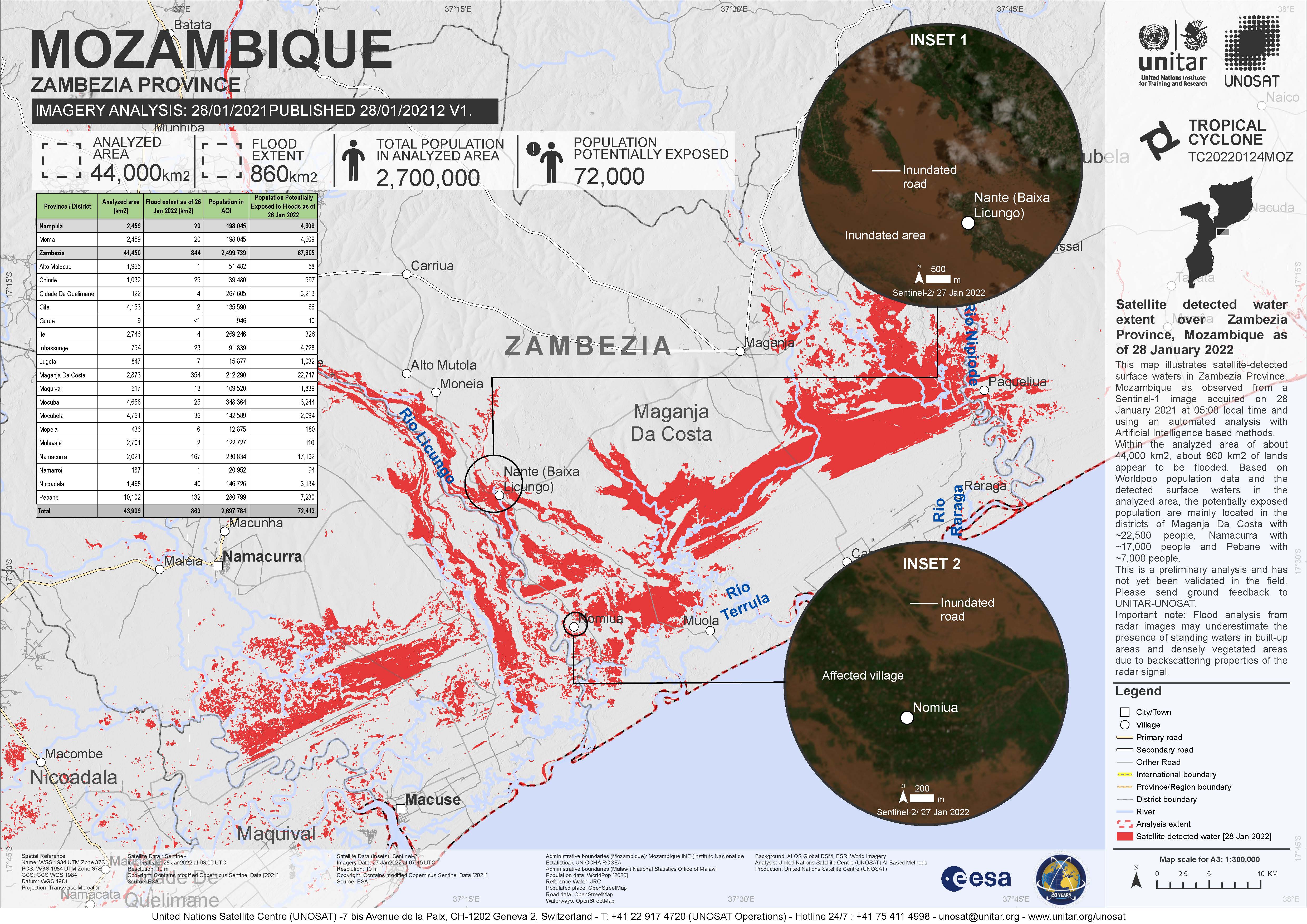
Detected flood in Mozambique, Licungo flood plain
版权: © (2022) DigitalGlobe, Inc., Longmont CO USA 80503. DigitalGlobe and the DigitalGlobe logos are trademarks of DigitalGlobe, Inc. The use and/or dissemination of this data and/or of any product in any way derived there from are restricted. Unauthorized use and/or dissemination is prohibited
Map produced by UE Geoinformation Systems
Information about the Product
已获得: 03/02/2022
源: WorldView-2
类别: Reference Map

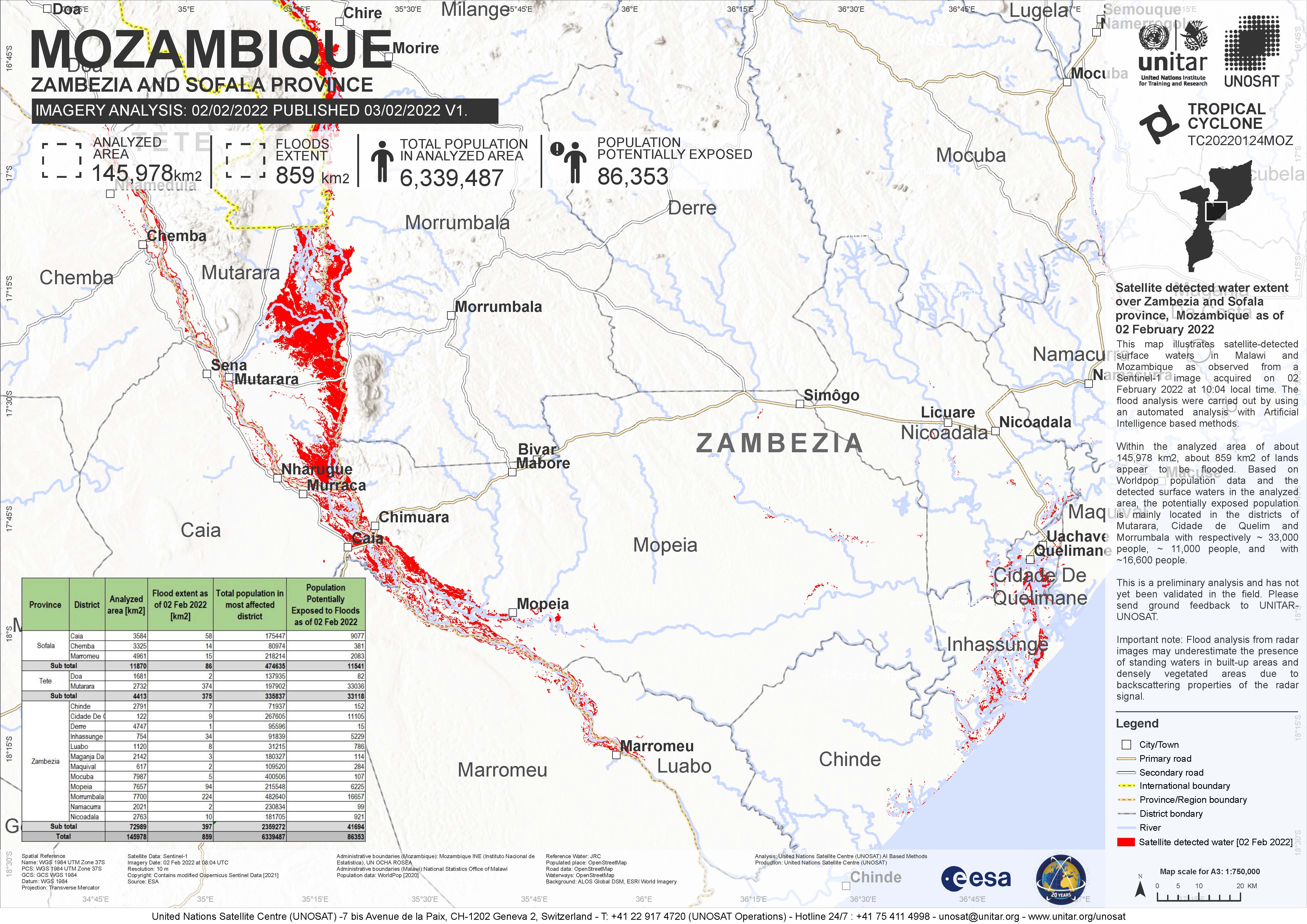
Detected flood in Mozambique and Malawi
版权: © DLR e.V. (2022), Distribution Airbus DS Geo GmbH
Contains modified Copernicus Sentinel data (2022)
Map produced by Geoinformation systems
Information about the Product
已获得: TerrSAR-X: 31/01/2022
Sentinel-1: 02/02/2022
源: TerrSAR-X, Sentinel-1
类别: Delineation Monitoring Maps


Water extends on Zambezi River, pre-event image and post-event image
版权: RADARSAT Constellation Mission Imagery © Government of Canada (2022) - RADARSAT is an official mark of the Canadian Space Agency
Contains modified Copernicus Sentinel data (2022)
Map produced by the Federal University of Santa Maria, Brazil
Information about the Product
已获得: Sentinel-1: 21/01/2022
RCM: 26/01/2022
源: Sentinel-1, RCM
类别: Reference Map
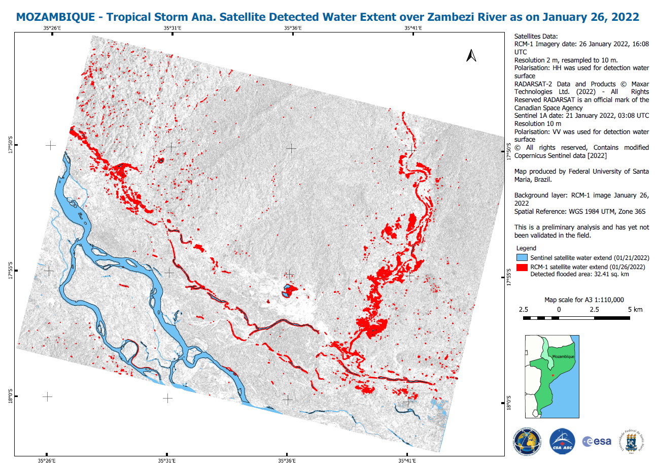
Satellite Detected Water Extent over Zambezi River, Mozambique
版权: Contains modified Copernicus Sentinel data (2022)
RADARSAT Constellation Mission Imagery © Government of Canada (2022) - RADARSAT is an official mark of the Canadian Space Agency
Map produced by Federal University of Santa Maria, Brazil
Information about the Product
已获得: RCM: 26/01/2022
Sentinel-1: 21/01/2022
源: Sentinel-1, RCM
类别: Reference Map


Flood situation in Mozambique, Zambezi river estuary
版权: RADARSAT Constellation Mission Imagery © Government of Canada (2022) - RADARSAT is an official mark of the Canadian Space Agency
Contains modified Copernicus Sentinel data (2022)
Map produced by Geoinformation systems
Information about the Product
已获得: Sentinel-2: 09/01/2022
RCM: 26/01/2022
源: RCM, Sentinel-2
类别: Reference Map
 返回完整的响应档案

