 English
 Spanish
 French
 Chinese
 Russian
 Portuguese
 最新宪章启动
Charter activations
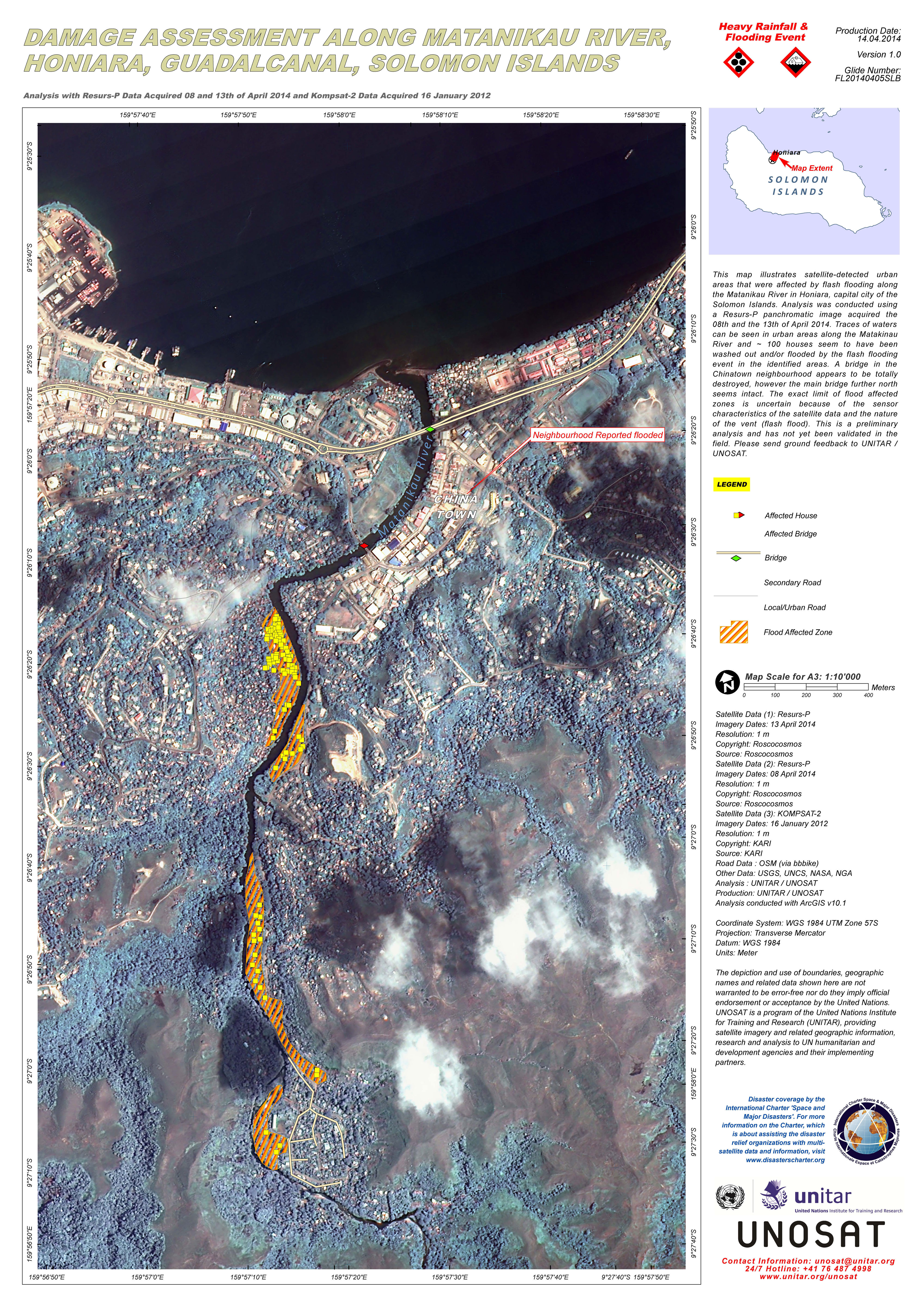
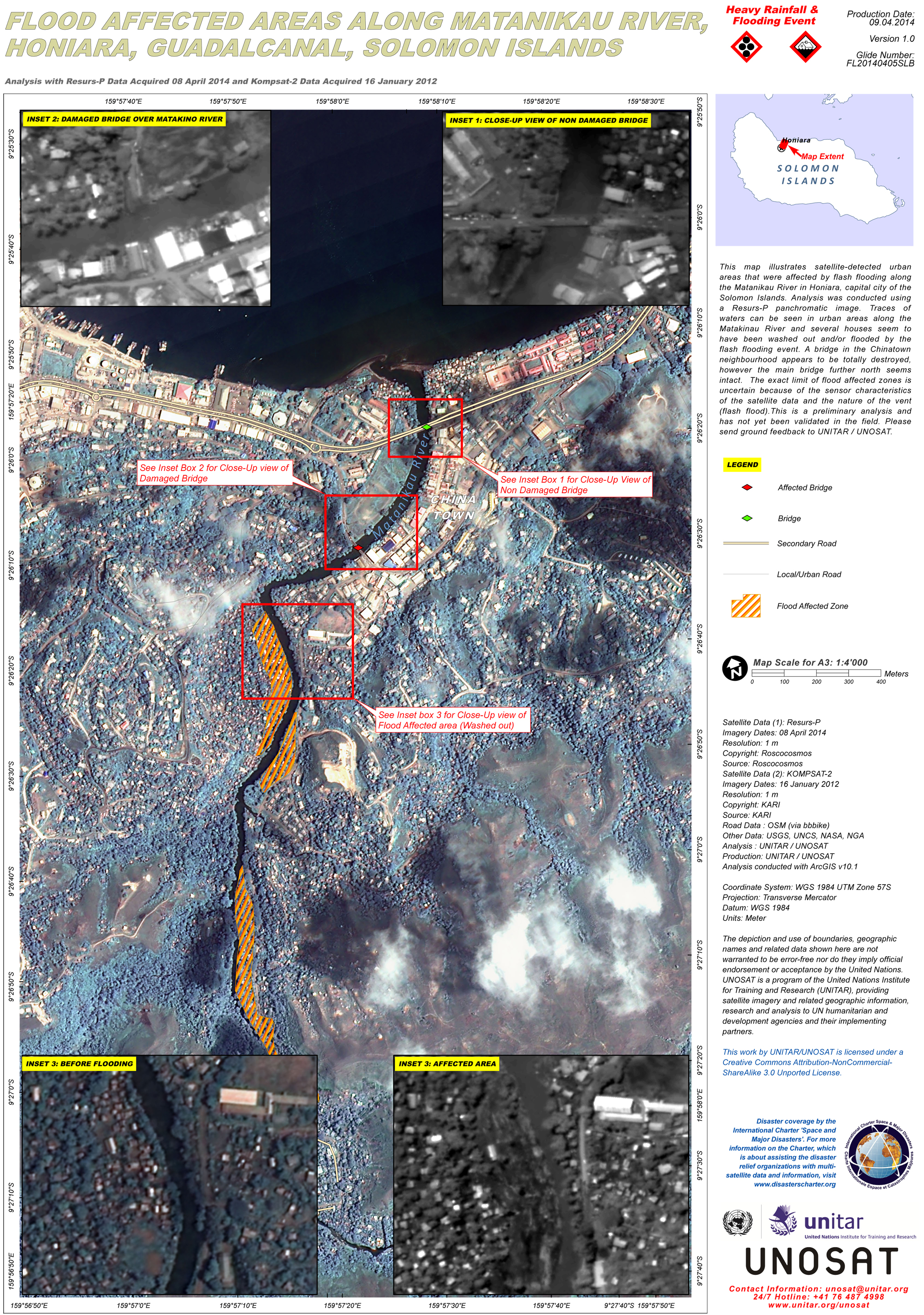
所罗门群岛洪水
数天的强降雨引发了所罗门群岛山洪,致使霍尼亚拉首都被淹没,数千人流离失所。据估计,19人死亡,约30人失踪。
2014年4月3日,由于强降雨造成横穿瓜达尔卡纳尔岛的河流决堤引发了洪灾。Matanikau河水淹没了霍尼亚拉的很多地区。据报道,该次洪灾摧毁了数千沿河房屋,损坏或破坏了沿河桥梁,切断或破坏了路面。
该河流水位的上升比预期中的要快很多,人们紧急撤离的时间非常紧迫。暴雨风后发展成第1类热带气旋Ita,该气旋将于周末移离所罗门群岛。
该地区已宣布进入紧急状态,据估计,在霍尼亚拉,多达1.2万人可能因此受影响。从2月5日起,风暴开始逐渐减弱,水位也开始消退,灾后的恢复和重建工作开始进行。
| 事件类型: | 洪水 |
| 事件地点: | 所罗门群岛Honiara |
| 启动宪章的日期: | 2014年4月5日 |
| 宪章要求者: | UNITAR/UNOSAT on behalf of UN ESCAP and UN OCHA |
| 项目经理: | UNITAR/UNOSAT |
Products


 返回完整的响应档案

