 English
 Spanish
 French
 Chinese
 Russian
 Portuguese
 Latest Activation
Charter activations
Flood in the Solomon Islands
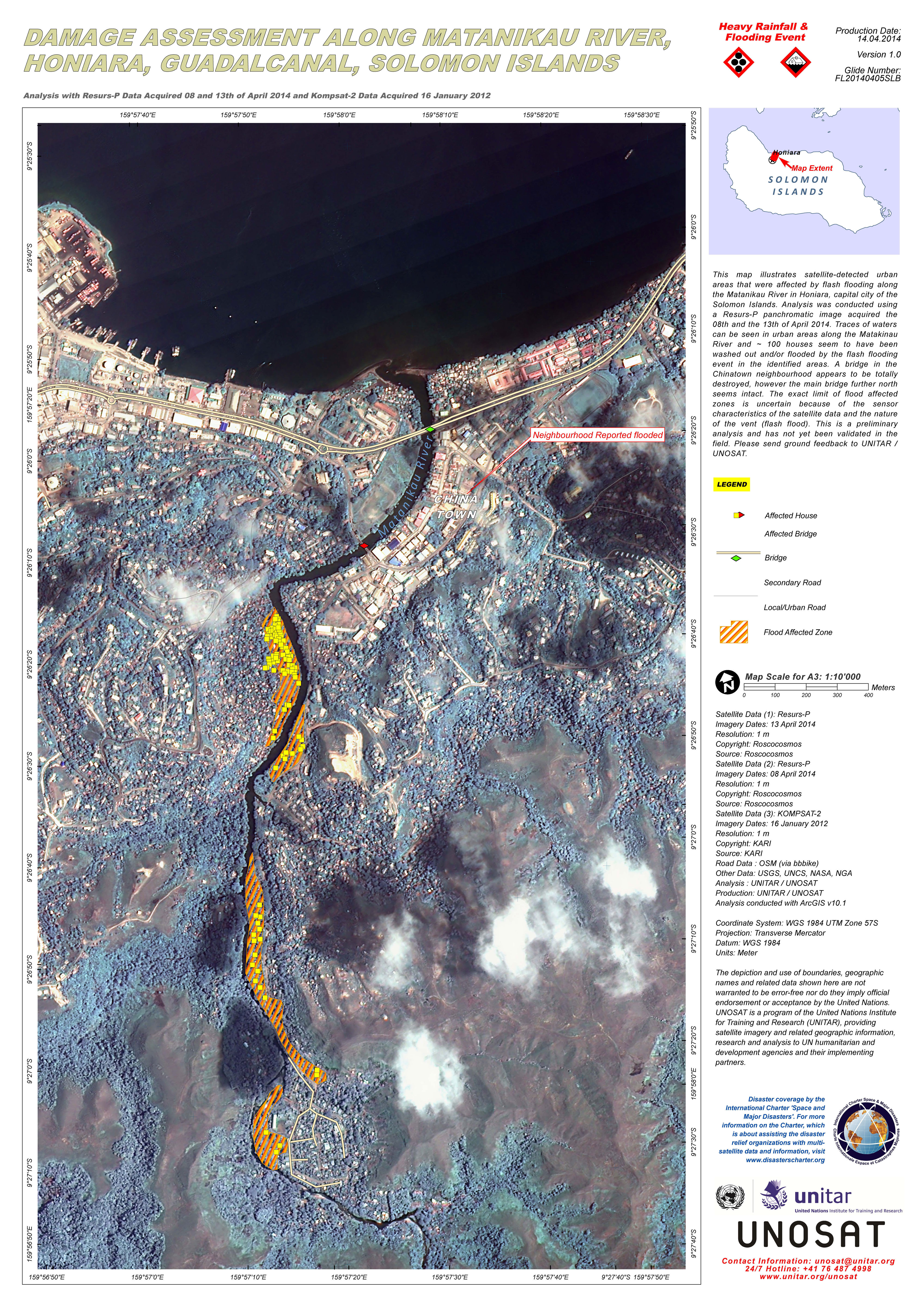
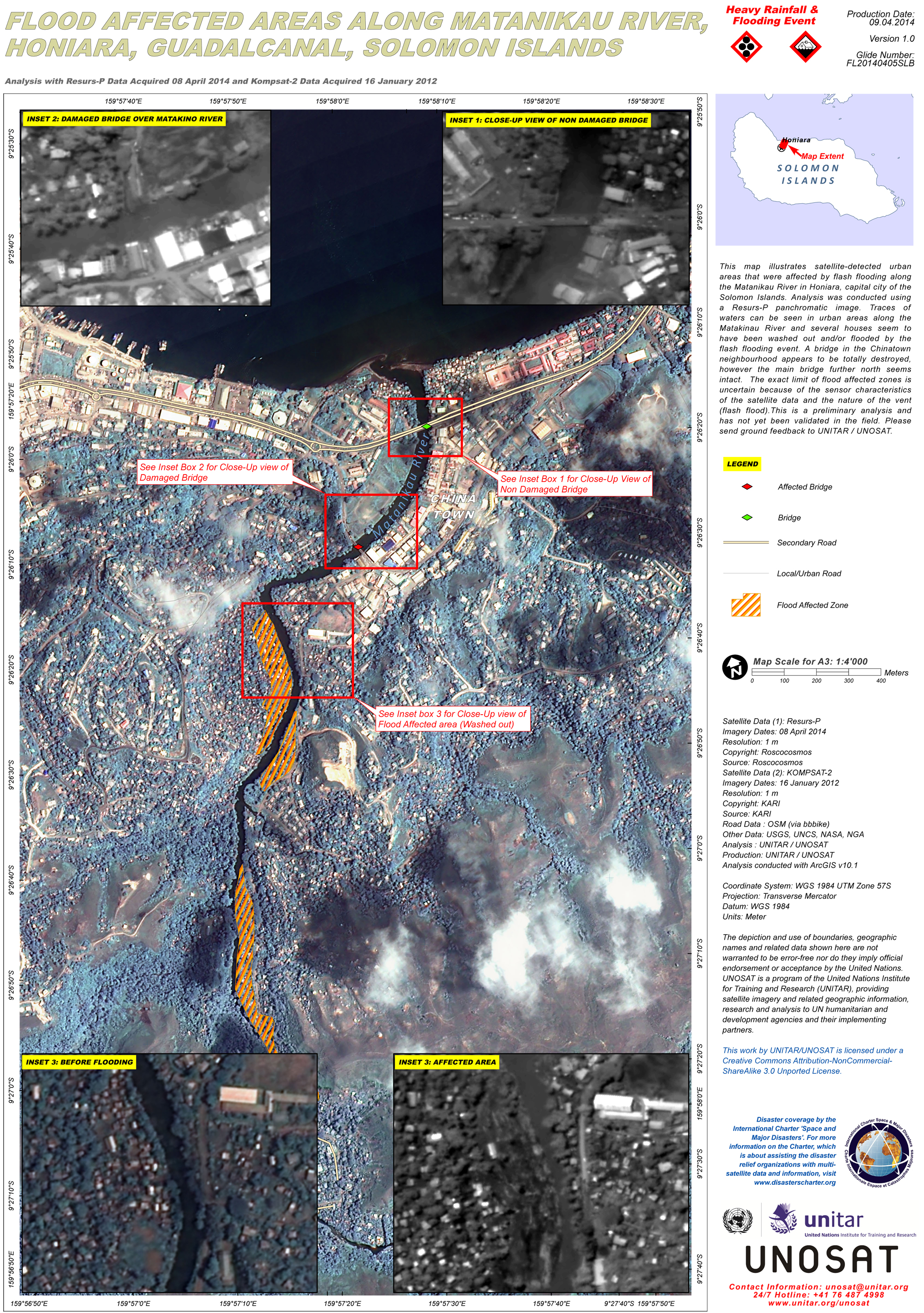
Days of heavy rainfall have caused flash flooding in the Solomon Islands, inundating the capital city of Honiara and displacing thousands of people. An estimated 19 people have been killed and almost 30 are still missing.
The flooding began on 03 April 2014 when the rainfall caused rivers across the main island of Guadalcanal to burst their banks. The floodwaters from the River Matanikau left many areas of Honiara underwater and reportedly destroyed thousands of homes along the rivers. The flooding has also damaged or destroyed bridges along the rivers and cut off or damaged roads.
The river levels rose much faster than anticipated, giving people little time to evacuate. The storm that caused the rain later developed into a Category 1 Tropical Cyclone, Ita, which moved away from the Solomon Islands over the weekend.
A state of emergency has been declared, and it is estimated that as many as 12,000 people could be affected in Honiara. While the storm weakened and water levels began to subside on 05 February, the long process of recovery and rebuilding is underway.
| Tipo de evento: | Flood |
| Local do evento: | Honiara - Solomon Islands |
| Data da Ativação da Carta: | 05 April 2014 |
| Requisitante da Carta: | UNITAR/UNOSAT on behalf of UN ESCAP and UN OCHA |
| Gerenciamento de projeto: | UNITAR/UNOSAT |
Products

Water level situation in Gold Ridge Dam, Guadalcanal, Solomon Islands
Direitos autorais: Terra © NASA
Landsat-8 data and products © USGS (2014) - All rights reserved
Map produced by UNITAR/UNOSAT
Information about the Product
Adquirida: Terra: 15/04/2014
Landsat-8: 15/03/2014
Fonte: Terra - ASTER / Landsat-8

 Voltar ao arquivo completo da Ativação

