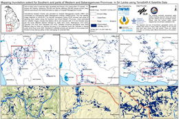
最小化 最新宪章启动

Charter activations

斯里兰卡洪水

斯里兰卡西部和南部的季风雨造成严重的洪水泛滥和泥石流,造成至少202人死亡,50多万人受灾。

这场灾难性的洪水是十年来最严重的洪灾,随着对受害者搜寻行动的继续进行,死亡人数预计会有所上升。

据报道,斯里兰卡25个地区中有15个受灾,但西南部受灾最为严重;特别是马塔拉和拉特纳普勒地区尤为突出。有77,000人被迫撤离家园,其中数千人损失严重。

斯里兰卡海军和空军被调配至受灾地区提供紧急救援,慈善救援机构正在提供志愿援助服务以帮助受害者。然而,军队的救援工作受到高水位和道路的阻碍,这些水道和道路被洪水冲塌或被山体滑坡的碎石阻塞。目前正在提供国际援助来帮助这场大规模的灾难。

斯里兰卡灾害管理中心(DMC)警告说,救援组织在未来几天应保持高度警觉,因为情况可能会进一步恶化。

随着洪水的持续,天气预报说可能会有更多降雨,令人担忧的是,登革热等疾病可能在受灾地区扎根。

事件类型:洪水
事件地点:斯里兰卡
启动宪章的日期:2017年5月26日
宪章启动时间:09:35:00
宪章启动时区:UTC-05:00
宪章要求者:美国地质勘探局代表斯里兰卡灾害管理中心
启动ID:533
项目经理:CGIAR(国际农业研究磋商组织)

Products

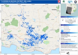
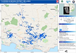
Flooding in Matara District, Sri Lanka

版权: © DLR e. V. 2017, Distribution: Airbus DS Geo GmbH
Map produced by GMC-AIT

Information about the Product

已获得: 30/05/2017

源: TerraSAR-X

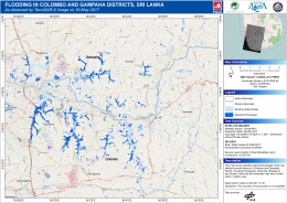
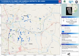
Flooding in Colombo and Gampaha District, Sri Lanka

版权: © DLR e. V. 2017, Distribution: Airbus DS Geo GmbH
Map produced by GMC-AIT

Information about the Product

已获得: 30/05/2017

源: TerraSAR-X

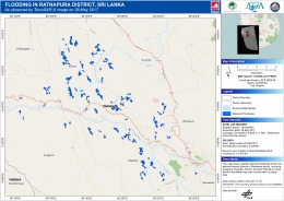
Flooding in Ratnapura District, Sri Lanka

版权: © DLR e. V. 2017, Distribution: Airbus DS Geo GmbH
Map produced by GMC-AIT

Information about the Product

已获得: 30/05/2017

源: TerraSAR-X

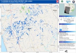
Flooding in Kalutara District, Sri Lanka

版权: © DLR e. V. 2017, Distribution: Airbus DS Geo GmbH
Map produced by GMC-AIT

Information about the Product

已获得: 30/05/2017

源: TerraSAR-X

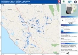
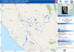
Flooding in Galle District, Sri Lanka

版权: © DLR e. V. 2017, Distribution: Airbus DS Geo GmbH
Map produced by GMC-AIT

Information about the Product

已获得: 30/05/2017

源: TerraSAR-X

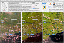
Flood extent for Hambantota in the Southern Province

版权: ResourceSat-2 data and products © ISRO (2017) - All rights reserved
Map produced by IWMI

Information about the Product

已获得: 27/05/2017, 30/05/2017 and 04/06/2017

源: ResourceSat-2

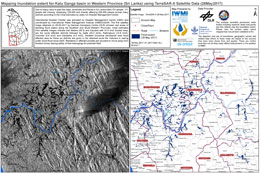
Flood extent for Kalu Ganga basin in the Western Province

版权: RADARSAT-2 Data and Products © MacDonald, Dettwiler and Associates Ltd. (2017) - All Rights Reserved. RADARSAT is an official trademark of the Canadian Space Agency.
Map produced by IWMI

Information about the Product

已获得: 29/05/2017 and 02/06/2017

源: RADARSAT-2
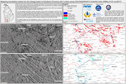
Flood extent for Gin Ganga basin in the Southern Province

版权: RADARSAT-2 Data and Products © MacDonald, Dettwiler and Associates Ltd. (2017) - All Rights Reserved. RADARSAT is an official trademark of the Canadian Space Agency.
Map produced by IWMI

Information about the Product

已获得: 29/05/2017 and 02/06/2017

源: RADARSAT-2
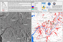
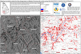
Flood extent for Kalu Ganga basin in the Western Province

版权: RADARSAT-2 Data and Products © MacDonald, Dettwiler and Associates Ltd. (2017) - All Rights Reserved. RADARSAT is an official trademark of the Canadian Space Agency.
Map produced by IWMI

Information about the Product

已获得: 05/06/2017

源: RADARSAT-2

Flood extent for Gin Ganga basin in the Southern Province

版权: RADARSAT-2 Data and Products © MacDonald, Dettwiler and Associates Ltd. (2017) - All Rights Reserved. RADARSAT is an official trademark of the Canadian Space Agency.
Map produced by IWMI

Information about the Product

已获得: 02/06/2017

源: RADARSAT-2

Emergency Response Data Viewer showing the flood extent, photographs and statistics on the disaster

版权: Produced by Geoinformatics Centre of the Asian Institute of Technology

Information about the Product

已获得: Sentinel-2: 28/05/2017
ALOS-2: 30/05/2017
TerraSAR-X:28/05/2017
RADARSAT-2: 29/05/2017

源: Sentinel-2, ALOS-2, TerraSAR-X and RADARSAT-2
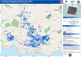
Flooding in Ratnapura District in the Southern Province

版权: JAXA (2017) - All rights reserved
Map produced by GMC-AIT

Information about the Product

已获得: 30/05/2017

源: ALOS-2

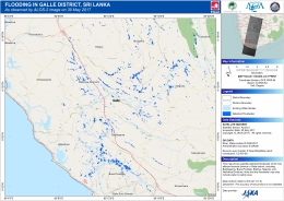
Flooding in Galle District in the Western Province

版权: JAXA (2017) - All rights reserved
Map produced by GMC-AIT

Information about the Product

已获得: 30/05/2017

源: ALOS-2

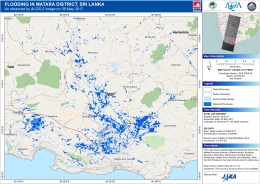
Flooding in Matara District in the Southern Province

版权: JAXA (2017) - All rights reserved
Map produced by GMC-AIT

Information about the Product

已获得: 30/05/2017

源: ALOS-2

Flooding in Matara District in the Southern Province

版权: RADARSAT-2 Data and Products © MacDonald, Dettwiler and Associates Ltd. (2017) - All Rights Reserved. RADARSAT is an official trademark of the Canadian Space Agency.
Map produced by GMC-AIT

Information about the Product

已获得: 29/05/2017

源: RADARSAT-2
Flooding in Colombo and Gampaha Districts in the Western Province

版权: © DLR e. V. 2017, Distribution: Airbus DS Geo GmbH
Map produced by GMC-AIT

Information about the Product

已获得: 28/05/2017

源: TerraSAR-X

Flooding in Ratnapura District in the Southern Province

版权: © DLR e. V. 2017, Distribution: Airbus DS Geo GmbH
Map produced by GMC-AIT

Information about the Product

已获得: 28/05/2017

源: TerraSAR-X

Flooding in Kalutara District in the Western Province

版权: © DLR e. V. 2017, Distribution: Airbus DS Geo GmbH
Map produced by GMC-AIT

Information about the Product

已获得: 28/05/2017

源: TerraSAR-X

Flooding in Galle District in the Western Province

版权: © DLR e. V. 2017, Distribution: Airbus DS Geo GmbH
Map produced by GMC-AIT

Information about the Product

已获得: 28/05/2017

源: TerraSAR-X

Flooding in Matara District in the Southern Province

版权: © DLR e. V. 2017, Distribution: Airbus DS Geo GmbH Map produced by GIC-AIT

Information about the Product

已获得: 28/05/2017

源: TerraSAR-X

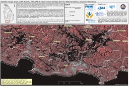
Flood in Matara district in the Southern Province

版权: KARI (2017)
Map produced by IWMI

Information about the Product

已获得: 30/05/2017

源: KOMPSAT-5

Flood extent in Hambantota in the Southern Province

版权: ResourceSat-2 data and products © ISRO (2017) - All rights reserved
Map produced by IWMI

Information about the Product

已获得: 27/05/2017 and 30/05/2017

源: ResourceSat-2

Flood extent in Gin Ganga in the Western Province

版权: © Copernicus Sentinel data (2017)
Map produced by IWMI

Information about the Product

已获得: 30/05/2017

源: Sentinel-1

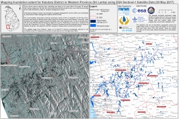
Flood extent in Kalutara District in the Western Province

版权: © Copernicus Sentinel data (2017)
Map produced by IWMI

Information about the Product

已获得: 30/05/2017

源: Sentinel-1

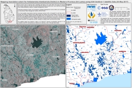
Flood extent in Ambalantota (Hambantota District) in the Western Province

版权: © Copernicus Sentinel data (2017)
Map produced by IWMI

Information about the Product

已获得: 30/05/2017

源: Sentinel-1

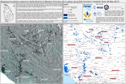
Flood extent in Galle District in the Western Province

版权: © Copernicus Sentinel data (2017)
Map produced by IWMI

Information about the Product

已获得: 30/05/2017

源: Sentinel-1

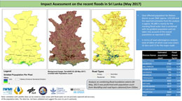
Assessment of the impact the floods have had on Matara district

版权: © DLR e. V. 2017, Distribution: Airbus DS Geo GmbH
Map produced by IWMI

Information about the Product

已获得: 28/05/2017

源: TerraSAR-X

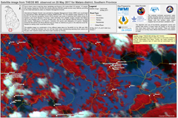
Flood extent in Matara District, in the Southern Province

版权: THEOS © GISTDA
Map produced by IWMI

Information about the Product

已获得: 28/05/2017

源: THEOS MS

Flooding in Matara District in the Southern Province

版权: JAXA (2017) - All rights reserved
Map produced by IMWI

Information about the Product

已获得: 30/05/2017

源: ALOS-2

Flood extent in Matara District in the Southern Province

版权: © DLR e. V. 2017, Distribution: Airbus DS Geo GmbH
Map produced by IWMI

Information about the Product

已获得: 28/05/2017 and 30/05/2017

源: TerraSAR-X

Flood extent in Kalutara District, in the Western Province

版权: © DLR e. V. 2017, Distribution: Airbus DS Geo GmbH
Map produced by IWMI

Information about the Product

已获得: 28/05/2017 and 30/05/2017

源: TerraSAR-X

Flood extent in Kalu Ganga basin in the Western Province

版权: RADARSAT-2 Data and Products © MacDonald, Dettwiler and Associates Ltd. (2017) - All Rights Reserved. RADARSAT is an official trademark of the Canadian Space Agency.
Map produced by IWMI

Information about the Product

已获得: 29/05/2017

源: RADARSAT-2

Flood extent in Gin Ganga and Galle in the Western Province

版权: RADARSAT-2 Data and Products © MacDonald, Dettwiler and Associates Ltd. (2017) - All Rights Reserved. RADARSAT is an official trademark of the Canadian Space Agency.
Map produced by IWMI

Information about the Product

已获得: 29/05/2017

源: RADARSAT-2

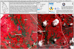
Flood in Hambantota district with submerged crop fields in the Southern Province

版权: © Copernicus Sentinel data (2017)
Map produced by IWMI

Information about the Product

已获得: 28/05/2017

源: Sentinel-2

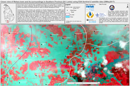
Flood in Matara in the Southern Province

版权: © Copernicus Sentinel data (2017)
Map produced by IWMI

Information about the Product

已获得: 28/05/2017

源: Sentinel-2

Flood in Matara in the Southern Province

版权: © Copernicus Sentinel data (2017)
Map produced by IWMI

Information about the Product

已获得: 28/05/2017

源: Sentinel-2

Flood in Matara in the Southern Province

版权: © Copernicus Sentinel data (2017)
Map produced by IWMI

Information about the Product

已获得: 28/05/2017

源: Sentinel-2

Flood extent in Matara in the Southern Province

版权: © DLR e. V. 2017, Distribution: Airbus DS Geo GmbH
Map produced by IWMI

Information about the Product

已获得: 28/05/2017

源: TerraSAR-X

Flood extent in Kalu Ganga basin in the Western Province

版权: © DLR e. V. 2017, Distribution: Airbus DS Geo GmbH
Map produced by IWMI

Information about the Product

已获得: 28/05/2017

源: TerraSAR-X

Flood extent in Sabaragamuwa Province

版权: © DLR e. V. 2017, Distribution: Airbus DS Geo GmbH
Map produced by IWMI

Information about the Product

已获得: 28/05/2017

源: TerraSAR-X

返回完整的响应档案