 English
 Spanish
 French
 Chinese
 Russian
 Portuguese
 最新宪章启动
Charter activations
斯里兰卡洪水
数日降雨导致了斯里兰卡的大面积洪涝,造成37人死亡,迫使数十万人撤离。
暴雨是孟加拉湾南部热带气旋的结果,预计大雨还会持续数日。截至5月15日的格林尼治标准时间0600,康堤市24小时内的降雨已经达到69毫米,加勒市降雨达到71毫米。同时科伦坡记录的降雨量达到128毫米。Pottuui在同一时期内降雨量甚至高达144毫米。基利诺奇镇在5月18日的24小时内降雨达到372毫米,是正常情况下全年降雨量的四分之一。
陆军和海军已被调派协助营救行动,并帮助疏散低洼地区或斜坡上处于洪涝和山体滑坡危险的居民。
有些地区被淹没的道路、碎石和坠落的电力线切断。警方警告驾驶人士要注意进一步的山体滑坡,并要求下游地区居民注意了解附近运河和河流的水位。卡拉尼河已经溢流,附近的居民已经撤离。
有20多万人在福利中心寻求避难,据估计,受灾人数可达30万人。数以千计的房屋遭到洪水的破坏,部分村庄被洪水彻底淹没或被山体滑坡掩埋。
| 事件类型: | 洪水 |
| 事件地点: | 斯里兰卡 |
| 启动宪章的日期: | 2016年5月17日 |
| 宪章启动时间: | 08:36:57 |
| 宪章启动时区: | UTC+02:00 |
| 宪章要求者: | 亚洲减灾中心(ADRC)代表国际水资源管理研究所IWMI-DMC |
| 项目经理: | 亚洲理工学院 (AIT) |
Products

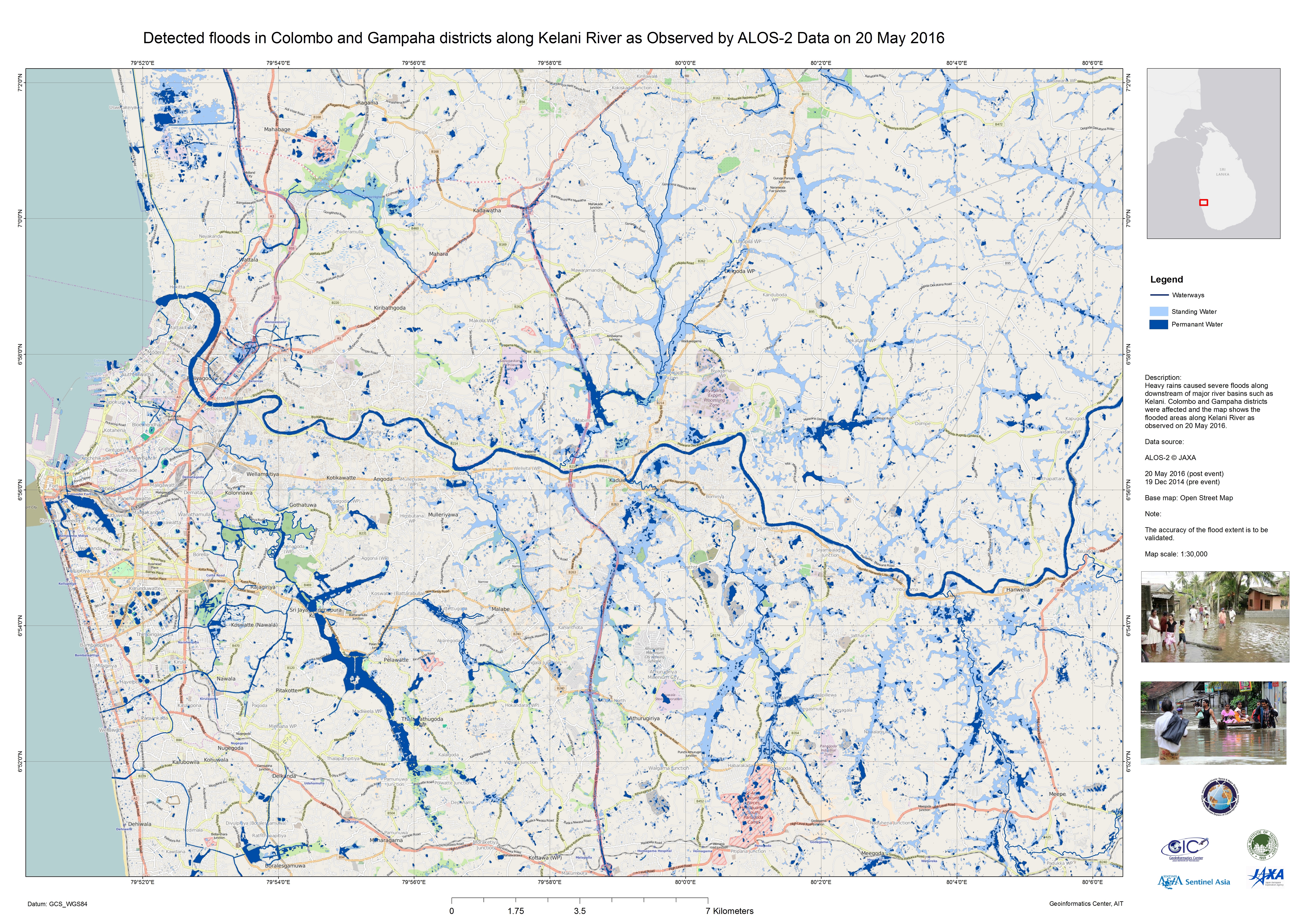
Flood in Colombo and Gampaha along the Kelani River, Sri Lanka
版权: RADARSAT-2 Data and Products © MacDonald, Dettwiler and Associates Ltd. (2016) - All Rights Reserved. RADARSAT is an official trademark of the Canadian Space Agency.
Map produced by Geoinformatics Center, AIT
Information about the Product
已获得: Pre-disaster: 30/09/2015
Post-disaster: 24/05/2016
源: RADARSAT-2
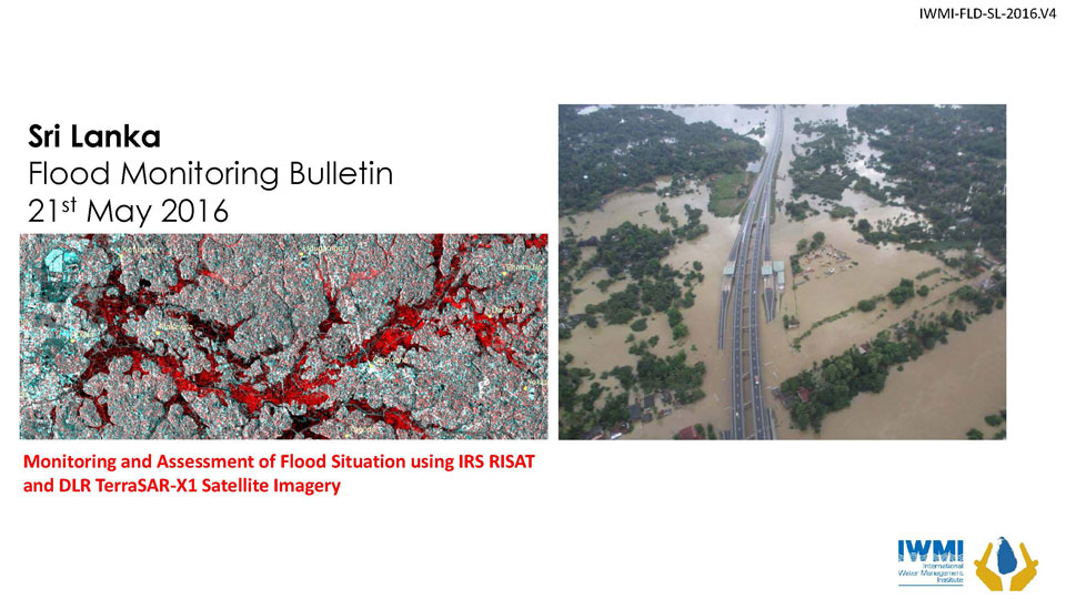
Monitoring and assessment of flood situation on 21 May
Download the flood monitoring bulletin
版权: RISAT-1 data and products © ISRO (2016) - All rights reserved
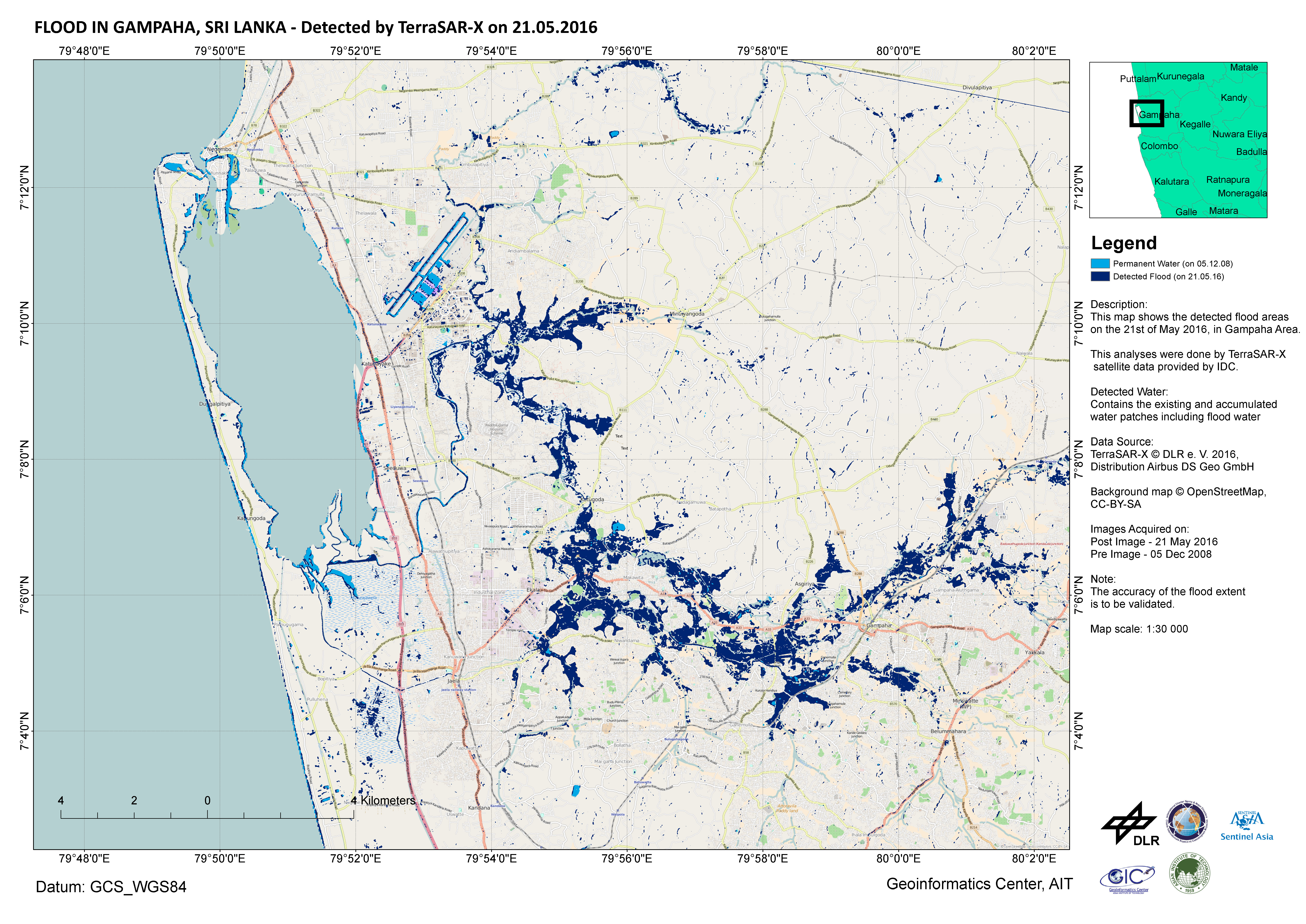
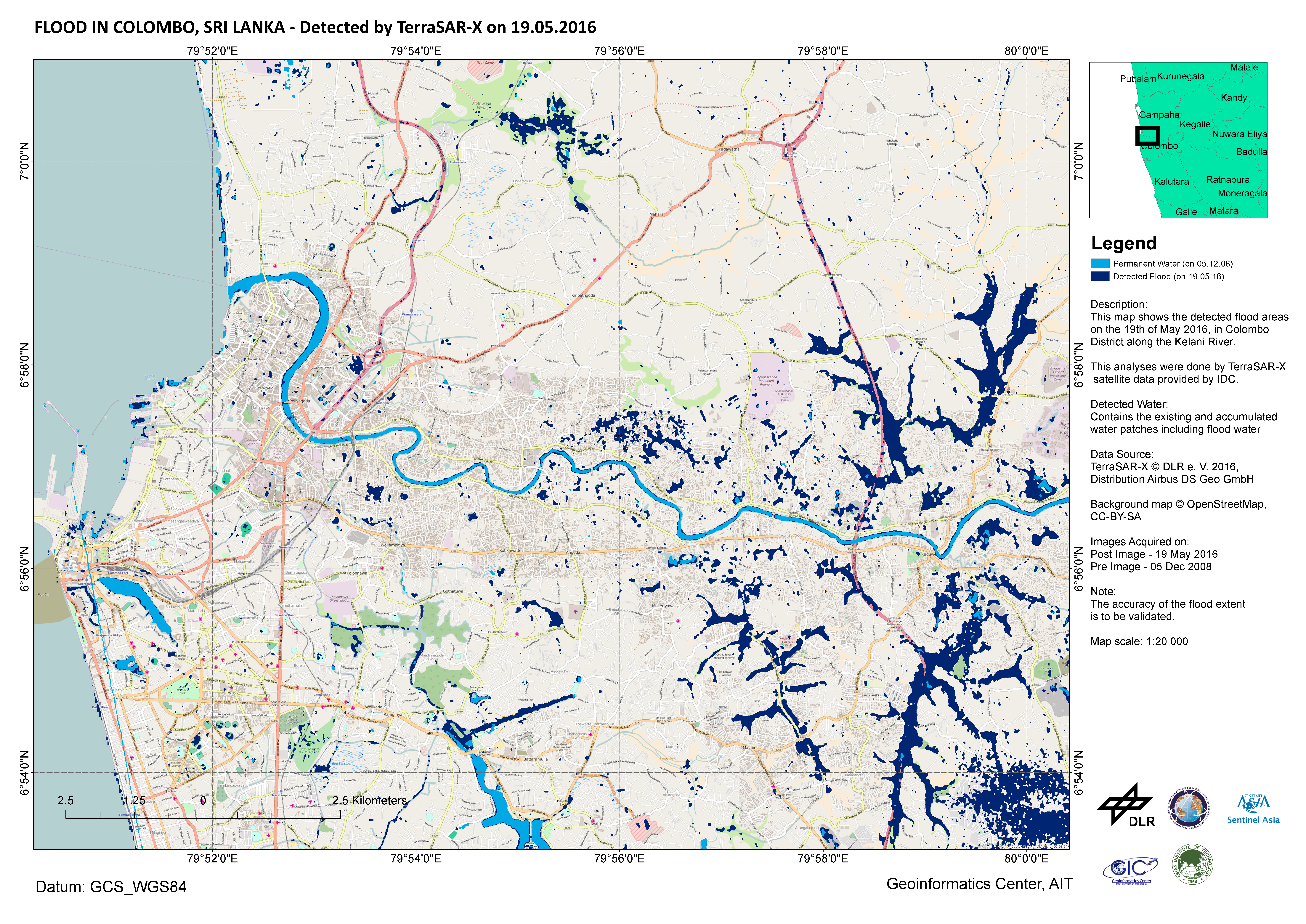
TerraSAR-X © DLR e. V. 2016, Distribution: Airbus DS Geo GmbH
Bulletin produced by International Water Management Institute
Information about the Product
已获得: RISAT-1: 20/05/2016
TerraSAR-X: 21/05/2016
源: RISAT-1 / TerraSAR-X

Monitoring and assessment of flood situation on 20 May using satellite data and Unmanned Aerial Vehicles
Download the flood monitoring bulletin
版权: DLR e. V. 2016, Distribution: Airbus DS Geo GmbH
Bulletin produced by International Water Management Institute
Information about the Product
已获得: Pre-disaster: 05/12/2008
Post-disaster: 21/05/2016
源: TerraSAR-X
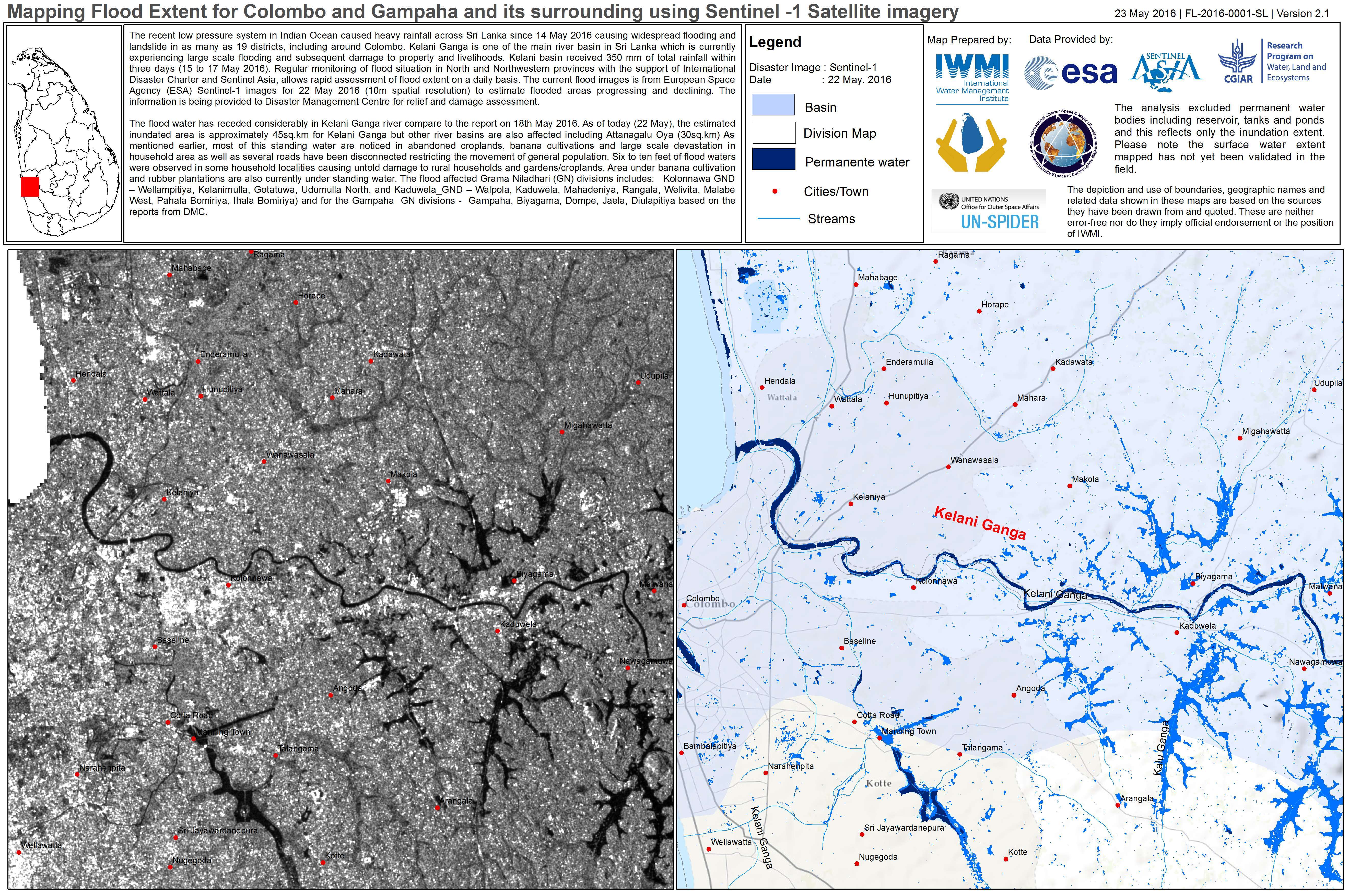
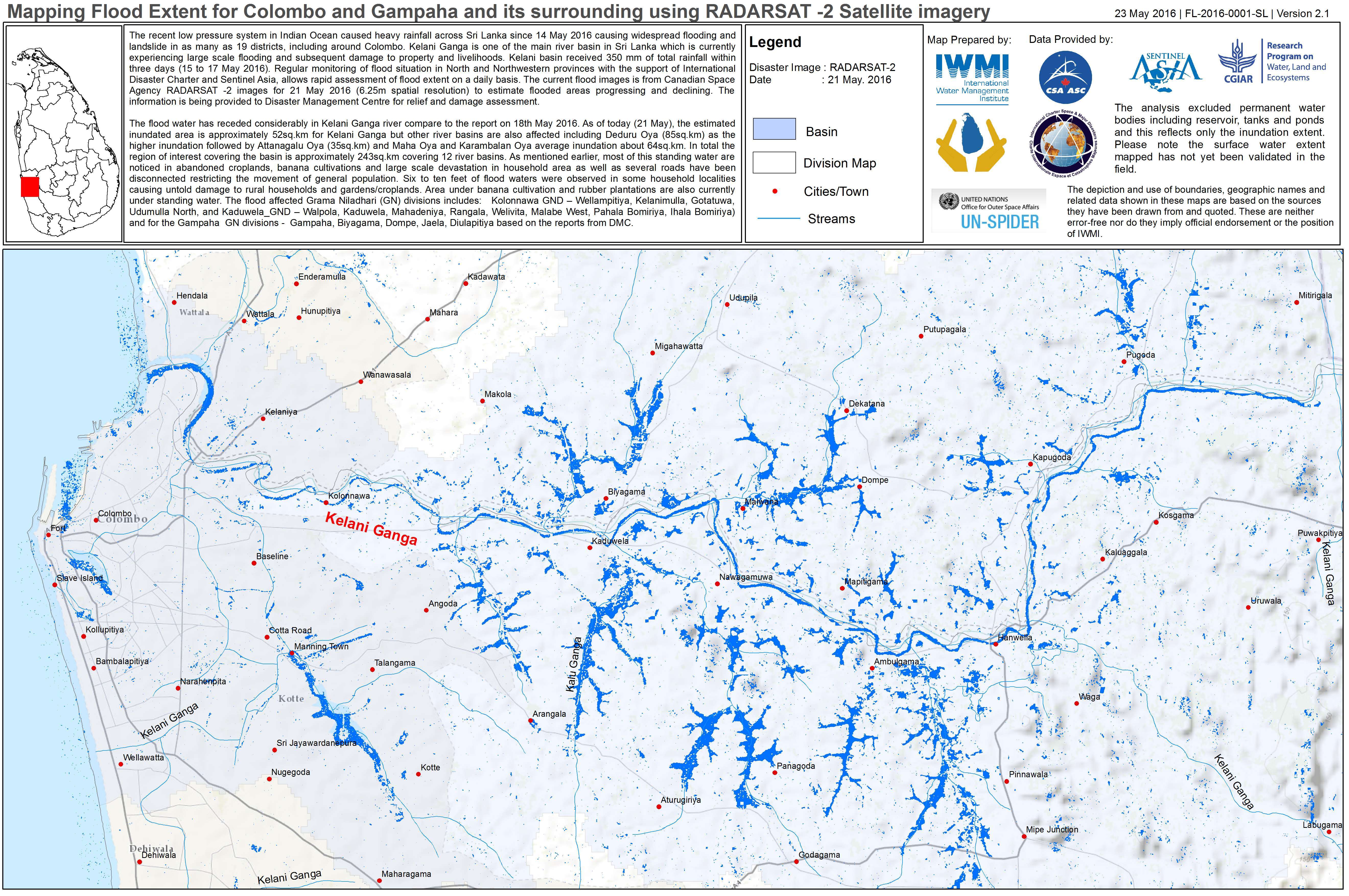
Flood extent for Colombo and Gampaha, Sri Lanka
版权: RADARSAT-2 Data and Products © MacDonald, Dettwiler and Associates Ltd. (2016) - All Rights Reserved. RADARSAT is an official trademark of the Canadian Space Agency.
Map produced by International Water Management Institute
Information about the Product
已获得: 21/05/2016
源: RADARSAT-2


 返回完整的响应档案

