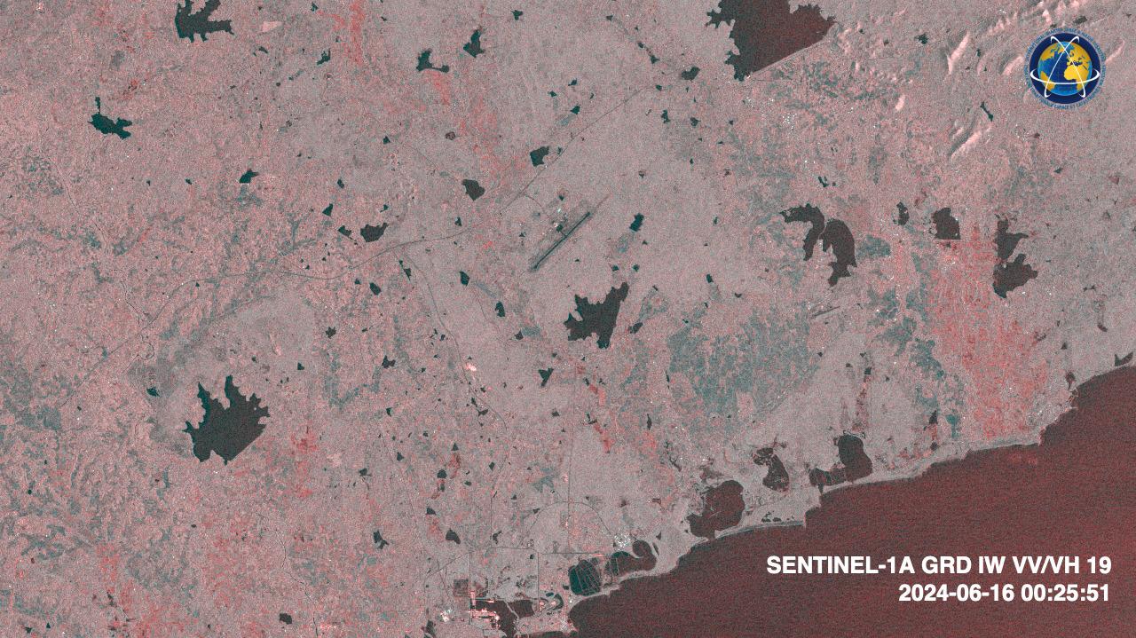
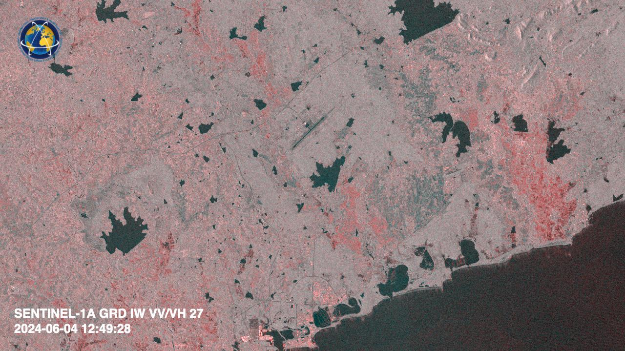
Свернуть Последняя Активация

Charter activations

Flood in Sri Lanka

Floods caused by monsoon rains were reported in several areas in the western part of Sri Lanka. As heavy rains swept across the country on Sunday, Sri Lanka's Disaster Management Center (DMC) issued a major flood alert in Sitawaka, located on the outskirts of the capital city, Colombo. Several other areas of the island have also been impacted, leading to power supplies being switched off in the affected regions.

The Irrigation Department reported that due to the heavy rains, water levels of the Kelani River and the Gin River in the south of Sri Lanka had reached spill levels. Strong winds took down trees in many areas, resulting in the loss of nine people.

Sri Lanka's military has deployed 10 Navy teams and will be adding a further 116. The army is providing food to displaced people, and three helicopters have been deployed to assist with relief efforts.

Related Resources:

UNOSAT AI web map for flood monitoring in Sri Lanka

Тип события:Flood
Место события:Sri Lanka
Date of Charter Activation:2024-06-03
Время активации Хартии:17:04
TЧасовой пояс в районе активации Хартии:UTC+02:00
Запрос на активацию поступил от:UNOSAT on behalf of United Nations Office for the Coordination of Humanitarian Affairs (OCHA) | Regional Office for Asia and the Pacific
Номер активации:887
Менеждер проекта от:Teodoro Hunger (UNITAR/UNOSAT)

Products

Preliminary satellite-derived flood impact assessment - Ratnapura District, Sabaragamuwa Province, Sri Lanka

Download full report

Авторские права: Contains modified Copernicus Sentinel data (2024)
Includes Pleiades material © CNES (2024), Distribution Airbus DS.
WorldView-2 © (2023) DigitalGlobe, Inc., Longmont CO USA 80503. DigitalGlobe and the DigitalGlobe logos are trademarks of DigitalGlobe, Inc. The use and/or dissemination of this data and/or of any product in any way derived there from are restricted. Unauthorized use and/or dissemination is prohibited.
Report produced by UNITAR / UNOSAT

Information about the Product

Получено: Sentinel-1: 04/06/2024
Pleiades: 06/06/2024
WorldView-2: 14/11/2020

Источник: Sentinel-1, Pleiades and WorldView-2

Категория: Reference Map

Satellite detected water extent in North Western Province, Sri Lanka

Авторские права: Contains modified Copernicus Sentinel data (2024)
Map produced by UNITAR / UNOSAT

Information about the Product

Получено: 04/06/2024

Источник: Sentinel-1

Категория: Delineation Map

Preliminary satellite-derived damage assessment - Galle District, Southern Province, Sri Lanka

Download full report

Авторские права: Includes Pleiades material © CNES (2024), Distribution Airbus DS.
WorldView-2 © (2023) DigitalGlobe, Inc., Longmont CO USA 80503. DigitalGlobe and the DigitalGlobe logos are trademarks of DigitalGlobe, Inc. The use and/or dissemination of this data and/or of any product in any way derived there from are restricted. Unauthorized use and/or dissemination is prohibited.
Map produced by UNITAR/ UNOSAT

Information about the Product

Получено: WorldView-2: 03/03/2023
Pleiades: 05/06/2024

Источник: Pleiades and WorldView-2

Категория: Reference Map

Satellite detected water extent in Gampaha, Colombo and Kalutara Districts, Western Province

Авторские права: Contains modified Copernicus Sentinel data (2024)
Map produced by UNITAR/ UNOSAT

Information about the Product

Получено: 04/06/2024

Источник: Sentinel-1

Категория: Reference Map

Preliminary satellite-derived damage assessment - Gampaha, Colombo and Kalutara District, Western Province, Sri Lanka

Download full report

Авторские права: Includes Pleiades material © CNES (2024), Distribution Airbus DS.
WorldView-2 © (2023) DigitalGlobe, Inc., Longmont CO USA 80503. DigitalGlobe and the DigitalGlobe logos are trademarks of DigitalGlobe, Inc. The use and/or dissemination of this data and/or of any product in any way derived there from are restricted. Unauthorized use and/or dissemination is prohibited.
Map produced by UNITAR / UNOSAT

Information about the Product

Получено: WorldView-2: 03/03/2023
Pleiades: 04/06/2024

Источник: Pleiades and WorldView-2

Категория: Reference Map

Quickviews

Quickviews are produced for illustration purposes only and do not contain any verified analysis of the disaster.

A pair of Sentinel-1 RedCyan VV-VH composites showing backscatter changes near Hambatota in Sri Lanka

Copyrights: Contains modified Copernicus Sentinel data (2024)

Information about the Quickview

Acquired: 16-06-2024 00:25:00 / 04-06-2024 12:49:00

Source(s): Sentinel-1 / Sentinel-1

Вернуться к полному архиву активаций