 English
 Spanish
 French
 Chinese
 Russian
 Portuguese
 Latest Activation
Charter activations
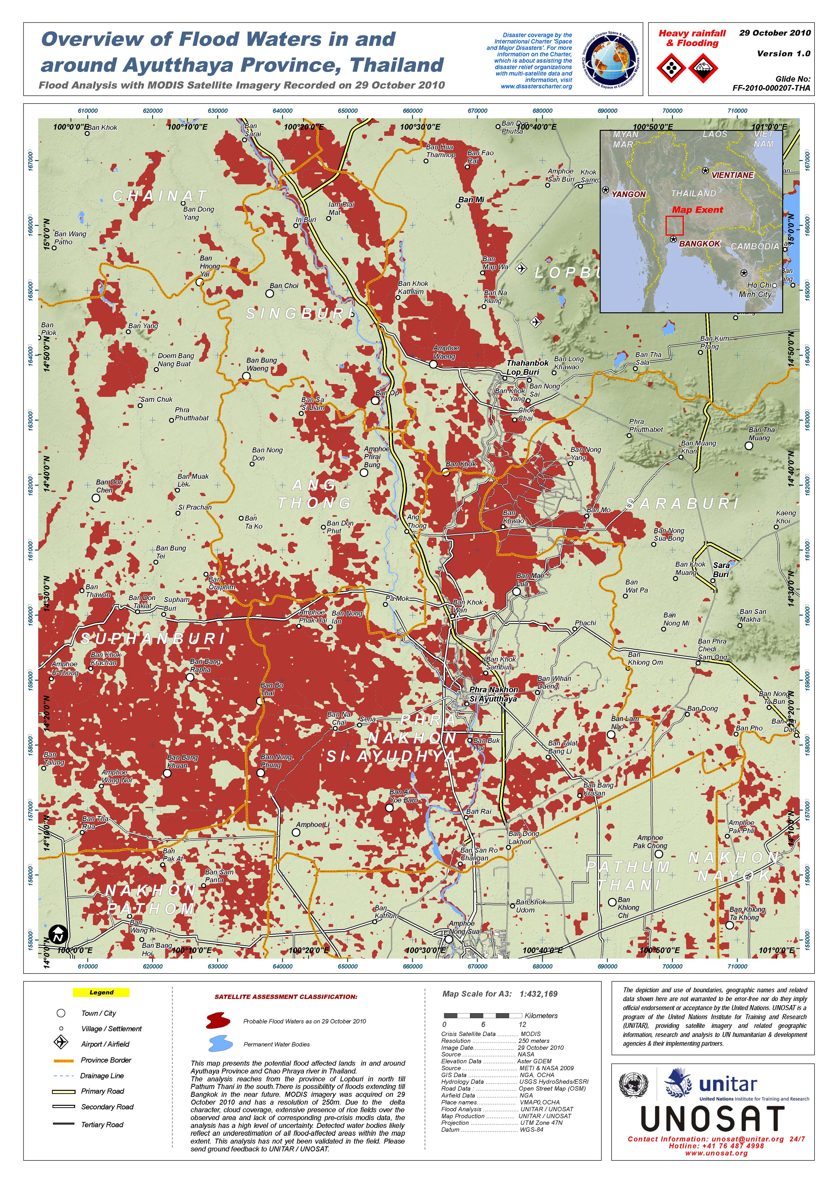
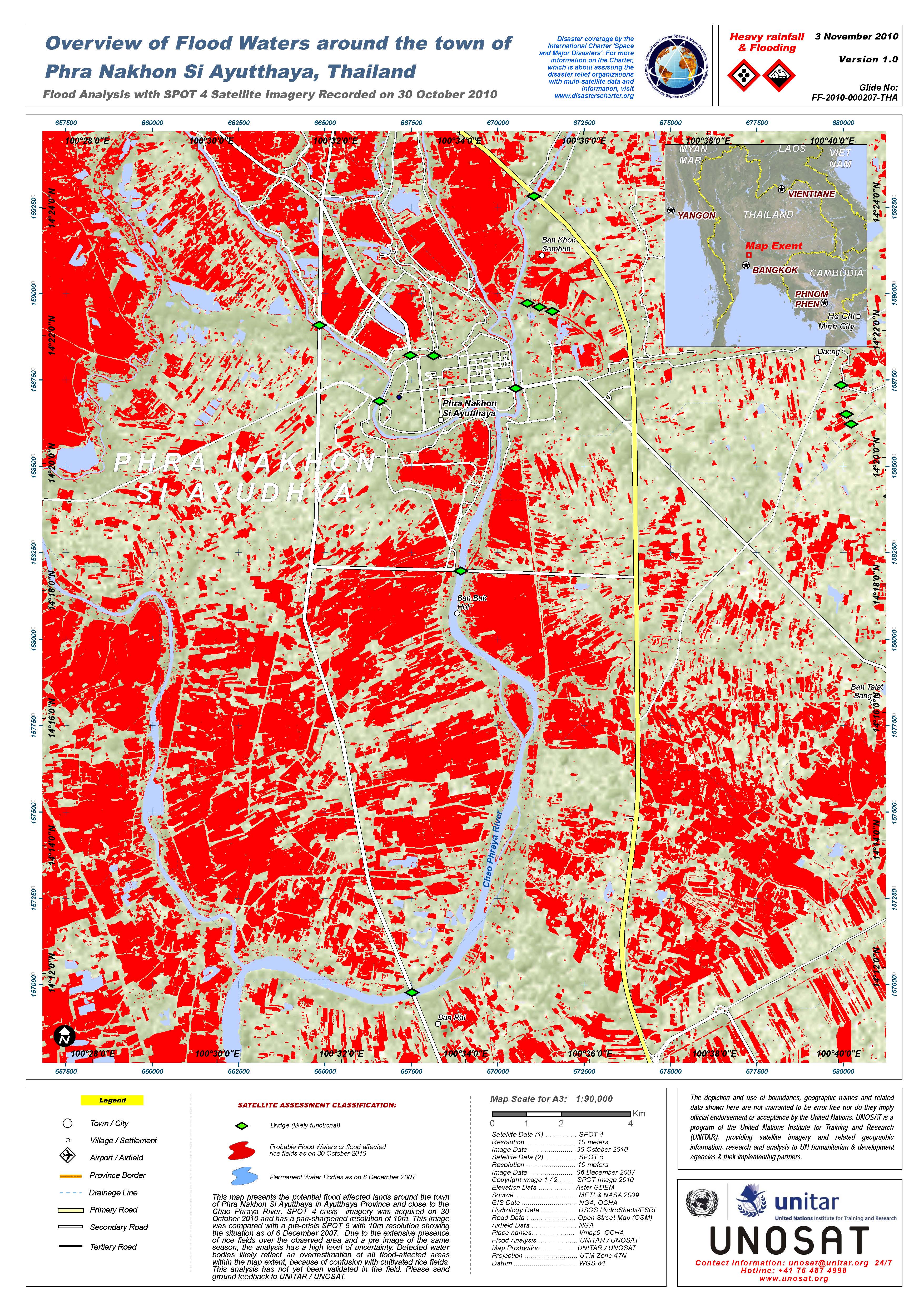
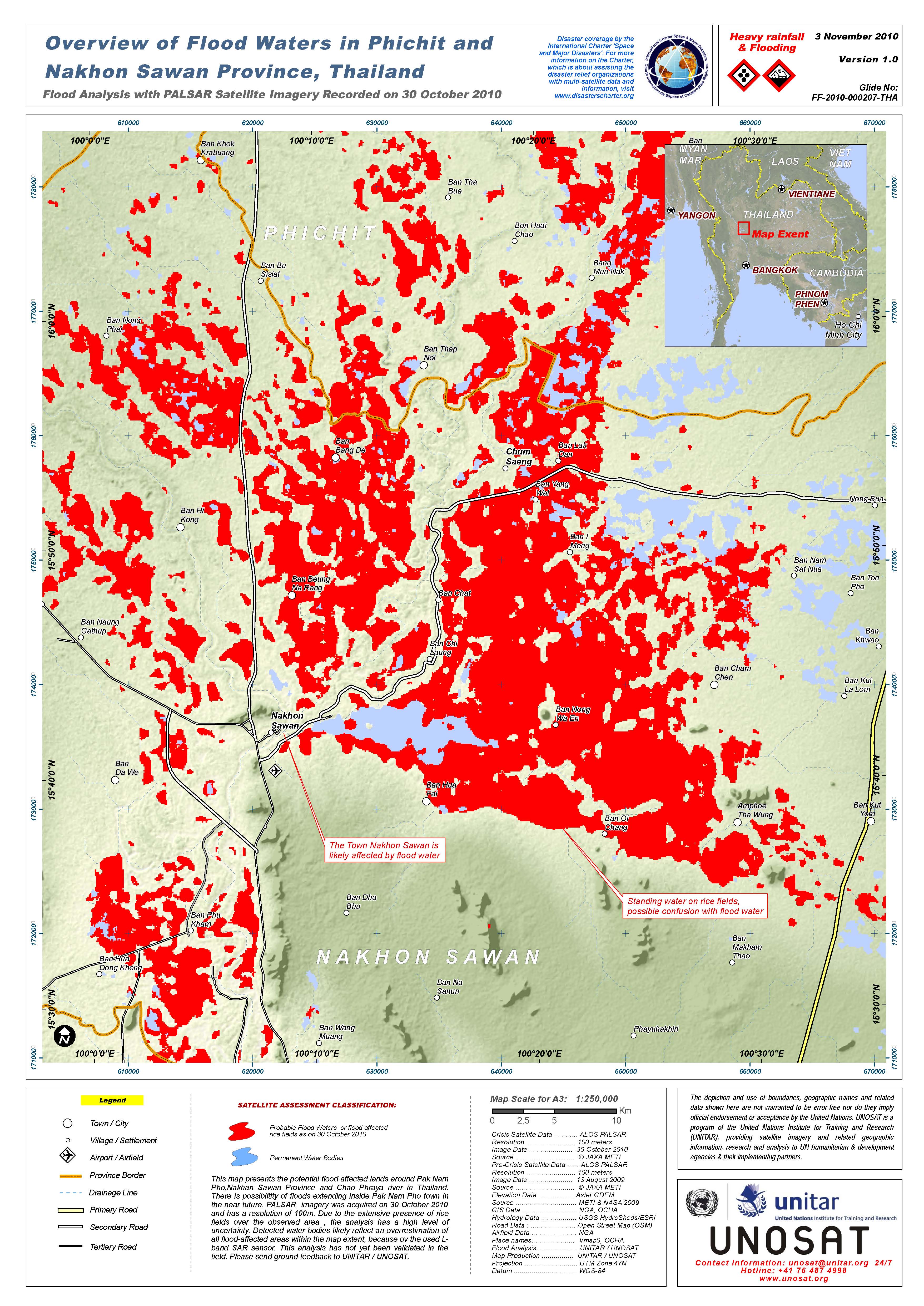
Flood in Thailand
3.2 million people in 27 provinces continued to be flood affected and the central provinces of Ayutthaya, Pathum Thani and Nonthaburi were severely affected, mostly from the seawater inflows.
In the North-eastern region, Mul River water now reached Buri Ram’s Sateuk district and would reach Ubon Ratchathani on 2 November 2010 at 3,200 cubic meters/Second, whilst Chi River water will reach there on 9 November 2010.
Request submitted via the Sentinel Asia escalation process
| Type of Event: | Flood |
| Location of Event: | Thailand |
| Date of Charter Activation: | 30 October 2010 |
| Charter Requestor: | ARDC for Geo-Informatics and Space Development Agency of Thailand (GISTDA) |
| Project Management: | UNOSAT |
Products


 Back to the full activation archive

