 English
 Spanish
 French
 Chinese
 Russian
 Portuguese
 Última Activación
Charter activations
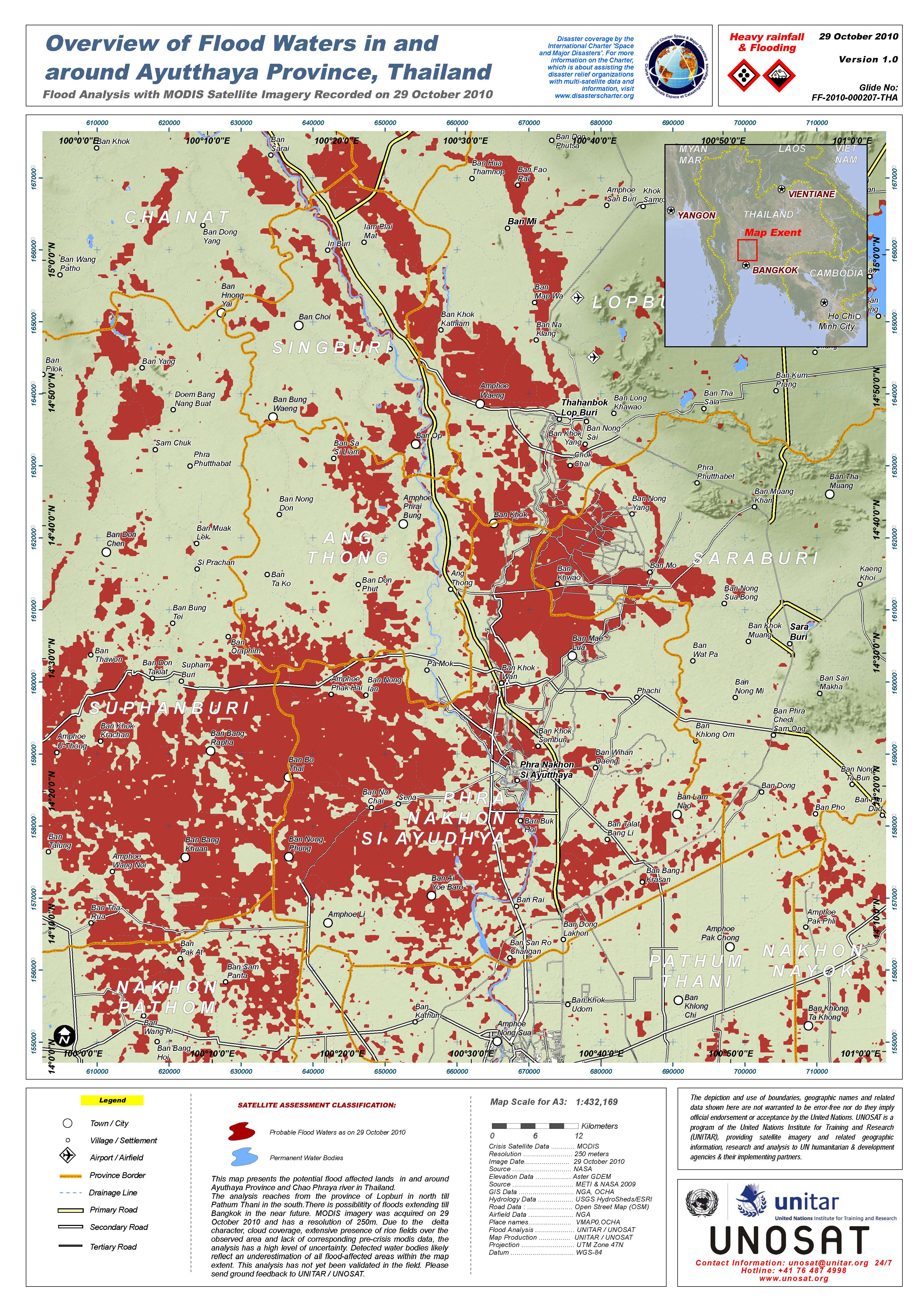
Inundaciones en Tailandia
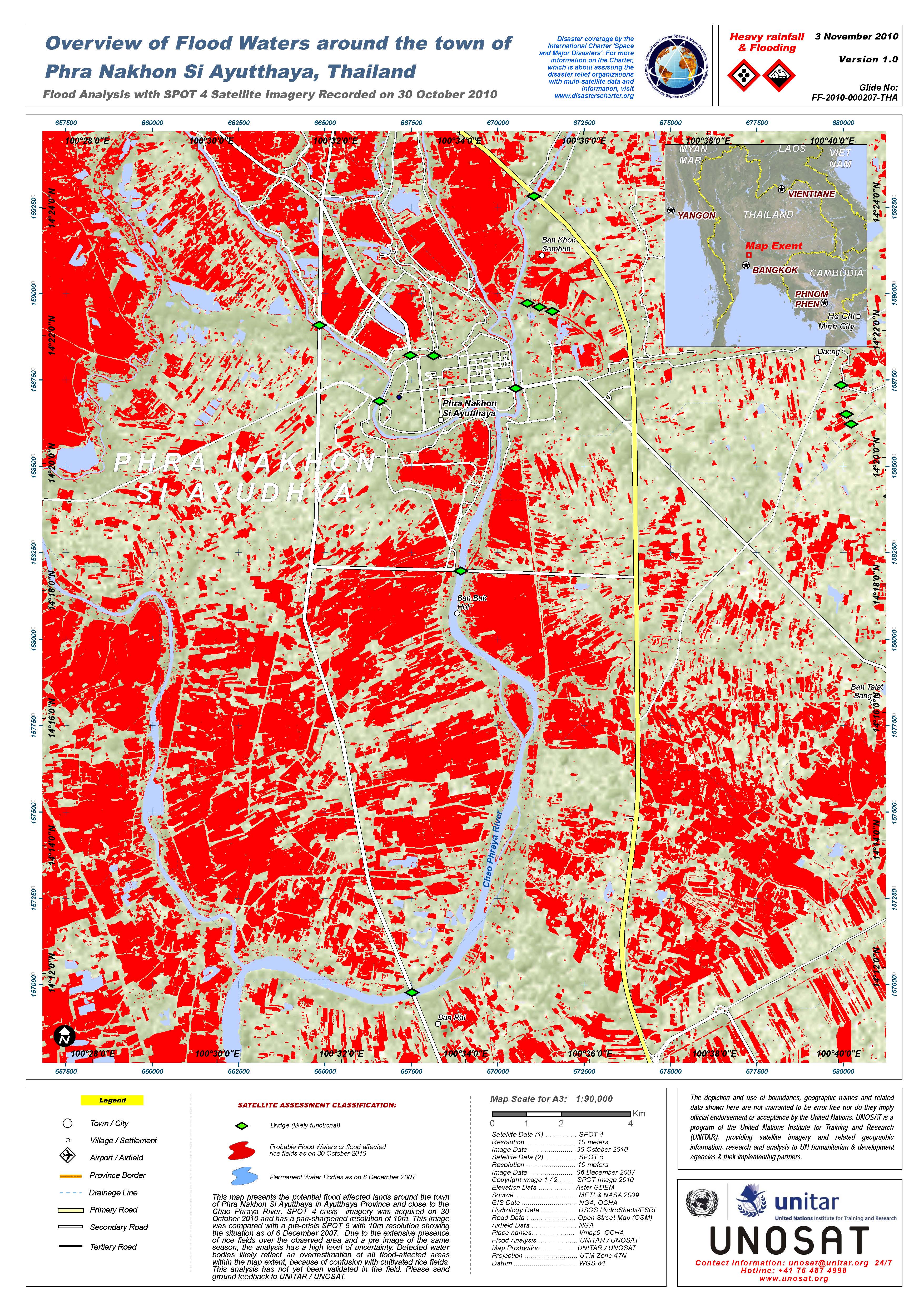
Las inundaciones continúan afectando a 3,2 millones de personas en 27 provincias. Las provincias centrales de Ayutthaya, Pathum Thani y Nonthaburi han sufrido importantes daños, causados en su mayor parte por agua marina.
En la región noreste, las aguas del río Mul han llegado al distrito de Buri Ram’s Sateuk y alcanzarán Ubon Ratchathani el día 2 de noviembre con un caudal de 3200 metros cúbicos por segundo; se estima que las aguas del río Chi llegarán a ese punto el 9 de noviembre de 2010.
Solicitud presentada a través del proceso de escalado Centinela Asia
| Type of Event: | Inundaciones |
| Location of Event: | Tailandia |
| Date of Charter Activation: | 30 octubre 2010 |
| Charter Requestor: | ARDC para Geo-Informatics and Space Development Agency of Thailand (GISTDA) |
| Project Management: | UNOSAT |
Products


 Back to the full activation archive

