 English
 Spanish
 French
 Chinese
 Russian
 Portuguese
 Dernière activation
Charter activations
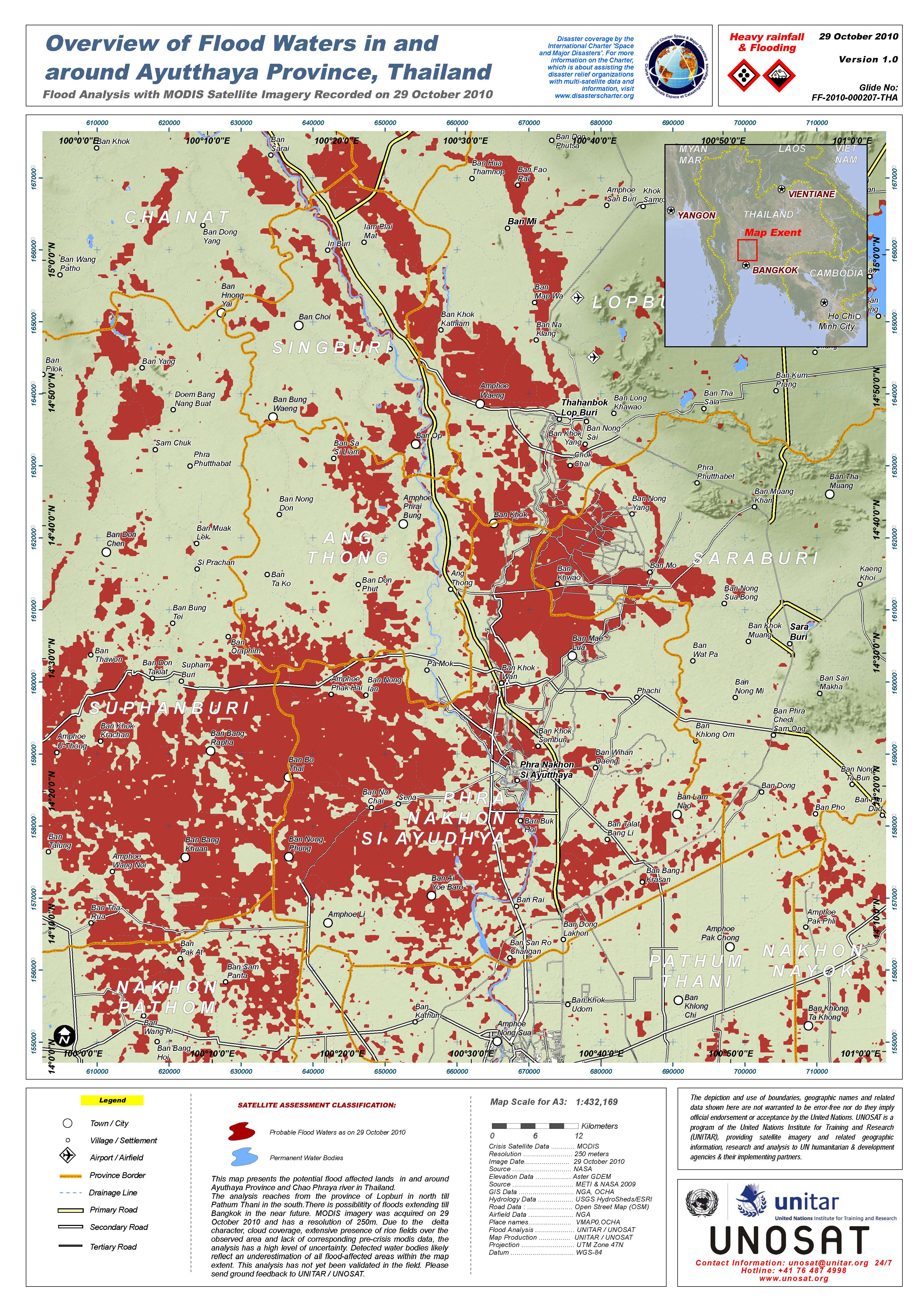
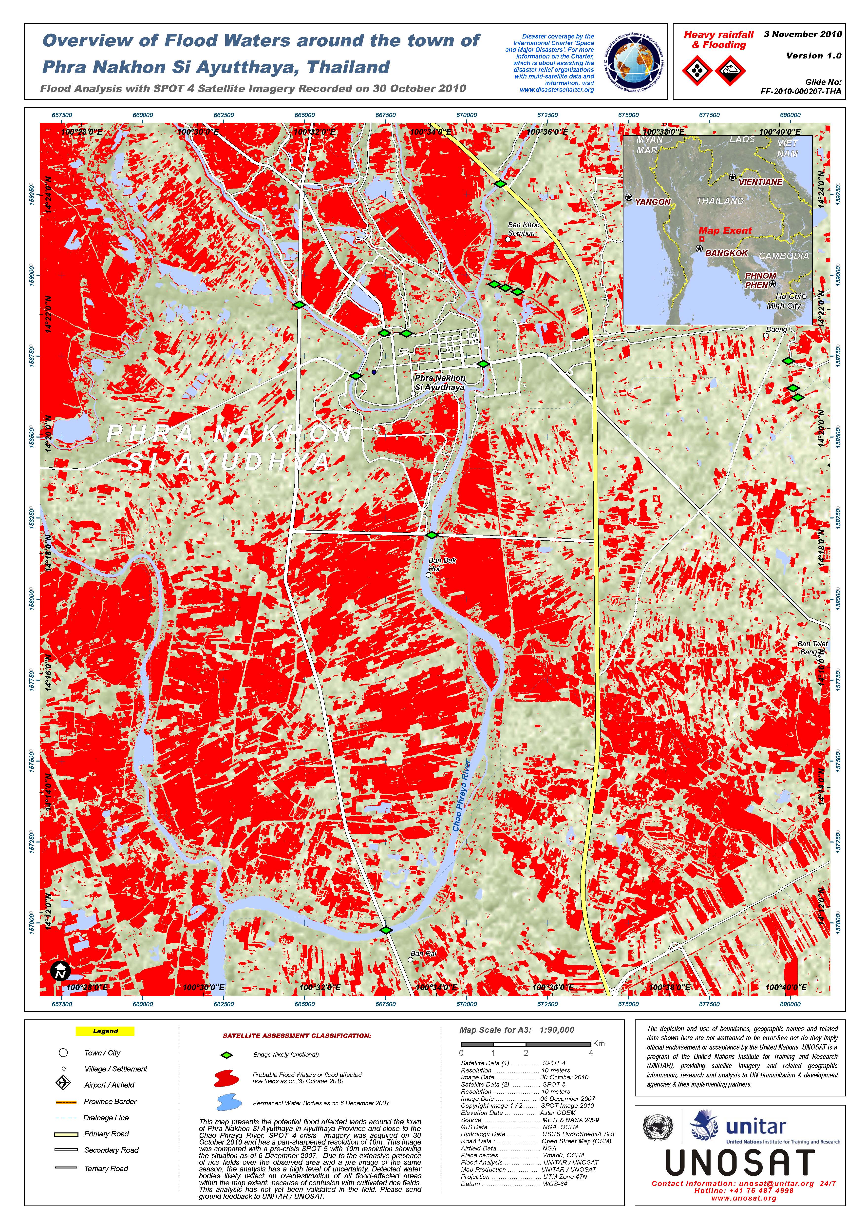
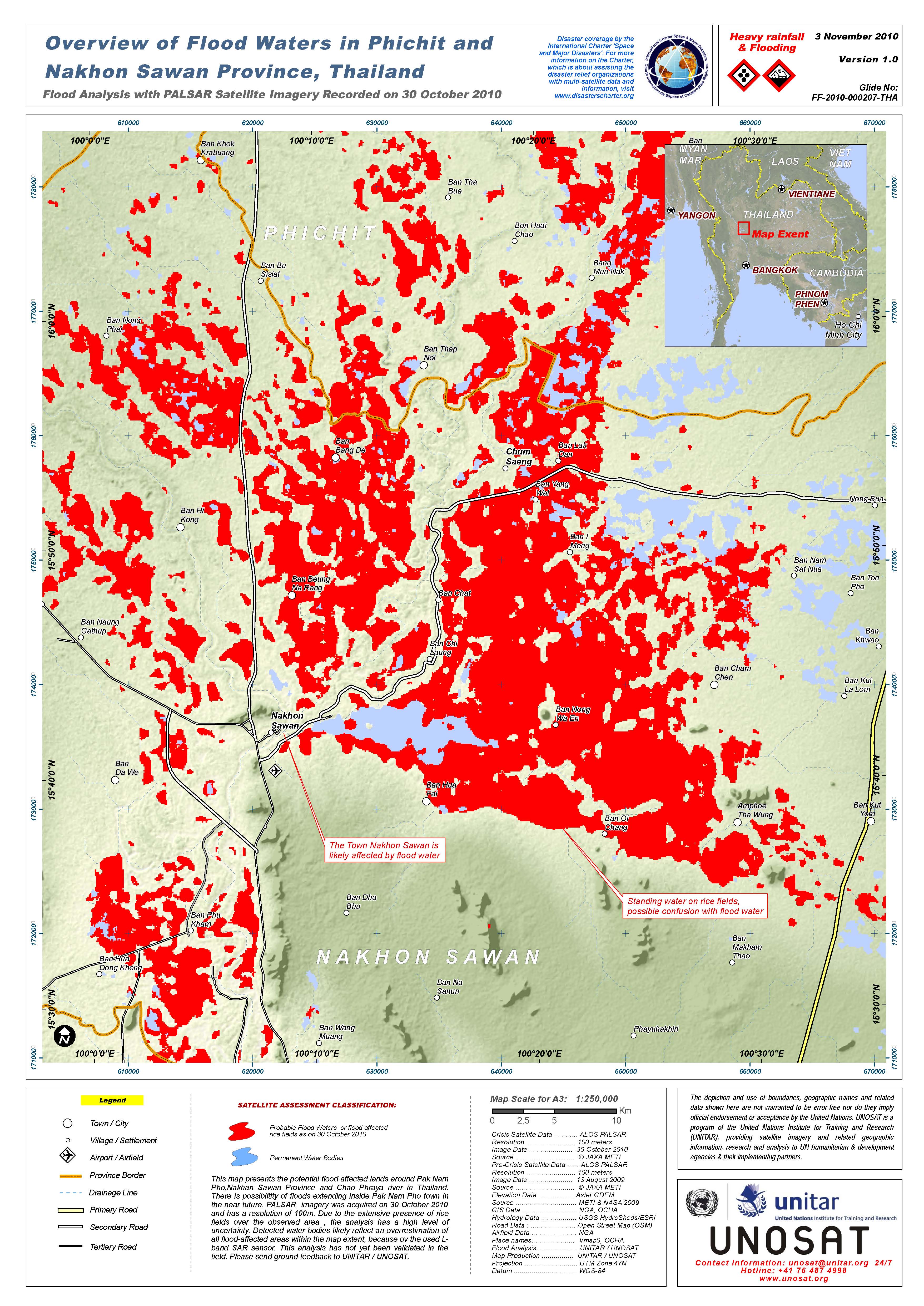
Inondations en Thaïlande
3,2 millions de personnes dans 27 provinces continuent d’être touchées par les inondations. Les provinces d’Ayutthaya, Pathum Thani et Nonthaburi ont été sévèrement touchées, principalement à cause de la montée des eaux de mer.
Dans la région du nord-est, les eaux de la rivière Mul ont maintenant atteint le district de Buri Ram’s Sateuk et atteindraient Ubon Ratchathani le 2 Novembre 2010 à 3,200 mètre cube/seconde, tandis que les eaux de la rivière Chi l’atteindraient le 9 Novembre 2010.
Demande présentée par le procédé Sentinel escalade en Asie
| Type of Event: | Inondations |
| Location of Event: | Thaïlande |
| Date of Charter Activation: | 30 octobre 2010 |
| Charter Requestor: | ARDC pour Geo-Informatics and Space Development Agency of Thailand (GISTDA) |
| Project Management: | UNOSAT |
Products


 Back to the full activation archive

