 English
 Spanish
 French
 Chinese
 Russian
 Portuguese
 Последняя Активация
Charter activations
Cyclone Freddy in Madagascar
Tropical Cyclone Freddy made landfall on the eastern coast of Madagascar north of the town of Mananjary on February 21 2023, weeks after storm Cheneso smashed into the northeastern part of the country bringing in heavy winds and triggering downpours that caused extensive flooding, killing at least 33 people and forcing tens of thousands of people from their homes.
The storm was slightly weakened upon arrival with wind gusts exceeding 130km/h (81mph),
Officials reported that 7,000 people had been pre-emptively evacuated from the coastal region directly in the cyclone's path, and that waves could reach over 8m (26ft).
Related News and Resources:
| Тип события: | Cyclones |
| Место события: | Madagascar |
| Date of Charter Activation: | 2023-02-21 |
| Время активации Хартии: | 19:25 |
| TЧасовой пояс в районе активации Хартии: | UTC+01:00 |
| Запрос на активацию поступил от: | Bureau National de Gestion des Risques et des Catastrophes (BNGRC) |
| Номер активации: | 804 |
| Менеждер проекта от: | Stephen Clandillon (ICube-SERTIT) |
| act-value-adders: | Copernicus EMS (Copernicus EMS) Sitraka Ranoeliarivao (BUREAU NATIONAL DE GESTION DES RISQUES ET DES CATASTROPHES (BNGRC)) |
| Activation handled in collaboration with Copernicus Emergency Management Service |
Products
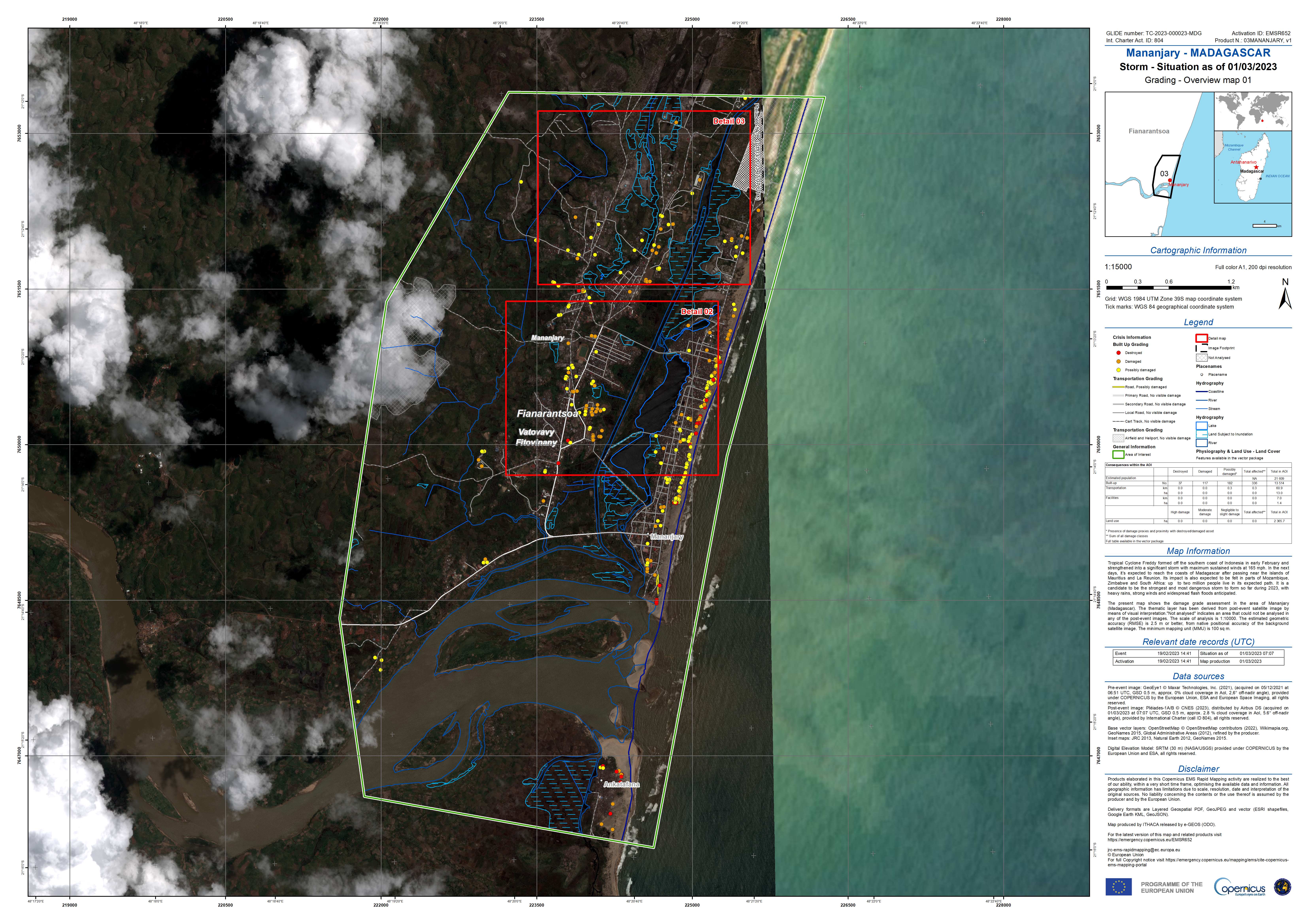
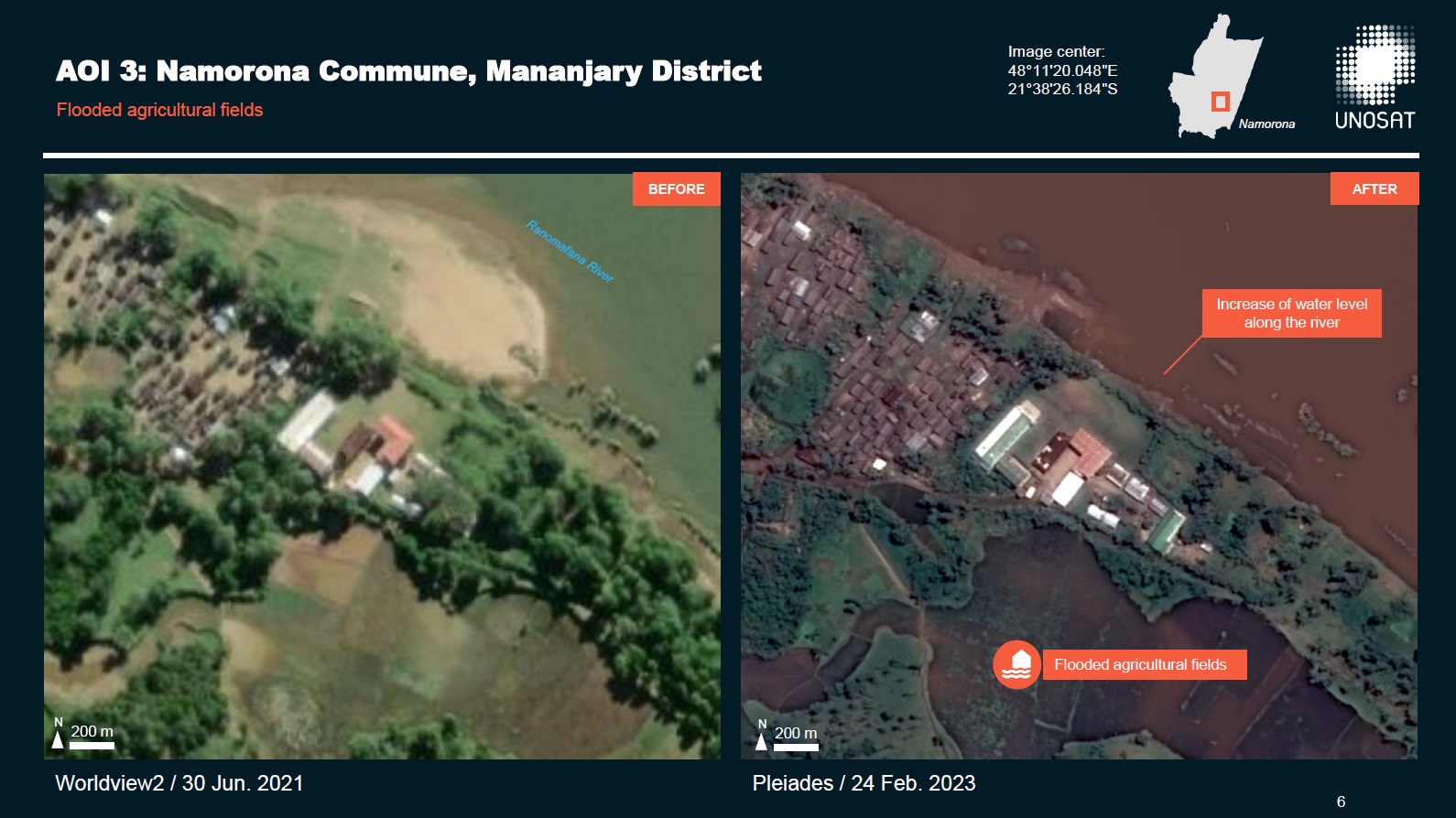
Preliminary Satellite-Derived Flood Assessment Report, Namorona Commune, Mananjary District, Vatovavy Fitovinany Region, Madagascar.
Download full report
Авторские права: Includes Pleiades material © CNES (2023), Distribution Airbus DS.
Report produced by UNITAR / UNOSAT
Information about the Product
Получено: 24/02/2023
01/03/2023
Источник: Pleiades
Категория: Dossier
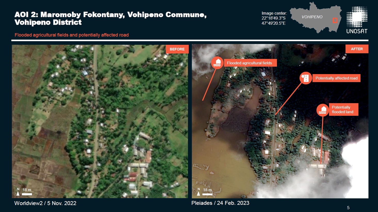
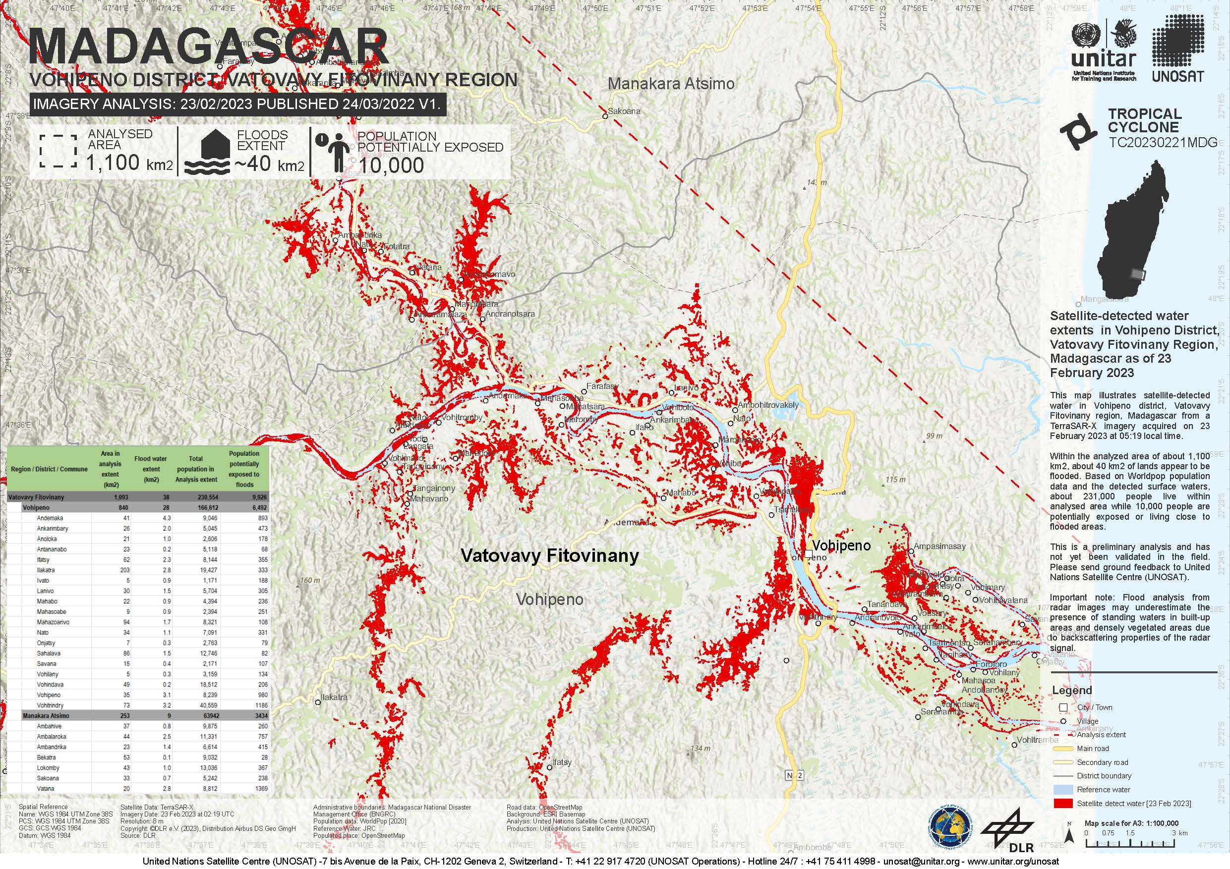
Preliminary Satellite-Derived Flood Assessment Report, Vohipeno District, Madagascar
Download full report
Авторские права: Includes Pleiades material © CNES (2023), Distribution Airbus DS.
Contains modified Copernicus Sentinel data (2023)
Report produced by UNITAR / UNOSAT
Information about the Product
Получено: Pleiades: 24/02/2023
Sentinel-2: 24/02/2023
Источник: Pleiades / Sentinel-2
Категория: Dossier
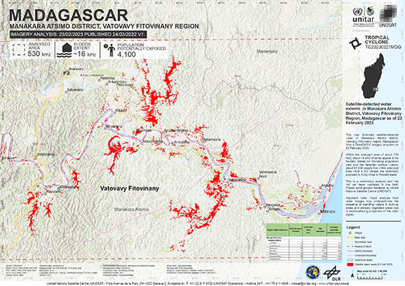
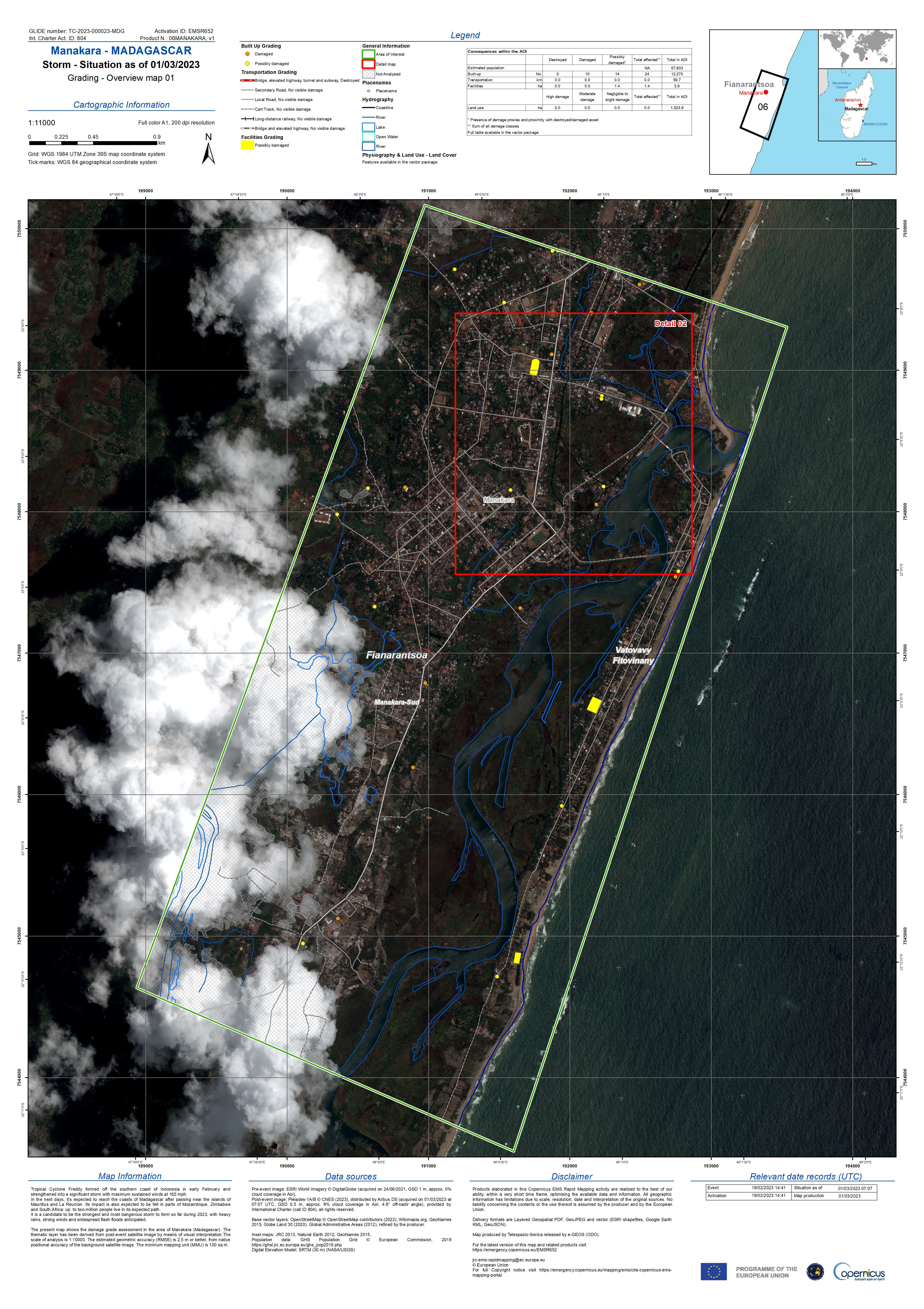
Satellite-detected water extents in Manakara Atsimo District, Vatovavy Fitovinany Region, Madagascar as of 23 February 2023
Авторские права: © DLR e.V. (2023), Distribution Airbus DS Geo GmbH
Map produced by UNITAR/UNOSAT.
Information about the Product
Получено: 23/02/2023
Источник: TerraSAR-X
Категория: Delineation Map
 Вернуться к полному архиву активаций

