 English
 Spanish
 French
 Chinese
 Russian
 Portuguese
 Последняя Активация
Charter activations
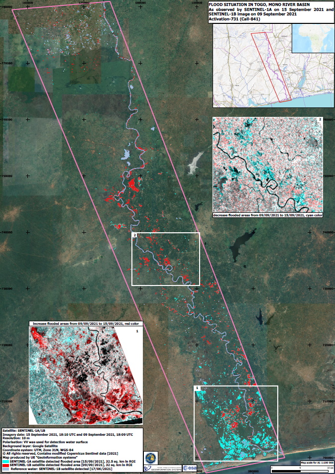
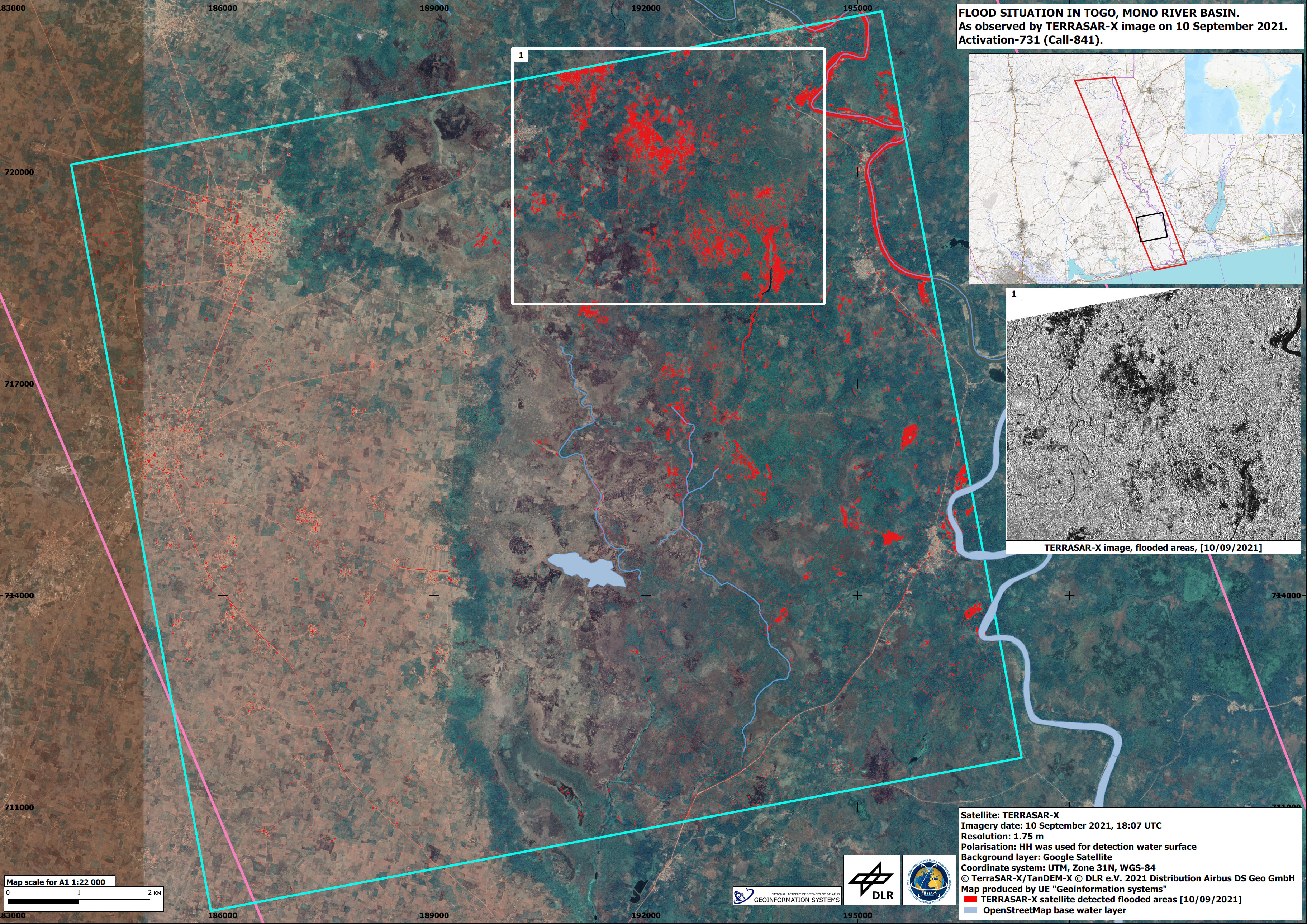
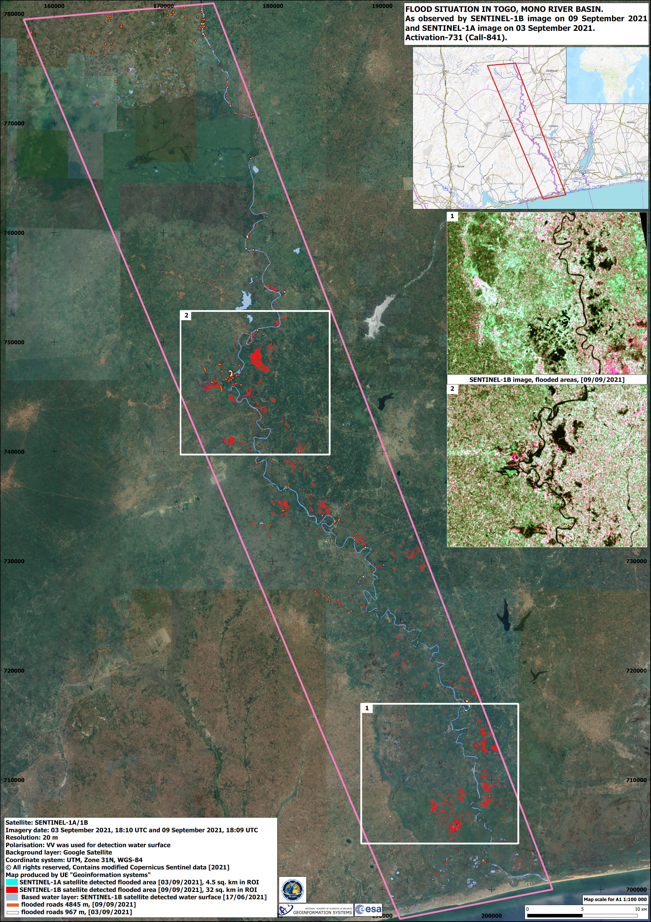
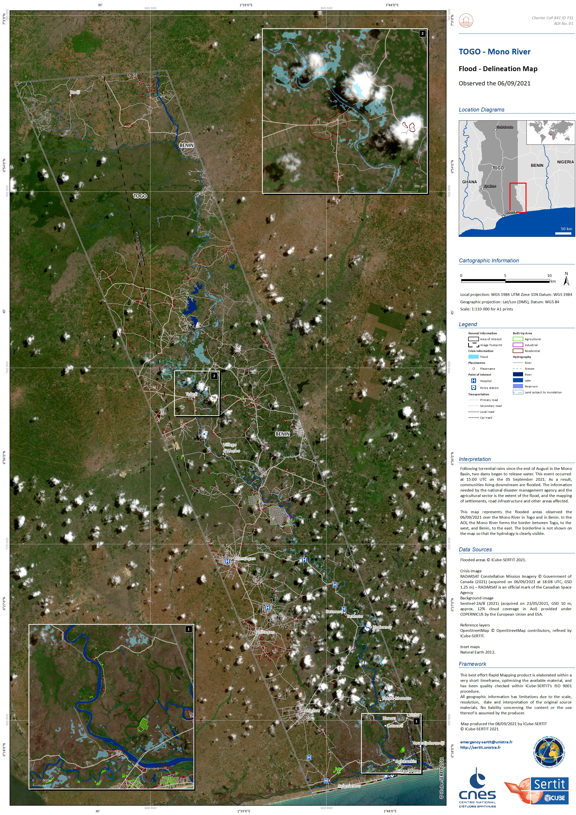
Flooding in Togo
Following torrential rains recorded at the end of August in the Mono River basin, two dams began to overflow. As a result, communities living in the immediate vicinity and downstream have had their houses and farmlands badly affected by flooding.
| Тип события: | Flood |
| Место события: | Togo |
| Date of Charter Activation: | 2021-09-06 |
| Время активации Хартии: | 10:47 |
| TЧасовой пояс в районе активации Хартии: | UTC+00:00 |
| Запрос на активацию поступил от: | National Agency for Civil Protection (ANPC) |
| Номер активации: | 731 |
| Менеждер проекта от: | ICube-SERTIT |
Products

Flood monitoring on Mono River, Togo
Авторские права: RADARSAT Constellation Mission Imagery © Government of Canada (2021) - RADARSAT is an official mark of the Canadian Space Agency
Map produced by ICube-SERTIT
Information about the Product
Получено: 09/09/2021
Источник: RCM
Категория: Reference Map
 Вернуться к полному архиву активаций

