 English
 Spanish
 French
 Chinese
 Russian
 Portuguese
 Dernière activation
Charter activations
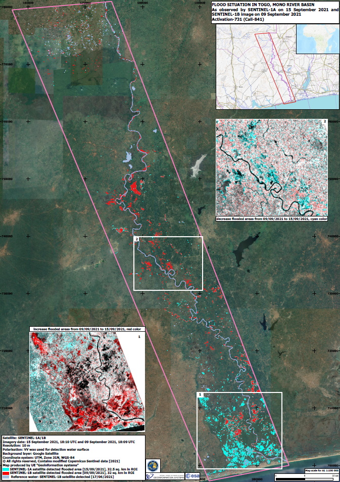
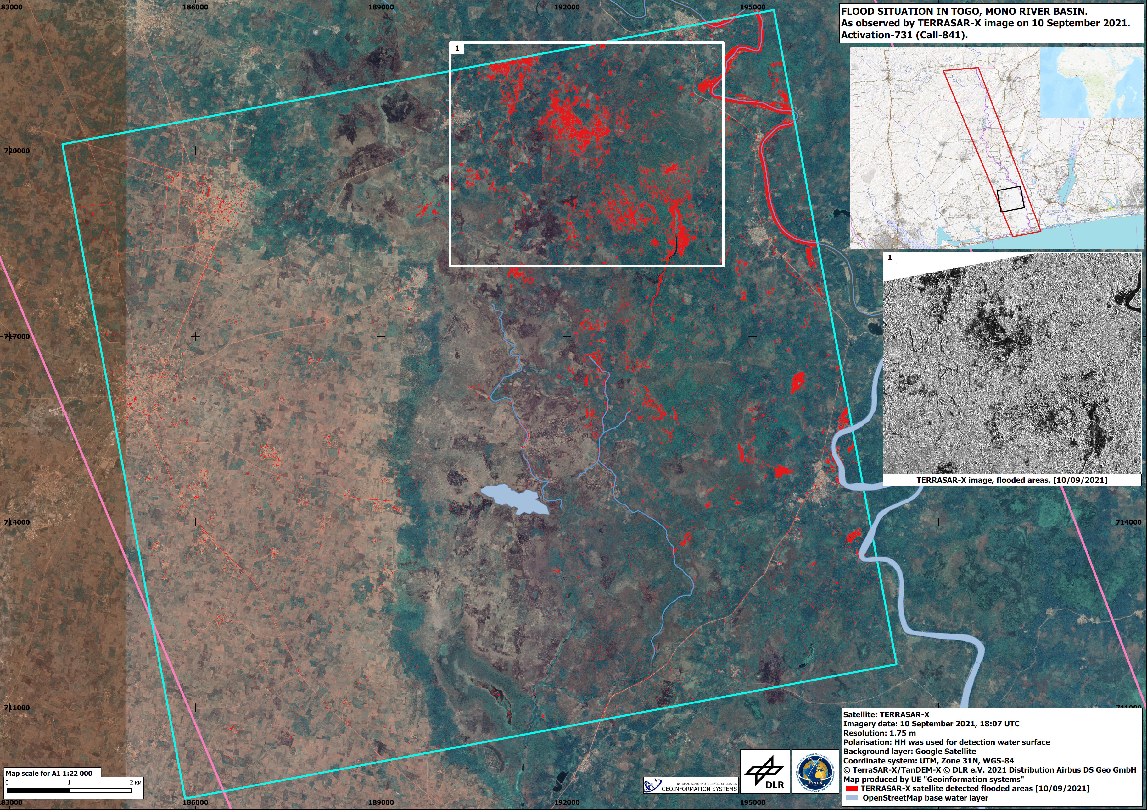
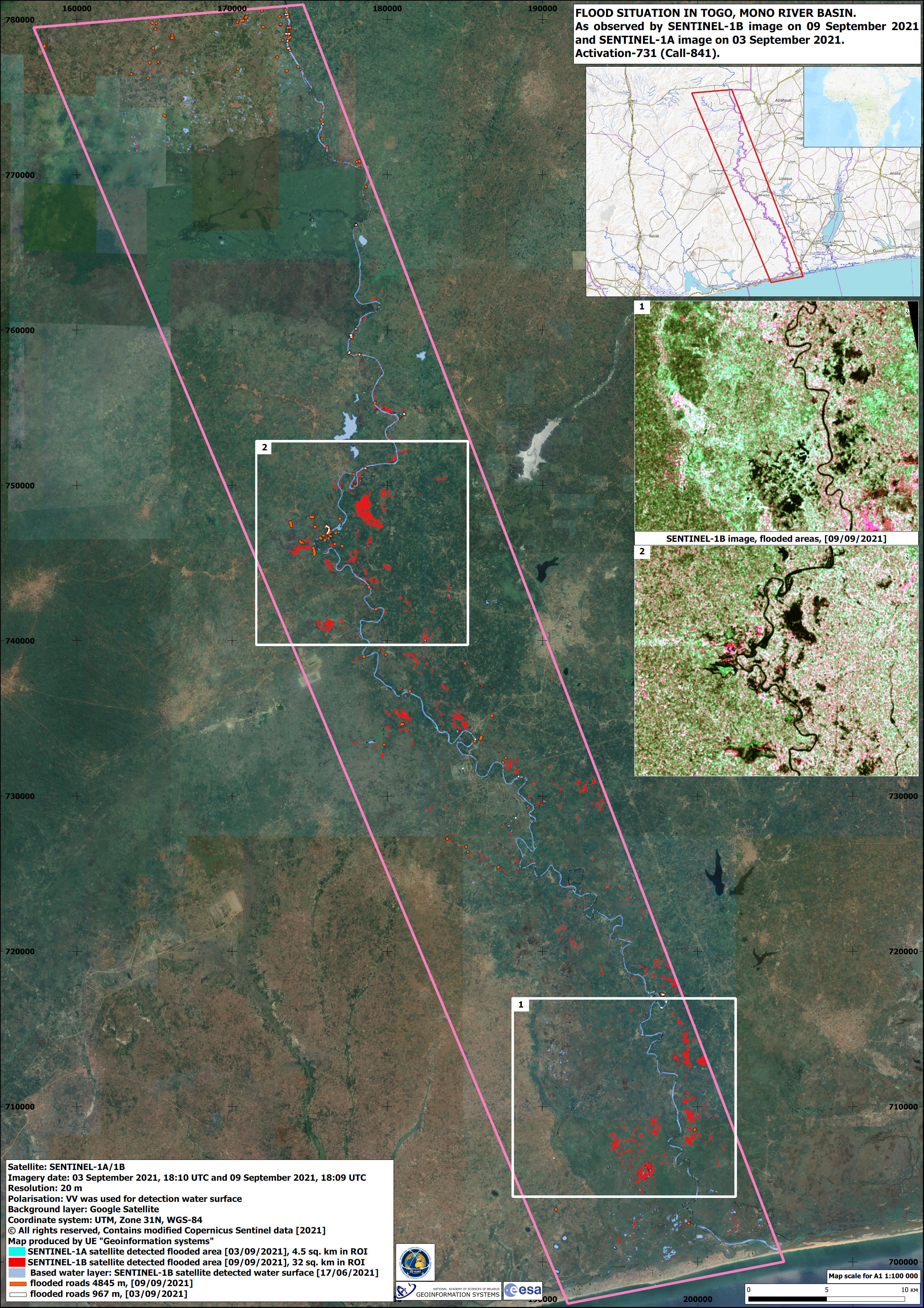
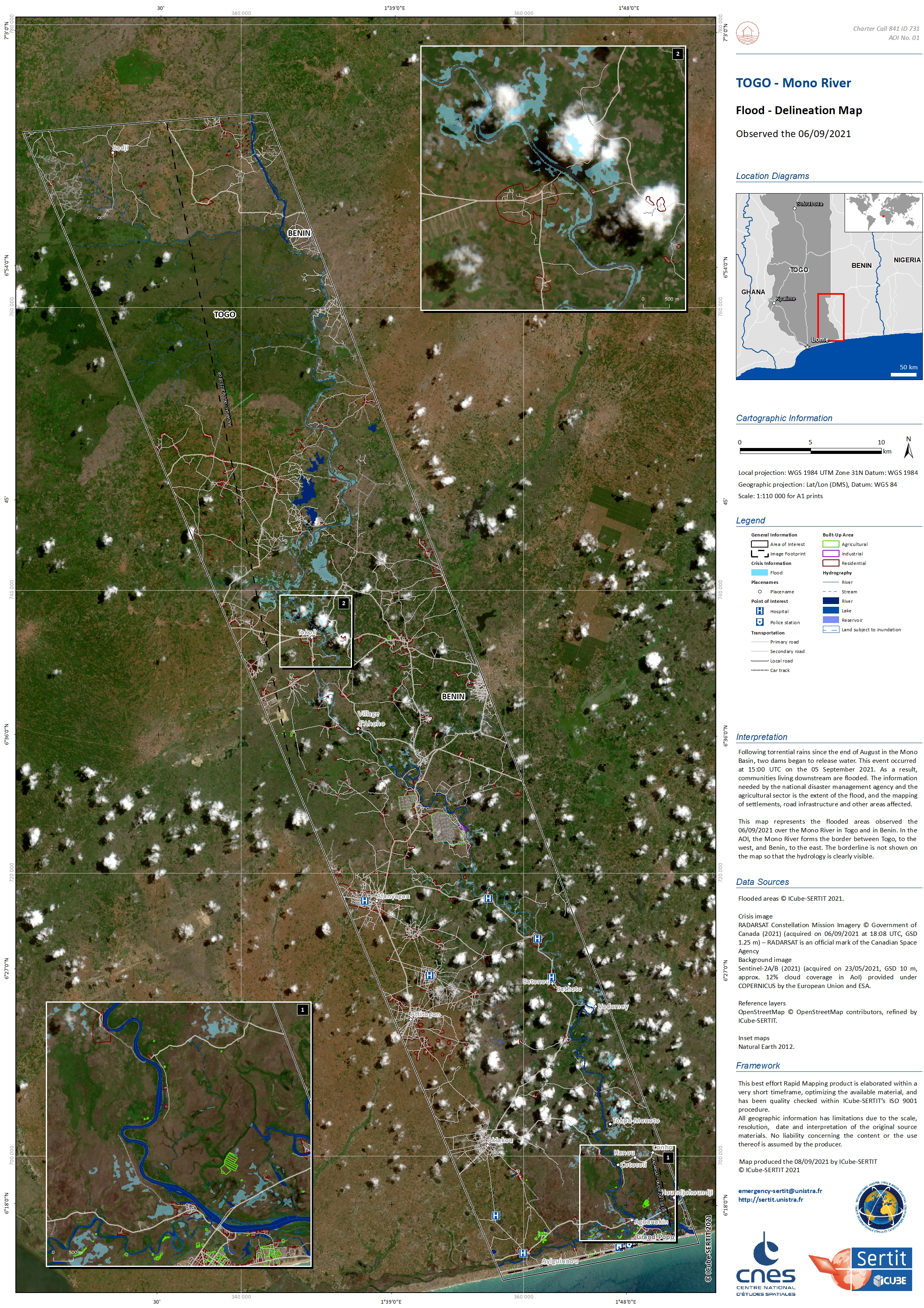
Flooding in Togo
Following torrential rains recorded at the end of August in the Mono River basin, two dams began to overflow. As a result, communities living in the immediate vicinity and downstream have had their houses and farmlands badly affected by flooding.
| Type of Event: | Flood |
| Location of Event: | Togo |
| Date of Charter Activation: | 2021-09-06 |
| Time of Charter Activation: | 10:47 |
| Time zone of Charter Activation: | UTC+00:00 |
| Charter Requestor: | National Agency for Civil Protection (ANPC) |
| Activation ID: | 731 |
| Project Management: | ICube-SERTIT |
Products

 Back to the full activation archive

