 English
 Spanish
 French
 Chinese
 Russian
 Portuguese
 Последняя Активация
Charter activations
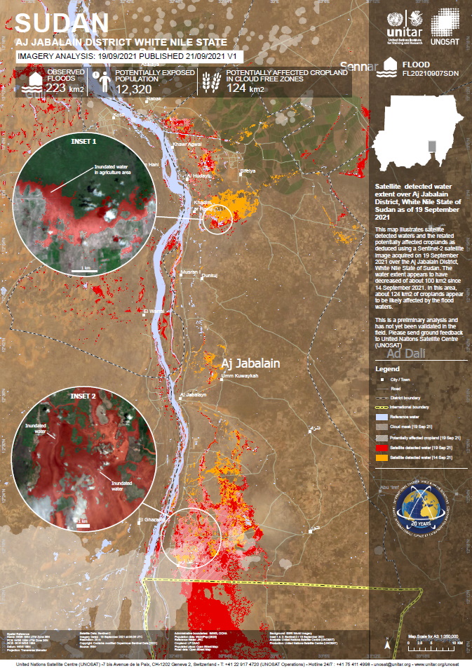
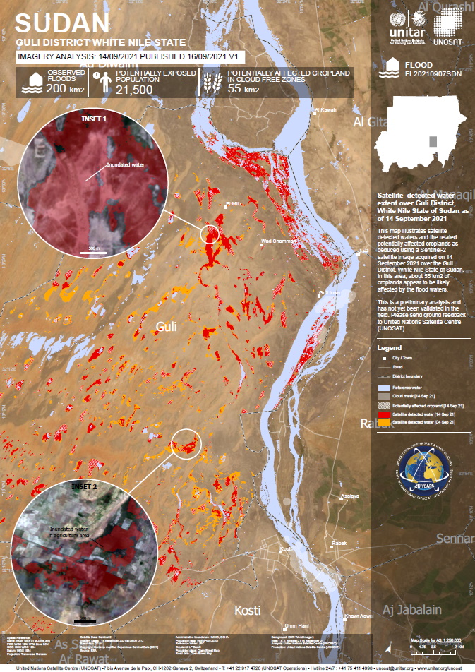
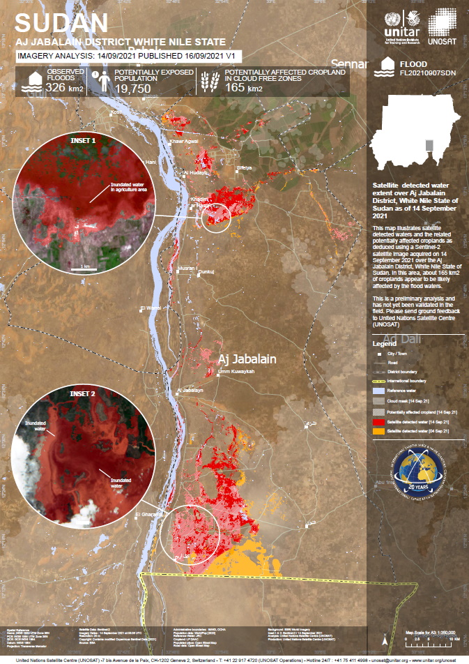
Flooding in Sudan
Flash floods following torrential rains have left a swath of destruction across Sudan. Entire farms and villages have been swept away, the capital Khartoum has been hit hard, and essential road links disrupted, while there are concerns that floods will also inundate the camps hosting thousands of South Sudanese refugees.
Humanitarian services continue to provide food and non-food items to people affected by floods in West Darfur, South Darfur, Gedaref, Khartoum, and River Nile states.
| Тип события: | Flood |
| Место события: | Sudan |
| Date of Charter Activation: | 2021-09-09 |
| Время активации Хартии: | 21:44 |
| TЧасовой пояс в районе активации Хартии: | UTC+02:00 |
| Запрос на активацию поступил от: | UNITAR on behalf of UNHCR |
| Номер активации: | 732 |
| Менеждер проекта от: | UNITAR / UNOSAT |
Products


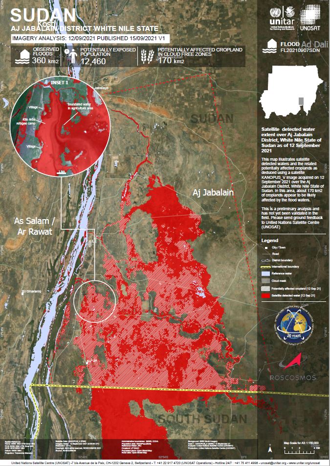
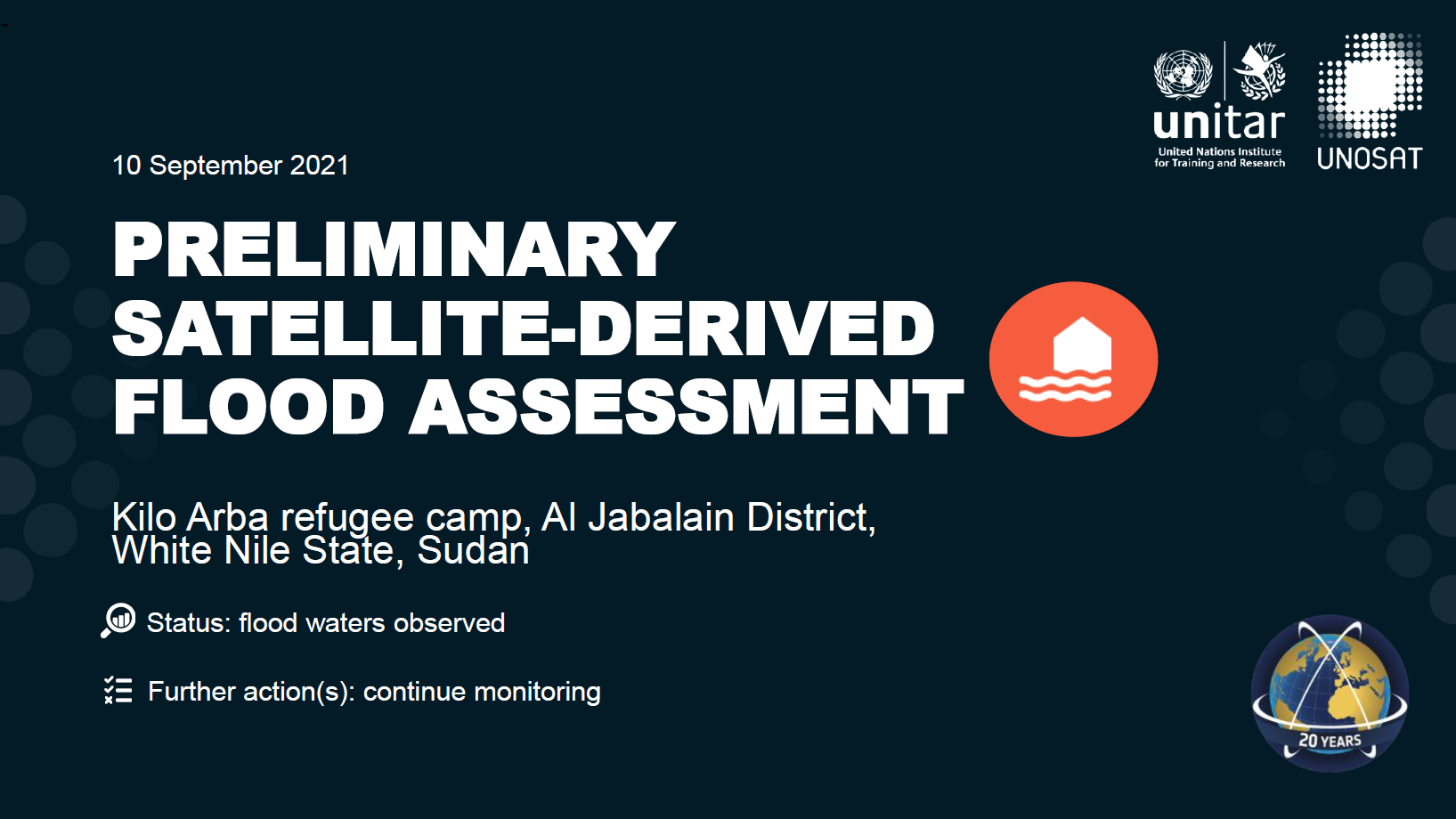
Preliminary flood assessment, Kilo Arba refugee camp, Al Jabalain District, White Nile State, Sudan
See full report
Авторские права: Includes Pleiades material © CNES (2021), Distribution Airbus DS.
Map produced by UNITAR /UNOSAT
Information about the Product
Получено: 10/09/2021
Источник: Pleiades
Категория: Reference Map
 Вернуться к полному архиву активаций

