Свернуть Последняя Активация

Charter activations

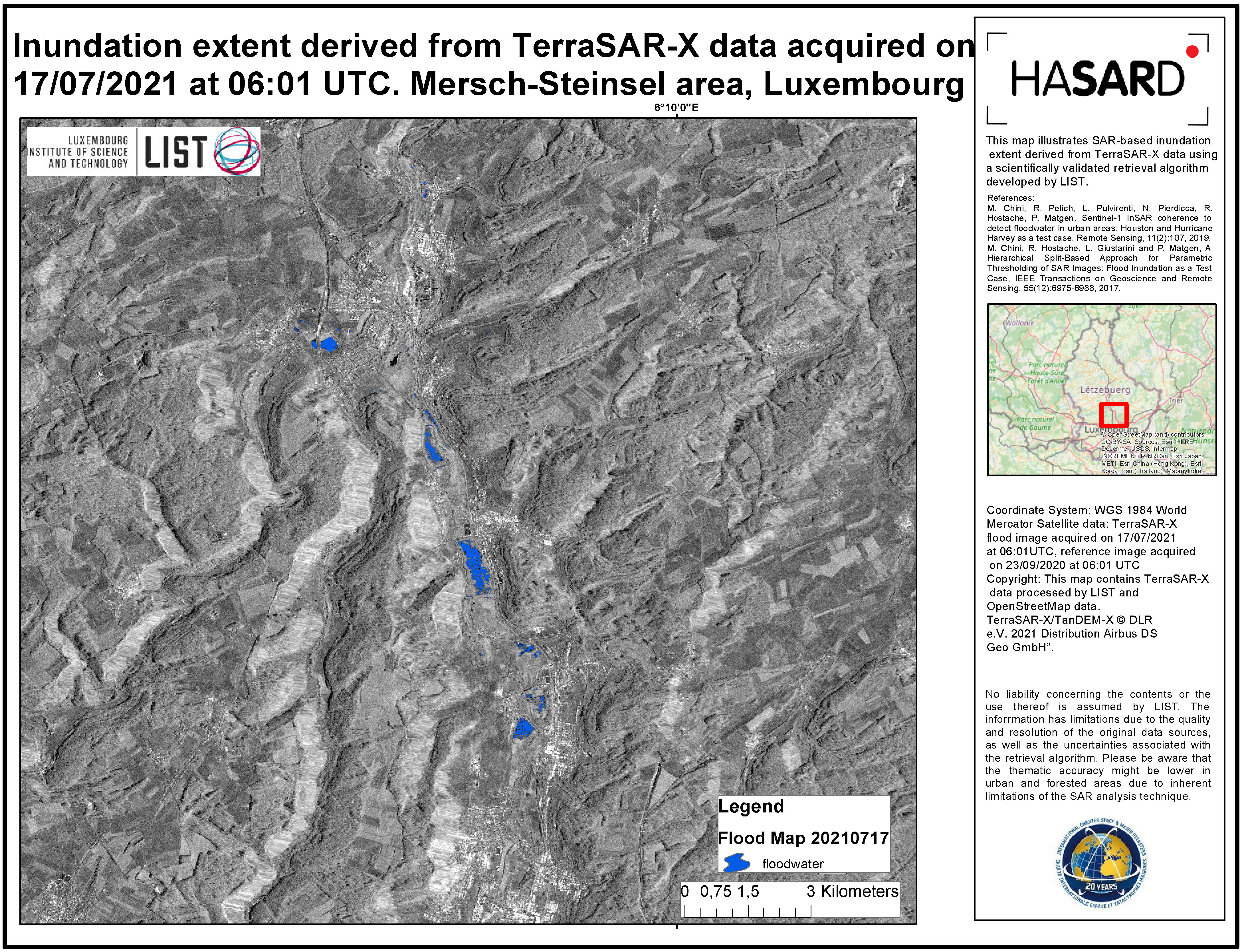
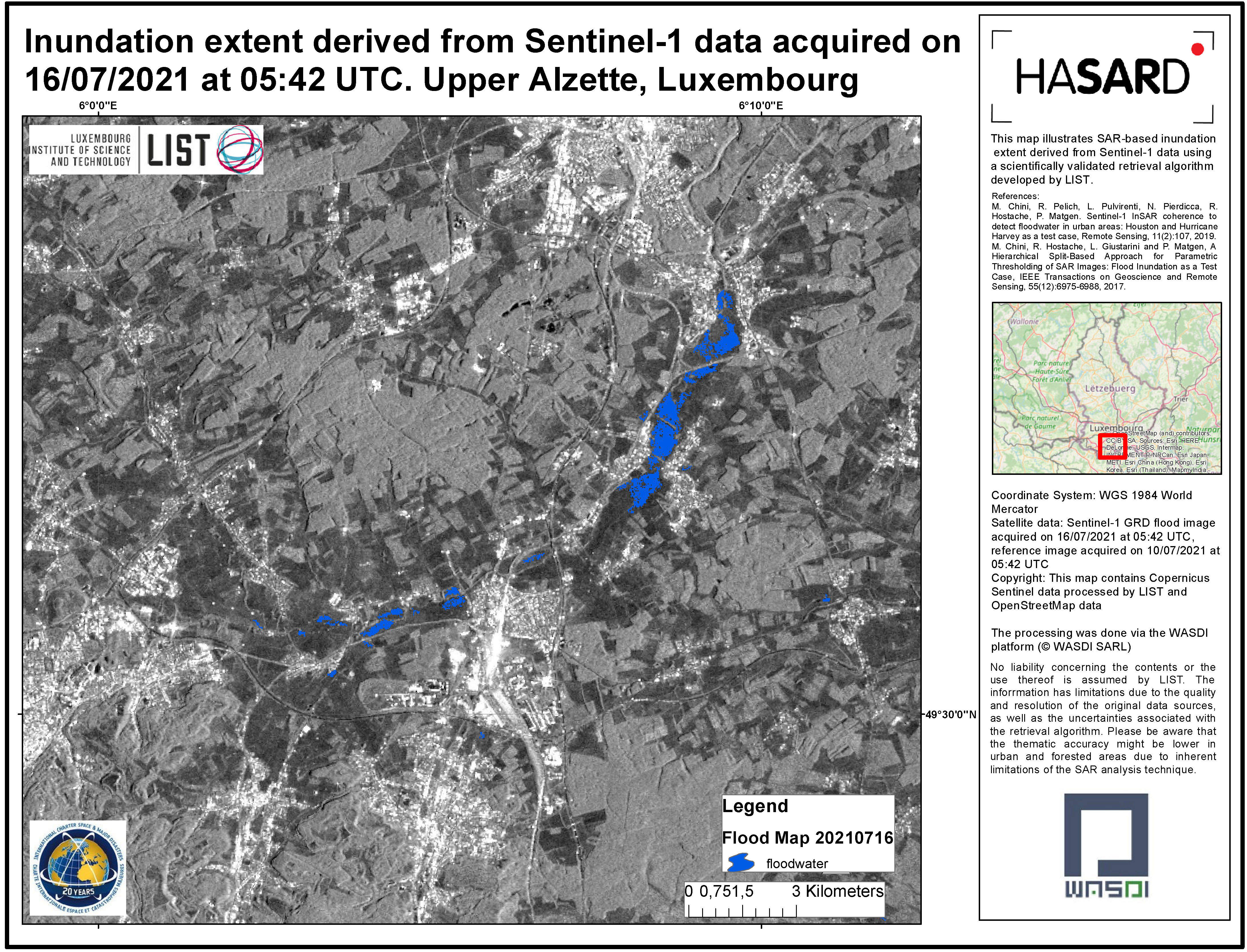
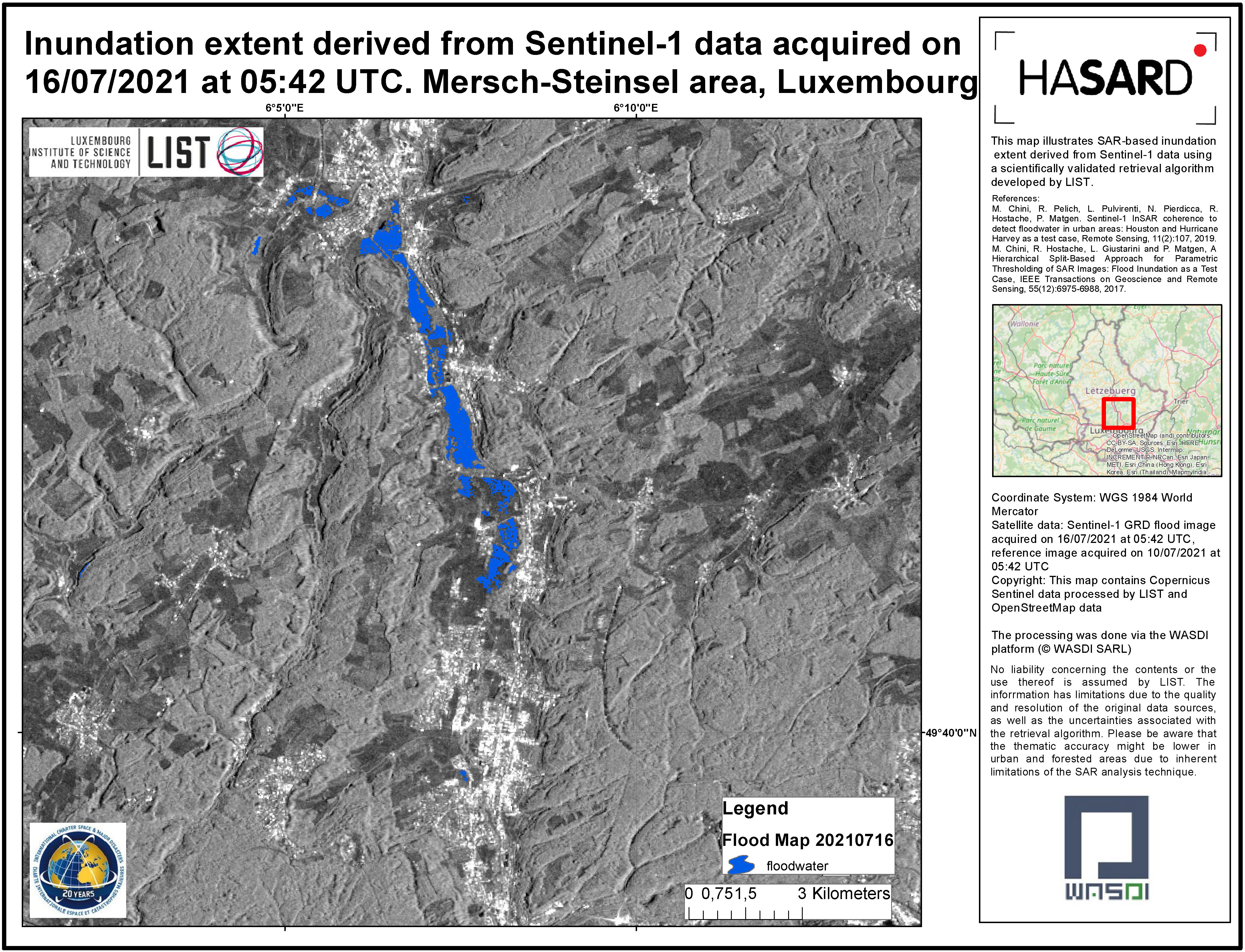
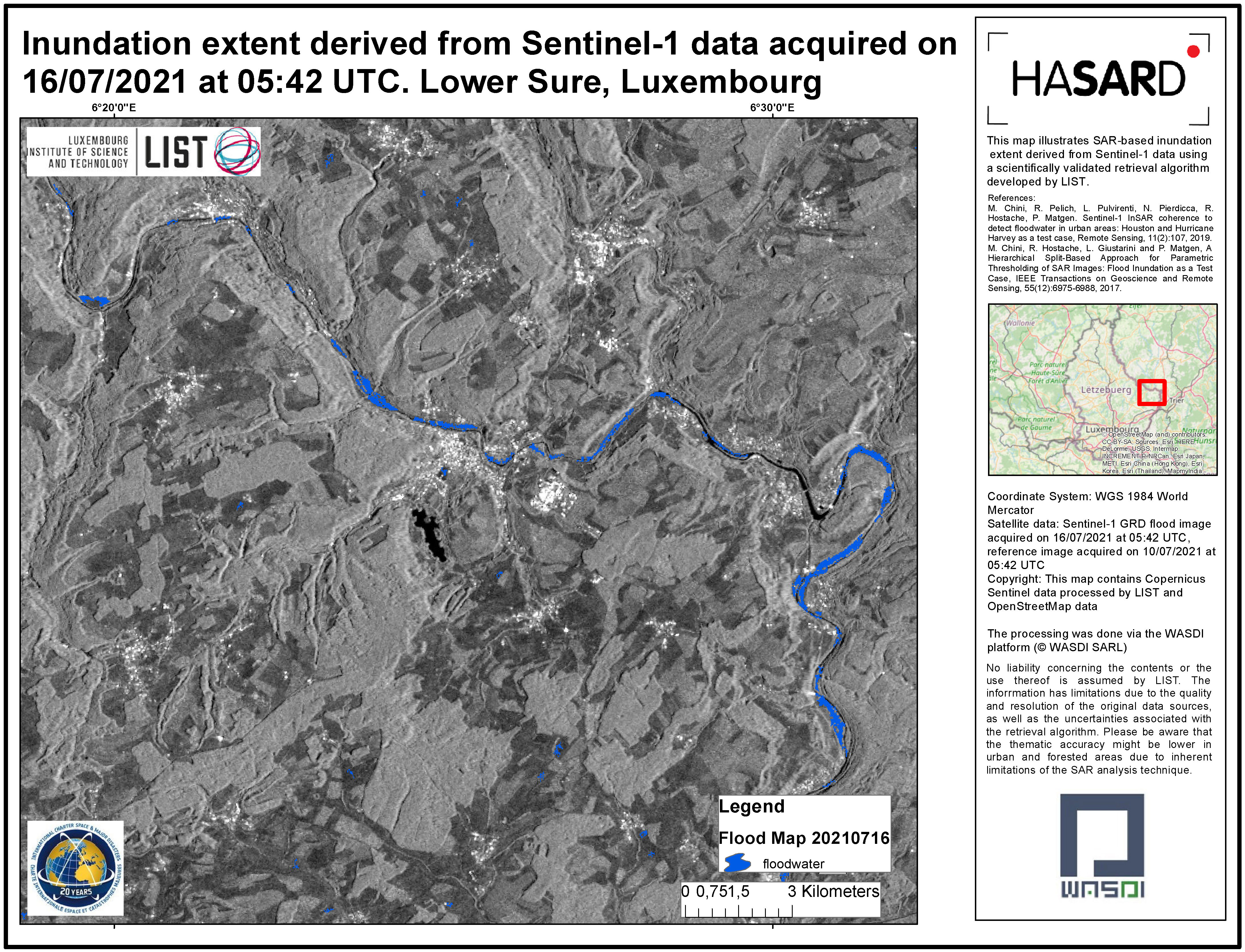
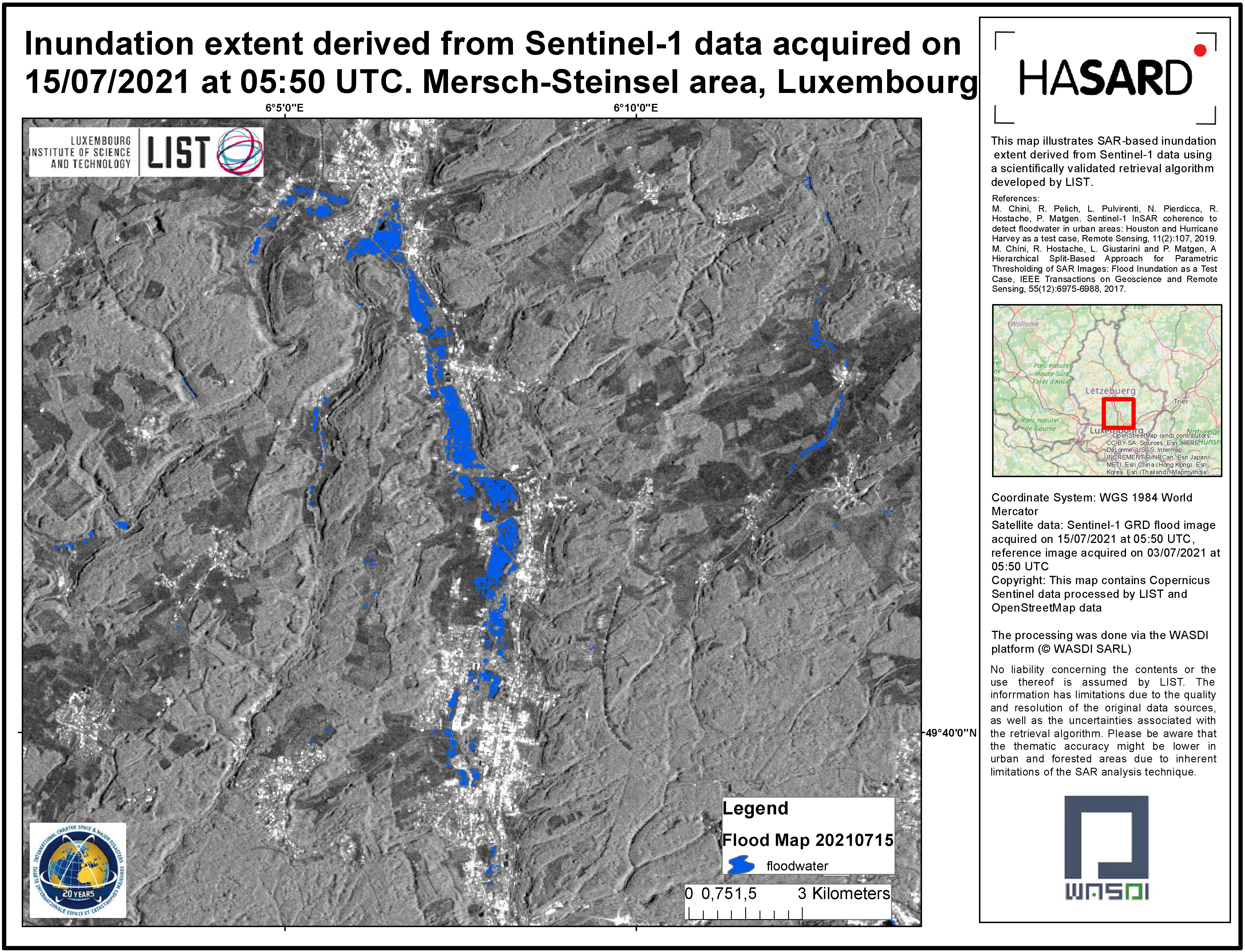
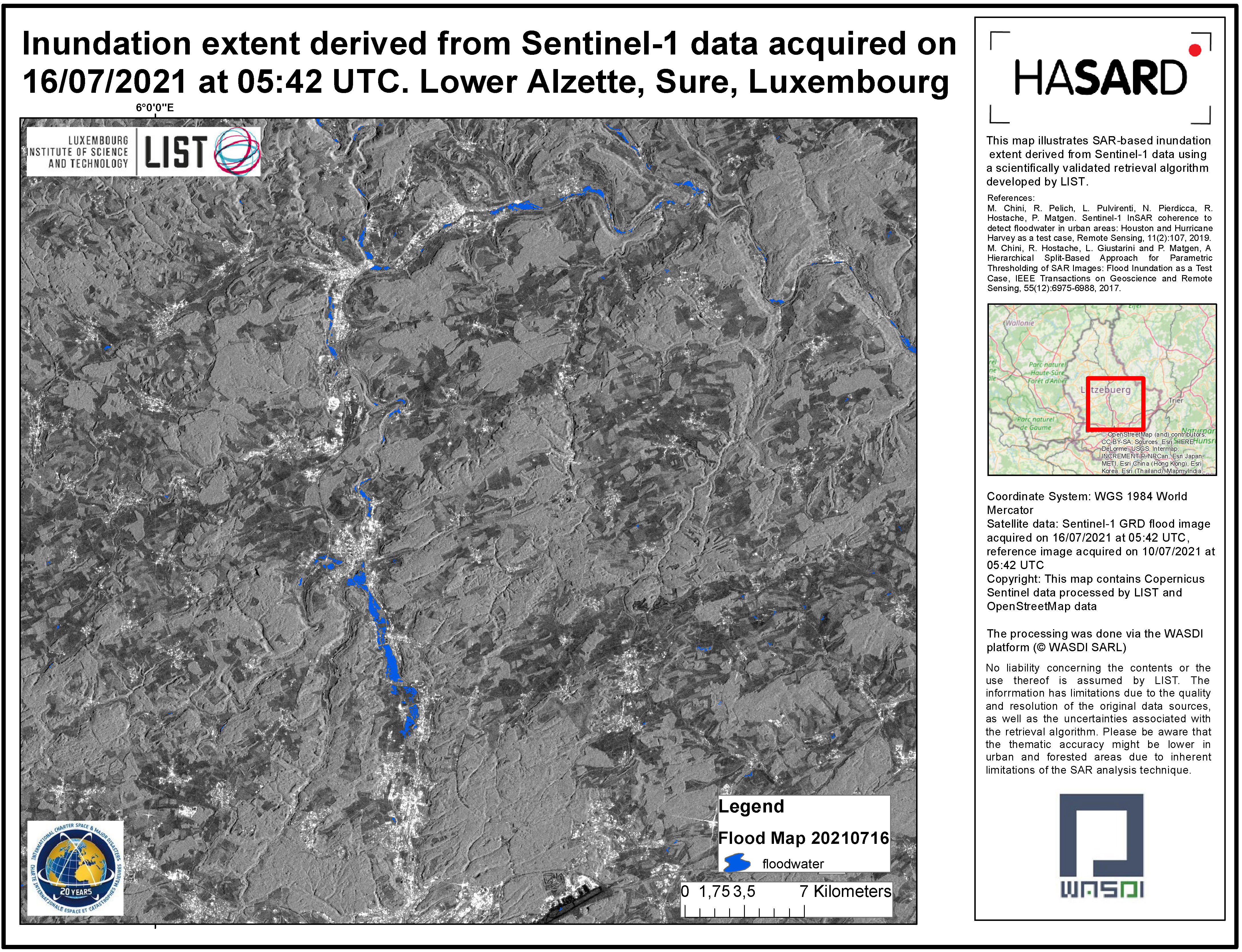
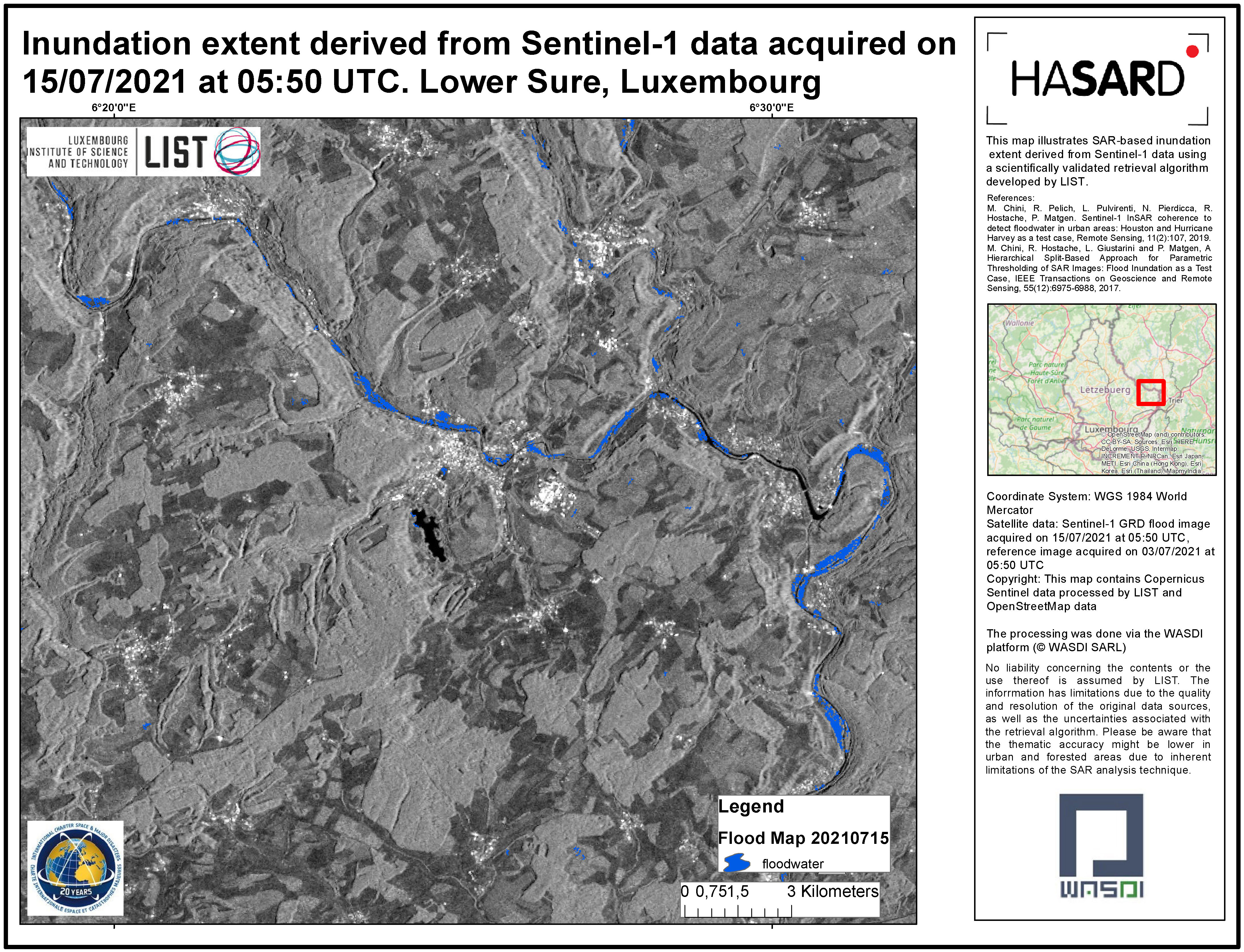
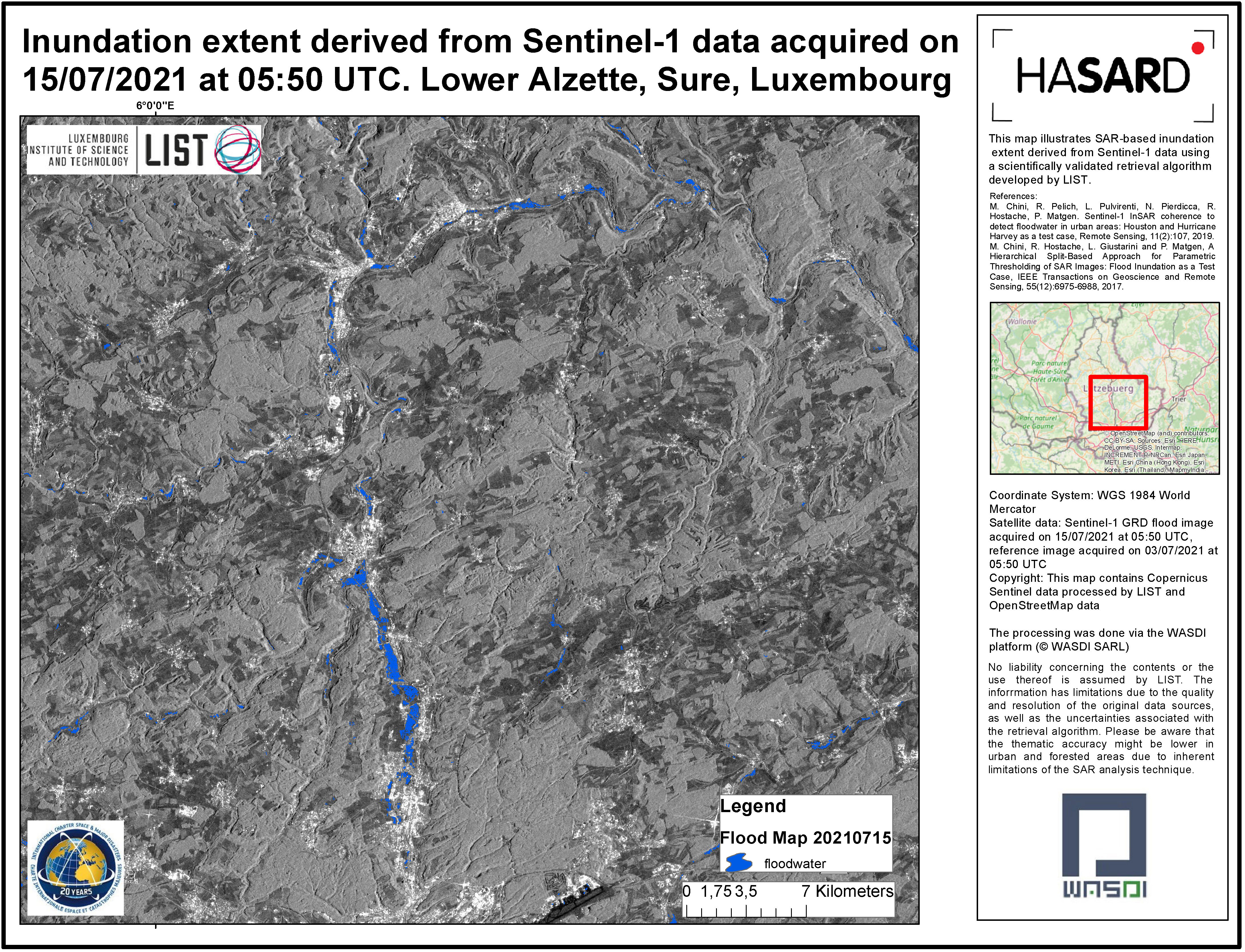
Flooding in Luxembourg

Torrential rain in Luxembourg has caused rivers to burst their banks, damaging homes and causing traffic disruption, and fallen trees have blocked roads.

The emergency services have reported people who were impacted by the floods have had to evacuate their homes and go to nearby centres. More rain is forecast, increasing the potential for further flooding.

Тип события:Floods
Место события:Luxembourg
Date of Charter Activation:2021-07-15
Время активации Хартии:14:11
TЧасовой пояс в районе активации Хартии:UTC+02:00
Запрос на активацию поступил от:CGDIS – National Fire and rescue Corps Luxembourg (Corps Grand-Ducal d'Incendie et de secours)
Номер активации:721
Менеждер проекта от:UNITAR

Products

Preliminary satellite-derived flood assessment over Luxembourg

Download the full report

Авторские права: Includes Pleiades material © CNES (2021), Distribution Airbus DS.
Report produced by UNITAR/UNOSAT

Information about the Product

Получено: 17/07/2021, 18/07/2021, 11/01/2021

Источник: Pleiades

Категория: Dossier

Flood extent at Mersch-Steinsel area, Luxembourg

Авторские права: © DLR e.V. (2021), Distribution Airbus DS Geo GmbH
Map produced by LIST

Information about the Product

Получено: TanDEM-X: 17/07/2021
TerraSAR-X: 23/09/2020

Источник: TanDEM-X / TerraSAR-X

Категория: Delineation Map

Flood extent at Upper Alzette, Luxembourg

Авторские права: Contains modified Copernicus Sentinel data (2021)
Map produced by LIST

Information about the Product

Получено: 10/07/2021 and 16/07/2021

Источник: Sentinel-1

Категория: Delineation Map

Flood extent at Mersch-Steinsel area, Luxembourg

Авторские права: Contains modified Copernicus Sentinel data (2021)
Map produced by LIST

Information about the Product

Получено: 10/07/2021 and 16/07/2021

Источник: Sentinel-1

Категория: Delineation Map

Flood extent at Lower Sure, Luxembourg

Авторские права: Contains modified Copernicus Sentinel data (2021)
Map produced by LIST

Information about the Product

Получено: 10/07/2021 and 16/07/2021

Источник: Sentinel-1

Категория: Delineation Map

Flood extent at Mersch-Steinsel area, Luxembourg

Авторские права: Contains modified Copernicus Sentinel data (2021)
Map produced by LIST

Information about the Product

Получено: 03/07/2021 and 15/07/2021

Источник: Sentinel-1

Категория: Delineation Map

Flood extent at Upper Alzette, Luxembourg

Авторские права: Contains modified Copernicus Sentinel data (2021)
Map produced by LIST

Information about the Product

Получено: 03/07/2021 and 15/07/2021

Источник: Sentinel-1

Категория: Delineation Map

Flood extent at Lower Alzette, Sure, Luxembourg

Авторские права: Contains modified Copernicus Sentinel data (2021)
Map produced by LIST

Information about the Product

Получено: 10/07/2021 and 16/07/2021

Источник: Sentinel-1

Категория: Delineation Map

Flood extent at Lower Sure, Luxembourg

Авторские права: Contains modified Copernicus Sentinel data (2021)
Map produced by LIST

Information about the Product

Получено: 03/07/2021 and 15/07/2021

Источник: Sentinel-1

Категория: Delineation Map

Flood extent at Lower Alzette, Sure, Luxembourg

Авторские права: Contains modified Copernicus Sentinel data (2021)
Map produced by LIST

Information about the Product

Получено: 03/07/2021 and 15/07/2021

Источник: Sentinel-1

Категория: Delineation Map

Вернуться к полному архиву активаций