Свернуть Последняя Активация

Charter activations

Flood in Venezuela

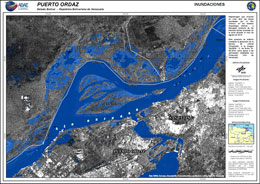
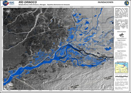
Persistent heavy rains have caused severe flooding in the Venezuelan provinces of Amazonas, Apure, Bolivar and Anzoategui. Over 10,000 people have been affected, with 36 sectors in the province on a red alert defined by the Venezuelan Civil Protection.

The Orinoco river burst its banks as it rose to levels not seen in 40 years. An aerial bridge has been set up by authorities so supplies of food and medicines can reach affeced persons.

Major arterial roads have been closed isolating some areas and many schools have closed. Local authorities have asked for donations of items such as tents, blankets and mats to aid those that have lost their homes.

The red alert is set to be in place until the end of August, with rains expected to continue to fall in the coming days.

Тип события:Flood
Место события:Venezuela
Date of Charter Activation:2018-08-15
Время активации Хартии:23:51
TЧасовой пояс в районе активации Хартии:UTC+01:00
Запрос на активацию поступил от:Venezuelan Civil Protection Directora de Gestión del Riesgo Dirección Nacional de Protección Civil y Administración de Desastres
Номер активации:581
Менеждер проекта от:ABAE

Products

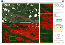
Flooding at Boca Araguáito in Delta Amacuro State, Venezuela

Авторские права: © DigitalGlobe Inc.
Map produced by ABAE

Information about the Product

Получено: 23/08/2018

Источник: WordView-2

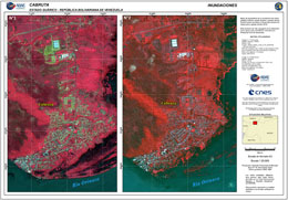
Flooding at Cabruta in Guárico State, Venezuela

Авторские права: VRSS-1 © ABAE (2018) - All rights reserved
Pleiades © CNES (2018), Distribution: Airbus DS
Map produced by ABAE

Information about the Product

Получено: VRSS-1: 09/07/2016
Pleiades: 16/08/2018

Источник: VRSS-1 / Pleiades

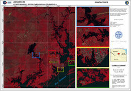
Flooding at Barrancas in Monagas State, Venezuela

Авторские права: © KARI 2018
Map produced by ABAE

Information about the Product

Получено: 26/08/2018

Источник: KOMPSAT-3

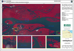
Flooding at Sacupana in Delta Amacuro State, Venezuela

Авторские права: © DigitalGlobe Inc.
Map produced by ABAE

Information about the Product

Получено: 23/08/2018

Источник: WorldView-2

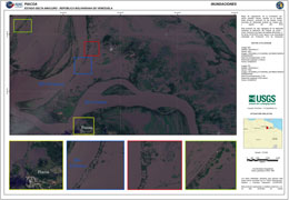
Flooding at Piacoa, in Delta Amacuro State, Venezuela

Авторские права: © DigitalGlobe Inc.
Map produced by ABAE

Information about the Product

Получено: 23/08/2018

Источник: WorldView-2

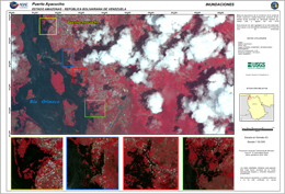
Floods at Puerto Ayacucho in Bolivar State, Venezuela

Авторские права: © DigitalGlobe Inc.
Map produced by ABAE

Information about the Product

Получено: 24/08/2018

Источник: WorldView-3

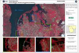
Floods at Puerto Ayacucho in Bolivar State, Venezuela

Авторские права: © DigitalGlobe Inc.
Map produced by ABAE

Information about the Product

Получено: 24/08/2018

Источник: WorldView-3

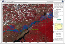
Floods at Ciudad Guayana in Bolivar State, Venezuela

Авторские права: Landsat 8 data and products © USGS (2018) - All rights reserved
Map produced by ABAE

Information about the Product

Получено: Pre-disaster: 01/04/2018
Post-disaster: 23/08/2018

Источник: Landsat 8

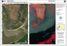
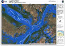
Flooding at Puerto Páez in Apure State, Venezuela

Авторские права: © KARI 2018
Map produced by ABAE

Information about the Product

Получено: 28/08/2018

Источник: KOMPSAT-2

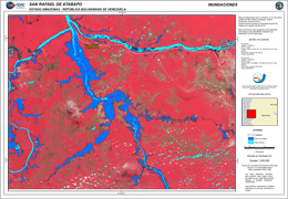
Flooding at San Rafael de Atabapo, Amazonas state, Venezuela

Авторские права: © INPE / CAST (2018) All rights reserved
Map produced by ABAE

Information about the Product

Получено: Pre-disaster: 30/01/2018
Post-disaster: 06/08/2018

Источник: CBERS-4

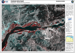
Flooding at Ciudad Bolívar, Bolivar State, Venezuela

Авторские права: © JAXA (2018) All rights reserved
Map produced by ABAE

Information about the Product

Получено: 28/05/2018 & 19/08/2018

Источник: ALOS

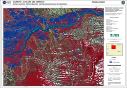
Flooding at Cabruta, Caicara del Orinoco, Venezuela

Авторские права: Landsat 8 data and products © USGS (2018) - All rights reserved
Map produced by ABAE

Information about the Product

Получено: 19/01/2018 & 21/08/2018

Источник: Landsat 8

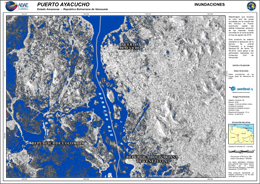
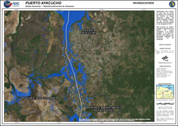
Flooding at Puerto Ayacucho in Amazonas State, Venezuela

Авторские права: © Copernicus Sentinel data (2018)
Map produced by ABAE

Information about the Product

Получено: 10/08/2018

Источник: Sentinel-1

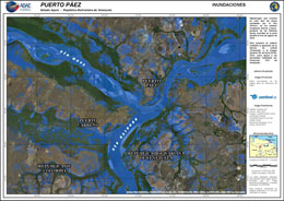
Flooding at Puerto Páez in Apure State, Venezuela

Авторские права: © Copernicus Sentinel data (2018)
Map produced by ABAE

Information about the Product

Получено: 05/08/2018

Источник: Sentinel-1

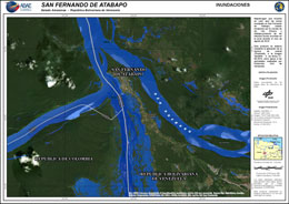
Flooding at San Fernando de Atabapo in Amazonas State, Venezuela

Авторские права: © DLR e. V. 2018, Distribution: Airbus DS Geo GmbH
Map produced by ABAE

Information about the Product

Получено: 21/08/2018

Источник: TanDEM-X

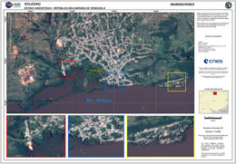
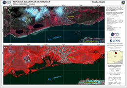
Flooding at Soledad, Venezuela

Авторские права: © CNES (2018), Distribution: Airbus DS
Map produced by ABAE

Information about the Product

Получено: 16/08/2018

Источник: Pleiades

Flooding in Bolivar State, Venezuela

Авторские права: © DLR e. V. 2018, Distribution: Airbus DS Geo GmbH
Map produced by ABAE

Information about the Product

Получено: Pre-disaster: 12/04/2016
Post-disaster: 18/08/2018

Источник: TanDEM-X

Flooding on the Orinoco River in Bolivar State, Venezuela

Авторские права: © DLR e. V. 2018, Distribution: Airbus DS Geo GmbH
Map produced by ABAE

Information about the Product

Получено: Pre-disaster: 12/04/2016
Post-disaster: 18/08/2018

Источник: TanDEM-X

Flooding at Puerto Páez in Apure State, Venezuela

Авторские права: © DLR e. V. 2018, Distribution: Airbus DS Geo GmbH
Map produced by ABAE

Information about the Product

Получено: 18/08/2018

Источник: TanDEM-X

Floods at Puerto Ayacucho in the Amazonas State of Venezuela

Авторские права: © DLR e. V. 2018, Distribution: Airbus DS Geo GmbH
Map produced by ABAE

Information about the Product

Получено: 18/08/2018

Источник: TanDEM-X

Flood areas in Soledad, Venezuela

Авторские права: VRSS-1 © ABAE (2018)
Pleiades © CNES (2018), Distribution: Airbus DS
Map produced by ABAE

Information about the Product

Получено: VRSS-1: 17/02/2018
Pleiades: 16/08/2018

Источник: VRSS-1 / Pleiades

Вернуться к полному архиву активаций