 English
 Spanish
 French
 Chinese
 Russian
 Portuguese
 Latest Activation
Charter activations
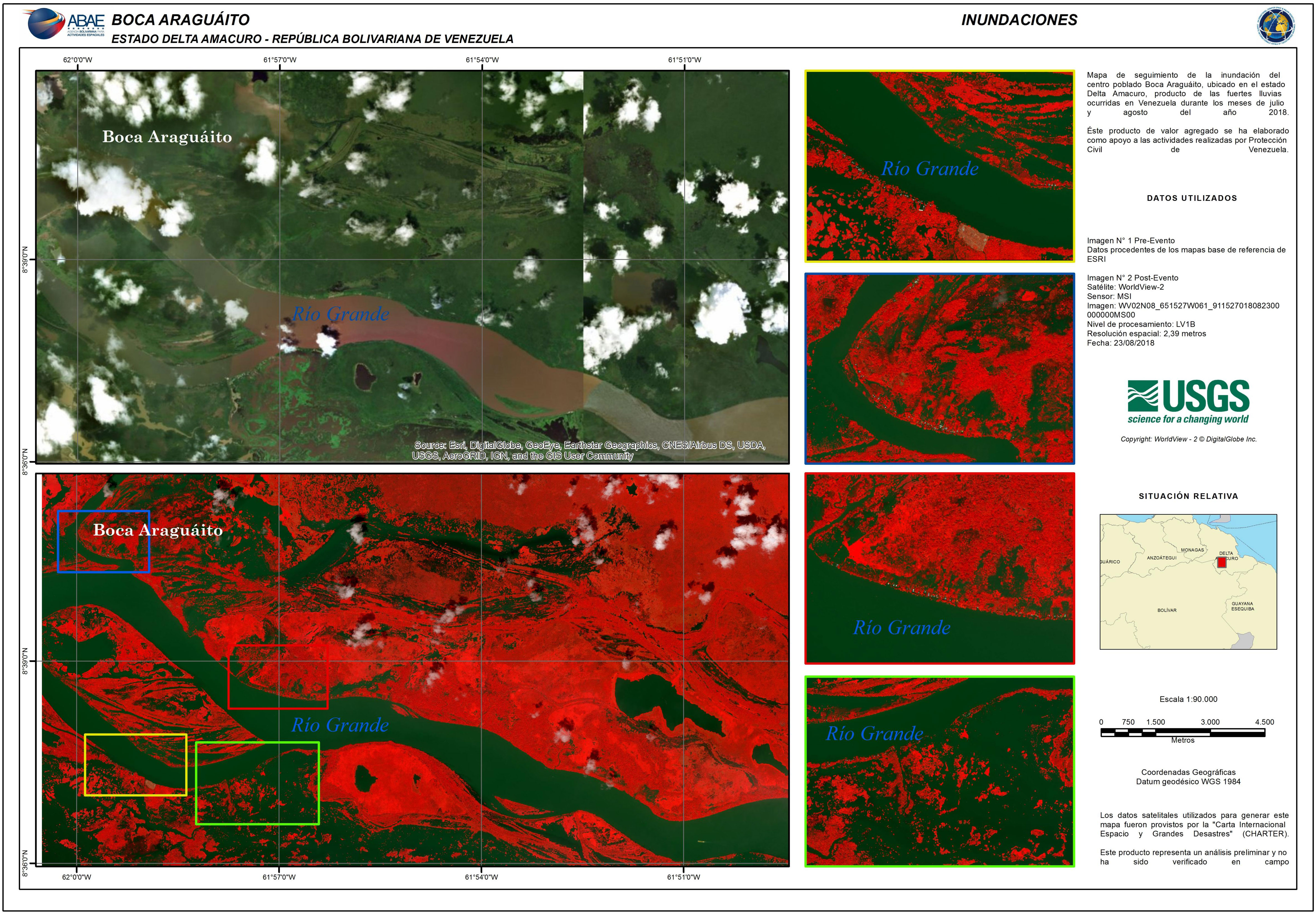
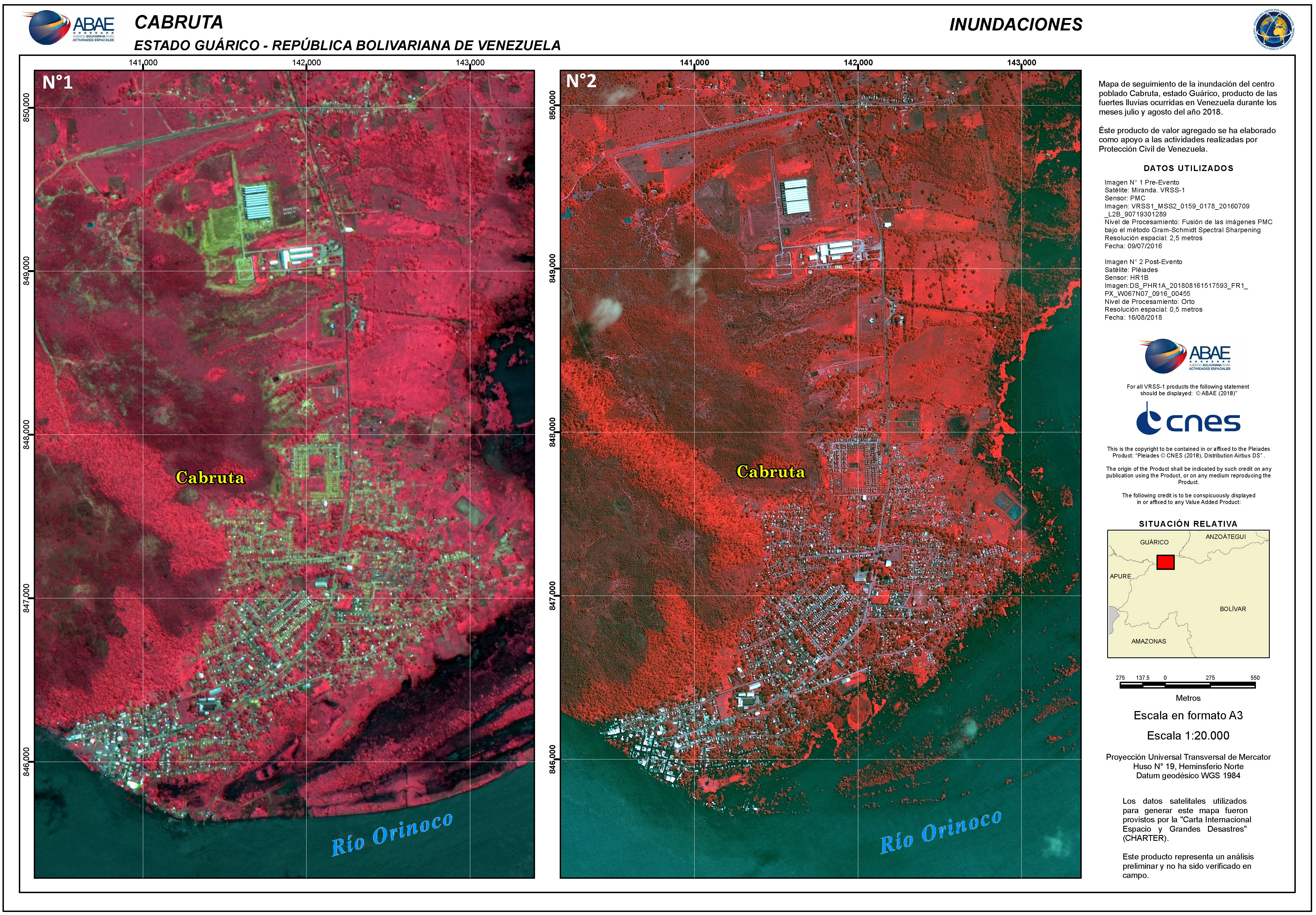
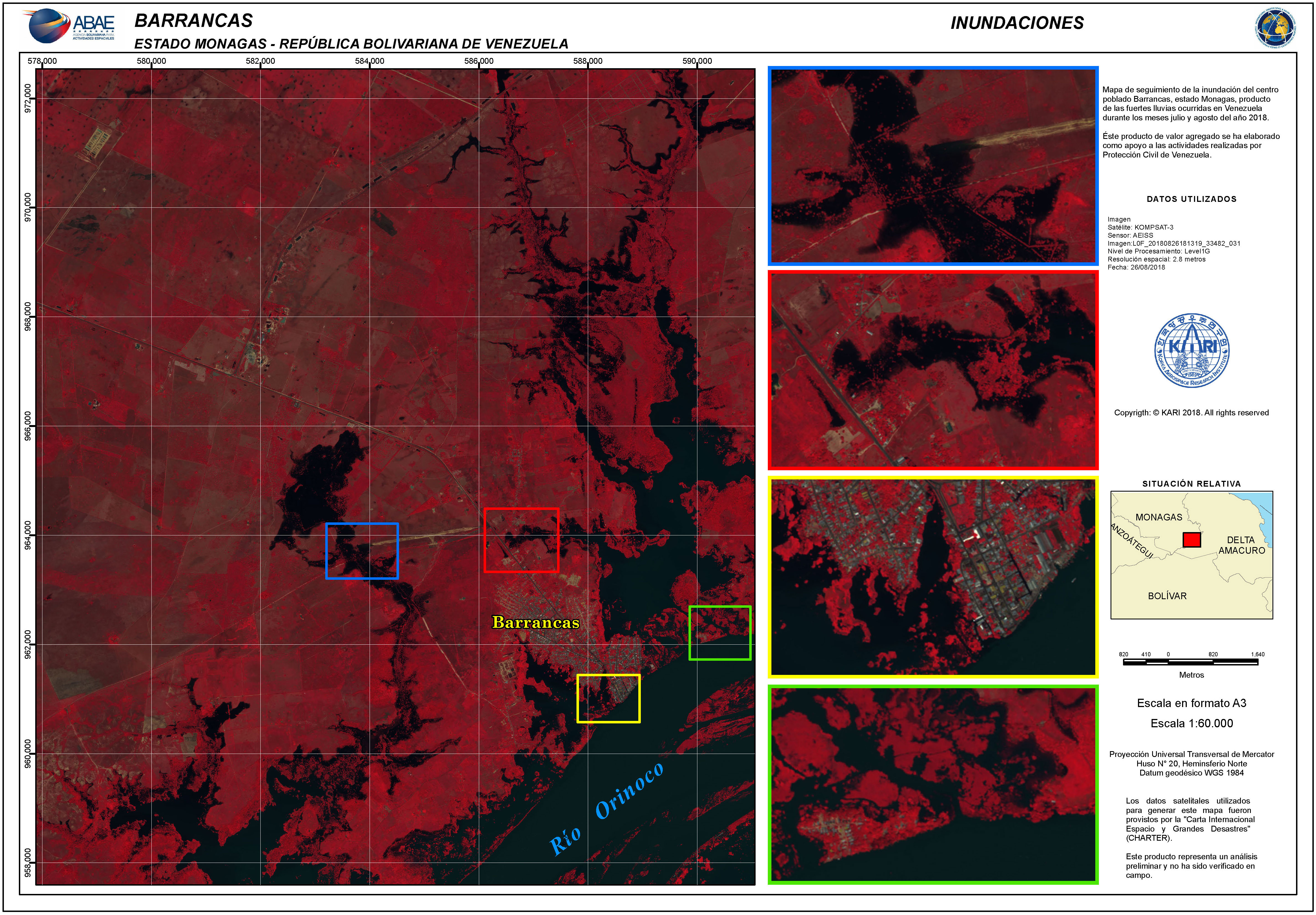
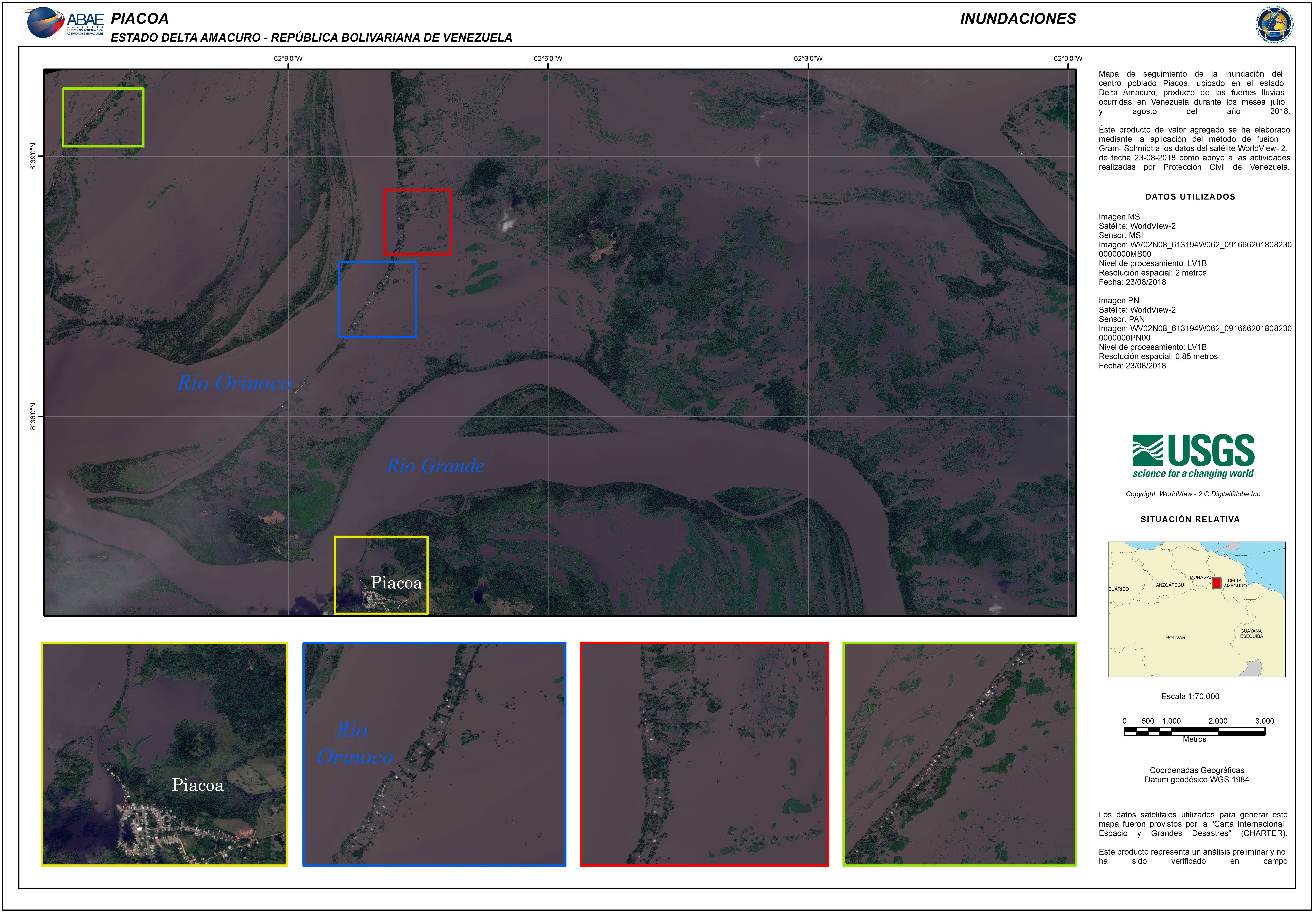
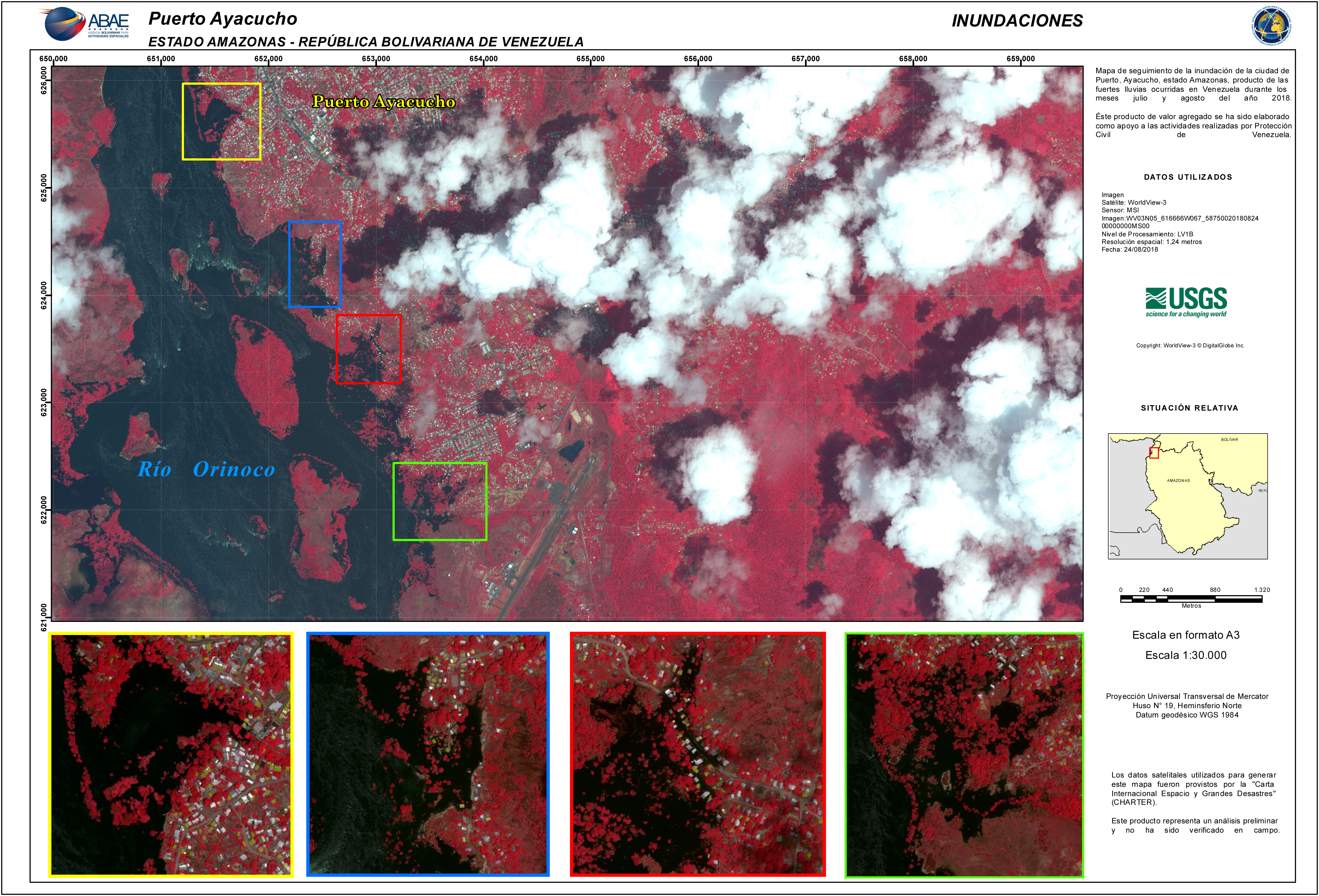
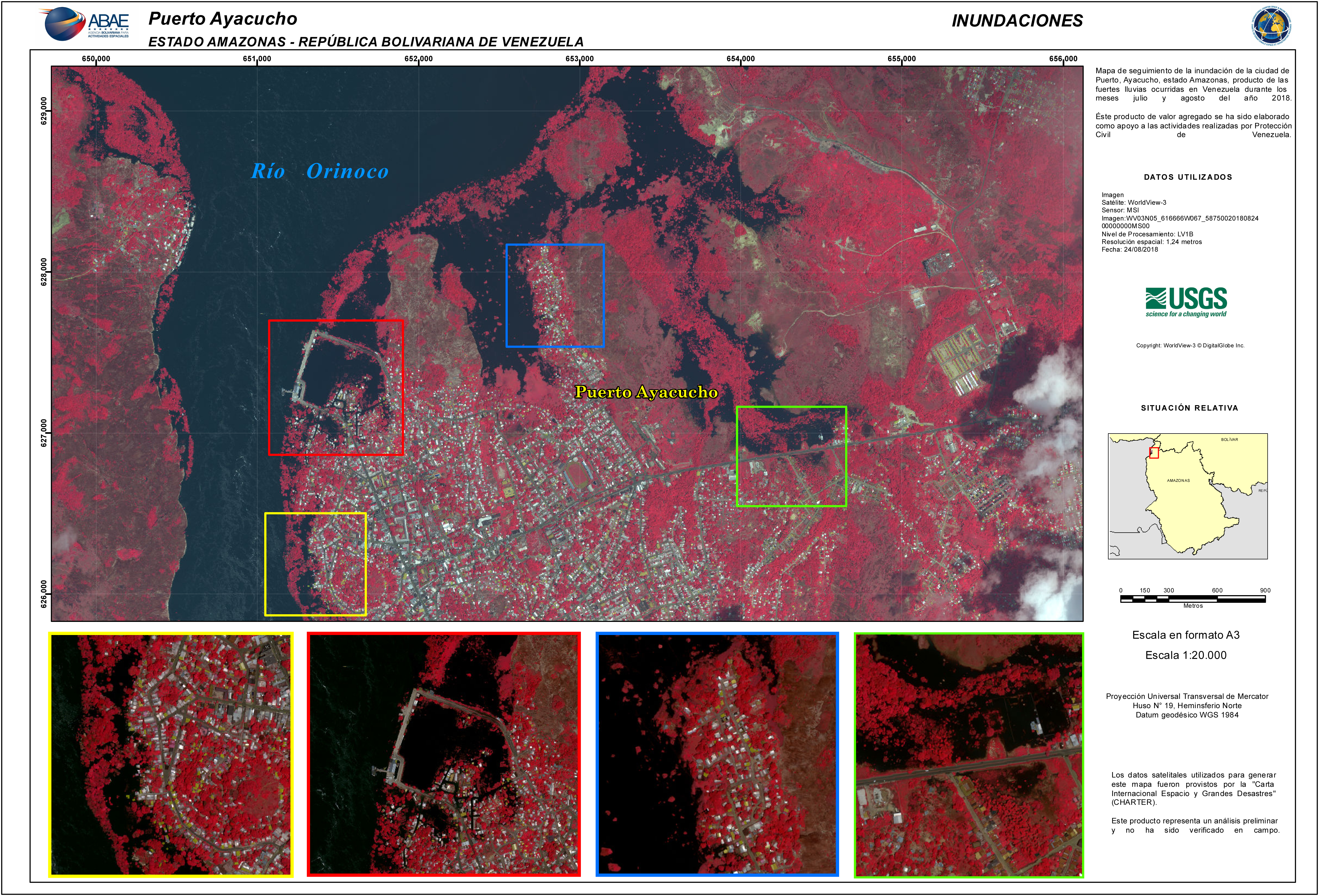
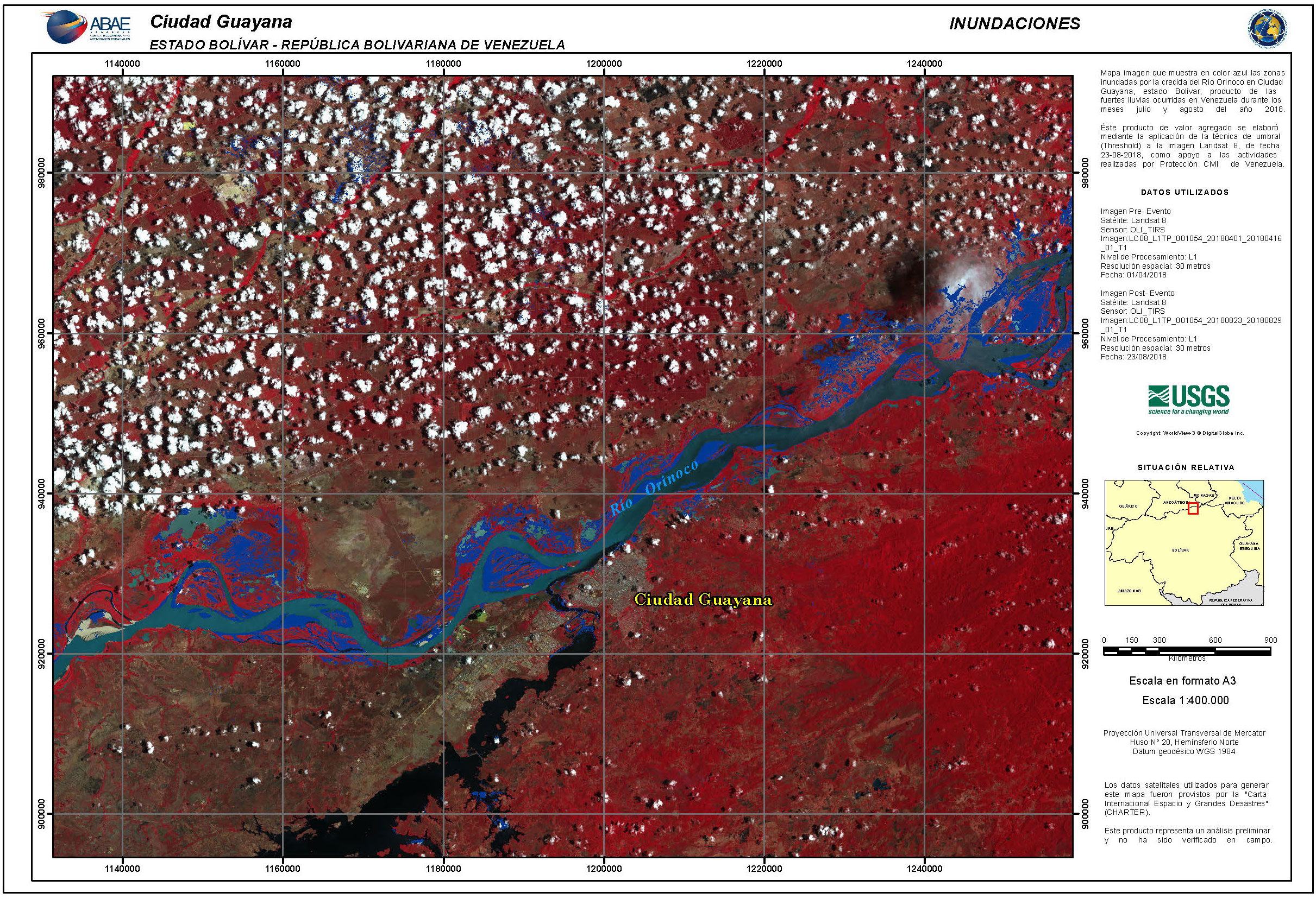
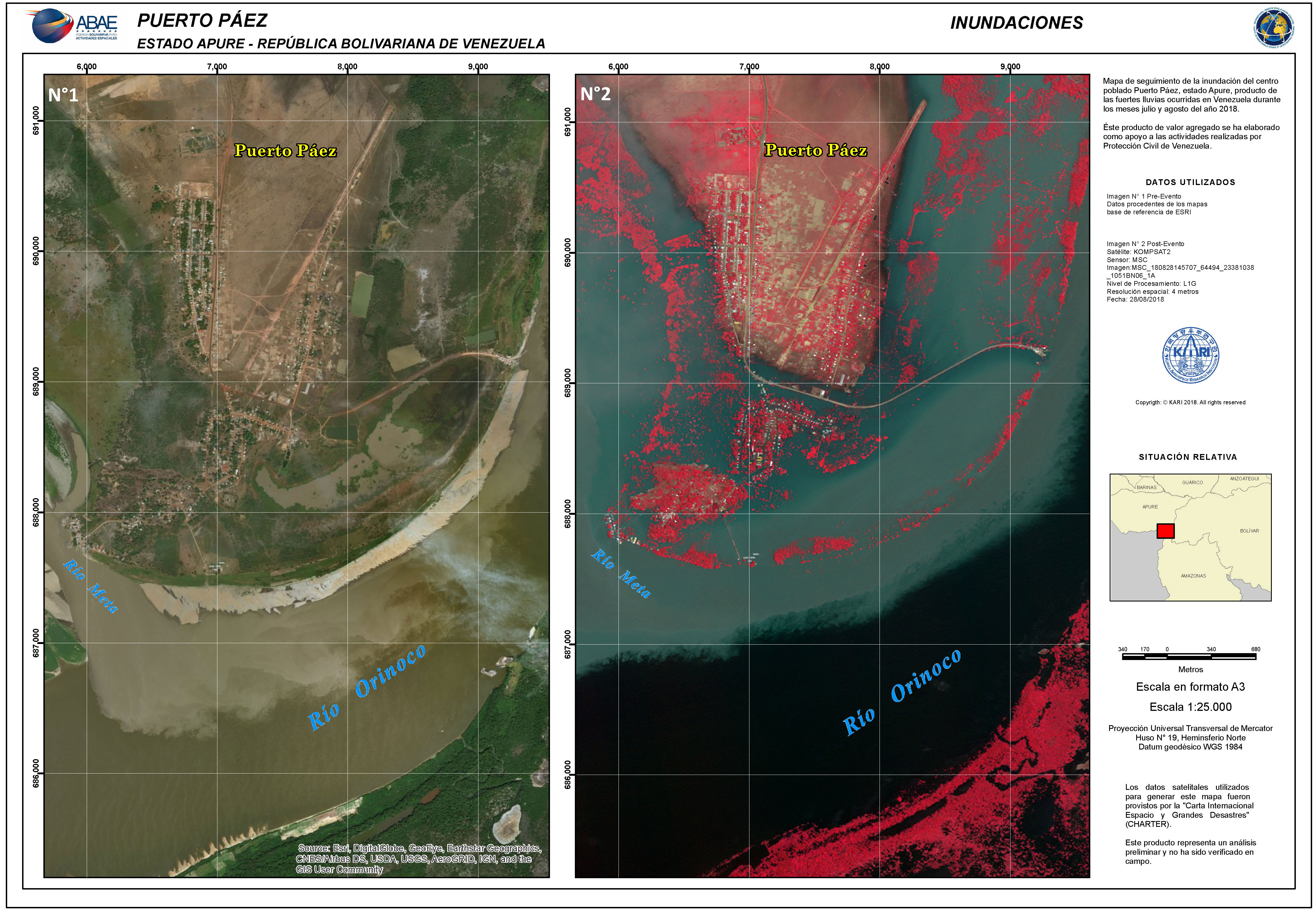
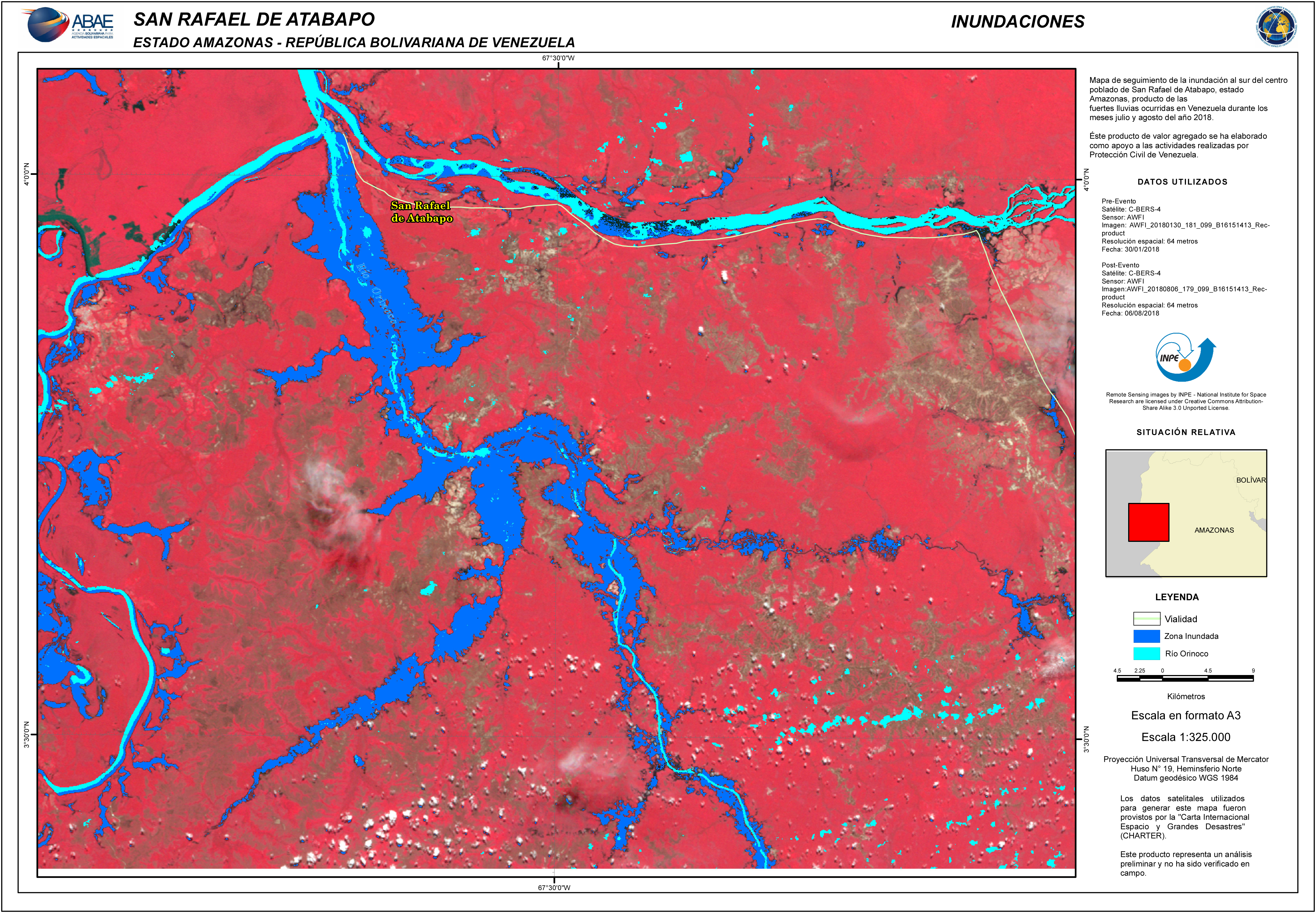
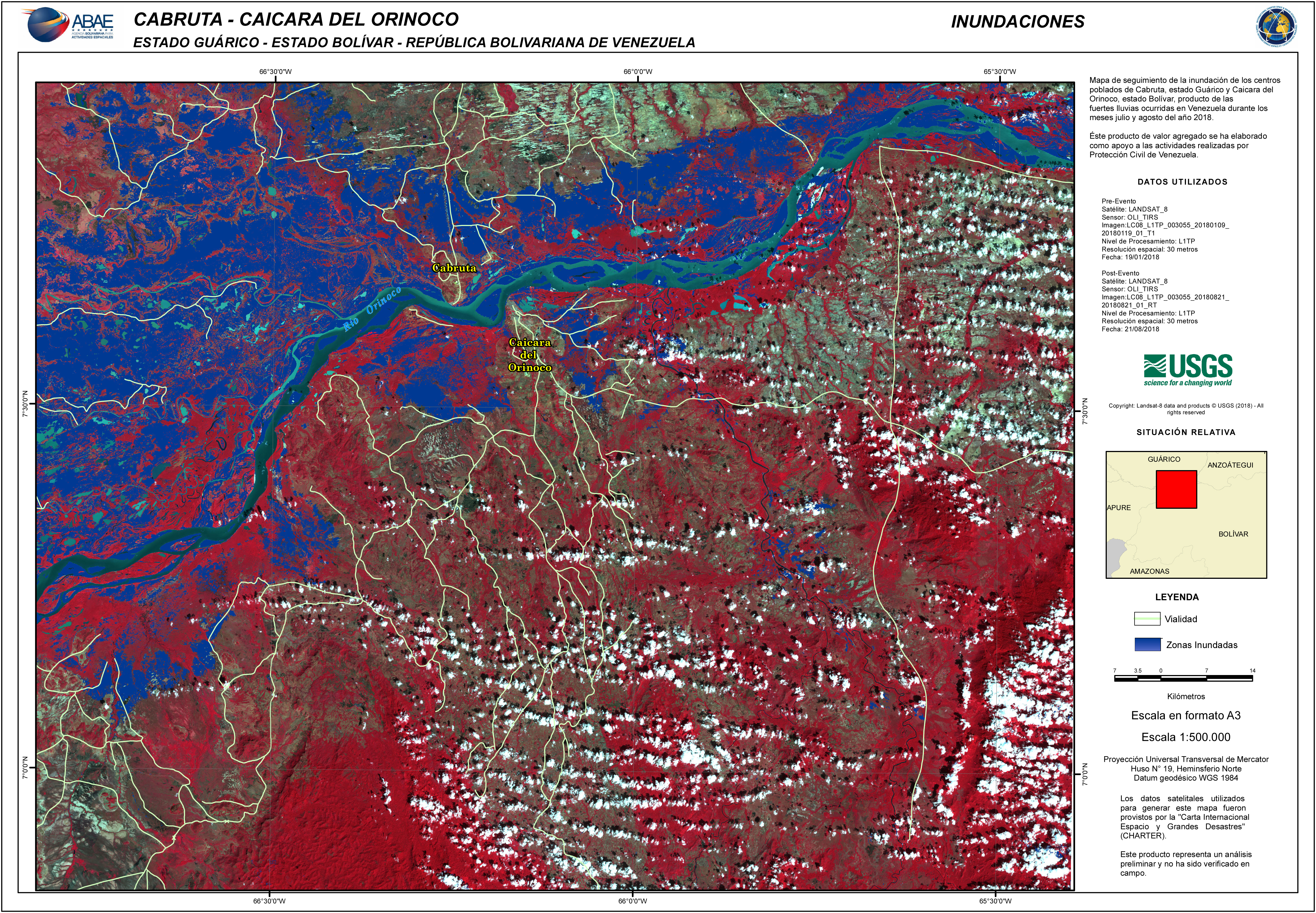
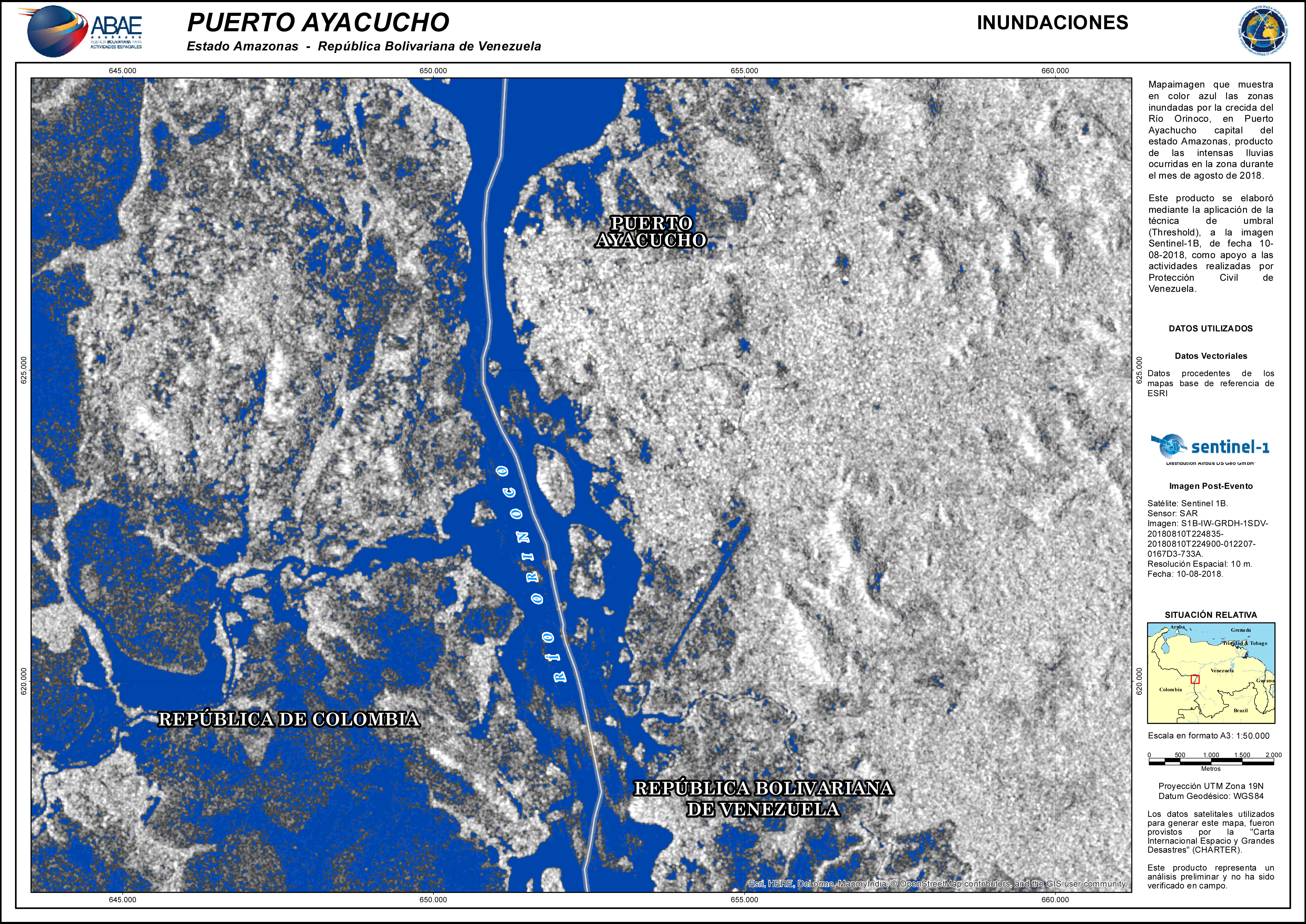
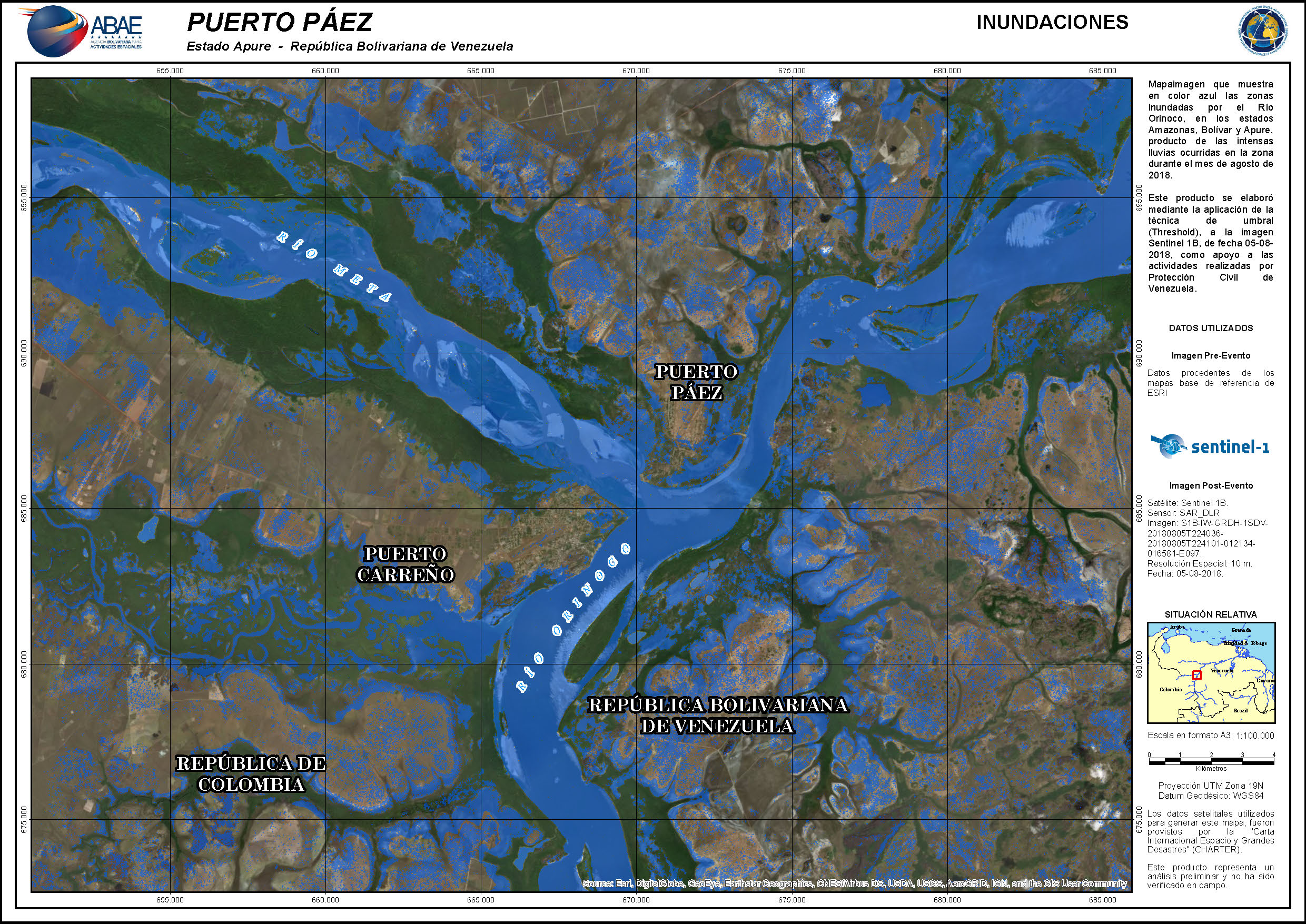
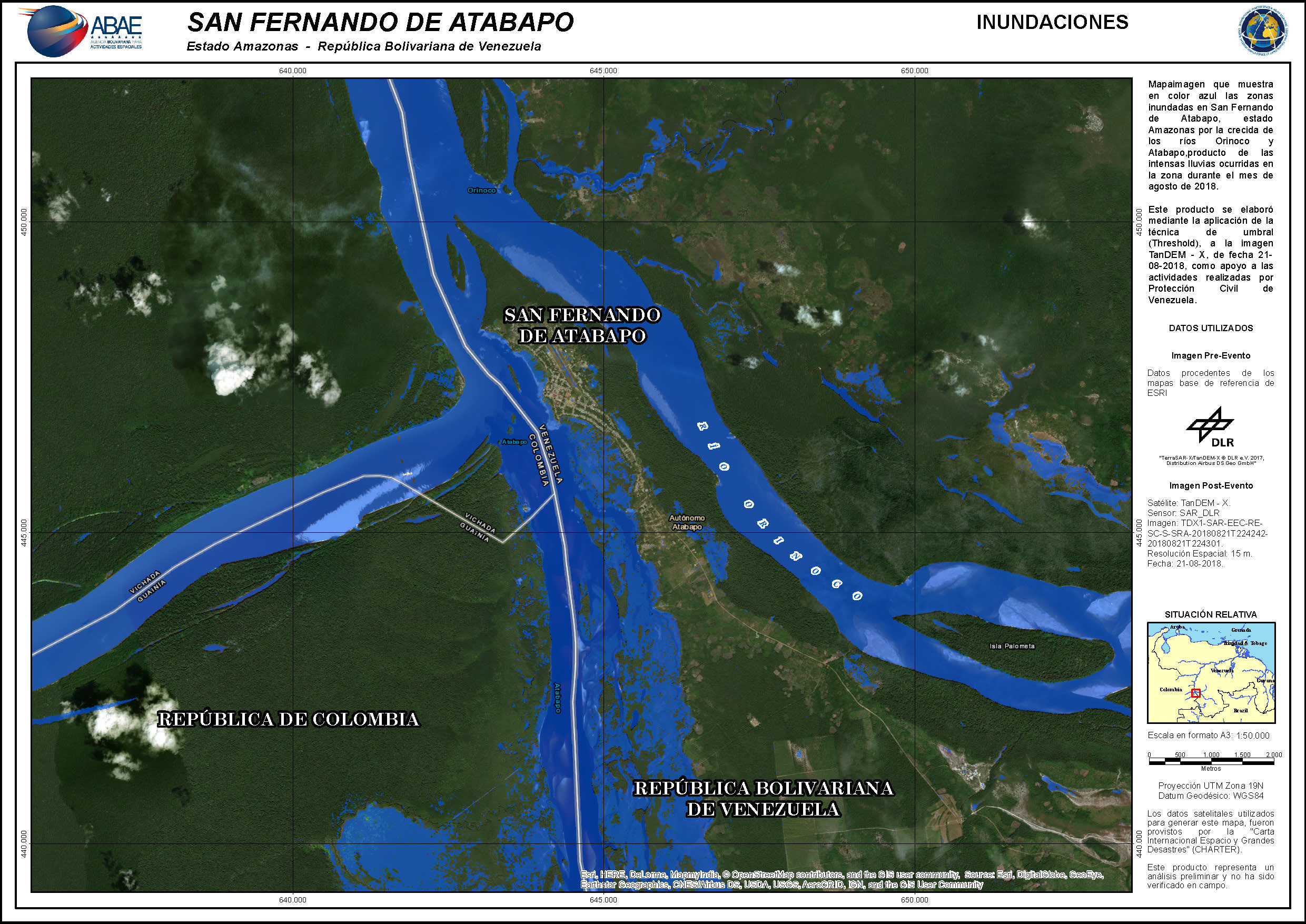
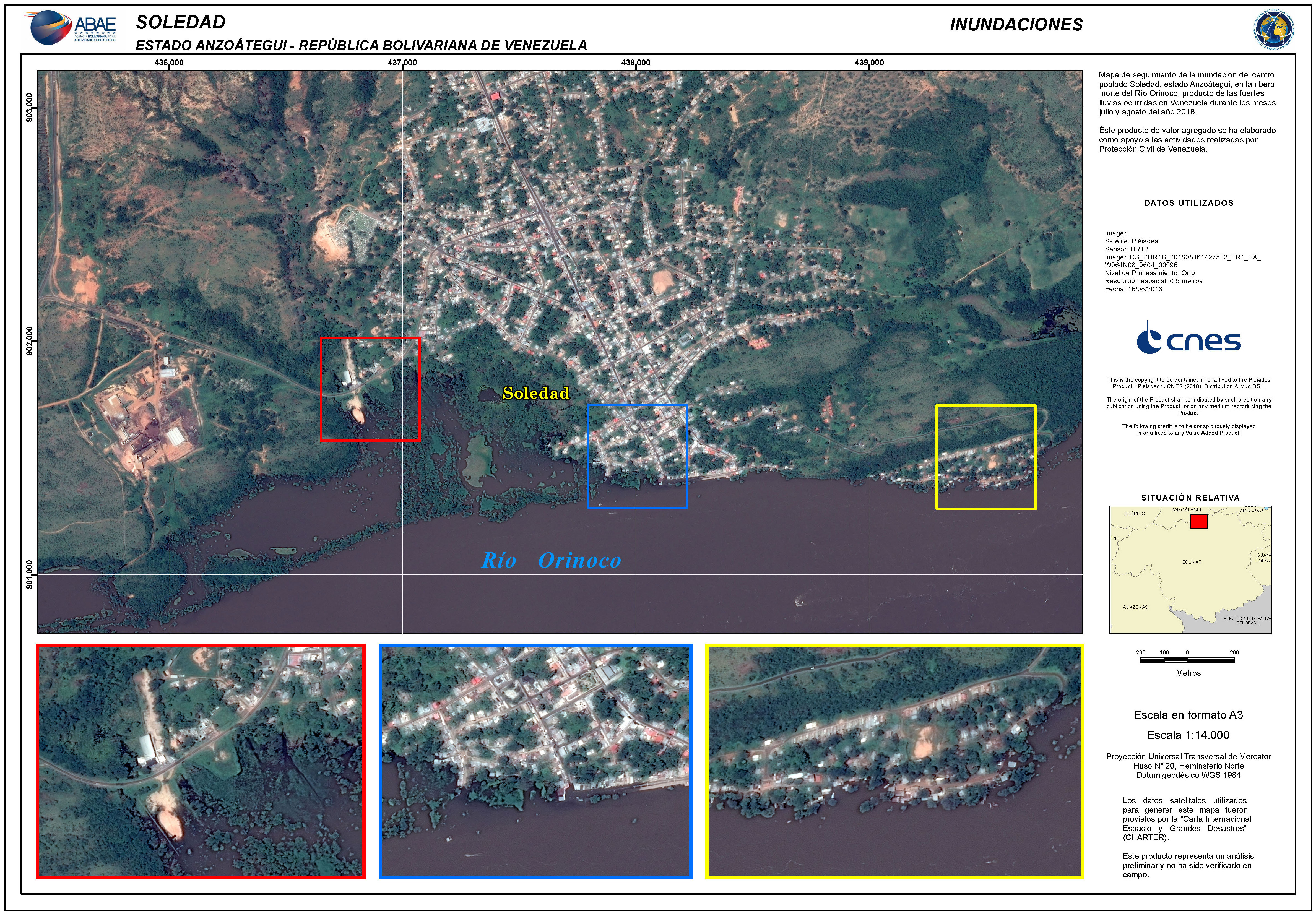
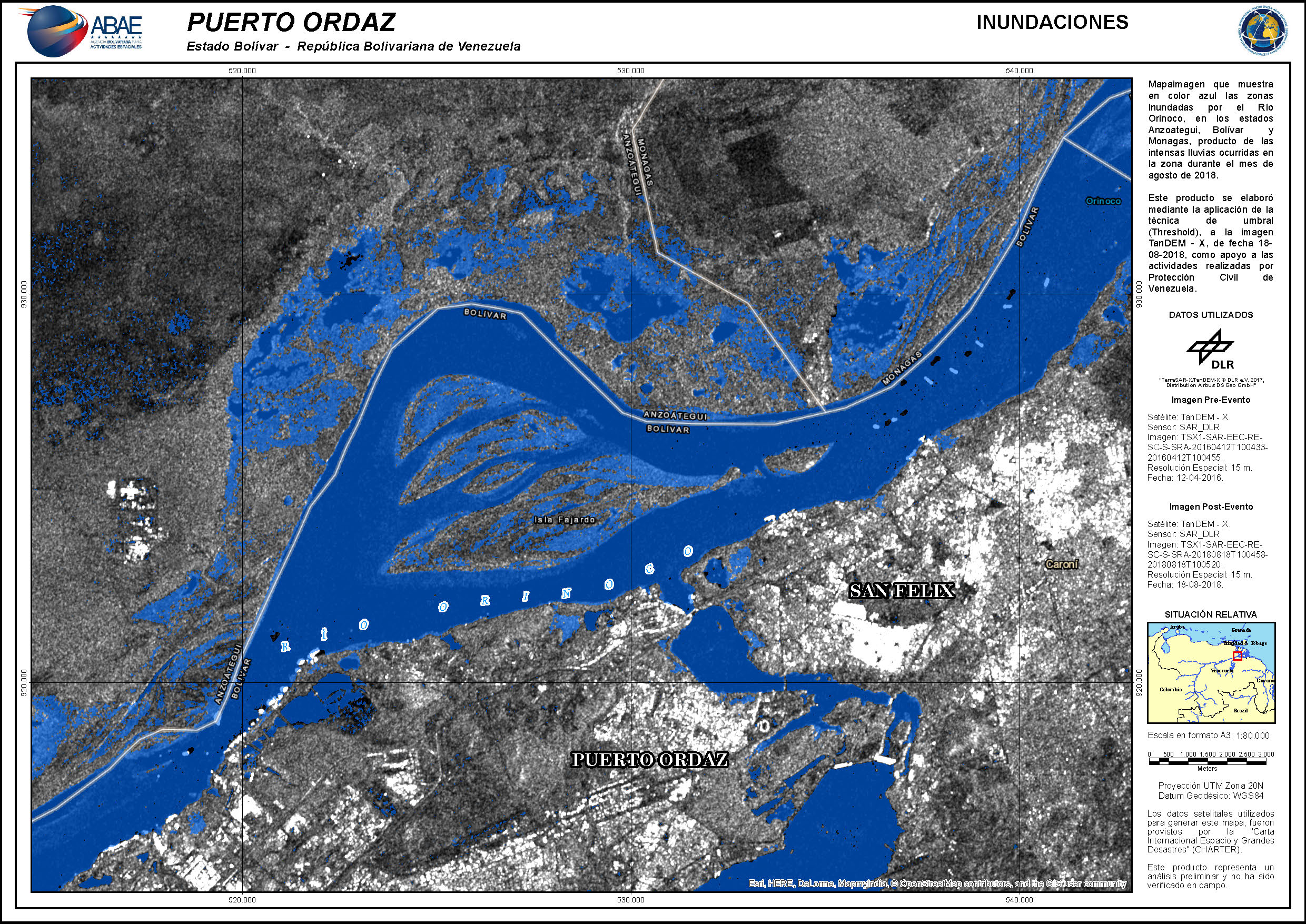
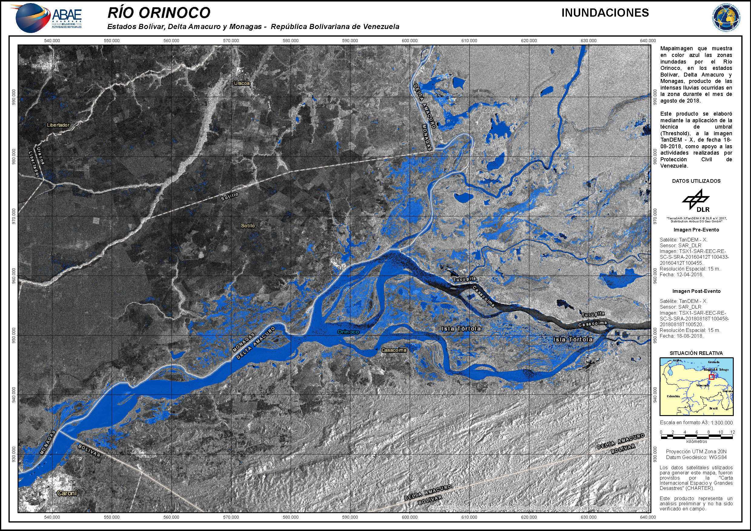
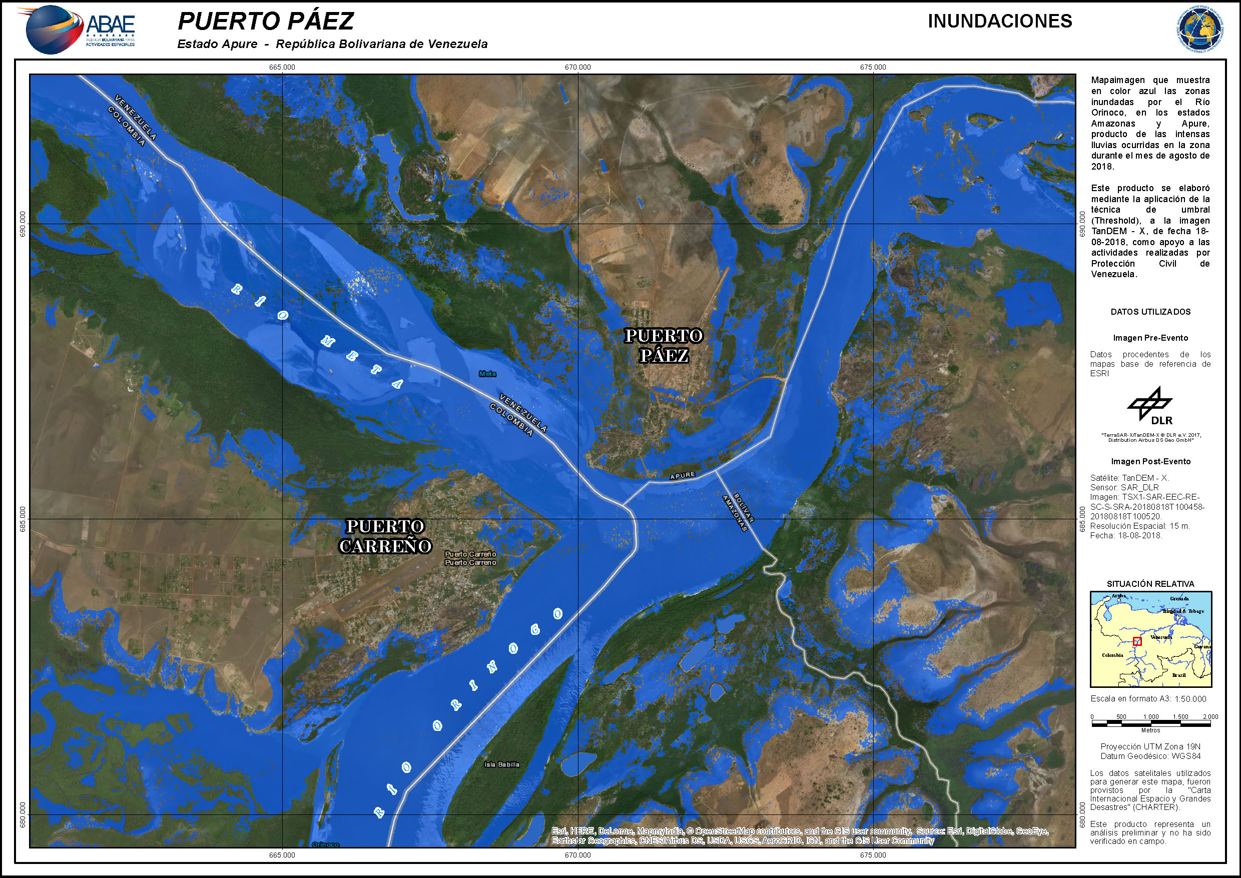
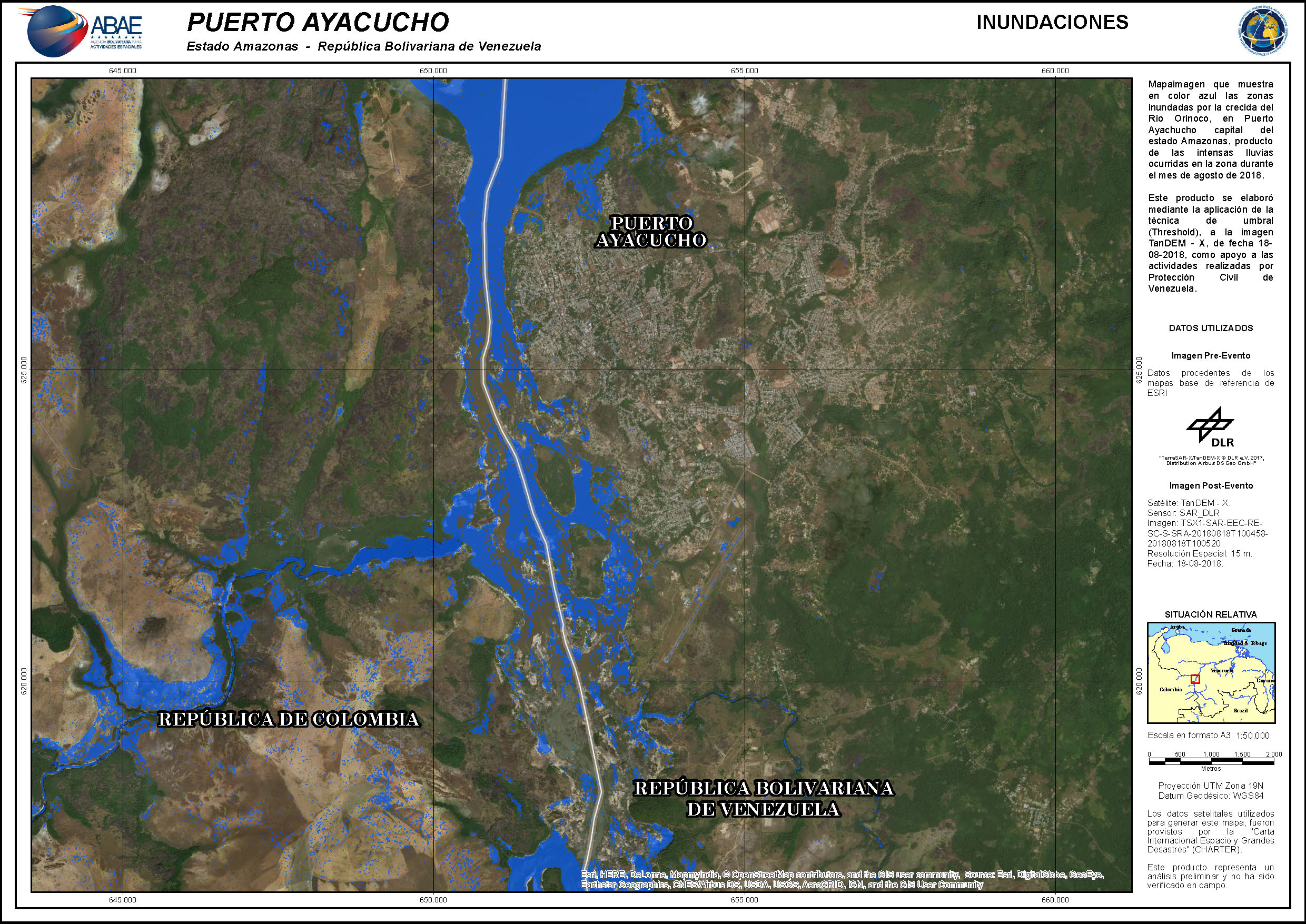
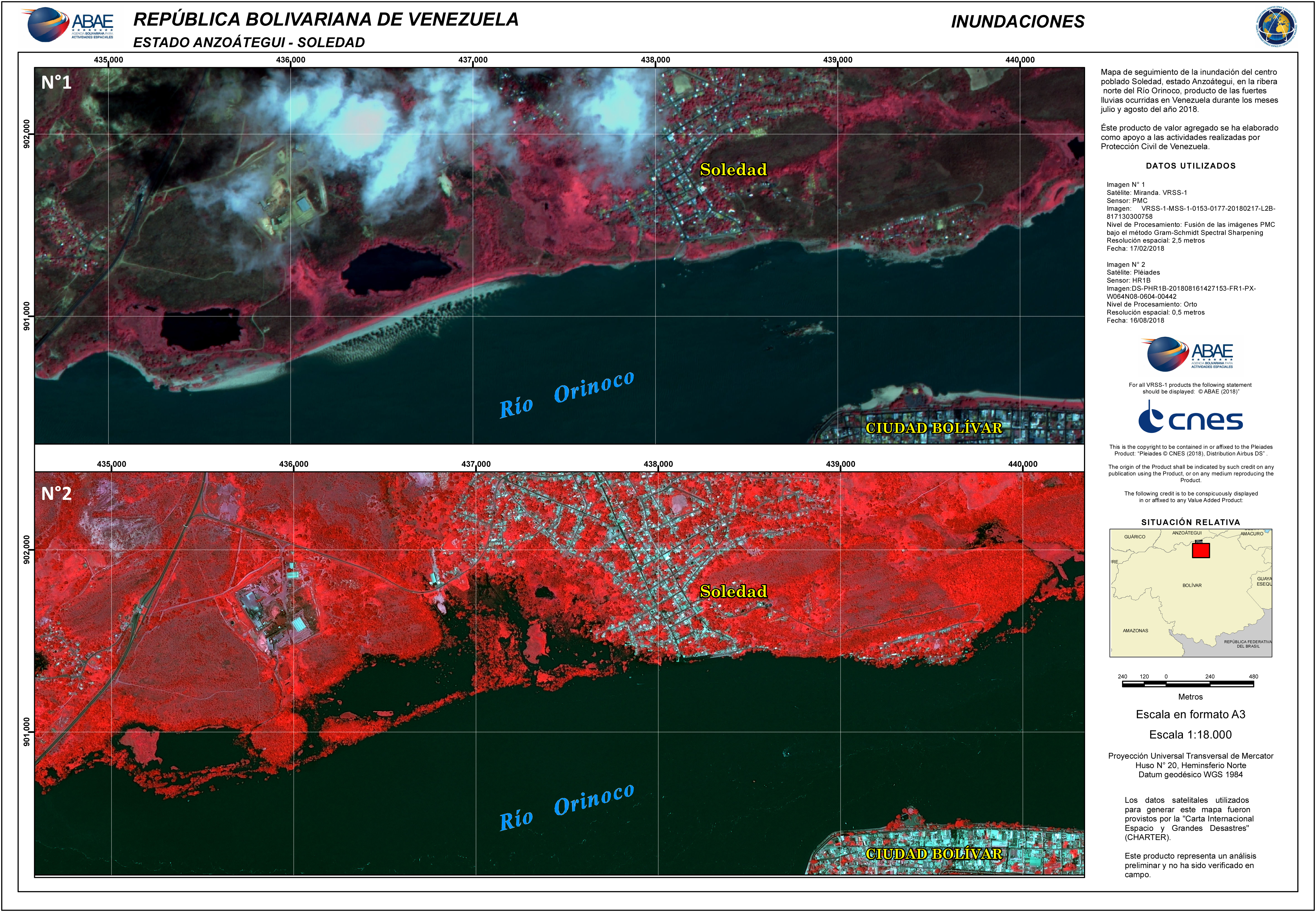
Flood in Venezuela
Persistent heavy rains have caused severe flooding in the Venezuelan provinces of Amazonas, Apure, Bolivar and Anzoategui. Over 10,000 people have been affected, with 36 sectors in the province on a red alert defined by the Venezuelan Civil Protection.
The Orinoco river burst its banks as it rose to levels not seen in 40 years. An aerial bridge has been set up by authorities so supplies of food and medicines can reach affeced persons.
Major arterial roads have been closed isolating some areas and many schools have closed. Local authorities have asked for donations of items such as tents, blankets and mats to aid those that have lost their homes.
The red alert is set to be in place until the end of August, with rains expected to continue to fall in the coming days.
| Tipo de evento: | Flood |
| Local do evento: | Venezuela |
| Data da Ativação da Carta: | 2018-08-15 |
| Tempo de Ativação da Carta: | 23:51 |
| Zona de Tempo da Ativação da Carta: | UTC+01:00 |
| Requisitante da Carta: | Venezuelan Civil Protection Directora de Gestión del Riesgo Dirección Nacional de Protección Civil y Administración de Desastres |
| ID da Ativação: | 581 |
| Gerenciamento de projeto: | ABAE |
Products


 Voltar ao arquivo completo da Ativação

