 English
 Spanish
 French
 Chinese
 Russian
 Portuguese
 Последняя Активация
Charter activations
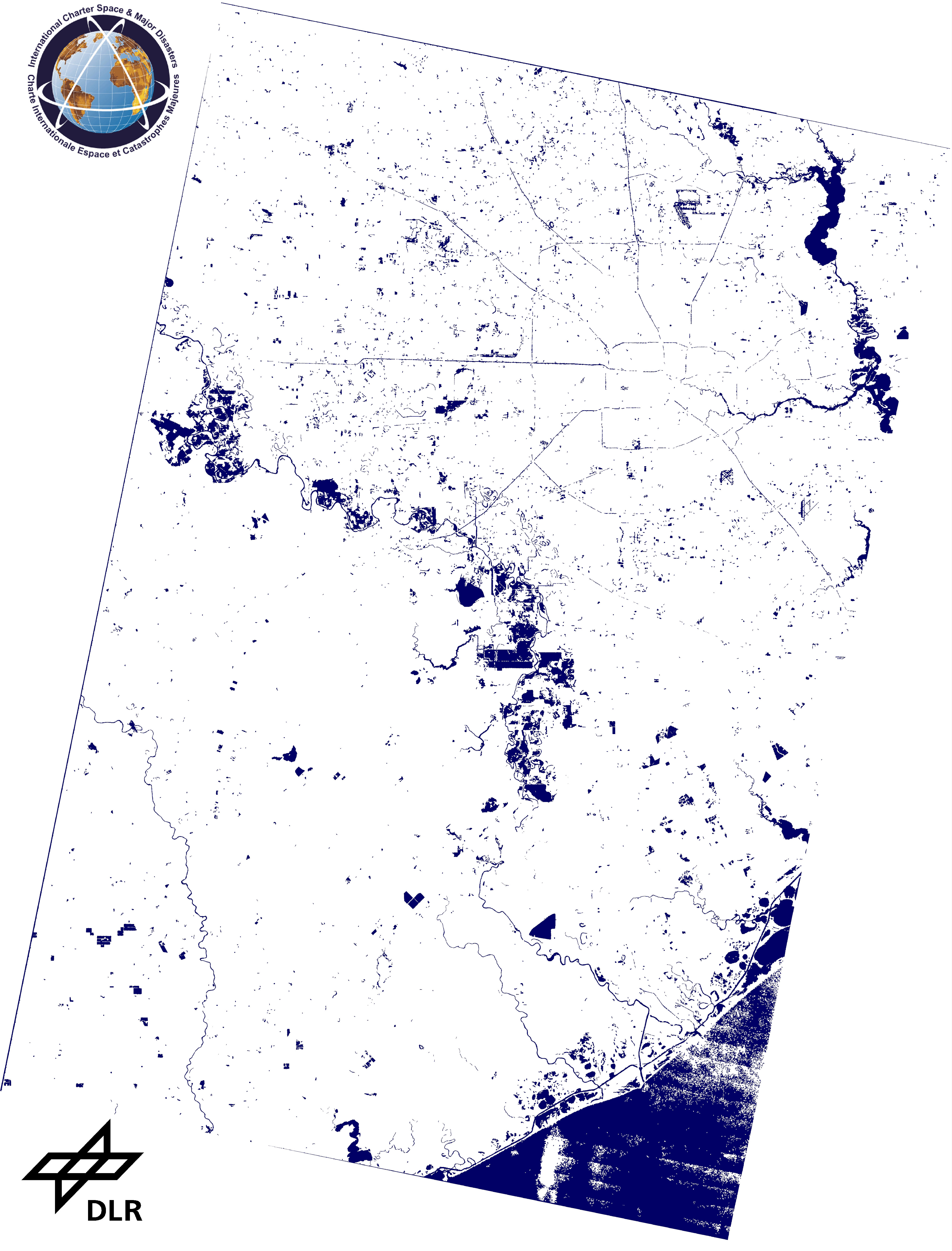
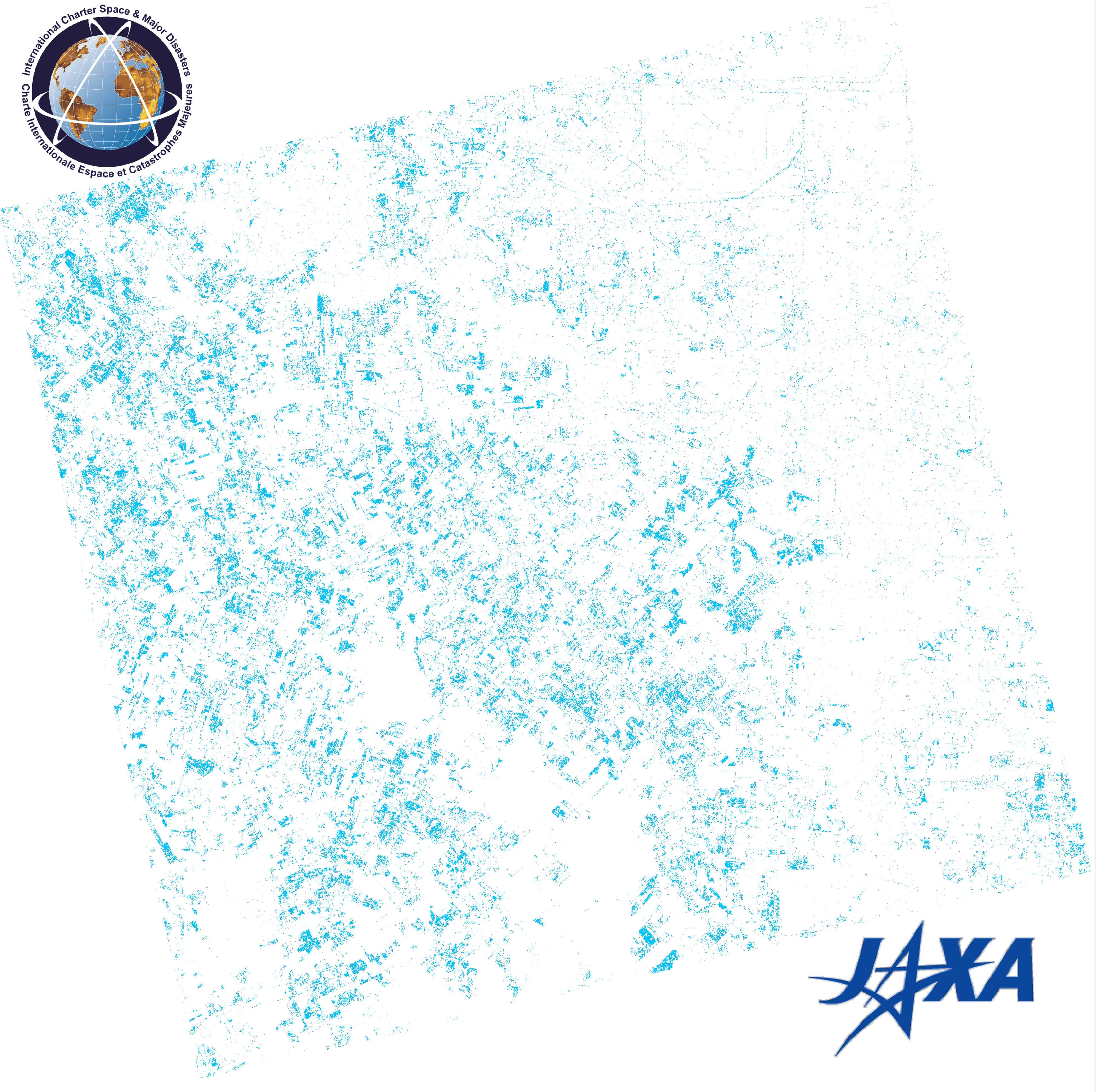
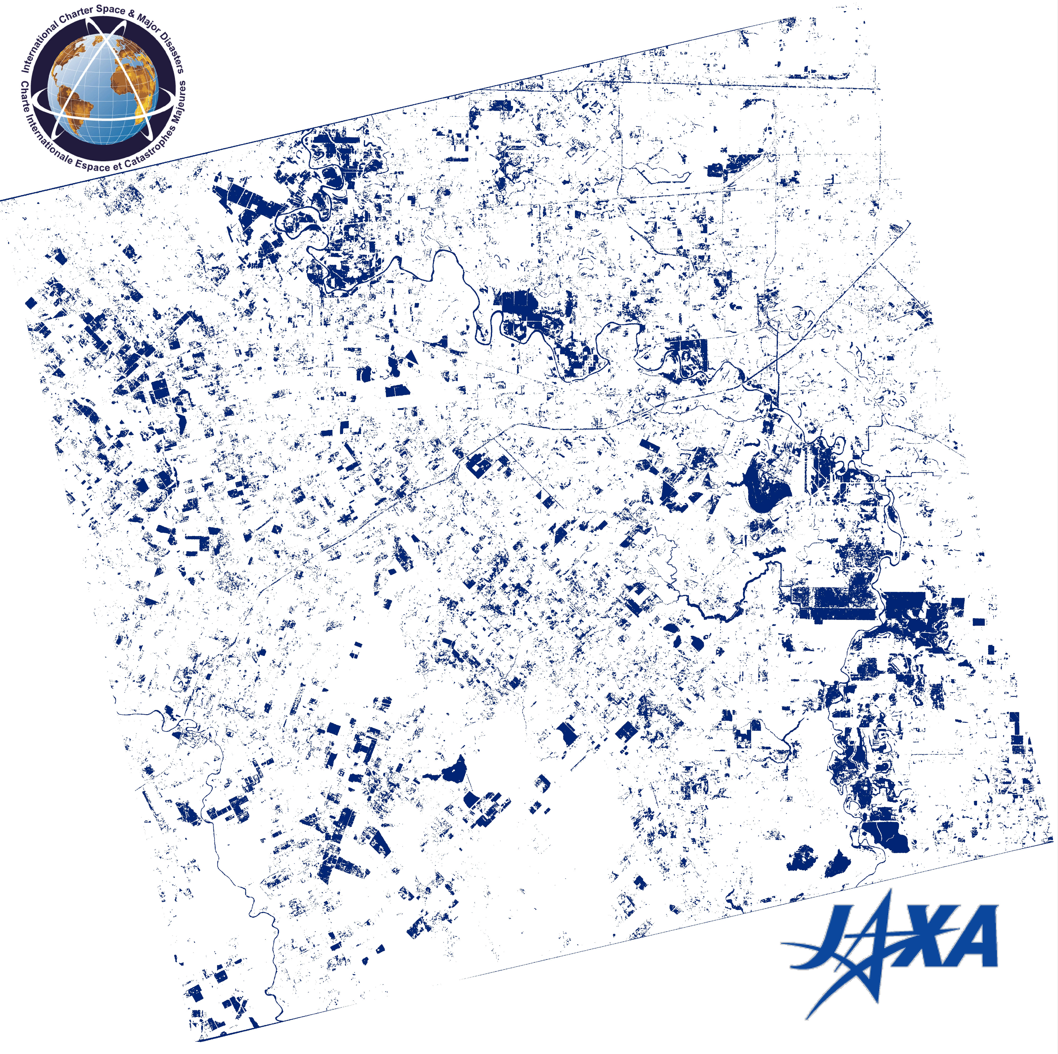
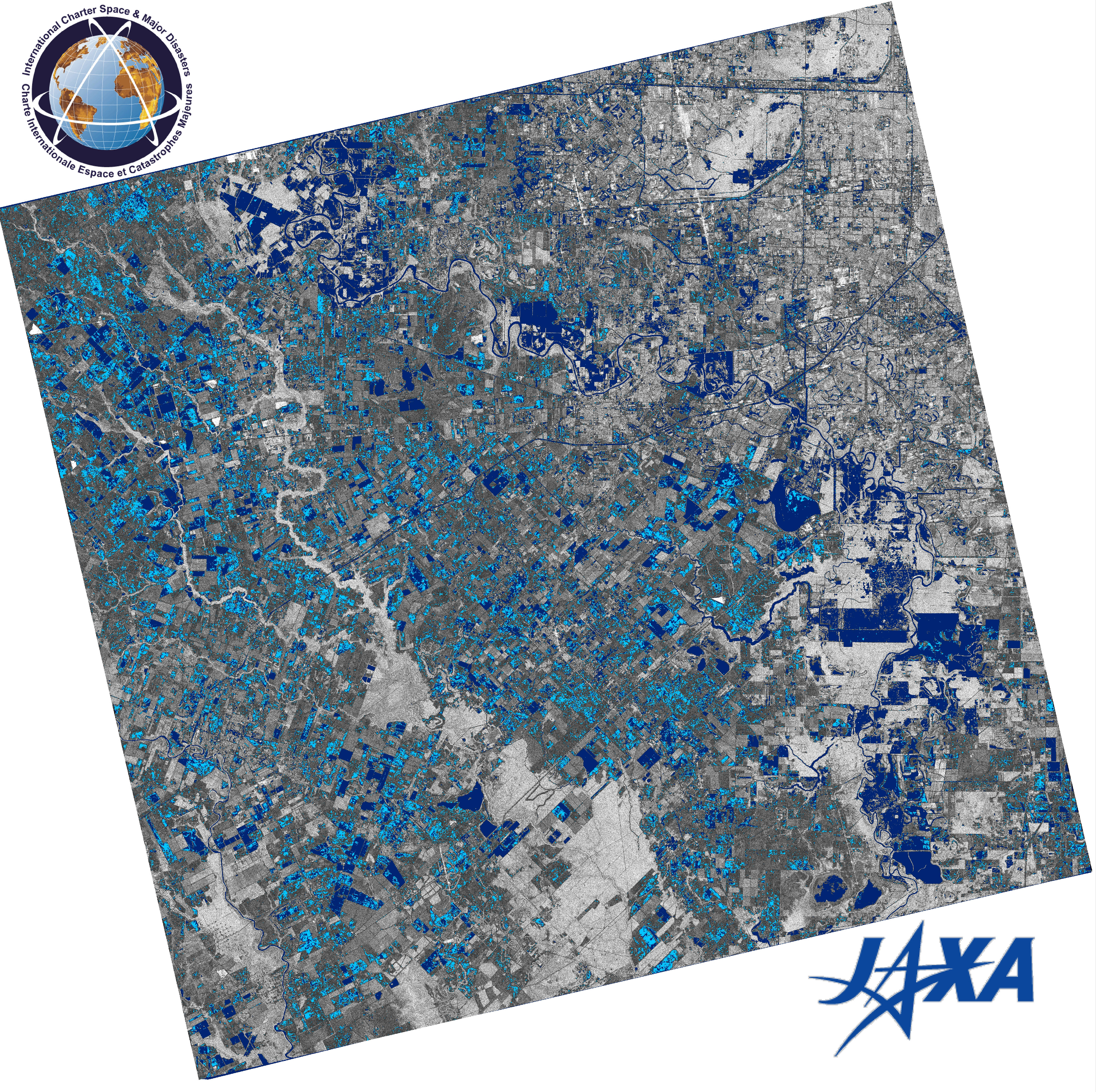
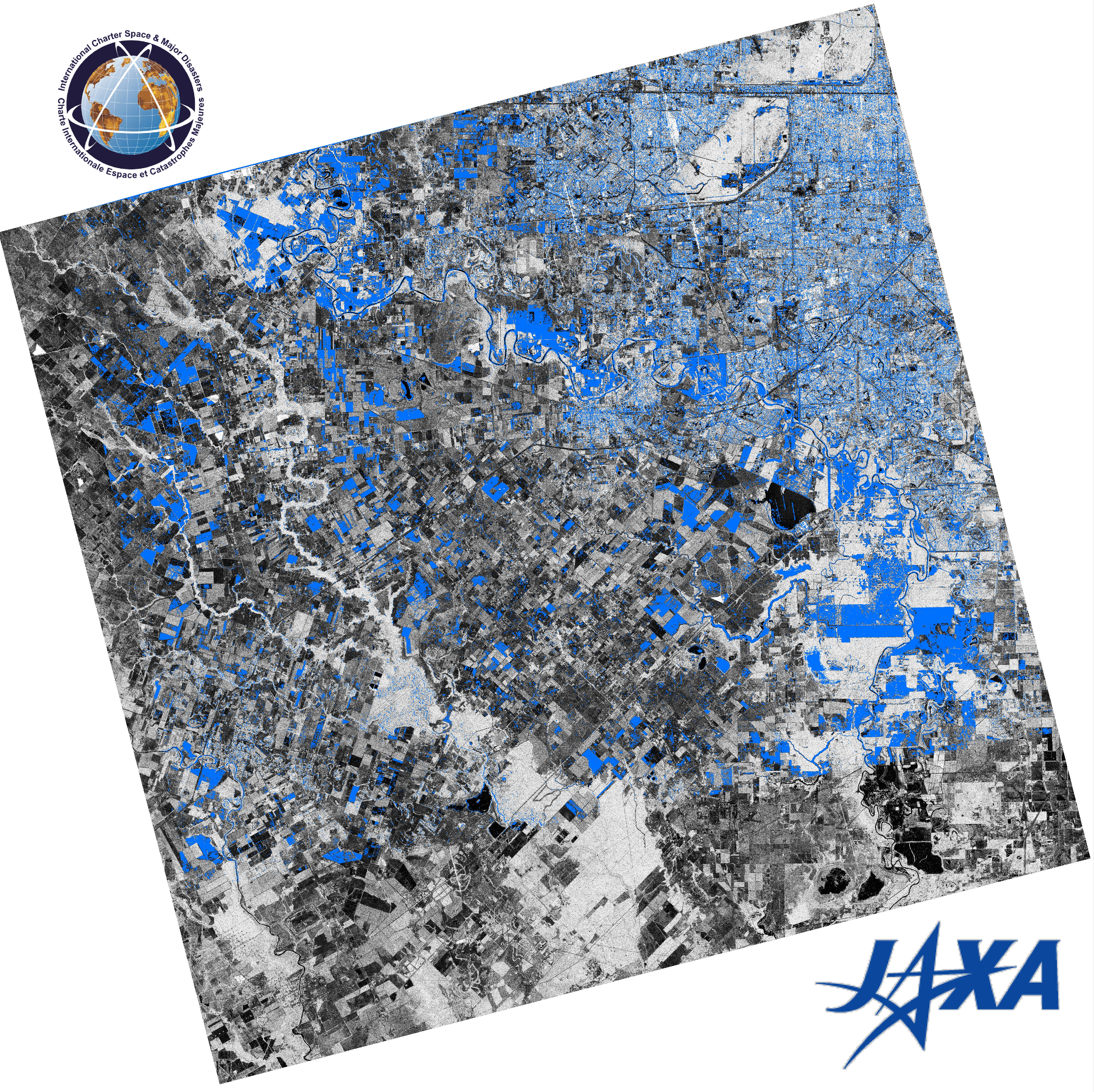
Flood in the United States
Days of heavy rainfall have resulted in record levels of flooding in Texas.
Seven people died and hundreds of homes were flooded. It is reportedly the worst flooding the area has experienced in over a century.
A state of disaster has been declared in nine counties around the Houston area, where the worst of the flooding has occurred.
More than a thousand people were rescued by emergency crews, retrieving people trapped in flooded homes and cars. Mandatory evacuation orders have been issued to residents along the Brazos River which has swollen to record water levels and contributed to the floods. Other rivers in the state are also flooding or at risk of doing so.
The heavy rainfall is expected to continue for several more days and it is expected that the flood waters will linger for some time, due to Houston's flat topography.
| Тип события: | Flood |
| Место события: | Texas, United States of America |
| Date of Charter Activation: | 31 May 2016 |
| Время активации Хартии: | 16:03:12 |
| TЧасовой пояс в районе активации Хартии: | UTC+02:00 |
| Запрос на активацию поступил от: | U.S. Geological Survey on behalf of Texas Emergency Management |
Products


 Вернуться к полному архиву активаций

