 English
 Spanish
 French
 Chinese
 Russian
 Portuguese
 Последняя Активация
Charter activations
Flood in Madagascar
Tropical Cyclone Enawo has been classified as the most destructive storm to hit Madagascar in years‚ with winds in excess of 231 km/h, making it a Category 4 hurricane on the Saffir-Simpson Wind Scale. Aid organisations are warning that more than 700‚000 people could be affected by the storm, but some reports suggest that there have already been fatalities and numerous injuries as the category-four cyclone nears the capital Antananarivo.
Furthermore, NOAA's National Hurricane Center reported that a Category 4 hurricane can severely damage homes and infrastructure; trees will fall and power poles will be downed, causing power outages to last from weeks to months. Consequently, most of the area will be uninhabitable for weeks or months.
| Тип события: | Ocean Storm - Cyclone |
| Место события: | Madagascar |
| Date of Charter Activation: | 6 March 2017 |
| Время активации Хартии: | 11:49:00 |
| TЧасовой пояс в районе активации Хартии: | UTC+01:00 |
| Запрос на активацию поступил от: | UNITAR-UNOSAT on behalf of UNOCHA |
| Номер активации: | 521 |
| Менеждер проекта от: | UNITAR |
Products
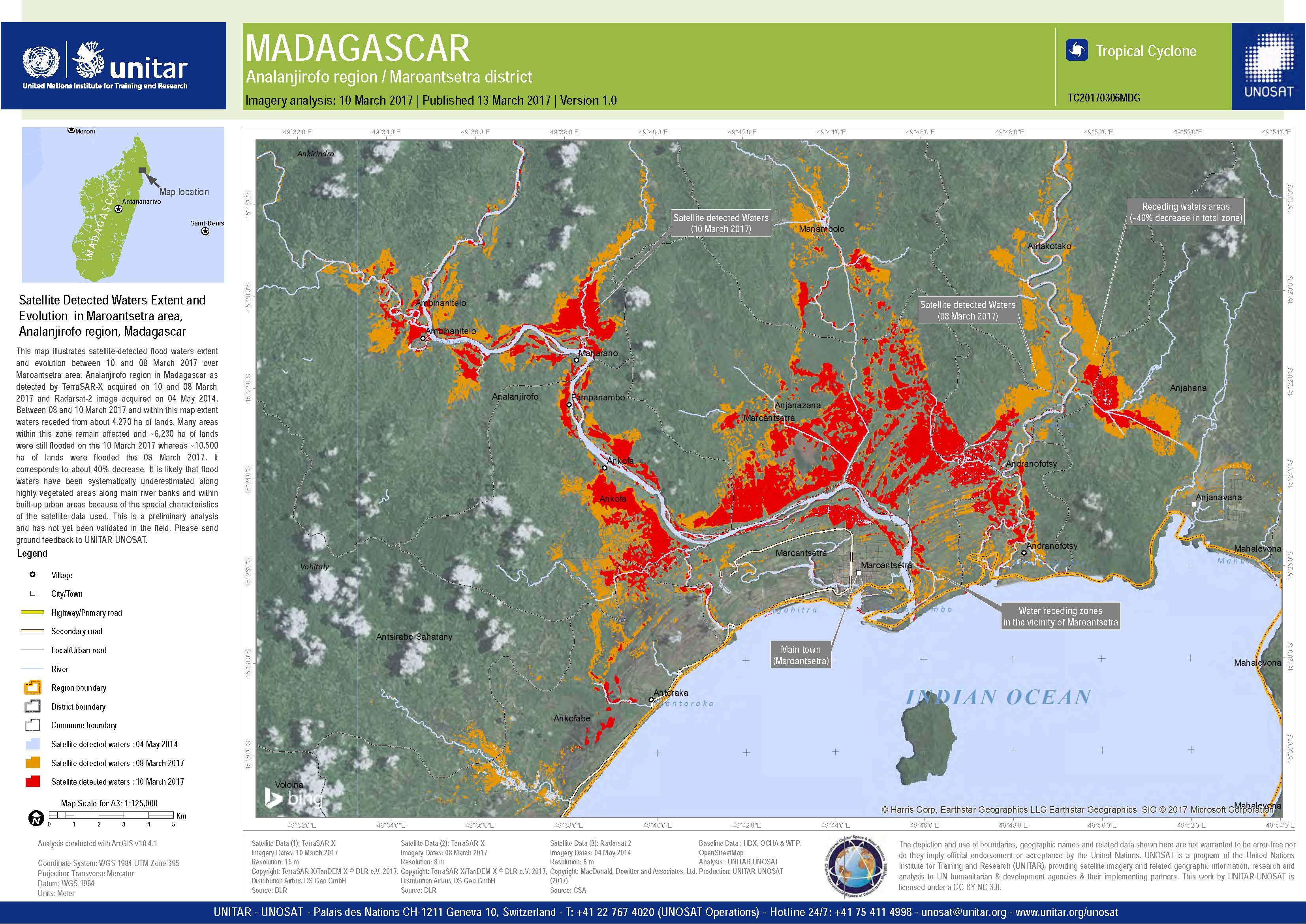
Satellite detected waters extent and evolution in Maroantsetra area, Analanjirofo region, Madagascar
Авторские права: TerraSAR-X DLR e. V. 2017, Distribution: Airbus DS Geo GmbH
RADARSAT-2 Data and Products © MacDonald, Dettwiler and Associates Ltd. (2017) - All Rights Reserved. RADARSAT is an official trademark of the Canadian Space Agency.
Map produced by UNITAR / UNOSAT
Information about the Product
Получено: TerraSAR-X: 08/03/2017 and 10/03/2017
RADARSAT-2: 04/05/2014
Источник: TerraSAR-X / RADARSAT-2
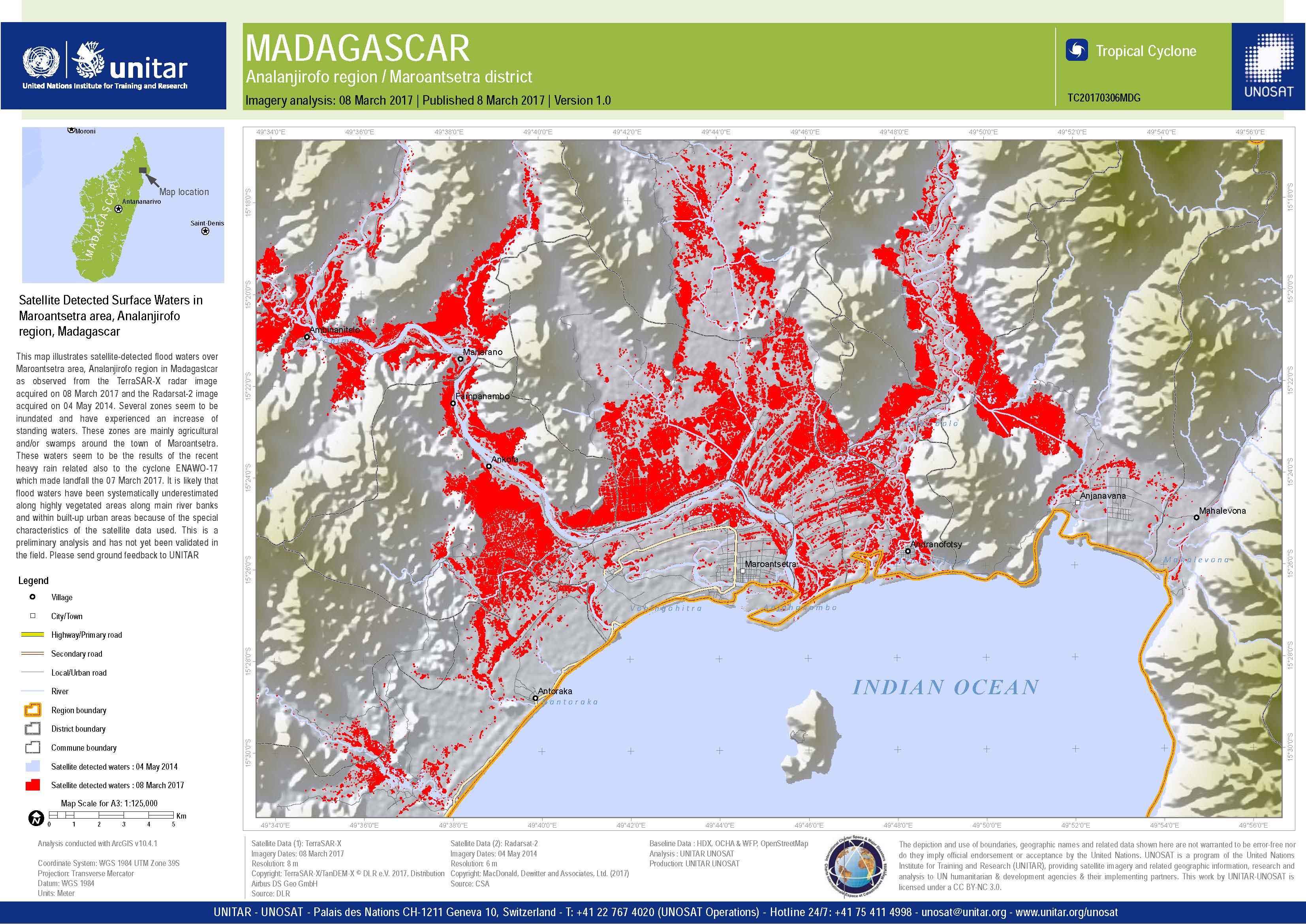
Satellite detected surface water in Maroantsetra area, Madagascar
Авторские права: RADARSAT-2 Data and Products © MacDonald, Dettwiler and Associates Ltd. (2017) - All Rights Reserved. RADARSAT is an official trademark of the Canadian Space Agency.
TerraSAR-X DLR e. V. 2017, Distribution: Airbus DS Geo GmbH
Map produced by UNITAR / UNOSAT
Information about the Product
Получено: RADARSAT-2: 08/03/2017
TerraSAR-X: 04/05/2014
Источник: RADARSAT-2 / TerraSAR-X
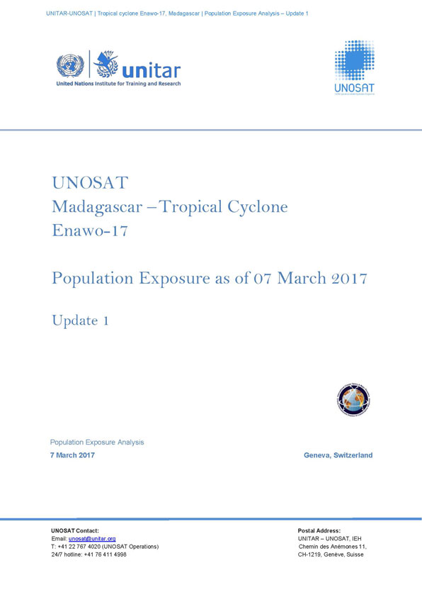
Population exposure analysis of Madagascar following Tropical Cyclone Enawo on 07 March 2017
Download the full report
Авторские права: Report produced by UNITAR/UNOSAT
Population exposure analysis of Madagascar following Tropical Cyclone Enawo on 06 March 2017
Download the full report
Авторские права: Report produced by UNITAR/UNOSAT
 Вернуться к полному архиву активаций

