 English
 Spanish
 French
 Chinese
 Russian
 Portuguese
 Latest Activation
Charter activations
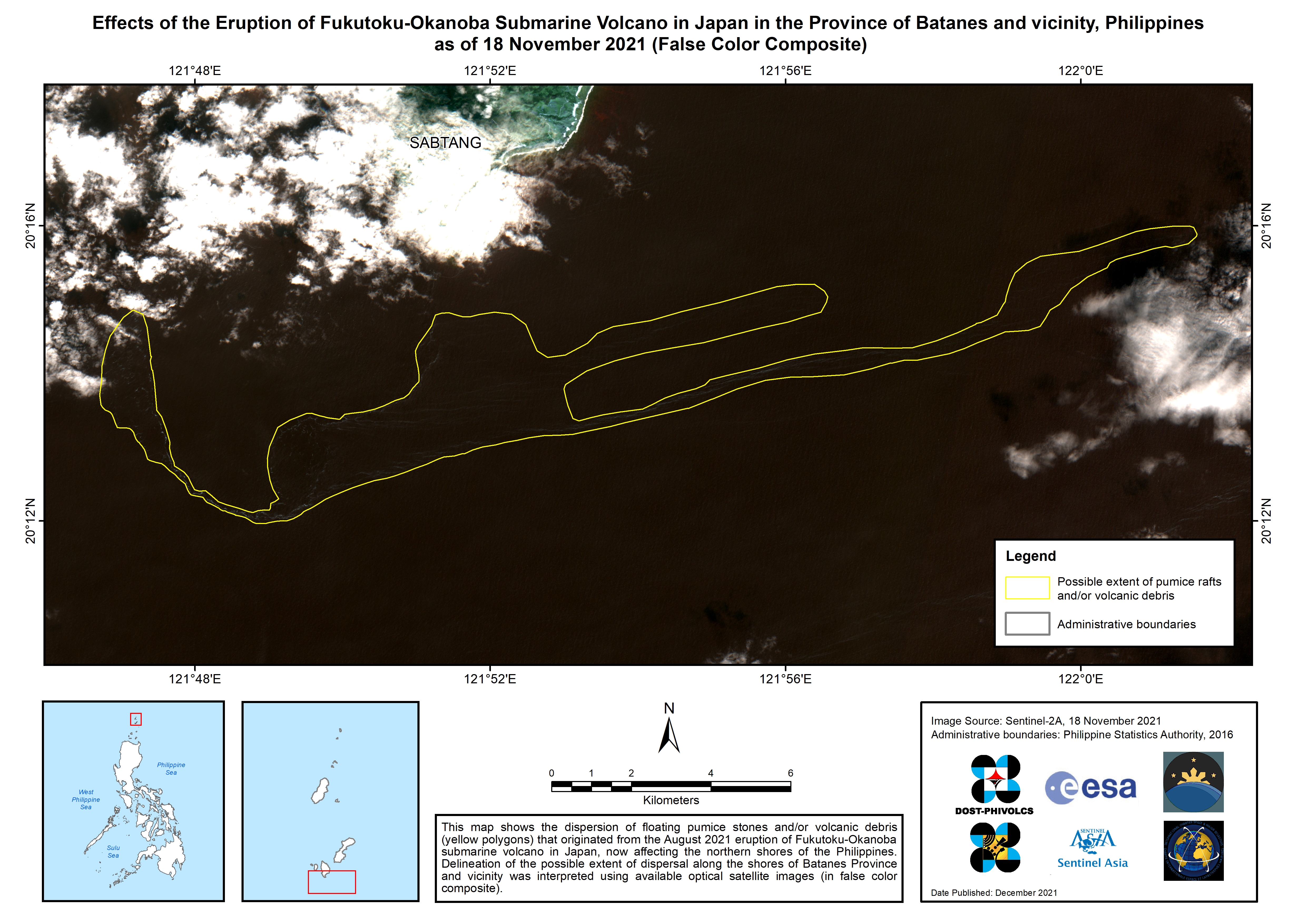
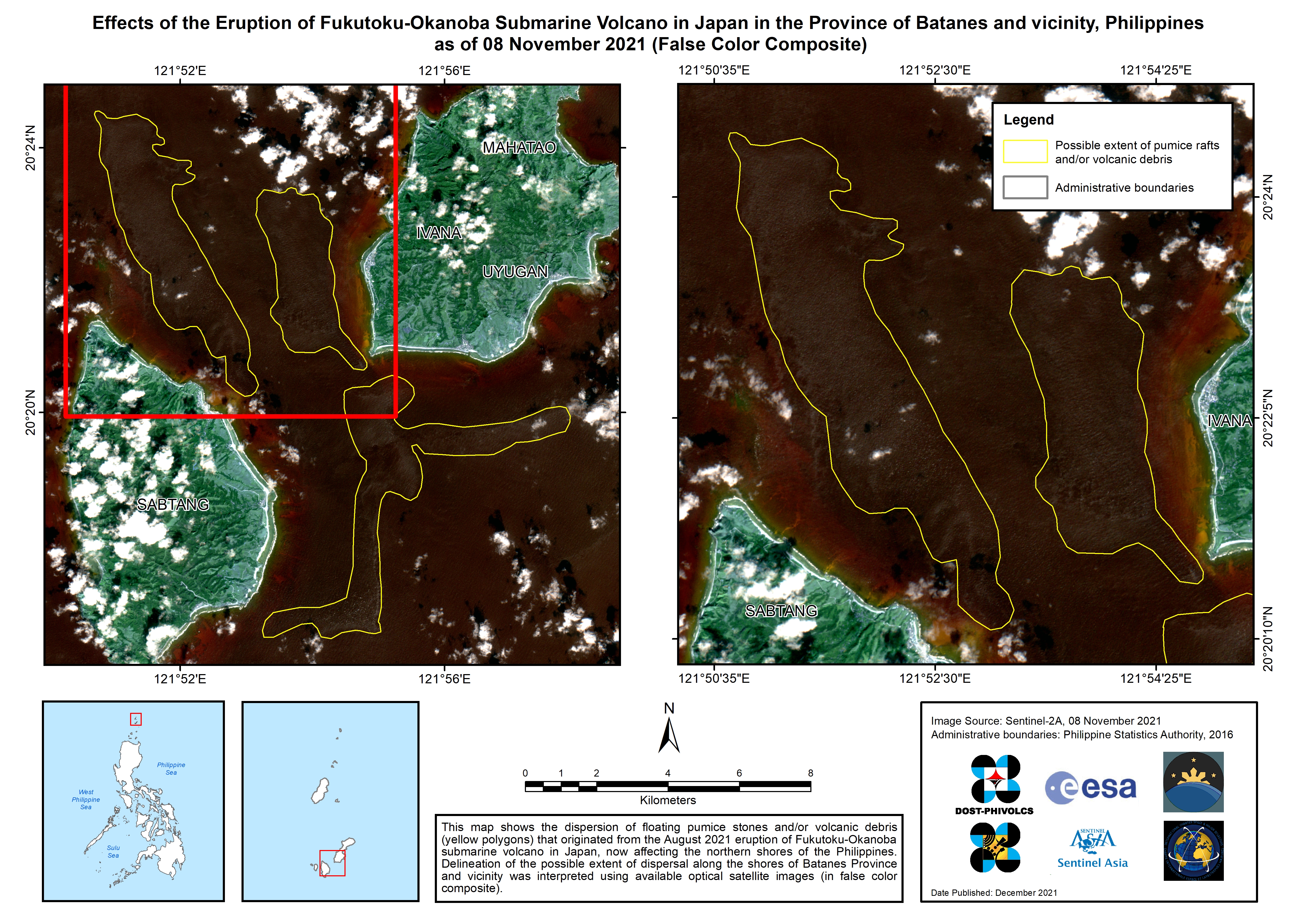
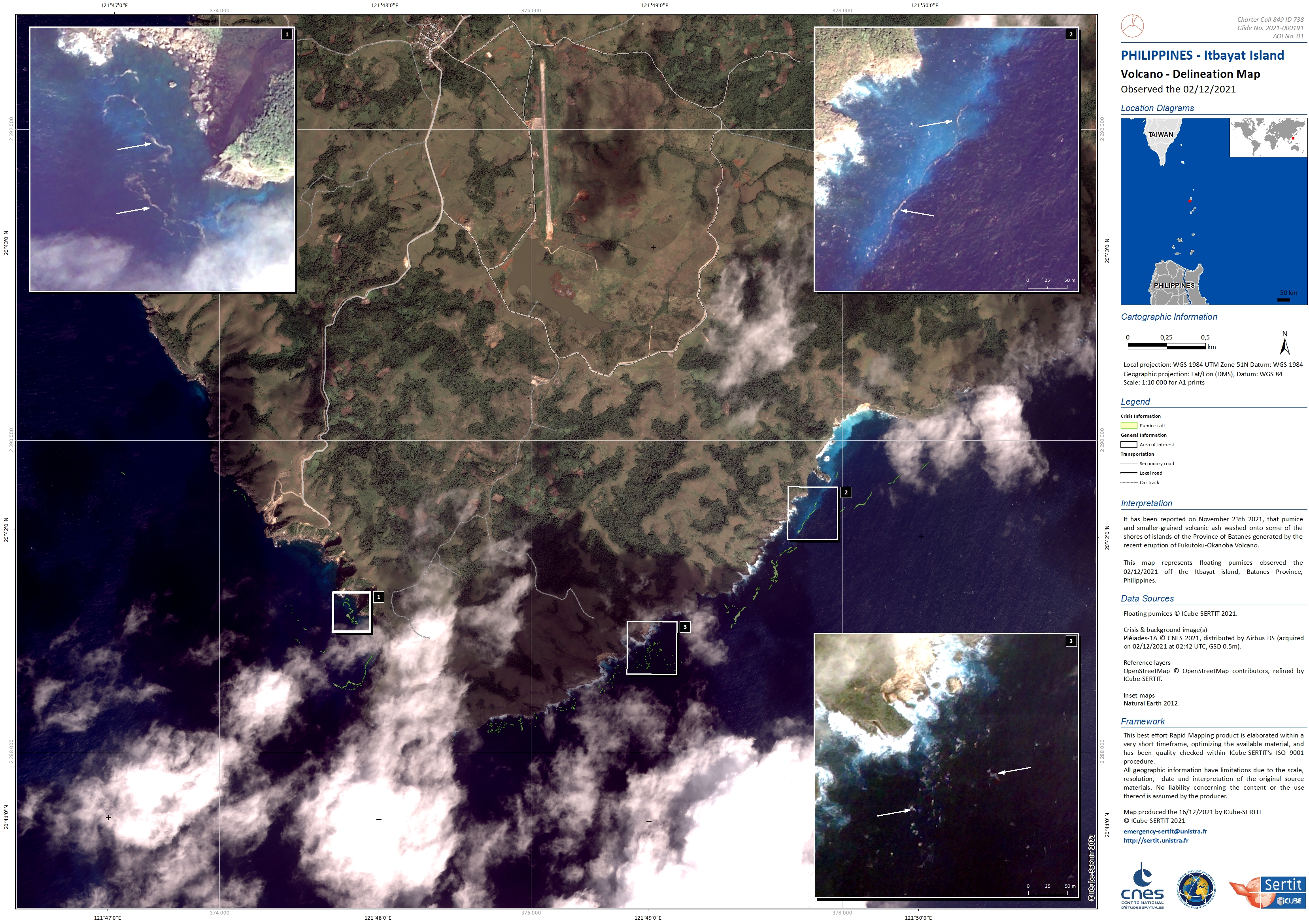
Floating volcanic debris in Philippines from the Fukutoku-Okanoba Submarine Volcano eruption
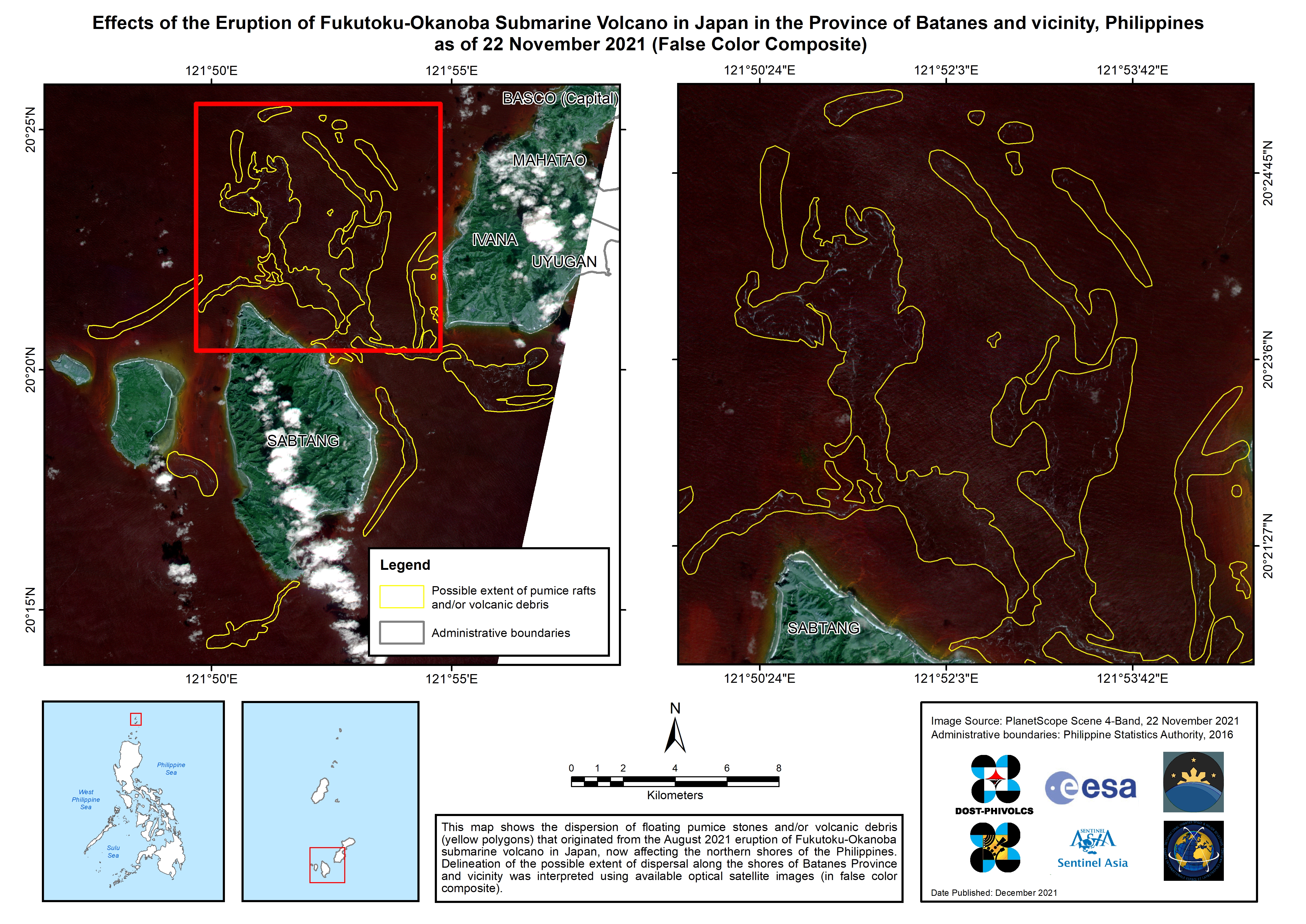
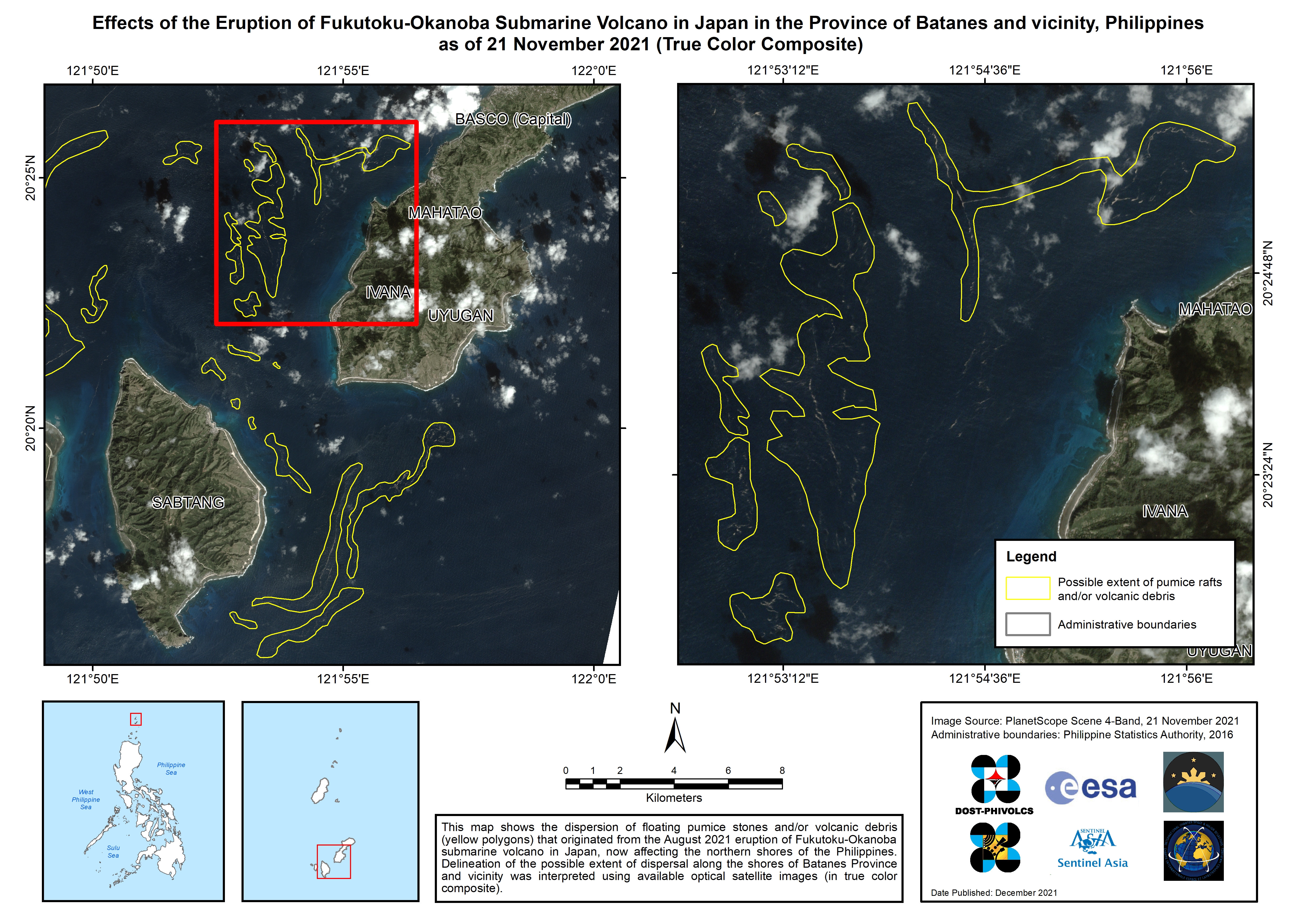
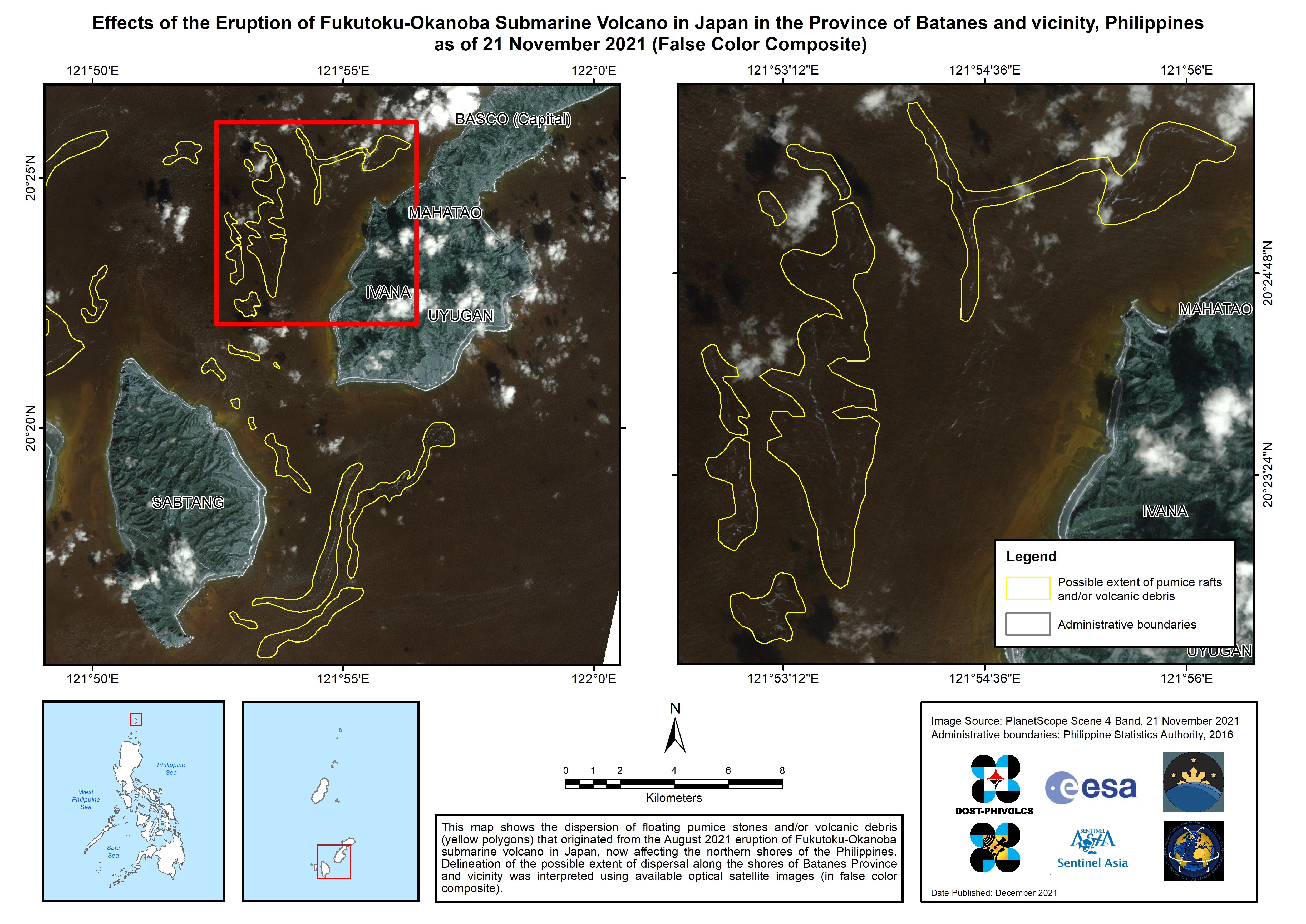
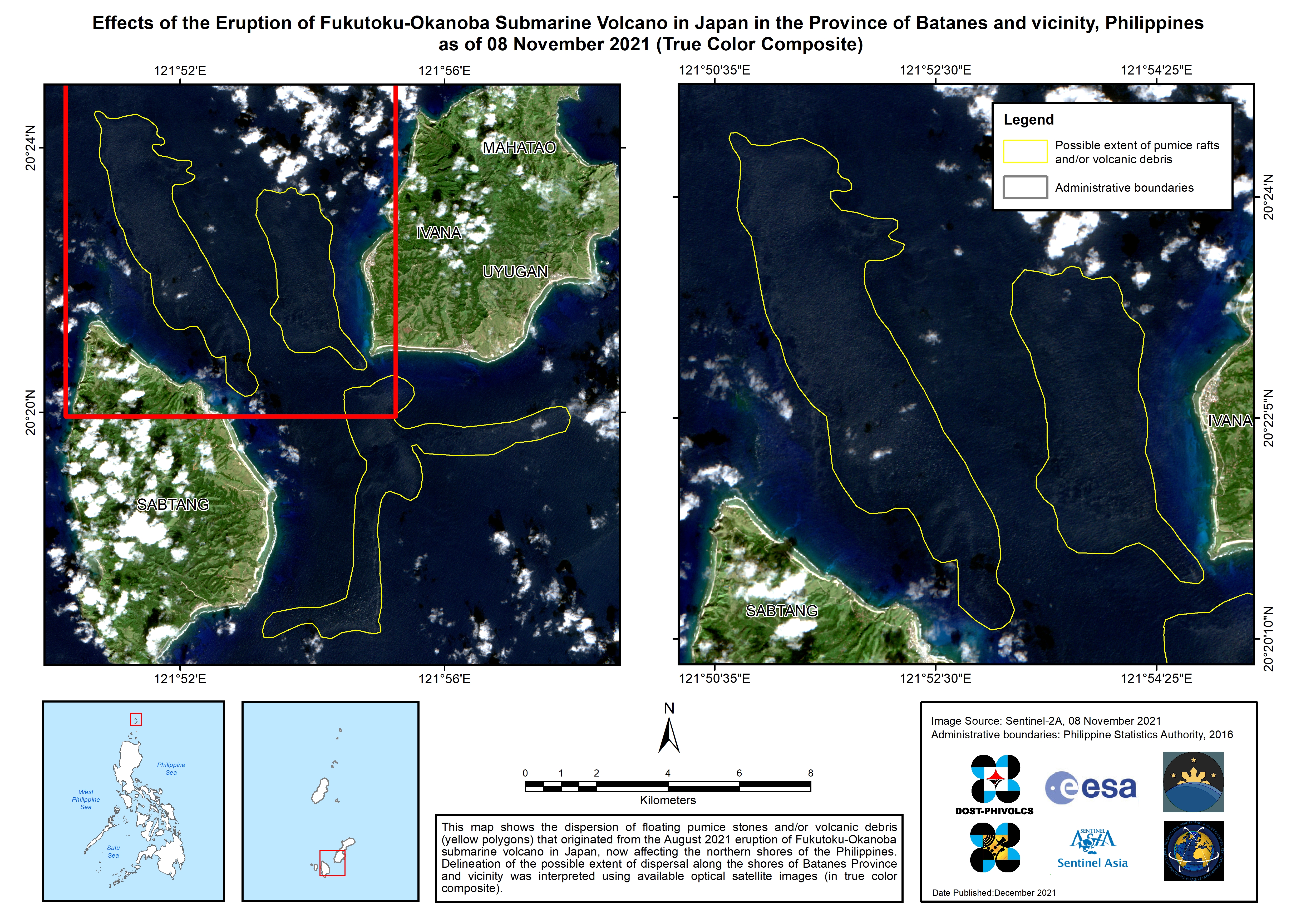
At 07:45 AM Philippine Standard Time (PST) of 23 November 2021, a Batanes Provincial Disaster Risk Reduction and Management Officer (PDRRMO),reported to the DOST-PHIVOLCS Batanes Seismic Station that volcanic material had been washed onto the shores of Sitio Maydangeb, Ivana, Batanes Province. This was first noticed in coves of Batan and Sabtang islands on 21 November 2021.
These materials are pumice and smaller-grained volcanic ash washed onto some of the shores of islands of the Province of Batanes generated by the recent eruption of Fukutoku-Okanoba Volcano.
The eruption also caused huge damages and disruption to the fishing industry, fishing vessels and port operations in Okinawa. Local officials reported that a large number of fish being held in Hentona port had died from swallowing the volcanic debris.
Related News and Resources
| Local do evento: | Philippines |
| Data da Ativação da Carta: | 2021-11-24 |
| Tempo de Ativação da Carta: | 21:24 |
| Zona de Tempo da Ativação da Carta: | UTC+09:00 |
| Requisitante da Carta: | ADRC on behalf of PHIVOLCS |
| ID da Ativação: | 738 |
| Gerenciamento de projeto: | PHIVOLCS |
Products
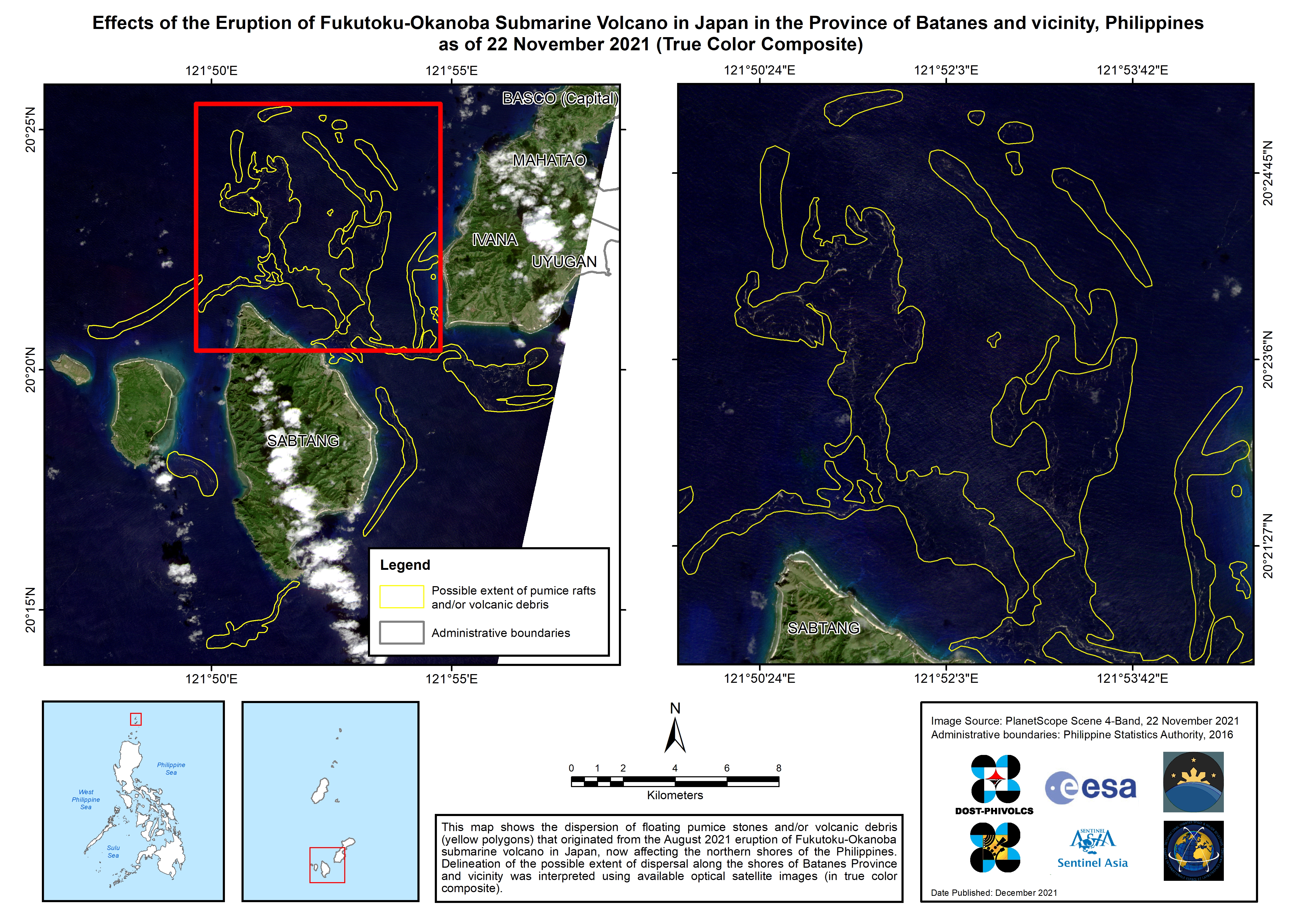
Effects of the Eruption of Fukutoku-Okanoba Submarine Volcano in Japan in the Province of Batanes and vicinity, Philippines
Direitos autorais: © Planet Labs Inc. (2021)
Map produced by DOST - PHIVOLCS
Information about the Product
Adquirida: 22/11/2021
Fonte: PlanetScope
Categoria: Delineation Monitoring Maps
Effects of the Eruption of Fukutoku-Okanoba Submarine Volcano in Japan in the Province of Batanes and vicinity, Philippines
Direitos autorais: © Planet Labs Inc. (2021)
Map produced by DOST - PHIVOLCS
Information about the Product
Adquirida: 21/11/2021
Fonte: PlanetScope
Categoria: Delineation Monitoring Maps
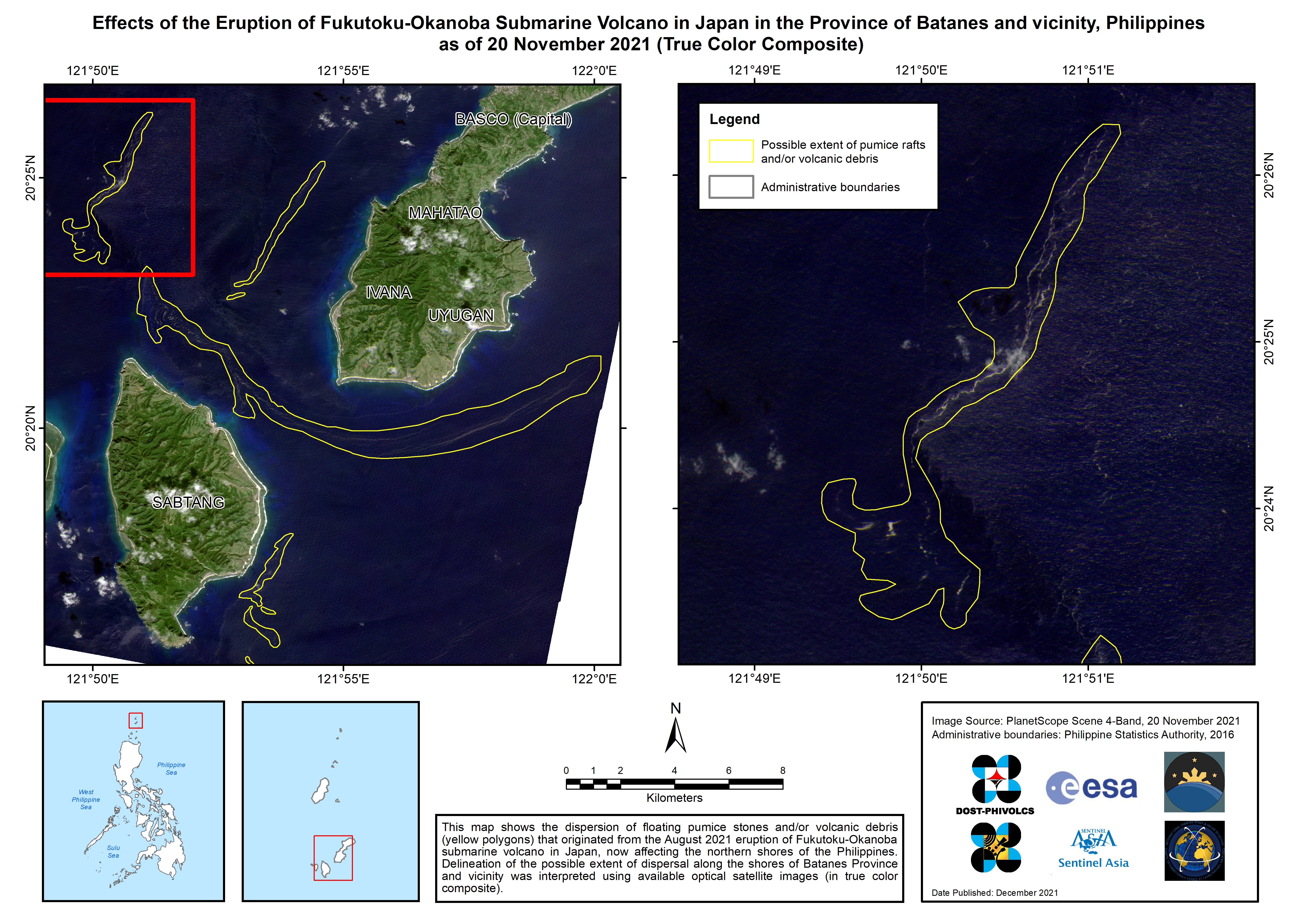
Effects of the Eruption of Fukutoku-Okanoba Submarine Volcano in Japan in the Province of Batanes and vicinity, Philippines
Direitos autorais: © Planet Labs Inc. (2021)
Map produced by DOST - PHIVOLCS
Information about the Product
Adquirida: 20/11/2021
Fonte: PlanetScope
Categoria: Delineation Monitoring Maps
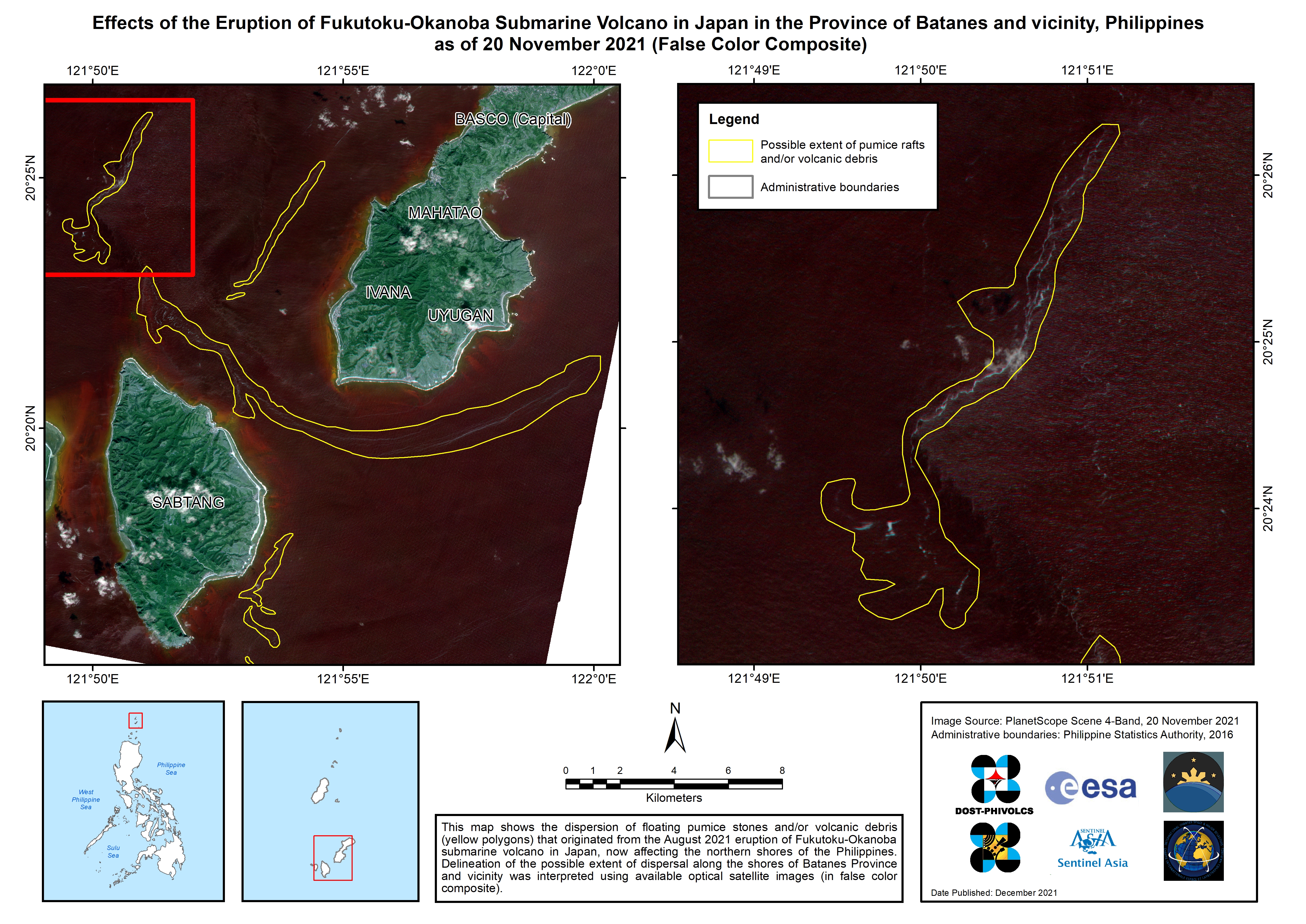
Effects of the Eruption of Fukutoku-Okanoba Submarine Volcano in Japan in the Province of Batanes and vicinity, Philippines
Direitos autorais: © Planet Labs Inc. (2021)
Map produced by DOST - PHIVOLCS
Information about the Product
Adquirida: 20/11/2021
Fonte: PlanetScope
Categoria: Delineation Monitoring Maps
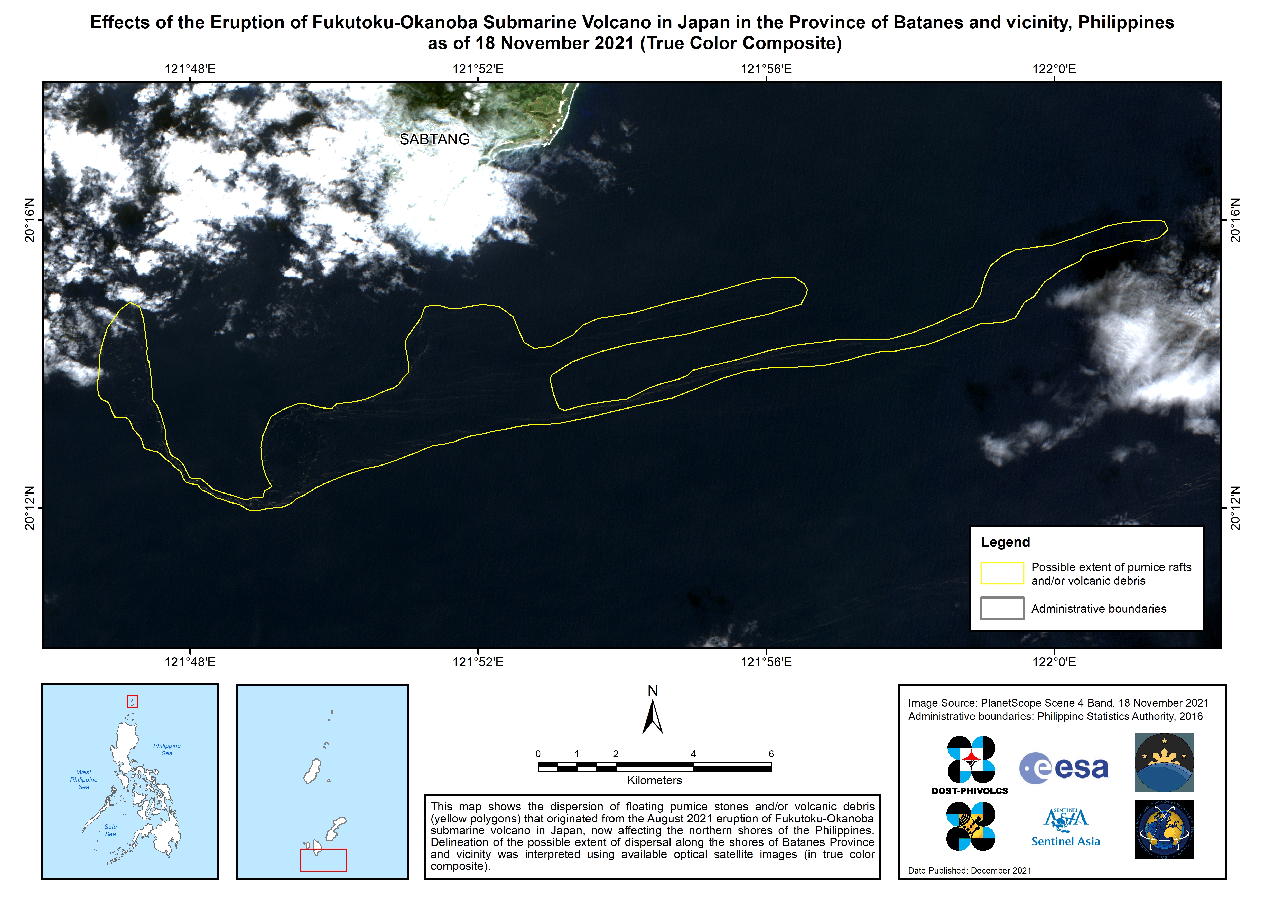
Effects of the Eruption of Fukutoku-Okanoba Submarine Volcano in Japan in the Province of Batanes and vicinity, Philippines
Direitos autorais: Contains modified Copernicus Sentinel data (2021)
Map produced by DOST - PHIVOLCS
Information about the Product
Adquirida: 18/11/2021
Fonte: Sentinel-2
Categoria: Delineation Monitoring Maps
Effects of the Eruption of Fukutoku-Okanoba Submarine Volcano in Japan in the Province of Batanes and vicinity, Philippines
Direitos autorais: Contains modified Copernicus Sentinel data (2021)
Map produced by DOST - PHIVOLCS
Information about the Product
Adquirida: 08/11/2021
Fonte: Sentinel-2
Categoria: Delineation Monitoring Maps
Effects of the Eruption of Fukutoku-Okanoba Submarine Volcano in Japan in the Province of Batanes and vicinity, Philippines
Direitos autorais: Contains modified Copernicus Sentinel data (2021)
Information about the Product
Adquirida: 18/11/2021
Fonte: Sentinel-2
Categoria: Delineation Monitoring Maps
Effects of the Eruption of Fukutoku-Okanoba Submarine Volcano in Japan in the Province of Batanes and vicinity, Philippines
Direitos autorais: Contains modified Copernicus Sentinel data (2021)
Map produced by DOST- PHIVOLCS
Information about the Product
Adquirida: 08/11/2021
Fonte: Sentinel-2
Categoria: Delineation Monitoring Maps
 Voltar ao arquivo completo da Ativação

