 English
 Spanish
 French
 Chinese
 Russian
 Portuguese
 Latest Activation
Charter activations
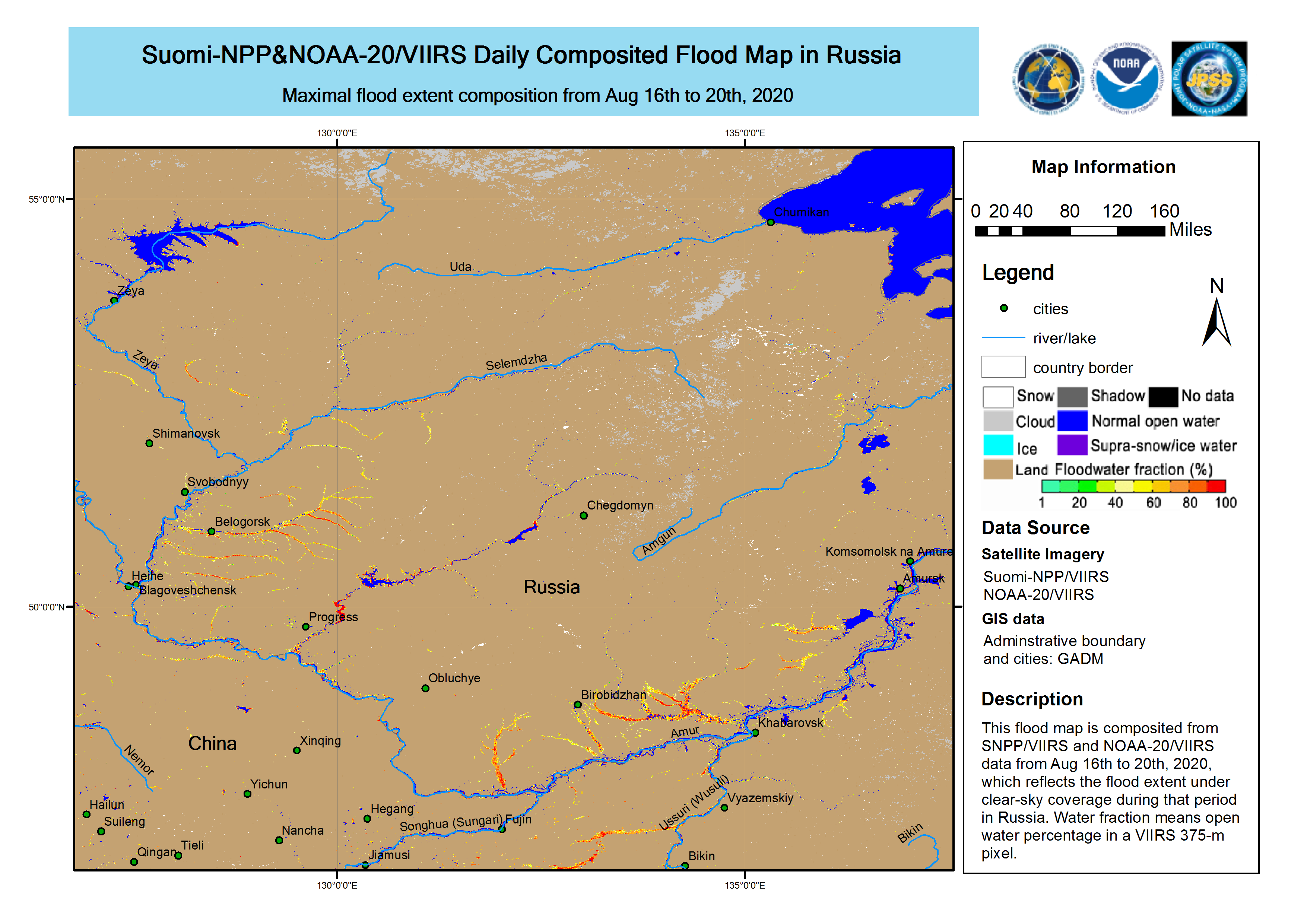
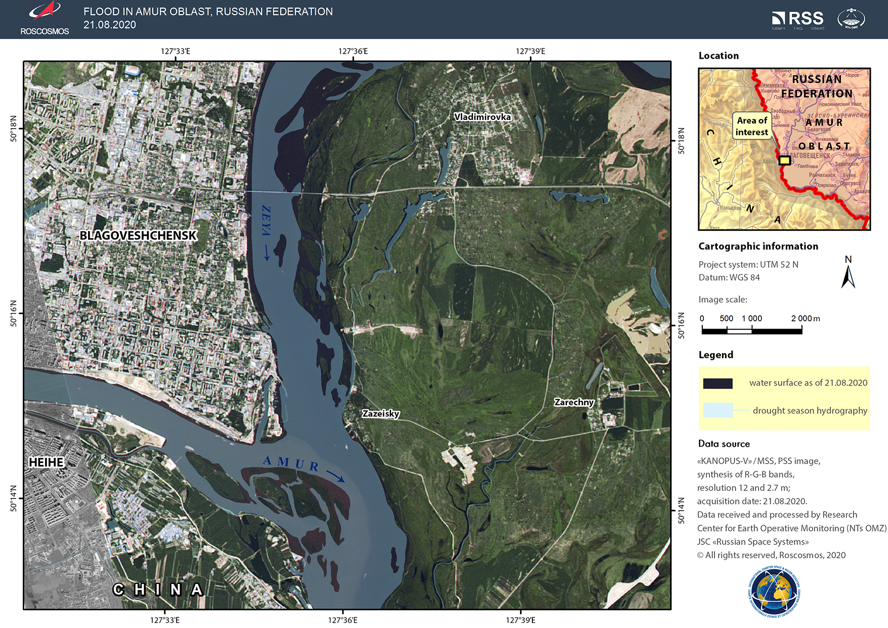
Flood in Russia
Heavy rain has caused flooding in south east Russia, between Khabarovsk Krai and Amur Oblast.
The full impact of the floods is not yet known, but it is expected that several towns and villages in the area are affected.
| Tipo de evento: | Flood |
| Local do evento: | Russian Federation |
| Data da Ativação da Carta: | 2020-08-19 |
| Tempo de Ativação da Carta: | 15:20 |
| Zona de Tempo da Ativação da Carta: | UTC+03:00 |
| Requisitante da Carta: | Ministry of the Russian Federation for Civil Defense, Emergencies and Elimination of Natural Disasters (EMERCOM) |
| ID da Ativação: | 670 |
| Gerenciamento de projeto: | ROSCOSMOS |
Products
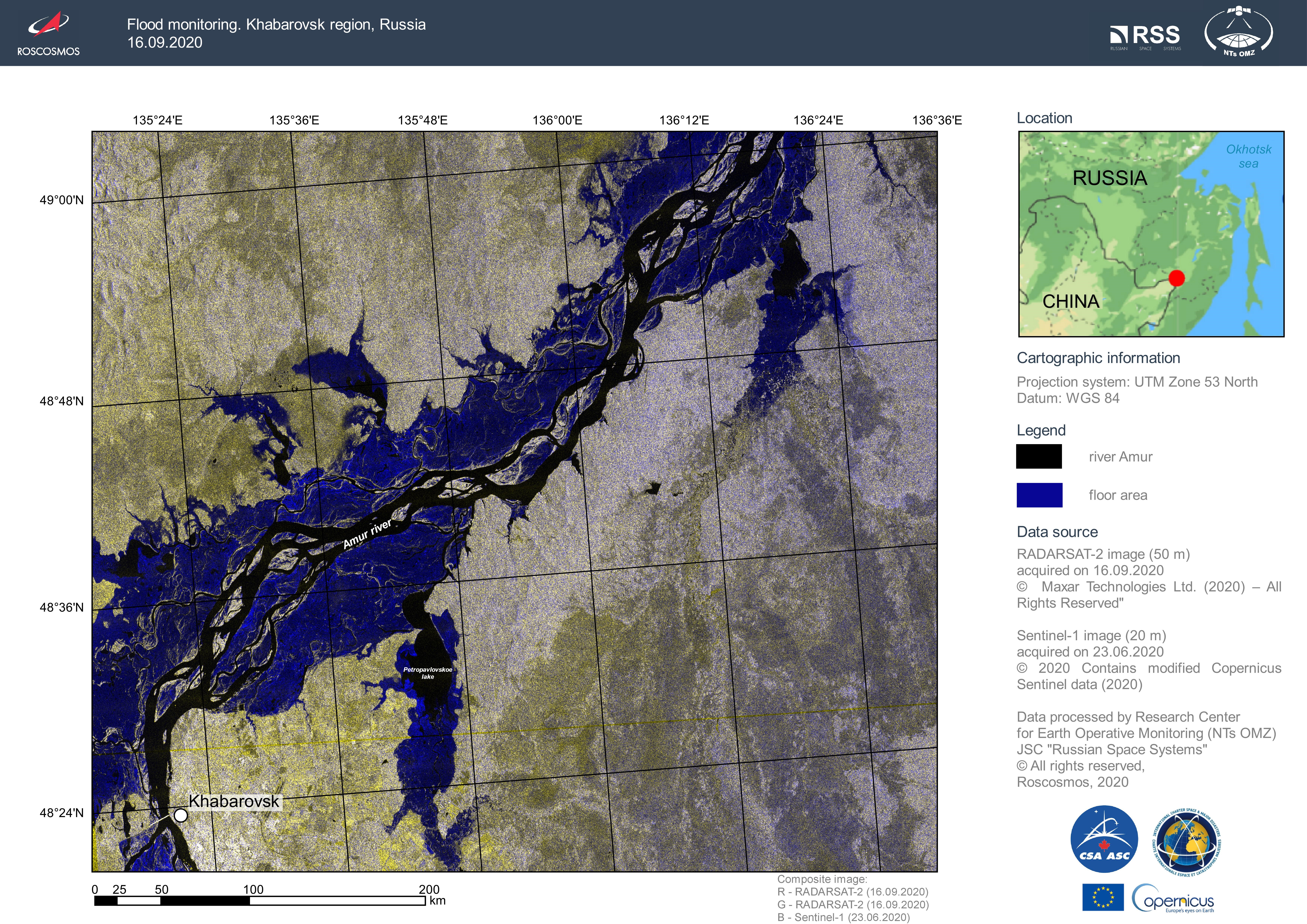
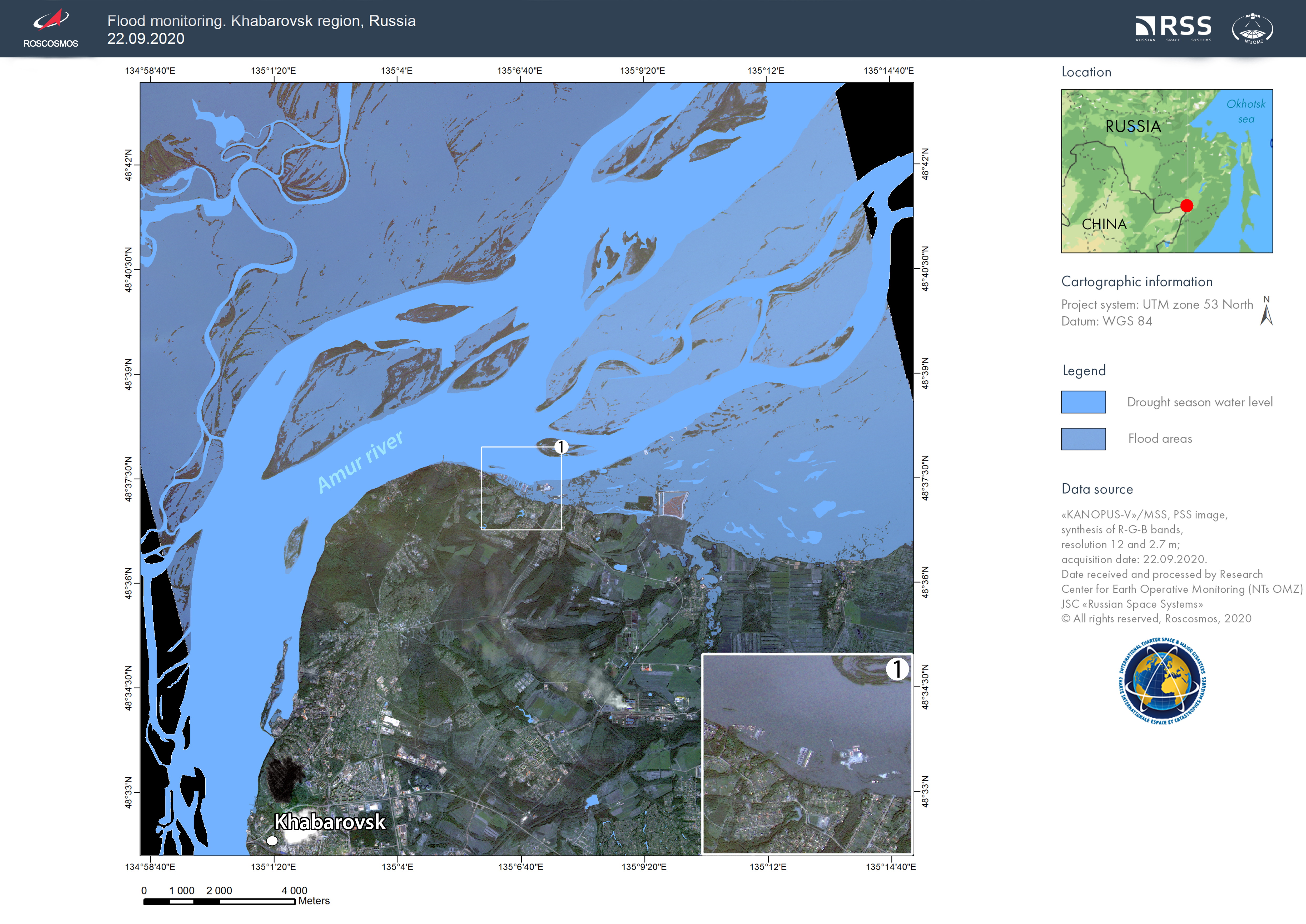
Khabarovsk region, Russia - Flood monitoring
Direitos autorais: RADARSAT-2 Data and Products © Maxar Technologies Ltd. (2020) – All Rights Reserved
RADARSAT is an official mark of the Canadian Space Agency
Sentinel-1 © Contains modified Copernicus Sentinel data (2020)
Map produced by NTs OMZ
Information about the Product
Adquirida: Sentinel-1: 23/06/2020
RADARSAT-2: 16/09/2020
Fonte: RADARSAT-2 / Sentinel-1
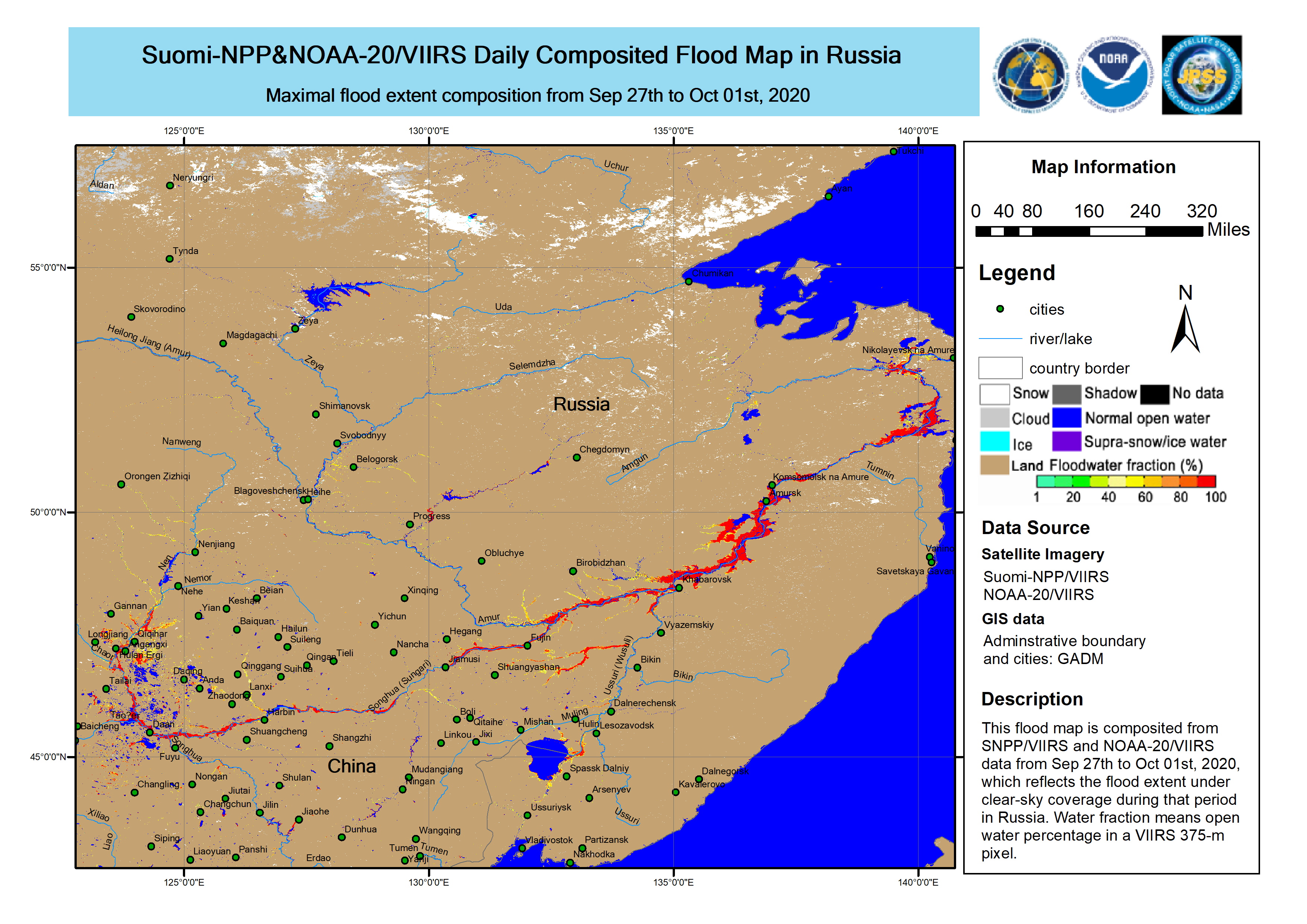
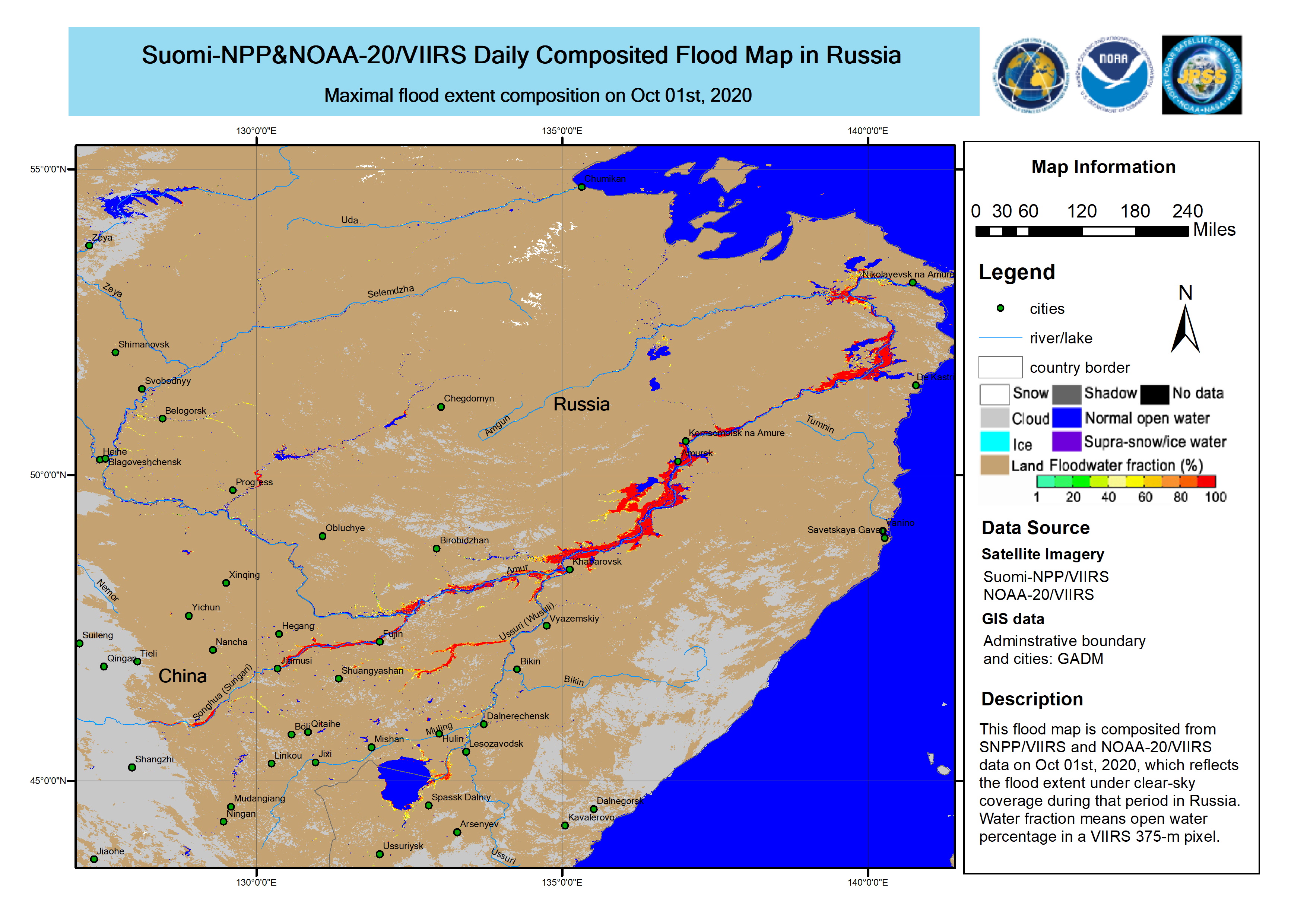
5 day maximum flood extend from the NOAA LEO Flood product over southeast Russia, between Khabarovsk Krai and Amur Oblast, from 27 September to 1 October 2020
Direitos autorais: NOAA - Suomi NPP / NOAA-20
Map produced by NOAA
Information about the Product
Adquirida: 27/09/2020 - 01/10/2020
Fonte: NOAA-20, Suomi NPP


 Voltar ao arquivo completo da Ativação

