 English
 Spanish
 French
 Chinese
 Russian
 Portuguese
 Latest Activation
Charter activations
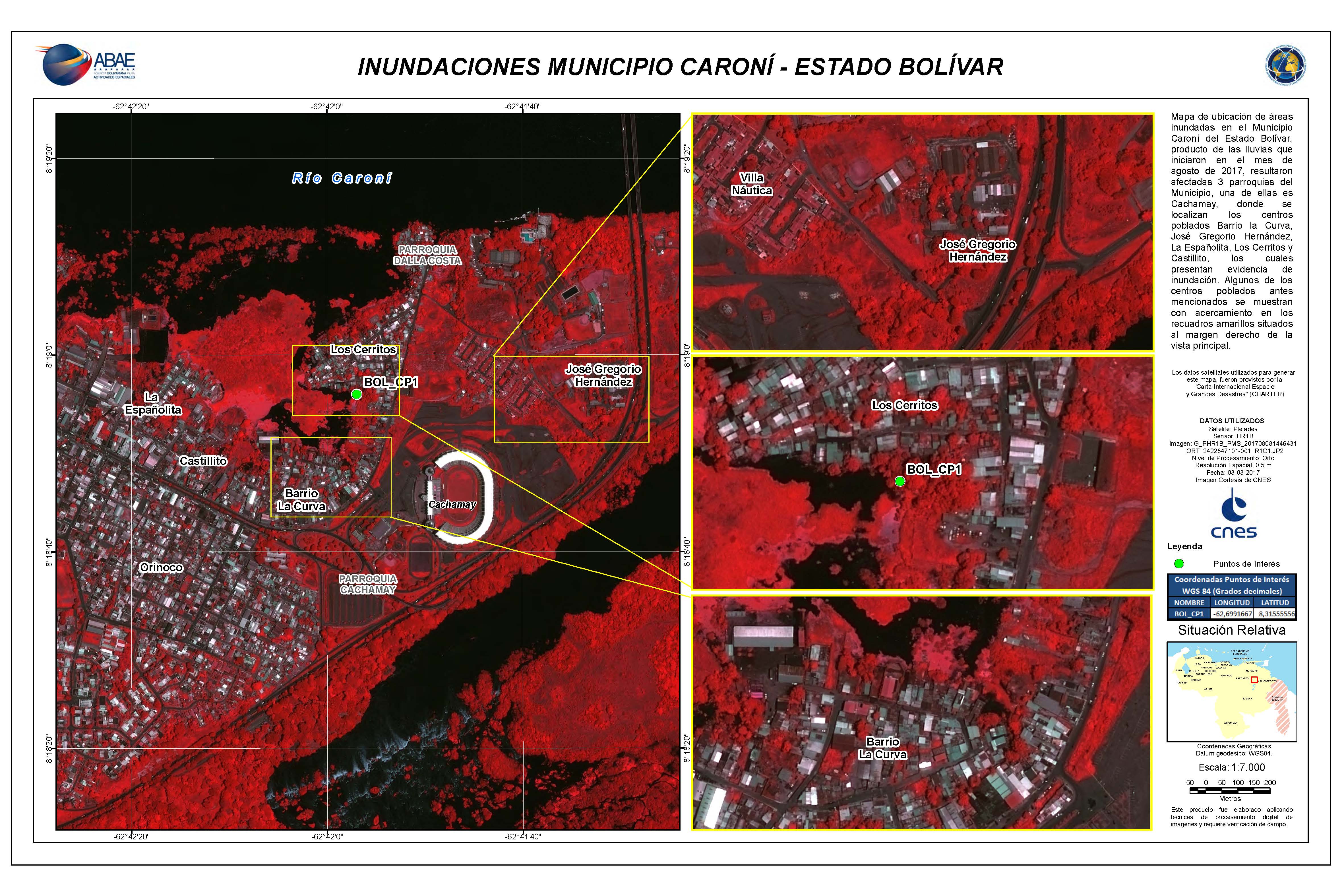
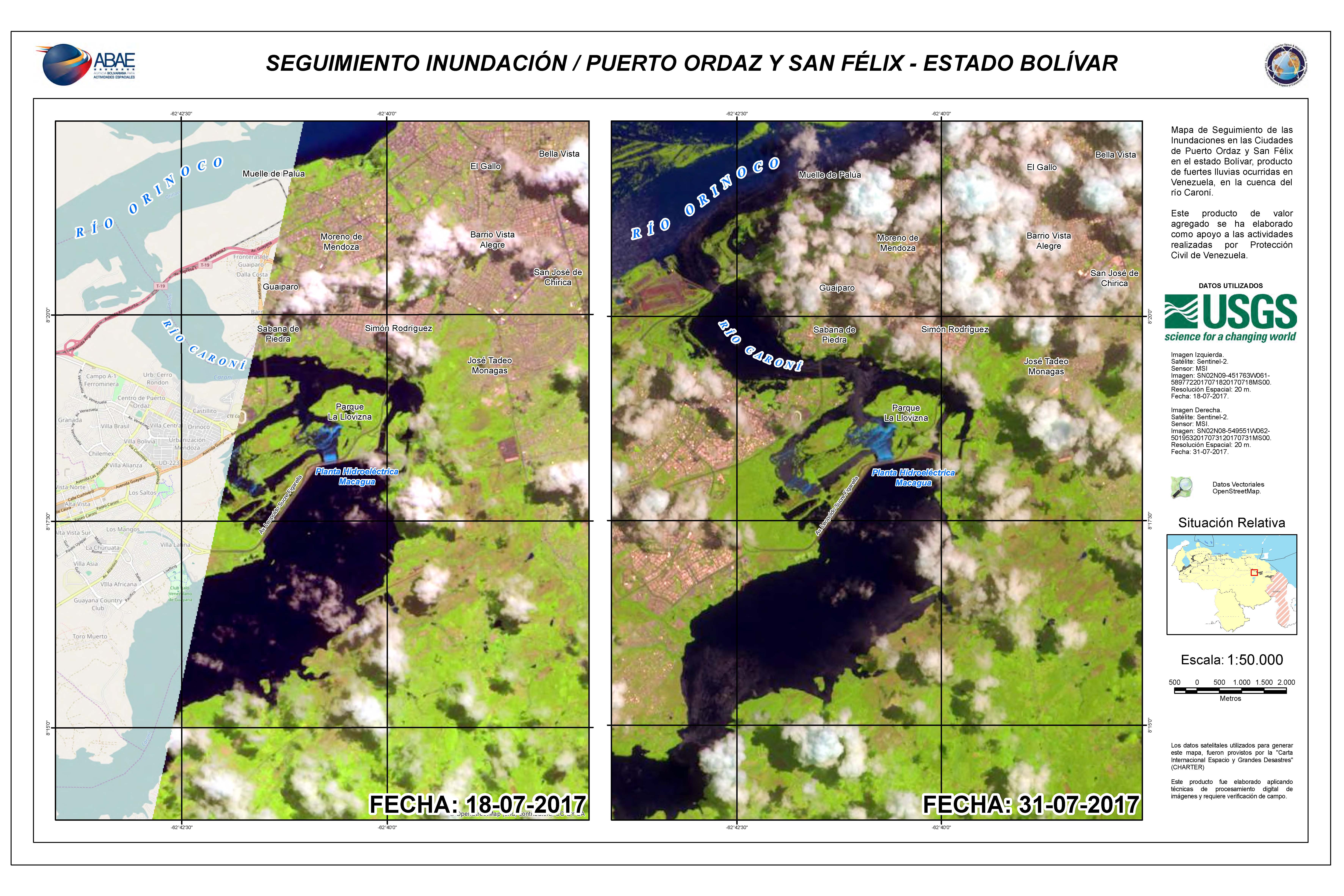
Flood in Venezuela
Heavy rains fell for several days across eastern parts of Venezuela causing widespread flooding.
The floods are affecting an estimated number of 15,000 people and 500 have been forced to evacuate their homes. Largely affected areas are the states of Delta Amacuro, Bolivar and Merida.
The water level in the Orinoco and Caroni River's have risen, causing flooding to nearby residential areas.
The Civil Protection Agency of Venezuela raised alert levels to the highest level and provided support to people in the worst affected areas.
| Tipo de evento: | Flood |
| Local do evento: | Venezuela |
| Data da Ativação da Carta: | 6 August 2017 |
| Tempo de Ativação da Carta: | 22:04:00 |
| Zona de Tempo da Ativação da Carta: | UTC-04:00 |
| Requisitante da Carta: | ABAE on behalf of Civil Protection of Venezuela |
| ID da Ativação: | 541 |
| Gerenciamento de projeto: | ABAE |
Products
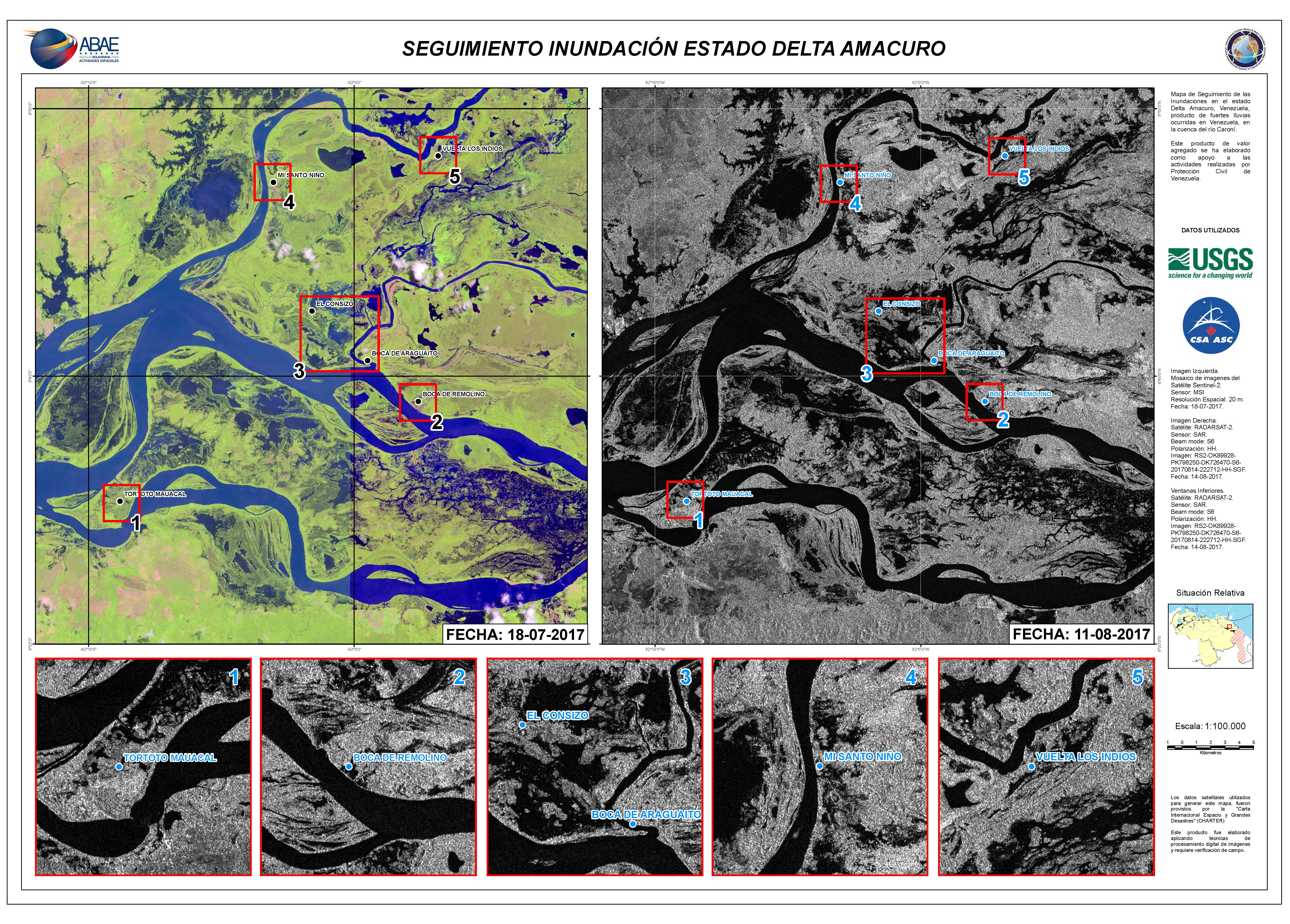
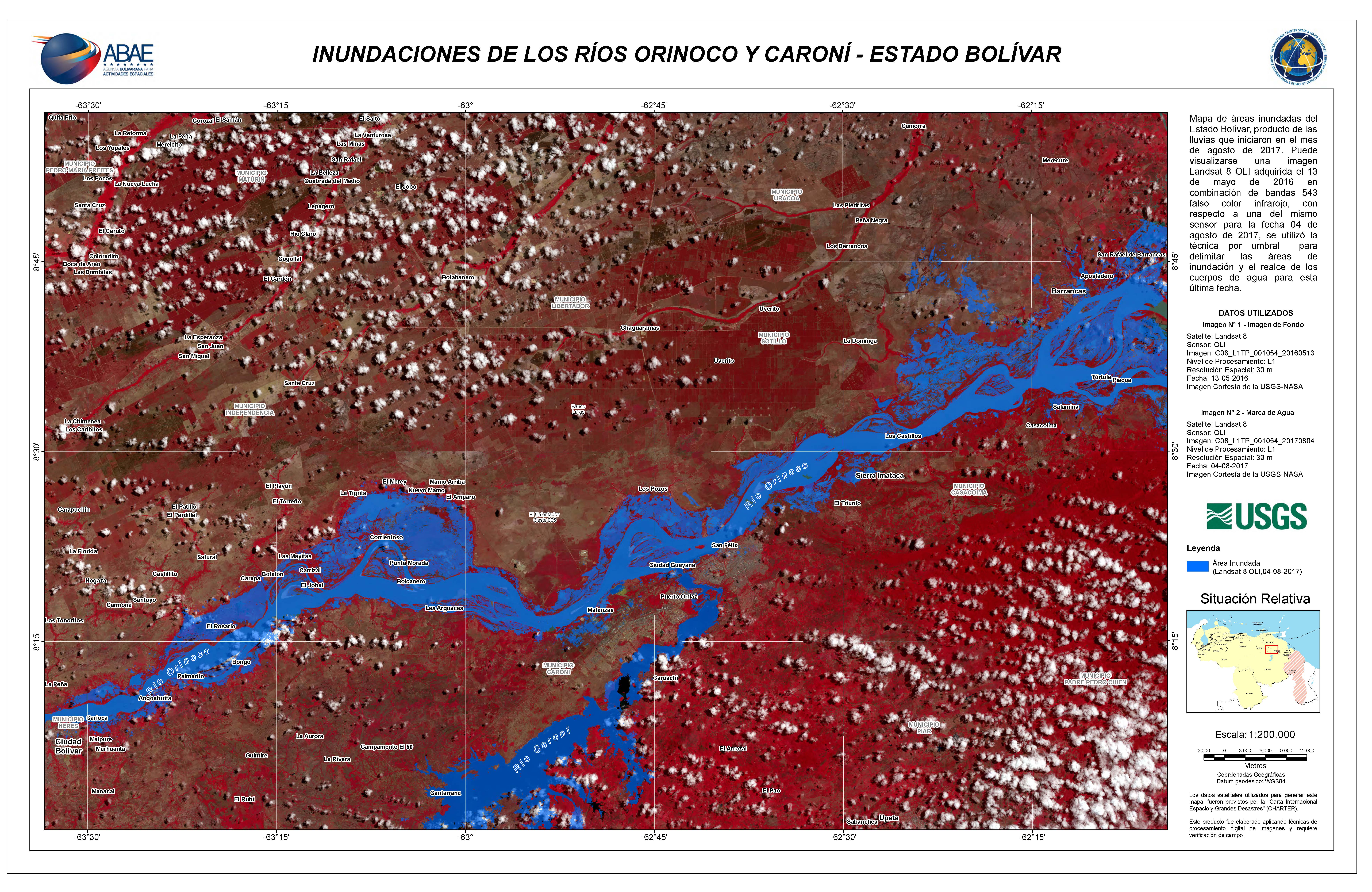
Flooding in Delta Amacuro State
Direitos autorais: RADARSAT-2 Data and Products © MacDonald, Dettwiler and Associates Ltd. (2017) - All Rights Reserved. RADARSAT is an official trademark of the Canadian Space Agency.
Sentinel-2 © Copernicus Sentinel data (2017)
Map produced by ABAE
Information about the Product
Adquirida: Sentinel-2: 18/07/2017
RADARSAT-2: 11/08/2017
Fonte: Sentinel-2 / RADARSAT-2
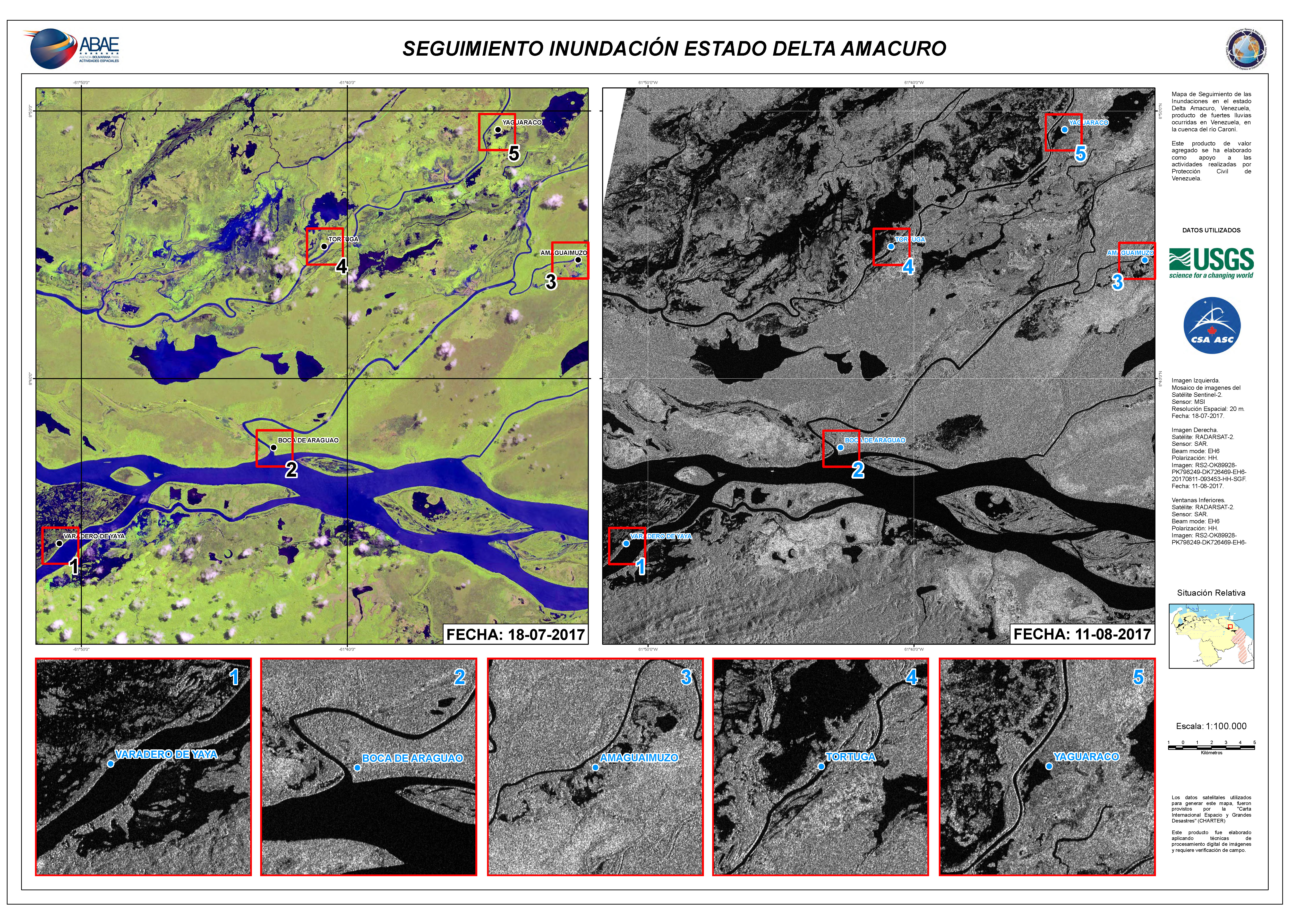
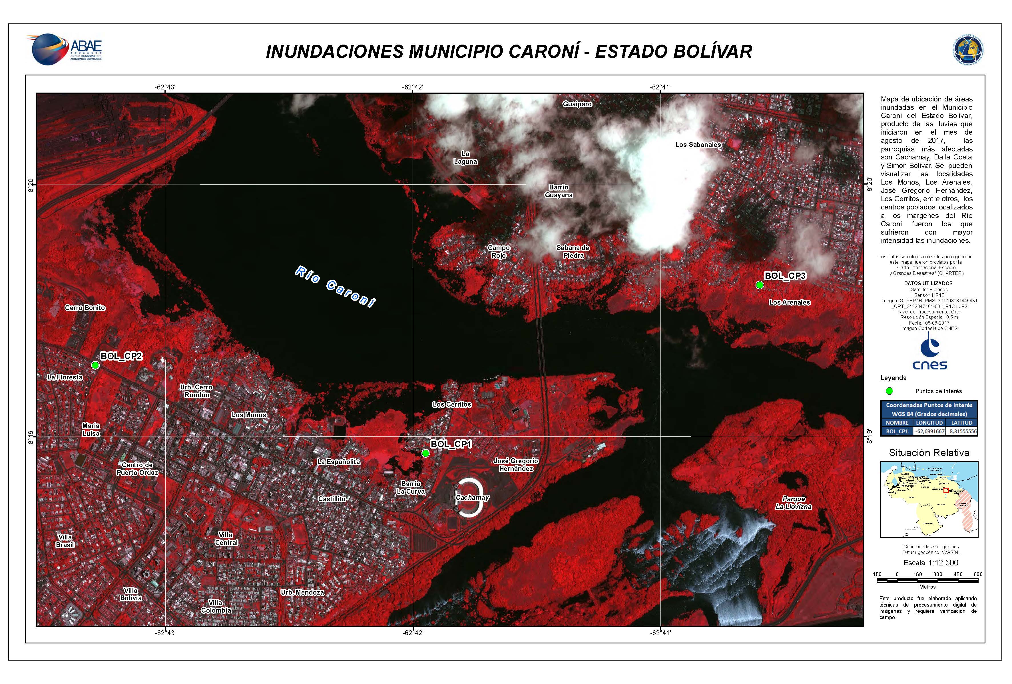
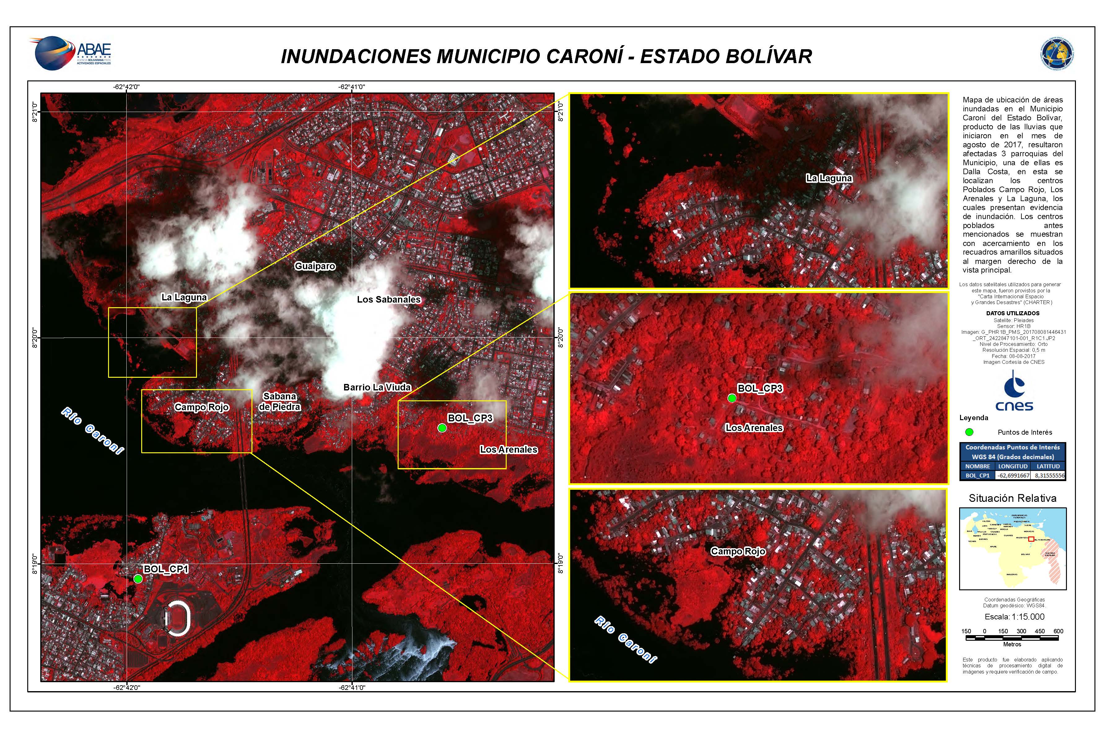
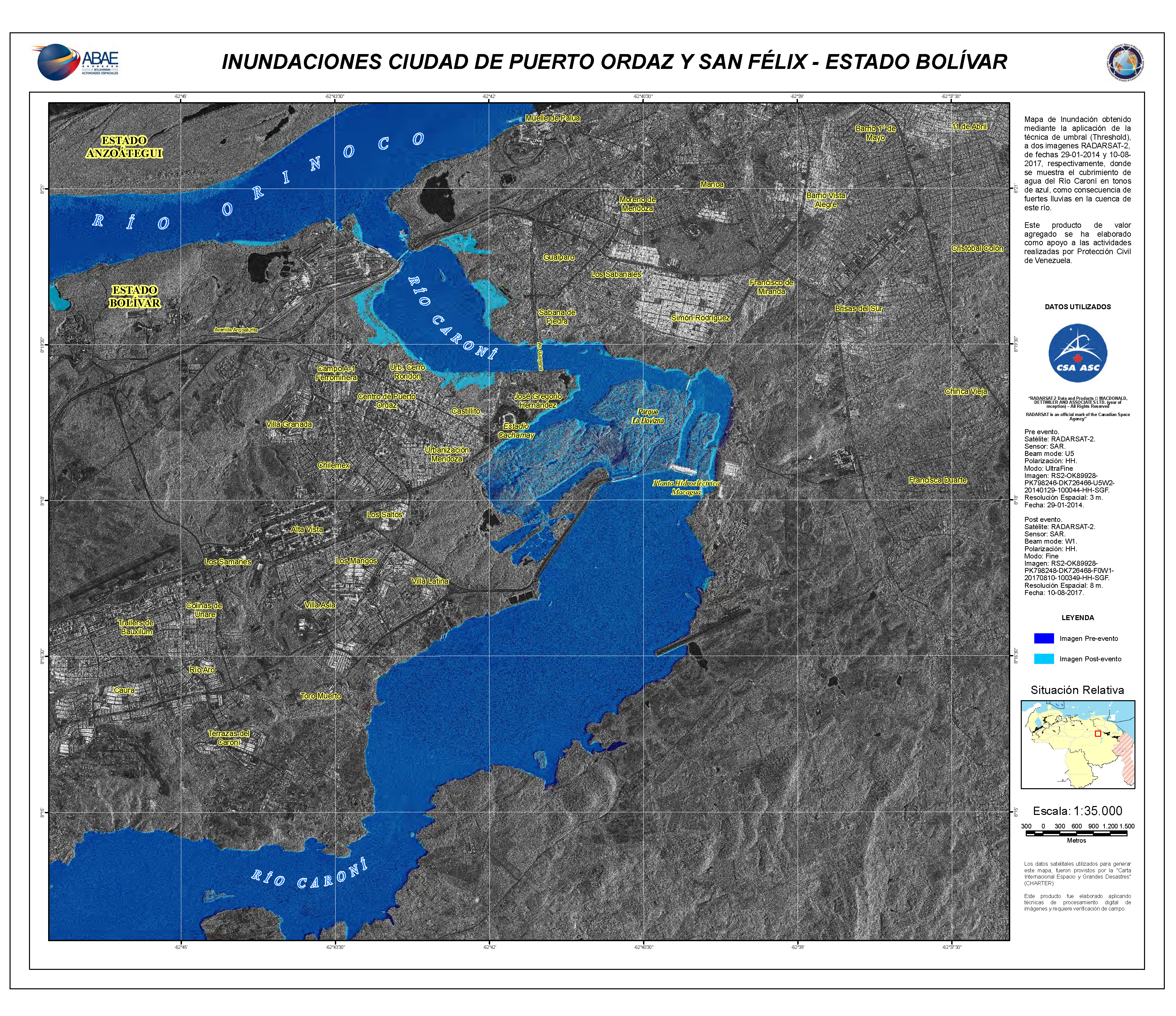
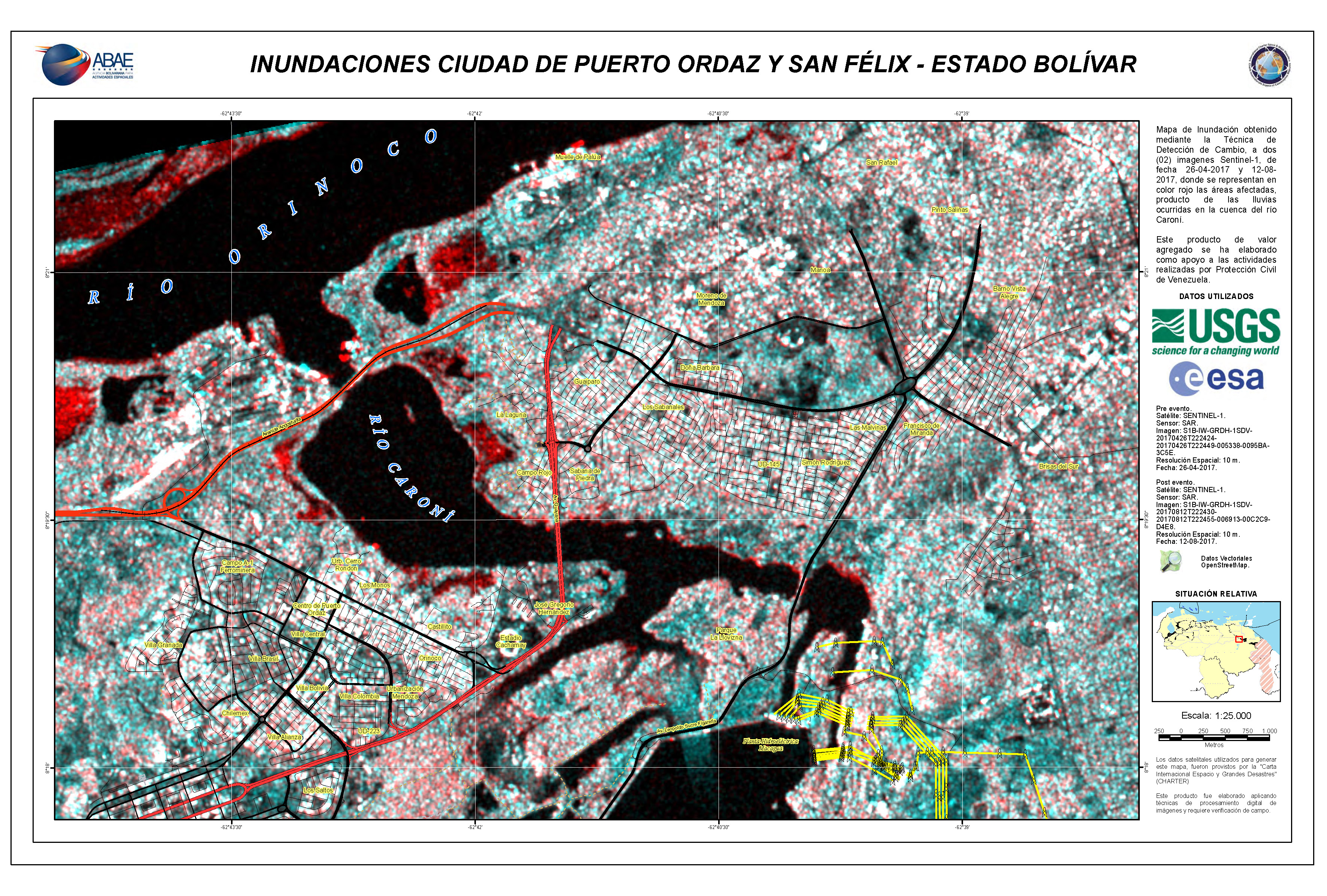
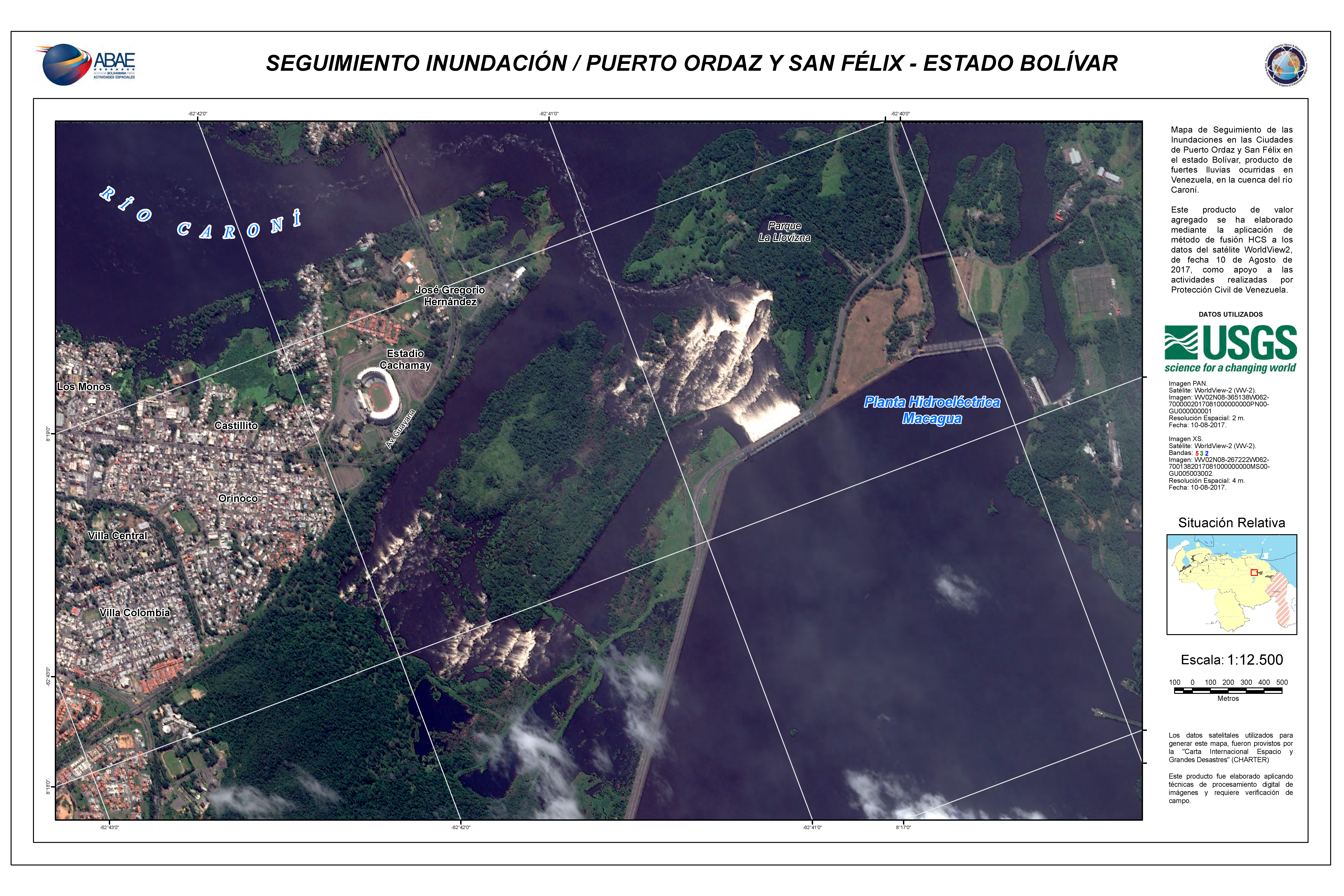
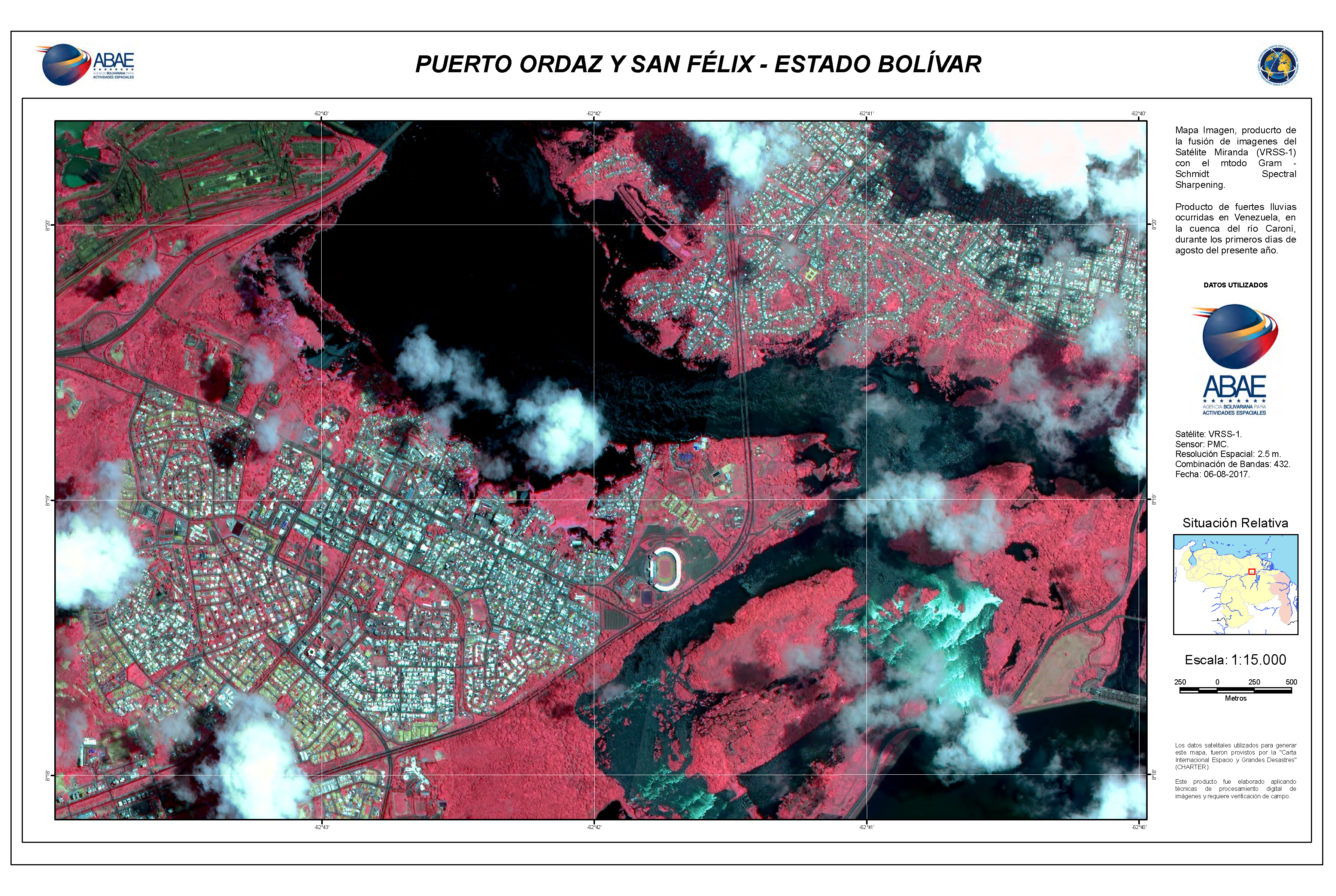
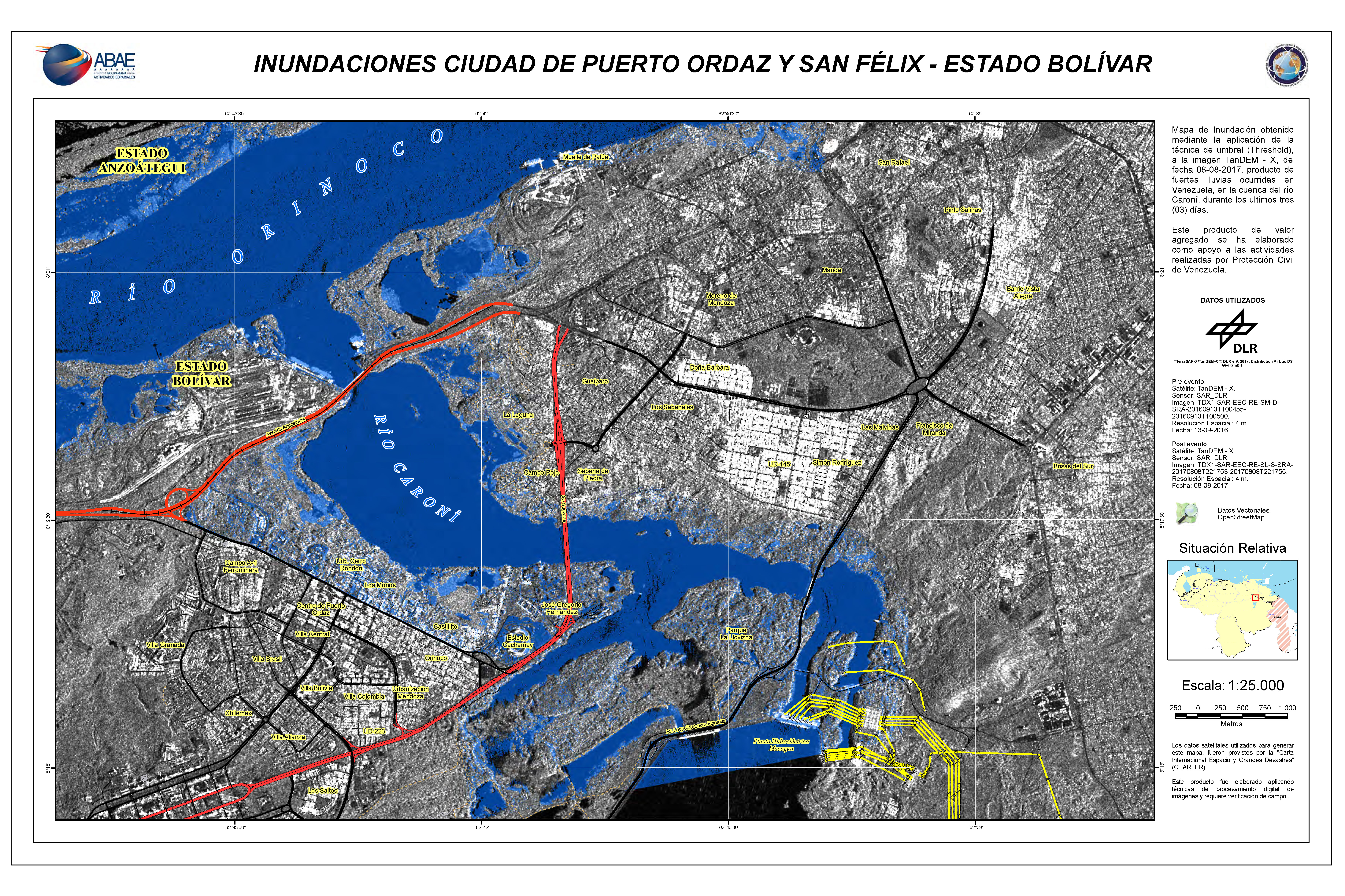
Flooding in Puerto Ordaz and San Felix, Bolivar State
Direitos autorais: RADARSAT-2 Data and Products © MacDonald, Dettwiler and Associates Ltd. (2017) - All Rights Reserved. RADARSAT is an official trademark of the Canadian Space Agency.
Map produced by ABAE
Information about the Product
Adquirida: Pre-disaster: 29/01/2014
Post-disaster: 10/08/2017
Fonte: RADARSAT-2


 Voltar ao arquivo completo da Ativação

