 English
 Spanish
 French
 Chinese
 Russian
 Portuguese
 Dernière activation
Charter activations
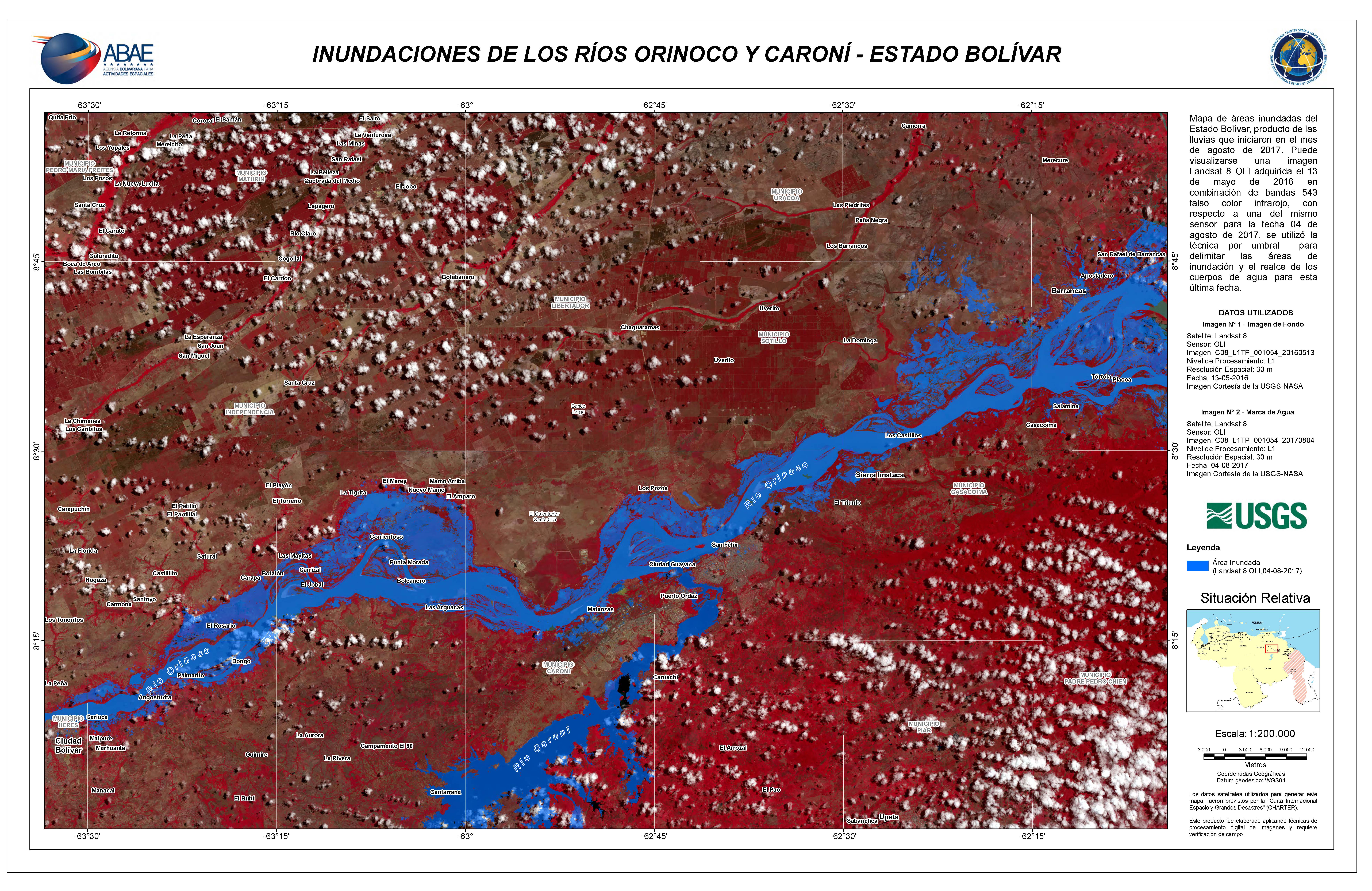
Inondation au Venezuela
De fortes pluies sont tombées pendant plusieurs jours dans les parties orientales du Venezuela et ont causé la propagation des inondations.
Les inondations ont affecté un nombre estimé à 15 000 personnes et 500 ont été obligées d'évacuer leurs maisons. Les régions très touchées sont les états de Delta Amacuro, de Bolivar et de Mérida.
Le niveau d'eau des rivières Orinoco et Caroni s'est élevé, provoquant des inondations dans les zones résidentielles voisines.
L'Agence de protection civile du Venezuela a augmenté les niveaux d'alerte au plus haut niveau et a aidé les personnes dans les zones les plus touchées.
| Type of Event: | Inonder |
| Location of Event: | Venezuela |
| Date of Charter Activation: | 6 août 2017 |
| Time of Charter Activation: | 22:04:00 |
| Time zone of Charter Activation: | UTC-04:00 |
| Charter Requestor: | ABAE au nom de la protection civile du Venezuela |
| Activation ID: | 541 |
| Project Management: | ABAE |
Products
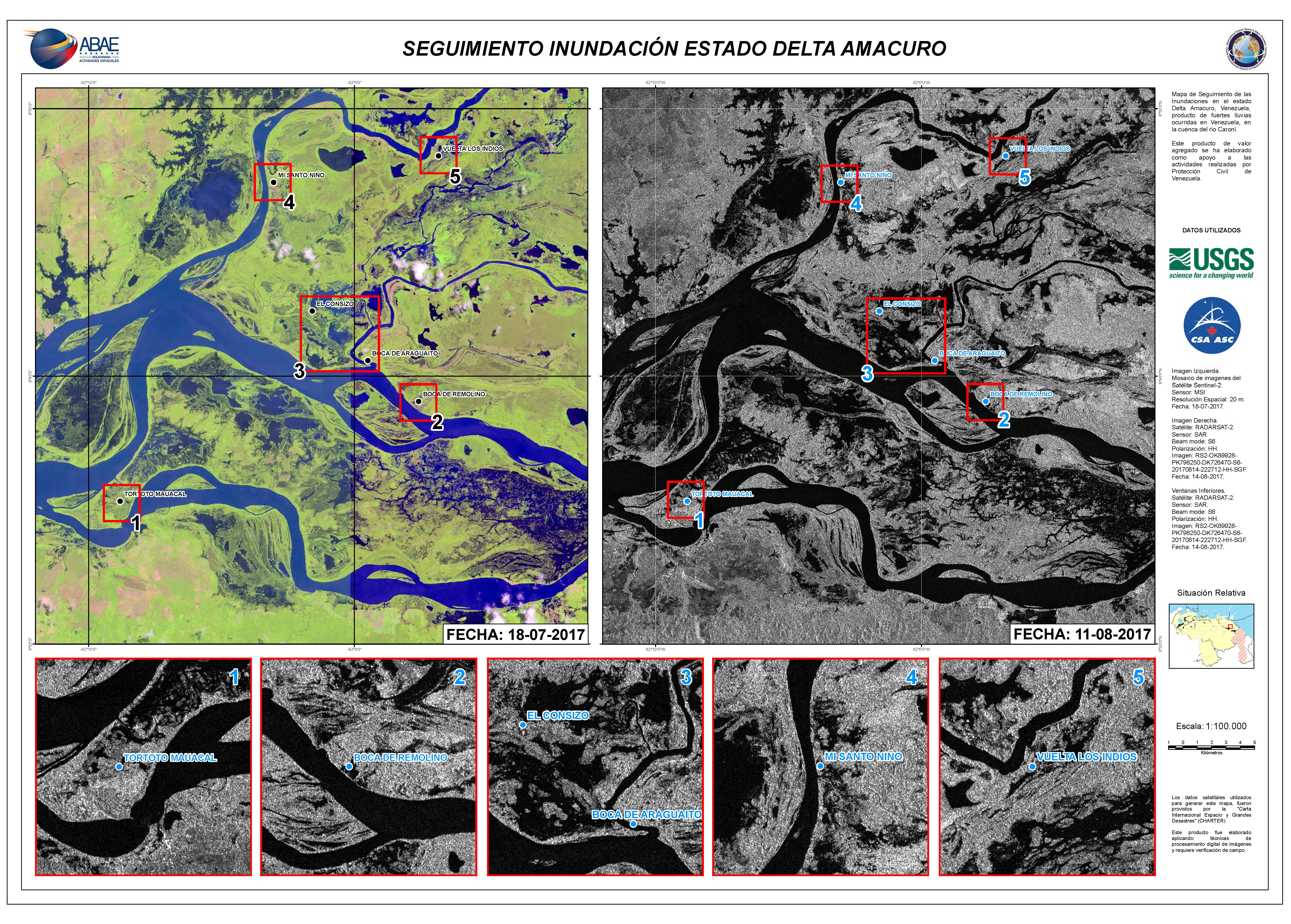
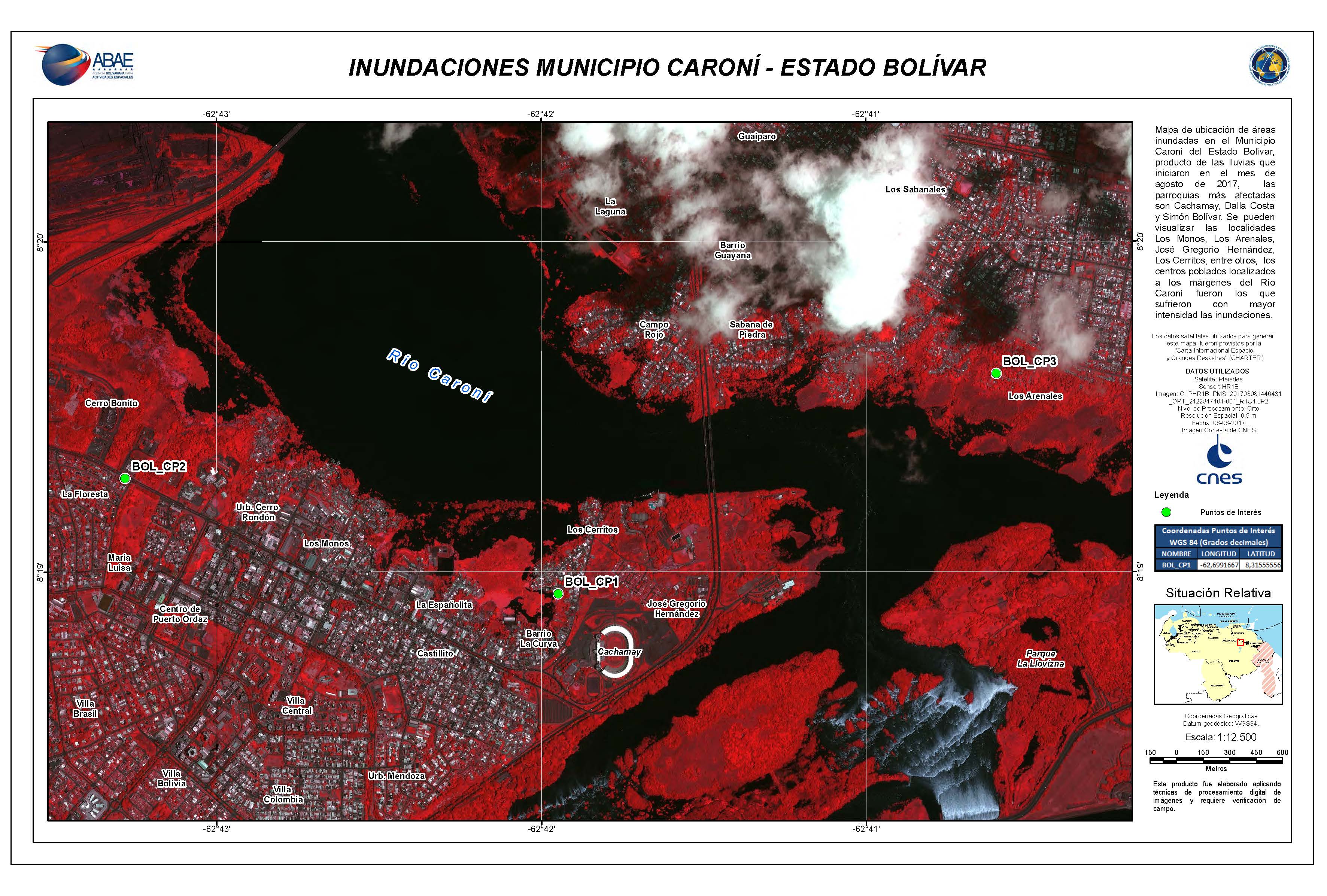
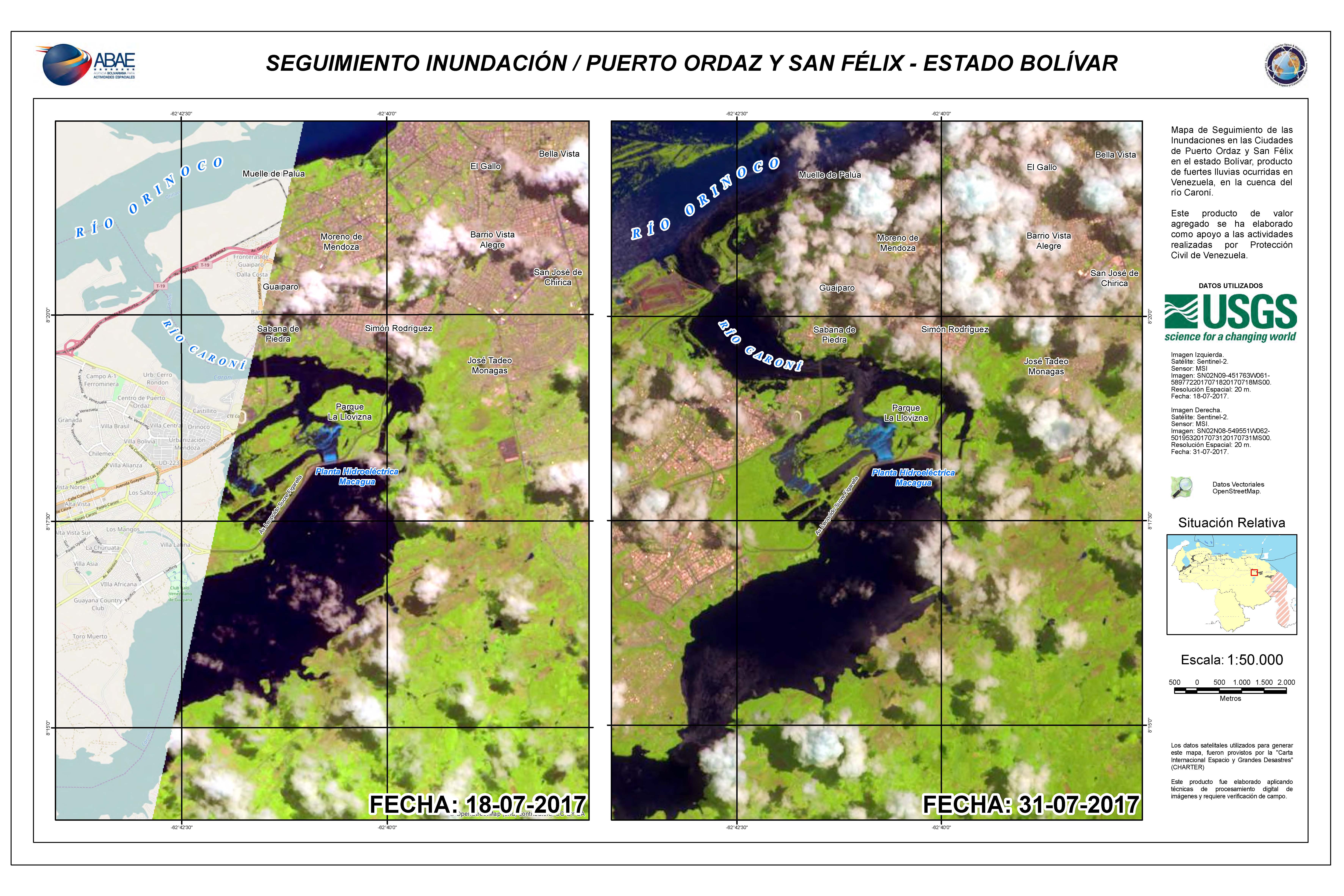
Inondations dans l'État de Delta Amacuro
Copyright: RADARSAT-2 Data and Products © MacDonald, Dettwiler and Associates Ltd. (2017) - Tous droits réservés. RADARSAT est une marque officielle de l'Agence spatiale canadienne.
Sentinel-2 © Copernicus Sentinel data (2017)
Carte produite par ABAE
Information about the Product
Acquired: Sentinel-2: 18/07/2017
RADARSAT-2: 11/08/2017
Source: Sentinel-2 / RADARSAT-2
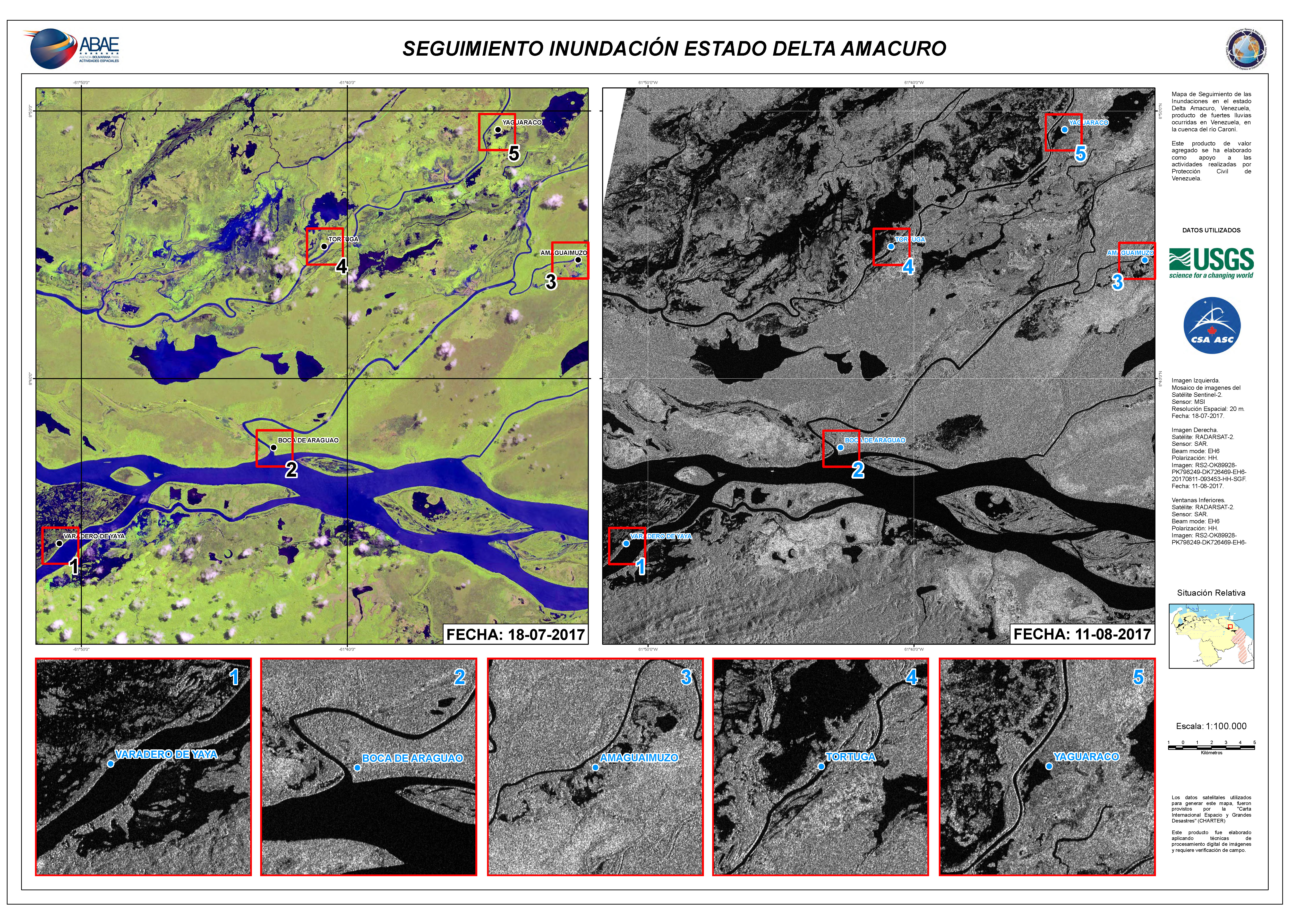
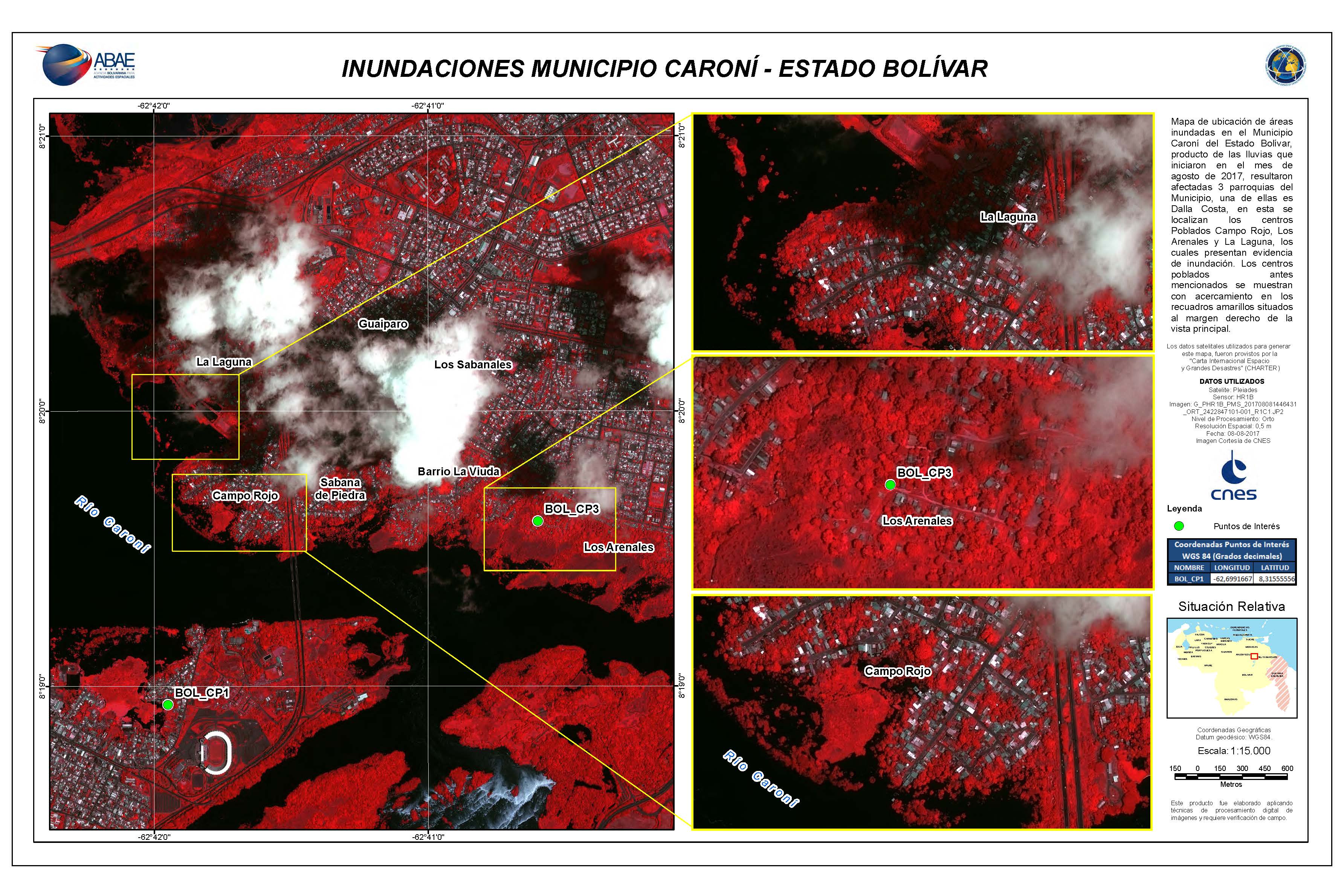
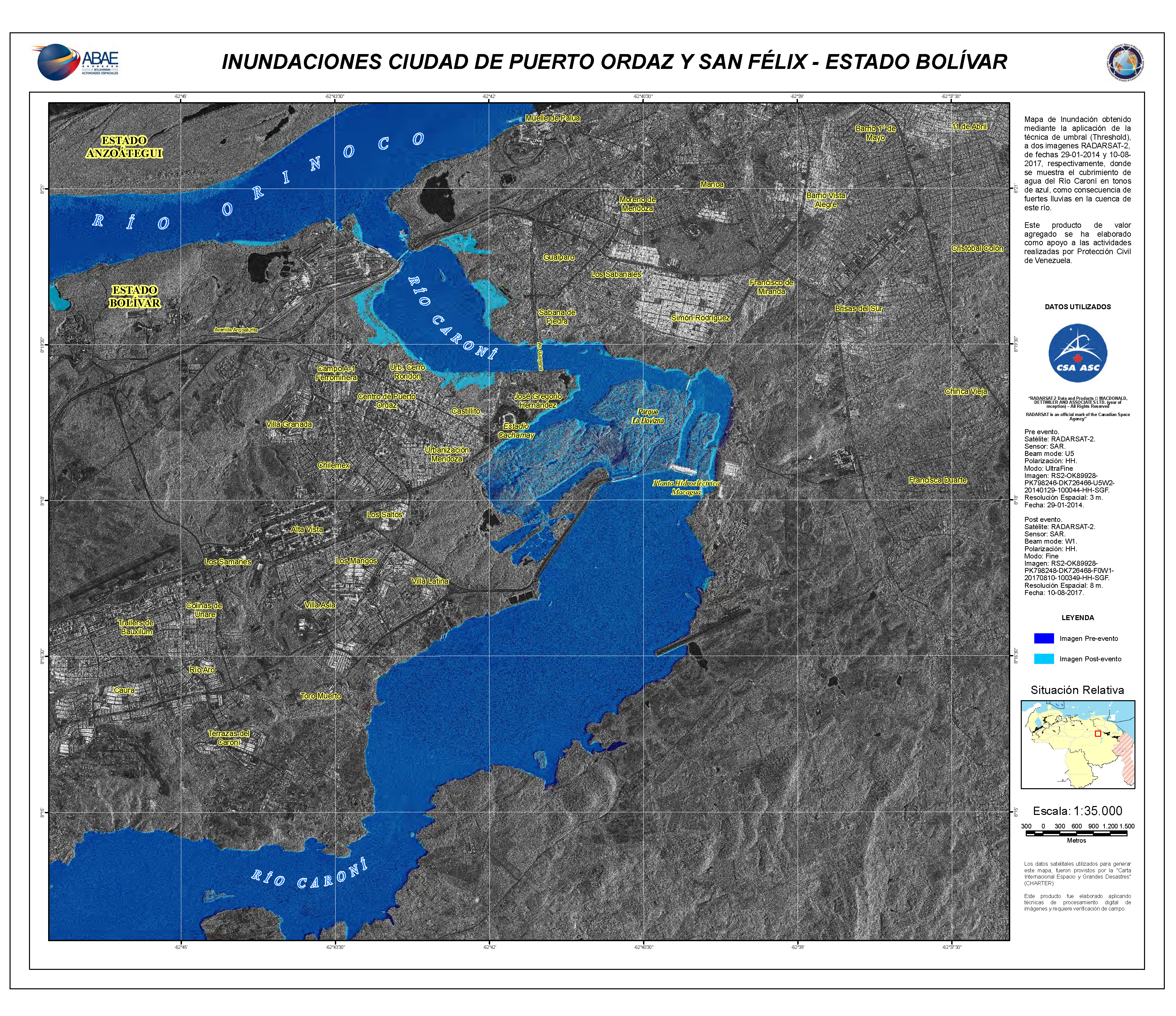
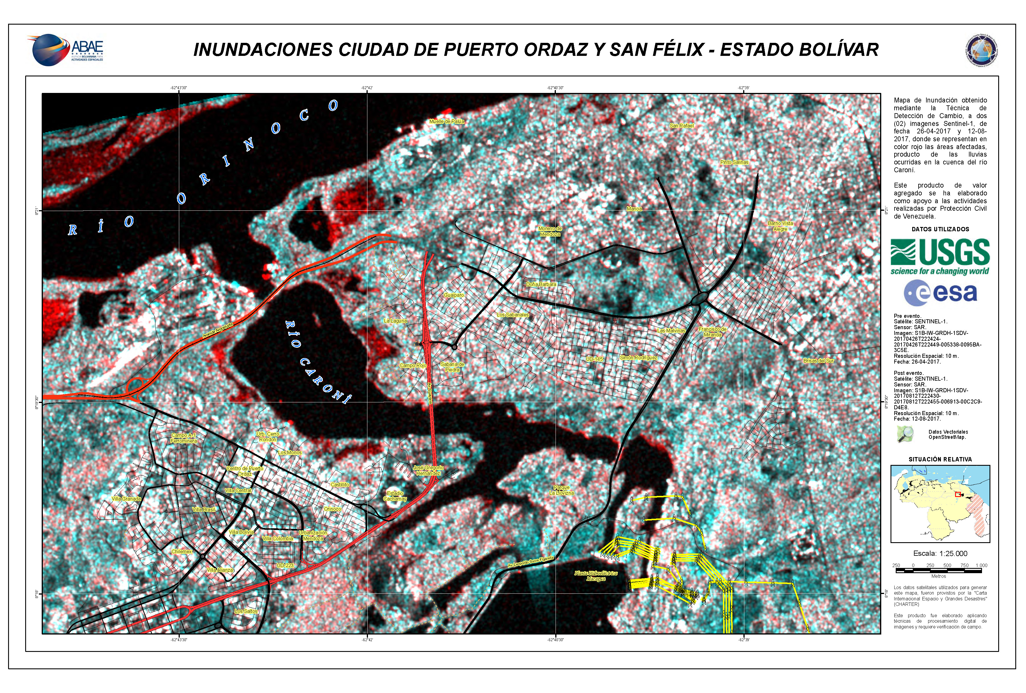
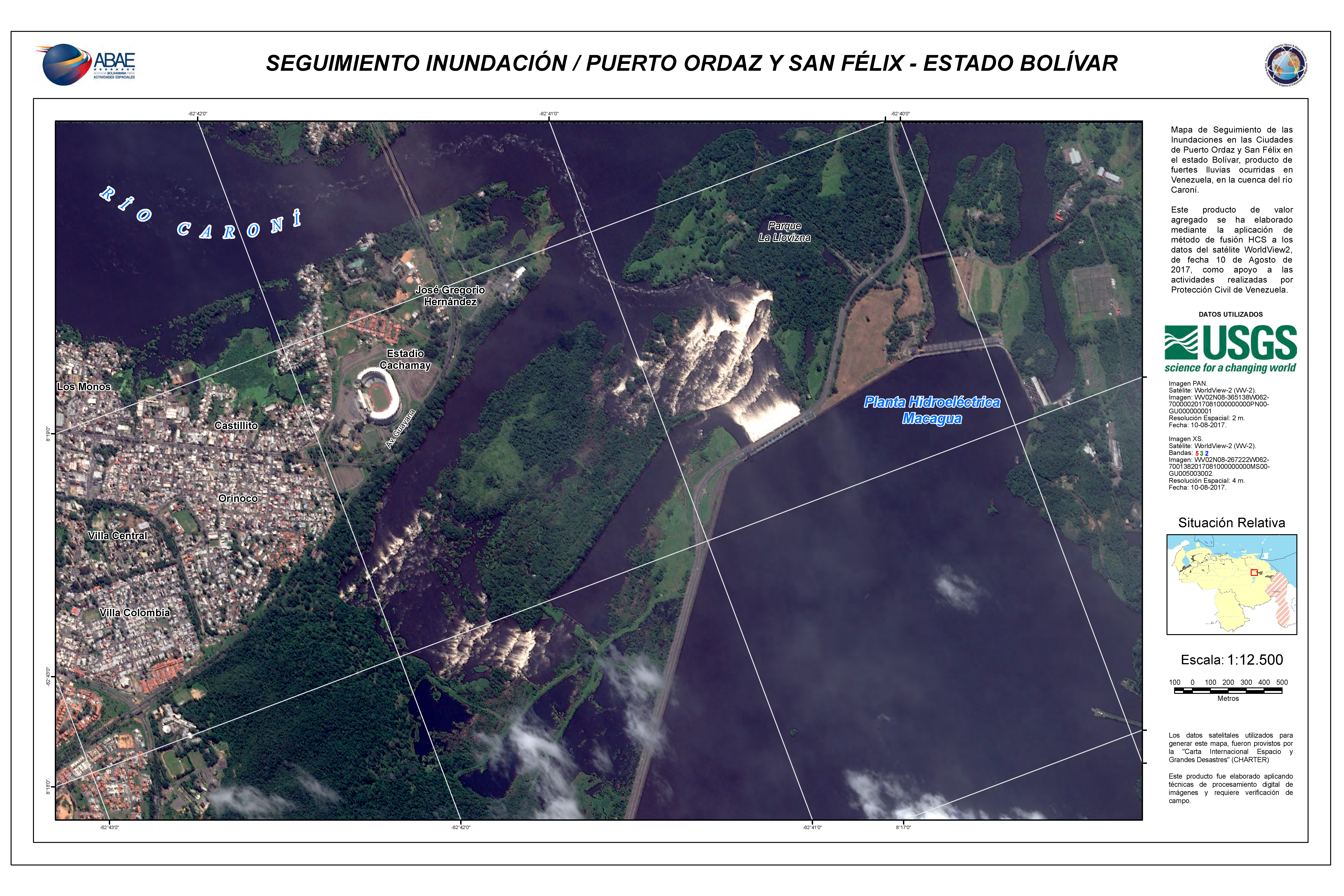
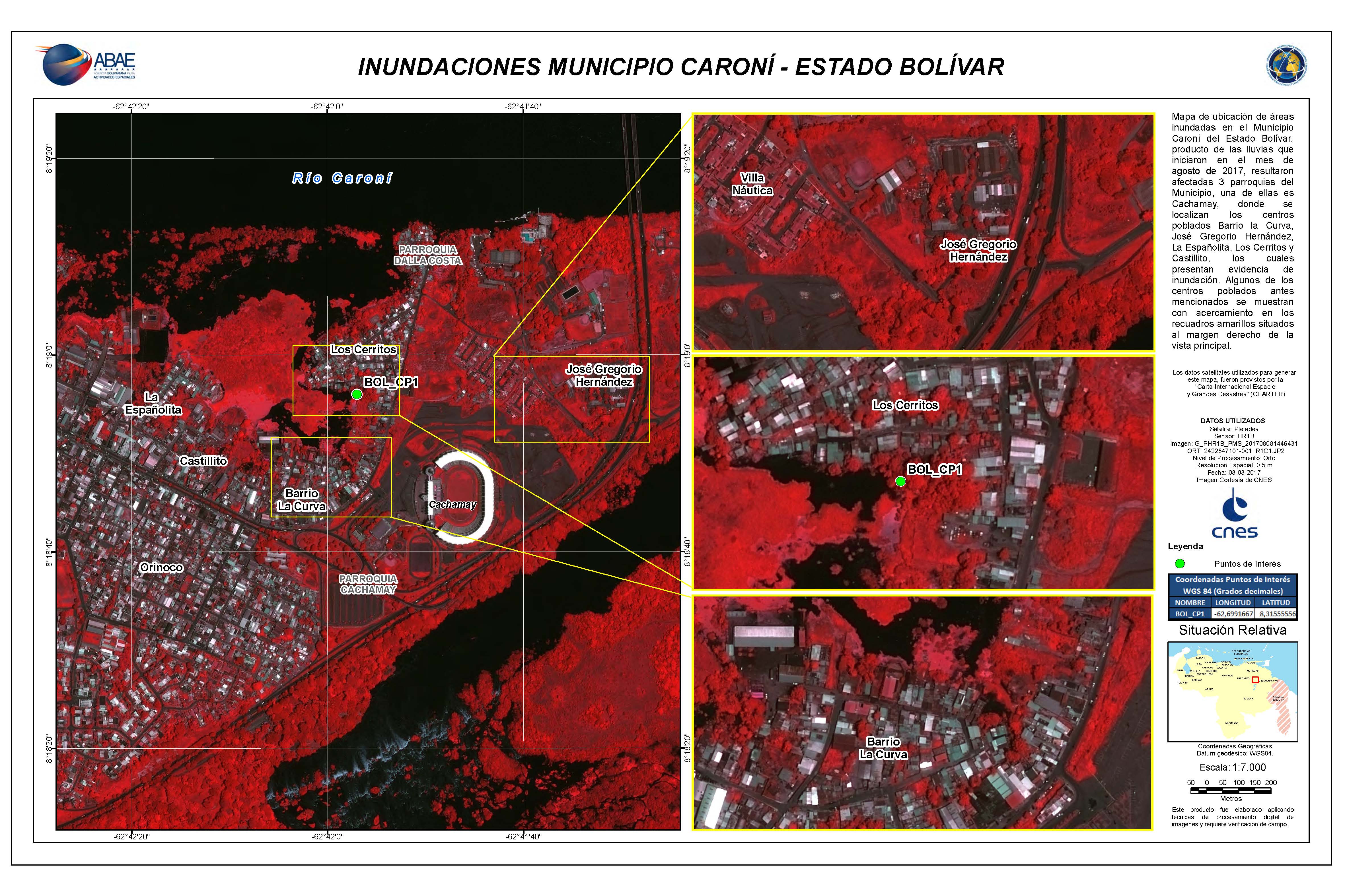
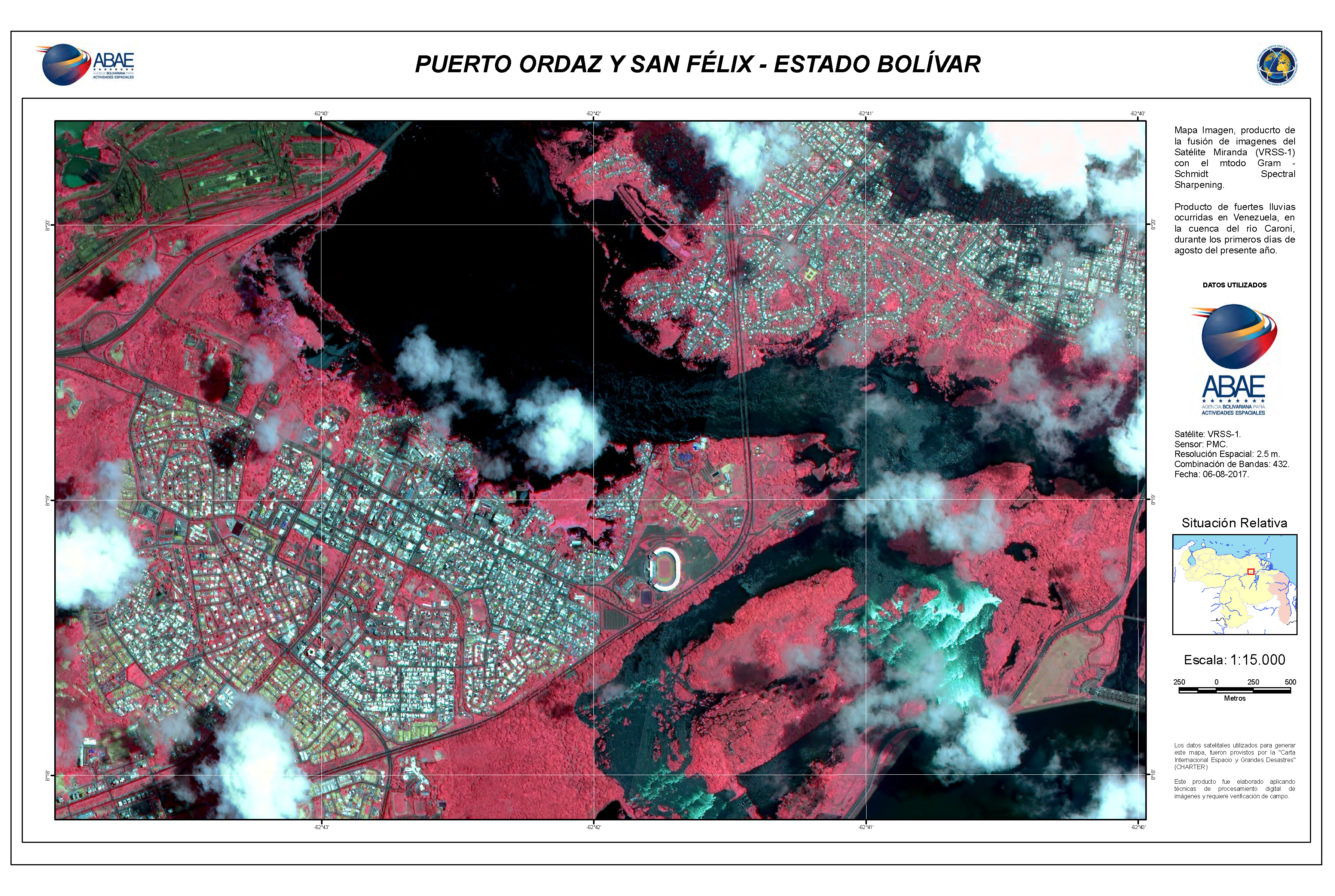
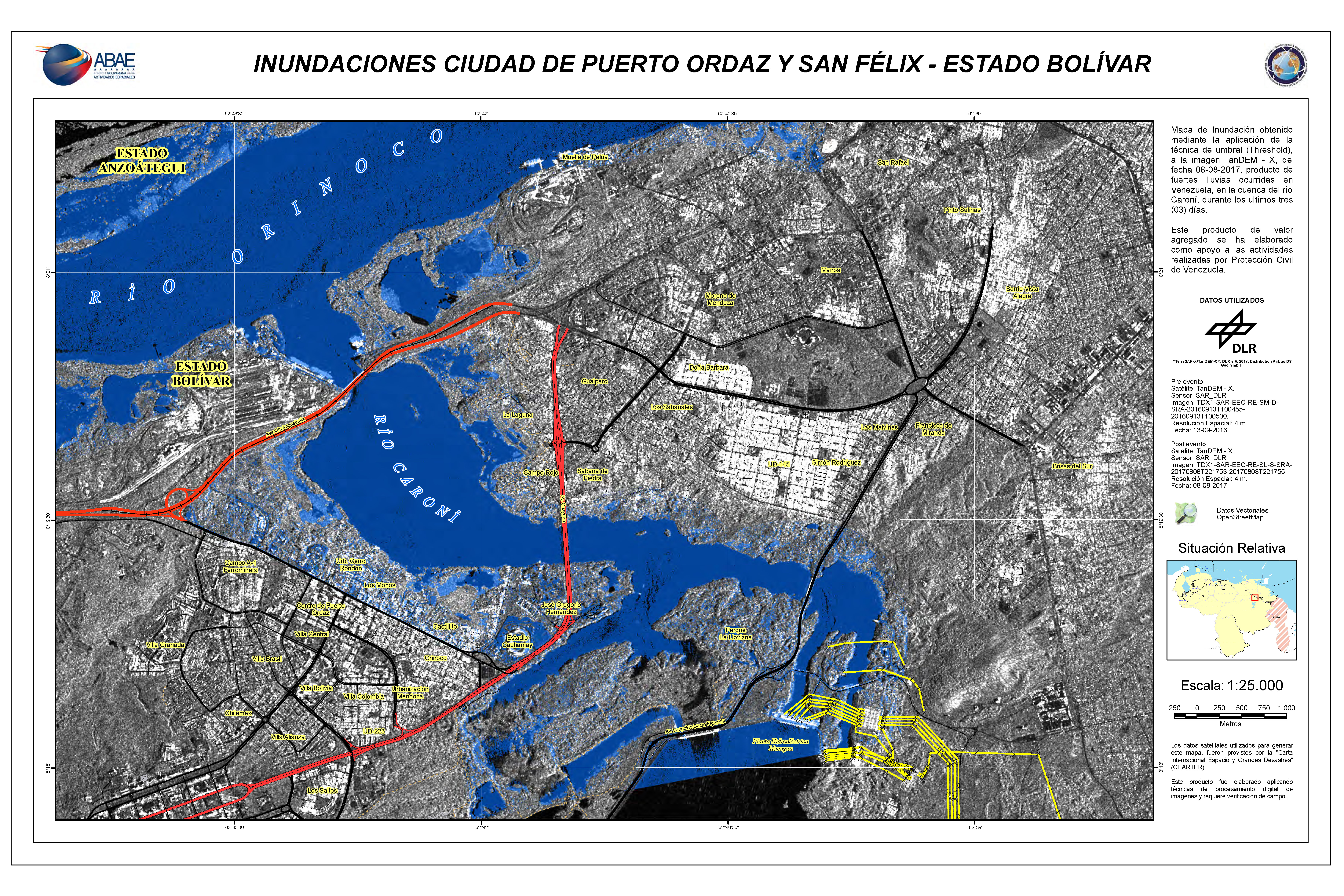
Inondations à Puerto Ordaz et à San Felix, État de Bolivar
Copyright: RADARSAT-2 Data and Products © MacDonald, Dettwiler and Associates Ltd. (2017) - Tous droits réservés. RADARSAT est une marque officielle de l'Agence spatiale canadienne.
Carte produite par ABAE
Information about the Product
Acquired: Pré-désastre: 29/01/2014
Post-catastrophe: 10/08/2017


 Back to the full activation archive

