 English
 Spanish
 French
 Chinese
 Russian
 Portuguese
 Latest Activation
Charter activations
Earthquake in the Philippines
At least one person has been killed and dozens injured when a magnitude 6.6 earthquake shook the central Philippines, damaging buildings, roads, and forcing residents to evacuate their homes.
The shallow quake struck southeast of Masbate Island in the Bicol region at 8:03am (00:03 GMT) at a depth of about 21 kilometres (13 miles) on Tuesday August 19, the US Geological Survey said.
The Philippines lies along the Pacific "Ring of Fire," an arc of faults around the Pacific Ocean where most of the world's earthquakes occur. It is also lashed by about 20 typhoons and tropical storms each year, making it one of the world's most disaster-prone countries.
Search-and-rescue efforts are still on-going in the region.
| Tipo de evento: | Earthquake |
| Local do evento: | Philippines |
| Data da Ativação da Carta: | 2020-08-19 |
| Tempo de Ativação da Carta: | 08:56 |
| Zona de Tempo da Ativação da Carta: | UTC+09:00 |
| Requisitante da Carta: | ADRC on behalf of Philippine Institute of Volcanology and Seismology (PHIVOLCS) |
| ID da Ativação: | 669 |
| Gerenciamento de projeto: | Philippine Institute of Volcanology and Seismology (PHIVOLCS) |
Products
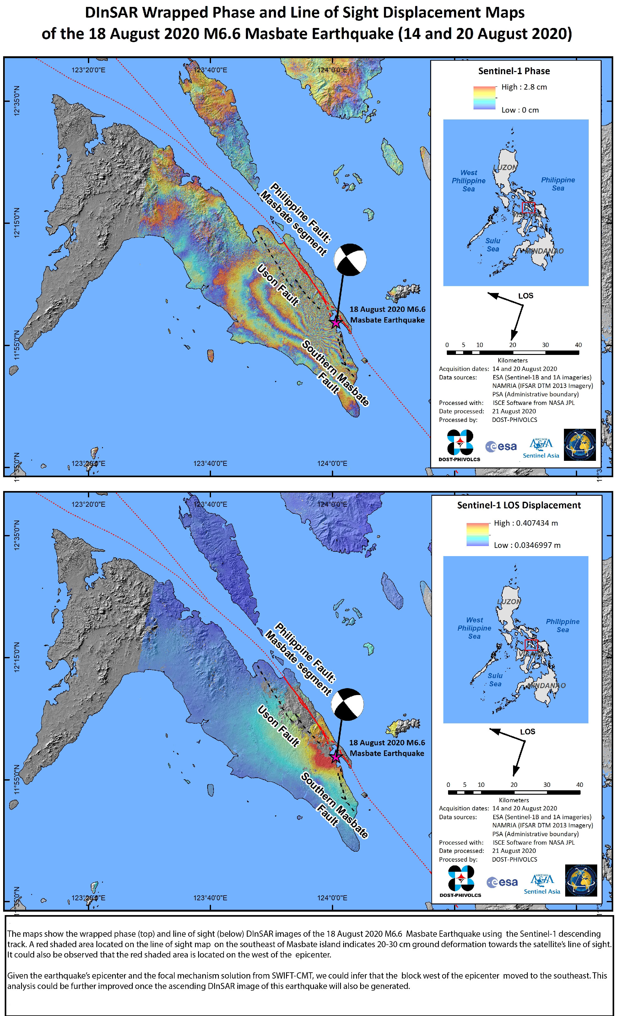
DInSAR Wrapped Phase and Line of Sight Displacement Maps of the 18 August 2020 M6.6 Masbate Earthquake in the Philippines
Direitos autorais: Contains modified Copernicus Sentinel data (2020)
Map produced by DOST-PHIVOLCS
Information about the Product
Adquirida: Sentinel-1B: 20/08/2020
Sentinel-1A: 14/08/2020
Fonte: Sentinel-1
 Voltar ao arquivo completo da Ativação

