 English
 Spanish
 French
 Chinese
 Russian
 Portuguese
 最新のチャータ発動
Charter activations
スリランカの洪水
モンスーンによる雨のため8人が犠牲になり、172人以上の人々が軍隊の救助を要請しています。スリランカ全土に降った150mmに及ぶ降雨の影響を8つの県が受けています。
| Type of Event: | 洪水 |
| Location of Event: | スリランカ |
| Date of Charter Activation: | 2018年05月21日 |
| Time of Charter Activation: | 20:49 |
| Time zone of Charter Activation: | UTC+02:00 |
| Charter Requestor: | スリランカ災害管理センター |
| Activation ID: | 573 |
| Project Management: | スリランカ災害管理センター |
Products

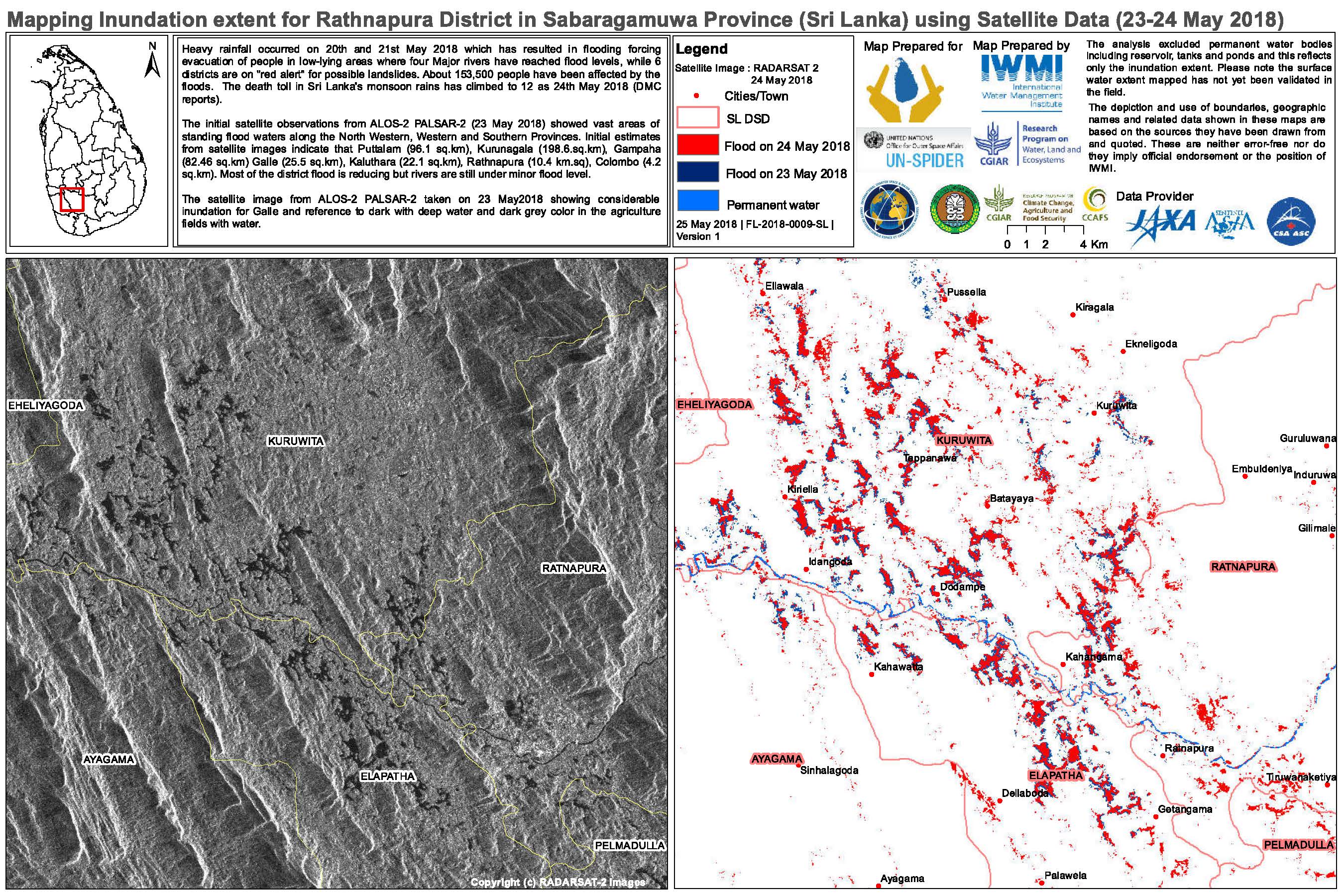
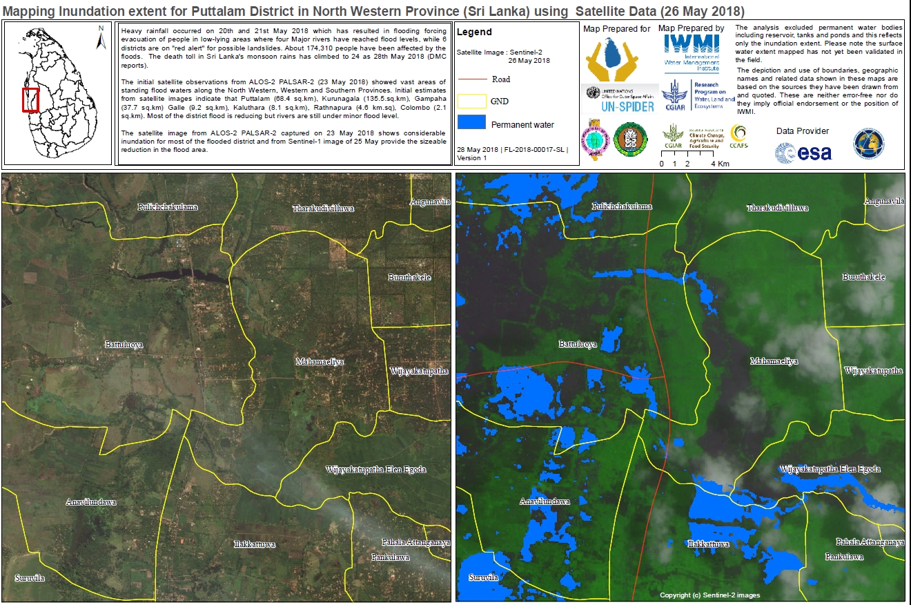
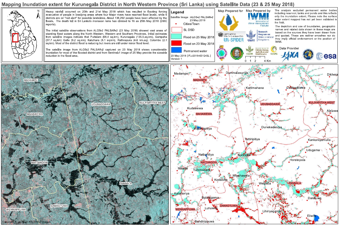
Flood mapping extent for Rathnapura District, Sabaragumuwa Province Sri Lanka
Copyright: RADARSAT-2 Data and Products © Maxar Technologies Ltd. (2018) - All Rights Reserved. RADARSAT is an official trademark of the Canadian Space Agency.
Map produced by IWMI
Information about the Product
Acquired: 23/05/2018-24/0/2018
Source: RADARSAT-2
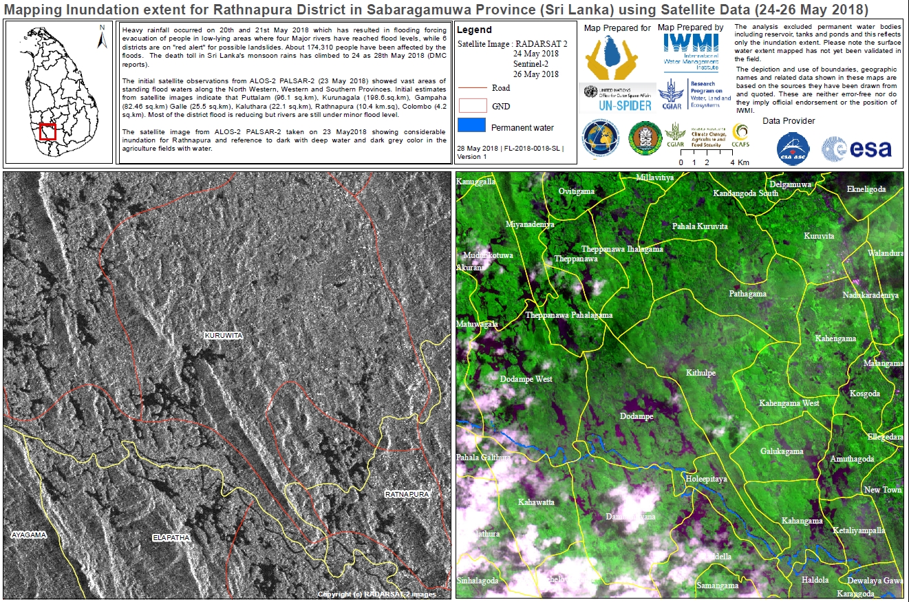
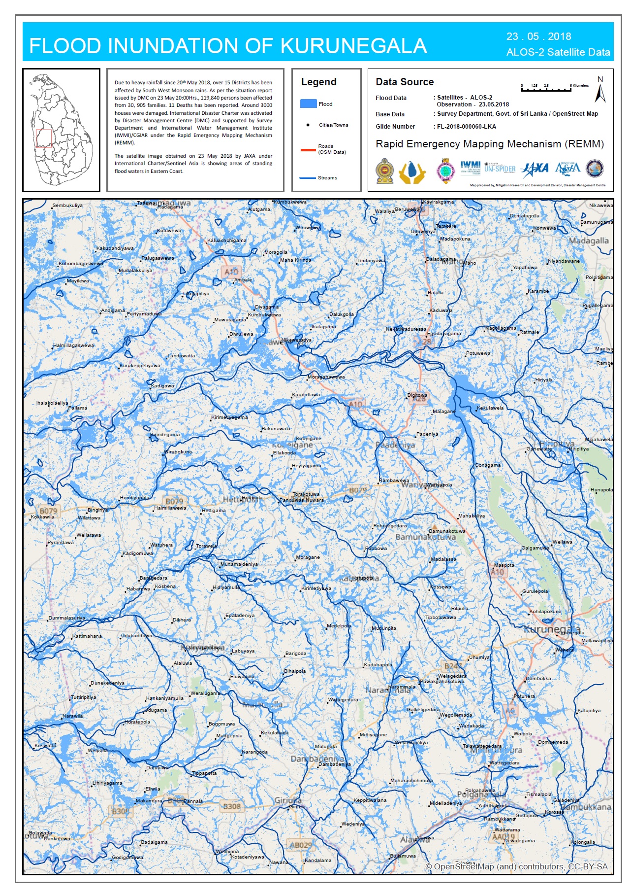
Flood mapping extent for Rathnapura District, Sri Lanka
Copyright: ALOS-2 © JAXA (2018) All rights reserved
RADARSAT-2 Data and Products © Maxar Technologies Ltd. (2018) - All Rights Reserved. RADARSAT is an official trademark of the Canadian Space Agency.
Sentinel-2 © Copernicus Sentinel data (2018)
Map produced by IWMI
Information about the Product
Acquired: ALOS: 23/05/2018
RADARSAT-2: 24/05/2018
Sentinel-2: 26/05/2018
Source: ALOS-2 / RADARSAT-2 / Sentinel-2
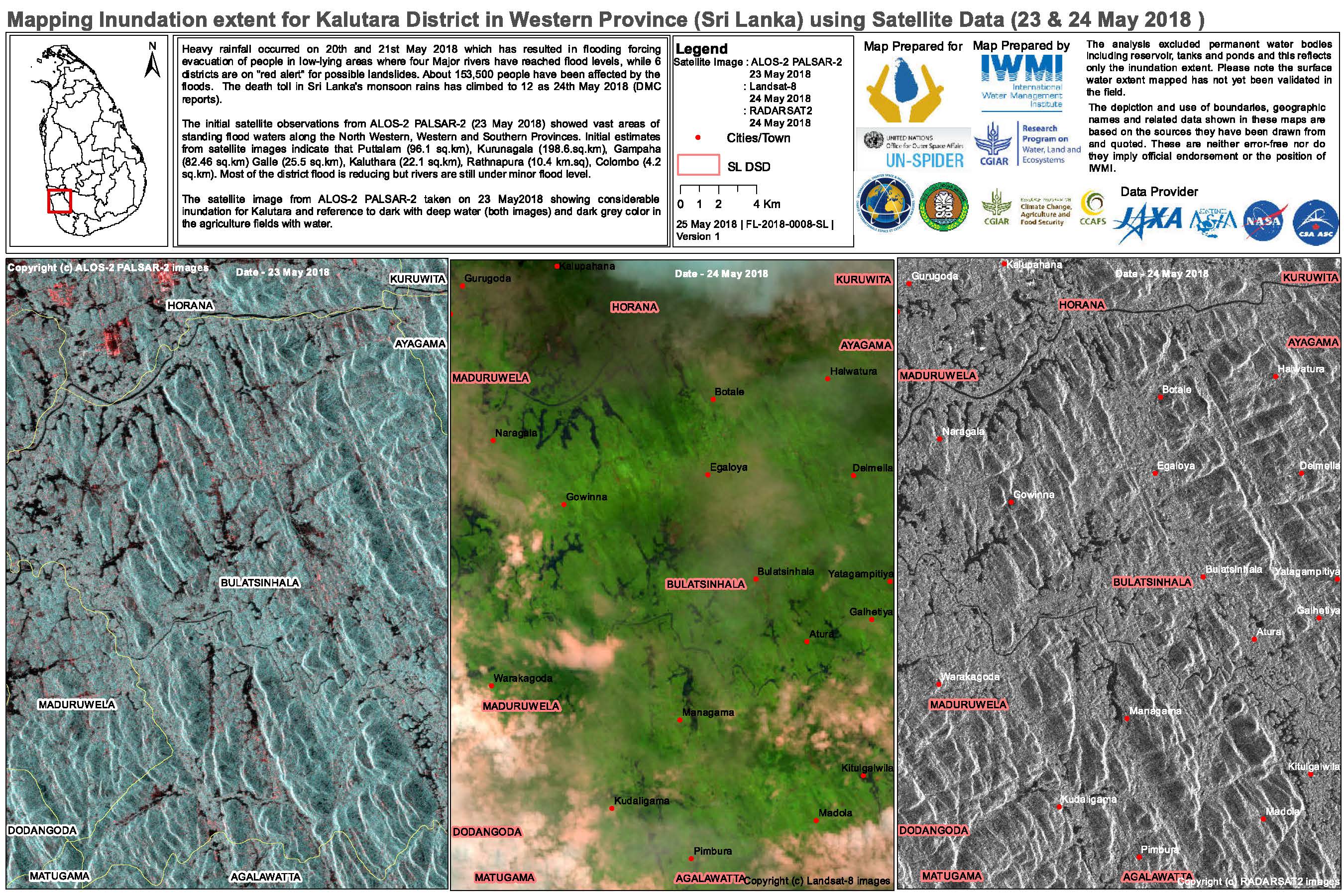
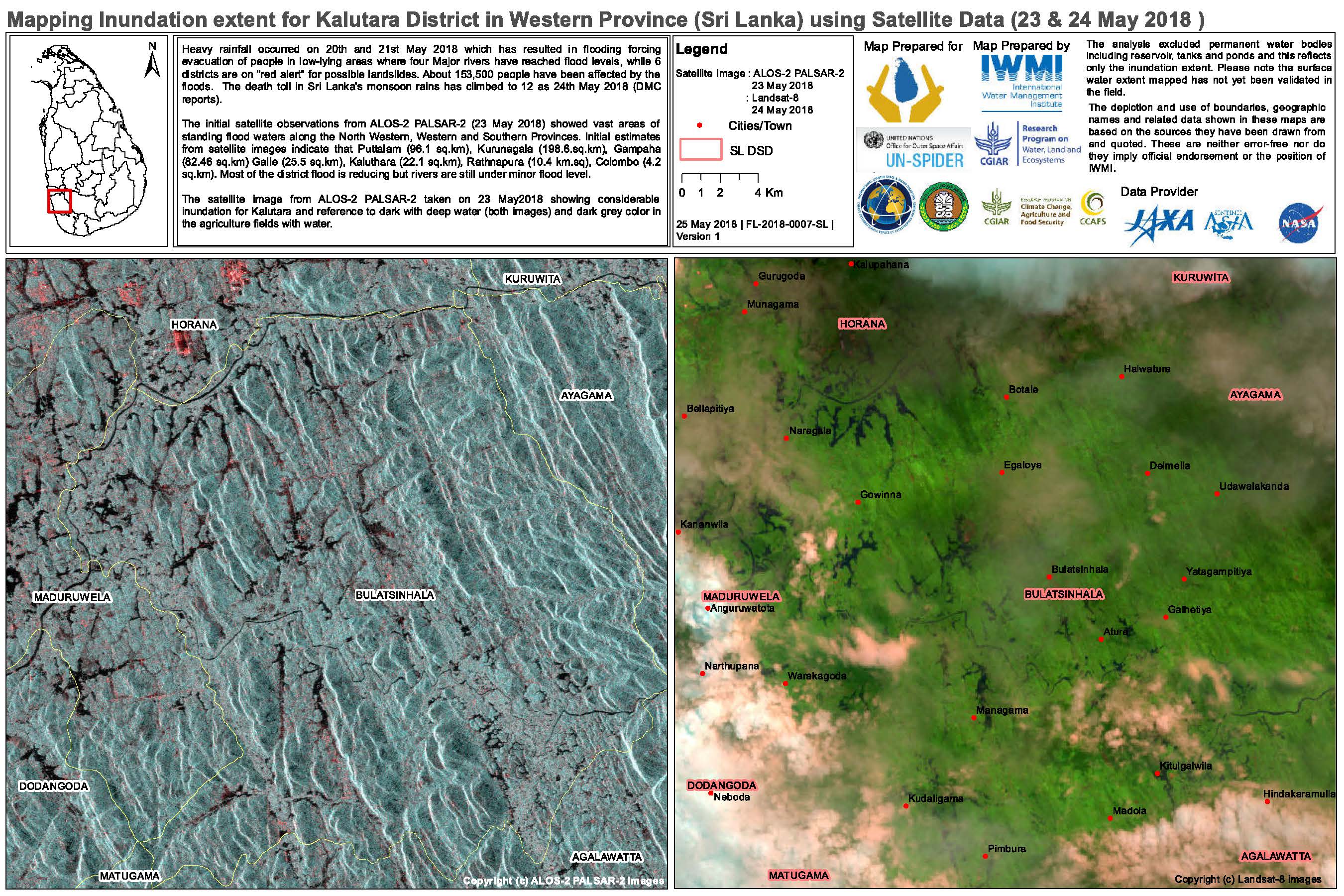
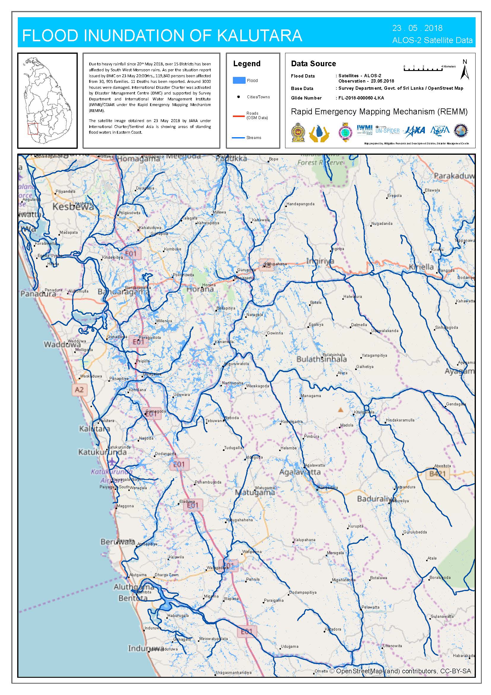
Flood mapping extent for Kalutara District, Western Province, Sri Lanka
Copyright: ALOS © JAXA (2018) All rights reserved
Landsat 8 data and products © USGS (2018) - All rights reserved
RADARSAT-2 Data and Products © Maxar Technologies Ltd. (2018) - All Rights Reserved. RADARSAT is an official trademark of the Canadian Space Agency.
Map produced by IWMI
Information about the Product
Acquired: ALOS: 23/05/2018
Landsat 8: 24/05/2018
RADARSAT-2: 24/05/2018
Source: ALOS-2 / Landsat 8 / RADARSAT-2
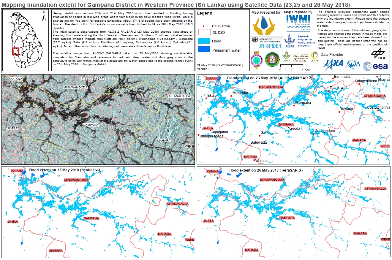
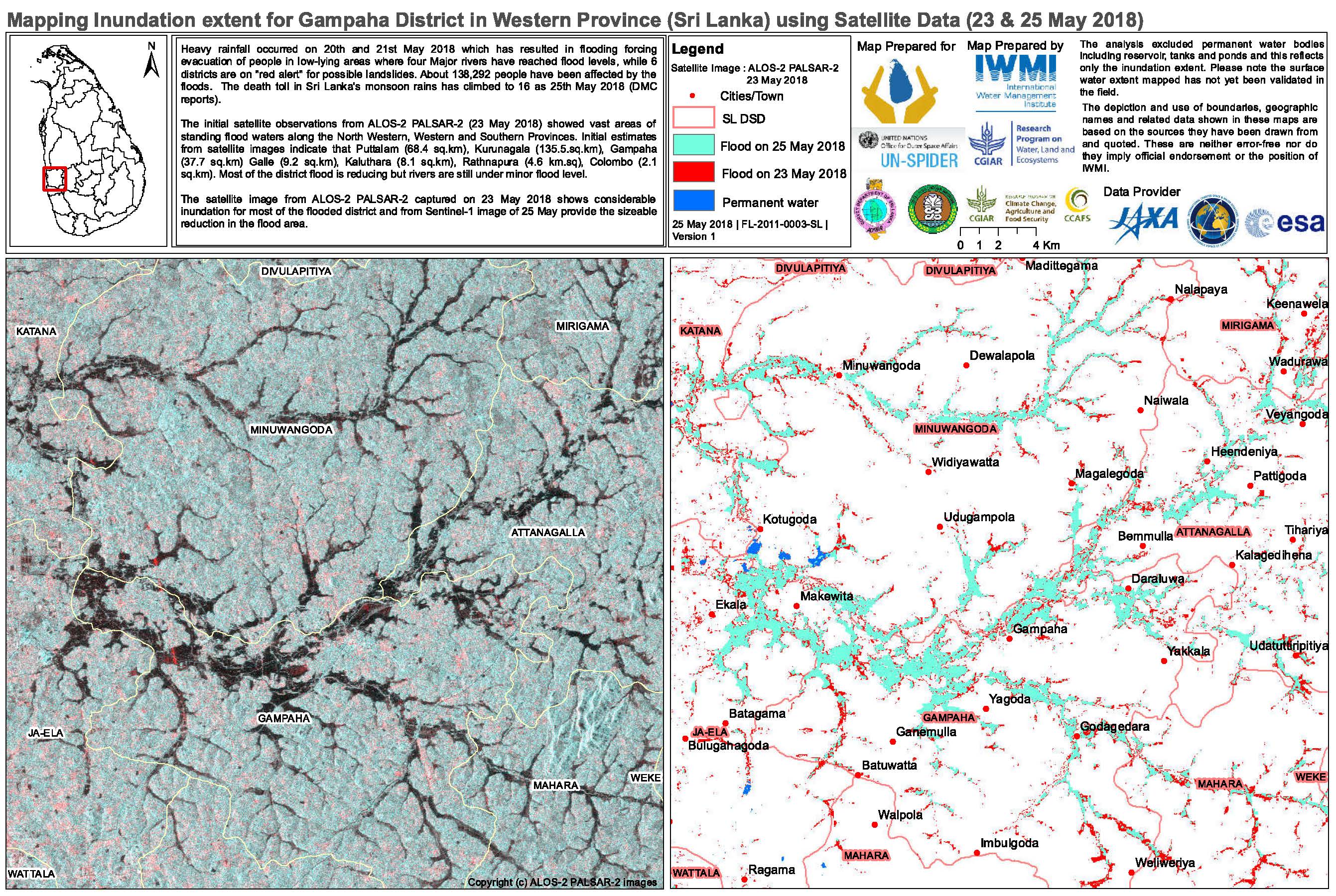
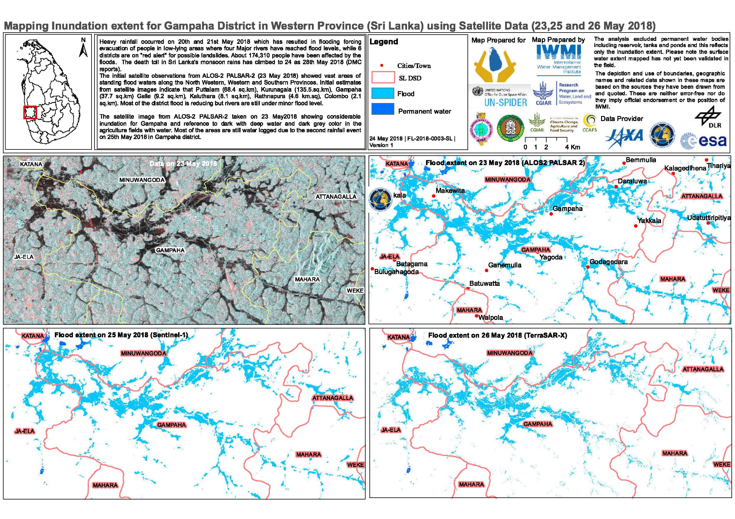
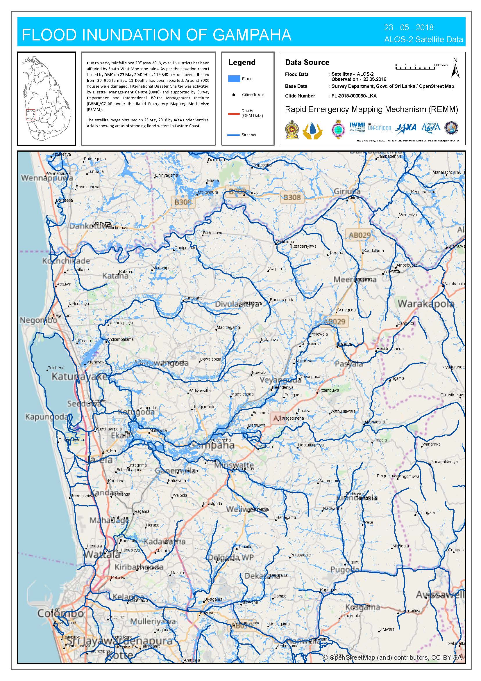
Flood mapping extent for Gampaha District, Sri Lanka
Copyright: ALOS © JAXA (2018) All rights reserved
Sentinel-1 © Copernicus Sentinel data (2018)
TerraSAR-X © DLR e. V. 2018, Distribution: Airbus DS Geo GmbH
Map produced by IWMI
Information about the Product
Acquired: ALOS-2: 23/05/2018
Sentinel-1: 25/05/2018
TerraSAR-X: 26/05/2018
Source: ALOS-2 / Sentinel-1 / TerraSAR-X
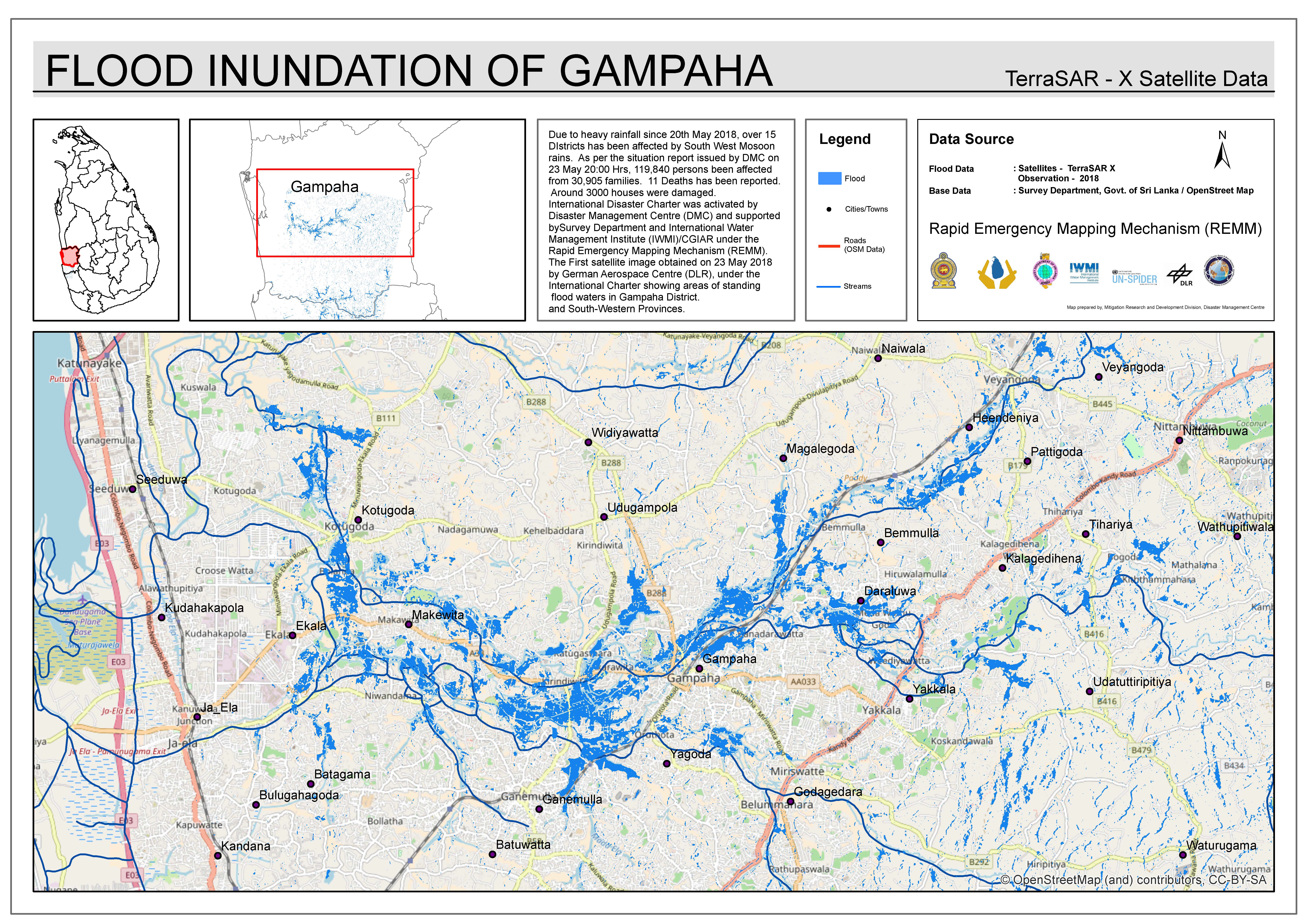
Flooding in Gampaha District, Sri Lanka
Copyright: ALOS © JAXA (2018) All rights reserved
Sentinel-1 © Copernicus Sentinel data (2018)
TerraSAR-X © DLR e. V. 2018, Distribution: Airbus DS Geo GmbH
Map produced by IWMI
Information about the Product
Acquired: ALOS-2: 23/05/2018
Sentinel-1: 25/05/2018
TerraSAR-X: 26/05/2018
Source: ALOS-2/TerraSAR-X /Sentinel-1
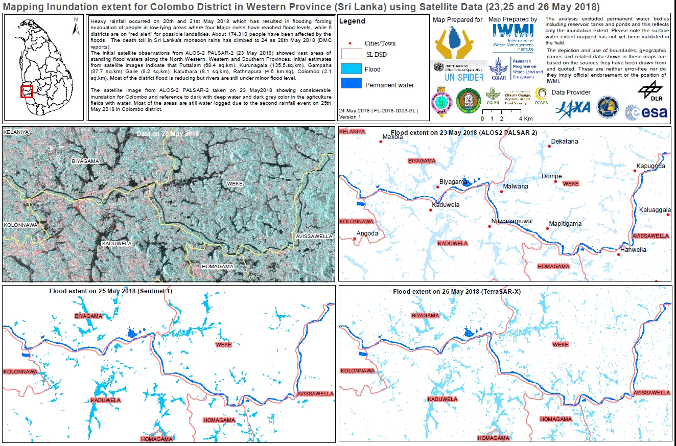
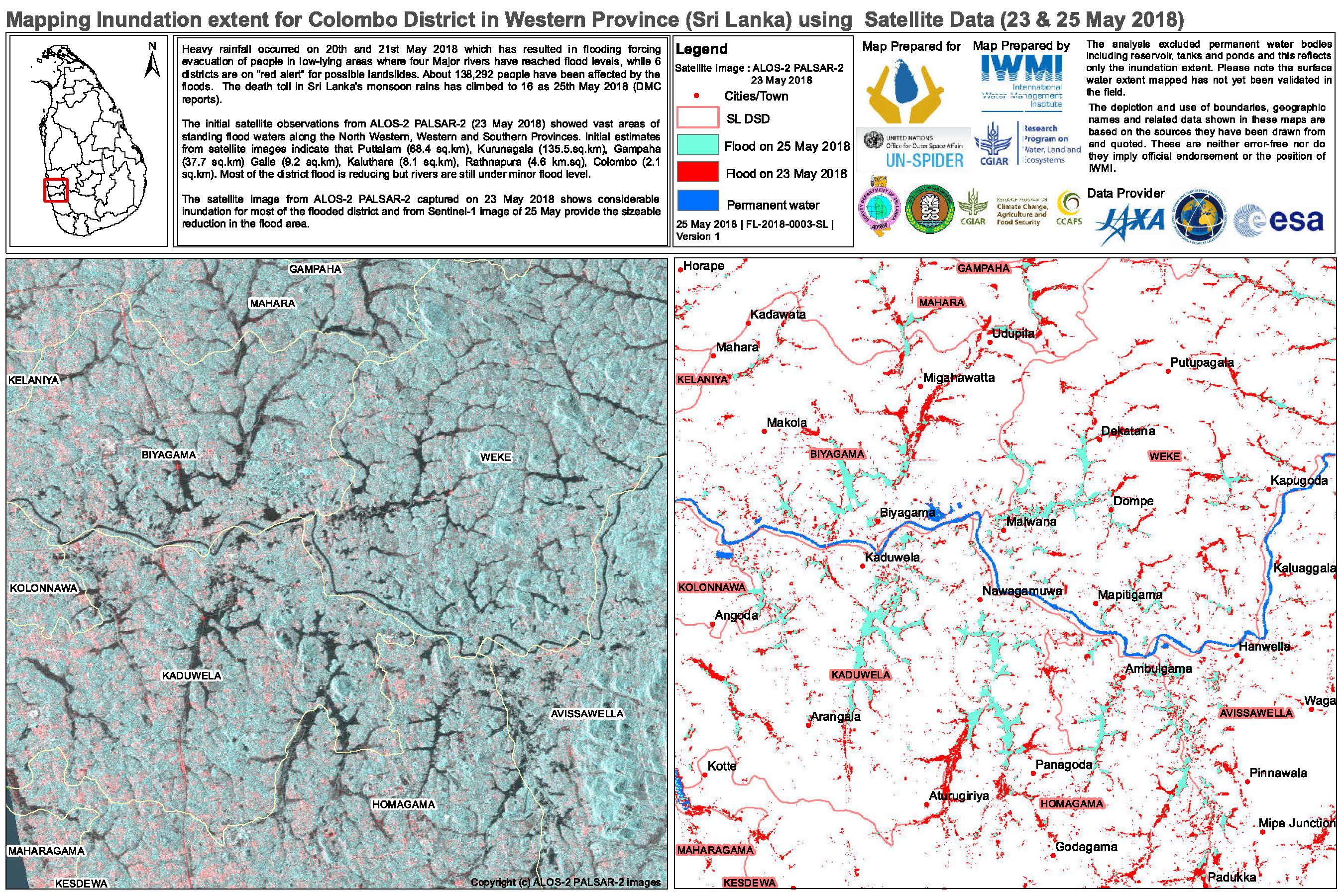
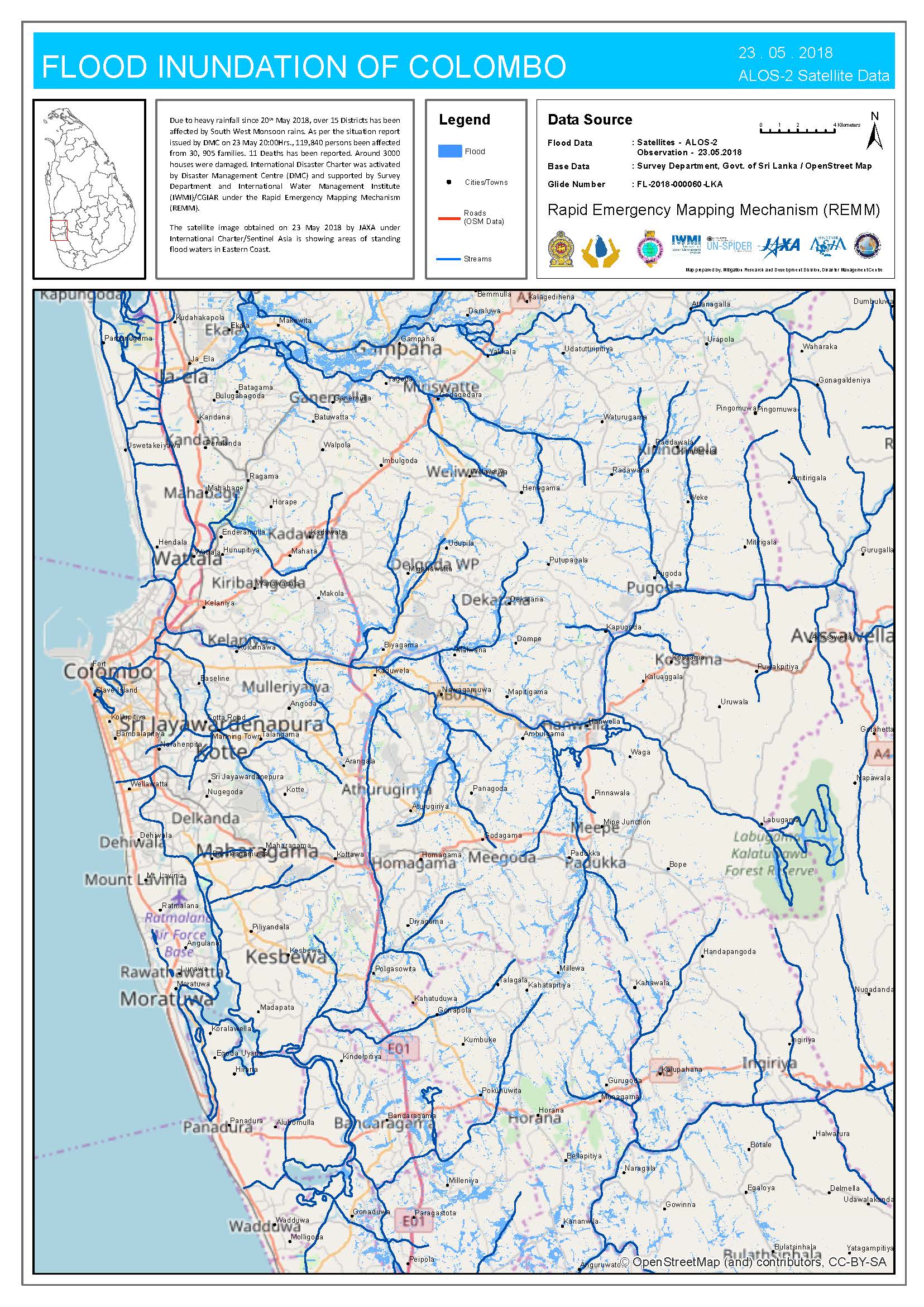
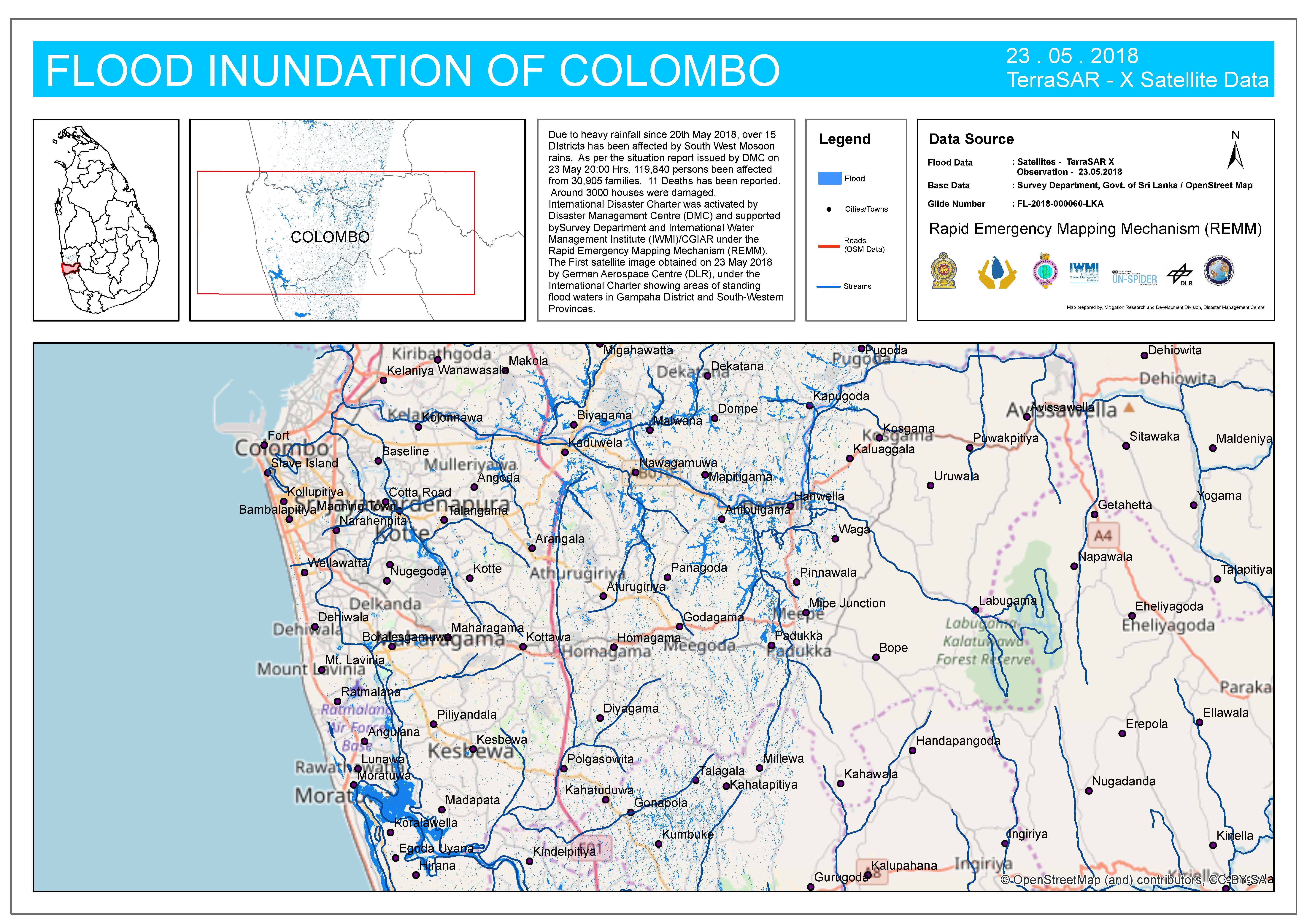
Flood mapping extent for Colombo District, Sri Lanka
Copyright: ALOS © JAXA (2018) All rights reserved
Sentinel-1 © Copernicus Sentinel data (2018)
TerraSAR-X © DLR e. V. 2018, Distribution: Airbus DS Geo GmbH
Map produced by IWMI
Information about the Product
Acquired: ALOS-2: 23/05/2018
Sentinel-1: 25/05/2018
TerraSAR-X: 26/05/2018
Source: ALOS-2 / Sentinel-1 / TerraSAR-X

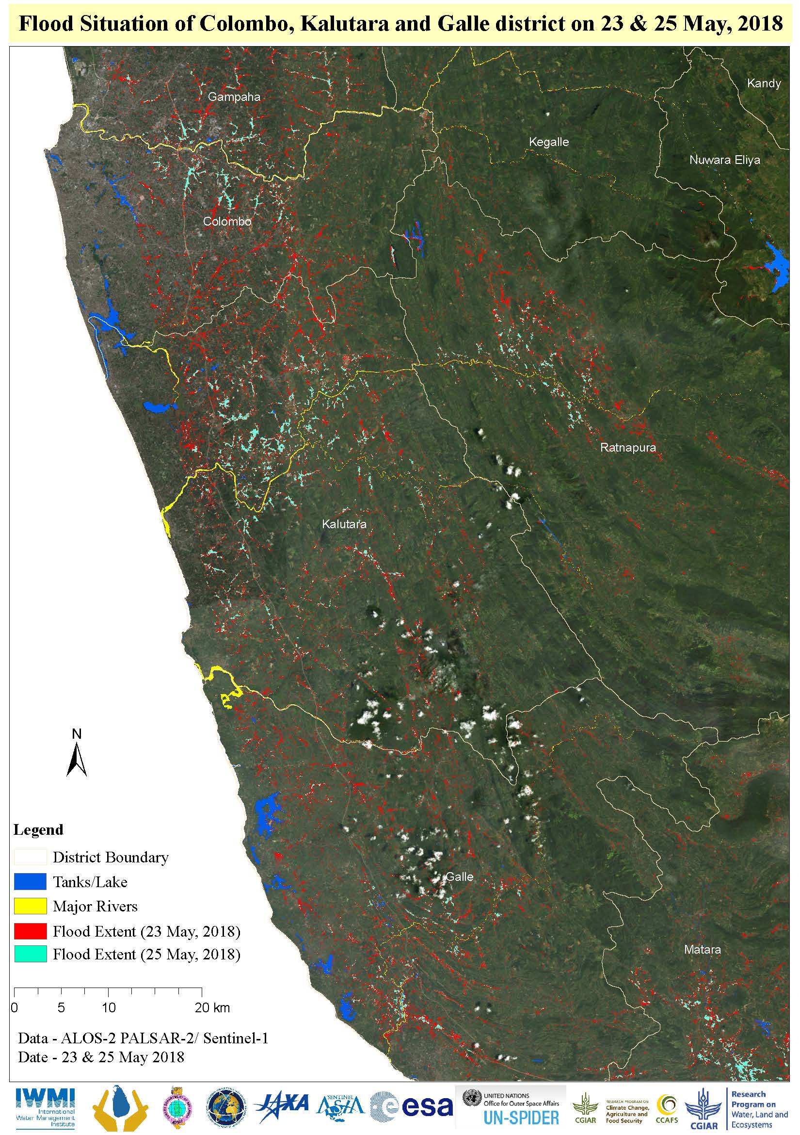
Flooding in Colombo, Kalutara and Galle District, Sri Lanka
Copyright: ALOS-2 © JAXA (2018) All rights reserved
Sentinel-1 © Contains modified Copernicus Sentinel data (2018)
Map produced by IWMI
Information about the Product
Acquired: ALOS-2: 23/05/18
Sentinel-1: 25/05/18
Source: ALOS-2 / Sentinel-1

 Back to the full activation archive

