Hurricane Melissa in Cuba
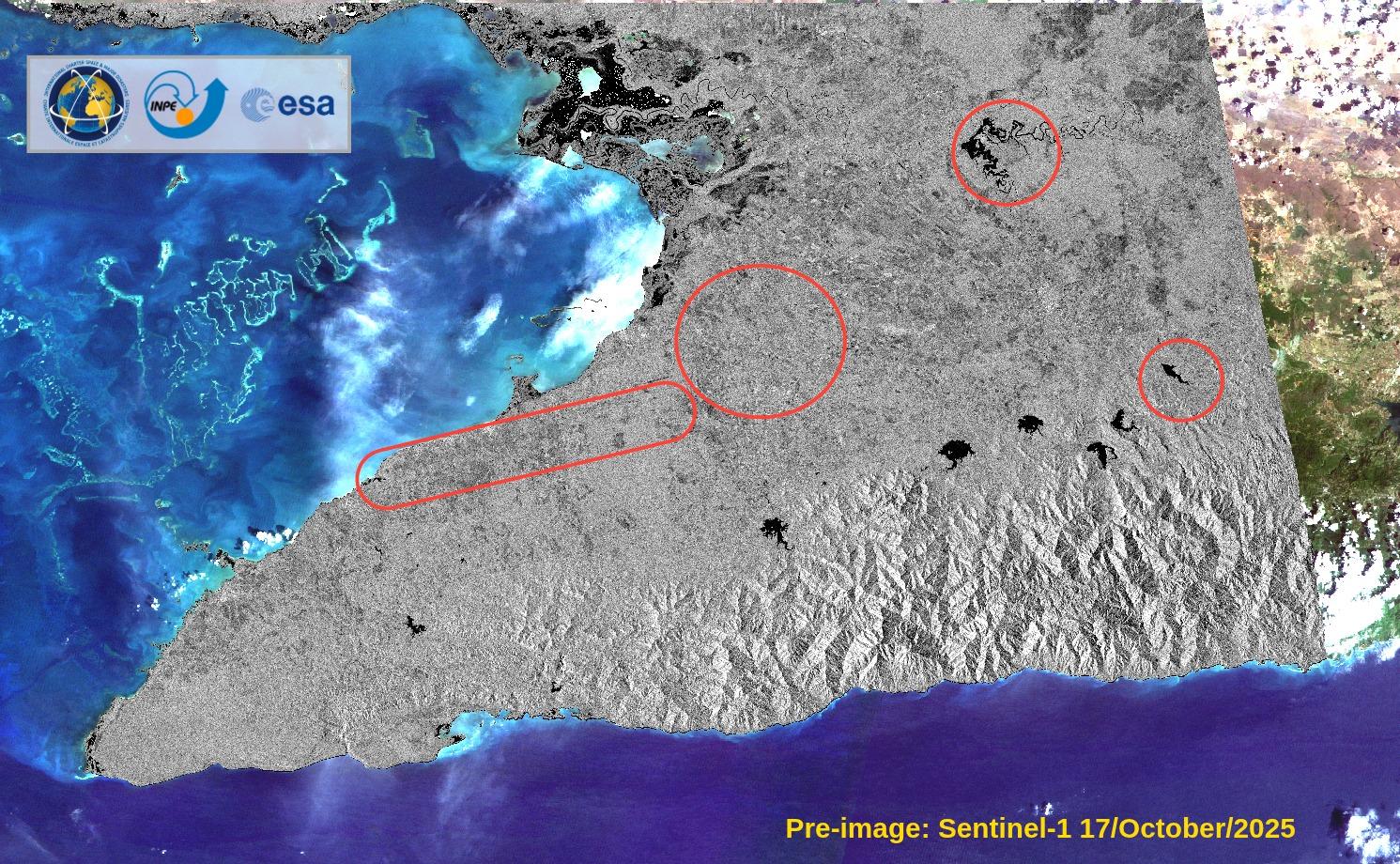
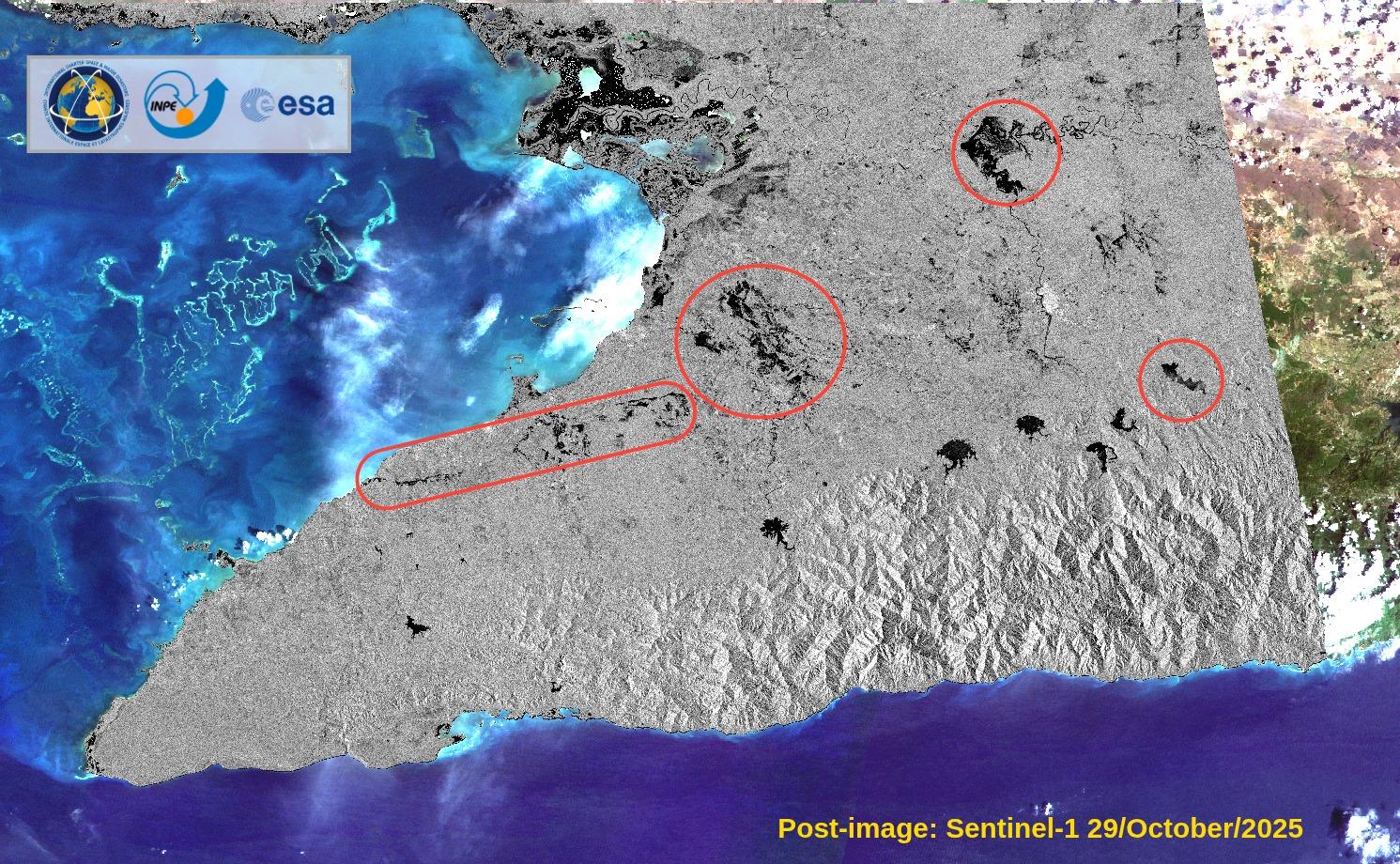
Hurricane Melissa made landfall in eastern Cuba on 28 October 2025, after causing severe damage in Jamaica and the Dominican Republic. The powerful Category 5 storm brought destructive winds, torrential rainfall, and coastal flooding to the Cuban provinces of Santiago de Cuba, Granma, Holguín, and Guantánamo. More than half a million people were evacuated as authorities worked to clear debris, restore power, and assist isolated communities. Satellite imagery and geospatial data were activated to support emergency response, helping identify affected areas, assess infrastructure damage, and guide relief and recovery efforts across the region.
Related Resourses:
- Type d'événement
- Tempête
- Lieu de l'événement
- Cuba
- Date d'activation de la Charte
- 2025-10-28
- Heure d’activation de la location
- 15:50
- Fuseau horaire d'activation de la Charte
- UTC-03:00
- Demandeur de charte
- Estado Mayor Nacional de la Defensa Civil
- Identifiant d'activation
- 997
- Gestion de projet
- Laercio Massaru Namikawa (INPE)
- Valeur ajoutée
- Javier Freites (ABAE),
- Karine Leal (INPE),
- Federal University of Santa Maria,
- Alejandra Rojas (Universidad de Costa Rica),
- Suwanan Sateiandee (UNITAR),
- Jose BisinotiNeto (CENAD),
- Carina Macedo (INPE),
- Lucas Jorge Gomes da Silva (CENAD/SEDEC),
- Manoel Araújo Sousa Júnior (Federal University of Santa Maria),
- Guy Schumann (RSS Hydro),
- Arnelle Isaac (Humanitarian OpenStreetMap Team (HOT))
Explorer les cartes de catastrophes d'UNOSAT
Accédez à des cartes interactives avec des évaluations satellitaires des inondations, des dégâts et des risques de catastrophes dans le monde entier.