Minimizar Última Activación

Charter activations

Las inundaciones en Somalia

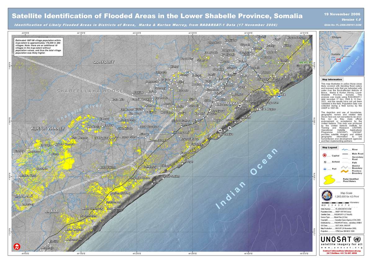
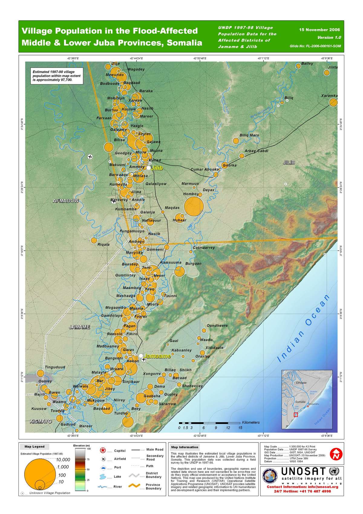
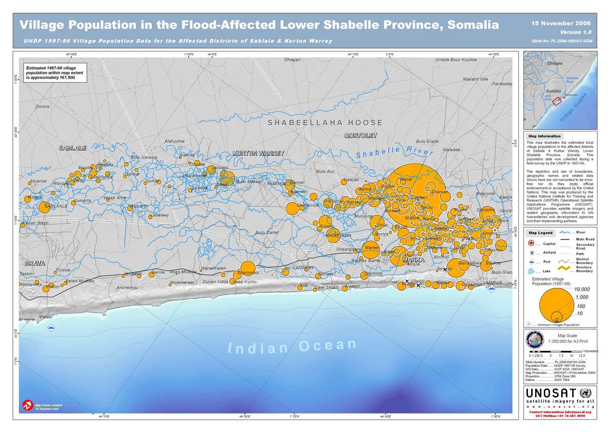
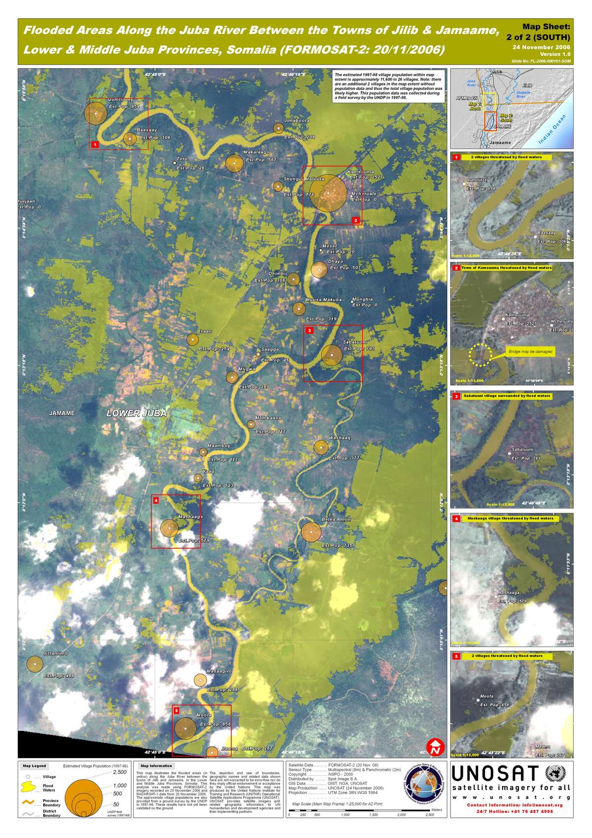
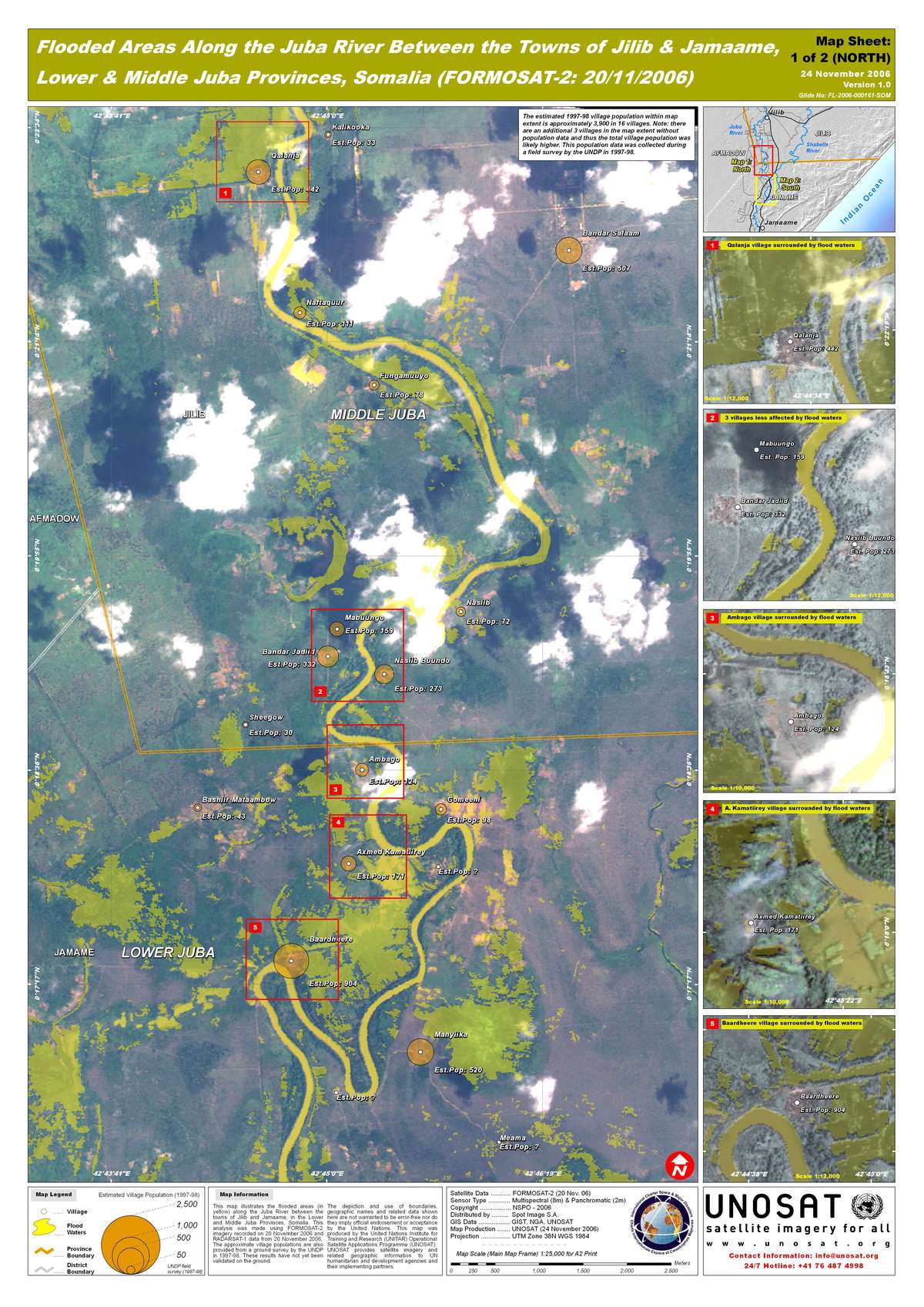
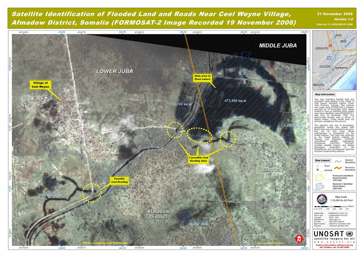
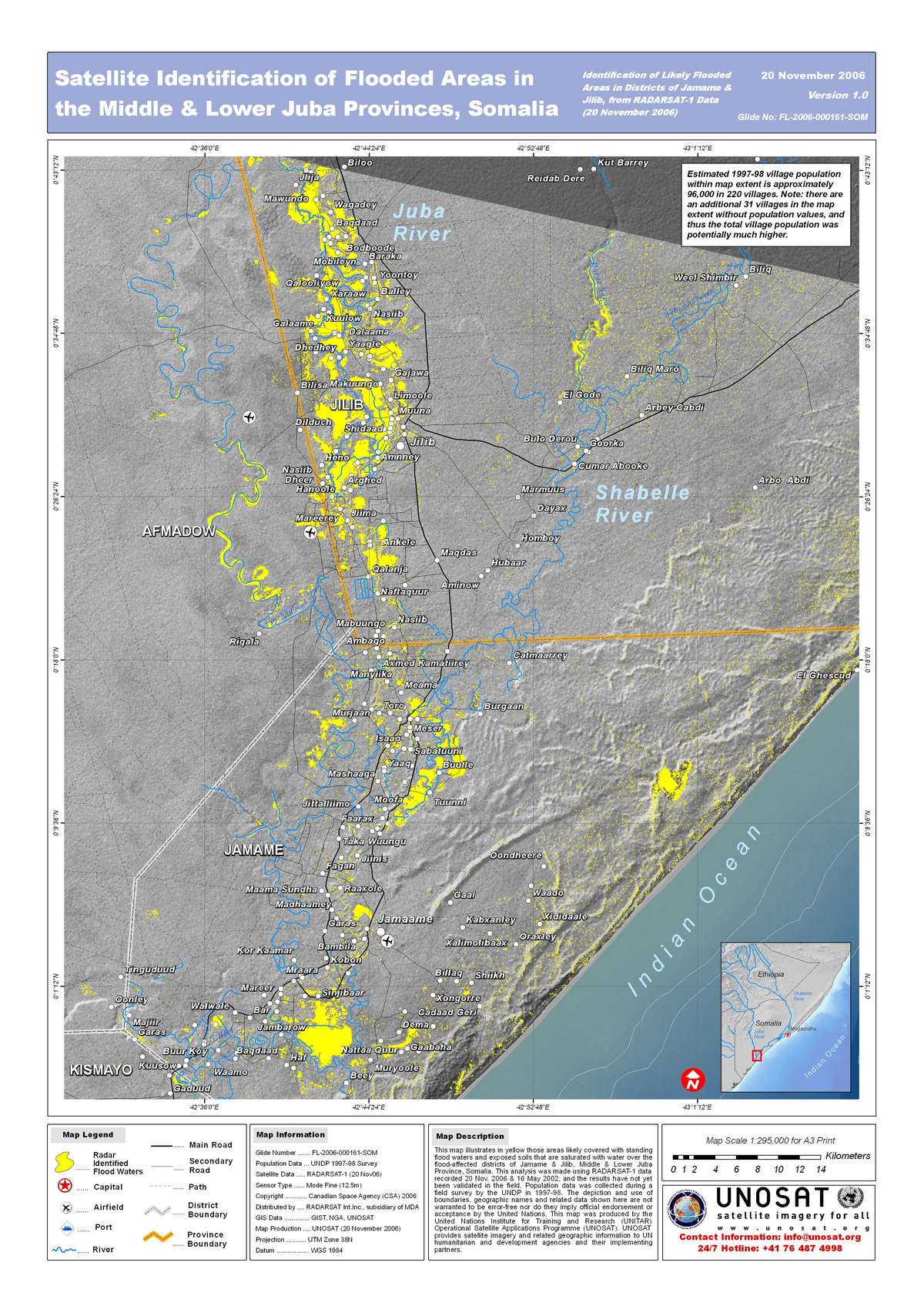
On 13-14 November 2006, severe flooding hit the area between Jillib and Jamane, between the middle and lower Juba Regions in the south of the country.  

Type of Event:Inundación
Location of Event:Somalia
Date of Charter Activation:13/11/2006 15:17 UTC
Charter Requestor:UNOOSA por WFP / UNOCHA
Project Management:UNOSAT

Products

Floods Radar Lower Shabelle

Copyright: CSA 2006, NSPO 2006 Image processing, map created 24/11/2006 by UNOSAT.

Information about the Product

Acquired: 20/11/2006

Source: RADARSAT-1, FORMOSAT-2

Floods Population Middle Shabelle UNDP 1997-98 Survey

Copyright: GIST, NGA, UNOSAT Image processing, map created 19/11/2006 by UNOSAT.

Information about the Product

Acquired: 1997-98

Source: UNDP Survey

Population Middle Juba UNDP 1997-98 Survey

Copyright: GIST, NGA, UNOSAT Image processing, map created 15/11/2006 by UNOSAT

Information about the Product

Acquired: 1997-98

Source: UNDP Survey

Population Lower Shabelle UNDP 1997-98 Survey

Copyright: GIST, NGA, UNOSAT Image processing, map created 15/11/2006 by UNOSAT.

Information about the Product

Acquired: 1997-98

Source: UNDP Survey

Formosat Flooding South Lower Juba

Copyright: NSPO 2006 Image processing, map created 24/11/2006 by UNOSAT.

Information about the Product

Acquired: 20/11/2006

Source: FORMOSAT-2

Formosat Flooding North Lower Juba

Copyright: NSPO 2006 Image processing, map created 24/11/2006 by UNOSAT.

Information about the Product

Acquired: 20/11/2006

Source: FORMOSAT-2

Formosat Flooding Ceel Weyne

Copyright: NSPO 2006 Image processing, map created 24/11/2006 by UNOSAT.

Information about the Product

Acquired: 20/11/2006

Source: FORMOSAT-2

Floods Radar Lower Jubba

Copyright: CSA 2006, NSPO 2006 Image processing, map created 24/11/2006 by UNOSAT.

Information about the Product

Acquired: 20/11/2006

Source: RADARSAT-1, FORMOSAT-2

Back to the full activation archive