 English
 Spanish
 French
 Chinese
 Russian
 Portuguese
 最新宪章启动
Charter activations
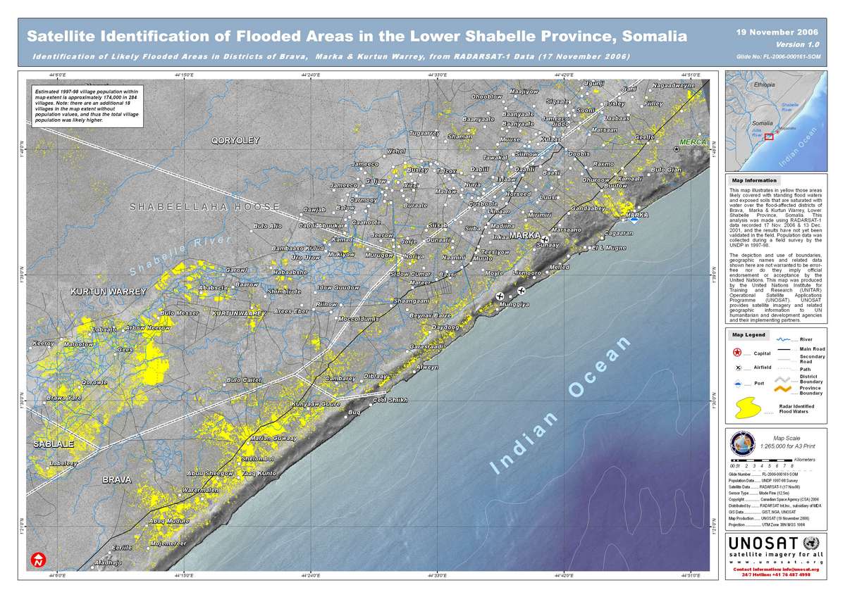
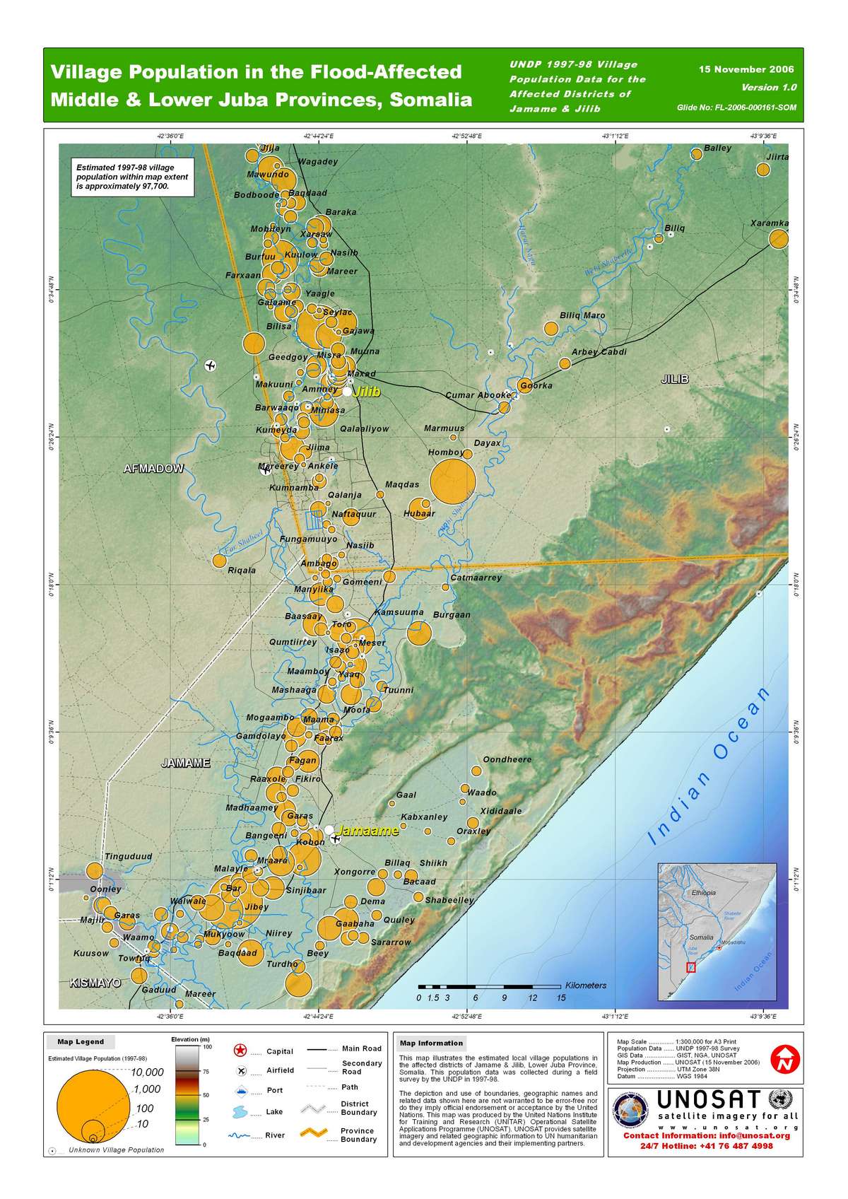
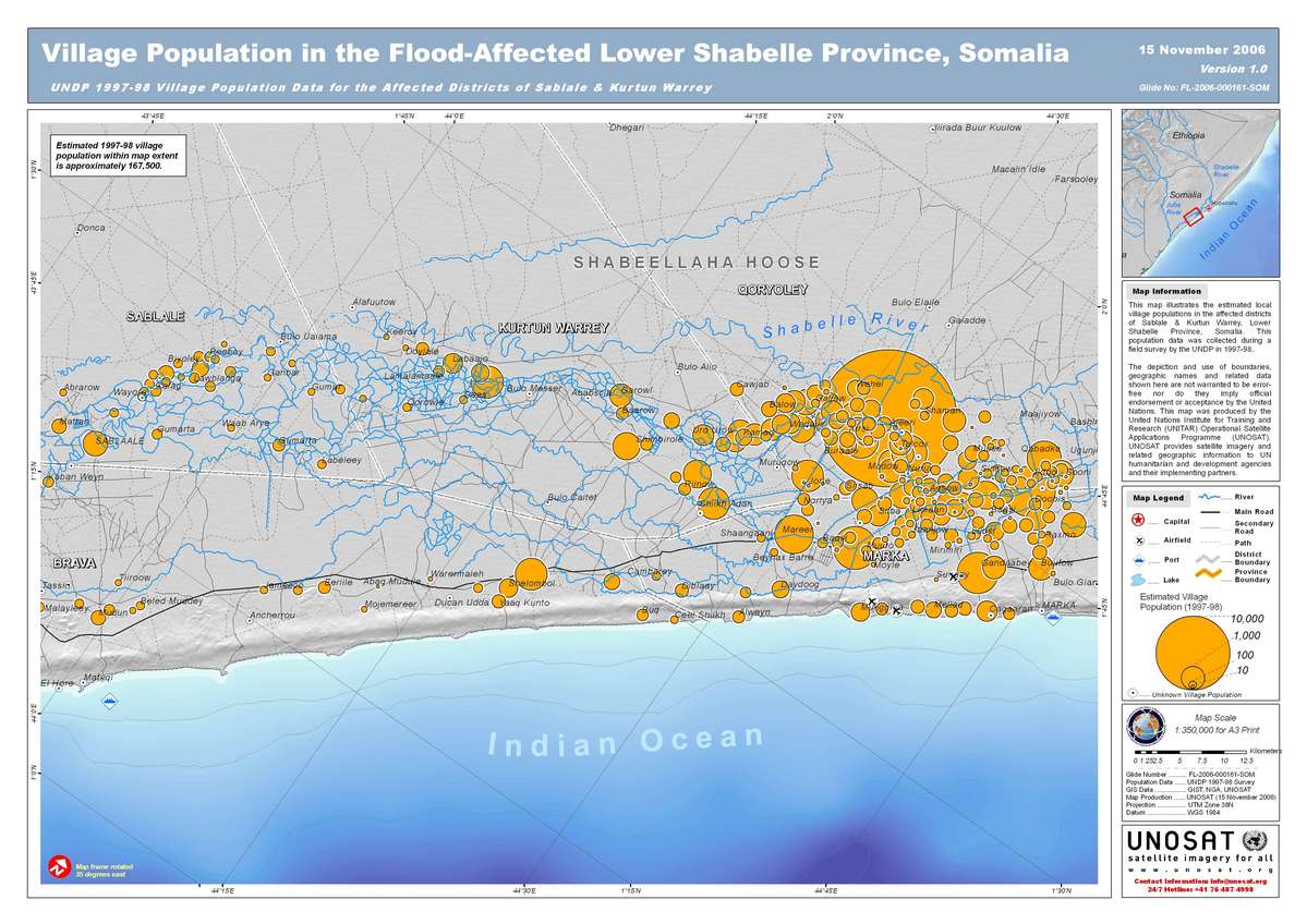
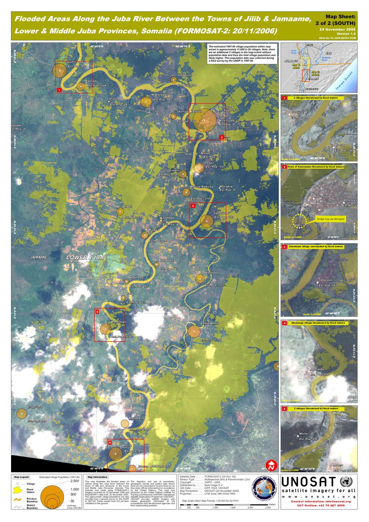
索马里洪灾
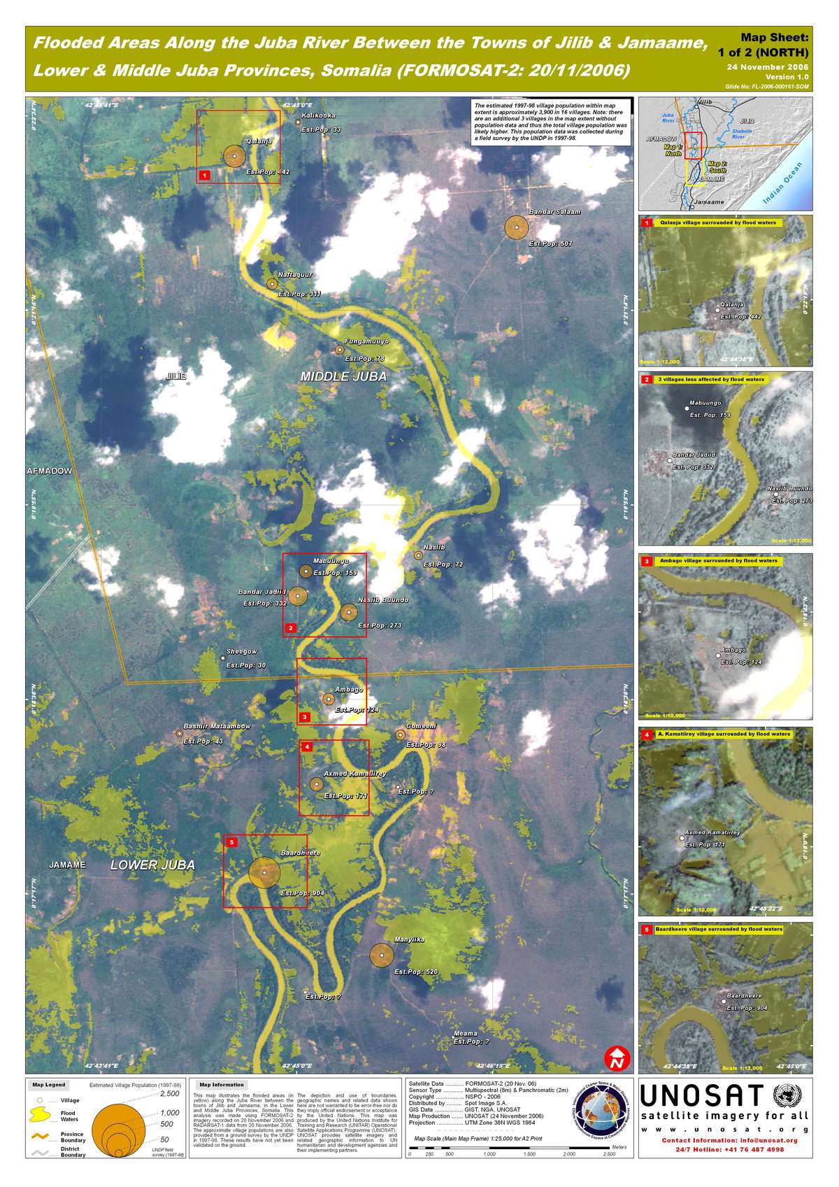
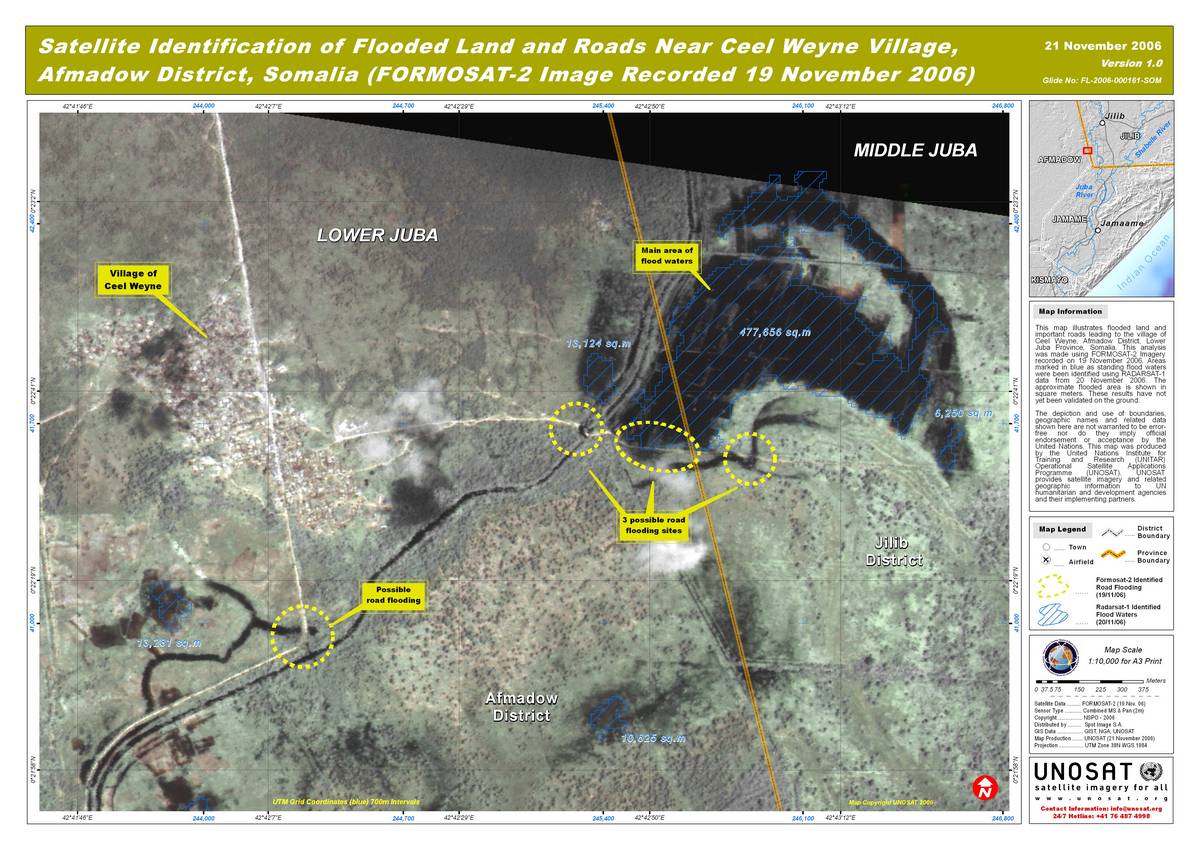
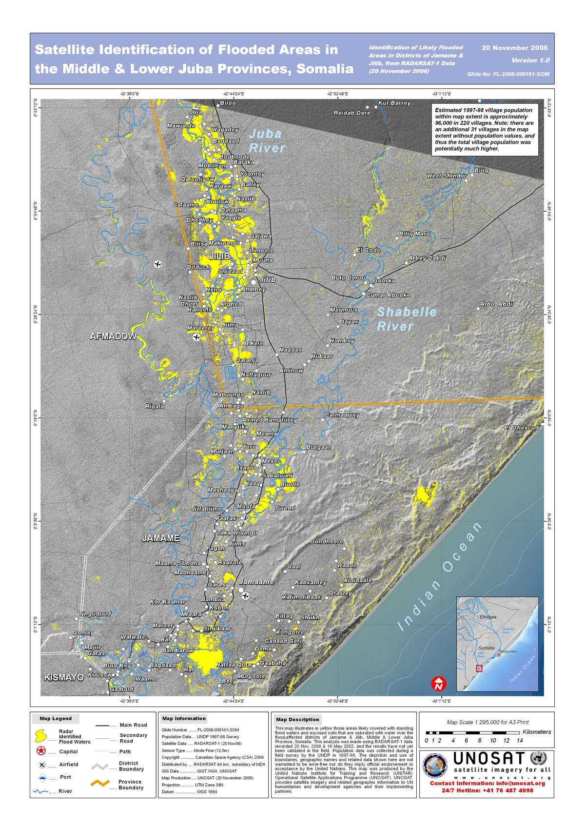
2006年11月13-14日,Jillib 至 Jamane之间的地区遭受严重洪灾,该地区位于索马里南部朱巴地区中部地势低洼区域。
| 事件类型: | 洪灾 |
| 事件地点: | 萦马里 |
| 启动宪章的日期: | 2006年11月13日世界时15时17分 |
| 宪章要求者: | UNOOSA代表 WFP / UNOCHA |
| 项目经理: | UNOSAT |
Products

 返回完整的响应档案
最新宪章启动
返回完整的响应档案
最新宪章启动
2006年11月13-14日,Jillib 至 Jamane之间的地区遭受严重洪灾,该地区位于索马里南部朱巴地区中部地势低洼区域。
| 事件类型: | 洪灾 |
| 事件地点: | 萦马里 |
| 启动宪章的日期: | 2006年11月13日世界时15时17分 |
| 宪章要求者: | UNOOSA代表 WFP / UNOCHA |
| 项目经理: | UNOSAT |
返回完整的响应档案

