 English
 Spanish
 French
 Chinese
 Russian
 Portuguese
 Última Activación
Charter activations
Inundaciones en Inglaterra
Fuertes lluvias afectaron al Reino Unido durante el fin de semana del 22 y 23 del pasado mes de diciembre, y las previsiones indican que el episodio no ha terminado. Las lluvias han causado inundaciones por todo el país, afectando particularmente el sud-este de Inglaterra y Gales.
A 24 de diciembre, la agencia de medioambiente ya ha emitido 140 avisos de inundación y 261 alertas, cubriendo todas las regiones del país.
Las condiciones meteorológicas persisten desde las inundaciones de finales de noviembre, provocando más problemas puesto que el suelo ya saturado sigue recibiendo más precipitaciones.
Docenas de hogares han sido evacuados debido a las inundaciones y preocupa que algunos ríos como el Támesis y el Severn puedan desbordarse.
| Type of Event: | Inundaciones |
| Location of Event: | Inglaterra, Reino Unido |
| Date of Charter Activation: | 21 diciembre 2012 |
| Charter Requestor: | CCS |
| Project Management: | Environment Agency (of England and Wales) |
Products
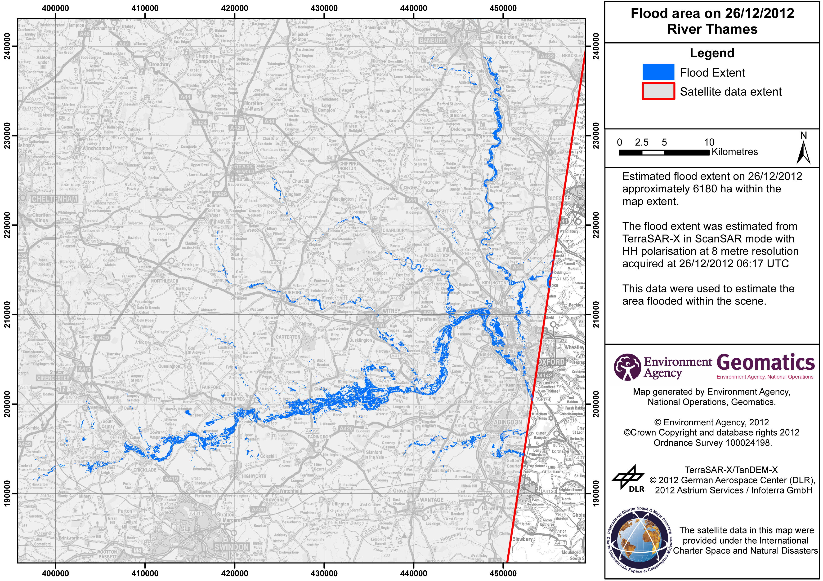
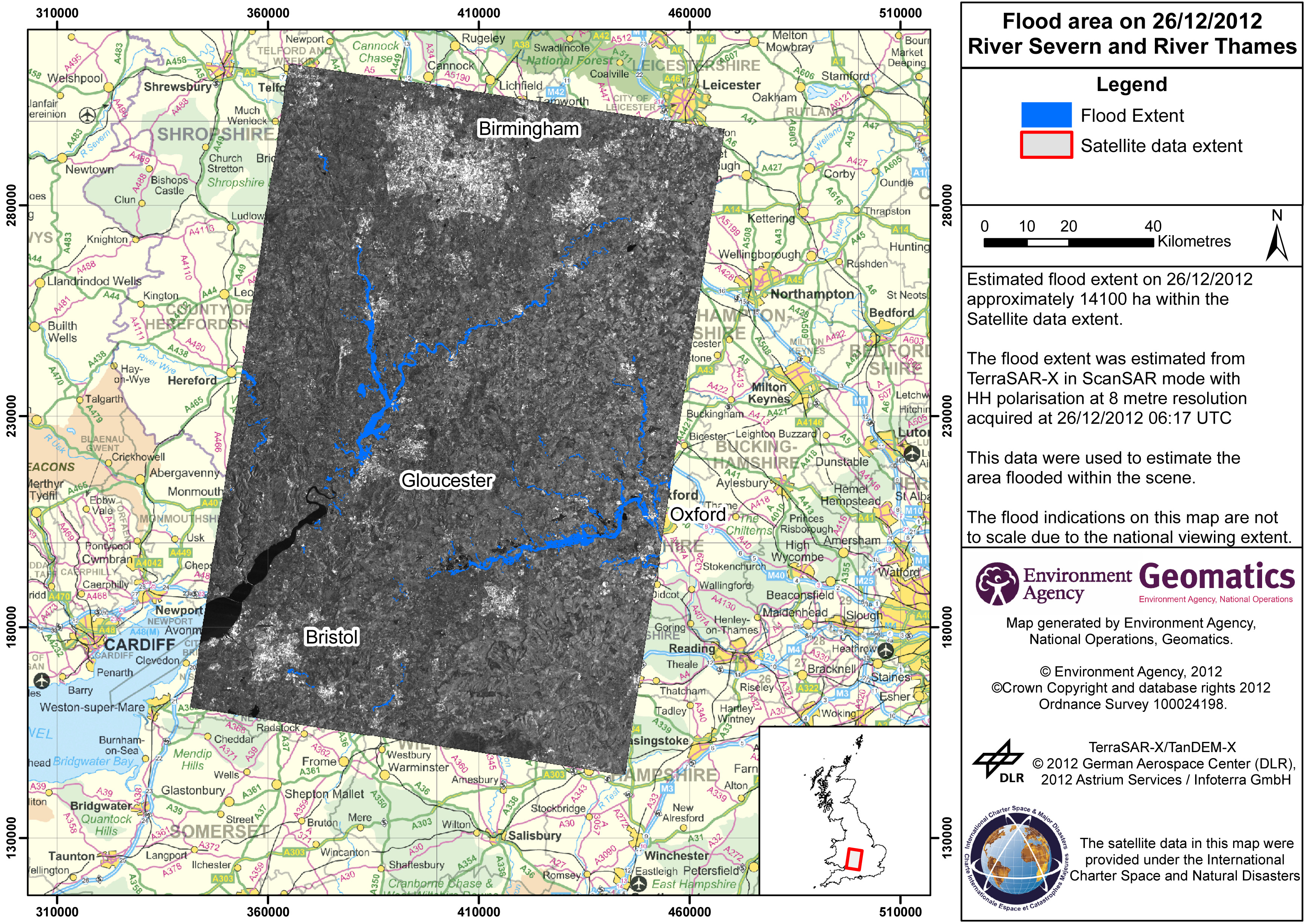
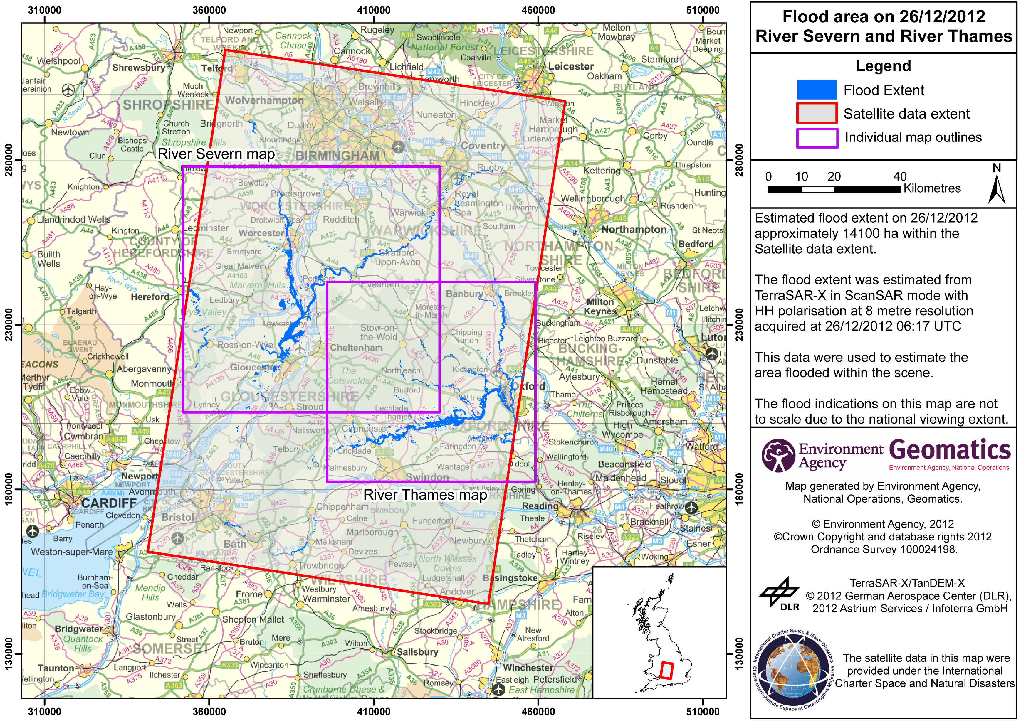
Inundación en área 26/12/2012 - Río Severn y el río Thames
Copyright: TerraSAR-X/TanDEM-X © 2012 German Aerospace Center (DLR), 2012 Astrium Services / Infoterra GmbH
Mapa producido por Environment Agency, National Operations, Geomatics
Information about the Product
Acquired: 26/12/2012
Source: TerraSAR-X
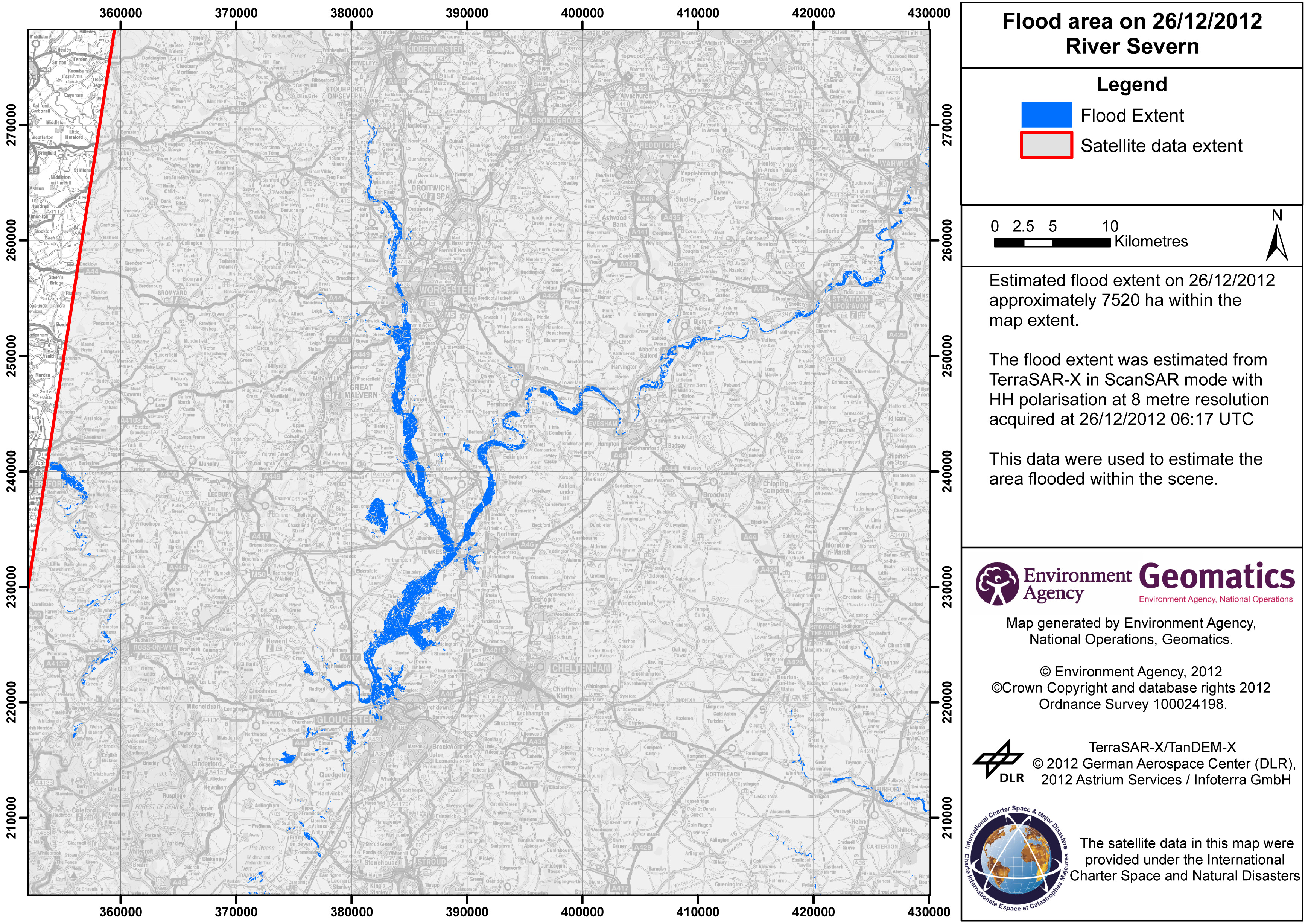
 Back to the full activation archive

