 English
 Spanish
 French
 Chinese
 Russian
 Portuguese
 Latest Activation
Charter activations
Flooding in the U.K.
Flooding of the Thames and Severn rivers forced thousands to evacuate and left 50,000 houses without power, following a month of heavy rain.
| Type of Event: | Flooding |
| Location of Event: | England (Gloucestershire, Herefordshire) |
| Date of Charter Activation: | 24/07/2007 13:53 UTC |
| Charter Requestor: | Environment Agency of the UK |
| Project Management: | The UK Environment Agency |
Products
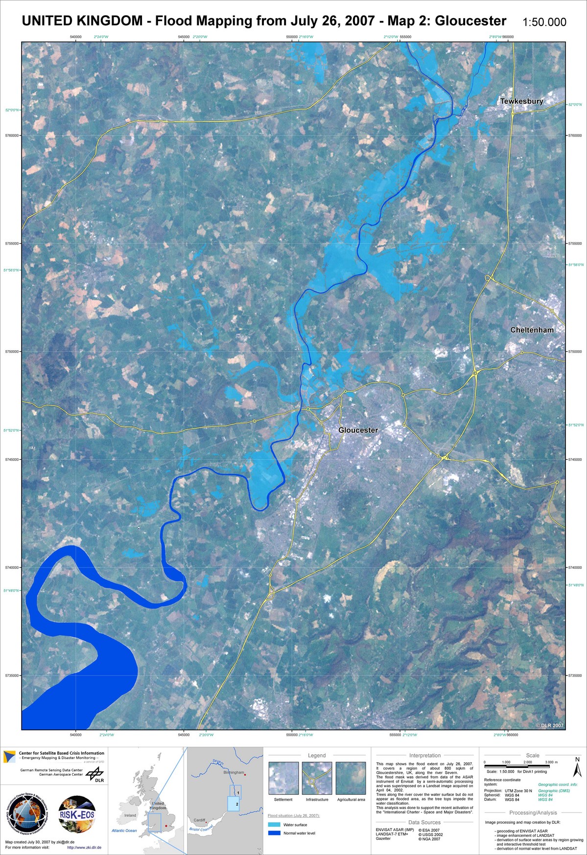
Envisat ASAR, flood situation 26/07/2007, Gloucester
Copyright: ESA 2007; USGS 2002 Image processing, map created 30/07/2007 by DLR.
Information about the Product
Acquired: 26/07/2007 (Envisat), 04/04/2002 (Landsat) ASAR precision-mode image (IMP) showing flood situation in Gloucester, superimposed on a pre-flooding Landsat image from which normal water levels are derived.
Source: Envisat ASAR, Landsat
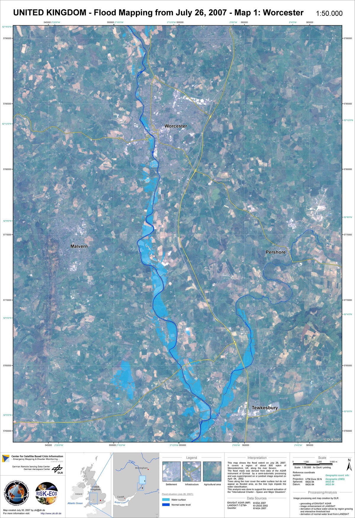
Envisat ASAR, flood situation 26/07/2007, Worcester
Copyright: ESA 2007; USGS 2002 Image processing, map created 30/07/2007 by DLR.
Information about the Product
Acquired: 26/07/2007 (Envisat), 04/04/2002 (Landsat) ASAR precision-mode image (IMP) showing flood situation in Worcester, superimposed on a pre-flooding Landsat image from which normal water levels are derived.
Source: Envisat ASAR, Landsat

TerrasSAR-X, flood extent in Tewkesbury, 25/07/2007
Copyright: DLR 2007 Image processing, map created 27/07/2007 by DLR.
Information about the Product
Acquired: 25/07/2007 Flood extent in Tewkesbury, using a flood mask derived from TerraSAR-X data, superimposed on the original image.
Source: TerraSAR-X
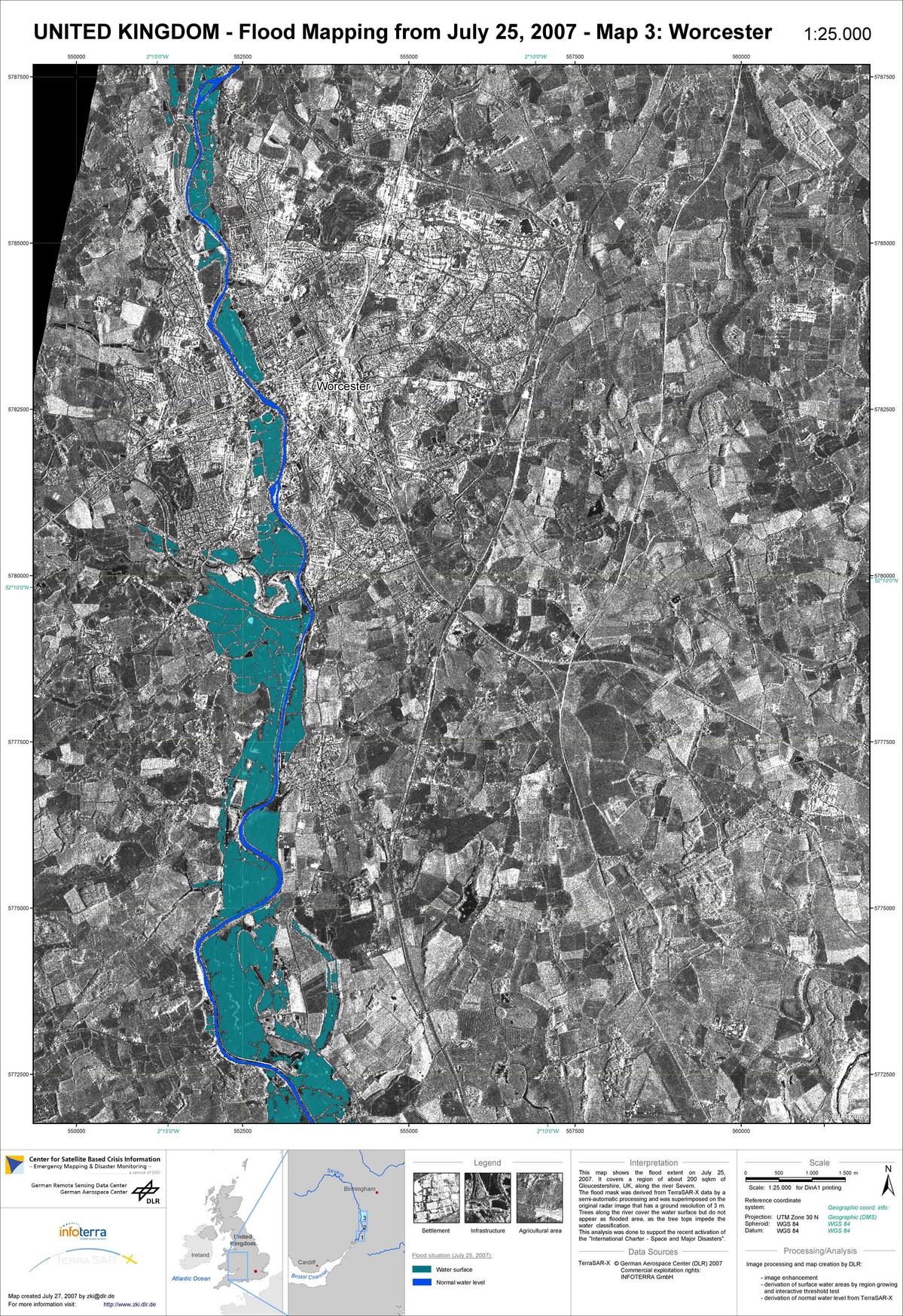
TerrasSAR-X, flood extent in Worcester, 25/07/2007
Copyright: DLR 2007 Image processing, map created 27/07/2007 by DLR.
Information about the Product
Acquired: 25/07/2007 Flood extent in Worcester, using a flood mask derived from TerraSAR-X data, superimposed on the original image.
Source: TerraSAR-X
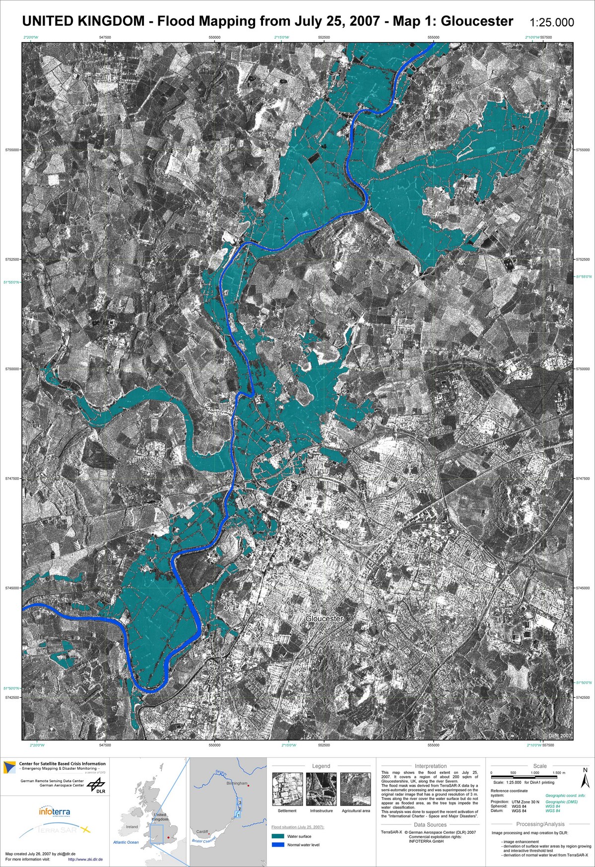
TerrasSAR-X, flood extent in Gloucester, 25/07/2007
Copyright: DLR 2007 Image processing, map created 27/07/2007 by DLR.
Information about the Product
Acquired: 25/07/2007 Flood extent in Gloucester, using a flood mask derived from TerraSAR-X data, superimposed on the original image.
Source: TerraSAR-X

Envisat ASAR WS, flood situation 23/07/2007
Copyright: ESA 2007 Image processing, map created 27/07/2007 by DLR.
Information about the Product
Acquired: 23/07/2007 ASAR wide-swath image showing flood situation in south-west England. Image is a multitemporal colour composite based on a 23 July acquisition and several earlier non-flooded acquisitions, geocorrected using Landsat imagery.
Source: Envisat ASAR
 Back to the full activation archive

