 English
 Spanish
 French
 Chinese
 Russian
 Portuguese
 Latest Activation
Charter activations
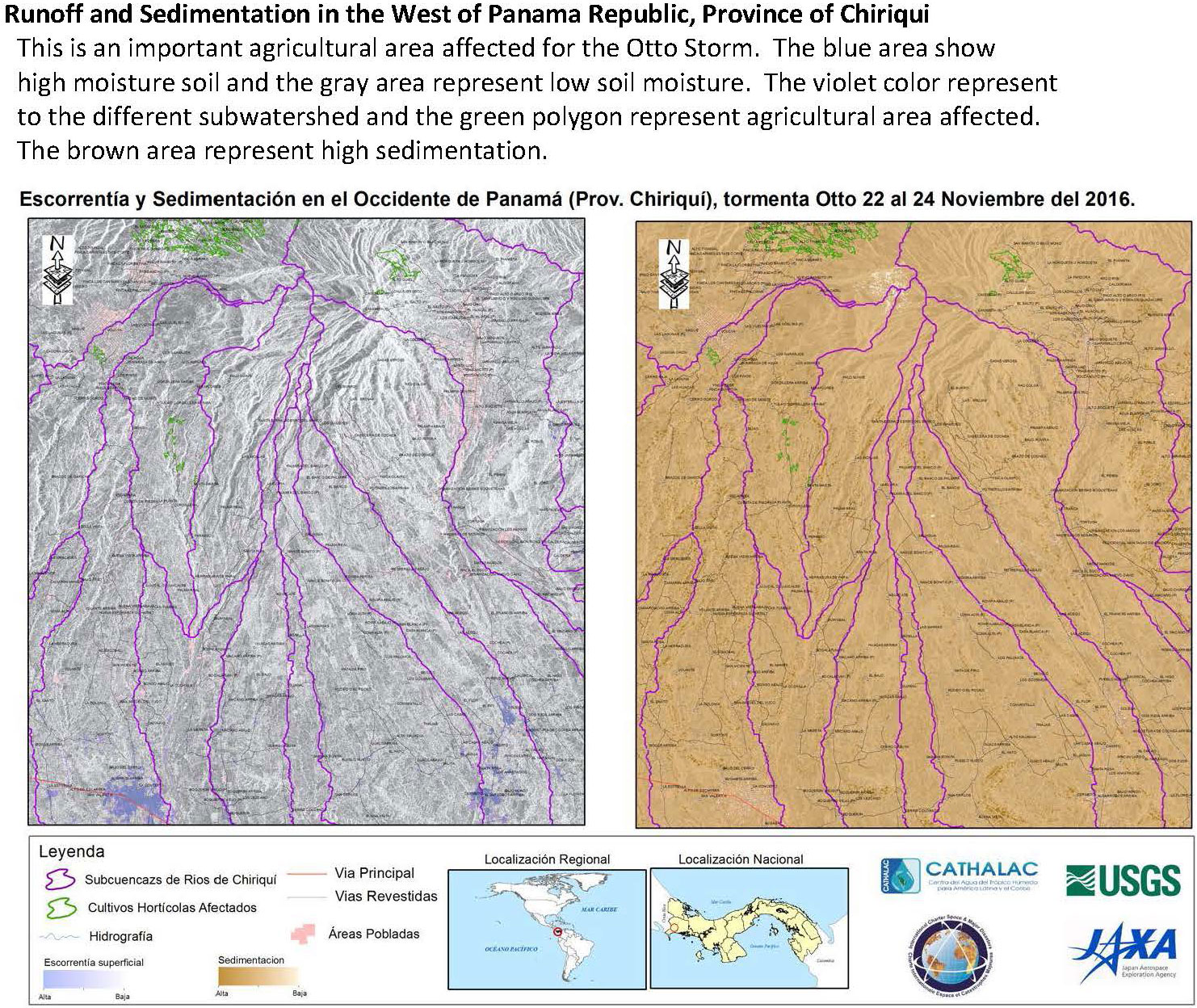
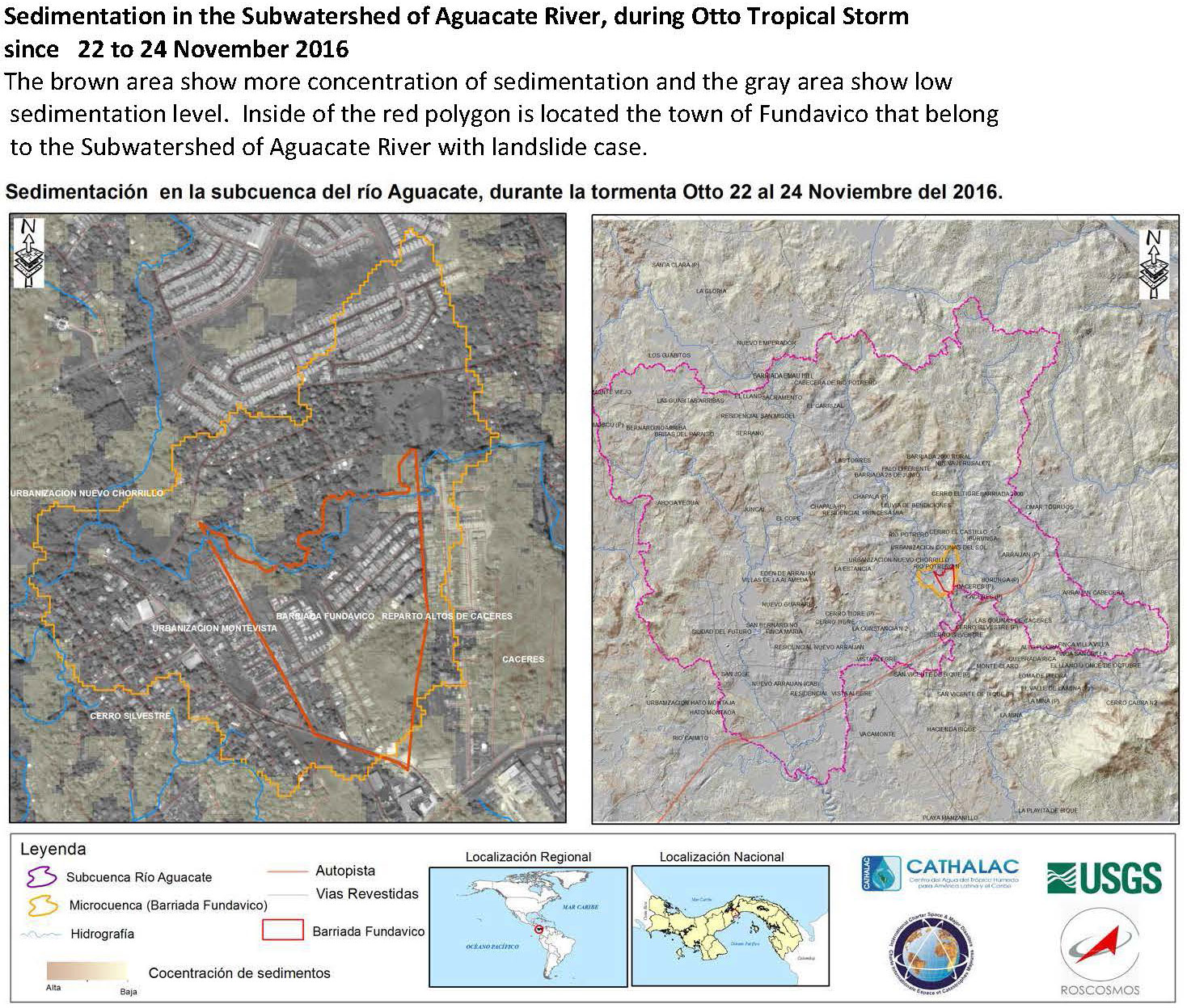
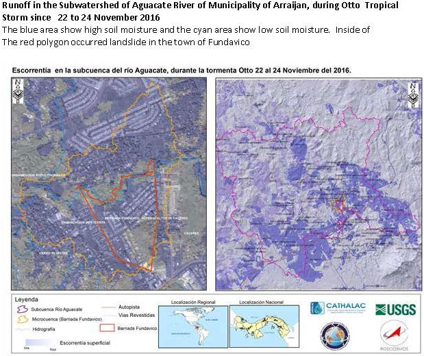
Flood in Panama
Flooding has been reported in Panama after days of heavy rain, with forecasts suggesting more rain in the coming days.
Hundreds of people have been affected in the provinces of Chiriquí, Bocas del Toro, Veraguas and Los Santos.
In Chiriquí province, the Palo Blanco, Gariche, Rabo de Puerco, El Colorado and Chiriquí Viejo Rivers are all overflowing and causing floods to the area. In Los Santos Province, La Villa River is also overflowing.
SINAPROC, the Panamanian civil protection agency, has been conducting evacuations for over 200 people across the affected provinces and it is estimated that at least 100 homes have been damaged.
| Type of Event: | Flood |
| Location of Event: | Panama |
| Date of Charter Activation: | 21 November 2016 |
| Time of Charter Activation: | 20:58:00 |
| Time zone of Charter Activation: | UTC+01:00 |
| Charter Requestor: | USGS |
| Activation ID: | 513 |
| Project Management: | CATHALAC |
Products

 Back to the full activation archive

