 English
 Spanish
 French
 Chinese
 Russian
 Portuguese
 Последняя Активация
Charter activations
Flood and landslide in the Republic of Panama
Nine people have died in the Panama Republic following flooding and landslides in the western part of the country. Amongst the damage, over twenty homes were destroyed, leaving almost 100 people homeless.
The floods and landslides occurred in Chiriqui Province after heavy rain fell over the area on 17 August 2014. The President of the Panama Republic has declared a state of emergency in the province, and efforts have been undertaken since then to repair the damage and rescue people affected by the disaster.
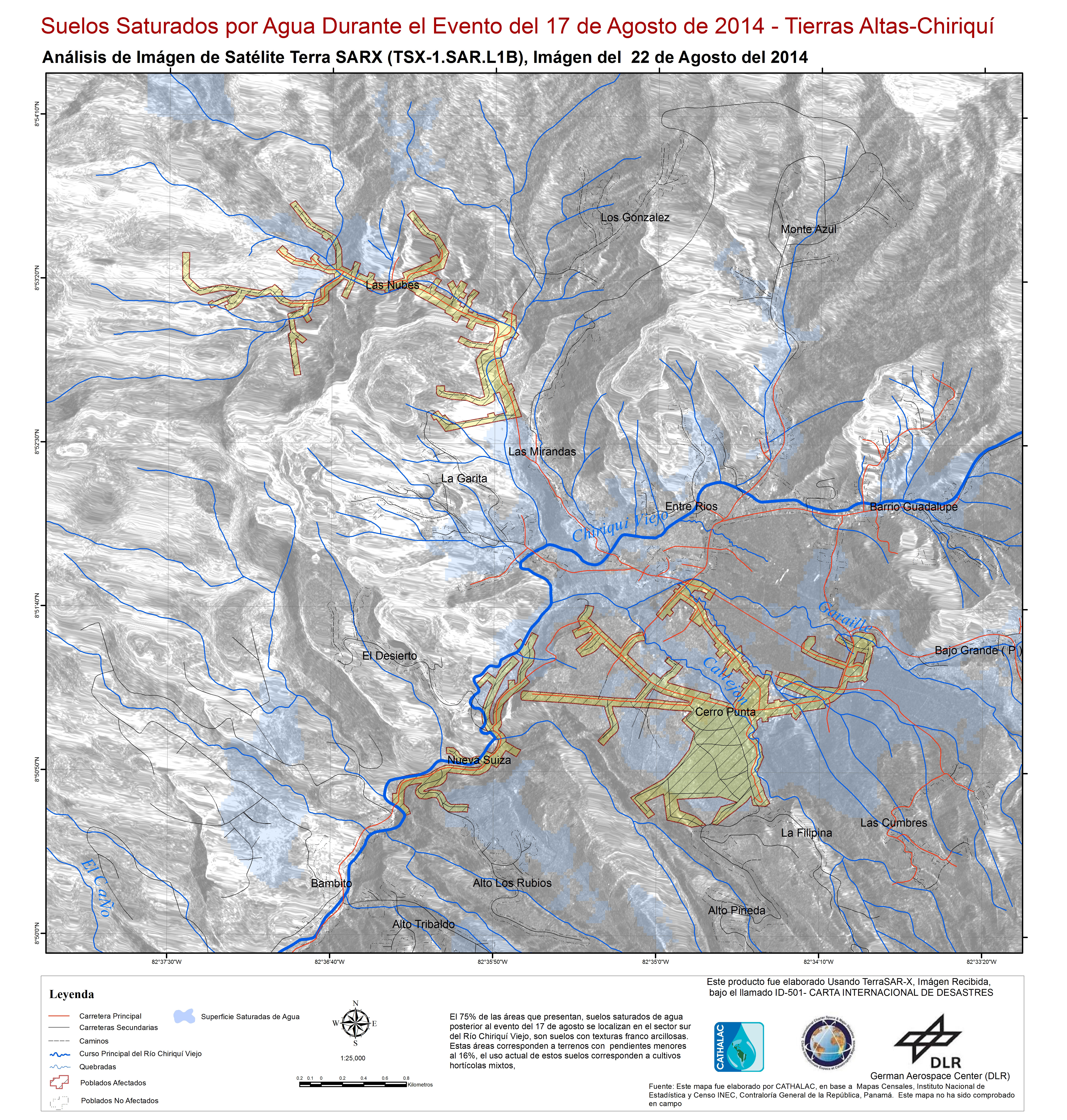
The rain caused the Chiriqui Viejo River to burst its banks in Chiriqui Province, which led to flooding in the city of Cerro Punta. The powerful flood waters from the river destroyed three bridges in the province, and rescue workers have constructed a temporary ford for relief and evacuation purposes. Further enhancing the damage from the floods is debris swept along by the river.
Four of the people killed were on a bus which crashed into the river when part of the road they were travelling on collapsed. The floods also left twelve people stranded in Las Nubes, when the overflowing river left them on an island, but they were rescued on 17 August.
| Тип события: | Flood and landslide |
| Место события: | Chiriqui Province, Republic of Panama |
| Date of Charter Activation: | 18 August 2014 |
| Запрос на активацию поступил от: | USGS on behalf of SINAPROC / Chiriqui Province / Municipality of Tierra Alta |
| Менеждер проекта от: | CATHALAC |
Products
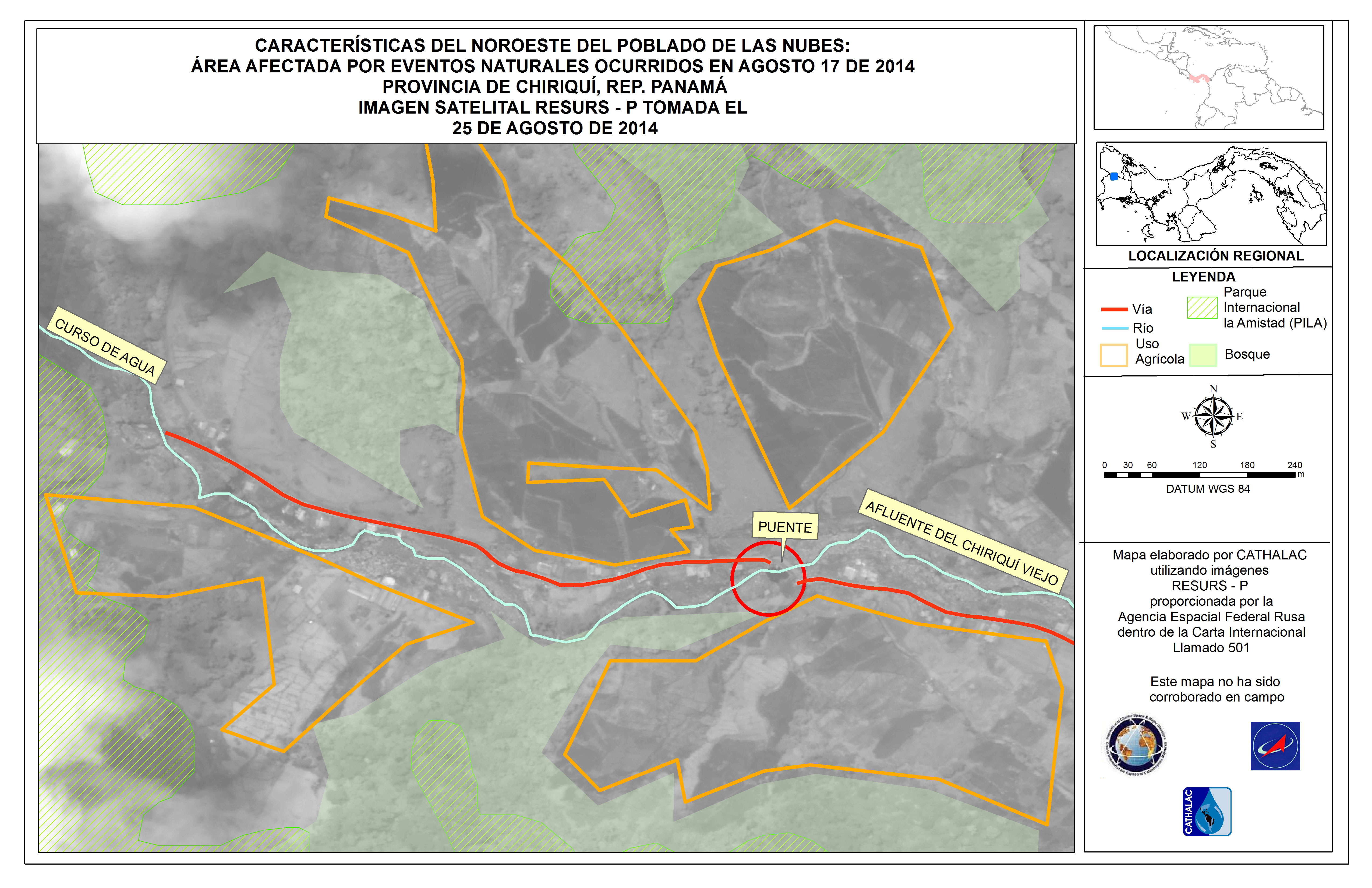


Agricultural areas and villages affected by Chiriqui Viejo River floods in the Chiriqui Province
Авторские права: RADARSAT-2 Data and Products © MacDonald, Dettwiler and Associates Ltd. (2014) - All Rights Reserved. RADARSAT is an official trademark of the Canadian Space Agency.
Map produced by CATHALAC
Information about the Product
Получено: 17/08/2014
Источник: RADARSAT-2
 Вернуться к полному архиву активаций

