 English
 Spanish
 French
 Chinese
 Russian
 Portuguese
 最新宪章启动
Charter activations
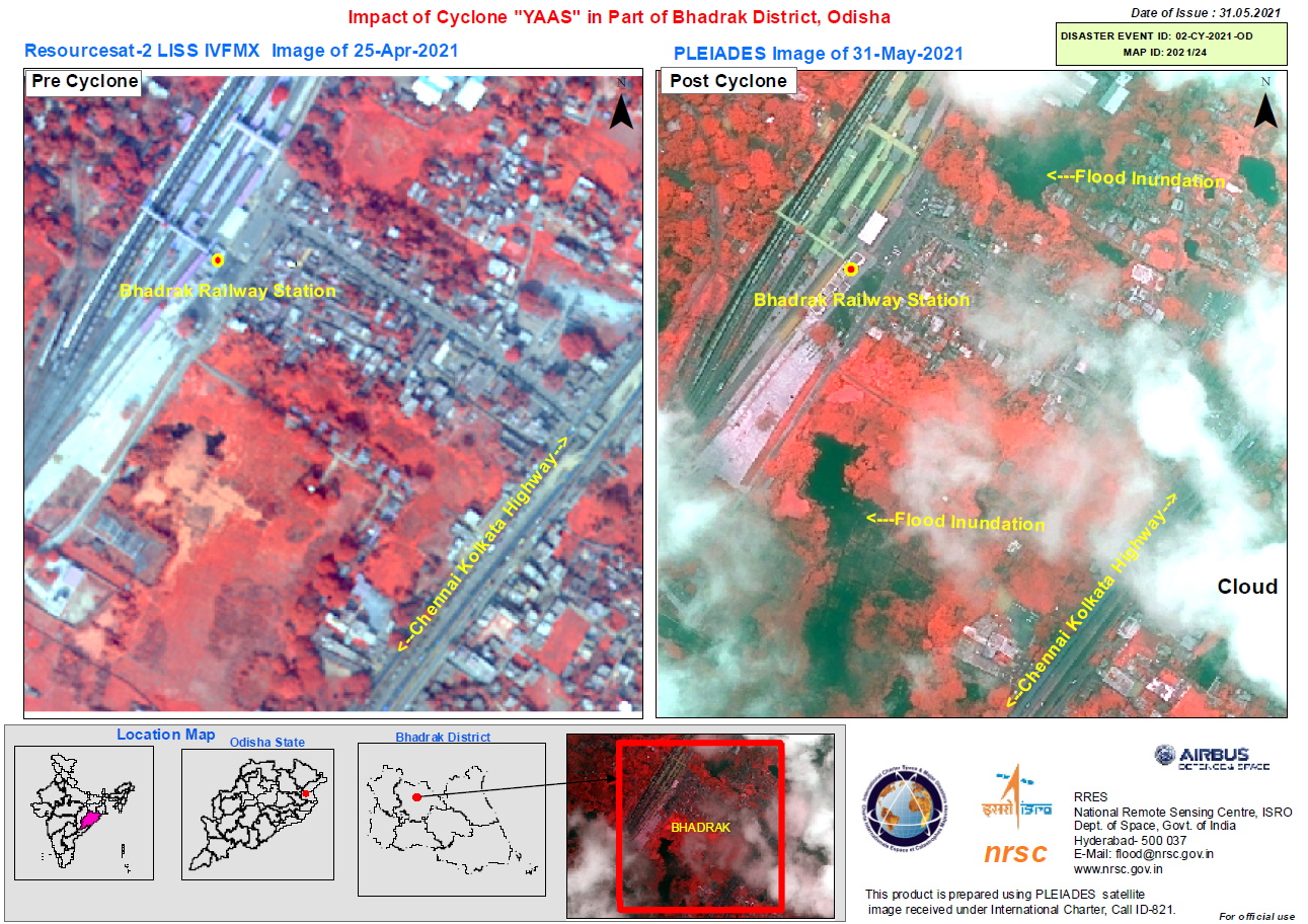
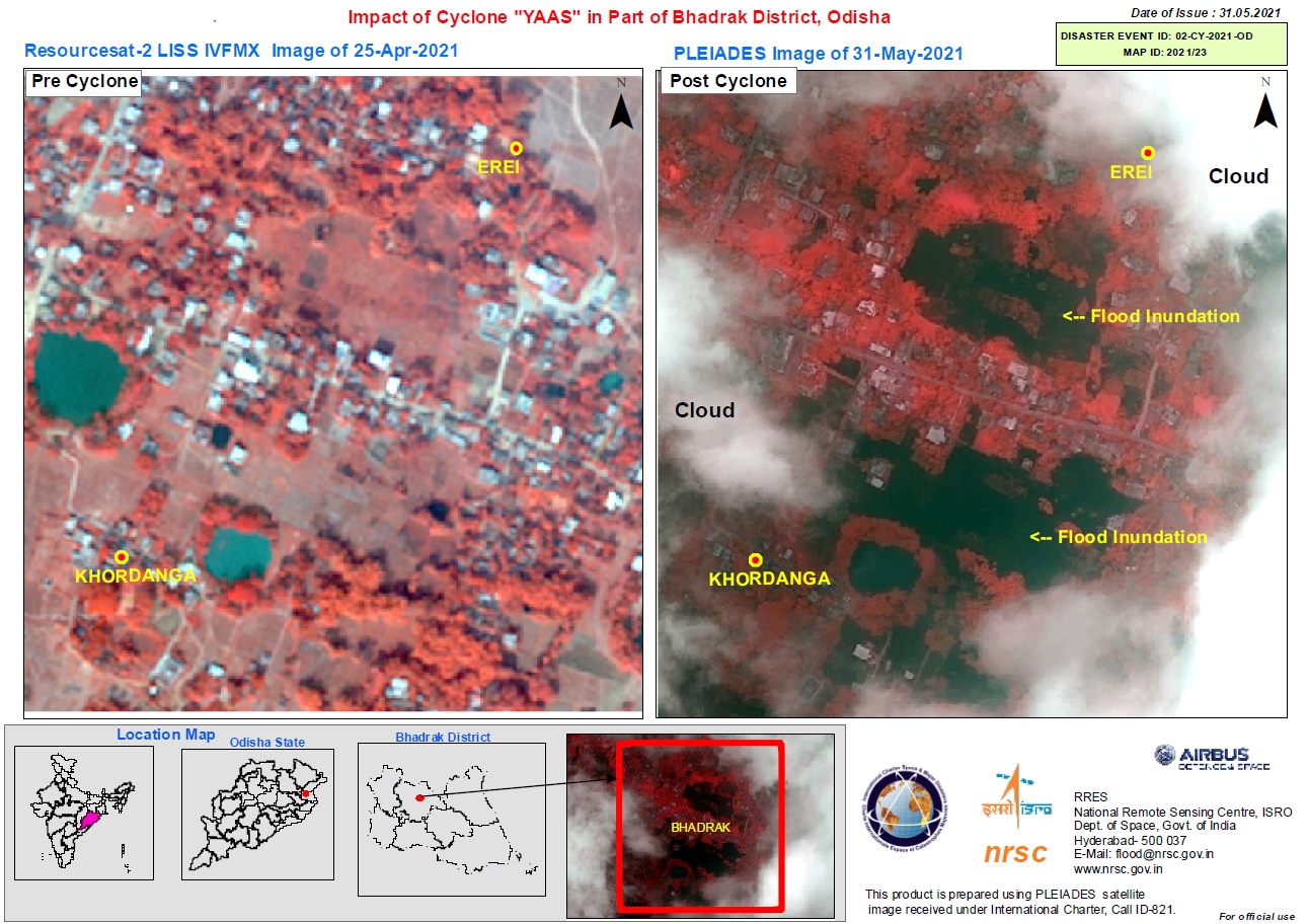
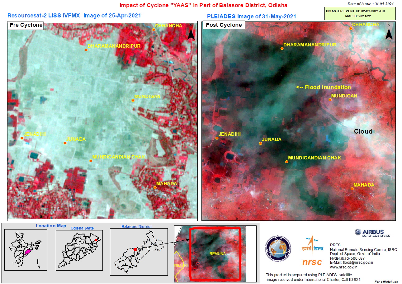
Tropical Cyclone Yaas, India
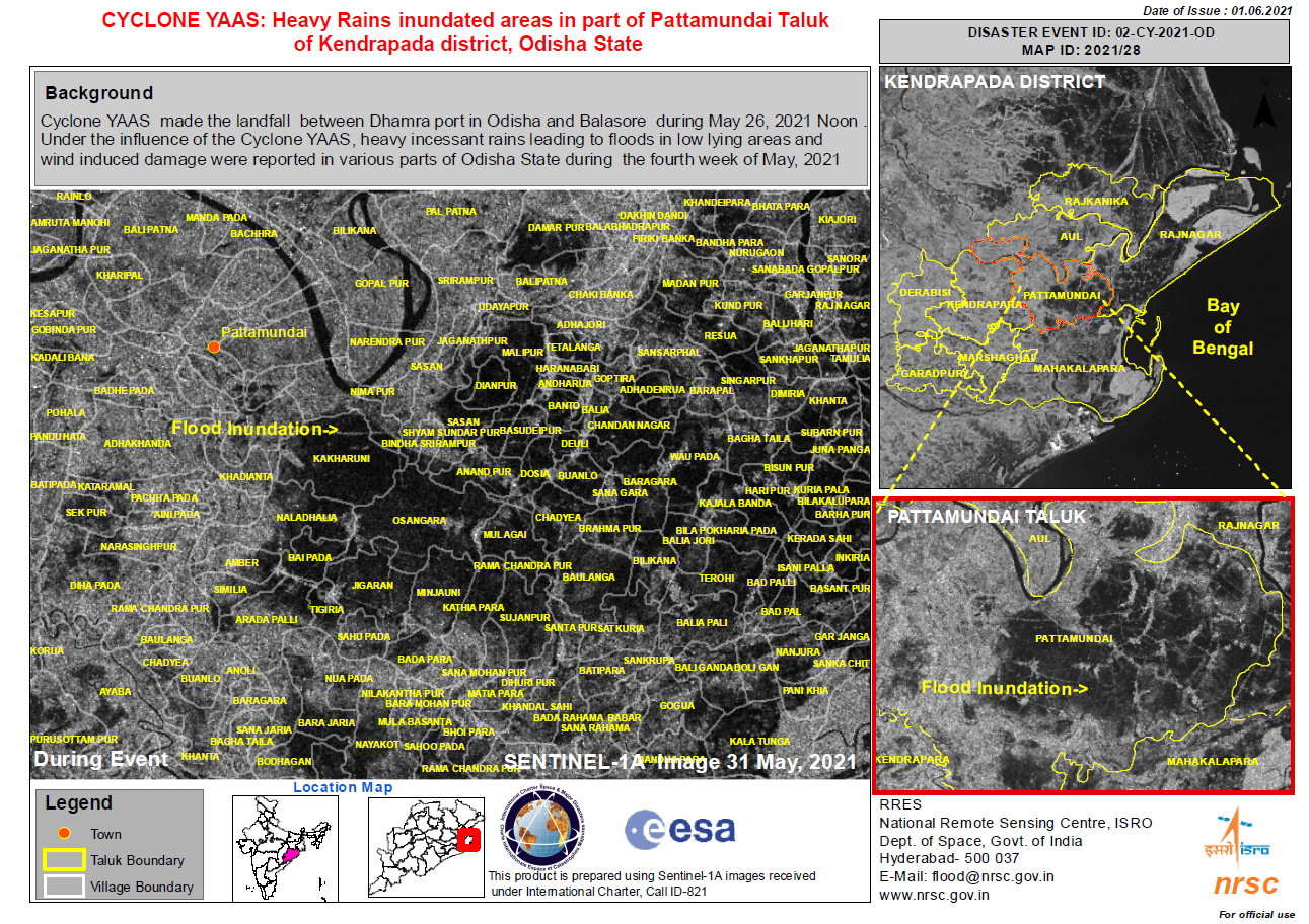
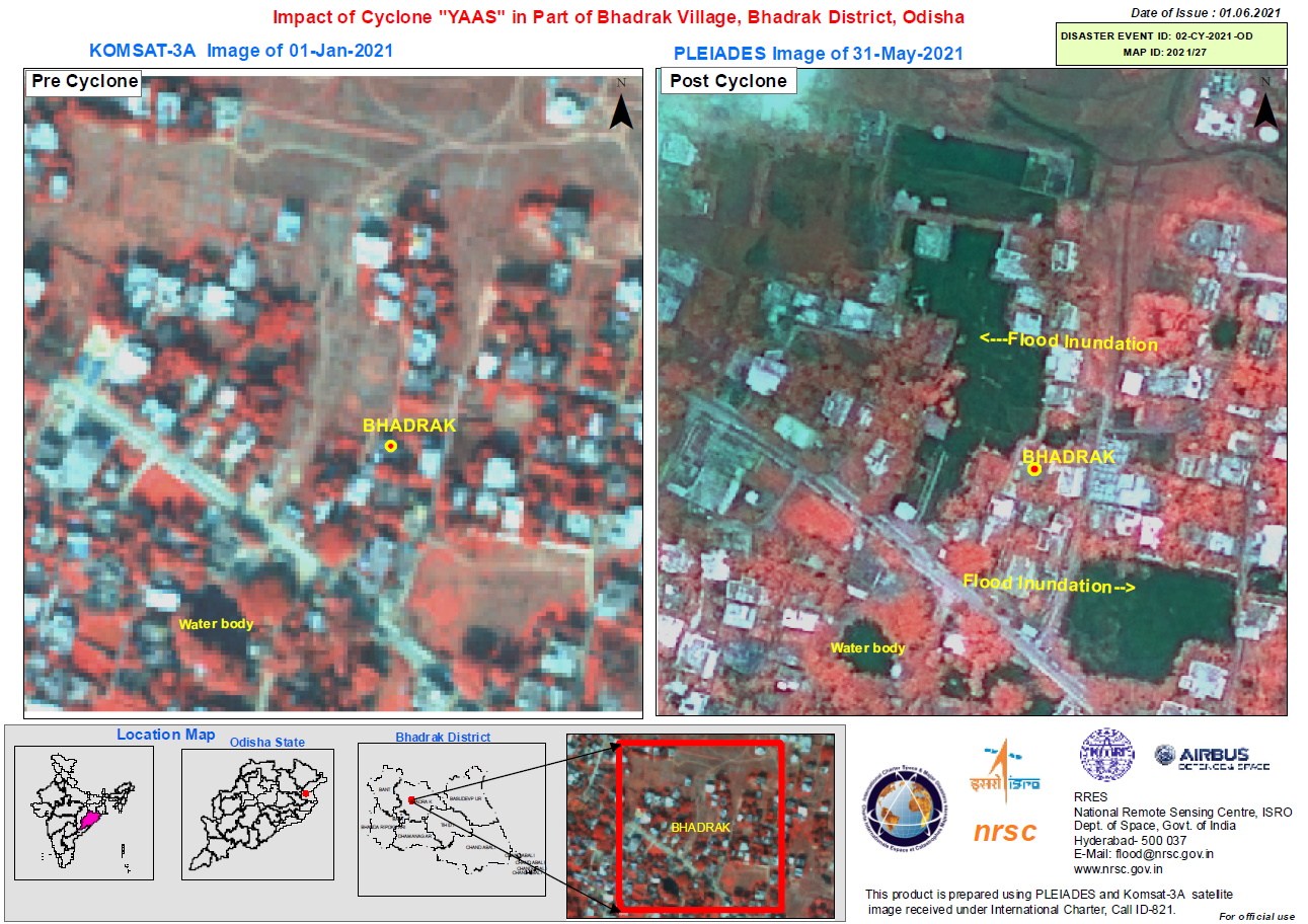
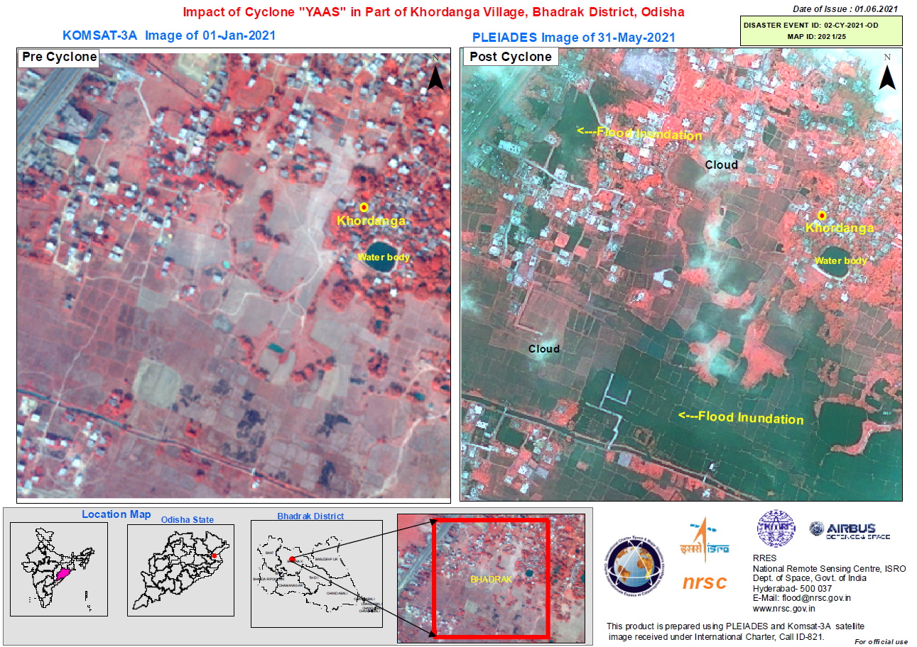
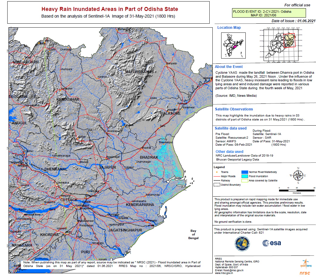
Cyclone Yaas, which is bearing down on Bengal and Odisha from the Bay of Bengal, will make landfall near Balasore coast in Odisha 240km from Kolkata on May 26 with an expected wind speed of 155kmph-165kmph.
Heavy rainfall could cause flash flooding in northeastern India, with a widespread 150 to 250 mm (6 to 10 inches) of rain and isolated totals over 250 mm likely. Some of the outer rain bands on the eastern side of the storm may lead to some flooding across portions of Bangladesh.
Tropical cyclones can form year round in the North Indian Ocean, but are especially common in the spring ahead of monsoon season.
| 事件地点: | India |
| 启动宪章的日期: | 2021-05-25 |
| 宪章启动时间: | 14:17 |
| 宪章启动时区: | UTC+05:30 |
| 宪章要求者: | ISRO |
| 启动ID: | 714 |
| 项目经理: | NRSC |
Products

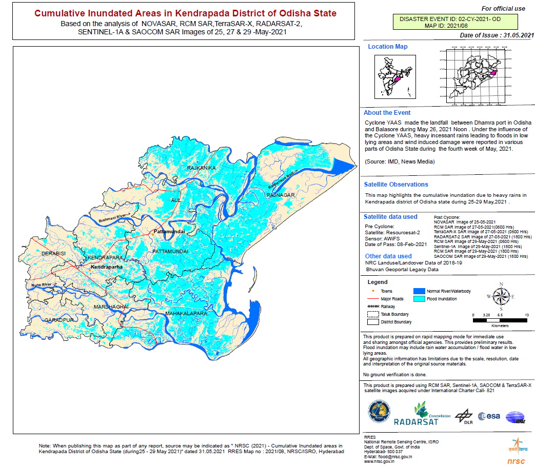
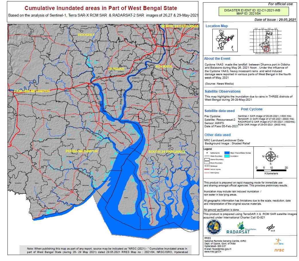
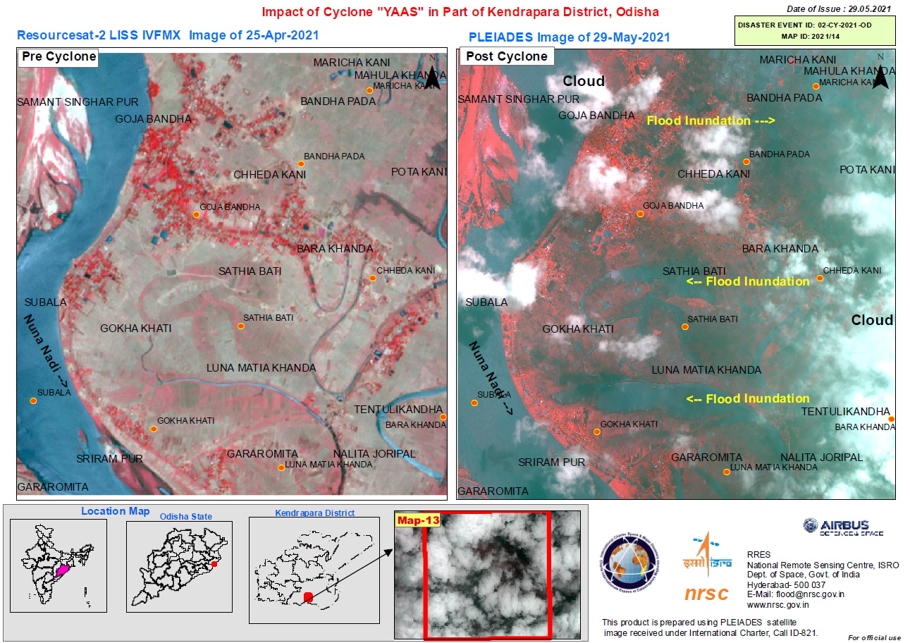
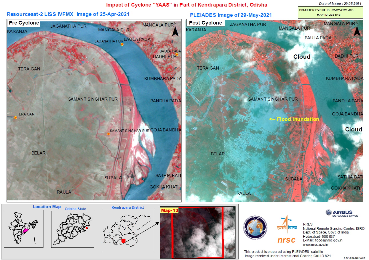
Cumulative Inundated Areas in Kendrapada District of Odisha State
版权: © DLR e.V. (2021), Distribution Airbus DS Geo GmbH
© CONAE (2021)
RADARSAT Constellation Mission Imagery © Government of Canada (2021) - RADARSAT is an official mark of the Canadian Space Agency
Contains modified Copernicus Sentinel data (2021)
ResourceSat-2 data and products © ISRO (2021) - All rights reserved
Information about the Product
已获得: ResourceSat-2: 08/02/2021
TerraSAR-X / RADARSAT-2/ RCM: 27/05/2021
RCM / SAOCOM-1 / Sentinel-1A: 29/05/2021
源: TerraSAR-X / SAOCOM-1 / RADARSAT-2 / RCM / Sentinel-1 / ResourceSat-2
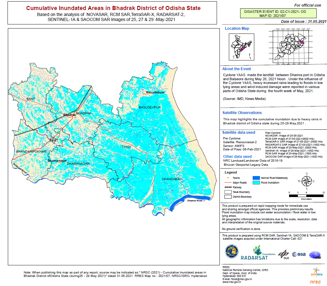
Cumulative Inundated Areas in Bhadrak District of Odisha State, India
版权: RADARSAT Constellation Mission Imagery © Government of Canada (2021) - RADARSAT is an official mark of the Canadian Space Agency
© DLR e.V. (2021), Distribution Airbus DS Geo GmbH
Contains modified Copernicus Sentinel data (2021)
© CONAE (2021)
Information about the Product
已获得: RCM / Sentinel-1 / SAOCOM-1: 29/05/2021
TanDEM-X: / RCM: 27/05/2021
Map produced by NRSC / ISRO
源: RCM / TanDEM-X / Sentinel-1 / SAOCOM-1
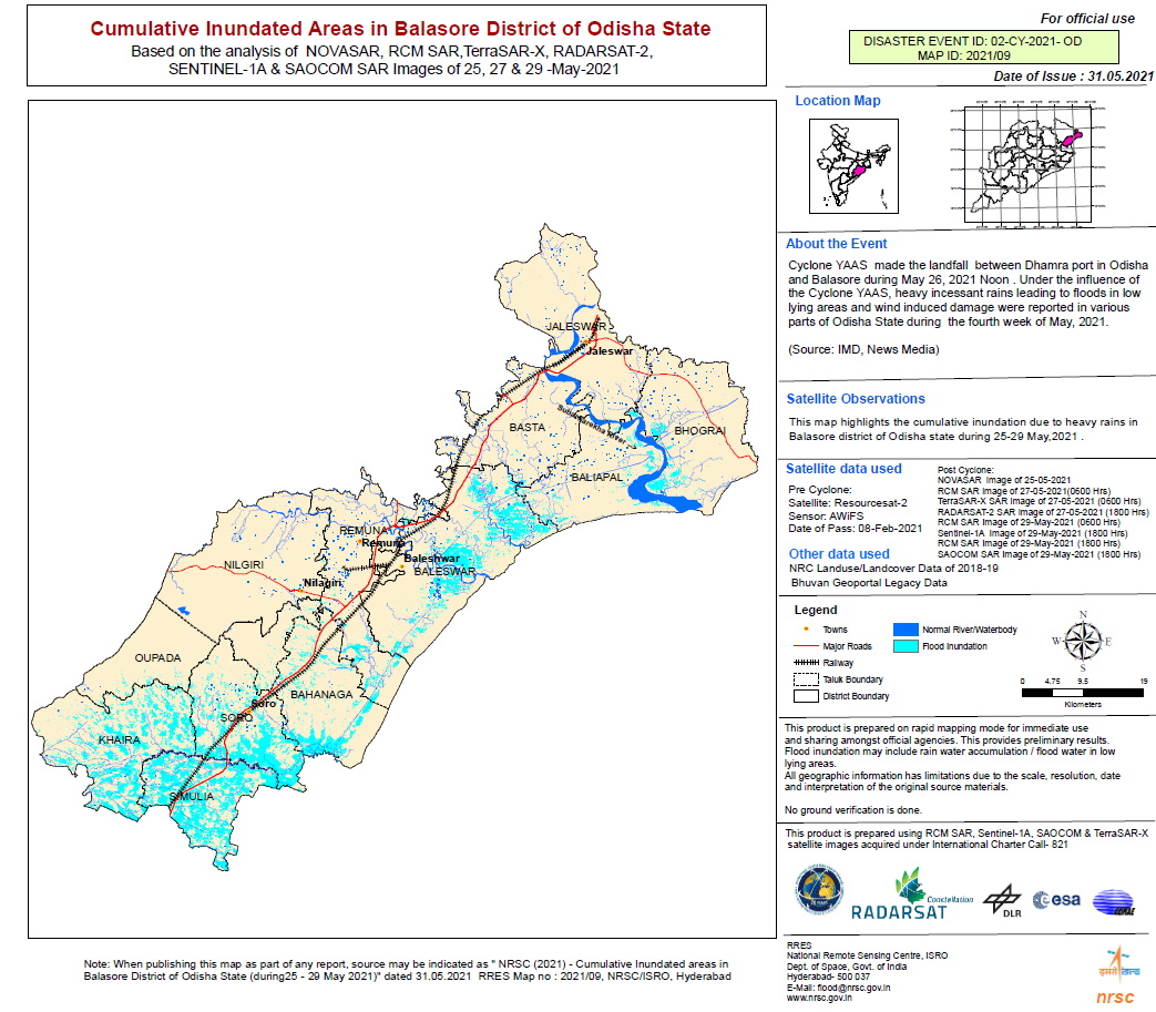
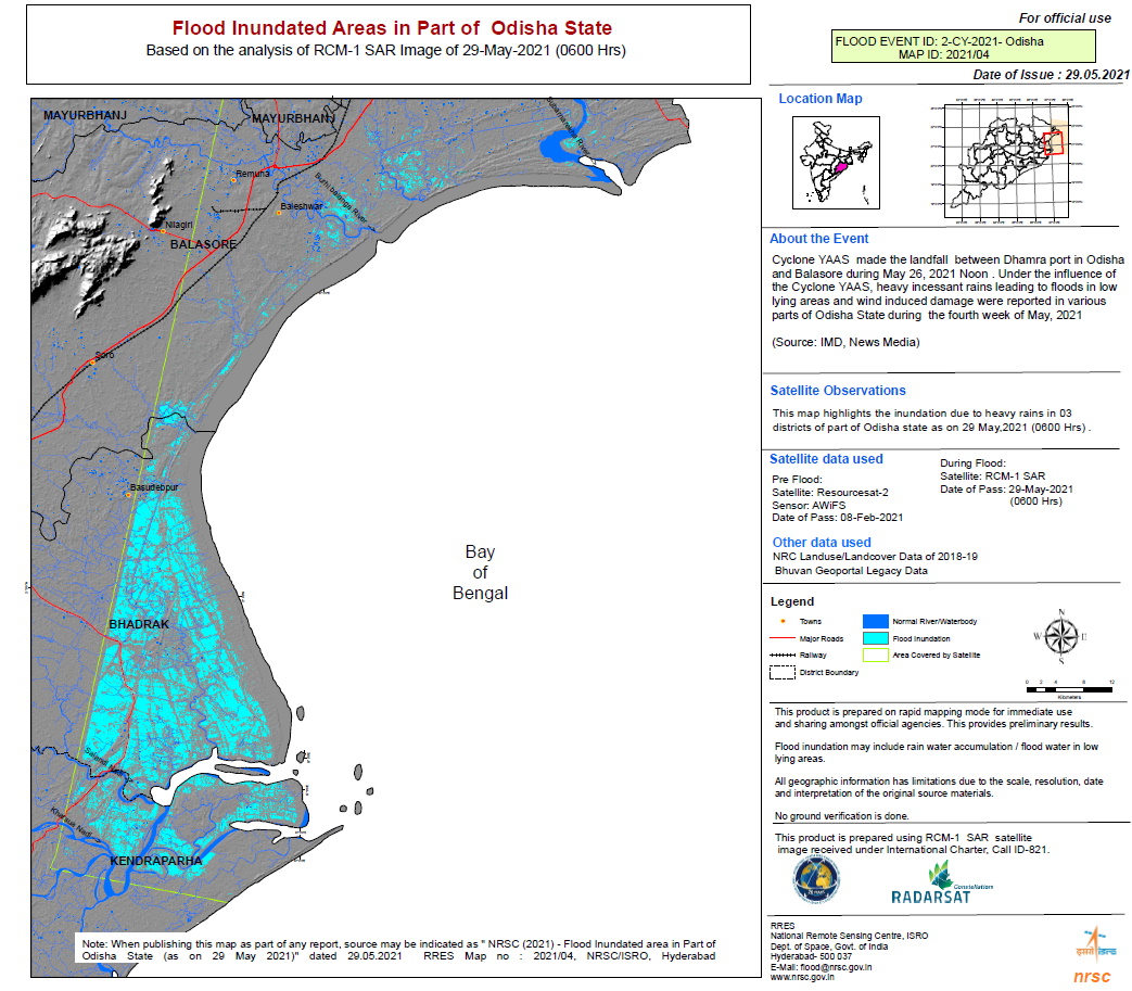
Flooded Areas in Balasore District of Odisha State
版权: Contains modified Copernicus Sentinel data (2021)
© CONAE (2021)
© DLR e.V. (2021), Distribution Airbus DS Geo GmbH
RADARSAT Constellation Mission Imagery © Government of Canada (2021) - RADARSAT is an official mark of the Canadian Space Agency
Map produced by NRSC / ISRO
Information about the Product
已获得: TanDEM-X / RCM : 27/05/2021
Sentinel-1 / RCM / SAOCOM-1: 29/05/2021
源: Sentinel-1 / SAOCOM-1 / TanDEM-X / RCM
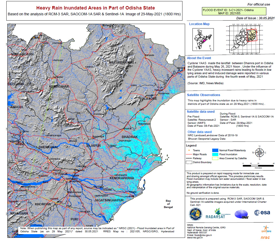
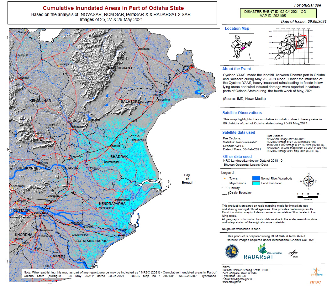
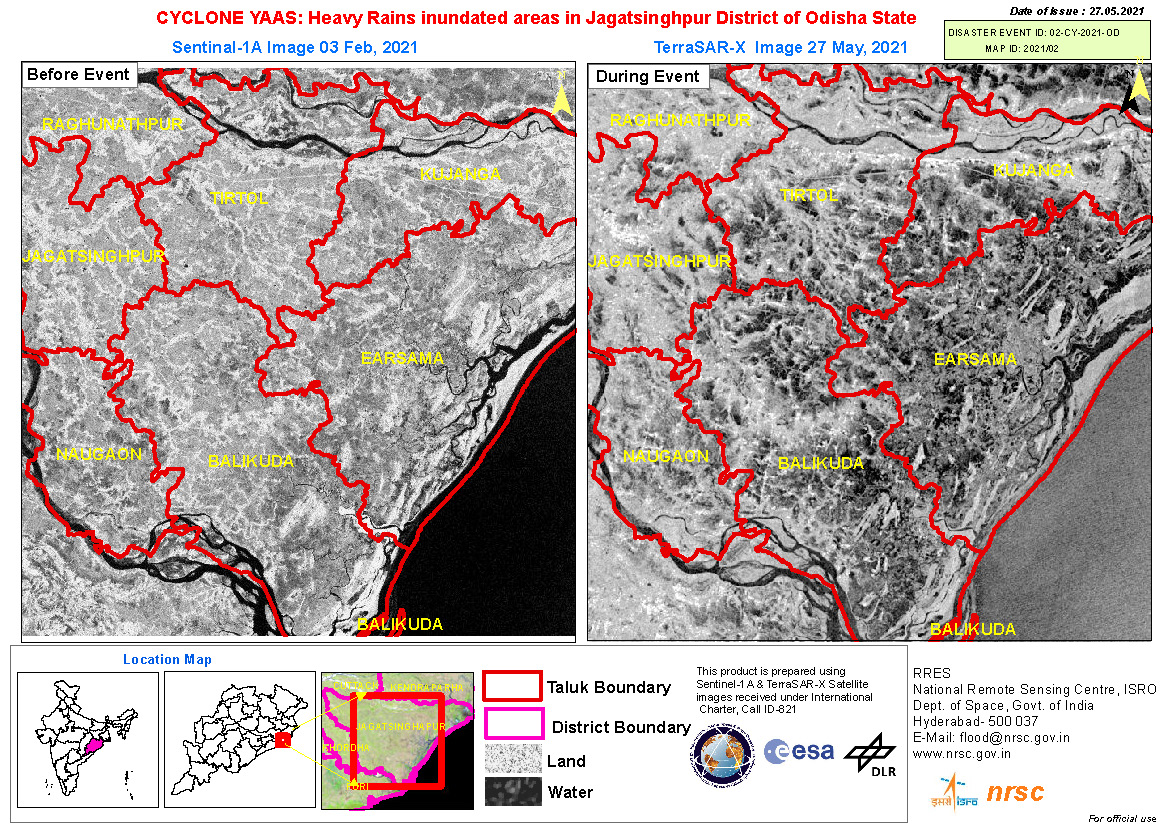
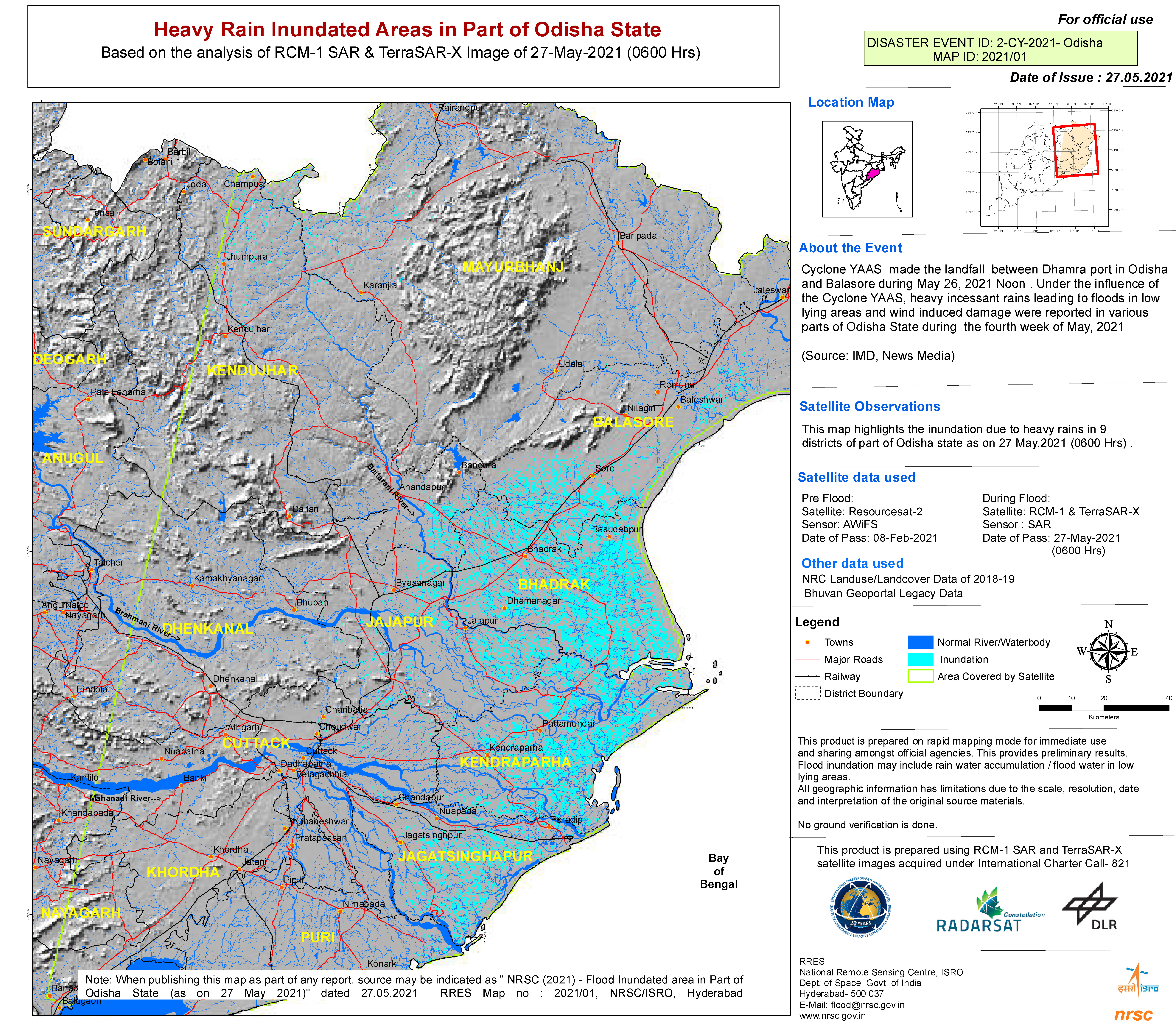
Heavy Rain Inundated Areas in Part of Odisha State
版权: RADARSAT Constellation Mission Imagery © Government of Canada (2021) - RADARSAT is an official mark of the Canadian Space Agency
© CONAE (2021)
Contains modified Copernicus Sentinel data (2021)
Map produced by NRSC / ISRO
Information about the Product
已获得: RCM: 29/05/2021
SAOCOM-1: 29/05/2021
Sentinel-1: 29/05/2021
源: RCM / SAOCOM-1 / Sentinel-1
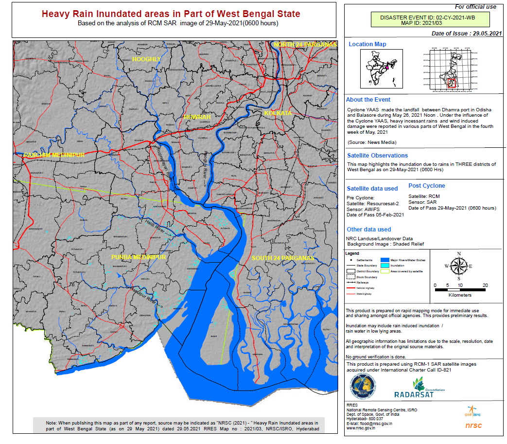
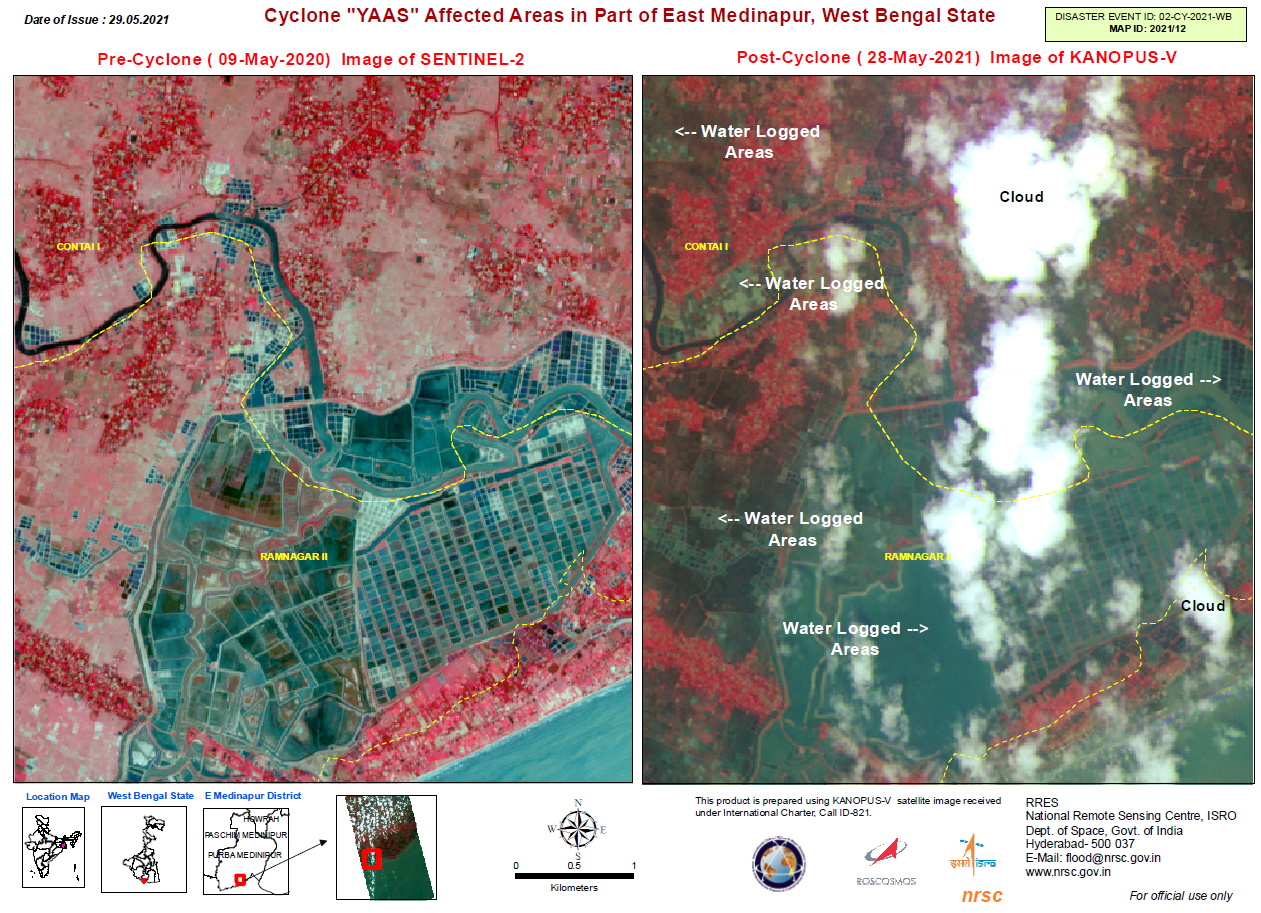
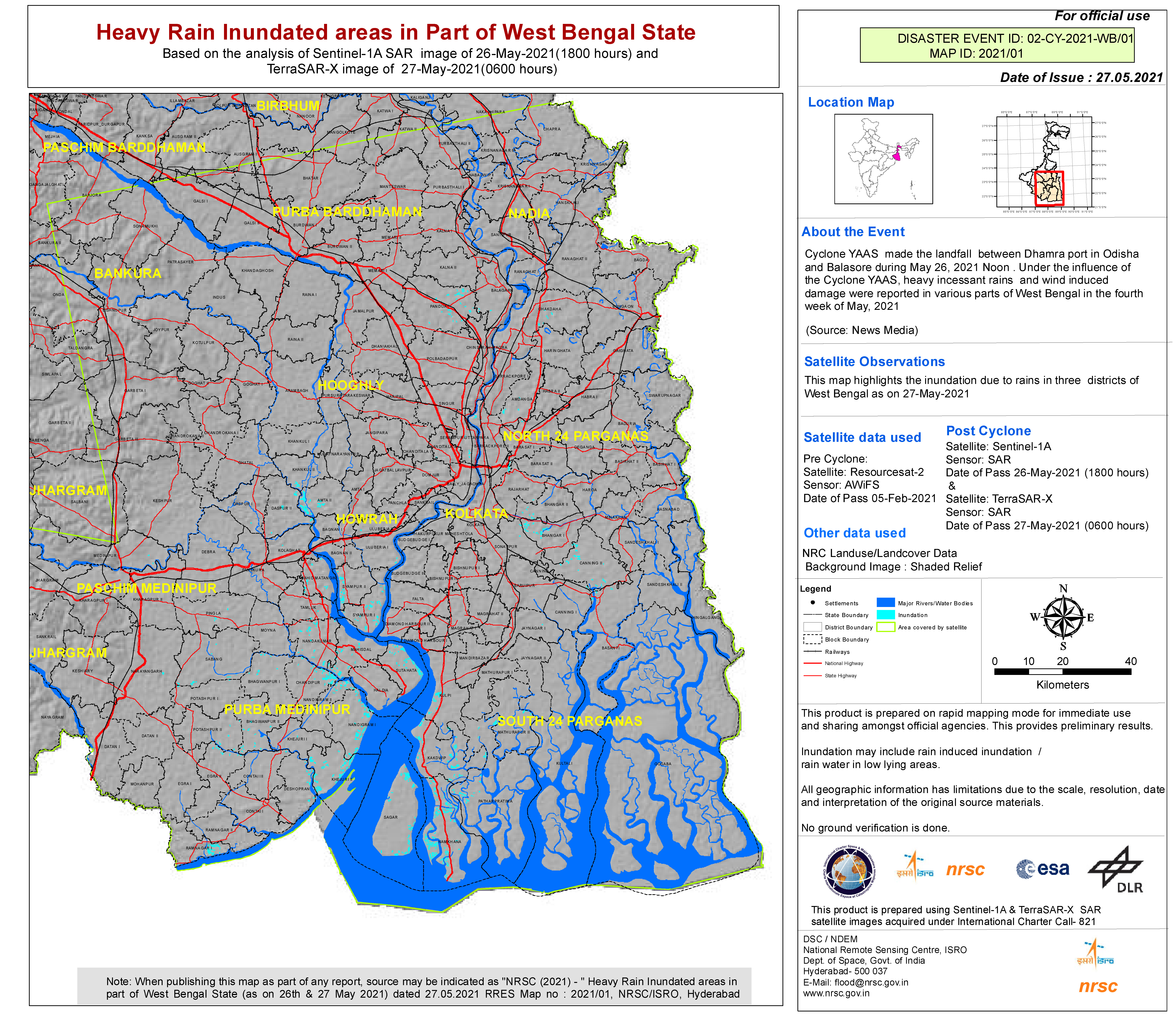
Flooded areas in Part of West Bengal State
版权: RADARSAT Constellation Mission Imagery © Government of Canada (2021) - RADARSAT is an official mark of the Canadian Space Agency
© DLR e.V. (2021), Distribution Airbus DS Geo GmbH
Contains modified Copernicus Sentinel data (2021)
Map produced by NRSC / ISRO
Information about the Product
已获得: Sentinel-1: 26/05/2021
TanDEM-X: 27/05/2021
RCM: 29/05/2021
源: RCM / Sentinel-1 / TanDEM-X
Flooded Areas in Part of Odisha State
版权: RADARSAT Constellation Mission Imagery © Government of Canada (2021) - RADARSAT is an official mark of the Canadian Space Agency
© DLR e.V. (2021), Distribution Airbus DS Geo GmbH
RADARSAT Constellation Mission Imagery © Government of Canada (2021) - RADARSAT is an official mark of the Canadian Space Agency
Map produced by NRSC / ISRO
Information about the Product
已获得: RCM: 27/05/2021, 29/05/2021
TanDEM-X: 27/05/2021
源: RCM / TanDEM-X
Heavy rain inundated areas in part of Odisha state
版权: RADARSAT Constellation Mission Imagery © Government of Canada (2021) - RADARSAT is an official mark of the Canadian Space Agency
TanDEM-X © DLR e.V. (2021), Distribution Airbus DS Geo GmbH
Map produced by NRSC/ISRO
Information about the Product
已获得: RCM: 27/05/2021
TanDEM-X: 27/05/2021
源: RCM / TanDEM-X
 返回完整的响应档案

